#Alaska-Yukon Ranges
Video
flickr
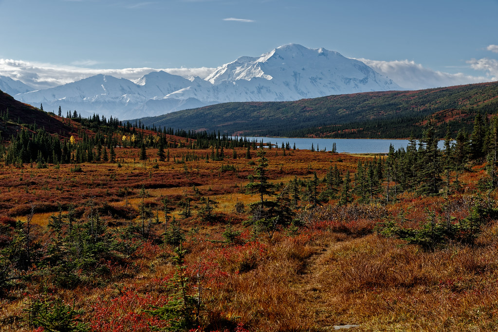
Denali National Park...Providing Mountain Viewing Experiences for a Few Million Years! by Mark Stevens
Via Flickr:
This was one of the first views that I had of Wonder Lake along the namesake trail from the North Face Lodge area. I had just come through a saddle between two hilltops and had this open plain in front of me with it's amazing view. That is what I was attempting to capture with this image in angling my Nikon SLR camera slightly downward and bring out a sweeping view across the tundra to my front with its vibrant colors of red, orange and yellows. The eyes would definitely be drawn to the waters of the lake and take in the wonder of the snowcapped peaks of Denali and the Alaska Range.
#Alaska 2019#Alaska Range#Alaska-Yukon Ranges#Azimuth 182#Blue Skies#Blues Skies with Clouds#Canvas#Day 10#Day Hiking in Denali#Denali#Denali National Park#Denali National Park & Preserve#Denali National Park and Preserve#DxO PhotoLab 3 Edited#Evergreen Trees#Evergreens#Hillside of Trees#Image Capture With Arsenal#Lake#Landscape#Landscape - Scenery#Looking South#Mount McKinley#Mountain Peak#Mountains#Mountains in Distance#Mountains off in Distance#Mountainside#Nature#Nikon D800E
3 notes
·
View notes
Text
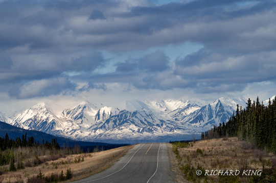
Arriving in Alaska, 2023
View On WordPress
#Alaska#Alaska Highway#Kluane Mountain Range#Nik 6 Silver Efex#Nikkor Z 100-400mm f/4.5-5.6 VR S#Nikon Mirrorless Camera#Nikon Z 6 II#Nikon Z6 ii#Photoshop 2023#Richard King Photography#Snow capped mountains#Sony Digital Film#www.richardkingphoto.com#YT#Yukon Territory
0 notes
Text

Alaskan Bull Moose
📷 Aaron and Deana on Instagram
The Alaska moose (Alces alces gigas), or Alaskan moose in Alaska, or giant moose and Yukon moose in Canada, is a subspecies of moose that ranges from Alaska to western Yukon. The Alaska moose is the largest subspecies of moose. Alaska moose inhabit boreal forests and mixed deciduous forests throughout most of Alaska and most of Western Yukon. Like all moose subspecies, the Alaska moose is usually solitary but sometimes will form small herds.
154 notes
·
View notes
Text

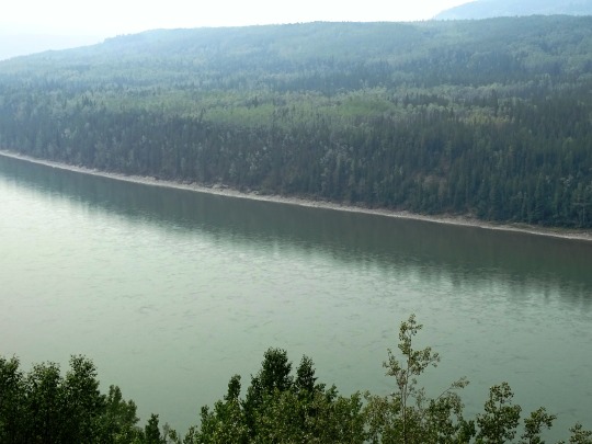
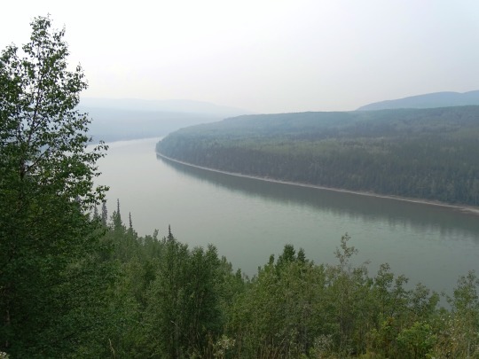

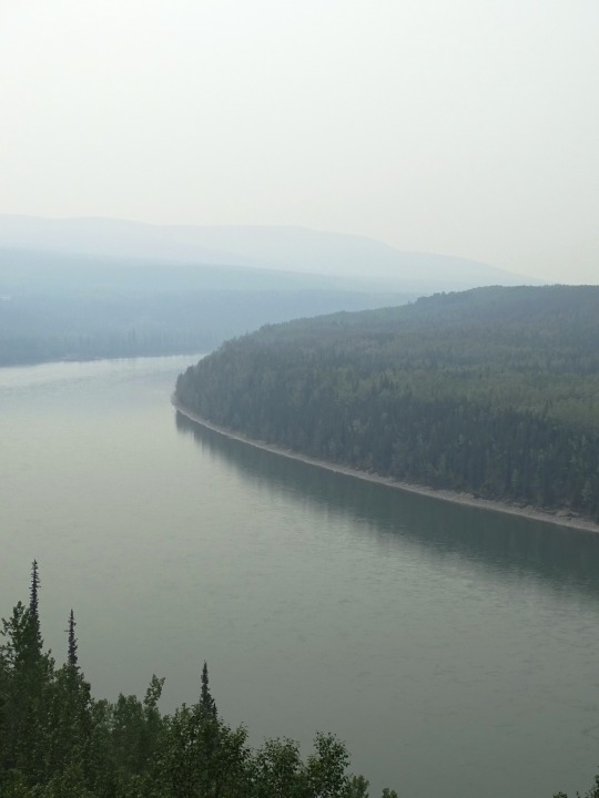

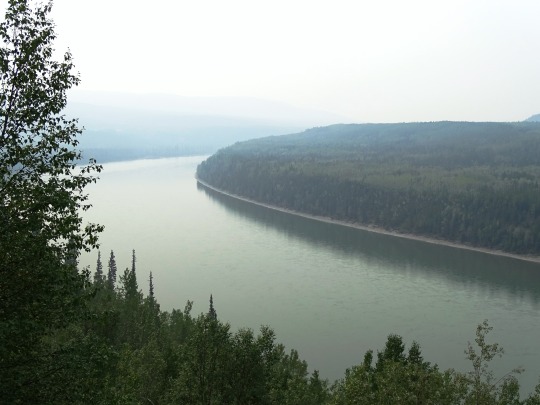


Allen's Lookout, BC (No. 1)
The Liard River of the North American boreal forest flows through Yukon, British Columbia and the Northwest Territories, Canada. Rising in the Saint Cyr Range of the Pelly Mountains in southeastern Yukon, it flows 1,115 km (693 mi) southeast through British Columbia, marking the northern end of the Rocky Mountains and then curving northeast back into Yukon and Northwest Territories, draining into the Mackenzie River at Fort Simpson, Northwest Territories. The river drains approximately 277,100 km2 (107,000 sq mi) of boreal forest and muskeg.
The river habitats are a subsection of the Lower Mackenzie Freshwater Ecoregion. The area around the river in Yukon is called the Liard River Valley, and the Alaska Highway follows the river for part of its route. This surrounding area is also referred to as the Liard Plain, and is a physiographic section of the larger Yukon–Tanana Uplands province, which in turn is part of the larger Intermontane Plateaus physiographic division.
The Liard River is a crossing area for Nahanni wood bison.
Source: Wikipedia
#Allen's Lookout#BC#Liard River#travel#original photography#vacation#tourist attraction#landmark#landscape#countryside#British Columbia#woods#forest#nature#flora#tree#river bank#wildfire smoke#summer 2023#Canada#view#vista point#boreal forest#Northern Rockies#Rocky Mountains
22 notes
·
View notes
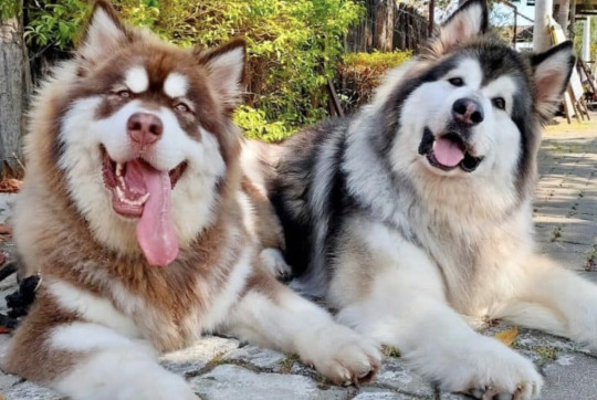
Note
Unleash your rage, please tell me all about the giant malamutes. Also I love your beasties, they’re so cute and you put a lot of effort into them and it shows!
Ohoho I have spoken about this many times before but since you asked so nicely....
Alaskan Malamutes are a type of Inuit freighting sled dog. Inuit sled dogs still bred and used by Indigenous people who have traditions in dog sledding look a very specific way and this includes size. There's a clear, straight line between the function of the dog (hauling heavy freight in cold climates) and the size of the dog.
Let's examine other Inuit sled dogs:
The Greenland Dog, one of the most isolated land race dogs in the world for example (in that its development was and is currently very isolated from admixture of European dogs). Size is quoted in their standard as: "Height: dogs: 58-68 cms (23-27 ins) at shoulder; bitches: 51-61 cms (20-24 ins) at shoulder.
Weight: dogs: 34-47.5 kgs (75-105 lbs), bitches: 27-41 kgs (60-90 lbs)."
Proportionally the dog should be longer than tall.

The Canadian Eskimo Dog (also known as the Canadian Inuit Dog or Qimmiq), is a rare sled breed due to the dog culls that occurred in the 1970s. Size is quoted in their standard as: "
Height: dogs 58-70 cms (23-27½ ins), bitches 50-60 cms (19½-23½ ins).
Weight: dogs 30-40 kgs (66-88lbs), bitches 18-30 kgs (40-66 lbs)."

The Alaskan Malamute has a complicated history, but can most accurately be described as an Inuit style freighting sled dog bred specifically for work in the Antarctic expeditions. Several things to note is that:
1.) a huge majority if not a majority of dogs that make up the founding of the breed are not from Alaska, but rather Eastern and Central Canada, mostly Labrador Huskies (a type of Canadian Inuit sled dog specifically from the Labrador Region) as well as a known Greenland Dog (Bessie).
Below: Labrador Huskies (yes they're still around!) from Northern Lights Dog Sledding:

2.) The standard for the Alaskan Malamute has been revised twice, most significant is the first revision which occurred after the studbooks were open to allow dogs of the M'Loot strain into registration due to the toll WWII work took on the original dogs (who were quite closely related).
3.) Three strains, or families of dogs, make up the modern Alaskan Malamute (Kotzebue (the original registered strain bred for the Antarctic), M'Loot (who were bigger in size and bred for companionship) and Hinman-Irwin (less a strain, more a handful of dogs owned by arctic explorers). This is significant information to understand because the while slight differences in these strains do exist, the dogs were so close in type they were breeding true during first generation admixture, were close enough in size, shape and overall form to be recognized as the same breed, and there are no pure strain dogs left today.
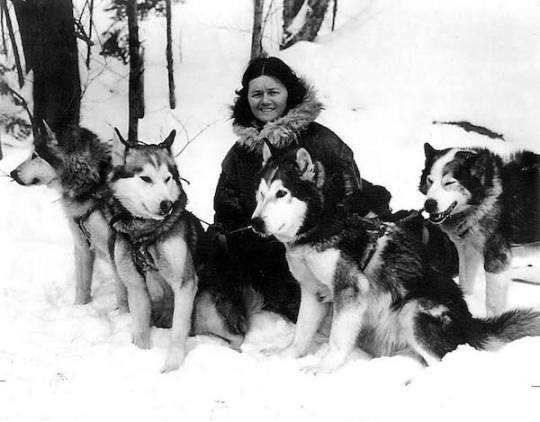
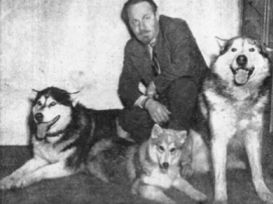
(Eva Seeley with four dogs from the first registered litter of Alaskan Malamutes including CH Gripp of Yukon. Parents were Yukon Jad and Bessie, a dog from Greenland).
The original Alaskan Malamute Standard has size as:
"Height: Of male dog averaging from 22 to 25 inches; of bitch averaging from 20 to 23 inches.
Weight: Of male dog averaging from 65 to 85 pounds; of bitch averaging from 50 to 70 pounds."
Prior to the M'Loot strain's inclusion into the breed registry the breeder of the strain, Paul Voelker lists his dogs as being: "mature dogs range from 23-26 inches at the shoulder and weigh 70-85 pounds".
(Paul Voelker with three M'Loot dogs above).
We know that many M'Loot dogs were larger than this, often exceeding 100 pounds much like my own dog, Sigurd who is 30" at the shoulder at 105 pounds (despite his Kotzebue heavy pedigree...), so seeing 110 pounds near the top of the LEAN WORKING WEIGHT would be an excessive animal by anybody breeding this dog's standards, but certainly not unachievable. Again, not desirable to Eva Seeley (founder of the Kotzebue strain, nor to Paul Voelker, founder of the M'Loot strain).
Because of this middle ground where both strains liked dogs around 85 pounds and 25 inches at the shoulder the standard was revised in 1960 to accommodate the inclusion of these slightly larger dogs. The standard now states: "There is a natural range in size in the
breed. The desirable freighting sizes are: Males—25 inches at the shoulders—85 pounds. Females—23 inches at the shoulders—75
pounds."
Proportionally the dogs are longer than tall.
So while there are several different families of dogs that make up the founding of the breed there is only ONE Alaskan Malamute. There is no secondary "type" that is gigantic (120-140 pounds like people like to claim). There is not "standard" Alaskan Malamutes and "Giant" Alaskan Malamutes because 1.) the standard already allows for and encourages the natural size range in the breed which is quite varied. 2.) nobody breeding these dogs in the historical context was calling their strains "Giant Alaskan Malamutes".
So let's examine WHY people call their dogs "Giant Alaskan Malamutes".
The answer is simple: Marketing. People love giant dogs and often see them as status symbols (if you've ever been in a dog breed group where people are bragging about their dog's weight regardless of what shape that dog is in (often overweight) you know what I mean).
More nuanced is that freighting sled dogs like Malamutes, Qimmiq and Greenland Dogs look absolutely behemoth next to "normal" sled dogs like Alaskan Huskies (where 70 pounds is HUGE and 50 pounds is normal) or Siberians which are of a similar size to Alaskans). They're a large dog breed, but they're not giant in the range of actual giant breeds such as Irish Wolfhounds or Mastiffs etc.
Many people breeding "Giant" Alaskan Malamutes also falsely believe and/or tell their clients that their dogs are "pure M'Loot" and spout the mythology that true Alaskan Malamutes from Alaska way back in the day (which is a breed myth, they're not from Alaska remember) were HUGE. like 120-140 pounds huge and use this to justify the size of the dogs they breed (which are just backyard bred, oversized, sometimes not even oversized but just overweight individuals). This myth is easily proven false because it's not like the weight of Voelker's dogs are an unknown, we have heights and weights on many of them and they are very true to many modern "standard" Alaskan Malamutes today. One cannot even claim that the original indigenous dogs were massive because 1.) they didn't exist as explorers at the time often confirm in their writing that the indigenous dogs in Alaska were much the same as those being used across the arctic and into the east 2.) Inuit still use sled dogs today. Traditional Freighting Sled Dogs and we know what they look like and we know what their size is like. The myth that the Alaskan Malamute is some "lost dog breed" is false and takes agency away from Indigenous traditional mushers.
Additionally a huge majority of "Giant" Alaskan malamutes today can be broken down into two categories: those from North America and those from Asia.
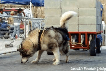
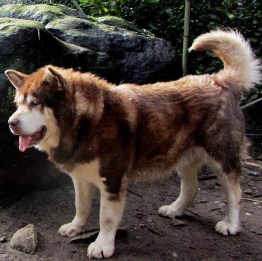
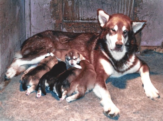
"Giant" Alaskan Malamutes from North America will often come from very similar pedigrees. You will see a lot of Cascade, Wakon (particularly this kennel...claiming the dogs are 35" at the shoulders and nearly 200 pounds) and Kingfisher in these pedigrees. These dogs are often long haired, breeders within these lines will often breed long haired dogs purposely as many buyers want very fluffy dogs. Often the dogs are not any bigger than "standard" Alaskan Malamutes, but some can be very big (there is rumor of non-malamute giant breed admixture occurring in the 1980's). Most people breeding within these pedigrees are not necessarily doing the fullest extend of health testing, but it is thankfully becoming more common (can we please for the love of gods tho get people to test more than just hips please). Some dogs in this pedigree type are often accomplish weight pull dogs (because long miles are not being asked of them....) and may or may not be of showable quality, just from a breeder that prioritizes size and breed mythology bs over everything else:
They range from functional and pretty breed standard looking:
To what the fuck is this:
These above dogs are not a "type" of malamute, just dogs with similar pedigrees no different than any other. There are always going to be dogs within a breed that share close pedigree with each other, it's literally just part of how this works. They are not separate unless you want to talk about hush hush paper hanging.
"Giant" Alaskan Malamutes in Eastern Asia unfortunately bear the brunt of the breed's lack of ethics. These dogs are bred HUGE in size, overly loose, overly flewey and the breeders are not shy about the fact that they've bred Tibetan Mastiff into these dogs to achieve the size and hair level. These dogs are bred as pure status symbols and are not getting proper health testing done. I have never once seen a dog from these types of breeders do anything remotely functional. This is a dog that is bred for looks ONLY:
I'm sure you've all see this video (screen shot shown below) of a dog that is absolutely suffering:

So when it comes to "Giant" Alaskan Malamutes there are some simple truths:
1.) They do not exist historically in Inuit freighting sled dogs
2.) Breeders in the mid-century, regardless of the strain of Malamute they preferred liked dogs around 85 pounds 25 inches at the shoulders.
3.) There are potentially hung papers within the breed histories of "Giant" dogs that may account for their overly large size.
4.) They are not a separate "sub-breed" or a different type of Malamute. They are simply all Alaskan Malamutes as the breed's standard allows for variation in size amongst the dogs.
5.) In my opinion breeding dogs overly large disrespects the purpose and function of the breed.
6.) Larger than average individuals can exist and often are produced from responsible breeders when breeding two ideal size or even smaller than ideal sized parents together. This is because genetics is complicated (Sigurd's mom was 80 pounds and his dad 25.5", 73 pounds. Sigurd is 30" and 105 pounds).
#dogblr#alaskan malamute#greenland dog#dog history#giant alaskan malamute#qimmiq#anyways because of the paper hanging and the NA 'giant' breeders distain for 'standard' dogs#it is unlikely that show/working breeders outside of their circles will associate with them#re: give them puppies or buy from them themselves#also lack of health testing until very recently#so i do suspect eventually they'll become a strain of their own#i can already kind of tell when a dog has certain kennels behind it bc i'm insane#but also even if they're recognizably pet bred 'giant' or whatever#they're still just alaskan malamutes#literally.
104 notes
·
View notes
Text
Varied Thrush (Ixoreus naevius)

"special in my heart….."
"Colorful!"
This is the only member of its genus, Ixoreus, which comes from the Greek ixos for mistletoe. It was a bit of an accidental naming, as Wikipedia describes:
The varied thrush is now the only species placed in the genus Ixoreus that was introduced by Charles Lucien Bonaparte in 1854. [Ixoreus] was a synonym of a former name for the mockingbird genus, Mimus; Bonaparte assumed wrongly that, because Swainson had shown a mockingbird and this thrush on the same plate of his book, they were related.
Varied thrush have a typical thrush diet, with insects dominating their diet and berries making up a large bulk at various parts of the year, typically migration. These birds prefer coniferous forests for nesting and breeding, and have a fairly stable range along the western coastline for both breeding (up in Canada and Alaska) and wintering (down in California and into Baja California). Their song is incredibly strange, often just a single, complex note sang while the male perches at the top of a tall tree.
Varied Thrush have eBird records in every state of the USA except for Mississippi and Hawaii, and also have been found in Bermuda and Britain. There's a range map linked to all eBird sightings, but it doesn't seem to be visible unless have an account.
Sources:
Image source: eBird ( Paul Maury)
10 notes
·
View notes
Text
Corridors between Western U.S. national parks would greatly increase the persistence time of mammals
https://sciencespies.com/nature/corridors-between-western-u-s-national-parks-would-greatly-increase-the-persistence-time-of-mammals/
Corridors between Western U.S. national parks would greatly increase the persistence time of mammals
National parks are the backbone of conservation. Yet mounting evidence shows that many parks are too small to sustain long-term viable populations and maintain essential, large-scale ecological processes, such as large mammal migrations and natural disturbance regimes.
A new study published on Jan. 11, 2023, in Scientific Reports found that enhancing ecological connectivity, known as “corridors” or “linkages,” among several of the oldest and largest national parks in the Western United States would greatly extend the time that many mammal species populations can persist. The authors analyzed the value of establishing ecological corridors for large mammals between Yellowstone and Glacier National Parks and between Mount Rainier and North Cascades National Parks. Their findings show that these corridors would not only enlarge populations, but also allow species to shift their geographic ranges more readily in response to climate change.
“Eliminating barriers of movement between parks and more carefully managing land-use along these pathways are crucial for the survival of many mammal species,” said William Newmark, research curator at the Natural History Museum of Utah and lead author of the study. “Establishing an expanded protected area network based on identified mammal pathways and incorporating adjacent wilderness areas would greatly enlarge available habitat for mammal species. And this would have a very positive effect on species persistence time.”
The authors found that linking Yellowstone National Park with Glacier National Park, and Mount Rainier National Park with North Cascades National Park would increase the long-term persistence time of mammal species by a factor of 4.3 relative to the persistence time of species in fragmented, individual parks.
The proposed corridor network would cross two- and four-lane highways, which would require multiple ecological bridges over and under the roadways. Fortunately, highway authorities in the Western U.S. and Canada are beginning to construct such over- and underpasses for wildlife.
“However, a much greater effort will certainly be required if we are to reduce the known adverse impacts of highways on species movement and dispersal,” said Paul Beier, professor emeritus of Northern Arizona University and co-author of the study.
It’s well supported that ecological corridors enhance population persistence of species, but most studies have been small-scale experiments. There are few assessments of the value of ecological linkages at large spatial scales. This study’s analysis drew heavily upon patterns of species loss over time in habitat fragments around the world.
“The analytical approach presented in this paper can provide conservation planners and practitioners with a powerful method of prioritizing and quantifying the value of ecological linkages between protected areas,” said John Halley, professor at the University of Ioannina and co-author of the study.
Over the past two decades, there has been worldwide efforts to establish networks of reserves interconnected by protected corridors. One of the boldest visions was first articulated a quarter century ago by co-author Michael Soulé, professor emeritus at the University of California, Santa Cruz, who passed away before this paper was completed. Soulé advocated to establish a protected area network that would extend from the top of Alaska down to the southern tip of South America at Tierra del Fuego. A more regionally-focused initiative to connect Canada’s Yukon territory to Yellowstone National Park in the northern Rocky Mountains has made considerable progress.
The study’s analysis highlights the positive effects that large-scale conservation initiatives can have on biodiversity conservation. The authors note that enhancing ecological connectivity between protected areas in Western U.S. and Canada could serve as an important template for large-scale biodiversity conservation both nationally and worldwide in the 21st century.
Other authors on the study include Phoebe B. McNeally of the University of Utah and Samuel A. Cushman of the U.S. Forest Service.
#Nature
4 notes
·
View notes
Text

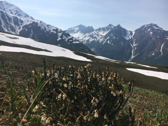
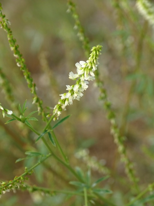
Crowberry Flowers❤️
In a month or two these tiny little plants will be covered on black berries!
Food uses for the berries include being stewed and used for syrups, cakes, muffins, fruit leather, and savory jams and jellies. An ice-cream topping can be made by mixing stewed Crowberries with honey and lemon.
For medicinal purposes, Discovering Wild Plants by Janice J. Schofield says this:
“Infusions of crowberry twigs and stems have been administered for colds, kidney troubles, and tuberculosis. Dena'ina Athabascans drink the tea for diarrhea. Kobuk River Eskimos use crowberry juice in sore eyes torelieve snowblindness. Decoctions of the roots and bark have also been used for sore eyes and cataracts.”
Crowberries are often found in bogs, heaths, tundra, and high mountains (the latter being where I took these photos yesterday). They range from Alaska and the Yukon to California.

Also something to note is that when you find them, you often find them in bulk. This is a mountainside completely covered in Crowberry flowers :-)
#flowers#plants#plant stuff#plant facts#cool plants#alaska#wilderness survival#wildflowers#wild plants#wild places#writing prompt#writers on tumblr#edible plants#wild berries#beautiful photos#adventure#homeopathy#herbology#natural herbs#herbsandflowers#wild herbs#cottagecore#survival#Alaska wilderness
19 notes
·
View notes
Video
youtube
Mysterious Gleaming Gold
Ever since prehistoric man first stumbled upon a nugget, raw gold with its radiant sun yellow coloration and metallic luster has captivated and fascinated mankind. The unique gleam of gold attracts the eye, enabling the seeker to detect the smallest of grains in visit site here an aggregate of many other materials. The tiniest flakes are easily detected.
Since prehistoric man first stumbled upon a nugget, raw gold with its radiant sun yellow coloration and metallic luster has captivated and fascinated mankind. The unique gleam of gold attracts the eye, enabling the seeker to detect the smallest of grains in an aggregate of many other materials. The tiniest flakes are easily detected.
Anthropological excavations of Stone Age burial sites indicate that gold was the first element collected and prized by man. This unique metal, gathered in the form of nuggets, seems to have been highly prized but was not used in practical applications. Rating 2.5 – 3 on Mohs scale of hardness, gold was much too pliable to be hammered into workable tools or weapons. Gold carried little value for prehistoric man except to be admired and treasured for its rare, intrinsic beauty.
However, as man developed he soon discovered numerous applications for the mysterious golden metal. The earliest record of gold exploration dates to Egypt around 2000 B.C. Ancient records tell of an enormous alluvial gold deposit in Nubia, between the Nile River and the Red Sea in southeastern Egypt. This incredible discovery encompassed over one hundred square miles. Using the most primitive of tools and working to an average depth of less than six feet, these first “miners” pried an estimated one thousand tons of gold from this rich discovery. Egyptian artisans, recognizing the extraordinary malleability of gold fashioned incredible jewelry, ornaments and idols of breathtaking beauty.
Throughout the history of man’s involvement with gold, the precious metal has been prized not only for its beauty but for gold’s ability to withstand the rigors of time. No substance that appears commonly in nature will destroy gold. Unaffected by air, moisture, heat or cold, this noble metal will not tarnish, corrode, rust or tarnish. Shimmering gold dust, golden nuggets of placer gold and brilliant vein occurrences have survived 4.5 Billion years of cataclysmic geologic and climate changes; volcanic eruption, earthquakes, upheavals and deposition. Treasures of gold jewelry, bullion and coins, buried for thousands of years beneath land and sea have been found intact; as brilliant as the day they were abandoned.
A relatively rare native metallic element, gold ranks fifty-eighth in abundance amongst the ninety two natural elements that make up the earth’s crust. Although considered a rare element, of all metals gold is, with the exception of iron, the most widely distributed over the planet. Gold has been found on 90 per cent of the earth’s surface and is mined in high mountain ranges, in the deeply weathered soil of the tropics, harsh deserts and in the permanently frozen tundra of the Arctic.
Gold is commercially mined on every continent with the exception of Antarctica. The richest gold producing area of the world is the Witwatersrand District of South Africa. This ultra rich area has yielded eighteen thousand tons of gold with no end in sight. Additional notable gold bearing areas around the world are Siberia in the former USSR, the Porcupine District in Ontario, Canada and in the United States the Yukon District of Alaska and the famous Mother Lode District in California.
1 note
·
View note
Video
Itineraries in Exploring Denali National Park & Preserve by Mark Stevens
Via Flickr:
A view looking to the south while walking the Wonder Lake Trail while taking in an amazing setting with Denali and other snowcapped peaks of the Alaska Range. I did some initial post-processing work making adjustments to contrast, brightness and saturation while playing around as I learned how to work with DxO PhotoLab 3 that I’d recently purchased after moving away from Capture NX2.
#Alaska 2019#Alaska Range#Alaska-Yukon Ranges#Azimuth 182#Blue Skies#Blue Skies with Clouds#Cloud Wisps#Day 10#Day Hiking in Denali#Denali#Denali National Park#Denali National Park & Preserve#Denali National Park and Preserve#DxO PhotoLab 3 Edited#Evergreen Trees#Evergreens#Hillside of Trees#Image Capture With Arsenal#Landscape#Landscape - Scenery#Looking South#Mount McKinley#Mountain Peak#Mountains#Mountains in Distance#Mountains off in Distance#Mountainside#Nature#Nikon D800E#No People
3 notes
·
View notes
Text
On the Chicken Highway
Day 16 -

We left Dawson and the Yukon River Valley after a visit to the bakery at 10am and took the ferry across the river to the west side and Hwy 9 to Chicken and Tok, AK.
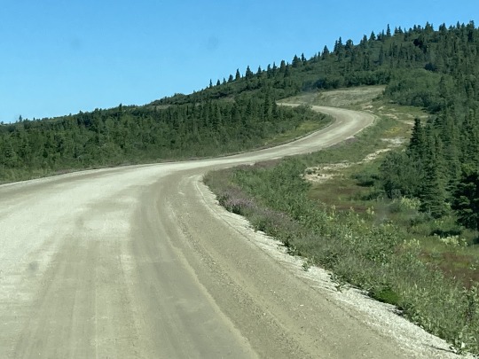
The road took us on a steady climb for 30km to the top of the ridge between the watersheds of the Yukon river and the Fairbanks valley.


We’re on the “Top of the World” Hwy to Chicken, Alaska. This name is used in many other places in the world, but here it really fits. Side valleys drop away to the north and to the south for the next 70km.
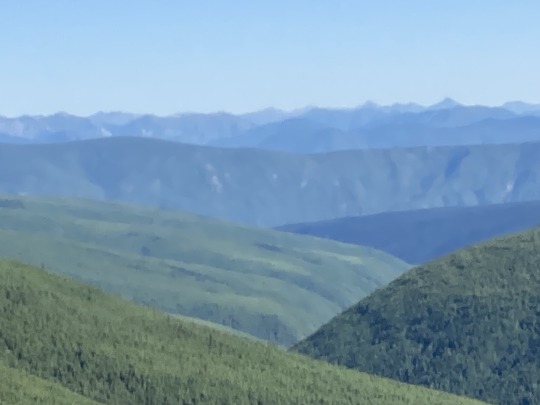

The Tombstone Mountain range (left) is in the far distance to the NE and the Alaska Range (right) a long way away to the SW. The vegetation is mainly black spruce, short and spindly, growing close to each other.

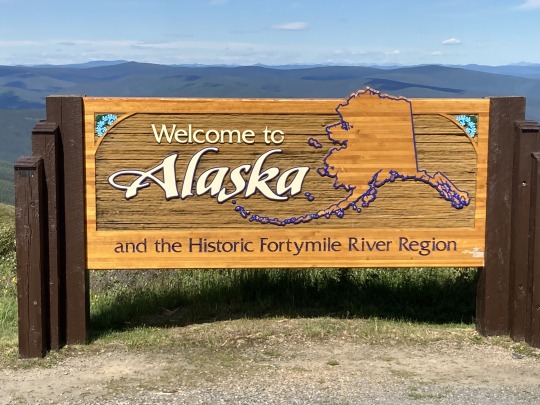
After driving 100km on a very good gravel road, we arrived at the US border. After the standard 4 questions, we were on our way to Chicken.


The first 10km on the US side is nice new pavement and then we got onto 50km of ugly dirt road all the way to Chicken.
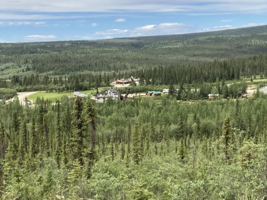

Not much going on in this town, not even BBQ’ed chicken;) so we pressed on down to the Tanana River Delta and the Alaska Hwy to set up camp for the night at Tok. The sun was still up at 11pm and at 1:30am I was able to read without a light.

The camp site offered car wash facilities, so we cleaned out all the dust from the Beast and gave it a good wash. Very nice and clean campground.
0 notes
Text
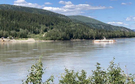
CANADA - YUKON
2023 July 6 (Thu) – We departed Skagway, Alaska, at 8 a.m. for our drive to Haines Junction in the Yukon. The campground is not much to look at and when we arrived, the clerk showed us a map with 16 sites assigned to us. We told her we needed 19. She moved one person from a pull-thru to a back-in site (that didn’t free up anything) and she moved another person to a dry spot. That still only gave us 17 campsites. We managed to maneuver things and get 18 into campsites with full hook-up. Paul and I had to make do with 15-amp and water shared with someone else. It was just for one night but annoying, nonetheless.
I walked across the street to the cultural center. I have been playing the Yukon poster contest – find posters located at various locations around the territory. One was in the cultural center and another in the visitor center next door. I found both and took their picture. On the way back to the campground, I was awestruck by the beauty of the scene. The campground stood at the base of a mountain range. It was beautiful.
0 notes
Text
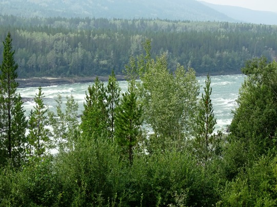


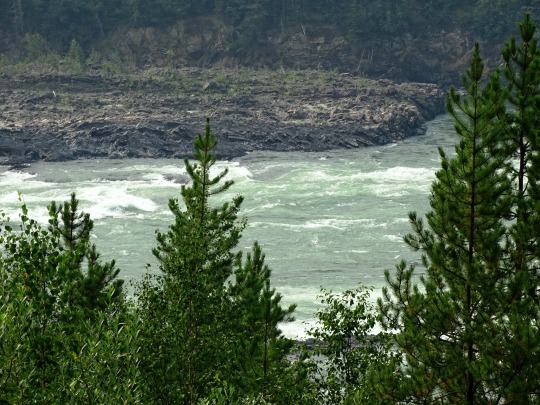


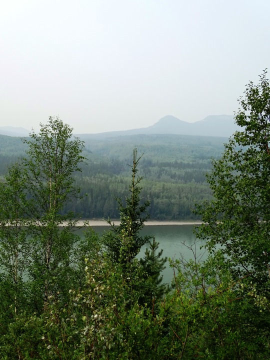
Liard River, BC
It flows south-east and east along the Alaska Highway, receiving the waters of Dease River, Kloye Creek, Trepanier Creek and Black Angus Creek. It continues east through the Dease Forest, where it receives the waters of the Hyland River south of Hyland River Provincial Park, then receives the Malcolm Creek, Tatisno Creek and Nustlo Creek. It flows along the Yukon border, where the Alaska Highway once again follows the Liard and receives the Cosh Creek, Contact Creek, Scoby Creek and Sandin Brook, then turns south around Mount Sandin, receiving water from Tsia Creek, Tsinitla Creek, Tatzille Creek and Leguil Creek. It turns eastwards along the northern margin of the Liard Plateau, where it receives the Kechika River near Skooks Landing, Niloil Creek from Niloil Lake and Coal River by Coal River. It continues east and south-east, south of Mount Reid, still followed by the Alaska Highway, receiving the waters of Geddes Creek, Grant Creek, Smith River, Lapie Creek, Teeter Creek, Mould Creek and Hoole Creek.
It enters the Liard River Hot Springs Provincial Park, where the Trout River empties into the Liard. Alaska Highway runs south along the Trout River, while the Liard flows east through the Liard River Corridor Provincial Park and Protected Area, south of the Sentinel Range of the Muskwa Ranges, receiving the waters of Deer River and Canyon Creek in the Grand Canyon of the Liard. It continues south-east between the Barricade Range and Mount Rothenberg of the Sentinel Range, where the Moule Creek and Sulphur Creek flow in the Liard. It flows east, out of the Northern Rockies and through the foothills, where it receives waters from the Brimstone Creek, Crusty Creek, Grayling River, Graybank Creek and Toad River. It turns north-west, receiving the waters from Garbutt Creek, Lepine Creek, Chimney Creek, Ruthie Creek, Scatter River and Beaver River. It then turns south-east, receives the waters from Catkin Creek, Dunedin River and Fort Nelson River. From here it turns north, receiving the waters of Zus Creek, Sandy Creek and La Biche River and crosses into the Northwest Territories, immediately east of the Yukon border.
Source: Wikipedia
#Kootenay#butterfly#wildlife#fauna#animal#BC#Liard River#travel#original photography#vacation#tourist attraction#landmark#landscape#countryside#British Columbia#woods#forest#nature#flora#tree#river bank#wildfire smoke#summer 2023#Canada#view#vista point#boreal forest#Northern Rockies#Rocky Mountains#wildflower
16 notes
·
View notes
Photo
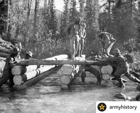
After the United States entry into World War II and faced Japanese maritime superiority in the Pacific, Alaska was vulnerable to attack. The only means of supplying military forces there was by air or sea, both of which were vulnerable to Japanese interdiction. With the agreement of Canada, the U.S. government moved on plans to build an overland supply route from the Canadian railhead and road junction town of Dawson's Creek in British Columbia, across Yukon to Fairbanks, Alaska. Work began on 8 March 1942 by the U.S. Army Corps of Engineers (USACE) - along with civilian contractors and Canadian military personnel - with the objective of completing at least a primitive "pioneer road" before the onset of winter. The need to finish accelerated when Japanese forces invaded the Aleutian Islands in June 1942. Working from both ends toward the middle, the engineers had to construct the road over inhospitable terrain that included the Canadian Rockies, forests and tundra in climates that ranged from 70 degrees above to 70 degrees below 0 f. The leading bulldozers of the converging 18th and 97th Engineers met in the vicinity of Beaver Creek near the Alaska-Canada border on 25 October 1942, and was officially dedicated on 20 November. The Alaska - or ALCAN (Alaska-Canada) - Highway was open to civilian traffic after the war. DID YOU KNOW The Army engineers built more than 200 bridges and 8,000 culverts along the route of the Alaska Highway. In the segregated U.S. Army of World War II, three of the seven Engineer regiments in the Provisional Engineers Brigade were all-black, or "colored" units. Of 10,607 U.S. Army Corps of Engineer (USACE) soldiers who worked on the road, 3,695 were African American. #Armyhistory #USArmy #TRADOC #AlaskaHighway #thisdayinarmyhistory #ArmyEngineers #CorpsofEngineers Posted @withregram • @armyhistory https://www.instagram.com/p/Cpilllyui7H/?igshid=NGJjMDIxMWI=
0 notes
Photo

MOUNTAIN GOAT Despite its name, a mountain goat (Oreamnos americanus) is actually not a member of the actual goat genus. Mountain goats belong to a group known as goat antelopes. The natural range of the mountain goat includes southern Alaska and Yukon, British Columbia, northern Idaho, northwest Montana and parts of Washington. British Columbia contains more than half of the world’s population of mountain goats. BOOK YOUR CORE EXAM HERE Mountain goats have the thickest and longest pelage of any North American ungulate aside from the muskox. Their coats are white and usually fairly shaggy, including hollow guard hairs up to 20 cm long and a fleecy undercoat that is 5 to 8 cm long. Both sexes sport a noticeable beard, which is longer in winter. Mountain goats have a deep chest and well-developed shoulder muscles that give them great strength for climbing and pawing for food in the winter. A mountain goat’s cloven hooves have rough, textured traction pads that project past the rim of the hooves, which makes them conducive to rocky and slippery terrain. BOOK YOUR CORE EXAM HERE Both sexes have long ears and narrow, black, short, sharply pointed horns. A nanny’s horns are more slender at the base and a bit more curved at the tip than a billy’s horns. A mountain goat’s horns will grow continuously and never be shed. The growth rings or annuli on the horns indicate age. During mating season a male often marks a female with a musky oil from glands at the base of his horns by rubbing his head against her body. https://www.instagram.com/p/CojFZ8WLXBf/?igshid=NGJjMDIxMWI=
0 notes
Text
Experience Alaska's Living Cultures
From dog sledding to meeting local artisans, there are countless ways to experience Alaska’s diverse cultures year-round.
— By Christina Nuñez

Experience Alaska's living cultures! Embark on an overland journey like no other, traveling over Alaska's terrain via dog sled. Dog sledding, or mushing, has a long history in Alaska: Originating as transportation for Alaska Native cultures, it went on to become the official state sport in 1972. Throughout the state, visitors can join a range of dog sled tours, from jaunts lasting a couple of hours to multiday backcountry camping excursions. In the summer, rides typically take place on wheeled carts, but if you’re craving the sledding experience, you can helicopter to a glacier and glide over snow and ice behind a team of dogs under the midnight sun.
In addition to tours, kennels offer demonstrations that reveal how sled dogs and their mushers prepare for long-distance trips. Rangers at Denali National Park and Preserve—the only national park with a kennel of sled dogs—hold daily demos from May to September. Depending on the time of year, you might also be able to catch a sled dog race: The legendary Iditarod Trail Sled Dog Race from Willow to Nome has a ceremonial start in downtown Anchorage every March, and the Yukon Quest International Sled Dog Race in February runs between Fairbanks and Whitehorse. CANNON PHOTOGRAPHY LLC, ALAMY
Learn about Alaska's aviation history! Thousands of Alaskans live in remote communities without road access. For many of these communities, small aircraft have long been a critical way to get supplies. Back when Alaska Airlines began in the 1930s, flights weren't scheduled—they took off when the plane was full. Today, traveling by bush plane or seaplane is an integral part of Alaskan culture.
The state's pioneering history of flight is on display at the Alaska Aviation Museum, located on the world's largest seaplane base, Anchorage's Lake Hood. Here, you'll be able to see more than 25 vintage aircraft, watch planes being restored, and get a pilot's-eye view in a full-immersion flight simulator. If you're eager to get off the ground, check out one of the state's many flightseeing and helicopter tours. Whether you take a short flight or a full-day trip, flightseeing is a great way to see some of Alaska's less-visited treasures, such as Wrangell-St. Elias National Park. FRANS LANTING, NATIONAL GEOGRAPHIC IMAGE COLLECTION
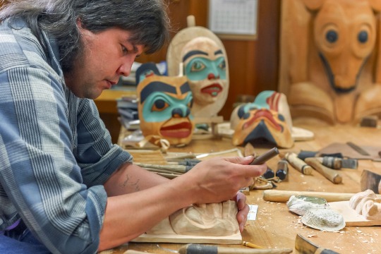
Tour Sitka National Historical Park! Located on Baranof Island in southeast Alaska, Sitka National Historical Park's natural beauty is punctuated by its signature feature: a collection of totem poles from the Tlingit and Haida people. They sit on ancestral land of the Tlingit Kiks.ádi clan, which is also the site of an 1804 battle between the clan and Russian invaders who eventually wrested control of Sitka. Americans acquired Alaska from Russia in 1867.
Nearly 40 years later, Tlingit and Haida tribes donated 15 totem poles to be exhibited at the Louisiana Purchase Exposition in St. Louis, Missouri. Most—but not all—made it back to Alaska. Today, visitors to the park can explore the mile-long Totem Trail, with its 18 Tlingit and Haida totems. A self-guided walking tour of the trail offers a window into the rich history of these carvings and the living cultures they represent. Local artisans such as Tlingit carver Tommy Joseph are also on-site throughout the week working on various totem carving projects and available to answer questions about their craft. PATRICK J. ENDRES, GETTY IMAGES

Explore Ketchikan on a local-led tour! Once the site of a Tlingit summer fish camp, Ketchikan lies at the southern end of the Inside Passage and is the first port of call for ships heading north, earning it the nickname “Alaska’s First City.” Distinguished by its colorful waterfront buildings and the fact that it boasts the largest number of standing totem poles in the world, Ketchikan draws fishing buffs, nature lovers, and those wanting to experience Alaska Native culture and art. You'll find collections of totems at the Totem Heritage Center, Totem Bight State Historical Park, Saxman Totem Park, and Cape Fox Lodge, as well as dotted throughout downtown Ketchikan.
Learn about Ketchikan's remarkable history and art on a local-led walking tour, such as Where the Eagle Walks run by Tlingit Elder Joe Williams, Jr. With your guide, you might wander the pedestrian boardwalk on Creek Street, learn about the salmon that migrate through the area's waters, or watch Tlingit totem carvers at work in nearby Saxman Village. BARCOS, ALAMY
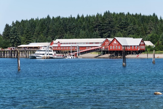
Visit Hoonah and Icy Strait Point! Over a century ago, Icy Strait Point was the site of a salmon cannery. Today, the striking red building is a "port for adventure" owned and operated by a local Alaska Native corporation, Huna Totem. Located about 30 miles west of Juneau on Chichagof Island, Icy Strait Point is a prime attraction in the town of Hoonah, Alaska’s largest Tlingit village. The restored cannery, which opened in 2004, is now home to a museum and 1930s cannery line display.
After soaking in the area's history, you can tour Hoonah’s many shops and restaurants, explore the surrounding wilderness, and embark on local tours. If you're a thrill-seeker, zoom down from the peak at Hoonah Mountain on the the state's longest zip line. For a more relaxed adventure, head to the Yaakw Kahidi Cultural Center to learn about Tlingit customs and traditions such as hand-carving dugout canoes. NAUM CHAYER, ALAMY
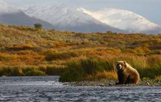
Experience wildlife, history, and culture on Kodiak Island! The second largest island in the United States is full of opportunities to spot wildlife, particularly bears and whales. Kodiak National Wildlife Refuge, established in 1941, is home to 3,500 Kodiak brown bears, which visitors can view from a safe distance on guided tours available through local lodges and camps. The Kodiak Brown Bear Center & Lodge, owned by the Alutiiq people, is one of several sightseeing operators located in the refuge. Offshore, local charter boats will take you whale watching, though you may also be able to see them from atop cliffs or on beaches.
In downtown Kodiak, check out the Alutiiq Museum. The museum features exhibits on local archaeology as well as the culture and art of the Alutiiq/Sugpiaq people, who have lived in Alaska's southcentral and southwest coastal areas for over 7,500 years. A short walk away you'll find the Kodiak History Museum. Its many stories begin with the building itself: Built in 1808, it was at various points a private home, event space, and boarding house. GETTY IMAGES
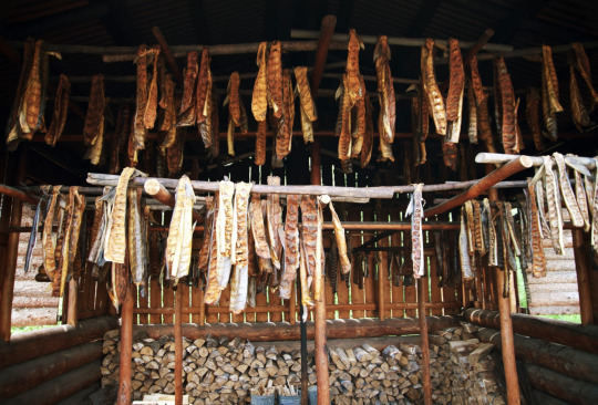
Discover Alaska's locally sourced food culture! The idea of "eating local," or sourcing food close to home, takes on a new dimension in Alaska. Home to over 12,000 rivers, three million lakes larger than five acres, and over 46,000 miles of shoreline, Alaska has an unparalleled bounty of fresh seafood. Some of the many species that inhabit Alaska waters include crab, shrimp, Pacific halibut, and salmon.
Don’t miss the chance to try salmon from an Alaska smokehouse, where filets are soaked in brine, hung out to dry, and smoked for hours over a wood fire. Historically, smokehouses indicated clan ownership of a river during the summer fishing season and are a longstanding way that Alaska Native cultures have preserved salmon. Restaurants like Duck Point Smokehouse in the Tlingit village of Hoonah allow visitors to indulge in this culinary tradition.
Other locally sourced products to keep an eye out for include birch syrup and meats such as elk, bison, and reindeer. Take a culinary tour or cooking class to sample and learn more about these foods. Also be sure to visit some of the state's many craft breweries, wineries, and distilleries. JMP TRAVELER, ADOBE
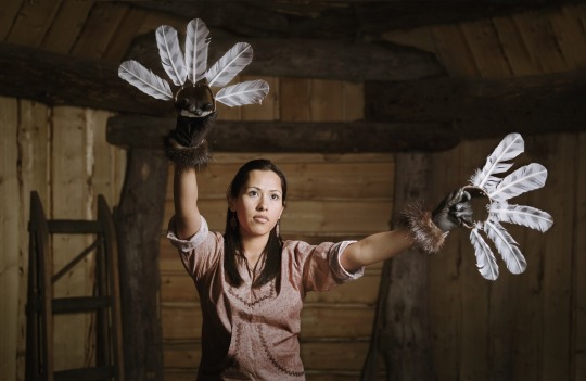
Visit the Alaska Native Heritage Center! Alaska is home to over 229 federally recognized tribes—and one of the best ways to learn about Alaska’s diverse living cultures is at the Alaska Native Heritage Center (ANHC) on Dena’ina lands in Anchorage. A unanimous vote of the Alaska Federation of Natives in 1987 kicked off the effort to build the center, which opened in 1999 and has welcomed visitors since. In 2021, the Ford Foundation recognized the ANHC as one of America’s Cultural Treasures.
The center includes six life-size villages, which offer a window into traditional ways of life for Alaska’s Iñupiat, St. Lawrence Island Yupik, Athabascan, Eyak, Haida, Tsimshian, Tlingit, Unangax̂, Alutiiq/Sugpiaq, Yup’ik, and Cup’ik peoples. Enjoy a self-guided tour of the villages’ dwellings and artifacts, but be sure to leave time to attend one or more of the many events at the center’s main complex, the Gathering Place. On any given day, you might be able to catch the astounding athletics of Alaska Native games, watch a traditional dance performance, learn words and phrases from one of Alaska’s 300 dialects, share teatime with an Elder, or join a guided tour of the exhibits at the Hall of Cultures. KILIII YUYAN
Visit Utqiaġvik, the northernmost U.S. town! Utqiaġvik is a town of great beauty and great extremes. In U.S. territory, it's as far north as you can get. From May 12 to August 2, the sun never sets. And from November 18 to January 23, darkness reigns 24 hours a day. Even in summer, a trip to the beach demands fortitude if you plan to go near the water, since the frigid Arctic Ocean waters hover in the low 30s Fahrenheit.
Drawn by the migration of Arctic bowhead whales, humans have inhabited Utqiaġvik for at least a millennium, with evidence of former residents going back as far as 1,500 years. Now one of the largest Iñupiat settlements in Alaska, Utqiaġvik was known as Barrow until 2016, when residents voted to revert back to the town's traditional name.
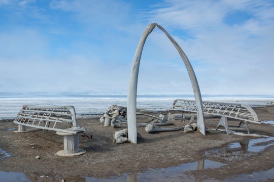
While you're visiting "the rooftop of the world," don't miss the Iñupiat Heritage Center, which features exhibits, a library, and events and demonstrations led by locals. Other spots to see include the "Gateway to the Arctic," a massive whalebone arch on the beach near the Cape Smythe Whaling and Trading Station that commemorates the town’s relationship to whaling, and the Birnirk National Historic Landmark archaeological site, which marks evidence of habitation by the Birnirk culture from about 500 to 900 A.D. MICHELLE HOLIHAN, ADOBE

Attend a festival or market! Year-round, Alaska hosts unforgettable events that offer a chance to experience regional customs, shop for locally made goods, and cheer on competitors in races and games. The Festival of Native Arts held each year in February or March is just one of many Alaska Native festivals and events. Since 1973, the festival has brought together artists, musicians, and storytellers at the University of Alaska Fairbanks to share workshops and performances.
Around the June solstice, Utqiaġvik holds the whaling festival of Nalukataq, a celebration that includes launching people into the air with a group-held blanket. "This cultural celebration is one of the best ways to experience the true meaning of sharing and really highlights the value system of the Iñupiat," writes Tara Sweeney, who grew up in Utqiaġvik. Other events include June's biennial Celebration festival in Juneau and the four-day World Eskimo-Indian Olympics, held in Fairbanks in July. VICKI BEAVER, ALAMY
1 note
·
View note
Last Seen Blogs

sylvctica
* 𝑨𝑹𝑩𝑶𝑹𝑼𝑴 𝑫𝑬𝑰 .

journalisminmassmedia
Journalism In Mass Media

yonderlad
Rufus the Red

mega-pc
MEGA PC

mightyspritey
Home Made Homestuck Sprites