#british columbia
Text
The B.C. government and the Council of the Haida Nation have signed an agreement officially recognizing Haida Gwaii's Aboriginal title, more than two decades after the nation launched a legal action seeking formal recognition.
The province announced last month that it had reached a proposed deal with the Haida, which Indigenous Relations and Reconciliation Minister Murray Rankin called a "foundational step in the reconciliation pathway of Haida Nation and B.C."
On April 6, the nation announced that more than 500 Haida citizens had voted 95 per cent in favour of approving the Gaayhllxid/Gíhlagalgang "Rising Tide" Haida Title Lands Agreement.
"This does not mean that the government is granting us anything. We have always held our inherent rights and title to our lands," Tamara Davidson, a Vancouver regional representative for the Council of the Haida Nation, told CBC News on Sunday.
"We were born knowing this is ours." [...]
Continue Reading.
Tagging: @newsfromstolenland, @vague-humanoid
#cdnpoli#Landback#Indigenous politics#Indigenous Sovereignty#First Nations#Haida Nation#Haida Gwaii#British Columbia
175 notes
·
View notes
Text
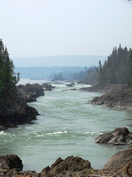
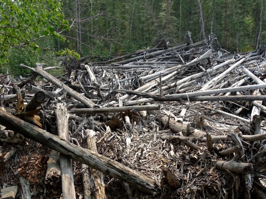

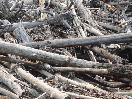

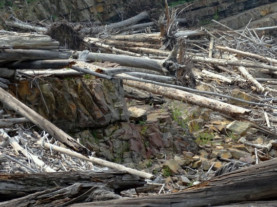


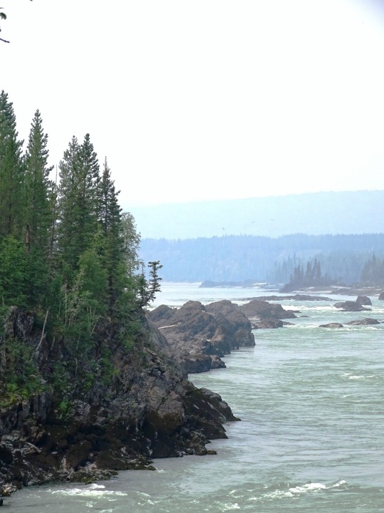
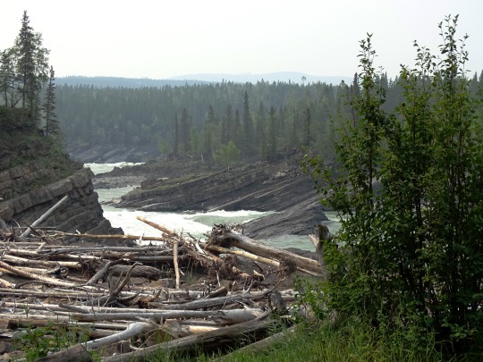
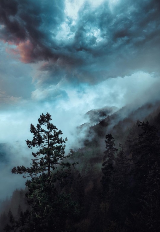
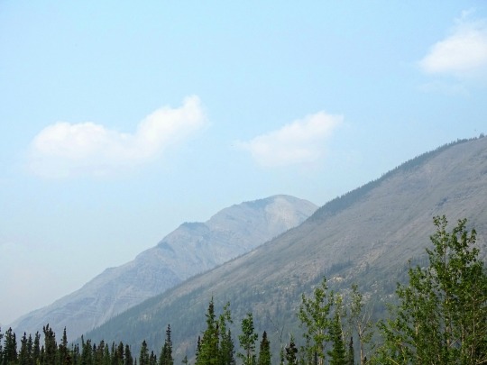
Whirlpool Canyon, BC (No. 5)
With the advent of industrial logging practices, the global quantity of driftwood has declined. Early accounts indicate that driftwood was once more plentiful. Early photographs of the pacific coast reveal greater amounts of driftwood on the beaches than is present today. Likewise, when traveling in Dixon Entrance in the late 1800s, George A. Dorsey recorded that many beaches were "piled high with drift, often to a height of sixty feet or more. " Melting polar ice may also contribute to the decline of Siberian driftwood in the Atlantic as the sea ice enabled driftwood to travel greater distances without becoming waterlogged.
Source: Wikipedia
#Skooks Landing#driftwood#Whirlpool Canyon#shale Rock#BC#Liard River#travel#original photography#vacation#tourist attraction#landmark#landscape#countryside#British Columbia#woods#forest#nature#flora#tree#river bank#wildfire smoke#summer 2023#Canada#view#vista point#boreal forest
20 notes
·
View notes
Text

King!
Pika - British Columbia
Taken By Alexandre Crouzet
#alexandre crouzet#photographer#pika#animal#mammal#wildlife#nature#british columbia#canadian geographic
28 notes
·
View notes
Text


(taken from @/sarahofmagdalene on instagram.)
A NOTE TO THOSE WHO MAY BE PARTICIPATING IN PRO PALESTINE ACTIONS IN VANCOUVER.
Please, even if you don’t live in Vancouver, reblog to spread awareness. The canadian media isn’t covering the protests, let alone the hostility protesters face, so we can only rely on each other to get news like this around!
EDIT: if you have either made this post about whether the punisher would disagree with the above, or you intend to do that, you are now being heavily advised to donate to either unrwa or the pcrf. i don’t care if you can’t spare more than a fucking nickel, donate the nickel. you saw a post about trying to keep anti-genocide protesters safe & reacted like this was fandom discourse, pay up & learn how to fuckin behave.
reblog this version going forward please.
#holy shit this is terrifying#free palestine#free gaza#gaza strip#gaza genocide#british columbia#protest safety#canada#vancouver#bc#gaza#palestine
16K notes
·
View notes
Text
For years, the people of the Kitasoo/Xai’xais First Nation watched over their waters and waited. They had spent nearly two decades working with Canada’s federal government to negotiate protections for Kitasu Bay, an area off the coast of British Columbia that was vulnerable to overfishing.
But the discussions never seemed to go anywhere. First, they broke down over pushback from the fishing industry, then over a planned oil tanker route directly through Kitasoo/Xai’xais waters.
“We were getting really frustrated with the federal government. They kept jumping onboard and then pulling out,” says Douglas Neasloss, the chief councillor and resource stewardship director of the Kitasoo/Xai’xais First Nation. “Meanwhile, we’d been involved in marine planning for 20 years – and we still had no protected areas.”
Instead, the nation watched as commercial overfishing decimated the fish populations its people had relied on for thousands of years.
Nestled on the west coast of Swindle Island, approximately 500km north of Vancouver, Kitasu Bay is home to a rich array of marine life: urchins and abalone populate the intertidal pools, salmon swim in the streams and halibut take shelter in the deep waters. In March, herring return to spawn in the eelgrass meadows and kelp forests, nourishing humpback whales, eagles, wolves and bears.
“Kitasu Bay is the most important area for the community – that’s where we get all of our food,” Neasloss says. “It’s one of the last areas where you still get a decent spawn of herring.”
So in December 2021, when the Department of Fisheries and Oceans withdrew from discussions once again, the nation decided to act. “My community basically said, ‘We’re tired of waiting. Let’s take it upon ourselves to do something about it,’” Neasloss says.
What they did was unilaterally declare the creation of a new marine protected area (MPA). In June 2022, the nation set aside 33.5 sq km near Laredo Sound as the new Gitdisdzu Lugyeks (Kitasu Bay) MPA – closing the waters of the bay to commercial and sport fishing.
It is a largely unprecedented move. While other marine protected areas in Canada fall under the protection of the federal government through the Oceans Act, Kitasu Bay is the first to be declared under Indigenous law, under the jurisdiction and authority of the Kitasoo/Xai’xais First Nation.

Pictured: "In some ways, I hope someone challenges us" … the Kitasoo/Xai’xais stewardship authority.
Although they did not wait for government approval, the Kitasoo did consult extensively: the declaration was accompanied by a draft management plan, finalised in October after three months of consultation with industry and community stakeholders. But the government did not provide feedback during that period, according to Neasloss, beyond an acknowledgment that it had received the plan...
Approximately 95% of British Columbia is unceded: most First Nations in the province of British Columbia never signed treaties giving up ownership of their lands and waters to the crown. This puts them in a unique position to assert their rights and title, according to Neasloss, who hopes other First Nations will be inspired to take a similarly proactive approach to conservation...
Collaboration remains the goal, and Neasloss points to a landmark agreement between the Haida nation and the government in 1988 to partner in conserving the Gwaii Haanas archipelago, despite both parties asserting their sovereignty over it. A similar deal was made in 2010 for the region’s 3,400 sq km Gwaii Haanas national marine conservation area.
“They found a way to work together, which is pretty exciting,” says Neasloss. “And I think there may be more Indigenous protected areas that are overlaid with something else.”
-via The Guardian, 5/3/23
#indigenous#indigenous issues#indigenous sovereignty#canada#british columbia#land back#first nations#tribal sovereignty#pacific northwest#marine protected area#conservation#sustainability#overfishing#marine science#canadian government#kitasoo-xai'xais#direct action#good news#hope
11K notes
·
View notes
Text
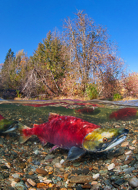

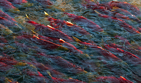
Male sockeye salmon (Oncorhynchus nerka) in Adams River, British Columbia
Photos by Alex Mustard
#Oncorhynchus nerka#Oncorhynchus#salmon#sockeye salmon#red#fish#red fish#male salmon#salmon river#adams river#river#river fish#british columbia#animals#wildlife#nature#breeding season
5K notes
·
View notes
Text
i was inspired by my last rb.
#i’m sorry the rest of the world#canada#geography#poll#polls#north america#yukon#northwest territories#nunavut#british columbia#alberta#saskatchewan#manitoba#ontario#québec#newfoundland#newfoundland and labrador#prince edward island#new brunswick#nova scotia#simon says
1K notes
·
View notes
Text

Mountain meadow near North Bend, British Columbia, Canada by Justin Brown
#canada#north bend#british columbia#mountain#mountains#meadow#meadows#landscape#nature#flowers#wild flowers#nature aesthetic#petitworld favs#petitworld
1K notes
·
View notes
Text

(by Nicholas Bullett)
#vertical#landscape#x#a#watsf#curators on tumblr#water#trees#Nicholas Bullett#cliff#waterfall#snow#Mission#British Columbia#canada
2K notes
·
View notes
Text
juusohd
3K notes
·
View notes
Text
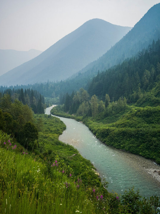
Selkirk mountains, Revelstoke, British Columbia, Canada
#Revelstoke#british columbia#canada#mountains#river#wildflowers#photography#curators on tumblr#nature#Aesthetic#nature photography#trees#forest#woods#landscapes#1k
6K notes
·
View notes
Text
The latest snow survey and water supply bulletin from the BC River Forecast Centre has provincial officials worried about the coming spring and summer months.
The report said B.C.’s snowpack is at 63 per cent of normal right now, which is the lowest in 50 years.
Last year at this time, B.C.’s provincial snowpack average was at 88 per cent.
“We know this is concerning news. Communities around B.C. experienced serious drought conditions last summer,” B.C. Minister of Water, Land and Resource Stewardship Nathan Cullen said.
“It fuelled the worst wildfire season ever, harmed fish and wildlife, and affected farmers, ranchers, First Nations and industry.” [...]
Continue Reading.
Tagging: @newsfromstolenland
#cdnpoli#British Columbia#environment#flora & fauna#conservation#Indigenous politics#environmental racism
59 notes
·
View notes
Text
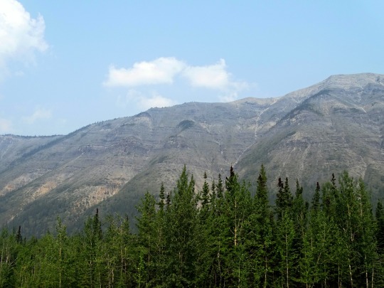
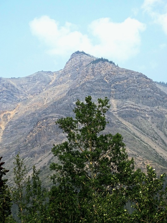


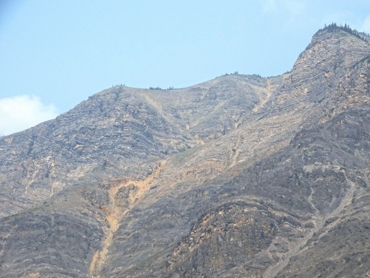
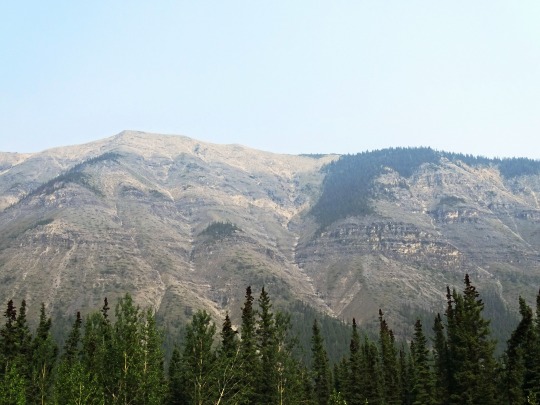
Sentinel Range, BC
The Sentinel Range is one of the northernmost sub-ranges of the Canadian Rockies, lying between Muncho Lake (SW) and the Liard River (N). The northernmost is the Terminal Range, so named for its position at the terminus of the Rockies, and lies to its west.
Source: Wikipedia
#Sentinel Range#BC#travel#original photography#vacation#tourist attraction#landmark#landscape#countryside#British Columbia#woods#forest#nature#flora#tree#wildfire smoke#summer 2023#Canada#view#vista point#boreal forest#Canadian Rockies#Rocky Mountains#blue sky#clouds#Northern Rockies
17 notes
·
View notes
Text
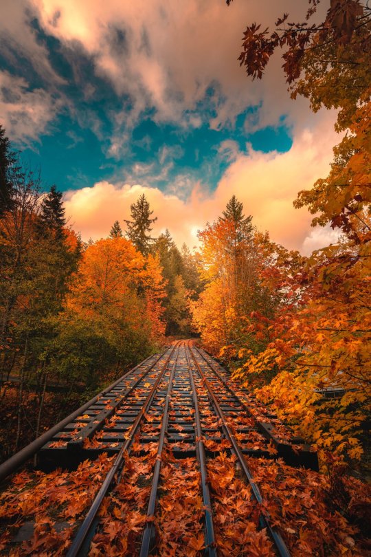
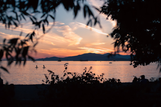
“The Autumn Express” by | Zach Doehler
Vancouver Island, British Columbia
#vancouver island#landscape#nature#autumn#fall#architecture#travel#british columbia#canada#curators on tumblr#uploads
2K notes
·
View notes
Text
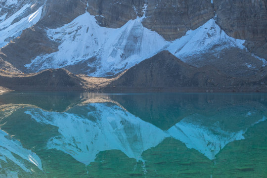

Floe Lake, Kootenay National Park by Darren Umbsaar
1K notes
·
View notes
Text
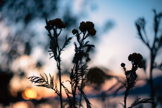
sammfisherphoto
#photographer#vancouver#photography#nature#travel#flowers#naturecore#aesthetic#british columbia#landscape#forestcore#photooftheday#photographers on tumblr#wonderland#cottagecore#urban forest#sunset#pastel aesthetic#bokeh#summer#beach#kitsilano beach#kits beach#tumblrphotos#instatumblr
2K notes
·
View notes
Last Seen Blogs

jdubbthaking-blog
Untitled

puff-3501
Puff_3501
vent-to-me-baby
crybaby

cherryborg71
The Love of Rosenthal 725
wandasshirtblog
WandaCrumbs