mountrainiernps
Mount Rainier National Park
The official Mount Rainier National Park tumblr page.
1617 posts
Don't wanna be here? Send us removal request.
Last Seen Blogs

autoeandthenerds
AutoE and my Nerddom
autoeandthenerds
AutoE and my Nerddom

origsmocs
Orig's Mocs & Such

cothach876
Sans titre

spirase
*₊ ° . ☆
Text

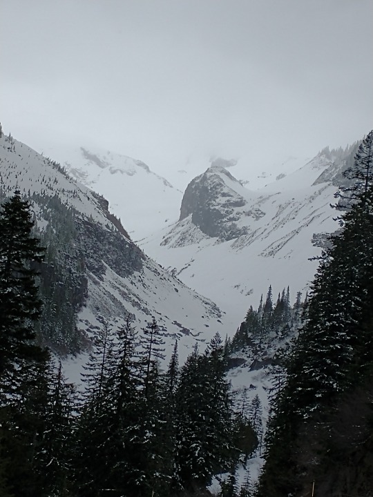
NPS Photo of Stevens Canyon Road viewed from Faraway Rock above Reflection Lakes.
When the National Park Service was created in 1916, the enabling legislation that created the park “for the benefit and enjoyment of the people” also mandated that the land be retained in its natural condition, protected from “injury and spoliation.” So, as Mount Rainier National Park was being developed, park officials had to provide access without marring the spectacular scenery. To solve this problem, park architects and engineers innovated a new design aesthetic that blended roads and structures with the natural landscape.
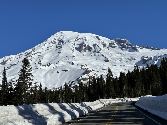
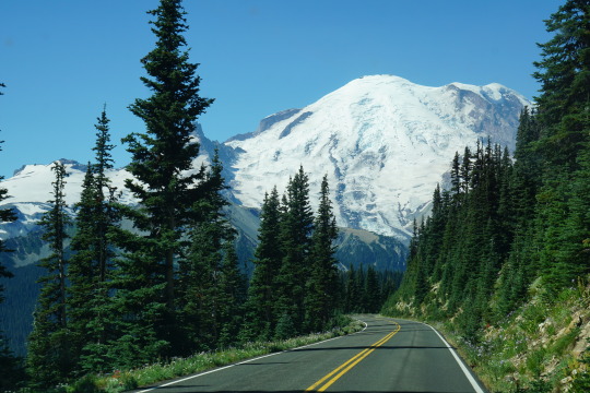
NPS Photos of Paradise Road (left) and Sunrise Road (right).
The parkwide road and bridge system built between 1920 and 1957 featured natural materials such as local stone and wood. Roads curved with the landscape to reveal views and bridges framed waterfalls. This “NPS Rustic” style of architecture became the design standard for the National Park Service. Today, Mount Rainier’s innovative roads and bridges are still preserved as part of the park’s National Historic Landmark District.
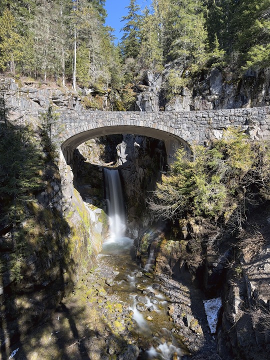
NPS Photo of Christine Falls Bridge.
#National Park Week#mount rainier national park#NPS Rustic#rustic architecture#National Historic Landmark District#historic roads#Christine Falls#Christine Falls bridge#historic bridge#Sunrise Road#Paradise Road
15 notes
·
View notes
Text
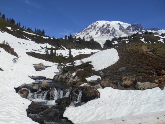
Creeks. In the summer, creeks are great little riparian areas to see water loving plants (Lewis monkeyflower, etc.) and water loving animals (American dipper to name one).
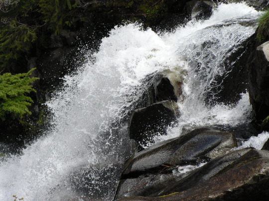
In Spring, creeks can be a bit more dangerous. One risk is that the deep snow pack builds snow bridges over the higher elevation creeks. As the snow melts, these snow bridges get thinner and thinner. Supporting less and less weight until something falls through. Please, don’t let that something be you.
While it’s great to spend these longer spring days out exploring, it’s important to know where a hidden creek may be lurking under a fragile snow bridge. Either using a paper or digital map, or GPS (make sure to have extra batteries), you can figure out where hidden creeks may be skulking and avoid these dangerous traps.
Creeks look happy, cheerful and benign in the summer but these hidden creeks can be running bank-full of just above freezing water. A fall could be a quick, freezing dip, or it could be far, far worse.
Play it safe and have a great adventure. Use your maps or GPS so you can have a wonderful time in your national park.
Which do you prefer paper maps or digital? Do you prefer a GPS over a plain map?
Park information on winter safety can be found here https://www.nps.gov/mora/planyourvisit/winter-safety.htm Information on the 10 Essentials can be found on this website https://www.nps.gov/articles/10essentials.htm Northwest Avalanche Center is at Home - Northwest Avalanche Center (nwac.us)
These photos are from years past and do not reflect current conditions. NPS/S. Redman photo. Waters of Paradise River cascade over rocks. June 2005. NPS photo. Looking up paved asphalt of Dead Horse Creek trail towards Mount Rainier. Dead Horse Creek waters run down over rocks beside the trail. May 2015.
25 notes
·
View notes
Text

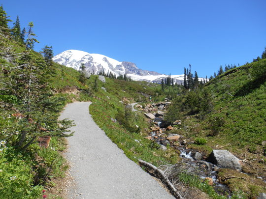
To kick off National Park Week, discover a park near you! All National Park Service sites are entrance fee free today. Is there a NPS site you’ve always wanted to visit?
Many of Mount Rainier National Park’s roads and trails are still covered in snow, but now may be a great time to discover a different side of the park. Snow can linger well into June, but by snowshoeing you can still explore the mountain! Check out Mount Rainier’s Beginner’s Guide to Snowshoeing to get started.
If you’ve already tried snowshoeing at Mount Rainier, what was your favorite memory of the experience?
NPS Photo of snowshoe tracks at Paradise.
25 notes
·
View notes
Text
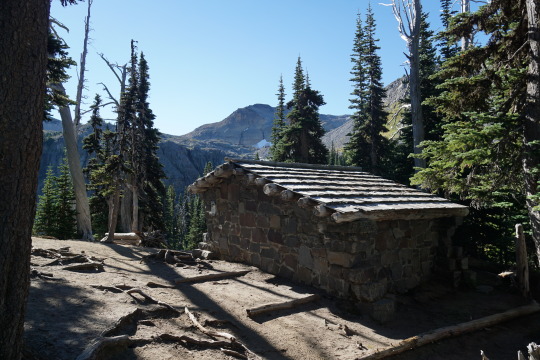
NPS Photo of the Summerland Shelter in 2020.
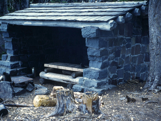
Most patrol cabins and shelters in Mount Rainier National Park are made out of wood, but two trail shelters along the Wonderland Trail were constructed out of stone by the Civilian Conservation Corps. The first, Summerland Trail Shelter, was built in 1934 and the second, Indian Bar Trail Shelter, was built in 1940.
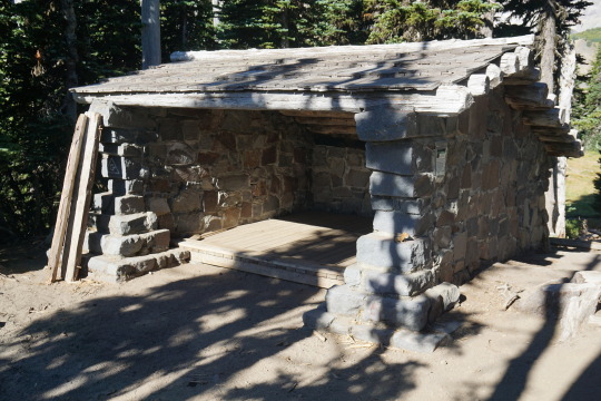
NPS Photos of the Summerland Shelter in 1963 and in 2020.
The supervisory landscape architect overseeing the construction of the Summerland Shelter remarked “the workmen were inexperienced in stonework and the shelter was not too good in appearance, but it was in harmony with its location”. The trail shelters have stone masonry walls on three sides, the fourth side open, log rafters, and cedar shake roofs. The Indian Bar shelter also has a stone chimney.


NPS Photo of Indian Bar Shelter in 1970 and NPS/RJ. Hentges Photo of Indian Bar Shelter, date unknown.
Both Summerland and Indian Bar Trail Shelters are part of the Mount Rainier Historic Landmark District. Have you stopped for a rest at one of these trail shelters while hiking?
#Historic Mount Rainier#mount rainier national park#trail shelter#historic building#national historic landmark district
30 notes
·
View notes
Text
Have you ever hiked somewhere in the summer or fall and thought, “this would be a great place for snow camping?”

Well, have we got a deal for you. Snow camping is still open in the higher elevations of the park, places like Reflection Lake or Mazama Ridge.
You’ll need a free backcountry permit that you can pick up from a ranger at the Longmire Museum on weekdays or Jackson Visitor Center on weekends. The rangers can help you figure out what spot might be good for you to snowshoe or ski to. Make sure you have ways to protect your food and food-smelling items safe from wildlife. And then, with all your gear prepped, it’s time to head out.
You can camp in one of these wonderful places and have it all to yourself. Reflection Lake to yourself? Doesn’t that sound amazing?
Snow camping closes when the snow is too shallow to protect plants or until May 15, whichever comes first.
Great information can be found online at https://www.nps.gov/mora/planyourvisit/winter-camping.htm
We hope you have a great time enjoying the snowy solitude of the park.
These photos are from years past and do not reflect current conditions. NPS Photo. Looking up a skinny dirt trail on Mazama Ridge through an autumnal meadow to evergreen trees and then Mount Rainier. October 2014. NPS Photo. View of snow covered trees and meadows of Paradise River Valley and Mazama Ridge beyond. February 2022.
24 notes
·
View notes
Text
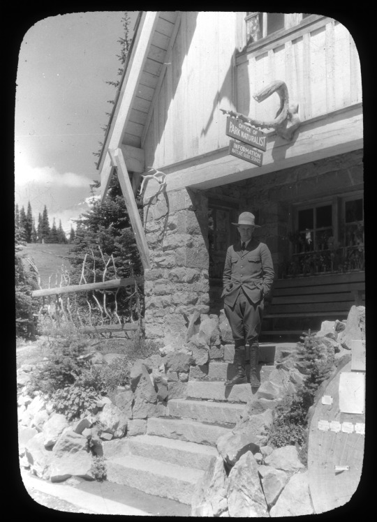
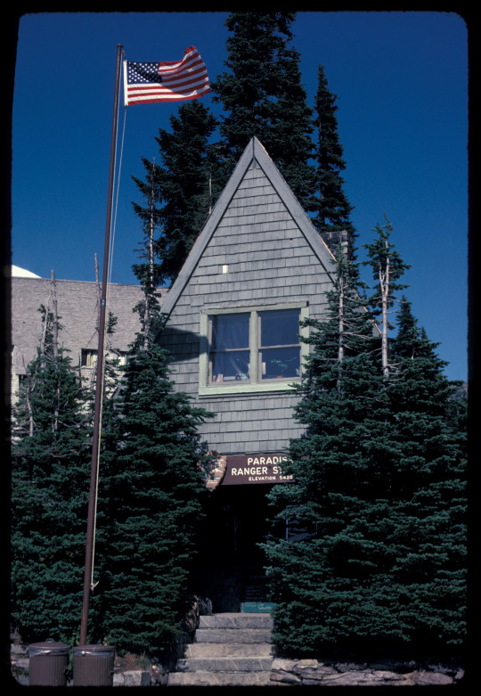
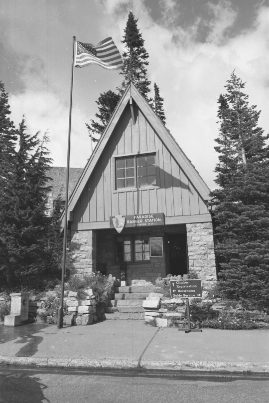
Mount Rainier National Park Archives Photo of the Paradise Ranger Station with the park’s first naturalist, Ranger Floyd Schmoe, in the 1920s.
The Paradise Ranger Station was constructed in 1921 and was the first government-built structure of its kind at Mount Rainier. Built by the National Park Service in the Rustic style, its steeply pitched roof was designed to withstand the excessive amounts of snowfall at Paradise. The front has a full width 1-story stone porch accessed by stone steps, which descend directly onto the sidewalk. The NPS Rustic style uses native materials like wood and stone to minimize contrast from the natural setting. Shrubs and trees were also planted around the ranger station to better help it blend with the environment and not detract from the visitors’ experience of nature. The Paradise Ranger Station is part of the Mount Rainier Historic Landmark District.
NPS Photo of the ranger station in 1984 (left). Mount Rainier National Park Archives Photo courtesy Val Lou photo of the Paradise Ranger Station in the 1990s (right).
The first floor of the ranger station was originally used as an information and checking station, with living quarters in the second story. The information center has since moved to the Climbing Guide House behind the ranger station, but the Paradise Ranger Station still serves as office space for rangers today. Have you noticed this building when visiting Paradise?
#Historic Mount Rainier#mount rainier national park#Paradise Ranger Station#Paradise#National Historic Landmark District#historic building#ranger station#NPS Rustic#architecture
38 notes
·
View notes
Text
Spring has sprung and our minds start to linger on …. snow.
Spring can be a great time to snowshoe, ski or snowboard. The light lasts longer and days are warming up. You can slather on the sunblock and head out for adventure from Paradise.
But before you leave the parking lot, can we take a moment of your time?
As the temperatures rise and solar increases, the snow pack is going through some changes. The warming temps can lead to risk from avalanches.
Most of the time, we think of avalanche danger as something after snowstorms, but it’s also in the spring. Wet slab and wet loose avalanches can and do occur on the slopes of our mountain.
So before you leave the parking lot, take one last second to research the latest weather and avalanche conditions. The hard working folks at Northwest Avalanche Center have tons of great intel on their website. Check your gear. Is your beacon on and have good power? Are you shovel and probe in good working condition? Do you have the latest info?
Great. Have a wonderful time on your mountain and tell us all about it when you get back.

Park information on winter safety can be found here https://www.nps.gov/mora/planyourvisit/winter-safety.htm Information on the 10 Essentials can be found on this website https://www.nps.gov/articles/10essentials.htm Northwest Avalanche Center is at Home - Northwest Avalanche Center (nwac.us)
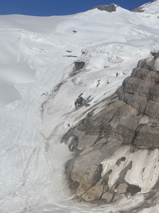
These photos are from years past and do not reflect current conditions. NPS Climbing Ranger Photo. Wet slab avalanche started below Anvil Rock running down to Cowlitz Glacier. 6/24/2022. NPS Climbing Range Photo. Wet loose avalanche in Glacier Basin. 6/2022.
20 notes
·
View notes
Text
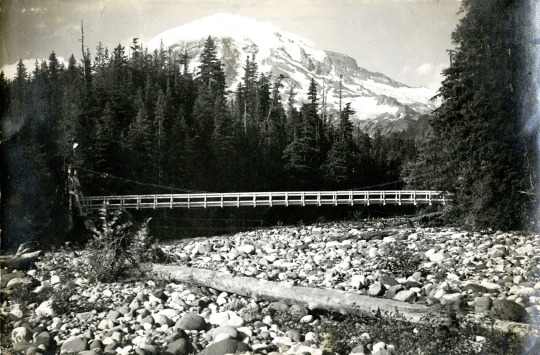
Mount Rainier National Park Archives Photo courtesy Phillip F Barrett of the Nisqually Suspension Bridge. A pedestrian bridge is faintly visible under the suspension bridge.
The Nisqually Suspension Bridge in Longmire is the only remaining timber-frame vehicle suspension bridge designed by the National Park Service. A pedestrian bridge had existed since 1911 but was replaced by a larger single-span suspension bridge in 1924 to connect Longmire to an area across the river that was developed as a campground. Superintendent Tomlinson described the newly completed bridge: “The bridge with its rustic towers supporting the cable suspension is a very fitting type of construction for a national park.” (HAER report No. WA-44).
The Nisqually Suspension Bridge was reconstructed in 1952 and 2005, using similar workmanship and materials to the earlier bridge. The Nisqually Suspension Bridge is a contributing structure in the Mount Rainier Historic Landmark District.
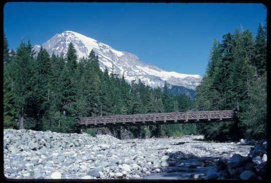

NPS Photos of the bridge in 1993 (top) and in 2021 (bottom).
The bridge is also part of the Longmire Historic Walking Tour. Stop in the Longmire Museum for a map of the walking tour or use the NPS App to follow the self-guided tour the next time you are in Longmire. Have you walked or driven over the Nisqually Suspension Bridge in Longmire?
#Historic Mount Rainier#mount rainier national park#Nisqually Suspension Bridge#Longmire#Longmire Suspension Bridge#bridge#suspension bridge#historic bridge#national historic landmark district
25 notes
·
View notes
Text
Can we talk about snow bridges?
Snow, especially when it piles up deep, can hide many things. It blankets the ground. It buries shrubs and small trees. It can even make bridges over creeks. When this happens, it’s called a snow bridge.
The problem with snow bridges? We just can not trust them. As Spring brings longer days and warmer temperatures, the snow pack warms too and slowly starts melting. The snow bridges that might have built up thick and deep get small, skinny and undependable. What one person snowshoed across in February is not necessarily safe in March. Holes melt out and sometimes animals or people can fall through into the icy waters below.

The photos are both of Edith Creek above Myrtle Falls. In the photo with deep snow, you can see snowshoe tracks across the snow bridge over the creek and it looks like everyone stayed safe and out of the water. In the second photo, it’s late spring and a lot of snow has melted. There are still some skinny bridges over the creek but hopefully no one trusted their life on them.
How do you stay safe around snow bridges?
What have you learned that has kept you safe and dry?
Park information on winter safety can be found here https://www.nps.gov/mora/planyourvisit/winter-safety.htm Information on the 10 Essentials can be found on this website https://www.nps.gov/articles/10essentials.htm Northwest Avalanche Center is at Home - Northwest Avalanche Center (nwac.us)
These photos are from years past and do not reflect current conditions. NPS Photo. Snowshoe tracks leading down and across Edith Creek then up into the hills of Edith Basin. January 2014. NPS Photo. View from wooden bridge looking up the cascades of Edith Creek to Alta Vista and Mount Rainier. Patchy snow with ground and plants showing. June 2019.
30 notes
·
View notes
Text
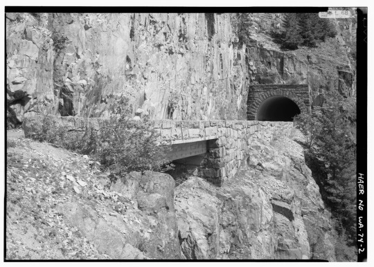
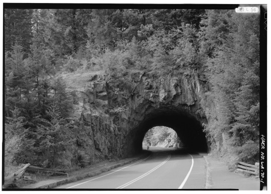
HAER-WASH-74 Photo of Stevens Canyon Tunnel (top) and HAER-WASH-70 Photo of Box Canyon Bridge (bottom) in 1992.
Stevens Canyon Road has two of the three tunnels found in the park (the third is along SR123). Stevens Canyon Tunnel was constructed in 1937 and bores through 210 feet of solid rock. Box Canyon Tunnel was built from 1950-1952 and is 160 feet long. Unlike Stevens Canyon Tunnel, the tunnel walls and portals of the Box Canyon Tunnel were not covered with masonry but left as bare rock due to the “excellent nature of the rock encountered” (HAER report No. WA-70). While built after World War II, the Box Canyon Tunnel is considered consistent with earlier park road structures in the historic district. Both tunnels are part of the Mount Rainier Historic Landmark District.

NPS/B. Burnett Photo of Box Canyon Tunnel in 2021.
Have you driven through these two tunnels on Stevens Canyon Road (open during the summer only)?
#Historic Mount Rainier#mount rainier national park#Stevens Canyon Road#Stevens Canyon Tunnel#Box Canyon Tunnel#tunnel#Historic road#National Historic Landmark District
20 notes
·
View notes
Text
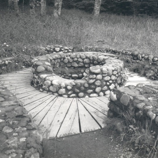
NPS Photo of Soda Springs in 2013.
The Longmire area was first settled by James Longmire, who’s family went on to run a health resort in the late 1800s to early 1900s using natural volcanic mineral springs found in the area. Two mineral springs built during 1920s remain from the original resort development in the Longmire Meadow.
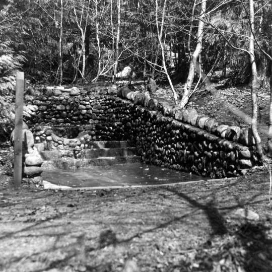
NPS/D. Schnute Photo of Soda Springs in 1986.
Soda Springs is named for the soda, magnesium, iron, and sodium chloride content of its waters. It has a stone masonry enclosure surrounded by a wooden plank walkway with a short spur trail edged by stone parapet walls.
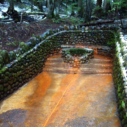
Mount Rainier National Park Archives Photo of Iron Mike circa 1940s (left). NPS Photo of Iron Mike in 2017 (right).
Iron Mike Springs has high iron content in the water, giving the spring both its rusty color and its name. Iron Mike has a circular stone masonry enclosure with concrete steps enclosed by a U-shaped parapet wall.
Both springs are contributing structures in the Mount Rainier Historic Landmark District. Have you viewed these springs along the Trail of the Shadows in Longmire?
#Historic Mount Rainier#mount rainier national park#Longmire#Longmire Meadow#Trail of the Shadows#Longmire Soda Springs#Iron Mike#volcanic mineral springs#mineral springs#history#national historic landmark district
22 notes
·
View notes
Text
How do you winter?
You might be thinking, “hey, it’s March and winter is over!”
That’s not quite true in the Cascade Mountains. As you go higher in elevation, it gets colder and more snow has piled up over the winter. At Paradise, we can get snow storms into June.
So while the temperatures are warming up, a little more sunshine, and days a bit longer, winter keeps a tight grip on the subalpine meadows like Paradise and Sunrise. The plants and animals are well adapted to the challenges of these winters.
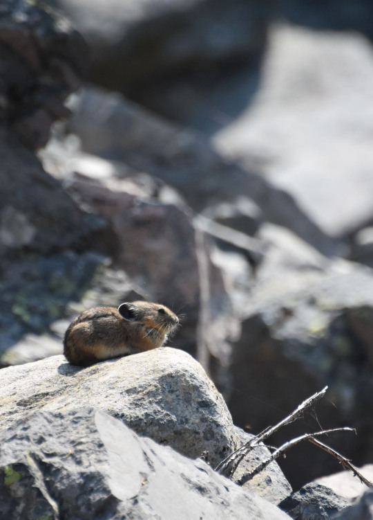
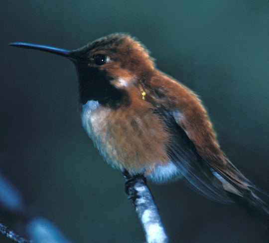
For animals, there is a choice. Do you travel to warmer climates, stay and snow camp, or snooze through the cold temps? Rufous hummingbirds are our champions or long-distance travel, migrating to the south and even Mexico in search of warm temperatures and food. Pikas are big winners at snow camping. They store food in the homes under the rocks all summer so that they can stay active all winter eating their stores. Last but not least, black bears are great hibernators. While not technically sleep, the bears lower metabolism, heart rate and respiration to make their fat stores last until snow melts and food emerges.
So, how do you winter?

NPS Photo. Rufous hummingbird circa 1975. NPS/I Metzen Photo. Pika perched on rock in talus field near Lake Louise. 2018. NPS/Spillane Photo. Black Bear, which come in several colors, among plants and shrubs. 2016.
113 notes
·
View notes
Text

Mount Rainier National Park Archives Photo of the Sunrise Day Lodge in 1932.
The Sunrise Day Lodge was built by the Rainier National Park Company (RNPC) in 1931. It was originally intended to be a much larger lodge similar to the Paradise Inn, but only one wing of the original design was constructed. Despite this, its large size, steeply pitched roof, and shingled exterior immediately attracts visitors arriving to Sunrise.

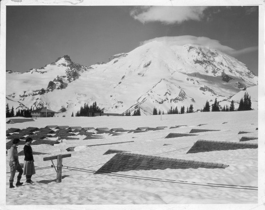
Mount Rainier National Park Archives Photos: Aerial view of Sunrise in the 1930s showing the cabins behind the lodge (left) and the cabins covered in snow in the spring (right).
Historically the lodge provided services to 215 overnight cabins with a cafeteria and concessionaire employee housing. The cabins were located on the meadow slopes behind the lodge. During World War II, tourism declined, and the concessionaire struggled to maintain funds. In an effort to offset their debt, the RNPC sold all the cabins at Sunrise for government defense installations as a part of the war effort and the structures were removed from Sunrise in 1944. However, the cabin’s linear rows left an indelible imprint on the fragile soil of the subalpine meadows. It took decades of natural growth and replanting to recover the area and some traces can still be seen on the slope behind the lodge.
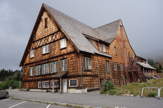
NPS Photo of the Sunrise Day Lodge in 2015.
The Sunrise Day Lodge is a contributing structure to the Mount Rainier Historic Landmark District. It still serves day visitors with a cafeteria/gift shop and has concessionaire employee housing. Have you stopped in the Sunrise Day Lodge during the summer?
#Historic Mount Rainier#mount rainier national park#Sunrise Day Lodge#Sunrise#Historic building#National Historic Landmark District#history
22 notes
·
View notes
Text
“I prefer winter and fall, when you feel the bone structure of the landscape. Something waits beneath it; the whole story doesn’t show.” – Andrew Wyeth
Winter lasts a long time in the higher elevations of the national park. Snow can cover the subalpine meadows into July. These long lasting, deep snows write amazing stories on the landscape. They also mean learning how to keep yourself and your friends and family safe.

How do you learn about being safe while having fun in the snow?
Do you have friends who are snow-savvy and showed you the ropes?
Did you take a class or two? Maybe from an outdoor community group or specialists like Northwest Avalanche Center?
What is your favorite source of winter and safety intel?

Park information on winter safety can be found here https://www.nps.gov/mora/planyourvisit/winter-safety.htm Information on the 10 Essentials can be found on this website https://www.nps.gov/articles/10essentials.htm Northwest Avalanche Center is at Home - Northwest Avalanche Center (nwac.us)
These photos are from years past and do not reflect current conditions. NPS Photo. Snow dusted Longmire parking and sidewalks with cars and building in background. December 2018. NPS Photo. Edith Basin blanketed in snow. Ski tracks crossing the snow leading up towards a ridge. January 2014. NPS Photo. View looking over a snowbank on the road to Paradise up to Mount Rainier with a lenticular cloud over the summit. January 2018.
19 notes
·
View notes
Text

NPS Photo of Mount Rainier with a portion of Mowich Lake Road viewed from Tolmie Peak in 1961 (Eunice Lake is in the foreground with Mowich Lake in the distance).
Mowich Lake Road, like other park roads, was initially planned as part of an “around-the-mountain” road system. Mowich Lake Road starts in the northwest corner of the park and was intended to connect to Westside Road, which starts from the southwest corner. The two roads were never completed due to budget constraints and the rugged topography of the mountain. Constructed from 1929-1934, Mowich Lake Road remains a six-mile long spur road (reached via SR165) and is a discontiguous portion of the Mount Rainier National Historic District. Original features along the road include one stone retaining wall and 39 rustic culverts with mortared stone headwalls.

Mount Rainier National Park Archives Photo of the Mowich Entrance Dedication in 1933.
Mowich Lake Road was dedicated in 1933 at the Mowich Lake Entrance (now at Paul Peak Trailhead). At the dedication, a log memorial was constructed in honor of Dr. William Fraser Tolmie who visited Mount Rainier a hundred years earlier in 1833 on a botanizing trip. The log memorial was intended to be incorporated into an entrance arch. The arch was never completed and the memorial no longer exists. Footage of the Mowich Lake Road dedication event can be viewed at: https://go.nps.gov/MMem-MowichDedication
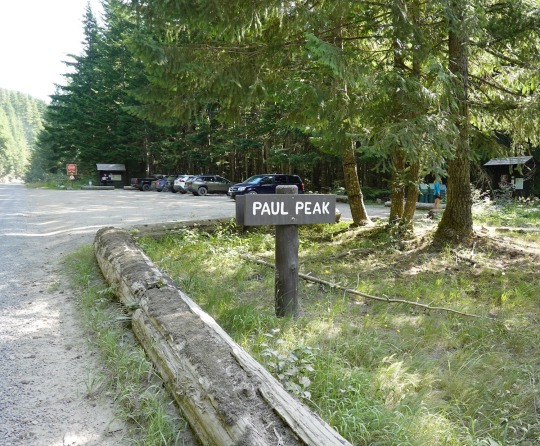
NPS Photo of the current Mowich Lake Road Entrance at Paul Peak Trailhead, 8/17/23.
While dedicated in 1933, delays due to construction and then WWII limited access and Mowich Lake Road did not open to vehicle traffic until July 1955. Have you traveled the historic Mowich Lake Road?
#Historic Mount Rainier#mount rainier national park#Mowich Lake#Mowich Lake Road#Paul Peak#Paul Peak Trailhead#historic road#national historic landmark district#history
62 notes
·
View notes
Text
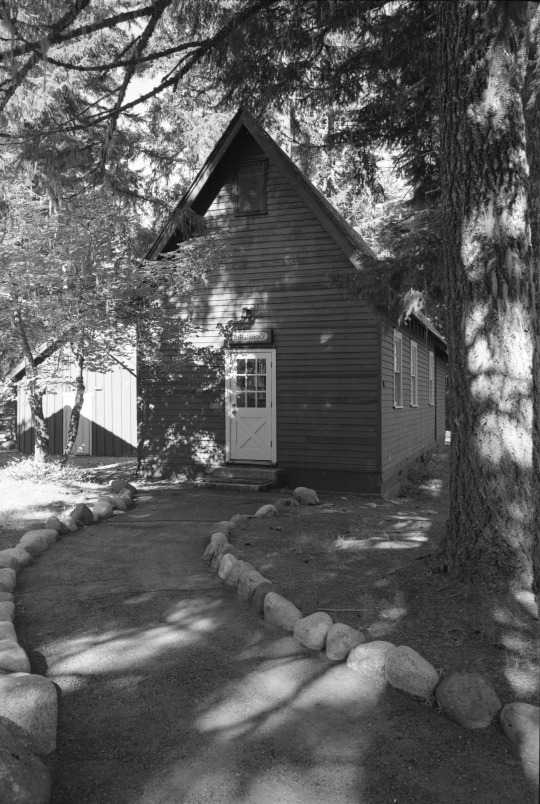
Mount Rainier National Park Archives Photo courtesy Val Lou of the Longmire Library in 1990s.
Most of the buildings in Longmire are excellent examples of the “National Park Service Rustic” style of architecture, which utilizes local materials like wood and stone to match the buildings to their environment. However, the Longmire Library predates the NPS Rustic style and serves as an example of an early, pre-NPS government building. The Longmire Library, completed in 1910, is the oldest government-built structure in Longmire. It features a steeply-pitched cedar shingle roof to shed snow and rough lapped Douglas-fir siding.
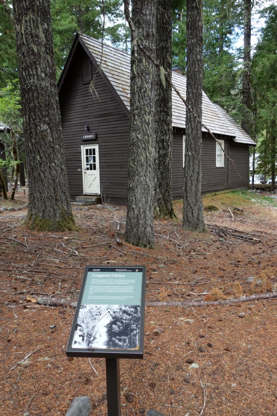
It first served as a community kitchen before becoming a library in the 1920s. From the 1950s to the 1970s, it was a branch of the Pierce County library system. Afterwards, the building served other purposes, such as a clubhouse for the Youth Conservation Corps. After its renovation in 1981, the building resumed its role as the park library where staff research the park's history and resources.
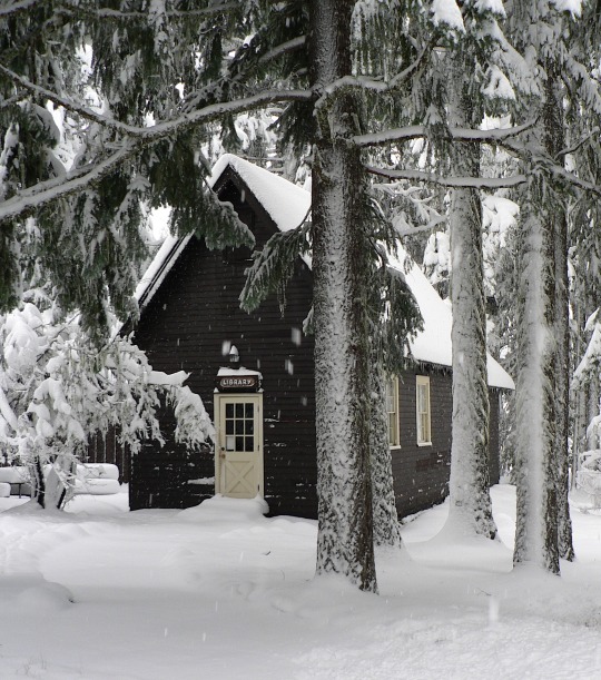
NPS Photos of the Longmire Library in winter in 2012 (left) and in summer in 2022 (right).
The Longmire Library is a contributing structure in the Mount Rainier Historic Landmark District and one of the stops along the Historic Longmire Walking Tour. Stop in the Longmire Museum for a map of the walking tour or use the NPS App to follow the self-guided tour the next time you are in Longmire.
#mount rainier national park#Historic Mount Rainier#Longmire#Longmire Library#National Historic Landmark District
18 notes
·
View notes
Text

If you’re going to camp out overnight in the winter, you’ll need a permit and a shelter. Do you like a tent, a snow cave, an igloo or do you prefer something else?
If you’re only going out snowshoeing or skiing for the day, what emergency shelter do you take with you?

As one of the Winter 10 Essentials, shelter can make a big difference when the unexpected happens and you need to spend a night out in the winter weather. There are lots of classes on this, from in-person to online.
Would you use your collapsible metal shove to dig a snow cave? Do you prefer to carry an emergency tent or tarp?
Winter camping and permit information can be found here https://www.nps.gov/mora/planyourvisit/winter-camping.htm .
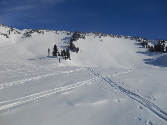
These photos are from years past and do not reflect current conditions. NPS Photo. View from trailhead for Carter Falls trail, looking across a snow covered Nisqually River channels to Eagle Peak. December 2018. NPS Photo. Upper end of Paradise River valley looking towards Sluiskin Falls with everything blanketed in snow. February, 2022. NPS Photo. View from Canyon Rim pull-out on road to Paradise of Nisqually River canyon to bottom of Nisqually Glacier. Upper Mount Rainier obscured by clouds. May, 2021.
28 notes
·
View notes