#灯台
Text


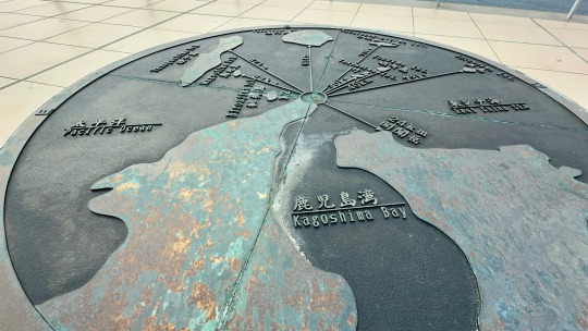


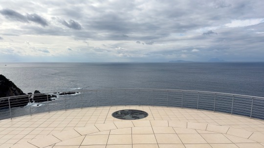

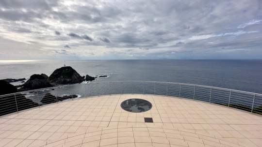
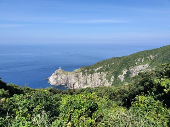
展望台の上からの景色
@佐多岬展望台
23 notes
·
View notes
Text

September 2023
28 notes
·
View notes
Text
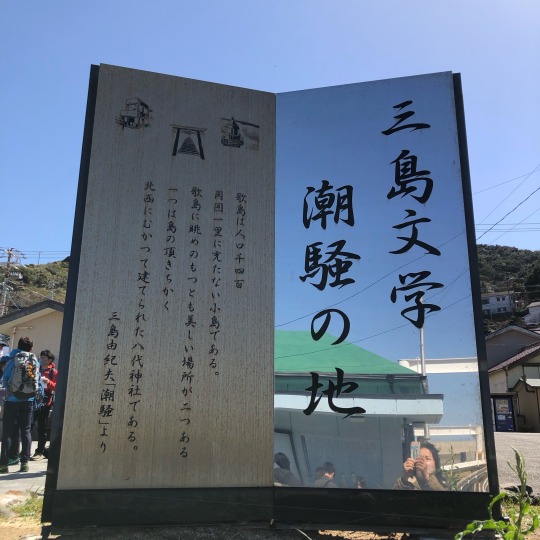


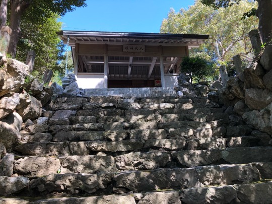

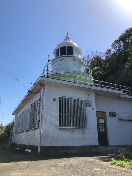
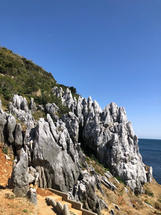
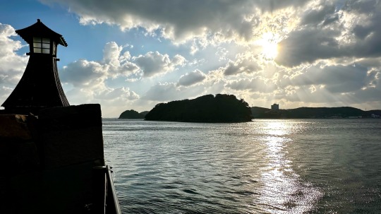
「潮騒」の旅をしに神島へ。美しい以上に美しく、あまりの素晴らしい景色に心が洗われました。
#神島#潮騒#潮騒の地#三島由紀夫#路地#時計台#どこも階段だらけ#八代神社#向かい獅子#灯台#カルスト台地#八丈岩#浜辺#yukio mishima#mishima#mishima yukio#the sound of waves#kamishima#kamishima iland#yatsushiro shrine#karst#karst topography#lighthouse#beach
62 notes
·
View notes
Text

103 notes
·
View notes
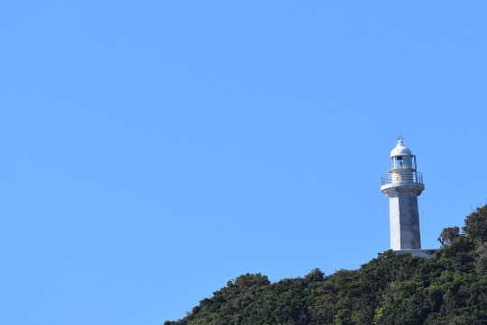
Photo
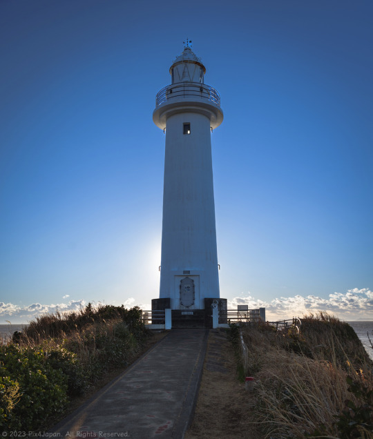
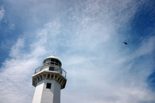
Towering Lighthouse on Cape
Location: Cape Tsumeki, Shizuoka Prefecture, Japan
Date: January 25, 2023
The Tsumekizaki Lighthouse (爪木崎灯台) was built in 1937 and rises 17.32 m (17.32 ft) above ground level and 37.83 m (124.11 ft) above sea level.
The lighthouse is only a 10-minute walk from the Cape Tsumeki parking lot. It’s a flat approach, so even if you have mobility issues, it is still easily accessible.
On a clear day, you can see eight of the inhabited islands that are as far as 10 km (6.21 mi) offshore of the Izu Peninsula and are still accessible by ferry.
Pentax K-1 II + DFA 28-105mm F3.5-5.6
28 mm ISO 100 for 1/250 sec. at ƒ/5.6
#海景写真#静岡県#南伊豆半島#爪木崎#爪木崎灯台#灯台#shootpentax#pix4japan#pentax_dfa28105#pentaxk1mkii#Shizuoka Prefecture#Japan#Izu Peninsula#Cape Tsumeki#lighthouse#seascape photography
19 notes
·
View notes


Text
***
– Я смотритель маяка. Моей ли душе пребывать во мраке?
– Под маяком всегда темно.
***
– I'm the lighthouse keeper. Should my soul be in darkness?
– It's always dark under the lighthouse.
13 notes
·
View notes
Text
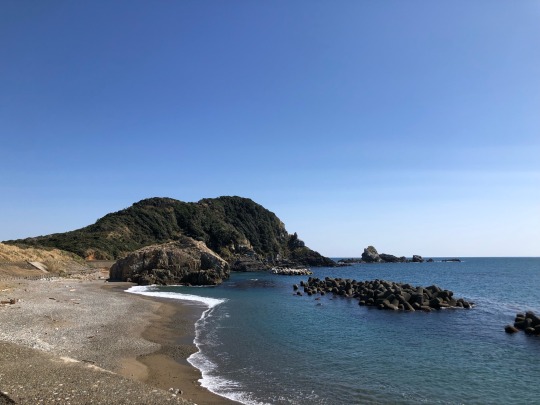
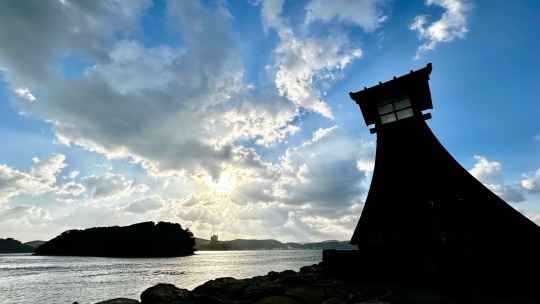
五島列島・福江島③

2023.8.28
灯台好きとしては外せない大瀬崎灯台にも行きました。映画「悪人」ロケ地です。
小さく見える灯台、分かりますか?
行きはよいよい帰りは…の道のりでした💦
行きは最寄りの駐車場から約20分下り、帰りは40分登りです。
開けたところに出てもまだある道!
横道にそれ、火曜サスペンスに出てきそうな崖道にも行ってみました(笑)
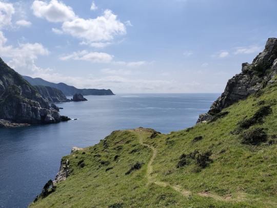

向こうの崖もすごかった!
#Fukuejima Island#Goto Islands#Nagasaki Prefecture#Osezaki Lighthouse#travel#五島列島#福江島#長崎県#大瀬崎灯台#lighthouse#灯台#旅行記#旅行
3 notes
·
View notes
Photo
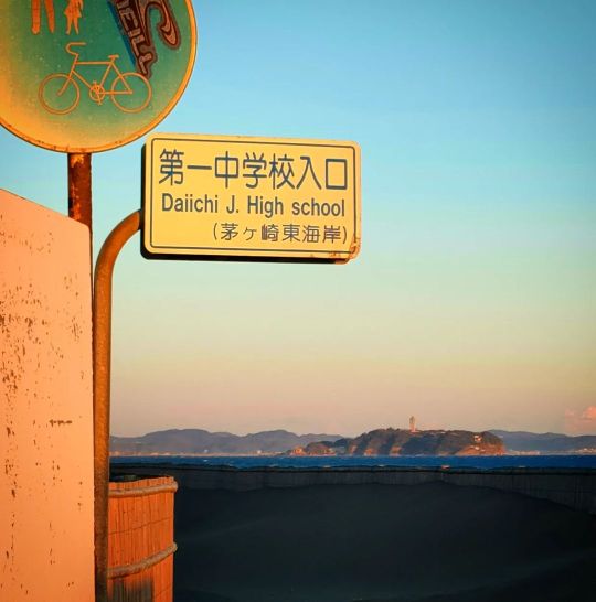
#江ノ島 の #灯台 は #ジャイアントアイスクリームコーン に似ている🤣 #Enoshima #Chigasaki #Fujisawa #Lighthouse that looks like a giant icecream cone!🤣🤣🤣 (ヘッドランドビーチ(Tバー)) https://www.instagram.com/p/CpTxfM1ydfX/?igshid=NGJjMDIxMWI=
2 notes
·
View notes
Photo

・ 東京 西荻窪のFALL @fall_mishina さんに、ポストカードやシールなどいろいろ納品させていただきました🪨🐚🌲カードでは冬の家、石ひろい、など最近のものから、羊を飼う、木のシリーズなど。灯台の蔵書票と封緘シールも。 イベントやフェア以外で都内で実際にお手に取っていただける場所なので、西荻さんぽの折などに思い出していただけたら嬉しいです。 展示のほか器に雑貨、本と音楽にアンティークと、それぞれが光りながらも同じ場所で調和する店内。棚のすみっこまで気になり、いつの間にか時間が経ってしまう不思議な空間です。先日は店主が何気なく売り場に置いた石ころたちと目が合ってしまいました🪨👀 #石 #石ころ #石ひろい #stone #ビーチコーミング #beachcombing #灯台 #lighthouse #活版印刷 #活版 #letterpress #knoten #knotenletterpress #西荻窪 #西荻窪fall #西荻窪さんぽ https://www.instagram.com/p/CoPkqtsvPcG/?igshid=NGJjMDIxMWI=
#石#石ころ#石ひろい#stone#ビーチコーミング#beachcombing#灯台#lighthouse#活版印刷#活版#letterpress#knoten#knotenletterpress#西荻窪#西荻窪fall#西荻窪さんぽ
2 notes
·
View notes
Photo

うみ~♪ 白い灯台&明石海峡大橋 #海 #灯台 #白い灯台 #明石海峡大橋 #瀬戸内海 #sea #lighthouse #akashikaikyobridge #明石市 #兵庫県 #akashicity #hyogoprefecture #Japan #水曜水分 #水曜水色 #青い空 #橋のある風景 #landscapephotography #landscape #seaphotography (明石港) https://www.instagram.com/p/CjlWfkkvVJ0/?igshid=NGJjMDIxMWI=
#海#灯台#白い灯台#明石海峡大橋#瀬戸内海#sea#lighthouse#akashikaikyobridge#明石市#兵庫県#akashicity#hyogoprefecture#japan#水曜水分#水曜水色#青い空#橋のある風景#landscapephotography#landscape#seaphotography
6 notes
·
View notes
Text
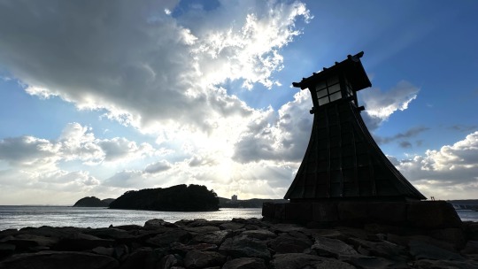
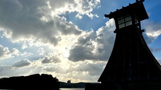
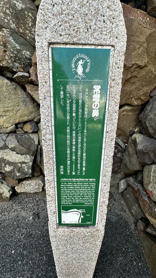


@常燈の鼻
10 notes
·
View notes
Text

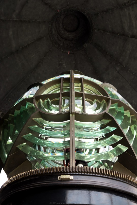
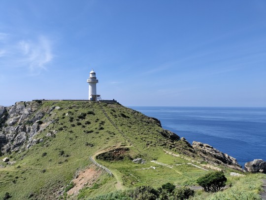
観音埼灯台
日本に数少ない登れる灯台
September 2023
#lighthouse#fresnel lens#historical buildings#kanagawa#fujifilm xf10#original photography#観音埼灯台#灯台#フレネルレンズ#神奈川
25 notes
·
View notes
Photo

#東海汽船 #さるびあ丸 #早朝 #伊豆大島 #岡田港 #灯台 #富士山 #朝焼け #日の出 https://www.instagram.com/p/CjMDfr2B0-7/?igshid=NGJjMDIxMWI=
3 notes
·
View notes
Photo

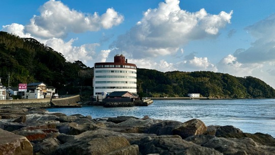
四国の西の果て『佐田岬灯台(さだみさきとうだい)』 Cape Sada Lighthouse, the western end of Shikoku. 愛媛県伊方町、日本一細い半島、佐田岬半島の先端に建つ灯台です。1924年(大正13年)、旧日本陸軍の芸予要塞として、12門の砲台跡が残されています。 This lighthouse stands at the tip of the Cape Sada Peninsula, the narrowest peninsula in Japan, in Ikata-cho, Ehime Prefecture, where the remains of 12 gun emplacements from the former Japanese Army Fort Geiyo (fortress) were found in 1924. #四国八十八景 #四国最西端 #愛媛 #伊方 #灯台 #佐田岬 #佐田岬半島 #愛媛旅行 #愛媛観光 #愛媛県 (佐田岬灯台) https://www.instagram.com/p/Ce7y9scPmAM/?igshid=NGJjMDIxMWI=
2 notes
·
View notes
Photo
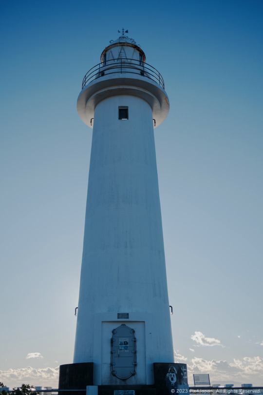
Towering Lighthouse on Cape
Location: Cape Tsumeki, Shizuoka Prefecture, Japan
Date: January 25, 2023
The Tsumekizaki Lighthouse (爪木崎灯台) was built in 1937 and rises 17.32 m (17.32 ft) above ground level and 37.83 m (124.11 ft) above sea level.
The lighthouse is only a 10-minute walk from the Cape Tsumeki parking lot. It’s a flat approach, so even if you have mobility issues, it is still easily accessible.
On a clear day, you can see eight of the inhabited islands that are as far as 10 km (6.21 mi) offshore of the Izu Peninsula and are still accessible by ferry.
Fujifilm X100V (23 mm) with 5% diffusion filter
ISO 160 for 1/250 sec. at ƒ/2.0
Classic Chrome film simulation
#海景写真#静岡県#南伊豆半島#爪木崎#爪木崎灯台#灯台#pix4japan#Fujifilm X100V#Fujifilm#Japan#Shizuoka Prefecture#Izu Peninsula#Cape Tsumeki#lighthouse#seascape photography
17 notes
·
View notes
Last Seen Blogs

ashokkumarsn
Ashok Kumar S N

neha9921
Untitled

hey-there-love
Lane


gothollywood-blog
Classic Hollywood Open 24/7