#Alpine Haute Route
Photo

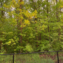
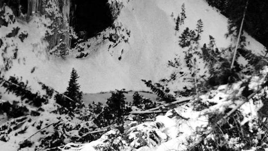
Sunset on the Matterhorn - Alpine Haute Route, June 2021
photo by: nature-hiking
#sunset#matterhorn#lake#mountains#landscape#alps#switzerland#zermatt#sunset on the matterhorn#AHR#Alpine Haute Route#long distance trail#wilderness#hiking#trekking#nature#photography#original photography#photographers on tumblr#AHR 2021
5K notes
·
View notes
Text
Chasing Winter Adventures in the Great White North: A Vanlife Tale Beyond the Clichés
By Alex Arseneault
When we hear about Vanlife most people see the classic cliché of someone laying on his bed rear doors open with a view on the ocean, right? For me, it’s anything but that.
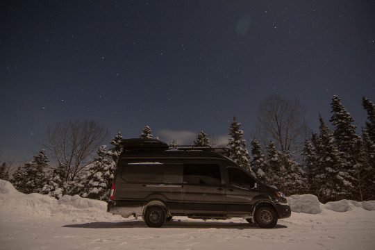
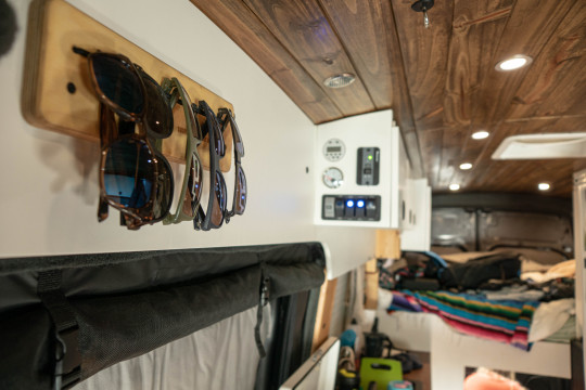
My name is Alex Arseneault, I live in Quebec City (Qc), Canada and I consider myself as a ‘’weekender adventurer’’. Experienced Kitesurfer / mountain biker / Snowboarder, I try to make the most of what my region has to offer while still have a normal job. The best tool I have found to make all those outdoors sports so much easy to handle is a Van. I often say to people that our van is our ‘’Mobile Chalet’’ ; it allow us to chase the best (Or worst) conditions, bring all the gear, be home everywhere and be selective on the destination.
This winter I wanted to go explore further and experience what the alpine backcountry skiing has to offer in our region and because life is better when you are in good company, I wanted to do this trip with my girlfriend & our dog. Meet Cynthia & Gustav! The spot on the radar: The Chic-chocs mountains in Gaspesie. We prepared ourselves with an AST1 Course early in the season and analysis of the approach & terrain of each mountain in the Gaspesie National Park. Thank to the APP Ski Haute-Gaspésie that give so much information’s and you can also use it in GPS mode to find the official skintrails & descent hallway.
There we go. It’s early February, it recently dumped 25 to 40 cm in the mountains, the conditions are at their best. We checked the Avalanches & Weather Forecast, loaded the Van of food, water, gear and hit the road for a 6-hour road trip. The route become quite scenic when we left the Trans-Canadian highway and reach the route 132 along the Saint-Lawrence River. This road is famous during the summer but let’s say it can be quite hazardous during winter. We get excited when we reach the small village of Saint-Anne-des-Monts, which is the entrance of the Gaspesie National Park. The view is insane while we drive on the sinuous road between the mountains. At this point, we have no more signal. No cellphones, no internet, nada. Just us, our small house on wheels and the white mountains.
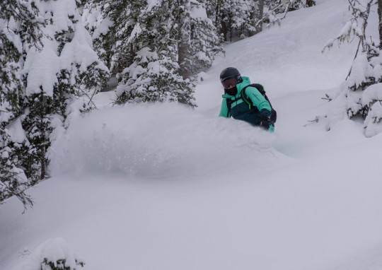
We spent two days at a mountain called Mount Lyall. Well parked at the entrance of the skin track, we made our basecamp in the parking thanks to SEPAQ that allows autonomous Camper to stay in the parking for 25$/day. A dry toilet Cabin is at our disposal if required. We had amazing conditions, beautiful weather and even manage to bring Gustav with us for a descent in the treeline. What a nice experience, we felt so grateful to be out there together and enjoy winter at his best. Let’s be honest, winter in the east can somehow be challenging. Trip like this, certainly reconciles us with those ‘’Quebec winters’’. Oh... and speaking of ''challenging'' did I mention that it announces extreme cold during our journey? Well, Environment Canada has issued extreme cold warnings that covers most of the province with wind chills expected to be between -38 and -42 degrees Celcius. Not worried, we build our van for it, but we knew we were not going to go snowboarding in the backcountry in that temperature, let’s say that it would not be safe or even fun.
So, before this major polar vortex hit us, we spend another day in a mountain called Hog’s back. Same basecamp setup, different terrain. We did two laps on this mountain, but the conditions were a bit more challenging when we reach the Alpine terrain. A crust of ice covered the entire alpine territory which made the terrain unstable and difficult to cross. We then decided to stay in the treeline limit and managed to find some powder again. The highlight of the day was the encounter with a Caribou, a first for us! We were extremely lucky since this species is endangered. What a beautiful creature!
The next stop of our trip is a small village called Murdochville. This old mining town reborn from its ashes and has become the hub for backcountry skiing and snowmobiling in East Canada. We wanted to see this place, somehow sticked in the 80’s by its architecture and see what it has to offer. We parked the Van at the Chic-Chac resort wich has a ‘’Vanlife’’ space and offers access to showers and more... After a well-deserved shower, we spoiled ourselves with dinner at the Chic-Chac headquarter. This place is famous for parties and hosting events!
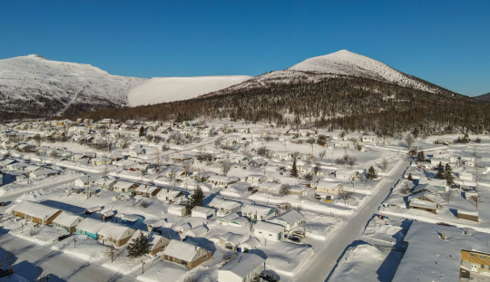
The next day we walked the town and finally went for a lap on Mont Porphyre. Being located just outside the northern limit of Murdochville, this mountain allows residents and town visitors to ski directly from town. As the day progresses, temperature drop every hour and strong Northwest wind is picking up. We checked the forecast and there were no chances of doing any outdoors activities for the next two days in this ridiculously cold weather. We ended up driving in a polar vortex blizzard for 6 hours at 25 mph but managed to reach my friend’s house and spend the coldest night still comfortably installed in our van. Let’s just say that the webasto heater has run like never before.
We spend the cold weather playing card games and drink hot chocolate next to the fireplace at my friend’s house.
I conclude on this quote: ‘’Winter forms our character and brings out our best.’’ Better enjoy it? #Exploremore
2 notes
·
View notes
Text
Wilderness Wanderlust: Exploring Remote and Untamed Extreme Hiking Routes with Richard Eitzel
For adventurers seeking the ultimate outdoor challenge, extreme hiking trails offer a thrilling opportunity to explore some of the most remote and untamed landscapes on Earth. From rugged mountain ranges to dense rainforests and arid deserts, these trails test the limits of endurance, courage, and determination. In this blog, we'll embark on a journey through the world's most extreme hiking routes with the help of experts like Richard Eitzel, uncovering the breathtaking beauty and formidable challenges that await those who dare to venture into the wilderness.
The Haute Route: Chamonix to Zermatt
Trekking the Haute Route from Chamonix to Zermatt is a dream for avid hikers seeking an unforgettable alpine adventure, as championed by experts like Richard Eitzel. This iconic route traverses the majestic peaks of the French and Swiss Alps, offering stunning vistas of snow-capped mountains, glacier-carved valleys, and picturesque alpine villages along the way.
The Haute Route is not for the faint of heart, with challenging terrain, steep ascents, and high-altitude passes presenting formidable obstacles for even the most experienced hikers. However, the rewards are well worth the effort, as adventurers are treated to unparalleled views of iconic peaks such as Mont Blanc and the Matterhorn, as well as the opportunity to experience the rugged beauty of the alpine wilderness up close.
The Kalalau Trail: Na Pali Coast, Hawaii
Nestled along the dramatic Na Pali Coast of Kauai, the Kalalau Trail is a legendary hiking route renowned for its breathtaking scenery and rugged terrain. Stretching 11 miles along the coastline, this remote trail offers intrepid hikers a glimpse into Hawaii's untouched wilderness, with towering sea cliffs, lush valleys, and pristine beaches awaiting those who dare to venture off the beaten path.
The Kalalau Trail is not for the faint of heart, with steep cliffs, narrow ridges, and unpredictable weather conditions posing significant challenges for hikers. However, those who brave the journey are rewarded with unparalleled views of the Pacific Ocean, secluded waterfalls, and the chance to immerse themselves in the natural beauty of one of Hawaii's most remote and unspoiled landscapes as emphasized by experts like Richard Eitzel.
The West Coast Trail: Vancouver Island, Canada
Traversing the rugged coastline of Vancouver Island, the West Coast Trail is a challenging and iconic hiking route that offers adventurers the chance to explore some of Canada's most pristine wilderness. Stretching 75 kilometers along the Pacific Rim National Park Reserve, this remote trail winds through dense temperate rainforests, rugged beaches, and towering sea stacks, offering stunning views of the wild Pacific Ocean.
The West Coast Trail is known for its challenging terrain, with steep ladders, muddy bogs, and treacherous tidal crossings testing the endurance and skills of hikers. However, the rewards are plentiful, with opportunities to spot wildlife such as whales, sea lions, and bald eagles, as well as the chance to camp on secluded beaches and witness breathtaking sunsets over the ocean.
The Inca Trail: Machu Picchu, Peru
Traversing the ancient footsteps of the Inca civilization, the Inca Trail is a world-renowned hiking route that leads adventurous trekkers to the legendary ruins of Machu Picchu. Stretching 43 kilometers through the rugged Andean mountains of Peru, this iconic trail offers breathtaking scenery, fascinating archaeological sites, and a glimpse into the rich history and culture of the Inca Empire.
The Inca Trail is not for the faint of heart, with steep ascents, high-altitude passes, and unpredictable weather conditions presenting formidable challenges for hikers. However, the rewards are unparalleled, with opportunities to explore ancient Inca ruins, witness stunning mountain vistas, and experience the magic of Machu Picchu at sunrise. For those willing to embark on the journey, the Inca Trail offers an unforgettable adventure as emphasized by experts like Richard Eitzel and a chance to connect with the spirit of the Andes.
The Grand Canyon Rim-to-Rim Trail: Arizona, USA
Embarking on the Rim-to-Rim Trail in the Grand Canyon is a bucket-list adventure for outdoor enthusiasts seeking an unforgettable wilderness experience. Stretching 23 miles from the North Rim to the South Rim, this epic hiking route offers breathtaking views of one of the world's most iconic natural wonders, as well as the chance to explore the rugged beauty of the canyon's inner depths.
The Rim-to-Rim Trail is not for the faint of heart, with steep descents, challenging terrain, and extreme temperatures presenting significant challenges for hikers. However, the rewards are well worth the effort, with opportunities to witness stunning geological formations, spot wildlife such as bighorn sheep and condors, and experience the awe-inspiring beauty of the Grand Canyon up close.
The Laugavegur Trail: Iceland
Traversing the stunning landscapes of Iceland, the Laugavegur Trail is a bucket-list adventure for hikers seeking an unforgettable wilderness experience. Stretching 55 kilometers from the hot springs of Landmannalaugar to the glacial valley of Thorsmork, this iconic route offers breathtaking views of volcanic landscapes, colorful rhyolite mountains, and dramatic river crossings along the way.
The Laugavegur Trail is known for its challenging terrain, with steep ascents, river crossings, and unpredictable weather conditions presenting significant obstacles for hikers. However, the rewards are plentiful, with opportunities to soak in natural hot springs, witness stunning geological formations, and experience the raw beauty of Iceland's untamed wilderness. For those seeking adventure and exploration, the Laugavegur Trail offers an unforgettable journey through one of the world's most breathtaking landscapes.
Extreme hiking trails offer adventurers the opportunity to explore some of the most remote and untamed landscapes on Earth as appreciated by experts like Richard Eitzel, testing their endurance, courage, and determination along the way. From the rugged peaks of the French Alps to the dramatic coastline of Hawaii's Na Pali Coast, these trails offer breathtaking scenery, challenging terrain, and unforgettable experiences for those willing to embark on the journey. Whether seeking solitude in the wilderness or craving adventure in the great outdoors, extreme hiking trails provide an opportunity to connect with nature, push personal limits, and create lasting memories that will be cherished for a lifetime.
0 notes
Text
PARIS-NICE ETAPE 5
Classement 2024 à l'issue de l'étape 5
SAINT-SAUVEUR-DE-MONTAGUT 07 - SISTERON 04
SAINT-SAUVEUR-DE-MONTAGUT
Idéalement situé au cœur du parc naturel régional des
Monts d’Ardèche, à l’intersection de quatre rivières
(Orsanne, Glueyre, Auzène et Eyrieux), la commune
de Saint-Sauveur-de-Montagut vous accueille dans
un cadre agréable.
Vous serez séduits par le village qui o
re un contraste
harmonieux entre vieilles pierres et verdure. Ce lieu
vous invite à découvrir son patrimoine historique et
naturel, dans une ambiance conviviale et authentique.
Vous pourrez admirer les ruines de l’ancien château
féodal, qui surplombe la vallée.

Vous pourrez également profiter de la Dolce Via, une
voie douce qui suit le tracé de l’ancienne voie ferrée
et qui relie Lamastre à La Voulte-sur-Rhône, sur plus
de 90 km. L’occasion idéale de pratiquer le vélo ou
la marche tout en contemplant les paysages variés
de la vallée de l’Eyrieux.
La rivière vous o
re aussi de multiples possibilités
de loisirs aquatiques, comme le canoë-kayak, la
baignade ou la pêche. Vous pourrez vous rendre
à la plage de Fontugne, sur les rives de la Glueyre,
pour vous rafraîchir et vous détendre dans un cadre
exceptionnel
SISTERON
Entre Provence et Dauphiné, sur les rives de
l’impétueuse Durance, Sisteron est aujourd’hui l’une
des villes phares des Alpes de Haute-Provence, au
pied du spectaculaire rocher de La Baume, joyau du
géoparc de Haute-Provence, et de son emblématique
citadelle. Un monument qui accueille chaque été le
festival des « Nuits de la Citadelle », l’un des plus
anciens de France avec ses spectacles de musique,
danse ou théâtre.
C’est à Sisteron que Napoléon fi t une halte historique
lors de son retour de l’île d’Elbe sur cette route qui
porte désormais son nom. Une ville séculaire par
son centre ancien, avec ses musées, galeries d’art
et de magnifi ques andrones, ces rues en escalier
rendues célèbres par la plume du romancier bas-alpin
Pierre Magnan.
VAINQUEUR
1 MATTIAS SKJELMOSE
Paris-Nice
0 notes
Text
Une promenade entre sœurs
Il était une fois une promenade entre soeurs. Toutes les trois s’étaient levées tôt pour gravir le chemin de randonnée qu’on leur avait conseillé. Elles étaient parties en week-end à la montagne, désirant s’éloigner de l’effervescence de la ville et retrouver leurs souvenirs d’enfance dans l’air des massifs alpins. La benjamine et l’aînée avançaient doucement derrière quand la cadette était déjà loin devant. Elle les entendait rire, chanter, se chamailler pendant que son seul compagnon de route demeurait le bâton qu’elle tenait dans la main. Elle ne pouvait pas leur en vouloir, l’idée était avant tout de passer un bon moment ensemble, pas de faire un marathon. Mais elle ne pouvait s’empêcher d’aller si vite. À chaque pas qu’elle faisait, elle pensait au repas qu’elle avait mangé, aux kilos qu’elle avait en trop, aux calories qu’elle espérait dépenser… Elle avait besoin de sentir l’effort, la douleur dans ses muscles, la transpiration dans sa nuque, la fatigue sur ses épaules, pour se purger et se débarrasser de toutes ces pensées qui l’envahissaient au quotidien. C’était plus fort qu'elle, sa peur de grossir passait avant l’amour qu’elle avait pour ses sœurs et sa volonté de partager leur compagnie. Depuis le temps que ça la dévorait, elle savait bien qu’elle n’était qu’une pauvre égoïste…
Arrivée au pic du sentier, elle fut prise de vertige face à l’immensité de la vue. Un paysage de carte postale. Comme cela lui faisait drôle de se retrouver seule là-haut, ça n’avait presque pas de sens. Ce n’était pas comme ça aurait du se passer. Quel intérêt à faire tant d'efforts si c’était pour n'avoir personne avec qui partager l’arrivée ? Alors, face au regard de l’aigle qui l’observait là-haut dans le ciel, elle s’empressa de revenir sur ses pas pour retrouver ses sœurs et se jeter dans leurs bras. Face au sourire de ces dernières qui s'empressèrent de lui partager la dernière anecdote qui les avait fait rire, elle se promit qu’un jour tout redeviendrait comme avant et que ce jour-là jamais plus elle ne laisserait aucune pensée l’isoler des deux personnes qu’elle aimait le plus au monde…

#women#free#love#family#familia#sister#hope#illustrator#illustration#life#life lessons#existence#thinking#reality#connection#my art#my post#my writing#writing#art#writers on tumblr
0 notes
Text
Aujourd'hui, la route alpine la plus haute d'Autriche pour arriver au glacier.


1 note
·
View note
Text
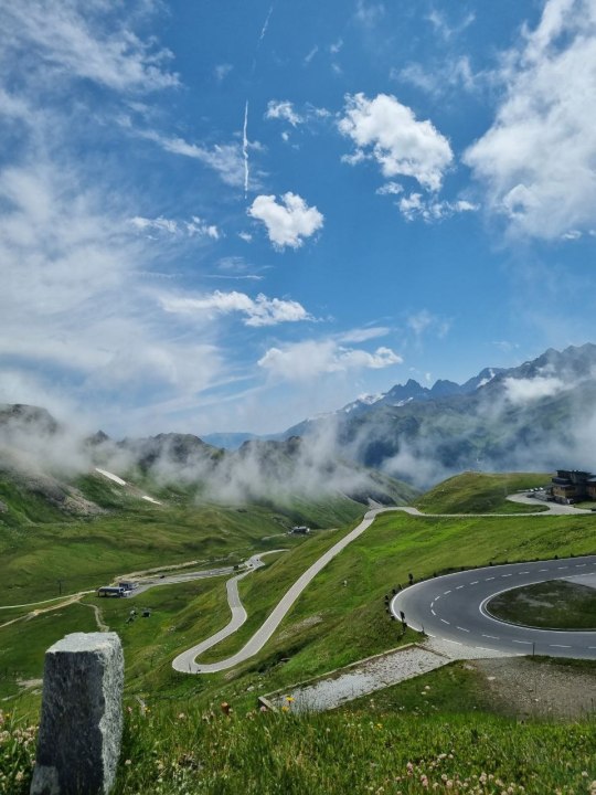
En images : entre Savoie et Hautes-Alpes, le déneigement du col du Galibier se termine.
See on Scoop.it - JamesO
À certains endroits, la couche peut atteindre 6 mètres, voire 9 mètres ou plus : le col du Galibier, entre La Grave, Briançon et Valloire, devrait ouvrir le vendredi 26/05/23. Le déneigement a débuté le lundi 24/04/23 par les services départementaux des Hautes-Alpes et de la Savoie, accompagnés de guides de montagnes. À 2.642 mètres, c'est un des derniers cols alpins à dégager avant l'été.
JamesO's insight:
Via l’agence JamesO Média❗️N.D.L.R. : article de presse publié par France Bleu Pays de Savoie le mercredi 24/05/23.
☀️ Le quotidien d’Annecy 🌕
&
⛲️ La quotidienne d’Annecy 🏰
#montagne #neige
#routes #transports #météo
#Savoie #HautesAlpes
ℹ️ JamesO.InfO 🏞
📨 Un nouveau média local 📧
🔴 Le fil rouge de JamesO.InfO
Annecy, le Grand Annecy et la Savoie.
0 notes
Text
REPORTAGE. "Une fois que l’on a vécu ici, c’est compliqué de redescendre" : en Isère, la vie paisible d'un des plus hauts villages de France
See on Scoop.it - Club euro alpin: Economie tourisme montagne sports et loisirs
A une heure de route de Grenoble en Isère, niché au cœur des Alpes, se trouve Villard-Reymond. Ce petit village, le plus haut de l'Isère et le deuxième plus haut de France ne compte que dix habitants. Ils nous on
Francis Fiesinger Pro's insight:
#alpeisere #villardReymond #montage
0 notes
Text
Colorado Helicopter Skiing Adventures With Telluride Helitrax
Both the Germans and the allies pursued helicopter improvement during WWII. The Germans had a variety of the more developed machines. The German Luftwaffe was the first to test and use helicopters in a high alpine environment.
For those electing for the 2-day option, trips do not must be taken on consecutive days, and might fall on any day of the week. After taking a short ride to your vacation spot, guides will cut up the group based on talent degree in order to make sure everyone will get ample alternatives to discover at their very Heliskiing own tempo. The early leaders in heliskiing realized by trial and error, and their experiences in across the helicopter have turn into a major component in heliskiing security protocols at present. Avalanche security has been equally essential to heliskiing operators. Numerous heliskiing operations have contributed closely to avalanche safety and analysis initiatives worldwide.
At Alpine HeliSki we offer a range of packages to assist match your talent and stamina with our guides and terrain. You should be a sophisticated skier in a position Heliskiing to ski steep terrain and trees in deep powder. As of this writing, the 2021 Alaska heliskiing season remains to be unclear because the pandemic spikes globally and vaccines start to roll out.
One of the beautiful ski safaris we create to our visitors might be this 12 day cross-border that includes Italy, Switzerland and France. Antartica additionally presents new beautiful and immersive itineraries for ski passionate. Other favourite drops are on the Alphubel, the Aeschhorn in the shadow of the mighty Weisshorn or the Testa Grigia on the border with Italy. Or the chopper can be used as an aerial elevator up the large slogs of the famous Haute Route from Zermatt-Chamonix, saving legs for the numerous stunning descents. If you're in search of a wild spot the place you're feeling you've never been before the Kamchatka is your house.
With every successive shot, Gabe goes first to lay down some tracks and then radios back with instructions to remain both skier’s left or proper of his, along with other intel concerning the terrain and situations. Everyone else pays shut consideration to the skier on slope in the Heliskiing occasion of an avalanche. Fortunately, that danger is low due to a really stable snowpack. There’s one aspect that has an inch of crust from a current wind occasion; in any other case, the snow is buttery soft and consistent.
0 notes
Photo

Matterhorn at sunset - Alpine Haute Route, June 2021
photo by: nature-hiking
#matterhorn#sunset#golden hour#zermatt#landscape#mountains#mountain lake#AHR#Alpine Haute Route#alps#long distance trail#wilderness#hiking#trekking#nature#photography#original photography#photographers on tumblr#AHR 2021
2K notes
·
View notes
Text
Nous sommes aujourd’hui le 25 janvier 2022, date anniversaire du dernier grand tremblement de terre du Valais. C’était il y a 76 ans, jour pour jour.

Le 25 janvier 1946, il est 18h30 lorsque soudain un fort séisme ébranle tout le Valais. La magnitude de 5,8 sur l’échelle de Richter est suffisamment forte et violente pour que le tremblement de terre soit ressenti dans toute la Suisse et même à l’étranger, en Haute Savoie et en Italie du Nord.
Dans la nuit qui suit, 46 répliques ébranlent le Valais et se succèdent jusqu’à 4h32 du matin. D’autres se répéterons de manière plus espacée jusqu’en juin 1946. L’Afrique remonte vers le nord et s’enfonce contre la plaque eurasiatique. Le plissement de l’arc alpin est le résultat de cette formidable poussée. Ce processus continue encore aujourd’hui et explique le caractère sismique du Vieux Pays.
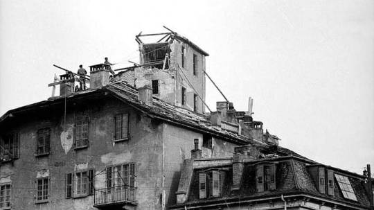
En 1946, l’épicentre était situé entre Sion et Sierre, en Valais Central, sur le versant droite de la vallée du Rhône où une grande faille passe sous les Alpes bernoises, de Vallorcine à l’ouest, jusqu’à Loèche-les-Bains à l’est, à l’entrée du Haut-Valais.
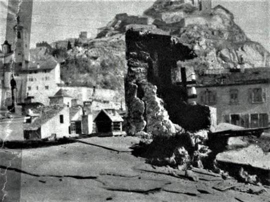
En 1946, le séisme cause quelques blessés sans gravité. Il provoque la mort de 4 personnes. Parmi celles-ci, un automobiliste français tué près d’Aix-les-Bains, en Haute-Savoie voisine, qui meurt écrasé sous le poids de sa voiture, alors qu’il changeait une roue, la secousse ayant fait basculer son cric !
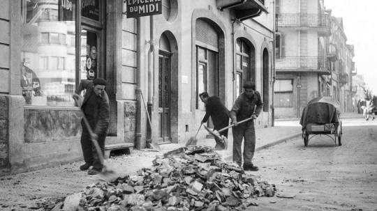
Tout le Valais est fortement secoué, du Léman au Glacier du Rhône. Un peu partout, des maisons se fissurent, des bâtiments s’effondrent en partie, des façades se lézardent, des pans de mur s’écroulent, des tuiles et des cheminées tombent brutalement des toits et s’écrasent dans les rues.
En tout, près de 3'500 constructions sont endommagées, plus ou moins. Sur les versants et dans les vallées, des forêts sont déchaussées, des glissements de terrain se produisent, dès arbres se couchent, des fissures s’ouvrent dans certaines prairies.

Les plus gros dégâts sont enregistrés en Valais central, entre Martigny et Loèche, plus particulièrement dans la région comprise entre Sion et Sierre.
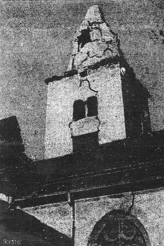
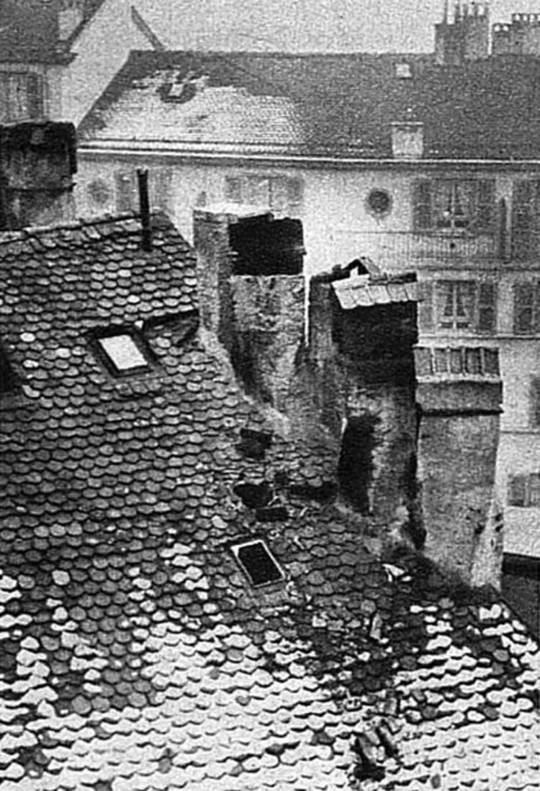
A Sion, la secousse est si brutale qu’une partie de la voûte et de la façade du couvent des Capucins s’écroulent sur la route de Savièse. Les murs de l’église Saint-Théodule et de la cathédrale Notre-Dame-des-Glariers sont lézardés. Sous l’effet du séisme, la flèche de la cathédrale est déplacée de 50 centimètres et nécessitera de grosses réparations entre 1947 et 1949. Des ardoises et des débris de cheminent jonchent les rues de la capitale et les trottoirs. On ne compte plus les cheminées effondrées ou à moitié détruites.
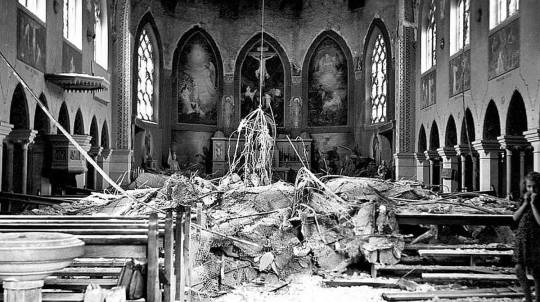
A Sierre, monsieur de Chastonay voit soudain de violents éclairs illuminer la nuit du côté de la gare CFF : ce sont les fils de la ligne ferroviaire du Simplon qui se touchent et produisent de violentes décharges électriques à chaque fois qu’ils entrent en contact en dansant. A Grimentz, les murs et la voûte de l’église sont si ébranlés qu’on sera forcé de reconstruire entièrement l’église. A Chippis, la secousse a été si violente que la voûte de l’église s’est effondrée d’un coup dans la nef. Par chance, il n’y avait personne dans l’édifice. La nuit du 25 au 26 janvier fut une nuit horrible pour la population valaisanne, effrayée par le séisme et apeurée par les répliques qui ne cessent d’ébranler le sol. Dans les localités et les villages, bon nombre d’habitants, qui avaient couru hors des maisons lors de la catastrophe, préférèrent passer la nuit dehors, plutôt que de regagner leur maison, par peur de mourir ensevelis. A Sierre, la plupart des habitants passent toute la nuit dans les rues, autour de feux improvisés en plein air pour se réchauffer, redoutant à chaque instant un autre tremblement de terre. De tels séismes de magnitude entre 5 et 6, ne sont pas fréquents en Valais, mais ils ne sont pas rares non plus. Il en survient un à peu près chaque siècle, en moyenne, car nous sommes dans une zone de sismicité. Le Diable ne cesse de faratter par en-dessous Les Diaberets, il continue sans cesse à creuser le sous-sol et à ébranler nos montagnes pour étendre son royaume des ténèbres sous le Valais ! Le tremblement de terre de 1946 eut lieu il y a 76 ans, jour pour jour. Certains de nos aînés, qui étaient alors enfants, s’en souviennent encore très bien et n’en gardent pas forcément un bon souvenir ! Quand j’étais enfant, je me rapelle que ma grand maman me montrait une fissure qui avait lézardé le mur de la cuisine en 1946. Et maintenant la question qui préoccupe nos autorités: à quand le prochain séisme ? Personne ne le sait ni ne peut le dire. Mais chacun doit s’y préparer, matériellement et psychologiquement, car il surviendra tôt ou tard, à coup sûr, c’est une certitude. Peut-être dans 100 ans, dans 10 ans ou demain matin… Espérons que ce sera le plus tard possible! De plus, il ne faut pas oublier qu’en 1946, le Valais était beaucoup moins urbanisé, la population bien moins nombreuse et les réseaux et voies de communication bien moins densifiés qu’aujourd’hui. Le prochain « coup de sac » risque donc de faire des dégâts plus considérables. Nous devons donc en être conscients et nous y préparer tous, pas seulement les autorités….

11 notes
·
View notes
Video
flickr
North face of Mont Blanc and the massif of Mont Blanc at winter time . No. 511. par Izakigur
Via Flickr :
Mont Blanc and the massif of Mont Blanc at winter time . No. 511. Mont Blanc Monte Bianco North face of Mont Blanc / Monte Bianco Elevation4,810 m (15,780 ft) Prominence4,696 m (15,407 ft) Ranked 11th Mont Blanc is located in Alps Mont BlancMont Blanc Location in the Alps LocationAosta Valley, Italy Haute-Savoie, France RangeGraian Alps Coordinates45°50′01″N 006°51′54″ECoordinates: 45°50′01″N 006°51′54″E Climbing First ascent8 August 1786 by Michel-Gabriel Paccard Mont Blanc (French pronunciation: [mɔ̃.blɑ̃]) or Monte Bianco (Italian pronunciation: [ˈmonte ˈbjaŋko]), both meaning "White Mountain", is the highest mountain in the Alps and the highest peak in Europe outside of the Caucasus range.It rises 4,810 m (15,781 ft) above sea level and is ranked 11th in the world in topographic prominence. The mountain lies in a range called the Graian Alps, between the regions of Aosta Valley, Italy, and Haute-Savoie, France. The location of the summit is on the watershed line between the valleys of Ferret and Veny in Italy and the valleys of Montjoie Valley and Arve Valley in France. The Mont Blanc massif is popular for mountaineering, hiking, skiing, and snowboarding. The three towns and their communes which surround Mont Blanc are Courmayeur in Aosta Valley, Italy, and both Saint-Gervais-les-Bains and Chamonix in Haute-Savoie, France — the latter being the site of the first Winter Olympics. A cable car ascends and crosses the mountain range from Courmayeur to Chamonix, through the Col du Géant. Begun in 1957 and completed in 1965, the 11.6 km (7¼ mi) Mont Blanc Tunnel runs beneath the mountain between these two countries and is one of the major trans-Alpine transport routes.
#Mont Blanc#Alps#Switzerland#France#Nikon D-200#Summits#verbier#Monte Bianco#100faves#CameraRoll#Ferret#Wallis#Canton du Valais#Valais#Nikon#fog#mountains#clouds#sky#200faves#Mont Fort#swiss#suisse#friends#BETA#300+faves#400faves#Hallelujah#Emji#500faves
9 notes
·
View notes
Text
«La philosophie est une route alpine, et le sentier escarpé qui y mène est jonché de pierres et d'épines. Plus vous montez haut, plus vous vous sentez seul, plus le chemin devient désolé ... »
~ Arthur Schopenhauer

5 notes
·
View notes
Text

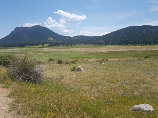

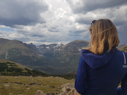


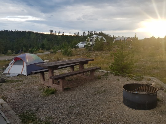
Jour 37: Rocky Mountain National Park
L'entrée du Parc National des Montagnes Rocheuses n'est qu'à 1h30 de route au nord-ouest de Denver. En chemin on a traversé Estes Park, un genre de station de ski autour d'un lac, où on a croisé tout un tas de cerfs qui se baladaient sur la route.
Les campings susceptibles d'avoir des places étaient tous situés à l'autre bout du parc, évidemment. On a mis bien 3h à le traverser de bout en bout, en s'arrêtant à tous les points de vue, mais vite fait parce qu'il faisait froid et venteux. La route montait à plus de 3500m. On a atteint les altitudes où, même en été, il reste un peu de neige et des lacs gelés. Paysages alpins essentiellement: des forêts de sapins, des clairières, des lacs, de la toundra arctique et des faces rocheuses. Vaste, haut, beau.
Mes déboires médicaux des jours précédents s'étaient précisés à défaut de s'arranger: infection urinaire (oui, on raconte tout!) Du coup pause pipi au moins toutes les heures, chaud-froid et changement de fringues constant entre la fièvre, le cycle d'efficacité du Dolipran, les sorties de voiture chauffée à haute altitude, etc.
Le dernier camping du parc était encore assez haut, plus que celui du Yosemite, et on a préféré continuer à descendre un peu au sud pour en trouver un où la nuit serait un peu moins fraîche. On est passés à côté de trois grands lacs successifs, tous hyper classes, à flanc de montagne, entourés de sapins et de cabanes. On a trouvé notre bonheur à Green Ridge, toujours au-dessus de 2000m mais on ne trouverait pas mieux dans le coin.
On a entamé la soirée en jouant au shithead dans un pur bar de trappeurs du Colorado, tout en bois avec des têtes de cerfs au mur et des vieux rednecks à l'entrée, dans des rocking chairs avec leurs clébards. Puis on est rentrés au camping faire la popote et arranger les épaisseurs de duvet pour la nuit fraîche en perspective.
2 notes
·
View notes
Last Seen Blogs