#Bottomland Hardwood Forest
Text
Warbler Showdown; Bracket 9, Poll 3

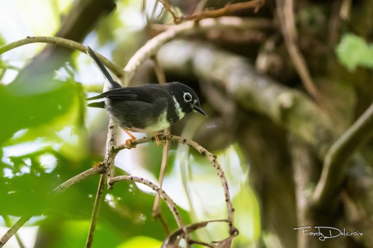
Swainson's Warbler (Limnothlypis swainsonii)
IUCN Rating: Least Concern
Range: migrant; breeds in the Southeast and overwinters in the Caribbean, as well as the Yucatan Peninsula
Habitat: prefers a dense understory with lots of leaf litter and few herbaceous ground cover. Breeds in bottomland hardwood and montane forests, and early-growth seral pine stands, but is less picky when overwintering.
Subspecies: none
Whistling Warbler (Catharopeza bishopi)
IUCN Rating: Endangered
Range: resident; St. Vincent island
Habitat: primary growth montane forests, especially those thick with undergrowth.
Subspecies: none
Image Sources: Swainson (Dorian Anderson) Whistling (Frantz Delcroix)
#NWW Showdown#swainsons warbler#whistling warbler#parulidae#passeriformes#wood warblers#new world warbler
16 notes
·
View notes
Text
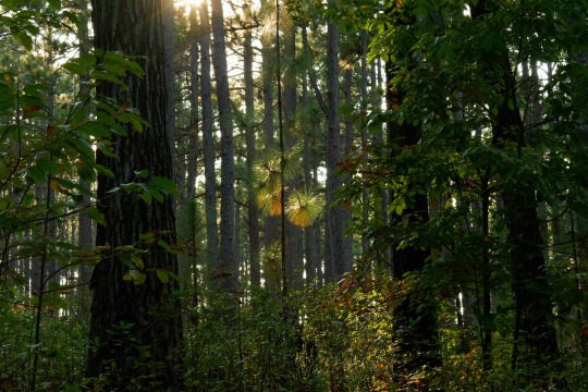

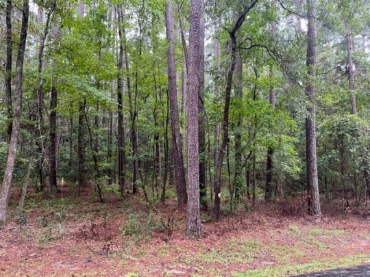
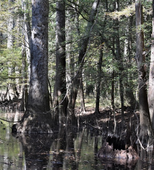
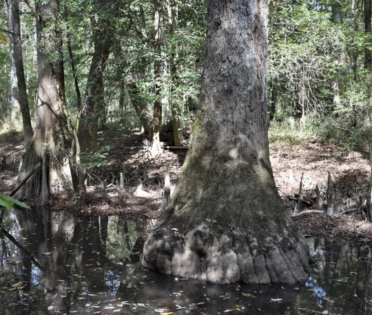
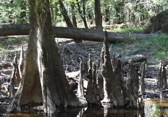
A Few Steps Along Lighter Stump Trail, Weymouth Woods
At times the forest seems like a house—light and airy rooms above, ceilings high enough to accommodate the height of pines singing in the wind, but then take the stairs down to the basement, light retreats into shadow and the walls lean-in, down there a cellar full of hardwoods and vines talking about bottomland life as they sip on sedate waters.
6 notes
·
View notes
Text

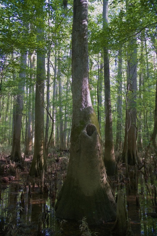

Some fun facts about Congaree:
- This park preserves the largest area of old growth bottomland hardwood forest left in the United States.
- It’s floodplain forest has one of the highest temperate deciduous forest canopies in the world, with an average height of over 100 feet.
- For thousands of years, Native Americans lived in Congaree, finding life in the many natural resources that the floodplain provided. African American slaves used the floodplain as a refuge and place to find liberty. After emancipation they fished Cedar Creek, hunted along its banks, and baptized children in its waters.
#congaree national park#nps#national park photography#fun facts#nature facts#park facts#history facts#beauty of nature#nature photography#woods#landscape photography#swamp#canon eos 2000d#canon photography#wandercore#trees and forests#forest#forestcore#wanderlust
39 notes
·
View notes
Text
Nature Walks in Pascagoula, Mississippi
Pascagoula, MS, and its surrounding areas offer several options for nature walks and outdoor exploration. Here are some suggestions:
Pascagoula River Audubon Center: Explore the trails at the Pascagoula River Audubon Center, where you can stroll through bottomland hardwood forests, marshes, and bayous while observing a variety of bird species and other wildlife.
Lighthouse Park: Take a walk…

View On WordPress
0 notes
Text


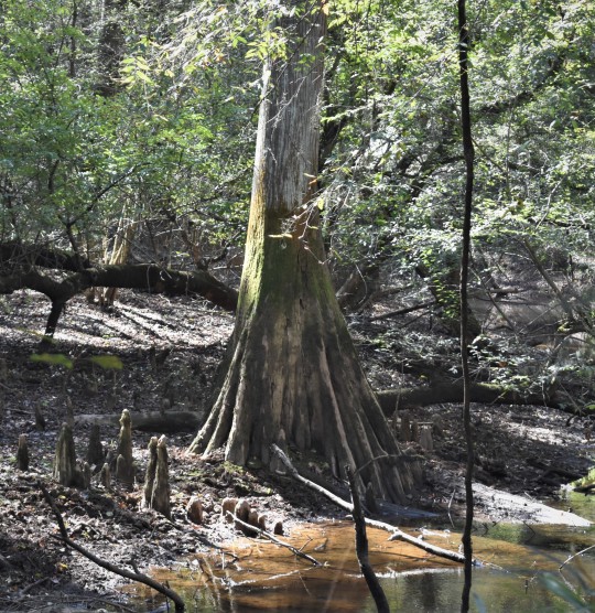
Leaving Camden we drove to Columbia and went to Congaree National Park, a relatively new park. This park showcases the largest remaining stand of old growth hardwood bottomland forest in the country. Some of the trees in this park are more than ten feet in diameter, and were so big that when cut could not be removed except by waiting for the Congaree River to flood sufficiently to float the trees out.
It's interesting that when I was a kid we used to hunt squirrels and deer in these same river bottoms. Some of those bald cypress were so large and heavy they could not be floated out and remained on the forest floor. I can recall seeing a few of these huge logs still on the ground back in the early 1960s when we hunted in there.
The large tree base in the visitor center was blown down during Hurricane Hugo in 1989 and was moved into the visitor center shortly thereafter.
0 notes
Text
Discover Congaree National Park
Find out what makes this uncrowded National Park unique. #NationalParkWeek
Congaree National Park is a beautiful and unique natural wonder in central South Carolina. The park is home to the largest intact expanse of old-growth bottomland hardwood forest in the southeastern United States.
Getting to Conagree National Park is easy. It is a short 17-mile drive south of Columbia, South Carolina.
Congaree National Park is known for its biodiversity. Flood waters from the…
View On WordPress
0 notes
Text
Materia Medica
Blood Root
Botanical Name: Sanguinaria canadensis
Common Name: Bloodroot, Red Root, Puccoon, Paucon, Pauson, Red Puccoon, Coonroot and Indian paint ((( all refer to Native American uses of the plant to color skin, clothes, and baskets ))) tetterwort ((( old english for skin disease ))) , sleep slumber, and snakebite ((( all of which were used mostly by Old English speakers ))).
Family: Papaveraceae or Poppy family
Parts Used: Rhizome, Root,
Energetics and Taste: Harsh, Bitter, Acrid. Drying and cooling in small amounts, warming and stimulating in larger amounts.
Actions and Properties: Bloodroot is currently used to cause expectoration and to clear the respiratory pathways of mucus. The herb can be taken internally to treat a variety of ailments such as asthma, emphysema, laryngitis, bronchitis, pharyngitis, sore throats, and croup. Cough lozenges are made by mixing fresh sap from roots with maple syrup or sugar. A homeopathic remedy containing
bloodroot has also been used to treat migraines. Fresh bloodroot sap or an infusion of the root can be applied externally to treat warts, benign skin tumors, ulcers, eczema, chilblains, or ringworm. The dried powder can be sniffed to treat nasal polyps. Sanguinarine, the medicinally valuable alkaloid found in bloodroot sap, is purported to have antibacterial and anti-inflammatory properties that inhibit
the formation of plaque and reduce gingival inflammation and bleeding. Research has shown that the alkaloid is retained in the mouth for long periods after brushing, providing longer resistance to plaque and gingival inflammation.
Constituents: Bloodroot exudes a bright orange-red sap from all parts when cut, with the highest concentrations found in the rhizome where the juices are stored. The sap contains isoquinoline alkaloids, red resin, and an abundance of starch. Sanguinarine is the predominant alkaloid, making up 50 percent of the total alkaloid content. The alkaloids in the sap contribute to the medicinal properties of the herb, though they can also be poisonous in large doses, causing nausea, vomiting, dizziness or fainting, dilated pupils, and heart failure. The alkaloids in bloodroot have strong antibiotic and anti-inflammatory properties. The herb has also been described as having antiseptic, cathartic, diuretic, emetic, emmenagogue, escharotic, expectorant, febrifuge, sedative, spasmolytic, stimulant, and tonic properties.
Description: Plants reach a height of 6 to 12 inches at maturity,
though they are typically only half that height at the time of bloom. Each plant consists of a single leaf wrapped tightly around
a flower bud; the leaf opens to expose the flower as it blooms. Bloodroot leaves are kidney shaped, with five to nine rounded lobes
arranged palmately and covered with a whitish-gray down. The pale underside of the leaf is prominently veined. Once the flowers have faded, the basal leaves persist until August, when they turn a deeper green and reach their maximum size of 6 to 10 inches. Each waxy, white flower grows on a single stem up to 8 inches in height,
blooming around late March and early April. Flowers are roughly 2 inches in diameter, with gold-colored stamens in the center. Whereas other members of the Papaveraceae family have flowers with 4 petals, bloodroot flowers have 8 to 10 petals arranged in 2 to 4 rows.
Habitat: Bloodroot is mostly found in rich woodlands or on sunny-to shady edges of wooded areas, on slopes, or on bottomlands along shaded streams. Bloodroot prefers light-to-medium well-drained soils with a sandy-to-loamy texture. Bloodroot can tolerate a range of pH, but does best in soils with a pH of 5 to 7 or higher. Soils with a layer of leaf cover in cool areas under deciduous trees are
optimal. Bloodroot is an indicator species for birch-maple-basswood and hardwood forests.
Harvesting/ Propagation: Bloodroot can be propagated by seed, root division, or leaf cuttings. Seeds can be sown in outdoor beds in the spring or summer, or in a cold frame in winter. A cold stratification period is required for the seed to produce a root, then another warm and cold period to produce a shoot. Rhizomes can be divided by breaking them into small pieces, each of which should contain one bud. This is typically done in late summer or early fall after the leaves die back. Leaf cuttings can be taken from shoots in late spring and set in a protected cold frame until the plants are established.
Preparation and Dosage: Roots are harvested in order to then make them into a powder or to make a dried root tincture. In small doses, bloodroot is relaxing and soothing, particularly on the bronchial muscles. In moderate doses, the herb has stimulating and emetic properties.
Contradictions/ Cautions: Large doses can cause irritation of the mucus membranes. Other negative side effects can either be a burning or stinging sensation in the mouth, or a sloughing of the epithelium cells when used orally. The alkaloids in the sap can be poisonous in large doses, causing nausea, vomiting, dizziness or fainting, dilated pupils, and heart failure. Should not used during Pregnancy. Regarded as abortifacient. Seeds are narcotic, with effects said to be similar to Datura seed ((( can cause death if taken internally ))). People should not use this herb unless under the guidance of a trained health care practitioner. The fresh root is more dangerous than the dry root. Do not use more than 1-2 drops every 2-4 hours in acute phase, then 1-2 drops per day after the acute phase. Long term use may be contraindicated. Long term users of products with sanguinarine in them have increased incidence of leukoplakia.
Ethnobotanical Considerations: Bloodroot is listed as “At-Risk” by the United Plant Savers organization. Often collected from the wild and marketed domestically and internationally, the plants on the “At-Risk” list have experienced pressure due to over-collection or habitat loss. This pressure, combined with the innate sensitivity and rarity of the plants listed, has led to the rapid decline of wild populations in their native ranges.
History/ Folklore/ Mythology: Native Americans used bloodroot as a dye, love charm, and potent medicine. European colonists learned of the Native American medicinal uses for the herb and adopted them to suit their own needs and as early as the 1800s Bloodroot was described in pharmacopoeias. In the mid-19th century at the
London Middlesex Hospital, Dr. J. Weldon Fell experimented with the use of bloodroot to treat skin cancers. Although used extensively at that time, the treatment eventually fell out of use until its revival in the 1960s for minor skin tumors, particularly those in the nose and ears. As of the year 2000 researchers were studying the ability of bloodroot alkaloids to selectively fight cancer cells without harming normal cells. Although it has experimentally shown anti-proliferative potential towards human carcinoma cells, current in vitro studies are not conclusive and more research is needed before bloodroot is considered for development as a commercial anticancer drug. Sanguinarine has been used in toothpaste and oral rinses. Bloodroot can be used as a botanical dewormer for cattle and sheep.
References:
0 notes
Text
Apocalyptic Landscape


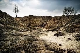


The Tundra and Bottomlands are two distinct types of landscapes that can be found in various parts of the world. Both landscapes have their unique characteristics and could present challenges to survivors in an apocalyptic scenario.
The tundra is a cold, treeless landscape found in high latitudes of the northern hemisphere. It is characterized by low precipitation, permafrost, and a short growing season. Due to the harsh conditions, few species of plants and animals have adapted to survive in the tundra. The tundra may pose challenges for survivors in an apocalyptic scenario due to the lack of food sources and shelter. However, the permafrost may provide a long-term source of preservation for food and other resources.
Bottomlands are low-lying areas along rivers and streams that are subject to flooding. These areas are typically rich in nutrients and can support a wide variety of plant and animal life. In an apocalyptic scenario, bottomlands could potentially provide a source of food and water for survivors. However, the risks of flooding and exposure to waterborne diseases would need to be taken into account.
Here are some links for further information on the tundra and bottomlands:
Arctic Tundra - National Geographic: https://www.nationalgeographic.com/environment/habitats/arctic-tundra/
Tundra - World Wildlife Fund: https://www.worldwildlife.org/ecoregions/na1101
Tundra - Encyclopedia Britannica: https://www.britannica.com/science/tundra
Bottomland Hardwood Forests - US Fish and Wildlife Service: https://www.fws.gov/southeast/wildlife/plants/bottomland-hardwood-forests/
Bottomland - National Park Service: https://www.nps.gov/miss/learn/nature/bottomland.htm
Floodplain Management - Federal Emergency Management Agency: https://www.fema.gov/floodplain-management
0 notes
Text
A Primer on South Carolina Bird Species
Birding enthusiasts living in or visiting the state of South Carolina have a number of interesting species to search for. The state, which encompasses both Atlantic coastal environments and Appalachian highlands, is home to nearly 450 species, about a quarter of which can be classified as “rare,” meaning one is unlikely to encounter them at any place in the state. The state bird of South Carolina is the Carolina wren, having replaced the mockingbird in 1948. Wrens are common throughout the state and can be found in a number of habitats, ranging from open fields to dense woodlands and swamps.
The rarest bird in the state of South Carolina is the bar-tailed godwit (Limosa lapponica), a short-legged sandpiper. A moderately sized bird, the standard bar-tailed godwit has a bill-to-tail length of from 15 to 16 inches and a wingspan of about 40 inches. Females are larger than males, with average weights of 22.2 and 14.1 ounces, respectively. In terms of coloration, the bar-tailed godwit has blue-grey legs and brick red and dark brown plumage. As a migratory species, the bar-tailed godwit has been known to fly for up to eight consecutive days without stopping.
On the opposite end of the spectrum, South Carolina is home to a larger number of “backyard birds” that can be observed in great numbers on a daily basis, in some cases year round. These species include the northern cardinal, the tufted titmouse, the Carolina chickadee, and the blue jay. South Carolina is also home to non-migratory populations of eastern bluebirds, sometimes described as the most sought after avian tenants in birdhouses throughout the United States. South Carolinians interested in luring a bluebird to their feeder can visit the South Carolina Bluebird Society online at southcarolinabluebirds.org. Additional backyard birds include the American robin and the mourning dove, among many more.
Regardless of the rarity of any individual species, fans of birding will have only moderate success unless they make a point to visit one of the state’s premier birding locations. A few of the state’s most popular birding sites include the Savannah National Wildlife Refuge and the Pinckney Island National Wildlife Refuge on Hilton Head Island. Tourists are particularly attracted to the state’s conserved southern bottomland hardwood environments, as well as bald-cypress swamps found in locations such as the Francis Beidler Forest Audubon Center and Sanctuary and Congaree National Park.
While some birding enthusiasts may simply be interested in finding and observing various species, other South Carolinians may be interested in taking a more proactive role in protecting the state’s most vulnerable animals. The South Carolina Wildlife Federation (SCWF) was established in 1931 and continues to maintain a comprehensive list of the state’s most endangered animals, including a list of vulnerable bird species. The state’s most endangered birds include the American swallow-tailed kite, Bachman’s warbler, and the red-cockaded woodpecker. The red-cockaded woodpecker, as well as Bachman’s sparrow, can be found in the pinewood regions of Francis Marion National Forest, but only by the most patient birding enthusiasts. Threatened bird species living in South Carolina range from the bald eagle to Bewick’s wren.
via WordPress https://jefferyroygrant.wordpress.com/2023/01/23/a-primer-on-south-carolina-bird-species/
January 23, 2023 at 01:35AM
0 notes
Text


Congaree National Park , SC USA old growth bottomland hardwood forest. Beautiful place to hike and ponder.
0 notes
Text
Stop burning trees for energy, scientists urge ahead of UN Biodiversity Conference
Stop burning trees for energy, scientists urge ahead of UN Biodiversity Conference
Little remains but stumps and puddles in what was once a bottomland hardwood forest on the banks of the Roanoke River in northeastern North Carolina. The trees were turned into wood pellets for burning in power plants in Europe. | Photo by Joby Warrick / The Washington Post via Getty Images
Forests are more valuable alive than dead, at least according to the more than 670 scientists who signed a…

View On WordPress
0 notes
Text
Round 3, Poll 1
Prothonotary Warbler vs American Dipper

sources under cut
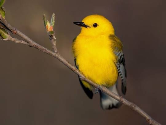
Prothonotary Warbler
"Truly a sleeper warbler. Classy color scheme, lots of spunk. We saw a handful at Magee Marsh last month and I've been calling him America's little darling ever since."
"prothonotary warblers are an indicator species for healthy bottomland hardwood forests in the lower Mississippi"
The only Eastern warbler that uses cavity nests! There are only two warbler species- out of 117!- that use cavities like nest boxes or old woodpecker nests.
American Dipper
"absolutely absurd to see them swim up-current. they're like fish to me. also i love their bounciness"
hey so who decided to let a songbird get in the water?? Most birds associated with water belong to the non-passerine families, but dippers decided no one else was jumping in those cold mountain streams and decided to do it themselves.
"They have even been known to place their nests behind waterfalls, so the birds must fly straight through falling water to access them."
22 notes
·
View notes
Text
Hello! Today I will be continuing my series regarding beautiful places in nature that are located in South Carolina Today I will be discussing the Congaree National park located 18 miles south east of Columbia, the states capitol. The park is known for its biodiversity. It preserves the largest tract of old growth bottomland hardwood forests left in South Carolina. Along with this, the trees located in its forest are some of the tallest trees in eastern United States. This park also contains the Congaree river and a boardwalk over this river.
0 notes
Text
The Atchafalaya National Heritage Area in southern Louisiana is rich with wildlife, cultural history, and Cajun food. It’s one of many parks in the southern U.S. offering adventure and fascinating glimpses into Native and colonial history. Photograph By TyroneTurner, National Geographic Image Collection
— By Stephanie Pearson | May 16, 2022
Parks are places of refuge, reflection, conservation, and community. The new National Geographic book 100 Great American Parks highlights some of the nation’s greatest natural and cultural treasures.
Established in 1916, the U.S. National Park Service manages more than 420 units (including 63 national parks) across 85 million acres. Some parks protect precious and vulnerable habitats, some serve as reminders of important events from our history, and others provide a serene space for visitors. Some are, admittedly, loose definitions of the word “park.” Those include historical sites, wildlife refuges, and congressionally designated wilderness areas. But each place has the potential to inspire.
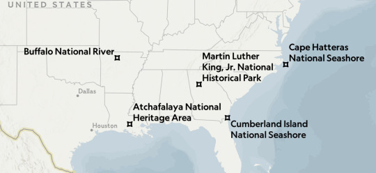
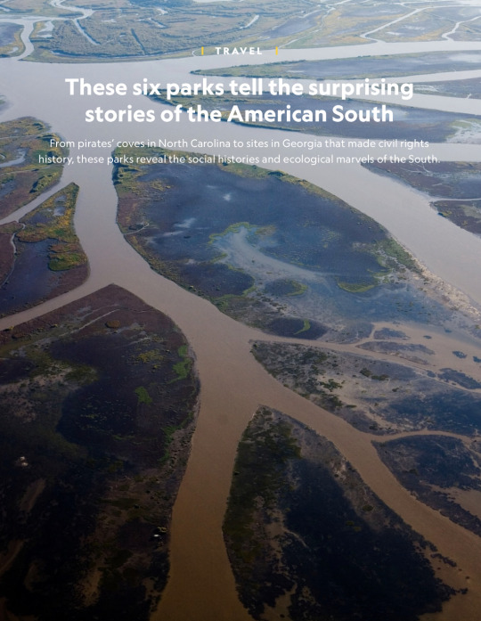
These six parks in the American South reveal surprising natural and social histories of spectacular places in Louisiana, Arkansas, North Carolina, Georgia, Florida, and beyond. Visitors to parks here are rewarded with vivid stories of Indigenous heritage, civil rights heroes, and ecological marvels.

Houseboats and cabins are available for rent in the Atchafalaya National Heritage Area, the largest contiguous bottomland hardwood forest on the continent. Photograph By Kris Davison, National Geographic Image Collection
Atchafalaya National Heritage Area
Visit a biodiverse region rich in cultural history. Louisiana’s Atchafalaya National Heritage Area highlights the Atchafalaya Basin, stretching across 14 of the state’s 64 parishes. It contains ancient oaks and towering cypresses along bayous, swamps, and backwater lakes, all centered around the Atchafalaya River, from the Choctaw words hacha falaia, or “long river.”
The cultural history of Atchafalaya is as complex as its waterways, starting 6,000 to 2,500 years ago, when the first Native Americans lived along natural levees and bayous of what was once the traditional Mississippi River floodplain. During the 1700s, the French arrived in the Atchafalaya Basin to trade furs with its Indigenous inhabitants and launch raids into their tribal areas to capture and enslave them.
Starting in 1703, roughly 3,000 Acadians from present-day Nova Scotia arrived after being exiled by the British. By 1718, most of the region’s Native American population had diminished, decimated by diseases brought by the outsiders and continuous warfare.
The Cajuns, descendants of the Acadians, are still the dominant culture in the Atchafalaya. But the region’s food, music, and traditions have been heavily influenced by the Native American, Spanish, French, Caribbean, African, and Acadian people who have lived here over the centuries.
Gumbo is synonymous with Cajun country and serves as a metaphor for the zone’s melding of cultures. It is derived from the word nkombo, Bantu for “okra,” a vegetable the Portuguese originally brought to America. Another key ingredient is filé, which is Native American in origin and made from ground sassafras leaves. The dish’s soup-like consistency is derived from a French bouillabaisse.

Autumn is a popular time to visit Arkansas’s Buffalo National River. The forests on the Ozark Mountains gradually transform from greens to fiery hues and Native Ponca elk become more active. Photograph By Randy Olson, National Geographic Image Collection
Buffalo National River
Explore a beloved river at the center of a conservation struggle. Buffalo River in Arkansas is the United States’ first national river, a designation that protects it from industrial uses and other obstructions that would alter the natural character of the waterway. The 135-mile-long national river portion features dramatic limestone and sandstone bluffs, more than 500 caves, 100-plus miles of hiking and horseback riding trails, and 12 species of game fish.
Buffalo National River’s designation did not come easily. In 1938, when Congress passed the Flood Control Act authorizing civil engineering projects like dams, dikes, and levees, the Army Corps of Engineers immediately began eyeballing the Buffalo’s hydroelectric potential and planned for two massive dams along its length. Conservationists forcefully rallied against the plan and, in an effort to bring attention to the issue, they took Supreme Court Justice William O. Douglas canoeing down the Buffalo.
The debate finally came to a head in 1965, when Arkansas Governor Orval Faubus refused to back the plan. Seven years later, Congress voted to establish Buffalo as the country’s first national river. Today there are 100 miles of wild, scenic, and recreational rivers across the country, inclusive of 209 protected rivers in 40 states and Puerto Rico.
Despite its protected status, the Buffalo is still vulnerable. In 2019, the nonprofit American Rivers ranked it as the eighth-most endangered river in the country due to the presence of a 6,500-head hog farm known as a concentrated animal feeding operation (CAFO) sitting on a hill above Big Creek, one of the river’s main tributaries. In June 2019, the state reached an agreement with the hog farm to close the facility and Governor Asa Hutchinson announced a permanent moratorium on industrial-scale farms operating in the watershed.

Cape Hatteras National Seashore offers 70 miles of golden beach where visitors can fly kites, picnic, search for shells, and enjoy a bonfire in the evening. Photograph By Stephen G. ST. John, National Geographic Image Collection
Cape Hatteras National Seashore
From pirates to the Civil War, this seashore has seen it all. Crashing surf, a secluded beach, and a cool dip in the Atlantic are what many visitors to North Carolina’s Outer Banks seek. The three sandy islands—Bodie, Hatteras, and Ocracoke—parts of which make up Cape Hatteras National Seashore, offer this peaceful repose. They also provide refuge for five species of sea turtles, nesting colonies of shorebirds, and a herd of Banker ponies. Legend has it that the ponies descend from animals shipwrecked sailors abandoned in the 16th or 17th century.
The history of the Outer Banks is a centuries-long string of harrowing tales of shipwreck and war. The water off the coast, known as the “Graveyard of the Atlantic,” has been the site of more than 600 shipwrecks, due to a “perfect storm” of deadly factors including the infamous Diamond Shoals, a bank of constantly shifting sandbars underwater. In order to take advantage of the currents, ships must sail close to the Outer Banks and risk the consequences.
Edward Teach, the pirate known as Blackbeard, terrorized the waters off the Outer Banks in the early 1700s. Ocracoke Inlet was Teach’s favorite anchorage. After a ferocious battle there in 1718, Teach and several of his crew were killed by Royal Navy Lieutenant Robert Maynard and his men.
During the Civil War, the islands were used as battlefields. Whoever controlled them, and the surrounding sounds, would ultimately control North Carolina. By the summer of 1862, a Union victory on Roanoke Island secured eastern North Carolina for the Union Army. Almost a century later, during World War II, German U-boats lurked offshore to wait for passing ships, illuminated by lights onshore.
The area is facing significant erosion affecting the stability of homes along the shore. Large-scale storm events, a result of climate change, have wreaked havoc on the coastline in recent years.
To counter the perilous sea, many light stations were constructed along the Outer Banks, including the Cape Hatteras Lighthouse. At 198 feet, the iconic black-and-white-striped structure, designed and built between 1868 and 1870, is still the tallest brick light tower in the U.S.

After his assassination in 1968, restoration began to make Martin Luther King, Jr.’s birth home into a historic museum. Today, rangers offer tours of the house where the civil rights icon spent the first 12 years of his life. Photograph By Martin Thomas Phptpgraphy, Alamy Stock Photo
Martin Luther King, Jr. National Historical Park
Learn about civil rights history and the heroes who advanced equality. Centered around a few city blocks on Atlanta, Georgia’s Auburn Avenue—the once thriving heart of the city’s Black community known as Sweet Auburn—the Martin Luther King, Jr. National Historical Park highlights the most formative spaces in the young King’s life.
From the day he was born until the age of 12, King lived at 501 Auburn Avenue in an 1895 Queen Anne-style house that his maternal grandfather, Reverend Adam Daniel Williams, bought for $3,500 from its white owners in 1909. The two-story house, with intricate scroll-cut wood trim and a front porch, was a bustling place: King shared the home with his grandparents, parents, two siblings, and an occasional border.
Ebenezer Baptist Church, just down the block from King’s childhood home, was perhaps the most influential space in his life. His grandfather became the church’s pioneering second pastor in 1894, preaching a social gospel of Black business development and civil rights. When he died in 1931, King’s father, Michael, a powerful patriarch and fierce preacher, became the head pastor. King, Jr., joined his father as co-pastor in 1959 and served at the church until his death. Of Ebenezer, King, Jr., once said, “My best friends were in Sunday School, and it was the Sunday School that helped me to build the capacity for getting along with people.”
The International Civil Rights Walk of Fame, located on a promenade leading to the park’s visitors center, features granite markers with the embedded footprints of human rights icons including Rosa Parks, Desmond Tutu, Congressman John Lewis, and Sidney Poitier.
The park is also the final resting place of King and his wife, Coretta Scott King. A four-hour drive southwest to Alabama is the Selma to Montgomery National Historic Trail, where King led nonviolent supporters of all races to fight for the Black right to vote.
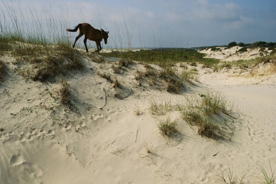
The feral horses of Cumberland Island National Seashore can be seen grazing in the island’s salt marsh, dune meadows, and fallow fields. Photograph By Melissa Farlow, National Geographic Image Collection
Gulf Islands National Seashore
History echoes in this coastal region, but environmental threats loom. Stretching 160 miles from Florida’s Santa Rosa Island in the east to Mississippi’s Cat Island in the west, Gulf Islands National Seashore spans two states, including seven islands and portions of the mainland. Its 13 unique areas range from historic forts predating the Civil War to wilderness beaches of white quartz sand accessible only by boat.
Florida’s Pensacola Bay, with its deep water and protected harbor, has long been considered the most important ship anchorage on the northern Gulf Coast. As such, Fort Pickens, designed to protect the bay and the Pensacola Naval Yard, was purposely built to look massive and intimidating. On the west end of Santa Rosa Island, the fort could hold more than 200 cannons and unleash fire from a maximum of 1,000 soldiers when under a siege.
This area also played a critical role in making beaches accessible to all, regardless of race. Jim Crow laws in the South made many beaches off-limits to Black families. As a result, many Black children drowned because they swam in unsupervised or unsafe waters. To change these laws, Dr. Gilbert Mason, Sr., led peaceful “wade-ins,” similar to restaurant “sit-ins,” into Gulf of Mexico waters off beaches near Biloxi. Many of the protests were met with violence, but in 1968, the Justice Department finally prevailed in opening these public beaches to all.
In many ways, Gulf Islands is a dreamy, idyllic destination, thriving with shorebirds and sea turtles and echoes of American history. A variety of animals make their nests and homes there, including 12 threatened or endangered species, such as the Gulf sturgeon and West Indian manatee.
But the seashore has also been under increasing human- and climate-induced pressure: In 2010, the Deepwater Horizon spill resulted in gobs of oil and tar washing on the sand, resulting in a fishing and swimming ban. Intense hurricanes, most recently Zeta and Sally, have wreaked havoc on roads and infrastructure. The delicate dance between man and nature is fully on display across these islands.
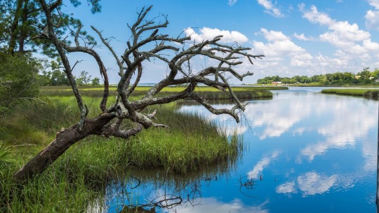
See bayous and coastal forests on the Mississippi side of the Gulf Islands National Seashore, shown here. On the Florida side, relax on white sand beaches and visit historic forts. Photograph By Ron Buskirk, Alamo Stock Photo
Cumberland Island National Seashore
Visit a storied Black settlement on a fragile barrier island. The shifting sand dunes, salt marshes, maritime forests, and miles of unspoiled beaches of Cumberland Island National Seashore on Georgia’s largest and southernmost barrier island echo with ghosts from the past.
For centuries, people have inhabited this 18-mile-long island, from its original Indigenous residents to the Timucua people and Spanish missionaries and to formerly enslaved Blacks to wealthy industrialists.
At the northern tip of the island, from where the ferry disembarks at Sea Camp, are the last remaining relics from the Settlement. It was a community established in the late 1800s by Black residents, some of whom were born into enslavement and freed after the Civil War. One of the last buildings standing is the one-room First African Baptist Church, built in 1893. It served an essential role in the community not only as a place of worship and fellowship, but also as a schoolhouse.
The wildly varied human history is juxtaposed with what is now a wilderness where wild turkeys, armadillos, and feral horses run free. With 17 miles of undeveloped beach, Cumberland Island is an ideal nesting area for loggerhead sea turtles, a federally threatened species. Each year the island accounts for 25 to 30 percent of the statewide nesting total. In 2019, 1,018 turtle nests were recorded, most of which belonged to loggerheads.
— The National Geographic
0 notes
Text
Thaden School Home Building, Arkansas
Home Building at Thaden School, Bentonville Building Development, Arkansas Real Estate, American Architecture Photos
Thaden School Home Building in Arkansas
May 20, 2022
Architects: EskewDumezRipple
Location: Bentonville, Arkansas, United States of America
Photos: Dero Stanford
Home Building at Thaden School
The Home Building is the central hub at Thaden School, a new high school in Bentonville, Arkansas, where students learn by doing. The building’s design, much like the school’s 26-acre campus, strives to establish an innovative vision for the future while reflecting the rich, pastoral heritage of the surrounding landscape.
The Thaden School challenges traditional paradigms of education. The school’s pedagogy is centered on three signature programs: Reels (where narrative and visual communication come alive through the production of film and video), Wheels (where physics and mechanics come alive through the construction and use of bicycles), and Meals (where biology, chemistry, and community come alive through the growing and preparation of food). After first leading the completion of the Master Plan for the campus (a collaborative effort between EskewDumezRipple, Marlon Blackwell Architects, Andropogon, and CMTA), EskewDumezRipple was tasked with designing the 34,000-square-foot Home Building, the heart of all student activities on campus.
Beyond the physical centrality of its location, the Home Building serves as both the social and spiritual center for students. As the hearth of the campus, the building provides an expansive dining hall, where all of campus comes together for meals, as well as a teaching kitchen, the student bookstore, a library, and several unstructured lounge and study spaces. In the dining hall, the celebrates the material technology within. A veil of poplar slats mounted underneath enormous truss frames reveal, rather than conceal, the structural design and bring a deep warmth to a space intended for communal dining. The design reconciles seemingly contradictory notion: lofty ambitions for the building’s design with the humble nature of local, vernacular architecture.
The building takes visual cues from the region itself, with board and batten facades and all wood construction incorporating the beauty of local, vernacular architecture. The building stretches across the landscape, bending and wrapping to define a new kind of campus, creating a network of outdoor spaces of varying scales, textures, and uses that interact with the diverse interior spaces. Indoor-outdoor relationships are explored at every opportunity. An ever-present “water lab” holds a majority of the rainwater that’s collected on site.
While simultaneously providing a unique opportunity for students to learn via their surroundings. The design employs common materials and methods in uncommon ways. Using techniques typically found in residential design, the design pushed the simple form to its limit, opening the floor plan to create porches and courtyards and gently sloping the roof up to a dramatic 38-foot-tall peak at its center. The roof plane enshrouds the simple gable form of the dining hall. A skyward opening punctures the roof of the outdoor courtyard where students frequently congregate outside the dining hall. Students take classes in a state-of-the-art teaching kitchen—one of the truly unique spaces in the Home building— one that deeply espouses the school’s “learning by doing” mantra.
The building’s design places sustainability central to students’ education. Transitional spaces, protected outdoor areas, landscape that acts as a botanical textbook filled with a diversity of plants, flowers, and trees—tall grass prairie, oak and pecan woodlands, bottomland hardwood forests, freshwater wetlands—a microcosm of the region’s native plant communities. Stormwater management (91% is managed onsite) is accomplished via a distributed strategy, with several detention areas across the site. In the rear of the Home Building, a “water lab,” detains the majority of rainwater, while offering a unique “classroom outside the classroom”—an opportunity for students to learn directly from their surroundings.
Low-flow plumbing fixtures are used throughout the building which will save roughly 30, or about 100,000 gallons of water each year. A geothermal well field sited directly on the large quad in front of the Home Building was selected instead of a traditional cooling tower, resulting in an additional 1.5M gallons of water savings annually. The Home Building was designed to achieve an Energy Use Intensity (EUI) of 23 (a school building recording 25 EUI or less is considered to be Zero Energy Ready).
The later addition of a rooftop photovoltaic array could result likely achieve Zero Energy (ZE). A dedicated outdoor air system ensures that occupants have fresh air throughout the entire building. By bringing all outdoor air into the building at a single location (instead of at each heat pump zone) it can be passed through an enthalpy wheel which transfers heat from the exhaust air to the incoming air which also provides dehumidification.
Thaden School Home Building in Bentonville, Arkansas – Building Information
Architect: EskewDumezRipple – https://www.eskewdumezripple.com/
Landscape Architect: Andropogon Associates, Ltd.
Civil Engineering: Ecological Design Group
MEP Engineering: CMTA Consulting Engineers
Structural Engineering: Engineering Consultants Inc. (ECI)
Project Management: Aegis Property Group | WEI
General Contractor: Milestone
Irrigation: Aqueous
Signage and Wayfinding: Tom Zetek
Photographer: Dero Stanford
Eskew+Dumez+Ripple
Thaden School Home Building in Arkansas images / information received 200522 from Eskew+Dumez+Ripple Architects, USA
Location: Bentonville, Arkansas, United States of America
Buildings in Arkansas
Arkansas Architecture
Contemporary Bentonville Buildings
The Momentary
Design: Wheeler Kearns Architects
photograph : Tom Harris Architectural Photography
The Momentary in Bentonville
CO-OP Ramen Restaurant
Design: Marlon Blackwell Architects
photo : Timothy Hursley
CO-OP Ramen Restaurant in Bentonville
Crystal Bridges Museum of American Art Bentonville
Crystal Bridges Museum Arkansas
New Arkansas Architectural Projects
15 Degrees House, Bella Vista
Design: Matthias J Pearson Architect
photograph : Timothy Hursley
Residence in Bella Vista
Harvey Clinic, Rogers
Design: Marlon Blackwell Architects
photograph : Timothy Hursley
Clinic Building in Rogers
Saint Nicholas Antiochian Orthodox Christian Church
Buildings in Neighbouring States to Arkansas
Texas Architecture
Louisiana Architecture
Missouri Architecture
Nevada Architecture
Oklahoma Architecture
American Architecture
Buildings / photos for the Thaden School Home Building, Arkansas designed by EskewDumezRipple Architects page welcome
The post Thaden School Home Building, Arkansas appeared first on e-architect.
0 notes
Video
flickr
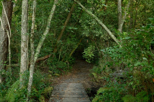
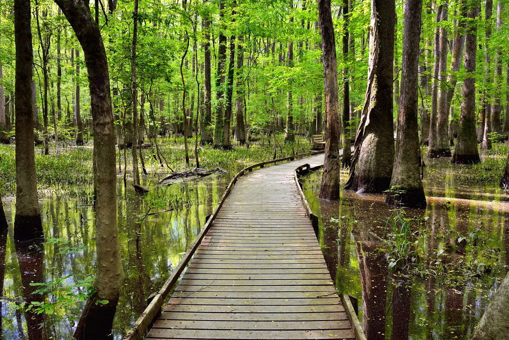
It Only Takes a Moment or Step to Start the Story We Call Life… (Congaree National Park) by Mark Stevens
Via Flickr:
There was definitely something magical about walking this boarded walk in Congaree National Park! The tall cypress trees all around, sunlight coming from above and a nice coolness still in the air with spring temperatures.
#Azimuth 354#Bald Cypress Trees#Benches#Boardwalk#Boardwalk Loop#Boardwalk Loop Trail#Bottomland Hardwood Forest#Capture NX2 Edited#Color Efex Pro#Congaree Floodplain#Congaree National Park#Congaree National Park and Atlanta#Cypress Trees#Day 2#Glass-like Reflections#Hiking Trail#Image Capture WIth Arsenal#International Biosphere Reserve#Lake Reflections on Water#Landscape#Looking North#Mostly Cloudy#Nature#Nature Trail#Nikon D800E#Old Growth Bottomland Hardwood Forest#One of Highest Temperate Deciduous Forest Canopy#Outside#Overcast#Partly Cloudy
6 notes
·
View notes
Last Seen Blogs

karanhts
Untitled

transitionsllc
Transitions Estate Sales, LLC

animatewarriorcats
Alex's Warrior Designs

sixteenecstacy
sixteenecstasy*