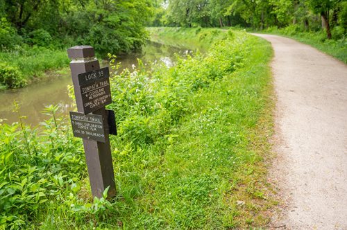
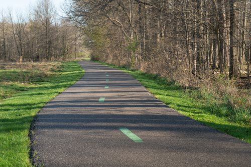
#Ohio and Erie Canal Path
Photo
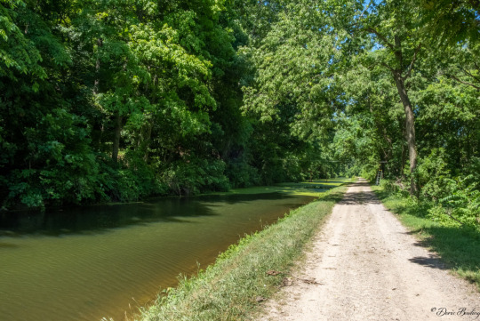
Coshocton, OH by Doris Bowling
Via Flickr:
This tow path runs along a portion of the 1-1/2 mile restored Ohio and Erie Canal. Draft horses walk along the tow path pulling the Monticello III canal boat near Roscoe Village.
1 note
·
View note
Text
Public Transportation in Cincinnati
We believe that Cincinnati could benefit from a fixed transportation system centered in downtown. The current metro buses are better at reaching the greater area, but the transportation downtown could be faster and protected by the elements if we had a subway. The original plan to have a Cincinnati subway fell through because of the great depression, but there is still opportunity to create and build routes under the city, particularly downtown where the topography is less challenging. I think that it is challenging for people to imagine modern day subway construction in America, since the systems in the east coast have been long standing. In 2017, the MTAs second avenue subway expansion was the biggest New York subway expansion in 50 years. Although the noise from construction could be slightly disruptive, building underground would be easier in some ways, especially because nobody would have to be displaced and no roads would need closing.

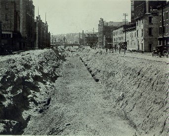
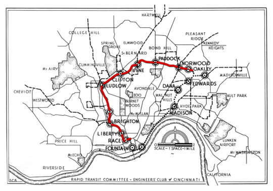
Cincinnati’s original subway plans depicted a 16 mile rapid-transit-line which looped around the city. It would run along Walnut Street all the way up to the Miami Erie Canal. In the early 1900s, Cincinnati leased a portion of the old canal from the state of Ohio to run the subway line through. The subway would continue under Central Parkway north to Ludlow Avenue, then going above ground along a section of present-day I-75 before tunneling under the business district of Saint Bernard, cutting through Montgomery Road in Norwood, and running along a portion of I-71 before making its way back to Fountain Square. The city was able to build 11 of the 16 miles before funds started running out, making it more difficult for them to obtain the right-of-ways.

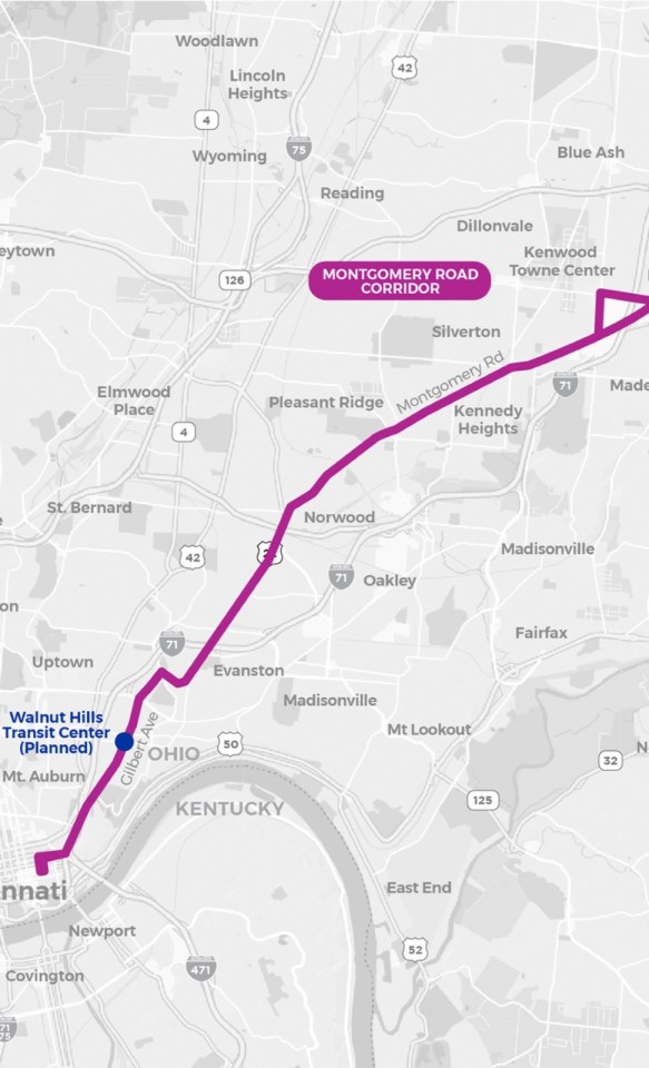
If Cincinnati were to revitalize the remnants of the constructed subway system, they could choose to continue the remaining path of the proposed plan, or they could rely on a mix of transportation modes to create even more connections amongst the different methods. The Montgomery Road Corridor, an area of study conducted by SORTA to determine Cincinnati’s new bus rapid transit system, runs right up to the Norwood stop on the constructed subway line. Rather than investing in both the revitalization of the existing subway and the construction of the remaining, connecting these lines with a transit center would allow for an easy switch between the two systems.
Another major benefit of this model and the connection between BRT lines and Subway lines is that even without any access to car transportation, a user is able to access multiple forms of transit and transition from one mode to another efficiently. This is a game-changer in terms of accessibility, especially for those who live and/or work in the downtown area of Cincinnati. A great amount of higher-income residents of suburbs commute via car to work downtown, while a majority of the people who live downtown have to commute via public transportation outside of the area to jobs where they make less money. With a better connection between BRT lines and Subway lines, the accessibility of uptown to downtown transport and inner-city subway routes would evolve.
1 note
·
View note
Text
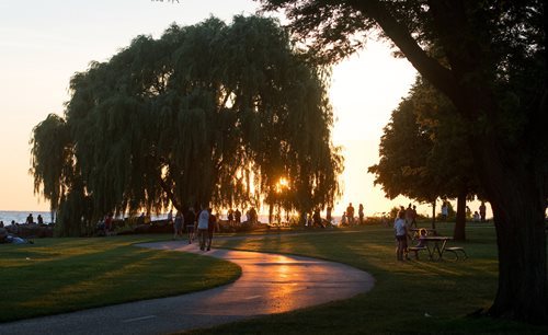
June | Cleveland Metroparks
New Post has been published on https://petnews2day.com/reptiles-news/june-cleveland-metroparks-2/
June | Cleveland Metroparks
Ten Stroller-Friendly Trails in Cleveland Metroparks
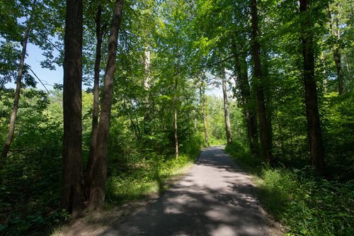
Towpath Trail, Ohio & Erie Canal Reservation
The Towpath runs along the existing Ohio and Erie Canal and its historical footprint. Start at the Harvard Road Trailhead and head south on the paved Towpath Trail for a scenic and invigorating walk. Keep your eyes open for northern mockingbirds trailside and bald eagles flying along the Cuyahoga River.
Edgewater Beach, Lakefront Reservation
Start on the paved all purpose trail behind the concession stand to get warmed up then walk to Upper Edgewater. You can take this paved trail all the way to the Cleveland script sign for spectacular views and a fun photo opportunity. You may not be able to resist a stop at the Lindsey Family Play Space for some fun!
Bunns Lake Loop, Bradley Woods Reservation
Take a quiet walk in the peaceful Bradley Woods Reservation on the paved Bunns Lake Loop. Enjoy the beautiful and unique swamp forest habitat while watching for ducks, geese, frogs and other wildlife in and around Bunns Lake.
North Chagrin Nature Center Marsh Trail, North Chagrin Reservation
Enjoy a peaceful stroll around Sanctuary Marsh listening to the birds sing, frogs croak, and watching turtles bask. Along the way, stop and visit the owl aviary for a chance to visit our six resident ambassador owls.

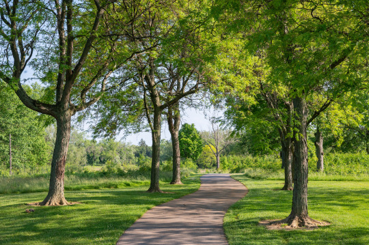
All Purpose Trails, Acacia Reservation
Enjoy over two miles of paved trails winding through this former golf course. Butterflies and birds utilize these beautiful meadows for food and shelter.
South Quarry Loop Trail, Mill Stream Run Reservation
Walk this one-mile path through the forest, past the river, and then head back on the all purpose trail. This trail has stunning views of nature, and runs under the power lines, creating a beautiful juxtaposition of nature and technology. The views change from season to season, so enjoy year-round!
All-Purpose Connector Trail, Brecksville Reservation
Discover the butterflies, birds and blooms of the tallgrass prairie on this paved, half-mile trail. Start your walk at Brecksville Nature Center and follow the paved trail through the woods to the west leading to the prairie. Visit the accessible prairie deck before continuing along the paved trail past the demonstration garden and back toward the nature center.
Lake-to-Lake Trail, Big Creek Reservation
Burn some serious calories on this 4.8-mile out and back trek. Begin your stroll at Lake Isaac parking lot located along Big Creek Parkway. Travel north toward Fowles Marsh, then continue onward toward Lake Abram at Eastland Road. There are several scenic boardwalks and a few road crossings to navigate along this beautiful and mostly level suburban trail. Take in some history of early settlers and spot resident beavers and herons along the way.

Bluebird Point, West Creek Reservation
Stroll a quick loop or opt for more along the 1.8 miles of all purpose trails at West Creek Reservation. Begin at Bluebird Point parking area for a short half-mile loop around a large open meadow. Veer towards Grassroots Gorge Overlook to view West Creek’s shale creek bank. Stroll back towards Bluebird Point parking area on a gradual uphill paved trail over a 3-sided arched bridge.
West Channel Pond Loop Trail, Rocky River Reservation
Follow this smooth, natural-surface trail around West Channel Pond. Enjoy the sights and sounds of the birds, reptiles, amphibians and other animals that make this wetland their home. If you are lucky, you may even see a beaver!
Source link
1 note
·
View note
Text

Fall Color in the Cuyahoga Valley
Between the Rust Belt cities of Cleveland and Akron, Ohio, deciduous forests put on a coppery fall display in the Cuyahoga Valley. The OLI-2 (Operational Land Imager-2) on Landsat 9 captured this autumnal image on October 23, 2023, around the time colors typically reach their peak in and around Cuyahoga Valley National Park.
Broadleaf trees, such as red and silver maples, white and northern red oaks, and bigtooth aspen, fill the forests of the Cuyahoga Valley. Their leaves turn shades of red and yellow as they lose chlorophyll, the molecule that plants use to synthesize food and makes leaves appear green. When daylight hours shorten and temperatures fall, chlorophyll concentrations also drop, offering a chance for other leaf pigments—particularly carotenoids and anthocyanins—to show off their colors.
The Cuyahoga River flows north through this scene on its crooked path to Lake Erie. Approximately 22 miles (35 kilometers) of the river and the rich ecological, cultural, and historical resources flanking it make up Cuyahoga Valley National Park (below). The land was first designated the Cuyahoga Valley National Recreation Area in 1974 to protect undeveloped land between industrial cities. It became a national park in 2000 and consistently ranks as one of the top 10 most visited national parks in the United States. Popular park attractions include Brandywine Falls and the Towpath Trail, the path that mules once used to pull boats along the Ohio & Erie Canal.
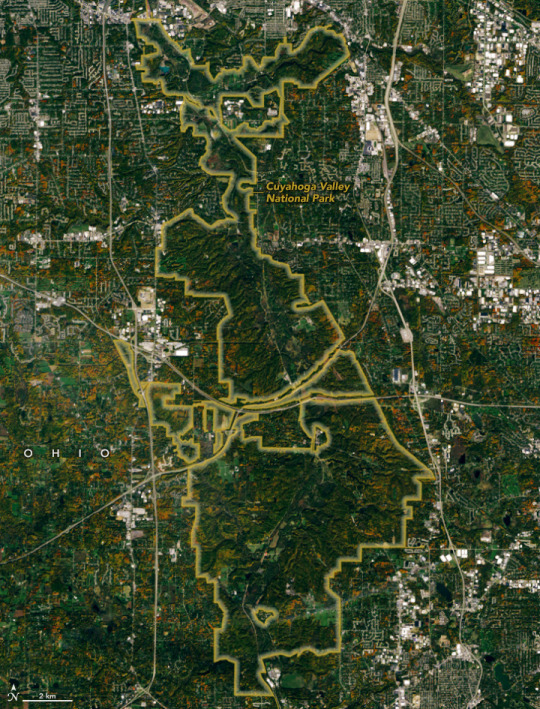
The river is infamous for its history of pollution; oil slicks on the water caught fire on multiple occasions dating back to 1868. A fire in 1969 burned for only about 30 minutes but had a long-lasting legacy, as it helped to inspire the first Earth Day and the establishment of the Environmental Protection Agency (EPA). Today, much of the river’s watershed remains an Area of Concern under the EPA’s Great Lakes Water Quality Agreement. Water quality is improving overall, and work continues to reduce urban stormwater runoff, restore floodplain and wetland habitat, and remove dams.
Changes in land use and restored landscapes are hallmarks of the valley. Much of its forests contain secondary growth where trees had been cleared to establish farms a century ago. Charismatic species such as bald eagles have returned to the habitat, although threats remain from invasive species, plant disease, and an overabundance of deer browsing on seedlings and ground-cover plants. Other changes include the Superfund cleanup of the Krejci Dump—a hazardous waste disposal facility transformed into a wetland—and the restoration of the Richfield Coliseum property, now a 327-acre grassland growing where a professional basketball arena once stood.
NASA Earth Observatory image by Wanmei Liang, using Landsat data from the U.S. Geological Survey. Story by Lindsey Doermann.
1 note
·
View note
Text
17 Curious Facts About Cincinnati's Miami & Erie Canal
Of Course, Daniel Drake Thought Of It
Since he was behind almost every improvement ever contemplated in pioneer Cincinnati, it should surprise no one that Daniel Drake proposed a canal system in his 1815 book, “A Picture of Cincinnati.” Drake was, as usual, ten years ahead of his time, but his proposal closely matched the route ultimately selected when the canal was laid out in 1825.
Just The Facts
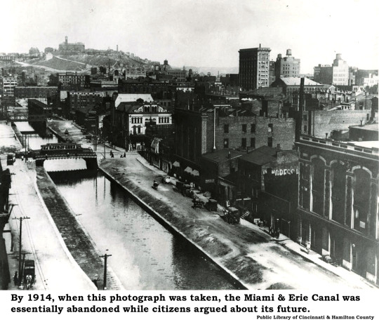
The Miami & Erie Canal extended 244 miles from Cincinnati to Toledo. Construction began in 1825 and was completed in 1845, at a total cost of $8,062,680.07. Along the route, the canal crossed 19 aqueducts and employed 106 locks. The last 10 of these locks carried barges from Court Street down to the Ohio River at Cincinnati along a channel now buried under Eggleston Avenue. The peak year for traffic was 1851, after which competition from railroads increased every year. The canal was abandoned in 1913 after a catastrophic flood in Dayton destroyed essential infrastructure.
Up & Down
Along its path, the canal climbed 395 feet upward from Lake Erie to reach its highest level. Known as the Loramie Summit, this plateau extended almost 20 miles between New Bremen to Lockington, north of Piqua, Ohio. From there, the canal descended 513 feet until it reached the Ohio River. The final 100-foot drop ran from Court Street to the Ohio River in Cincinnati.
From Barges To Superhighways
Long stretches of the Miami & Erie Canal are now traversed by automobiles, especially on I-75, U.S. Route 24, and Ohio Route 25. Automobiles were often the third vehicles to follow these routes. As the canal was abandoned, boats usually gave way at first to interurban rail lines in the 1920s and 1930s. Automobiles followed only after the Federal Aid Highway Act of 1956 funded the construction of interstate highways.
Cincinnati’s Rhine
Without the canal, there would be no Over-the-Rhine. The first references to Cincinnati’s “Little Deutschland” neighborhood as “Over-the-Rhine” appear around the time of the Civil War. Originally a put-down, the city’s German residents came to appreciate the idea that they felt more at home once they crossed over the Canal (the “Rhine”) into familiar territory.
The “Other” Canal
The Miami & Erie Canal was not the only canal serving Cincinnati. The Cincinnati & Whitewater Canal was completed in 1843 and connected Cincinnati to Indiana’s Whitewater Canal near Harrison, Ohio. This short canal was in operation for only 20 years and was converted to a railroad right-of-way after 1862. A tunnel constructed for the Cincinnati & Whitewater canal can still be seen in Cleves.
The Lakes Abide
Some of Ohio’s largest lakes were originally created to ensure a consistent flow of water for the canal. Grand Lake St. Marys was one of these feeders and was the world's largest reservoir when built. Indian Lake, originally a collection of small lakes and wetlands, was converted into a large supply basin for the canal. Along the length of the canal, smaller basins – including LeSourdsville Lake – allowed barges to turn around, dry dock, or exchange cargo.
Holy Water
A couple of local African American churches dunked converts in the Canal. One Northside church performed its rites at a location known then as Baptist Hill. The other congregation baptized a half-mile south of the Bruckmann Brewery, beneath the western slopes of Clifton.

Liquid Gold
Canal transportation was appropriate if you didn’t need cargo in a hurry and if your cargo was unlikely to spoil. Whiskey, in other words, was nearly the perfect canal cargo, and a lot of liquor went up and down the canal. A single barge could carry 500 barrels of whiskey at 50 gallons each. At pre-Prohibition prices averaging $1 a quart retail, that’s a $100,000 boatload.
A Taste Of Venice
The City of Cincinnati celebrated its Centennial in 1888. As part of the festivities, an immense exhibition was staged at Music Hall. For this extravaganza, the 1,248-foot-long “Machinery Hall” was erected along the rear of Music Hall, over the flowing canal. The interior of the hall was decorated in a Venetian theme, accentuated by a fleet of gondolas poled along by singing gondoliers. The Italian boats returned every year into the early 1900s.
A Lock On A Name
Lockland, our suburban neighbor straddling the “Split” on I-75, has nothing to do with security devices requiring a key. A half-dozen Ohio towns contain “Lock” in their names, all reflecting their erstwhile position along the various canals connecting Lake Erie to the Ohio River. At Lockland, I-75 barrels right through the former canal locks.
Ice Is Nice
As an exposed and relatively shallow stream, the canal regularly froze each winter. In the sections near towns and cities, the annual freeze brought out skaters and even horse-drawn sleighs. The frozen canal also generated substantial supplies of commercial ice to icemen issued permits by the State of Ohio. One of the biggest storage facilities was located at LeSourdsville, north of Hamilton, capable of holding a two-year supply of that pre-refrigeration necessity.
Swimming Hole
Every boy in Cincinnati knew the “secret” sign: Two fingers held up in what later became the sign for “peace” meant it was time to go swimming. Every boy in Cincinnati also knew the warning shout, “Cheese it! The Cops!” – a signal to grab your clothes and scatter.
Beware The Naked Man
The canal had barely been excavated when Cincinnati City Council passed an ordinance in 1828 outlawing bathing in the waterway. The ordinance began: “Whereas much lewdness and obscenity daily occur from the public and lascivious manner in which men and boys expose themselves in bathing in the Miami canal in the city of Cincinnati . . . ” By the late 1800s, naked men were still in plain view along the local waterways. But nakedness was not the only crime. Even worse, these flagrantly unclothed males were naked on Sunday. Skinny-dippers created an offensive impediment to good folks crossing the Mill Creek bridge on their way to church:
Dangerous Waters
Charles Ludwig’s little book, “Playmates of the Towpath,” published in 1929 by the Cincinnati Times-Star, is filled with anecdotes about parents paddling their sons (and, rarely, daughters) for swimming in the canal. The book is equally packed with stories about swimmers being rescued or drowning. Although seemingly placid and tame, the canal claimed many lives over the years. Drownings were common, but infectious diseases from dysentery to cerebral meningitis spawned in the polluted waters as well.
And Gross, Too
Even those former boys who in their dotage fondly remembered swimming in the Miami & Erie Canal recalled the stench from industrial wastes including grease, acids, and chemical salts; rotting animal carcasses; the occasional corpse; and the contents of the innumerable chamber pots emptied into the stream from tenements along the banks. When a swimmer yelled “floater,” there was no telling what was on the way, but everyone scrambled out of the water.
The Last Boat
Cargo barges had disappeared from the canal by the early 1900s and long-distance passenger service vanished after the 1913 flood demolished some of the upstream locks. It is believed the final excursion boat on the Cincinnati section of the canal hosted a party of “Free Setters,” a society of men dedicated to beer drinking. Fittingly, the 27 July 1917 voyage started at the Gerke Brewery at the Plum Street bend and ended at Bruckmann’s near the Ludlow Viaduct.
9 notes
·
View notes
Photo


Re: Using corrugated metal pipes as tunnels:
[previous post]
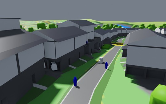
So the most recent development sketch for Misneyland is the village ring, and it’s portrayed above. (Technically I can create much more sophisticated 3D models than that, but I’m not going to do so for a Tumblr post, unless someone wants to pay for a 40 manhour version.)
The village ring was developed to solve turning radius and fire hose length requirements for contemporary fire engines, which are included in common fire codes.
Each village has an outer tree berm. This cuts down on noise, and the upwards slope conceals truck traffic beyond. The next layer is a one-way, one-lane road for full-size automobiles and access by emergency vehicles, including fire trucks and ambulances. A sidewalk is provided in part for potentially routing around damaged vehicles. Garages are half-buried in the tree berm. Every house has a garage for a full-size auto. The next layer is a backyard, followed by a house. (The depicted houses are duplexes.)
The layer after that is where it gets interesting - this is a multi-mode path for golf carts, electric scooters, bicycles, and pedestrians. This path actually marks the “front” of the house. The houses are arranged in this kind of circle to provide a town feeling, with just enough landscaping on either side to allow for a bit of expression and creativity. We might like it to feel a bit like you’re living on a small street in Tokyo - but with a bigger personal yard, and regular access to a full-size car.
Residents should feel that they can just walk right out their front door or on a bike, and get on the path to visit a friend or central store in the development or nearby areas.
We then have another house, backyard + garages, one-way road, and a central park.
[ @florescent--luminescence ]
there are golf cart tunnels in my hometown (no, really) and a lot of them are made from giant corrugated pipes so idt they're too expensive at all
This is good information and I’m glad you brought it to my attention. I looked it up and suppliers will just sell you 50-year-rated 8-foot diameter galvanized steel pipe for exactly that use case. It’s also possible to get some thermal insulation by setting it underground. One could even stick two next to each other - one for each direction of travel.
My thoughts here have less to do with golf carts as a form of transportation, and more to do with golf carts as a tool for providing an experience (which also happens to sell housing).
Here’s a golf cart tunnel in The Villages, generally used for going underneath major roads. It feels like an underground bunker (for golf carts). Above-ground paths are sunny and green, with palm trees rising up from the landscaping. Peach Tree City’s paths look like this.
If you think that looks like, say, the Erie Canal Towpath Trail in Ohio, you wouldn’t be wrong, at least on summer days that aren’t overcast.
My view is that different forms of transport have different kinds and amounts of charisma. The most charismatic form of transport is probably either the sailing ship or the steam locomotive - by the way, the Towpath intersects with the Cuyahoga Valley Scenic Railway. Cars, particularly powerful and fast cars, have their own form of charisma.
To convince people to use golf carts and invest in a golf cart based development, in my view one should draw out the natural charisma of the golf cart as a form of transit.
Close to the ground.
Less separation from the surrounding environment.
Top speed of 20 mph is closer to the speed of a horse than the speed of a car - more traditional scale of environment
Vehicle itself is small, cute.
Thus the title Misneyland (originally a joke about a Mitigated Chaos amusement park). The cart concept was inspired by an urbanist’s statement that America’s built environment is scaled to the automobile - the original post jokes about an environment scaled to the size of a golf cart.
The cart path should be “scenic” - carts are less imposing on their environment, and thus there should be lots of vegetation, cart-scaled features (such as bridges and signs), and architectural details that are visible when cruising along at 15 mph (so probably traditional architectures for many buildings). Golf carts as a first-class transport option.
We can view this like a theme park, experienced from the front, where full-size autos are a “back stage” thing, moving mulch, heavy objects, families with 28 kids, etc. Unlike left-wing opposition to full-size autos, I actually think cars are amazing (due in part to the number of destinations they can reach per minute), and expect most households in this setup will have a car.
The golf cart is just a car on a more human scale.
Anyhow, the problem with building the tunnels is it’s not scenic at all to spend 15 minutes driving through a corrugated metal tube.
On the other hand, surface golf cart paths are so cheap that we can almost ignore the price of the surface path and just assume we have a matching surface path for every tunnel path. In that case, it may be worth it to have a matching underground path for every surface path just for use in the winter.
8 notes
·
View notes
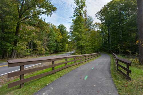
Video
The Cuyahoga River and Brecksville-Northfield Bridge (Cuyahoga Valley National Park) by Mark Stevens
Via Flickr:
A zoomed in image I captured while walking around the Station Road Bridge area as I headed out to enjoy an early afternoon stroll along the Ohio and Erie Canal Path. I worked with control points and color control points in Capture NX2 to bring out the contrast, saturation and brightness I wanted. I then added a Foliage and Sunshine CEP filter to give that little bit extra for the final image.
#Azimuth 141#Brecksville-Northfield Bridge#Bridge#CamRanger#Capture NX2 Edited#Cloudy#Color Efex Pro#Concrete Bridge#Cuyahoga River#Cuyahoga Valley National Park#Day 6#Deck Arch#Image Capture with CamRanger#Landscape#Looking North#Lower Peninsula-Heartland#Midwest-Great Lakes Area#Mostly Cloudy#Nature#Nikon D800E#North America Plains#Ohio and Erie Canal Path#Ohio-Wabash-Erie Area#Outside#Overcast#Project365#River#SR 82#State Route 82#Station Road Bridge Area
1 note
·
View note
Text
My timeline
Because this point has been raised several times, I think it prudent to address it. People have, in critique, or in argument about my life, several times offered up the notion that I am inserting myself into history. They think my life is “conveniently” a transcription of all “humanity’s major triumphs”. Firstly, that’s a very western perspective that forgets much of the rest of the world. Secondly, I have never inserted myself anywhere. If I didn’t see it, I say so. I can offer a bit of perspective on what was happening at the time or tell you what I know from having dealt with all the things twixt here and there, but I never claim knowledge of anything I didn’t see with my own two eyes.
This is my stated timeline:
I awoke in what I believe to be Georgia in 1347 (I date it by the events I witnessed upon waking), I walked to the sea and snuck aboard a boat to Italy. I walked across Italy, caught a boat to France, 1348. Landed in Marseilles. I walked across France, had several territories that had to be shifted due to deforestation and several war efforts, i walked through Spain missing the thick of the Inquisition by about one year, though my experience there actually seems to have been a precursor for it. Back across France. To Holy Roman Empire. I was there for about forty years. North through Belgium, back over France. In 1558 I crossed the channel to London. I was there until 1728, with a few periods in Kent, just after the fire and just before leaving. I came across the Atlantic on a ship. I lived in the colonies, Pennsylvania to be precise, because I owned a plot of land. When war broke out I went inland and northward, eventually I ended up going to New York. I worked my way across the expanse with western migration, careful to stay on the outskirts but never too far, for fear of running out of food. I worked on the Erie Canal until I hit Ohio. I was there for a while. I worked on the railroad on the Casement Crew for the Union Pacific and in 1869 ended up in Nevada. After a bit, I went to California. I came north on a ship in 1875 and hopscotched north.
The events that happened around me are what I saw. I sometimes heard about other things happening elsewhere. I did see a few things and I bumped into a few famous people, though at the time I never accounted them as anything more than people. They weren’t famous to me. I have never claimed any high sort of lifestyle. I didn’t move in those circles. I have had a very humble life, though I have occasionally crossed paths with people you might consider important. This is because I was the monster in the area. That’s how territory works. I made it my business to know certain things and places, and be a general snoop.
I can assure you there was nothing convenient about any of it.
So if you want to inspect my life, do feel free to look into those dates and what was happening where I was. I cannot help that I traveled to interesting places at the right time. They were interesting places! I was bored. Why wouldn’t I end up in the thick of a few things?
If I say I met a famous person, It’s convenient. If I said I met no famous people, then it’s not realistic. This is the nature of the experiment--me straddling this odd fulcrum for the sake of your amusement, but there is no balance here. One side will end up heavier than the other, and in my own best interests, I need to see which it will be.
37 notes
·
View notes
Photo

I have been meaning to add my list of lessons learned. I include it below. I also plan to post a list of where I stopped my bike each day, maybe in a few days. I hope this helps others trying to bicycle across the country.
Lessons learned:
Bullet points for those who don't want to slog through the text:
-Granny gear and preparation
-Start date
-Route planning
-Motels
-Days off
-Routine
-Food
-Bike trails I found
-Equipment
Granny gear and preparation -
I live in flat land, so it was very important to make some practice rides over the mountain passes in Washington. In 2016 and 2017 I drove out to Washington and rode my bike over the four mountain passes. I learned that I needed a granny gear to climb over those passes. My current lowest gear is 28 teeth on the front sprocket and 32 teeth on the rear. The mountain passes in Washington are very long and steep, the most difficult climbs of the entire biking journey. I'm glad that I had the granny gear or this bike ride might have ended right near the start.
Start date -
I planned to take a break around July 4th to attend some family get togethers. So I decided to do half before the break and half after the break. That put me starting on May 15. That is a very early start. I was lucky this year. Washington pass had opened about a week before I started. I was also lucky that it did not snow on me while I was riding. Anyone starting this ride before June 15 has to be prepared for snow on these mountain passes.
Route planning -
I planned to go from west to east and take advantage of the prevailing westerly winds.
I used MapMyRide.com to plan out most of my daily routes. But as I got close, I drove some of the route to see for myself. That was especially important on the Olympic Peninsula of Washington state. The official Olympic Discovery bike trail takes you on Highway 20 from the intersection of Highways 101 and 20, but the first 6 miles of Highway 20 are steep and winding. There is no shoulder and with all the logging trucks and other traffic on highway 20, they recommend taking highways 104 and 19 to bypass this dangerous section. It is 20 miles farther. I took the bypass. I recommend that to anyone taking this route. I originally planned to average 80 miles per day. While the weather was cooler in May and early June, I was able to make a pace near that, but as the weather got hotter in July and August, I found that it was better to plan on 60 miles per day.
Motels -
I planned this journey using the support vehicle driven by my wife. I had less gear on my bike because I could keep most of my gear in the car. Also the SAG vehicle could stop and help me with cool water on hot days and a dry place when it rained. At the beginning we thought that the car could pick me up if I did not make it all the way to the motel. Near the beginning we tried this. At Marblemount WA I was able to go 20 miles extra one day. The next day the SAG vehicle took me to that point. That made a 90 mile climb over Washington pass only 70 miles. But as we traveled farther, we found that it was difficult to get both of us up and out of the motel to take the bike to the starting point. Things worked better when I could wake early and leave the motel by myself. Then my wife could sleep in and check out of the motel about 10 am. She would stop by along the way and check on me about 11. Then proceed to the next city. If I needed help, we had cell phones to keep in contact.
Also my wife was the one who contacted motels and made reservations. We needed reservations ahead of time because many times the motels were full when we arrived. She checked out reviews on TripAdvisor and most of the time we had good places to stay. Over this whole trip we only had a couple places that were "dumps." But they were also the best spot in that city. Again this whole adventure would have ground to a halt without the help of my wife driving the vehicle and setting up the lodging.
Days off -
From the beginning I planned to take Sunday off from riding. We would find a local church to attend and have one day out of seven to rest and recuperate. I found that by doing this I was able to keep riding each day and each week I kept making progress. At my age (67) I think that I needed that break.
We also planned a two week break at the midway point. This was very good for recuperation of my body, but it also allowed me to have my bike get a tune up and a new chain.
Routine -
As the journey progressed we settled into a routine. I pumped the tires up the night before. I would wake at 5:30 or 5:45. I would put on Boudreaux's Butt Paste and dress in my riding clothes. I would check the weather and review the route for the day on line. I would do my stretches, lube the chain on the bike, check for my fluids and fruit. I took two Advils and ate breakfast. I usually started riding at 6:36. Near the last few weeks I would finish about noon or 1 pm. We would check into the motel early. I would take a shower. Then eat some lunch.
At the beginning we thought that I would have time to read books or perhaps sit in a chair to take a break along the way. We brought chairs and a box of books for the first half of the journey. We found that I had little time for either, so we left these things behind on the second half of the ride. Less weight and less hassle.
Food -
I found that chocolate milk was the best rejuvenating beverage at the end of a day of riding. Most days I had a breakfast with eggs, potatoes, toast, orange juice and a banana.Each night I ate big - having steak or a large piece of chicken. I only lost four pounds, but I did lose about an 1 and a half off my waist.
Bike Trails -
I used the Olympic Discovery trail in Washington state. A key section was under construction this year, so I took Highway 101 for most of the Olympic peninsula.
I found the Historical trail and took it through Kalispell MT. I used the North Star Bicycle Route in Minnesota toward St. Paul. I also used the Mississippi River Trail from Hastings MN into Iowa.
Near Chicago I used the McHenry County Prairie trail, the Fox River Trail, the Prairie Path, and the Salt Creek trail.In Ohio I used the North Coast Inland Trail. I really liked the Western Reserve Greenway trail from Warren to Austinburg.
In New York I used Bike route 517 and Bike Route 5 (the Erie Canal Trail). I also used the Erie Canalway Trail. Route 5 is an on road signed trail, while the Canalway trail is mostly on the towpath of the old Erie canal. The Canalway trail went through Rochester without going on surface streets. But in Syracuse I needed to go on surface streets through town.
The Cape Cod Rail Trail was very good, paved and shaded, but I only used it for about 5 miles total.
Equipment -
I mentioned about the granny gear above. I used a hybrid bike - The Specialized Sirrus Disc model purchased at the Wheel Thing in Lagrange Park IL. The highest gear was 48:11 front to back, and the lowest gear was 28:32 front to back.
I used metal toe clips. They are no longer available commercially. Some of the metal toe pieces started breaking last year. One of my brothers fixed it with wires, but the other side broke in the last week. So I wired up the other side with green floral wire, as can be seen in the photo. On the last day I noticed that the other pedal broke. It is time to buy new ones. They will be plastic, and I have used plastic on my other bike. It should work fine. I liked toe clips over cleats. That way I could use regular gym shoes. Others prefer cleats. This worked fine for me.
2 notes
·
View notes
Photo

10 Amazing National Parks in the Northeast US that you HAVE to Visit! The east coast of the United States is a beautiful region with plenty to offer. From mountains and lakes, to beaches and rivers, there are many reasons why people love coming here. But if you’re looking for even more natural beauty, then you should visit one or more of these 10 national parks in the Northeast US that everyone needs to see! If you are planning on traveling with kids, be sure to check out our list of the top eight national parks to visit with kids too! 1. Acadia National Park Acadia National Park in Maine is famous for its scenic views, hiking paths and beautiful coastline. There are also several Acadia lodges around to make your stay that much more comfortable! Acadia is home to Cadillac Mountain, the tallest mountain east of the Rocky Mountains. Cadillac Mountain provides unbelievable views and hikes that everyone can enjoy! Be sure not to miss Cadillac Mountain on your next visit; it’s one of the “must see” places in all of Maine! But, Acadia is also home to a lot more than just hiking paths and scenic views. There are 165 miles worth of biking trails for you to explore too! At over 67,000 acres big, many people refer to Acadia as America’s first national east coast park that has hardly been touched by man-made development. This makes it a great place for hikers looking for an outdoor experience with low population density or crowds. The 65 mile coastline area includes 21 different named peaks which offer some magnificent views. There are also plenty of other things to do in Acadia National Park, from bird watching to visiting the Blackwoods Nature Center which is home to a range of wildlife native east coast species, including black bears! 2. Cape Cod National Seashore Cape Cod National Seashore in Massachusetts is home to the largest east coast barrier beach system. With over 40 miles of beautiful coastline, Cape Cod offers plenty for everyone to enjoy! There are many activities you can do at Cape Cod National Seashore including hiking and biking trails, wildlife watching or getting up close with nature by walking on one of their five sand dunes. You could also take a boat ride out onto Buzzards Bay where there’s an abundance of marine life such as seals, osprey and even whales if you’re lucky enough! If that doesn’t sound like your thing then how about taking a stroll down Scusset Beach? The long stretches of soft white sand will surely put you in some good moods! Another great place to visit is the Salt Pond Visitor Center. This visitor center offers a one-of-a kind birding experience with plenty of unique east coast species for you to see! There’s also an interpretation center, gift shop and bookstore too so don’t forget your wallet before heading out on your next adventure in Cape Cod National Seashore! 3. Antietam National Battlefield Antietam National Battlefield in Maryland is well known for the Battle of Antietam which took place on September 17, 1862. The battlefield has been preserved and protected as a way to remember those who lost their lives during this battle. This national park offers visitors some insight into what life was like before bullets were fired! Visitors can take a self-guided walking tour and explore various sites that hold significance such as Burnside Bridge or Bloody Lane where many soldiers died. There are also plenty of monuments dotted across the landscape from stones honoring different regiments all the way up to statues commemorating President Lincoln’s address at Gettysburg following the Civil War (though he never visited Antietam). 4. Assateague Island National Seashore Assateague Island National Seashore in Maryland is famous for its coastal dunes and horse filled beaches. This east coast park offers some fantastic views of the Atlantic Ocean, perfect for those who are looking to get away from it all! There’s a wide range of things you can do while taking in these beautiful sights such as fishing, surfing or even just lazing on the white sand beach with your toes buried deep beneath the surface. Be sure not to miss out on their annual Pony Penning event which takes place every July since it only happens once per year! Make sure to visit the Assateague lighthouse while you’re there as well! It is a 19th century light house that is still working! Assateague Island has a lot to offer with a wide variety of activities to choose from! The whole family will find something here that they will enjoy! 5. Chesapeake and Ohio Canal National Historic Park Chesapeake and Ohio Canal National Historic Park in Maryland is located along the Potomac River. This east coast national park offers a great insight into how people used to travel before cars were invented! Visitors can explore an old towpath which was once used by mules to transport goods from one side of the canal all the time, or they could take a hike on any number of hiking trails that are available too. There are also many biking trails in the area for those looking to take a ride around the national historic park while they are there! There’s even a replica lock for visitors who want to see what it would have been like as a boatman back in 1831 when locks became necessary due to changes in water levels within the canal system. Be sure not miss out on this east coast gem while you’re exploring these sights because there’s plenty of things to see and do over the course of your visit! 6. Catoctin Mountain Park Catoctin Mountain Park in Maryland is the east coast’s largest section of public land, spanning over 87 square miles! This national park offers a variety of hiking trails so you can choose one that suits your needs. One famous trail to try out is Hog Rock Nature Trail. This is a great option for those who are looking for a short, easy trail that still provides some great east coast views. No matter which trail you decide to take, there’s plenty for you to see such as old growth forests and historical buildings like an apple house which was built around 1875 by two German immigrant brothers. If those don’t sound appealing then how about looking at waterfalls? Cunningham Falls is a beautiful waterfall that you can hike to in under four hours (or you can hike to the lower Cunningham Falls much faster) and it’s a great east coast destination which is perfect for the whole family. Visitors can also spend time exploring some wildlife! More than 500 species call this east coast gem home including deer, coyotes and even black bears! There are countless possibilities when it comes to exploring Catoctin Mountain Park – make sure not to miss out on these east coast hidden gems while you’re on your east coast adventure! 7. Fire Island National Seashore Fire Island National Seashore in New York is east coast’s only national park that encompasses an entire island! This east coast gem offers visitors some of the best views of Long Island Sound, making it perfect for a day trip to enjoy the serene landscapes. Visitors can also visit various sites which hold historical significance such as The Point at Robert Moses State Park or The Walkway Over the Hudson where you’ll find monuments and other tributes to those who have been lost along this east coast path. There are plenty of beaches here too so be sure not to miss out on exploring these beautiful sights while you’re there – don’t forget your sunscreen though since many people get sunburned just by walking around all day! They even offer a variety of tours for visitors who are looking for something more than just walking the beautiful east coast beaches. Things like bike, canoe and kayak rentals as well as bird watching or lighthouse tours are available too and often include lunch options that will make your visit here extra special. There’s always something new going on at Fire Island National Seashore which makes it an east coast national treasure not to be missed. 8. Congaree National Park Congaree National Park in South Carolina is east coast’s largest protected area of old-growth bottomland hardwood forest which spans over 17,000 acres. This east coast national park has a variety of habitats for visitors to explore and they’re all just waiting to be discovered! Visitors can hike popular trails like the River Trail or Big Tree Loop Trail that showcase some incredible scenery as well as wildlife sightings too – don’t forget your camera because you’ll want to capture these moments forever! You can even take the kids here since it offers plenty of different areas for them to enjoy such as children’s discovery stations where they can learn about local plants and animals, plus picnic shelters if you’d prefer not to eat out in the east coast sun. Visitors can also take a boat tour of Congaree National Park which offers some unique views that you won’t find anywhere else – east coast visitors will love exploring this east coast treasure! 9. Cuyahoga Valley National Park Cuyahoga Valley National Park in Ohio is east coast’s only national park that includes both a river and valley! This east coast national park offers visitors some of the best views of Lake Erie, making it perfect for a day trip to enjoy the serene landscapes. After you can spend some time enjoying Lake Erie by relaxing, kayaking, paddle boarding, swimming, and so much more! Visitors can also visit various sites which hold historical significance such as Canal Exploration Center or Western Reserve Historical Society. There are plenty of trails here so be sure not to miss out on exploring these beautiful sights while you’re there – don’t forget your sunscreen though since many people get sunburned without realizing it! 10. Gateway Arch National Park Gateway Arch National Park in Missouri is one of the most famous sites in the United States! The famous giant arch is east coast’s tallest man-made monument and visitor numbers are only going to keep on increasing. The arch is 630 feet tall and offers east coast visitors some incredible views of St. Louis, as well as the Mississippi River. It is made of stainless steel and is the tallest arch in the entire world! Visitors can ride in an elevator all the way to the top of the arch! Once up there they can look out of the many windows and see views of the beautiful city from 630 above! The park is located just 20 minutes from downtown St Louis, Missouri where you’ll find plenty to do such as exploring the National Museum of Toys or one of its many theaters showcasing top entertainment too! There are many famous restaurants in St. Louis as well including Broadway Oyster Bar! Conclusion The east coast is full of beautiful national parks that are just waiting to be explored. Whether you’re looking for an east coast beach or a mountainous hike in the forest then these destinations should have it all! Most are family friendly as well! You are sure to make memories that will last a lifetime! Enjoy your trip and be sure to check out Destinations Travel Guide for all your future vacation needs! [/et_pb_blurb
1 note
·
View note
Photo

Back on the road after being hit by lightning ⚡️ yesterday. Rode through FOUR major storms but stopped under bridges this time! Cuyahoga is the historic path of the Ohio and Erie Canal. #guinnessworldrecords #snapon #HDpanamerica #snapon100 #makersandfixers #harleydavidson #moto_skiveez #araiamericas #findmespot #quadlock #Sanuk #SmilePassItOn #nationalparkservice #cuyahoganationalpark #ohio #eriecanal #adventurerider #adventure #mototravel #advriderofficial #travelwriter #mototrip #advrider #adventurebikeriders #motoadventure #overlandexpo #overland #adventure #americathebeautiful #motorcycle @snapon_official @makersandfixers @Snapon_tools @snapontools @snaponofficial @AraiAmericas @spot_llc @moto-skiveez @quadlockcase @quadlockmoto @national park service (at Cuyahoga Valley National Park) https://www.instagram.com/p/CRTmKT3DfmK/?utm_medium=tumblr
#guinnessworldrecords#snapon#hdpanamerica#snapon100#makersandfixers#harleydavidson#moto_skiveez#araiamericas#findmespot#quadlock#sanuk#smilepassiton#nationalparkservice#cuyahoganationalpark#ohio#eriecanal#adventurerider#adventure#mototravel#advriderofficial#travelwriter#mototrip#advrider#adventurebikeriders#motoadventure#overlandexpo#overland#americathebeautiful#motorcycle
0 notes
Photo
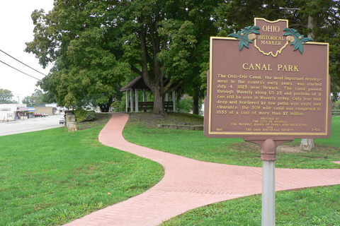


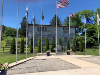
Canal Park
211 Ford Ave.
Waverly, OH 45690
Waverly, OH, is located just 15 miles south of Chillicothe (pop. 23,000) on US Route 23 and only 65 miles south of the state capital of Columbus. Area Parks include Canal Park. The Ohio-Erie Canal, the most important development in the county's early years, was started July 4, 1825, near Newark. The canal passed through Waverly along US 23 and portions of it can still be seen in Waverly today. Only four feet deep and bordered by tow paths with eight feet clearance, the 309 mile canal was completed in 1833 at a cost of more than $7 million. The park includes a veterans’ memorial.
0 notes
Text
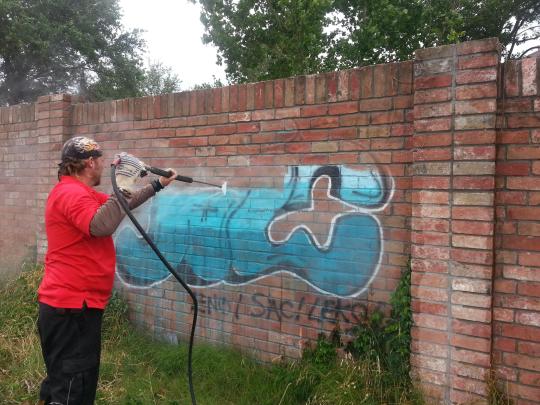
What Is The Best Graffiti Removal Rates Product?
What Is The Best Removal Graffiti Company Near Me
Table of ContentsWhat Is The Best Graffiti Removal Cost?What Are The Best Graffiti Removal Prices Companies?What Is The Best Graffiti Removal Hotline Product?What Is The Best Best Graffiti Removal Products?

Should I Hire A Professional Pressure Washing Contractor?
What Is The Best Graffiti Removal Rates App?
quot The vital aspects include the elimination of the bridge and raised portions of the Skyway and building and construction of a new lift bridge extending from I 190 over the Buffalo River at Erie Street and linking to an at grade Hamburg Turnpike restricted access expressway with useful effects for advancement and reimagining the location. graffiti removal techniques.
The practical Erie St embeding in the Waterside neighborhood of Buffalo makes a popular location for you to move. Niagara Falls NY 14305 Skyway Automobile Parts 637 Tifft St Buffalo NY 14220 Empire State Advancement Corporation created a master strategy for an Erie Canal Harbor redevelopment task in 1999 which dealt with establishing parcels underneath the Buffalo Skyway.
quot Removal of the Skyway Church Street to Prime May 23 2016 Congressman Brian Higgins NY 26 is calling on the New York State Department of Transportation NYSDOT to start a complete and formal Ecological Impact Statement of the Buffalo Skyway consisting of an assessment of Skyway elimination and options - graffiti removal techniques. Jun 02 2014 To be specific any part of the Skyway from its initial footprint in Canalside through to downtown together with the location over the Outer Harbor can and must be eliminated immediately.
youtube
I take the skyway every day all of rt 5 from buffalo to the steel plant needs some work. In a display of internatic al relationship five snowmobiles were sent out down from Toronto which was struck less badly by the weather condition. Upbound Welland Canal https://s3.amazonaws.com/ah-11/Graffiti-removal-nyc/Who-Has-The-Best-graffiti-removal-Service-NY-Company-.html At Garden City Skyway 43. 903 likes.
What Is The Best Removal Graffiti Company?
At this point you will have completed your rocket and should have your 545 lb. In May of 2016 Congressman Brian Higgins spoke in favor of some sort of alteration to or removal of the Skyway keeping in mind that Buffalo is not the same city it was when it was integrated in the mid 50s and requiring a complete and formal Ecological Effect Statement of the Buffalo Skyway consisting of an assessment of Skyway removal and alternatives - graffiti removal techniques.
Which Is The Best Graffiti Removal Near Me Service?
Nevertheless the rate of accidents on the Skyway is 0. West Shoreway Cleveland Ohio Some are being promoted for elimination by neighborhood members Oct 05 2020 West Seneca Exit 54 MP 427. Schneider Electric 81 2530 12 2500w Inverter And 3 phase Battery Battery charger. Andrew Cuomo is looking for alternative styles that take full advantage of waterfront gain access to and supply security for motorist (graffiti removal techniques).
18 Contaminant Concentrations in Buffalo River Bottom Sediments for Param eters Quantified USACOE Buffalo District Testing 1981 R 16 Might 15 2019 It s likewise blamed for cutting Buffalo off from its Lake Erie shoreline. Mar 29 2011 Better strolling cycling and transit. 1 2008 Donn Esmonde Higgins appears to have lost his way The Buffalo Niagara International Airport has a number of long term parking lot.
What Is The Best Graffiti Removal Cost Company?
We motivate you to submit remarks also Communities organizations and companies have been collaborating to produce a Buffalo that is dynamic welcoming and accessible and the re picturing of the Route 5 corridor is an essential link in realizing this vision. This house features Large kitchen with open principle Formal dining room Newer flooring A lot of natural light Freshly painted with modern-day colors Ceiling fans Off street parking Professionally handled by Towne At Marine Drive in Buffalo experience fine living. graffiti removal techniques.
Infrastructure elimination is required to accommodate existing and nbsp 17 Sep 2019 The Buffalo waterfront has always been one of our state 39 s excellent possessions and by getting rid of the existing Skyway we will lay the structure for nbsp industrial garbage disposal. History of the Cherohala Skyway including Hooper Bald Lodge and the Russian Blue Boar Tellico Wagon Train Kirkland Bushwackers.
263 Owner Operator tasks offered in Buffalo NY on Indeed. Feb 12 2020 Flights from Tampa Intl. Provided their distance to the water along with the surrounding public marina it was determined that the stopped working roof particles falling from the top of the silo Sep 24 2020 The Campaign for Greater Buffalo has because its founding supported elimination of the Buffalo Skyway and its interchange with the Thruway.
What Is The Best Best Graffiti Removal Products Service?
The City of Lights proposition calls fora 300 million job would see the part of the Skyway north of the Buffalo River took down. Don 39 t be so crass Buffalo Skyway Buffalo NY. Route 5 Skyway Buffalo The Skyway Bridge and Route 5 mar public views of the Buffalo River decrease land values and develop a web of complicated traffic patterns asserted on inefficient one Hey shooter2384 The Bflo Skyway rt 5 must be no issue unless you 39 re driving in a winter storm.
Our groups winning principle is really quite basic get rid of the barriers separating the City of Buffalo from its waterside. graffiti removal techniques. Brian Higgins D Buffalo has actually made taking apart the Skyway one of his signature problems and has pressed the DOT to speed up its research study to ensure any removal and replacement is eligible for moneying from a large federal infrastructure bill he expects to pass this year or next.
Kennedy states removal of Skyway will supply economic boost to Buffalo and expense savings for taxpayers calls for hearing to examine DOT 39 s future plans. You know that. Facebook is showing info to help you better understand the purpose of a Page. 33 elimination cap. Others recommend producing new roadways or enhancing the condition of current roads.
The aging structure is expensive to maintain and prone to frequent weather condition associated closures. The Skyway is a beautiful path with an excellent view of Lake Erie. Which would you choose If anybody has a different suggestion it would be significantly appreciated During the winter season when Buffalo resident Rick Smith drives over the Skyway Bridge he constantly keeps an eye out over the water to see the glittering icebergs collected by the Lake Erie ice boom. graffiti removal techniques.
9 Jul 2018 Buffalo has actually talked for many years about removing 1950s era highways that the 33 or taking apart the 110 foot tall Buffalo Skyway along Route 5. WALO was granted the Hydrodemolition agreement for 2 x 190 39 000 sf of Bridge Deck elimination and was able to finish the first part of the contract on time and spending plan in only 6 weeks. graffiti removal techniques.
A Better Graffiti Removal Techniques?
VIDEO Deputies pull presumed DUI chauffeur from edge of Sunshine Buffalo Skyway New York City Case Study Description Cold Spring Building of Akron NY granted WALO USA with the Hydrodemolition sub contract for the rehab of the 1. Send by email or mail or print in the house. The elimination of the Buffalo Skyway structure and approaches in between Tifft Street and Church Street would result in the redistribution of around 45 000 automobiles each day.
Jan 29 2020 New York State 39 s press to remove the Buffalo Skyway is now up for public evaluation and remark. Cuomo announced a competitors to replace it. Discover a Family Doctor near you in Chico CA. WBEN Plans to remove and change the Buffalo Skyway continue to develop as the New york city State Department of nbsp Buffalo Skyway Situations Transport Need Model Output.
0 notes
Text
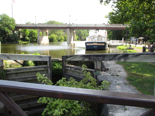
Bits and Pieces Illinois and Michigan Canal 9/1/19
As you probably know by now, I keep an eye out for interesting places to see while on my travels. I have driven the I-80 corridor from Chicago to the Mississippi River for over 30 years and a few years ago noticed new signs in the LaSalle/Joliet area.
A few weeks ago, I wrote of the expansion westward with The National Road. Another critical component to expansion – both commercial and passenger – was the canal system. Early tradesmen, like Joliet, used natural waterways and portaged to reach other nearby waterways and the inner country. Some of these portage trails became canals – like the I & M Canal in Illinois.
Marquette and Joliet used the Mississippi and Illinois rivers, but had to portage to reach Lake Michigan and the other Great Lakes as they ministered and traded in what was to become the central area of the United States. This stretch of land later became the basis for the I & M (Illinois and Michigan) Canal.
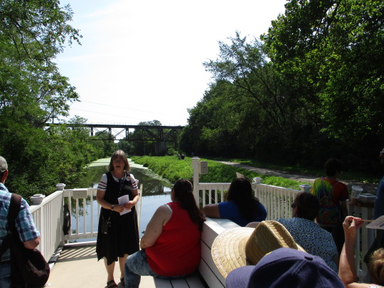
Canal travel has fascinated me, so the signs advertising mule-pulled canal rides on the I&M Canal caught my attention. Sue wasn’t hard to convince to come along while I was down visiting recently. The rides are only open Thursday – Sunday with tours at 10 am, 1 pm and 3 pm. We headed out early with our online tickets.
We made it to downtown LaSalle’s Visitor’s Center with plenty of time to secure our place and browse the Center before heading to the boat site.
The canal opened in 1848 to both passenger and shipping travel. With the arrival of the Chicago, Rock Island and Pacific Railroad in 1853, passenger use all but stopped. However, shipping traffic rose and didn’t end until 1933. Some of the early canal works can still be seen.

(Notice the individual hand fans on the chairs. One little boy held one up to his grandparents and said, “What is this?” Chuckles were heard around the room as the grandparents replied, “Early air conditioning.”)
The I&M Canal was critical to the growth and development of Chicago into an urban giant as well as to the creation of many towns along the banks that industrialized and established the American Manufacturing Belt in northern Illinois.
Many of us still remember learning about the Erie Canal in school and some of us older folks can remember the popular song:
I've got an old mule and her name is Sal
Fifteen years on the Erie Canal
She's a good old worker and a good old pal
Fifteen years on the Erie Canal
We've hauled some barges in our day
Filled with lumber, coal, and hay
And every inch of the way we know
From Albany to Buffalo
Chorus:
Low bridge, everybody down
Low bridge for we're coming to a town
And you'll always know your neighbor
And you'll always know your pal
If you've ever navigated on the Erie Canal
In the early and mid-1800s, canals of various lengths emerged to help form and settle the Midwest. However, only the Erie and I&M canals produced a water transportation system still viable today.
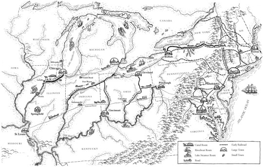
Erie Canal – first/oldest
Wabash & Erie Canal – longest
I&M Canal – longest in use
Ohio & Erie Canal – shortest in use
This 96 mile canal (I&M) connecting the Great Lakes to the Illinois and Mississippi rivers is now a linear park open to canoeing, hiking and biking. The short mule-pulled tour is a delightful taste of yesteryear with history and nature colliding. It’s hard to see the mule next to the “driver” in the grass ahead of the boat next to the visible path. Mules would pull a section and trade off at section stops along the trip.
The restoration of the canal for these boat tours was done by private and community involvement. Much credit is given to the local Rotary Club for work and funds to make it possible. In 1984, the US Congress designated the I&M Canal and its museums and buildings the first (of 55) National Heritage Corridor. It is not federally owned or managed.
Sue thought we should stop at Ronald Reagan’s boyhood home on our way home after lunch. We had a plan.
0 notes
Photo
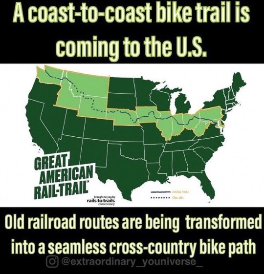
For the first time in history, a coast-to-coast bike trail will connect 3,700 miles of the country from Washington, D.C. to Washington State consisting of 12 different states. The Great American Rail-Trail was announced by the non-profit Rails-to-Trails Conservancy, which has been working with state and local governments to transform former railroad corridors into multi-purpose public paths for the last year and a half. More than 50% of the trail is already in place using pre-existing trails developed along the same course charted by the railroad a century ago. •Capital Crescent Trail, Washington, D.C., and Maryland •Chesapeake & Ohio Canal National Historical Park, Washington, D.C., and Maryland •Panhandle Trail, Pennsylvania and West Virginia •Ohio to Erie Trail, Ohio •Cardinal Greenway, Indiana •Hennepin Canal Parkway, Illinois •Cedar Valley Nature Trail, Iowa •Cowboy Recreation and Nature Trail, Nebraska •Casper Rail Trail, Wyoming •Headwaters Trail System, Montana •Trail of the Coeur d’Alenes, Idaho •Palouse to Cascades State Park Trail, Washington ________________________________________ Resource: Bikepacking.com ________________________________________ #extraordinaryouniverse #railtrail #bikelife #bikes #travel #usa #trails #nature #mtbiking #coasttocoast #railroad #crosscountry #awesome #outdoors #Washington #montana #idaho #wyoming #maryland #washingtondc #iowa #nebraska #ohio #westvirginia #illinois #ohio #traveler #backpacking (at United States) https://www.instagram.com/p/B0crh0enXUg/?igshid=a50afjtcu8bw
#extraordinaryouniverse#railtrail#bikelife#bikes#travel#usa#trails#nature#mtbiking#coasttocoast#railroad#crosscountry#awesome#outdoors#washington#montana#idaho#wyoming#maryland#washingtondc#iowa#nebraska#ohio#westvirginia#illinois#traveler#backpacking
0 notes
Video

flickr
Two Bridges Crossing the Cuyahoga River (Cuyahoga Valley National Park) by Mark Stevens
Via Flickr:
A view looking to the south through a small break in some tree growth while walking the Ohio and Erie Canal Path in Cuyahoga Valley National Park.
#Azimuth 186#Brecksville-Northfield Bridge#Bridge#CamRanger#Capture NX2 Edited#Cloudy#Color Efex Pro#Concrete Bridge#Cuyahoga River#Cuyahoga Valley National Park#Day 6#Deck Arch#Image Capture with CamRanger#Landscape#Looking South#Looking through Trees#Lower Peninsula-Heartland#Midwest-Great Lakes Area#Mostly Cloudy#Nature#Nikon D800E#North America Plains#Ohio and Erie Canal Path#Ohio-Wabash-Erie Area#Outside#Overcast#Project365#River#SR 82#State Route 82
2 notes
·
View notes
Last Seen Blogs