#ancient monument
Text
3K notes
·
View notes
Text
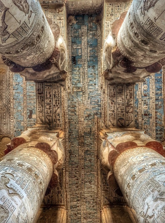
Dendera Temple Complex 3
#original photography#photographers on tumblr#travel photography#original artist#archeaology#ancient history#ancient architecture#ancient monument#egypt#egyptology#ancient egypt#egypt tours#ancient#hieroglyphs#antiquity#dendera temple complex
173 notes
·
View notes
Text

At 5000 yrs, the Fortingall Yew Tree is the planet's oldest living thing.
#Fortingall#Perthshire#Scottish Highlands#churchyard#UK#5000 yr old Yew Tree#world's oldest tree#Church of Scotland#natural wonder#gravestones#stone wall#ancient monument
86 notes
·
View notes
Text

Stela N by Alfred Maudslay, Copan, Honduras 1885.
#Vintage photos#Maya ruins#1880-1900#ancient monument#monument#maya#ancient civilizations#mid-eighth century#photo#photography#photos#Stela N by Alfred Maudslay#Copan#Honduras 1885#1885#Honduras
25 notes
·
View notes
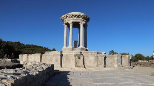
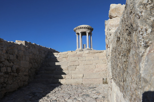
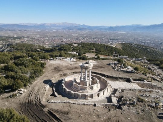
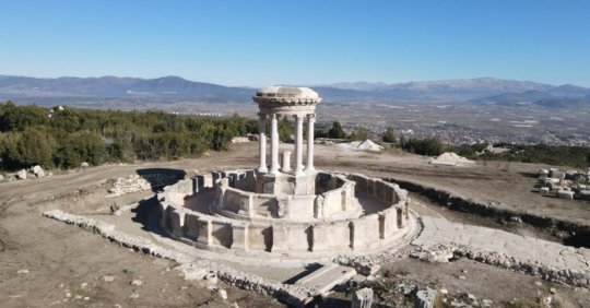
Text
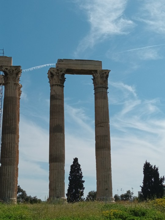
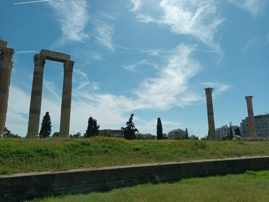


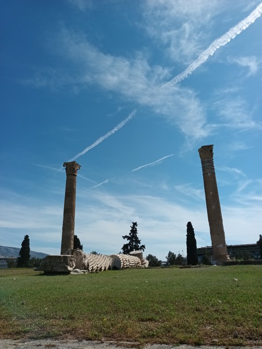

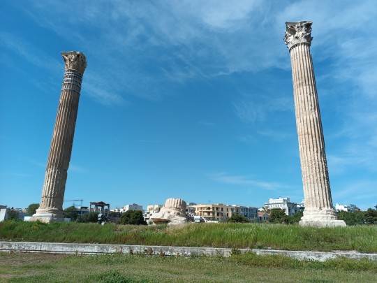
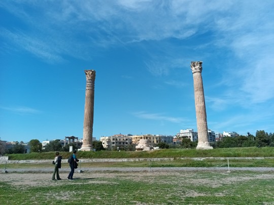
Today I went to the Pillars of Olympian Zeus in Athens, Greece and I wanted to show you!
13 notes
·
View notes
Text
Architecture and Monuments: Great Sphinx of Giza - Egypt
The Great Sphinx of Giza is a limestonestatue of a reclining sphinx, a mythical creature with the head of a human and the body of a lion. Facing directly from west to east, it stands on the Giza Plateau on the west bank of the Nile in Giza, Egypt.
The Sphinx is the oldest known monumental sculpture in Egypt and one of the most recognizable statues in the world. The archaeological evidence suggests that it was created by ancient Egyptians of the Old Kingdom during the reign of Khafre (c. 2558–2532 BC).
A special feature of the Sphinx is its actual lack of a nose. The circumstances surrounding it about being broken off are uncertain, but close inspection suggests a deliberate act using rods or chisels. Contrary to a popular myth, it was not broken off by cannonfire from Napoleon's troops during his 1798 Egyptian campaign. Its absence is in fact depicted in artwork predating Napoleon and referred to in descriptions by the 15th-century historian al-Maqrīzī.
It is unknown how the name of the Sphinx came to be, due to propably multiples origins, for example of its creator of the Old Kingdom, as the Sphinx temple, enclosure, and possibly the Sphinx itself was not completed at the time, and thus cultural material was limited. In the New Kingdom, the Sphinx was revered as the solar deity Hor-em-akhet (English: "Horus of the Horizon"; Hellenized: Harmachis)
The commonly used name "Sphinx" was given to it in classical antiquity, about 2,000 years after the commonly accepted date of its construction by reference to a Greek mythological beast with the head of a woman, a falcon, a cat, or a sheep and the body of a lion with the wings of an eagle (although, like most Egyptian sphinxes, the Great Sphinx has a man's head and no wings). The English word sphinx comes from the ancient Greek "Σφίγξ" (transliterated: sphinx) apparently from the verb σφίγγω (transliterated: sphingo / English: to squeeze), after the Greek sphinx who strangled anyone who failed to answer her riddle.
Over the centuries, writers and scholars have recorded their impressions and reactions upon seeing the Sphinx. The vast majority were concerned with a general description, often including a mixture of science, romance and mystique.
From the 16th to the 19th centuries, European observers described the Sphinx having the face, neck and breast of a woman. Examples included Johannes Helferich (1579), George Sandys (1615), Johann Michael Vansleb (1677), and some others following it. Most early Western images were book illustrations in print form, elaborated by a professional engraver from either previous images available or some original drawing or sketch supplied by an author, and usually now lost. Seven years after visiting Giza, André Thévet (Cosmographie de Levant, 1556) described the Sphinx as "the head of a colossus, caused to be made by Isis, daughter of Inachus, then so beloved of Jupiter". He, or his artist and engraver, pictured it as a curly-haired monster with a grassy dog collar. Athanasius Kircher, however, depicted the Sphinx as a Roman statue
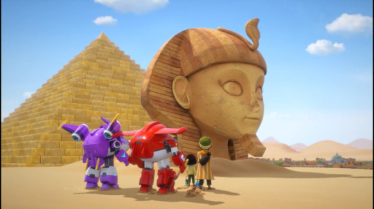
#super wings#super wings cultural#ancient monument#historical architecture#cultural monument#cultural history
11 notes
·
View notes
Text


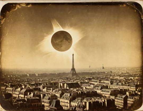
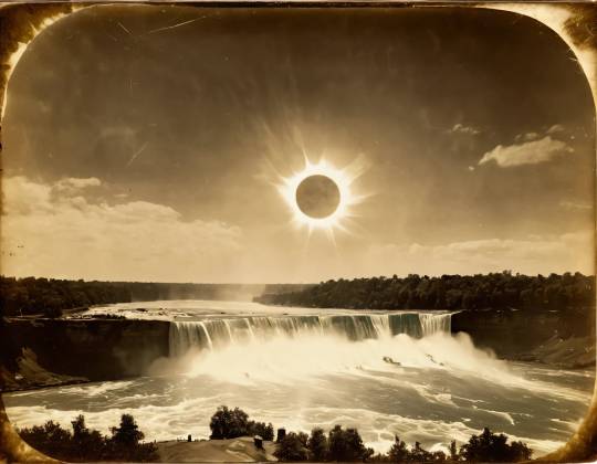
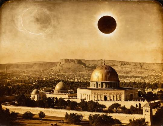
#solar eclipse#vintage#1800s#sepia#black and white#ancient monument#digital art#ai illustration#ai art#ai art generation#ai artist#ai generated#ai art gallery#ai image#ai artwork#stable diffusion#vintage photography
8 notes
·
View notes
Photo
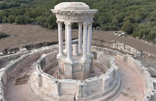


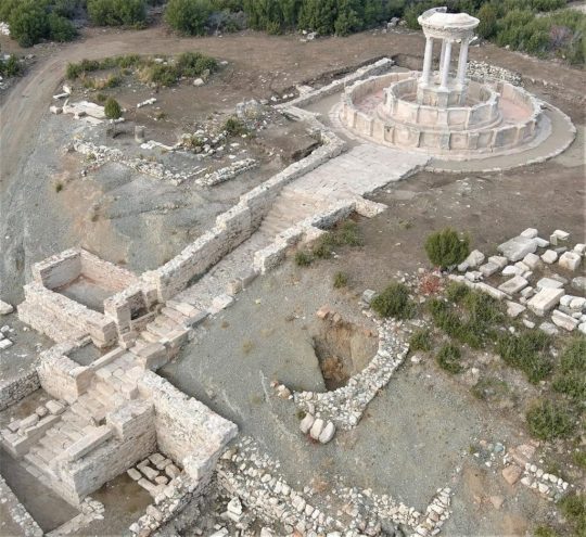
City of Gladiators Fountain Flows Again After 2,000-Years in Turkey
An ancient fountain that was destroyed in a 23 BC earthquake has been restored in Turkey's “City of Gladiators.' Now, the two millennia old water font is streaming drinkable water again, just as it did some 2,000-years ago.
Unearthing Turkey’s Ancient City Of Gladiators
The ancient city of Kibyra, or Cibyra Magna, is situated in the township of Gölhisar in the southwestern Burdur Province of Turkey. In ancient times it represented the capital city of an independent state known as Cibyratis, that lay just outside the north-western limits of the ancient province of Lycia, that thrived in Anatolia from 15-14th centuries BC, and as Lukka until 546 BC.
Strabo recorded Kibyra as having originally been settled by ‘Lydians,’ who were indigenous people in this region of Asia Minor. These people constructed over 100 stadiums and after the Roman general Lucius Licinius Murena defeated the ruler of Kibrya in 83 BC the city became part of the greater Roman province of Asia. Listed on the UNESCO World Heritage Tentative List , ancient Kibyra is known as the “City of Gladiators.” Now, archaeologists have announced that “a colossal fountain” has been restored and that it will “flow with fresh water for the first time in 2,000 years.”
Piecing Together An Ancient Masterpiece
Dr. Sukru Ozudogru, an archaeologist at Mehmet Akif Ersoy University, recently told Anadolu Agency ( AA) that his team of archaeologists have spent the past four months collecting “150 original fragments from the ruins.” Now, they have successfully “pieced the architectural masterpiece back together.” The “round-planned fountain” measures 15.24 meters (50 ft) in diameter by 7.92 (26 ft) high and after being built it was used for more than 600 years.
The team of archaeologists have also restored the original water supply system from the spring, so that the fountain now flows with drinkable water “just the way it did 2,000 years ago.”
Dr. Ozudogru described the water from the restored fountain as “spouting from the mouths of lion and panther.” Not only do these two animals feature heavily in Roman mythology but they are two of the animals that gladiators fought in the arenas. Incidentally, it was after the discovery of the “10,400-person stadium” that hosted hundreds of gladiatorial fights that Kibyra became known as the “City of Gladiators.”
Rebuilding What Nature Attempted To Destroy
Blending both Roman and Byzantine architectural styles, during the 1000 years of the Roman empire the city became famous for its blood-thirsty gladiatorial contests. However, a 23 BC earthquake almost flattened Kiybra, and if it were not for diligent citizens in the aftermath rebuilding the giant fountain it would have been lost in time long ago.
The AA article said the restoration of the fountain and its two pools required “68 original architectural pieces and 24 imitation blocks produced from the original stone type.” Furthermore, it was observed that the original fountain featured one large circular pool and the second pool was added decades later. Dr. Ozudogru maintains that when the fountain was functional, some 2,000-years-ago, the two circular pools supplied potable water to four different parts of the city.
Sticking With The Original Plan
As far as aesthetics are concerned, fragmentary remains informed the researchers the original fountain was detailed with “elaborate statues of animals, huge columns and embossed friezes.” The archaeologists used two moldings taken from original sculptures that were both unearthed during recent excavations, and the originals are currently being exhibited in the Burdur Museum.
The researcher explained that in Roman times “Water was a mythological hero” that flowed into the two pools from the mouths of “lion and panther” statues. Relating these two animals to Roman mythology “ Heracles lay on a panther skin and Dionysus, the god of wine, wore a lion skin," according to the professor. However, both of these animals were fought by gladiators in the 10,400-person stadium in Kibrya, which Akkurnaz explained “was a building designed for an assortment of blood-soaked spectacles, including gladiator fights and wild animal fights”.
By Ashley Cowie.
#City of Gladiators Fountain Flows Again After 2000-Years in Turkey#Turkey’s Ancient City Of Gladiators#ancient city of Kibyra#ancient monument#ancient fountain#ancient artifacts#archeology#archeolgst#history#history news#ancient history#ancient culture#ancient civilizations#roman history#roman empire#long reads
71 notes
·
View notes
Photo
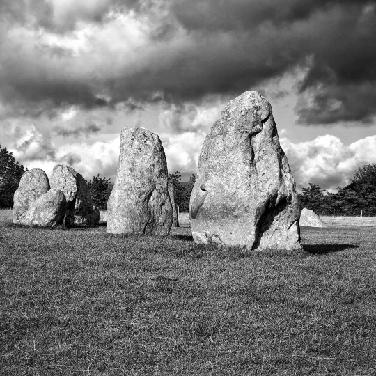
Castlerigg Stone Circle. Keswick, Cumbria, September 2018.
#black and white photography#castlerigg stone circle#cumbria#iphone photography#keswick#original photographers#photographers on tumblr#photography#stone circle#ancient monument
103 notes
·
View notes
Text
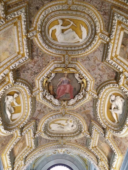
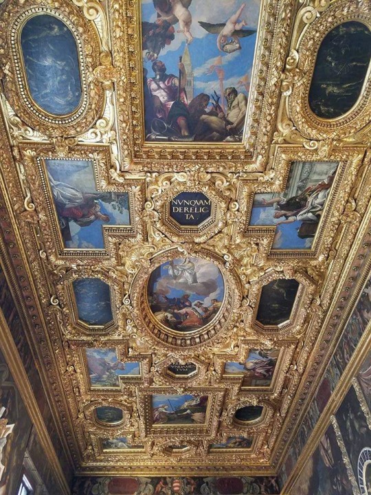
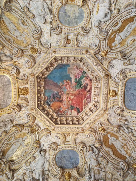

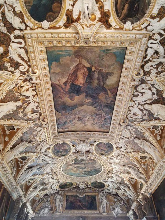


Palazzo Ducale/Doge Palace (Venice, Italy)
#italy#venice#artedit#italian architecture#photography#architecture#art#gothic architecture#palazzo ducale#doge palace#ancient buildings#monument#palaces#gothic style#ceiling#luxury#italian art#ancient building#ancient monument#beautiful things#travel#masterpiece
68 notes
·
View notes
Text
Sunrise at Ballymacdermot Cairn on the Winter Solstice.
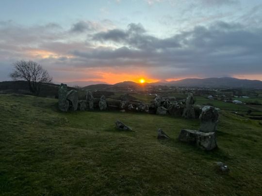
#freezing but worth it#Ireland#winter solstice#winter#Armagh#ancient monument#pagan#stone circle#cairn#photography#sunrise#prehistoric
16 notes
·
View notes
Text
757 notes
·
View notes
Photo

Chester Higgins, Kemet, The 4,700 year-old Bent Pyramid of King Snefru, Dynasty 4. Dashur, Egypt, 2010 (© Chester Higgins)
22 notes
·
View notes
Photo

Tomb of Ramesses VI, Valley of the Kings discovered in 1898.
Source: World of History
#tomb of ramesses#valley of the kings#ancient egypt#egypt#tomb#tombs#1898#19th century#ancient#monument#ancient monument
306 notes
·
View notes
Text


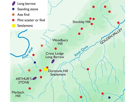
Arthur's Stone is a fabulous pre-historic monument, a Neolithic burial chamber made of great stone slabs with a huge cap stone weighing some 25tonnes that has cracked in half. Set in the hills above Herefordshire's Golden Valley which is rich in prehistoric archaeology.
Like many prehistoric monuments in western England and Wales, this tomb has been linked to King Arthur since before the 13th century. According to legend, it was here that Arthur slew a giant who left the impression of his elbows on one of the stones as he fell.
It has recently been excavated by archaeologists for the very first time (the dig was featured on Digging for Britain on the BBC 2023) and I can’t wait to read the results.
It is free to visit and is owned and managed by English Heritage.
0 notes
Photo


Architecture and Monuments: The City of Petra - Jordan
Petra , originally known to its inhabitants as Raqmu or Raqēmō is a historic and archaeological city in southern Jordan. It is adjacent to the mountain of Jabal Al-Madbah, in a basin surrounded by mountains forming the eastern flank of the Arabah valley running from the Dead Sea to the Gulf of Aqaba. The area around Petra has been inhabited from as early as 7000 BC, and the Nabataeans might have settled in what would become the capital city of their kingdom as early as the 4th century BC.
The trading business gained the Nabataeans considerable revenue and Petra became the focus of their wealth. The Nabataeans were accustomed to living in the barren deserts, unlike their enemies, and were able to repel attacks by taking advantage of the area's mountainous terrain. They were particularly skillful in harvesting rainwater, agriculture and stone carving. Petra flourished in the 1st century AD, when its famous Al-Khazneh structure – believed to be the mausoleum of Nabataean king Aretas IV – was constructed, and its population peaked at an estimated 20,000 inhabitants.
Although the Nabataean kingdom became a client state of the Roman Empire in the first century BC, it was only in 106 AD that it lost its independence. Petra fell to the Romans, who annexed Nabataea and renamed it as Arabia Petraea. Petra's importance declined as sea trade routes emerged, and after an earthquake in 363 destroyed many structures. In the Byzantine era several Christian churches were built, but the city continued to decline, and by the early Islamic era it was abandoned except for a handful of nomads. It remained unknown until it was rediscovered in 1812 by Johann Ludwig Burckhardt.
Petra is a site located in a rocky cirque structured by several faults dug by wadis, which constitute the main communication routes. The main axis is the wadi Mousa, which crosses the site from east to west, first in the Sîq gorge ("the ditch") located to the east, whose entrance, preceded by the "Djinn tombs", was surmounted by a large arch, now collapsed. This gorge, crossing the Khubtha massif, was the main access route to Petra, and was paved in antiquity.

From its exit, where the Khazneh is located, the space widens. At this point there are many tombs as well as the theater. The course of Wadi Mousa changes its orientation to head north for a few hundred meters, before resuming its course on an east-west axis, where the center of Petra is located, with its main monumental complexes. This area is defended by walls on its more exposed northern and southern flanks, while the defense of the eastern and western sides does not pose any difficulties due to the narrowness of the access routes.
Since springs are scarce in this semi-desert region, rainwater, about 150 mm per year (today 50 to 250 mm), provided most of the needs. The local springs alone could only provide water for a few families. The Nabataeans built a system of water collection and redistribution, with rules for distribution to the inhabitants.
Petra, located in a basin, could collect rainwater from a 92 km basin thanks to the relative impermeability of the rocks. This low permeability of the soil nevertheless posed many problems, such as the triggering of seasonal floods of the wadis (winter and spring) that were very powerful and therefore destructive (especially the Wadi Moussa). Indeed, until it was diverted in the twentieth century, the watercourse of Wadi Moussa ("stream of Moses"), which flows from the source of Ain Moussa ("source of Moses") in the Sîq to the village of Gaia, was the source of deadly floods, as in 1963 when 24 French tourists drowned, surprised by the arrival of a monstrous wave. However, the danger of floods is not entirely removed: in November 2018 twelve people died in bad weather around Petra and 4,000 tourists had to be evacuated from the tourist site. There is also a "small Sîq" that joins the main Sîq near the royal tombs.

When the city was booming, water was used mainly for the consumption of the inhabitants and their livestock and, in a later phase, for watering the gardens. Cereals, such as barley and wheat, fruit trees and vines were probably cultivated in Petra. Presses carved into the rock have been found, probably dating from the period of Roman rule, which gave wine great importance.
Petra has a long history and its valley is particularly prized for its ease of defense. The first inhabitants were prehistoric. There are some material traces of dwellings used by them not far from Petra. It is from around 1200 BC that the place begins to be inhabited. Then, a few centuries before our era, during the Nabatean period, a city was developed, mostly dug in the rock. The Nabatean civilization settled there for several centuries, until the Roman period. After the Byzantine period, the site was practically abandoned. The scarcity of sources for this last period makes it difficult to reconstruct the history of the city. There are still a few written traces dating from the Middle Ages, after which the city is forgotten.

Originally, the Nabataeans being a nomadic people, their buildings were simple goatskin tents established along the Wadi Musa around the 4th century BC.
These temporary camps were replaced over the next two centuries by very simple dwellings carved out of the rock: with smooth facades, they had a doorway excavated in the lower part with one or two staircase-shaped cut-outs. This Nabataean sedentarization is expressed in buildings that are an adaptation of the Syrian tombs; being in constant contact with the surrounding civilizations, they were inspired by the style of several of them, in particular Alexandria.
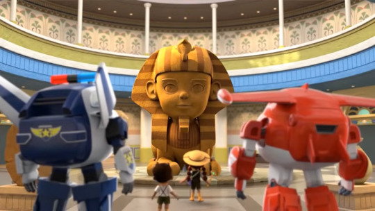
#super wings#super wings cultural#cultural history#historical monuments#ancient monument#cultural monument#historical architecture
14 notes
·
View notes
Last Seen Blogs

honestnonsense-blog
Honest Nonsense

fandoms-spamdom
Sleepygirl Lumine Central

readinghomestuckin2021
LE SIGN

playlists-for-kpop
Playlists and Moodboards

thenicolebaella-blog
WWE Manips