#bike lanes
Text


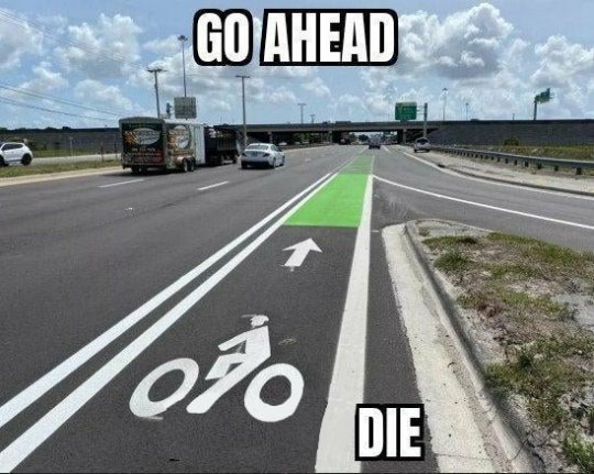


#4th of july#america#usa#transit#roads#car culture#political#multipost#urban planning#car dependency#not just bikes#moodboard#usa moodboard#american dream#urbanism#urban design#bike lanes
21K notes
·
View notes
Photo

All the bike lanes in the Netherlands.
418 notes
·
View notes
Text

Grounded, Viena [08.09.23]
#photooftheday#photography#photographers on tumblr#original photographers#photoblog#cityphotography#travel photography#travel#streetphotography#streetview#people#bike lanes#birds eye view
63 notes
·
View notes
Text
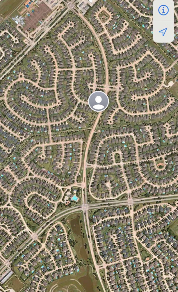
how certain street layouts make it easier or harder to keep vehicle lanes, bike lanes, and sidewalks clear and usable.
{source}
36 notes
·
View notes
Text
The bicycle paradise that Atlanta planned and ignored

A 1973 publication titled "The Bicycle" was commissioned by the Atlanta Regional Commission (ARC), the Georgia Department of Transportation, and MARTA. It was the nation’s first regional bikeway plan. Seriously, it really was. And it would have been right here in Atlanta -- if it had been built.
In 1977, the City of Atlanta produced an actual, detailed plan would’ve produced a biker’s paradise, influenced by that publication (the image above is from that plan).
The city's stated intention was to: “provide bike paths within the rights-of-way of major streets and highways when such streets are improved or newly constructed.”
It also called for the development of “bicycle lanes in coordination with the construction of MARTA line segments.”
If the city had implemented the plan, by 1992 Atlanta would have had a reputation as a cyclist’s paradise.
I don't know the specific reasons why it never happened -- not beyond the basic inertia that seems to chronically vex cities like Atlanta, which suffer from decades of car-centric thinking.
My aim is not to make people sad about what never happened, by the way.
What I want is to send a warning: there is no shortage of great ideas for improving Atlanta's urbanism; what we have is a shortage of boldness within our leadership when it comes to implementation of the plans, and standing up to the resistance from people who fear changes to the status quo.
Watch out for that inertia.
Info source, Joe Hurley's great post here:
https://www.threadatl.org/2018/08/15/atlantas-second-chance-to-build-bikeways-and-complete-streets/
158 notes
·
View notes
Text
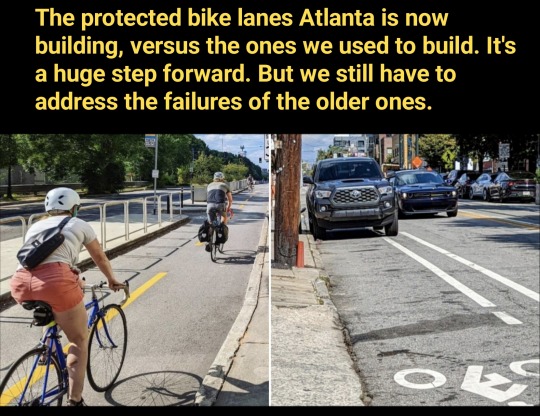
Atlanta is now producing the kind of protected bike lanes we should have been building long ago, as seen here on Bill Kennedy Way. It's good progress.
But we still need to address those older ones (like the unprotected lane on Edgewood Ave) where cars can get in.
If there's truly no room in the width of the street for a fully protected lane, I wonder if we could consider a bold redesign that slows cars dramatically and creates a safe shared space?
26 notes
·
View notes
Text

Bike Lane (Green) - 9th Avenue, New York CIty by Andreas Komodromos®
#bike lanes#bicycle#skyline#street#street level#manhattan#city#nyc#cityscape#new york#urban#travel#new york city#nyandreas#architecture#9th avenue#chelsea#tumblrpic#tumblr photographer#autumn
19 notes
·
View notes
Text

15 notes
·
View notes
Text
youtube
4 notes
·
View notes
Photo

Photo: a truly protected bike lane on Centennial Olympic Park Drive in Downtown Atlanta! It's a beautiful sight, but lanes like this are too scarce on major roads in the city.
The results of a new study demonstrate how crucial is it for cities to build physically-separated bike lanes if they want to encourage more cycling and reduce car trips.
When asked which factors deter cyclists from riding, three of the top four reasons were directly related to being squished by cars.
The low number of genuinely-safe bike lanes, which contain physical protection from cars, is a major barrier to our goals for sustainability -- and also to our goals for equity, since lower quality bike lanes don't serve the needs of riders of all ages and abilities.
#bikelane#bikeinfrastructure#bike lanes#protected bike lanes#street design#urban design#urban planning#atlanta
37 notes
·
View notes
Text
youtube
And Casey Neistat's report on the "bike lane bounty" proposal.
2 notes
·
View notes
Photo

Mapping Bike Infrastructure in 100 Cities Around the World
by u/UnrequitedReason
With the surge in bicycle use over the course of the COVID-19 pandemic, municipalities around the world are experiencing a unique opportunity to transform urban spaces to be more cyclist-friendly. This includes building protected bike lanes that make it easier for cyclists to share busy city streets with cars.
Bike network density is the most important factor in encouraging people to ride bikes, with each standard deviation (about 1 kilometer of bike infrastructure per square kilometer) associated with an additional 150 bike commuters per 10,000 commuters. Bike network connectivitity is the second most imoirtant factor, with one standard deviation correlated to an additional 37 bike commuters per 10,000 commuters.
By using a combination of webscraping and computer vision techniques, we mapped bike infrastructure in 100 cities around the world, making it possible to view differences in network connectivity and density,
Source: Google Maps Tools: Python, HTML
Note: Data was limited to cities with bike lane data on Google Maps.
All data, code, and images for this analysis can be found here.
203 notes
·
View notes
Link
Edmonton city council voted to add millions of dollars to the city's proposed four-year capital budget Friday for initiatives like bike lane infrastructure, building retrofits and emissions-neutral vehicles.
Mayor Amarjeet Sohi introduced 17 amendments this week to alter the existing 2023-26 $7.75-billion budget.
Council agreed to support the amendments, which still need final approval when council votes on the city's capital, operating, utility and carbon budgets.
After hours of debate Friday, council approved a plan to fund $100 million to implement the city-wide bike lane network, many of which are multi-mode paths.
Continue Reading.
Tagging: @politicsofcanada @abpoli
47 notes
·
View notes
Text
Official measurements have found that Paris is rapidly becoming a city of transportation cyclists. The survey of how people now move in Paris was conducted with GPS trackers by academics from L’Institut Paris Région, the largest urban planning and environmental agency in Europe.
The institute’s transportation report was published on April 4. It found that the way Parisians are now traveling from the suburbs to the city center, especially during peak periods, has undergone a revolution thanks in part to the building of many miles of cycleways.
Those cyclists now on the streets and roads of central Paris are not Spandex-clad professionals as seen on the Tour de France but everyday transportation cyclists.
L’Institut Paris Région carried out the survey for a consortium of fourteen public and private partners, including local government and rail companies.
Reporting on the institute’s survey, French TV channel 20 Minutes told viewers that the “capital’s cycle paths are always full.”
Between October 2022 and April 2023, 3,337 Parisians aged 16 to 80 years old were equipped with GPS trackers to record their journeys for seven consecutive days. In the suburbs, where public transit is less dense, transport by car was found to be the main form of mobility. But for journeys from the outskirts of Paris to the center, the number of cyclists now far exceeds the number of motorists, a huge change from just five years ago. Most of the journeys recorded were commuter trips.
The city’s socialist mayor Anne Hidalgo has pushed through a great many anti-motoring measures during her two administrations—such as reducing the number of parking places, restricting access by SUVs, and closing some major roads to motorists—and the latest survey will be validation for her policies, none of which have caused the kind of protests that the French capital has long been famous for.
In short, culling cars has been far more popular than her petrolhead critics predicted, with Paris becoming cleaner and healthier to boot.
Notably, and without the spread of conspiracy theories common outside of France, Paris is also putting into practice the home-grown concept of the “15-minute city,” creating urban areas where access to amenities is close and hence there’s less need to drive. {read}
Carlton Reid
I was Press Gazette’s Transport Journalist of the Year, 2018. I’m also an historian – my most recent books include “Roads Were Not Built for Cars” and “Bike Boom”, both published by Island Press, Washington, D.C.
#article#paris#france#forbes#cars#bikes#bike lanes#infrastructure#urban planning#urban design#Anne Hidalgo
23 notes
·
View notes
Text
It's taking too long to get safe routes for cyclists in Atlanta.
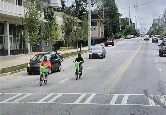
While looking at Google Maps photos of Boulevard (this is a couple of blocks south of North Avenue) I spotted a couple of cyclists grappling with the mixed traffic on this six-lane street.
Why have we not put bike lanes here for safety? This isn't a state road that we don't control. It's a city street that we could change tomorrow.
Why does this mess of a car-sewer still exist in 2024?
On the Atlanta DOT website, the plans for a "complete street" redesign for this part of Boulevard only state "consideration for bike lanes" 🙄 (meanwhile a linked PDF shows a concept with no bike lanes.)

Also, the project start is 2016, and the end is 2028. Ugh. This should not be acceptable by anyone in our city government. Atlanta voters have approved special taxes *twice* in the last 10 years for safer streets.
Aside from the special taxes, Atlanta is a gentrifying city with escalating land values that should be funding improvements with equitable results.
The fact that we still have a major lack of safe routes for cycling in much of the city, especially on major routes like this, is ridiculous.
#atlanta#urbanism#safe streets#street design#cycling infrastructure#bike lanes#urban planning#urban design#transportation planning
10 notes
·
View notes
Text
I got this shout-out from Bike Lane Uprising 😊
If you see vehicles blocking bike lanes, submit them to BLU to help them build their map so cities can see which areas need better bike infrastructure! (And if you live in the greater Boston area, send them to Boston Bike Blockers too!)
3 notes
·
View notes
Last Seen Blogs

micheledalmeida
@palavrasporela

deltamb3r
A ghost called Amb3r

butts-bouncing-on-the-beltway
Made My Day


mooncro
Pink Monday