#california map
Text
Suisun Bay Middle Ground to New York Slough Nautical Chart 18666
This NOAA chart number 18666 is based on the original, traditional paper nautical chart. It covers Suisun Bay in California from Middle Ground to New York Slough. You can find a number of products that use this chart for the design.
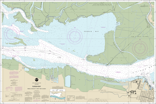
#nautical#nauticaldecor#coastaldecor#decor#nauticalideas#nauticalcharts#maps#oceanmaps#coastal#map#california map#West Coast Chart
0 notes
Text
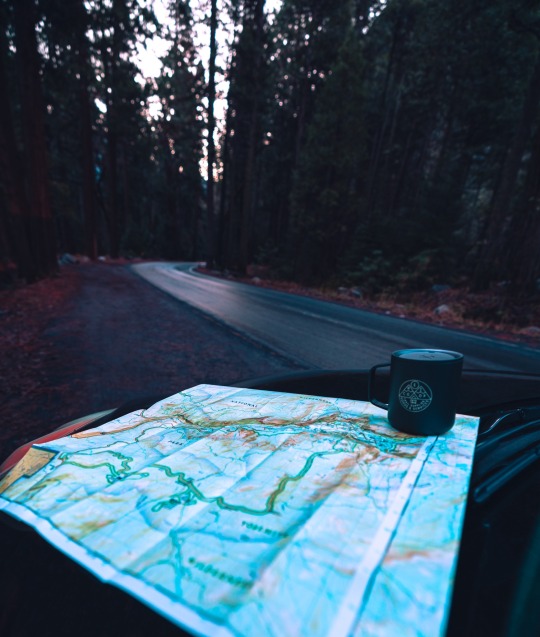
Sunrise adventures in Yosemite
#Yosemite national park#Yosemite#California#aimeekb#lesbians who hike#let’s get lost#adventure#Sierra Nevadas#forest#travel#hiking#mountains#maps#coffee#explore#nature#landscape#redwoods#sequoia
768 notes
·
View notes
Text

Largest religious denomination in the USA by county
Btw this doesn’t show atheism/irreligion, so like in Los Angeles, 60-70% of religious people are Catholic, it’s not that 60-70% of Angelenos are Catholic, just the ones who profess a religion.
#map#maps#cartography#usa#data#americas#geography#religion#catholic#Catholicism#orthodox#christ#christblr#chart#demographics#theology#history#counties#states#California#Texas#Florida#New York#nyc#Mormon#LDS#Mormonism#protestantism#evangelical#evangelicals
746 notes
·
View notes
Text
i don't like criticizing animations or fan projects (barring obvious issues of course) because they're almost always done for free and for fun, but sometimes i do see a premise, song choice, and character choice where it could've easily focused on a much less popular character or story and instead chooses the most popular characters available and just uh. crams them in to fit the song.
#deer rambles#me seeing a hotel california map and going oh cool this would be the perfect song for a dark forest animation#and then it's not </3
308 notes
·
View notes
Photo

Indigenous Ethnic and Linguistic Groups of California prior to European Arrival
383 notes
·
View notes
Text
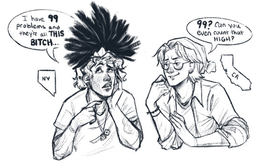
The pettiness will kill them before the water crisis ever does /lh
Thanks @aceasadhd for inspiring this dialogue!
Alt text:
NV: “I have 99 problems and they’re all THIS BITCH.”
CA: “99? Can you even count that high?”
#wttt#wttt california#wttt Nevada#welcome to the table#welcome to the statehouse#wttt Fanart#mur art#my geography ocd is bugging me bc they’re OUT OF ORDER 😂#idk if you notice but I normally draw the states roughly in their map position#today is Opposite Day I guess
200 notes
·
View notes
Photo
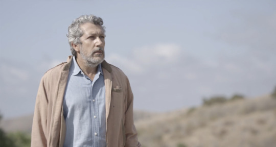


Realité / Reality
Quentin Dupieux. 2014
Building
Peppertree Ln, Brandeis, CA 93064, USA
See in map
See in imdb
#quentin dupieux#realite#reality#alain chabat#concrete#brutalism#sidney eisenshtat#architecture#brandeis#california#simi valley#united states#movie#cinema#film#location#google maps#street view#2014
57 notes
·
View notes
Text
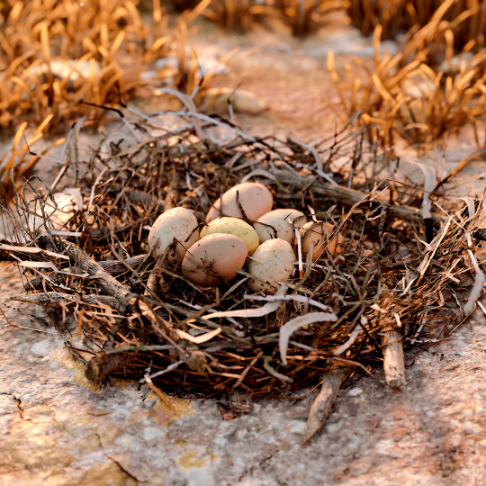

canada goose (and eggs)
#horizon forbidden west#hfw#canada goose#eggs#holiday-ily appropriate. ish?#idk if these are actually representative of canada goose eggs - they look a bit too colorful? and do they actually breed in california?#but we'll go with it because there were a lot of geese in this section of the map#anyway i spent *way* too long looking for these shots in my folder#i knew they were there but i couldn't remember when the hell i took them so it was a looooooooong scroll lmao#gamingcreatures#hfw salt bite#hfw goose#hfw wildlife
33 notes
·
View notes
Note

Thoughts on this? (You mentioned awhile ago that you want ppl to send you interesting maps; I’m happy to oblige)
Love the fact California is split. Bakersfield is not the worst (I am biased because Dwight Yoakam)
In my opinion: The worst city in Michigan is Grand Rapids, the worst city in Arizona is Tempe, the worst city in Massachusetts is Boston, and the worst city in New York is NYC (this is purely a joke because I have family in all these cities. I actually really love my family)
Socal and NorCal are two different states and there for two different people confirmed. Thank you for map, map is brain fuel
#wttt#wttt fandom#welcome to the table#welcome to the statehouse#wttt california#wttt headcanons#wttt fanfic#wttt texas#wttt florida#wttt new york#wttt maps#ask
34 notes
·
View notes
Text

Somewhere in California...
21 notes
·
View notes
Text

San Francisco to Point Arena California Nautical Chart 18640 - a design used for products on Society6
#nautical#nauticaldecor#coastaldecor#decor#nauticalcharts#maps#nauticalideas#oceanmaps#coastal#map#California nautical chart#California map
0 notes
Photo
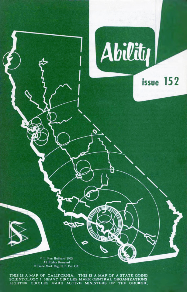
Source details and larger version.
Strange maps and even stranger maps are collected here.
#map#california#scientology#religion#1960s#vintage illustration#illustration#vintage magazine#magazine
23 notes
·
View notes
Text
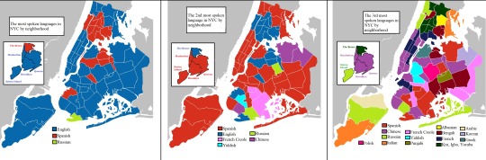
First, second, and third most spoken language in New York City 🗽🚇🌭 and Los Angeles County 🌴⭐️🌆
#map#maps#cartography#usa#data#geography#americas#latin america#langblr#languages#language#new york city#nyc#los angeles#la#new york#california#united states#diversity#chart#history#spanish#chinese#english#east coast#west coast#lana del rey#russian#armenian#french
208 notes
·
View notes
Photo

Rae Lakes, 42 miles of nonstop summer fun!
#california#map#wilderness#i hiked it in a day once... i drew this just so i could humblebrag about that#my art
405 notes
·
View notes
Photo

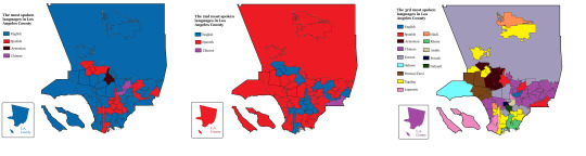
First, Second and Third most spoken language in California by county
by mexidominicarican8
172 notes
·
View notes
Photo

Official California Visitor Map, 1979.
413 notes
·
View notes
Last Seen Blogs