#earth map
Text
Tornado Quest Top Science Links For January 27 - February 3, 2024 #science #weather #climate #wintersafety #windchill #cocorahs #citizenscience #droughtmonitor
Greetings everyone. This week, you’ll find a way to get involved in collecting valuable weather data as a citizen scientist. We’ll also continue our look at winter weather safety, the latest US Drought Monitor, and other interesting reads, so let’s get started.
If you’re looking for a nice map of our planet, check out this site.
This is a informative read on clearing the air regarding many…
View On WordPress
#citizen science#citizenscience#climate#climate change#climate disasters#climatology#cocorahs#disaster#earth#earth map#environment#health#map#meteorology#public health#science#sunscreen#weather#weather disasters#wildfire#wildfire smoke#wind chill#wind chill chart#wind chill safety#winter safety#winter weather preparedness#winter weather safety
1 note
·
View note
Photo
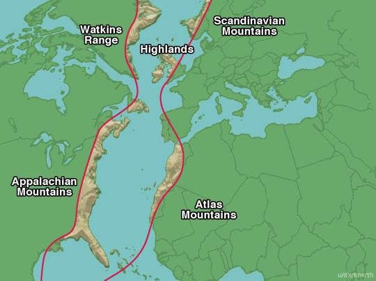
The Appalachian Mountains, Atlas Mountains, Scottish Highlands and Scandinavian Mountains were all once part of the same "Pangea Central Mountain Range" millions of years ago before Earth's continents split.
#maps#earth history#appalachians#atlas mountains#scottish highlands#scandinavian mountains#interesting
4K notes
·
View notes
Text

I'm obsessed with Flat Earth conspiracy maps so I made my own, I hope it catches on 😇
1K notes
·
View notes
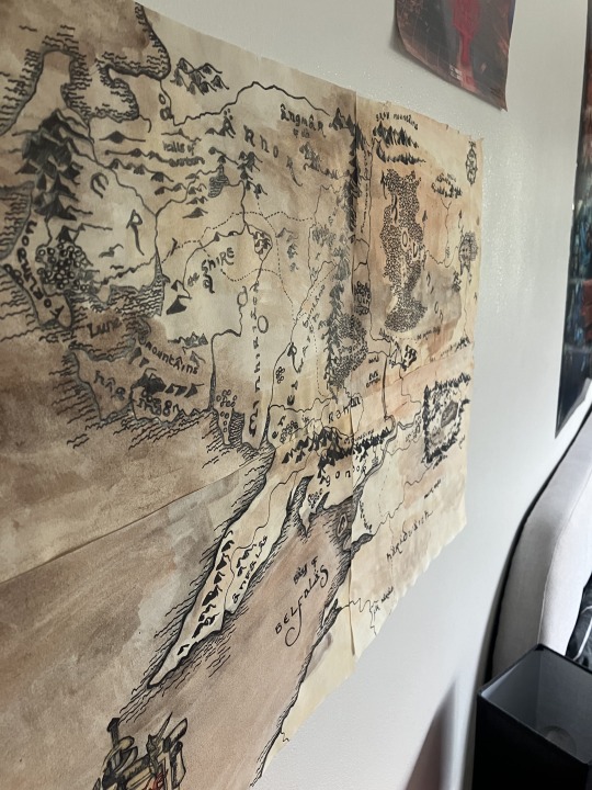
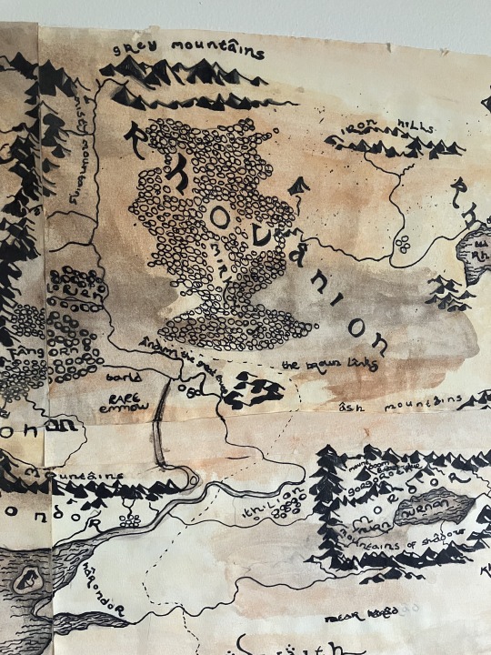
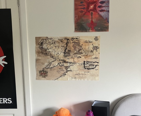
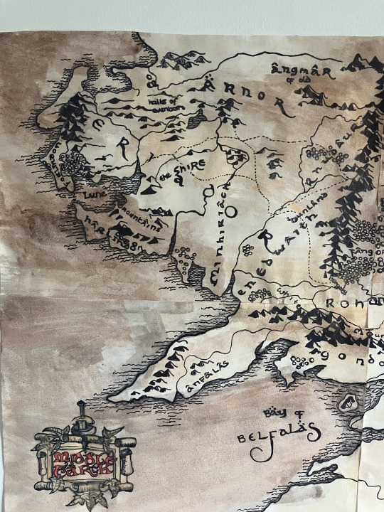
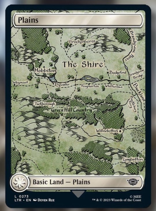
Text
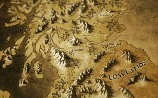

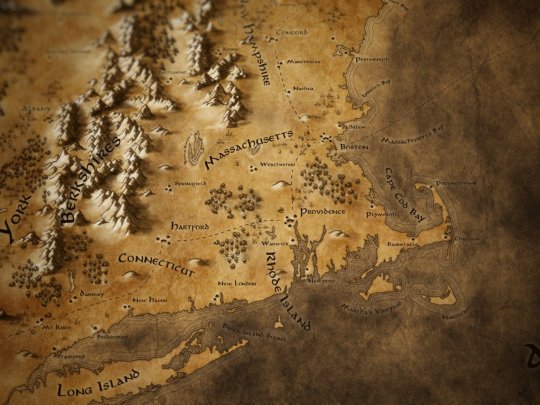
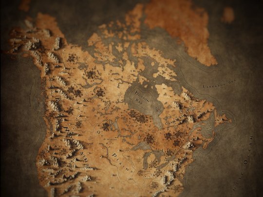
I made a set of Tolkien inspired fantasy maps of real-world locations including Scotland, the UK and Ireland, Europe, New England and North America for fun but turns out people like using them in their games so, here's how you can find them!
You can download copies of all these maps for free with or without labels for printing or use in your TTRPGs over on my Tumblr page here:
Fantasy Maps in a Tolkien Style
You can also buy prints of these maps on my Redbubble page :
If you would like to use these in a commercial project, drop me a DM and I'd love to chat!
#Maps#Tolkien#cartography#middle earth#lotr#fantasy maps#D&D#dnd#pathfinder#ttrpg#map making#hobbits#shire#rpg#roleplaying game#gimp#mountains#Scotland#UK#America#New England#Ireland#Europe#scottish#jrr tolkien#lord of the rings#the hobbit#mapmaking#digital art
2K notes
·
View notes
Text
The evidence is overwhelming 🤔

#pay attention#educate yourselves#educate yourself#knowledge is power#reeducate yourself#reeducate yourselves#think about it#think for yourselves#think for yourself#do your homework#do some research#do your own research#ask yourself questions#question everything#earth#flat earth#flight path#air travel#gleason map
227 notes
·
View notes
Text


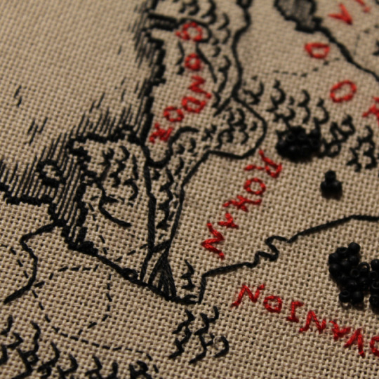
photos of my map of middle earth I embroidered in this week's video :D
211 notes
·
View notes
Photo
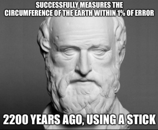
Eratosthenes of Cyrene
He is best known for being the first person known to calculate the circumference of the Earth, which he did by using the extensive survey results he could access in his role at the Library; his calculation was remarkably accurate. He was also the first to calculate Earth's axial tilt, which has also proved to have remarkable accuracy. He created the first global projection of the world, incorporating parallels and meridians based on the available geographic knowledge of his era..
Read more: https://en.wikipedia.org/wiki/Eratosthenes
#Eratosthenes#ancient greece#ancient history#history#greece#geography#maps#earth science#Earth#science
1K notes
·
View notes
Text

On top of the world. The magic forest. 1903.
Internet Archive
#map#globe#earth#children's book illustration#whimsy#on top of the world#western hemisphere#nemfrog#1903#early 1900s
228 notes
·
View notes
Text
IT IS FINISHED
MY MAP OF MIDDLE-EARTH
IS DONE
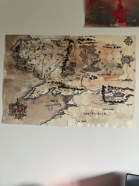

One does not simply draw mordor (it wasn’t simple those mountains were a pain in the ass)

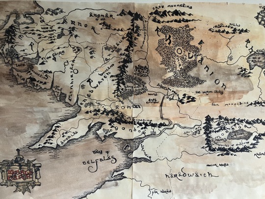
Some things are slightly out of proportion due to some “technical difficulties” when i drew the top left corner and also problems came from lining it all up since i did them on four separate sheets but overall i think it came out good :)
#lord of the rings#the hobbit#map of middle earth#middle earth#maps#my art#this took forever#one does not simply draw mordor#tolkien#the silmarillion#tolkien art#lord of the rings fanart
550 notes
·
View notes
Text
Finished my first attempt at embroidery
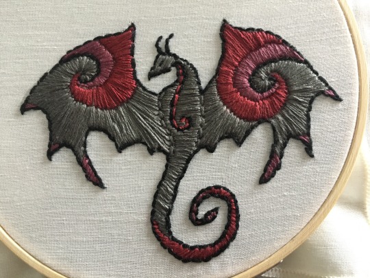
It's about four inches from wingtip to wingtip and took me 4-5 hours to complete
#Technically this is my 3rd attempt at embroidery; but one is unfinished and the other is simply a few practice stitches so they don't count#And I'm learning embroidery purely so I can embroider maps of Middle-earth; the Oath of Feanor; and the Doom of Mandos on my clothes XD#embroidery#dragon#my art#artwork#crafts
120 notes
·
View notes
Text
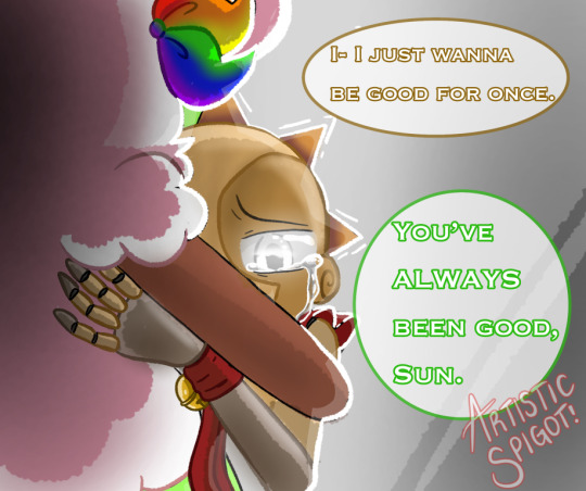
Taking part in Mc_L’s TSAMS MAP (in the lore art section), and decided to do this, one of my favorite scenes and wonderful sibling dynamic :3.
#tsams fanart#tsams earth#tsams sun#mc is goated#I’m so excited for this map#I love Sun and Earth’s relationship:’)
78 notes
·
View notes
Photo
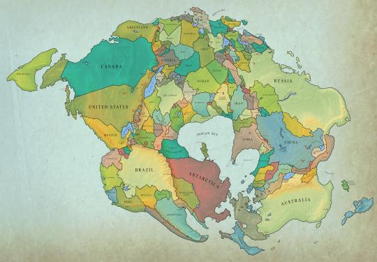
Map of the nations of the world in 250 million years from now
2K notes
·
View notes
Text
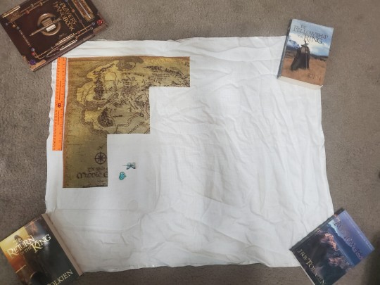
I'm making a giant map of Middle Earth with Cross Stitch! It's 14 count and should be 32x24 inches when completed. I drafted it using Pic2Pat, and there are 25 colors, 24 pages, and I'm 23% complete.
If you have any question/stuff to say/whatever, say hi! I miss the r/crossstitch community.
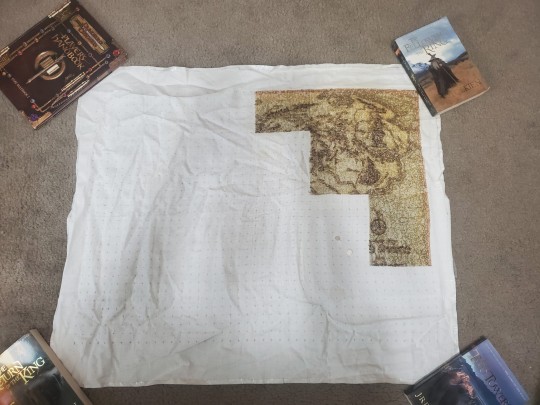
This is a full shot of the back of the project.
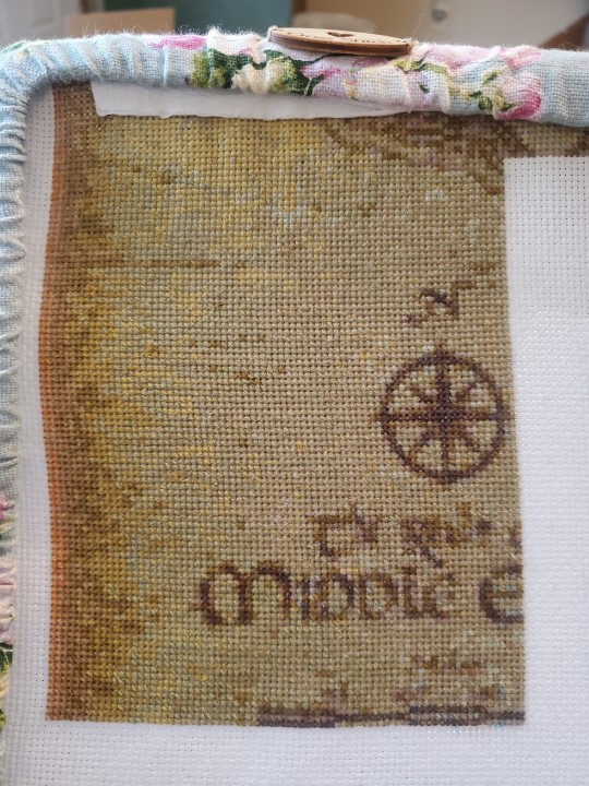
A close up of the front.
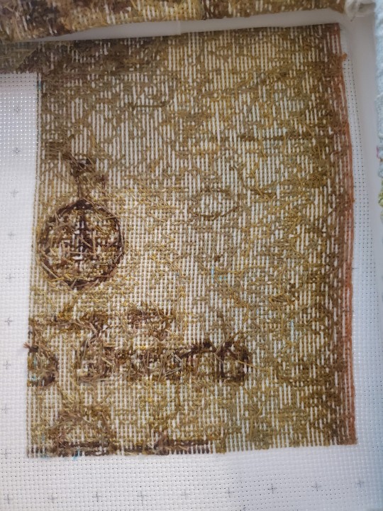
Close of of the most recent back.
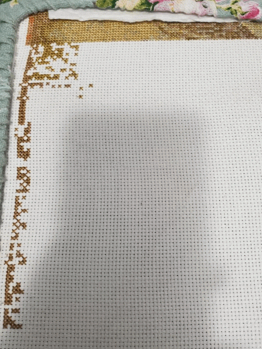
And a progress GIF!
Cat hair needle minder: SnarkyCrafterDesigns
Butterfly needle minder: Woodandcat
Grime guard: Woodandcat
304 notes
·
View notes
Text
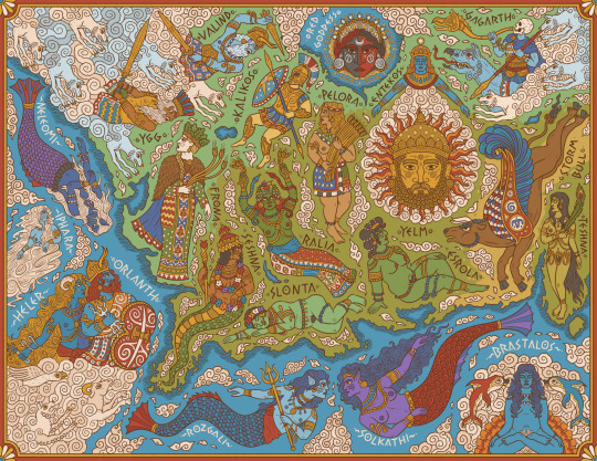
A map of central and western Genertela, showing the major deities of Earth, Sea, and Air.
One of my pieces for Martin Heldson's brilliant Ships & Shores, which you should definitely check out and includes high-res labelled and unlabelled version of this and other maps.
#artists on tumblr#digital art#fantasy#illustration#glorantha#fantasy art#runequest#mythologyart#ttrpg art#ttrpg#fantasy map#map#fantasy maps#rpg maps#i'm especially happy with how the earth goddesses here look#they're very expressive i feel
158 notes
·
View notes
Text
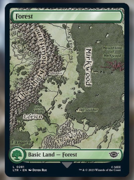


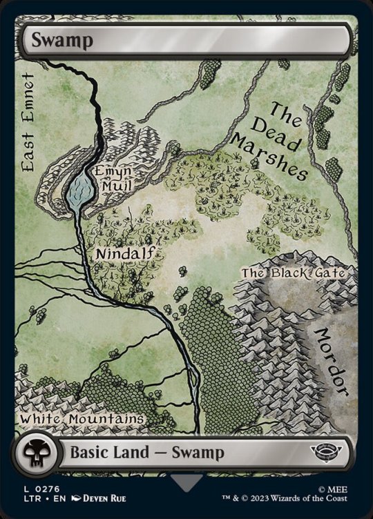
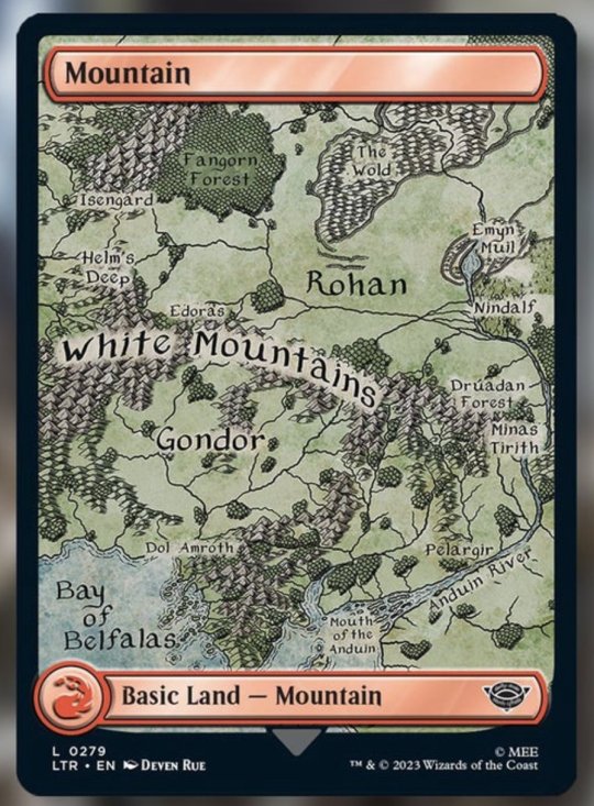
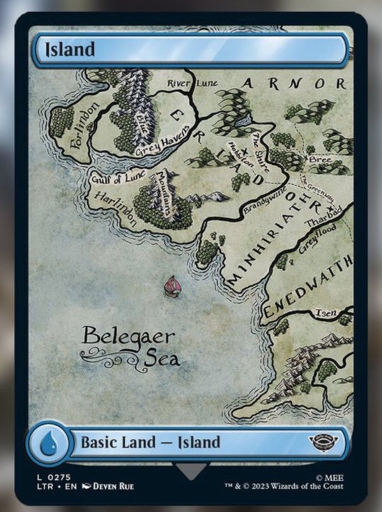
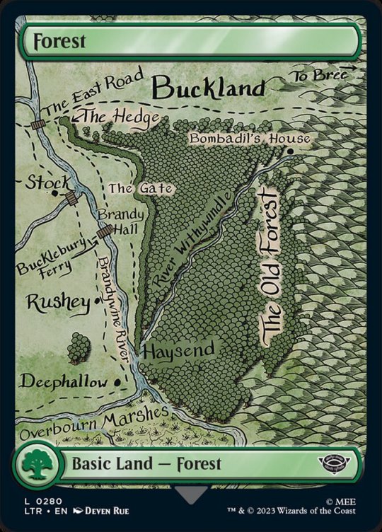
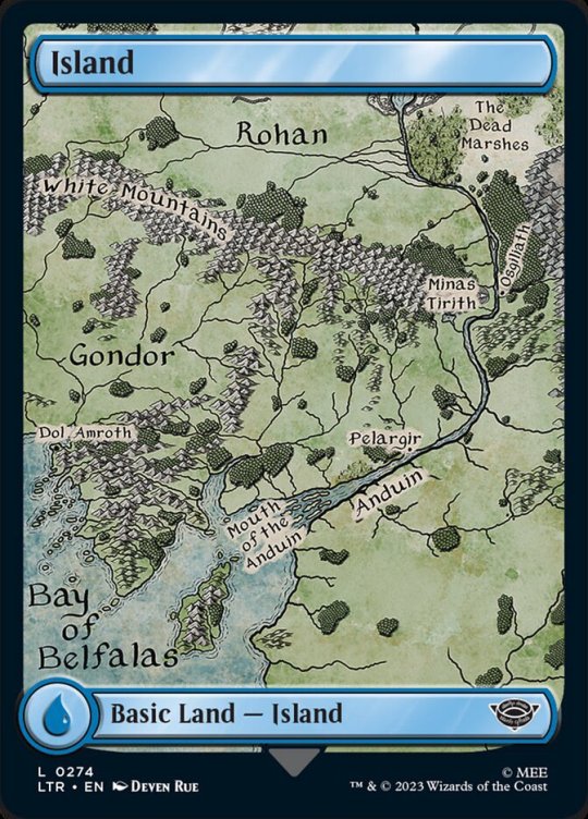
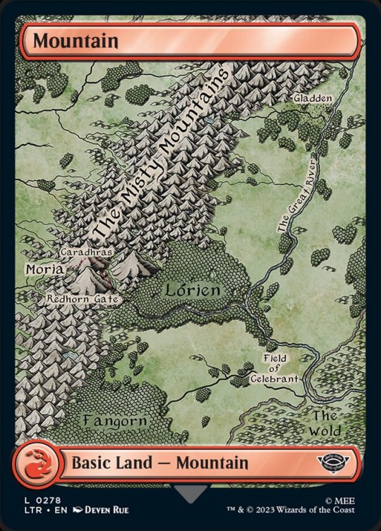
The cards I created for MtG LotR are finally revealed and I'm so proud of them!
434 notes
·
View notes
Last Seen Blogs