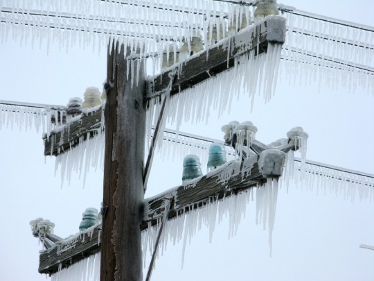
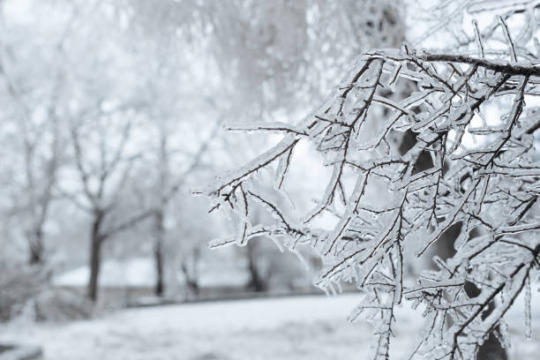
#freezing rain
Text
64K notes
·
View notes
Text
꧁★꧂
#freezing rain#frozen#ice#icy#wires#telephone poles#power lines#electricity#winter#kentucky#aesthetic#flickr#oldweb#old web
833 notes
·
View notes
Text

walk softly..
368 notes
·
View notes
Photo
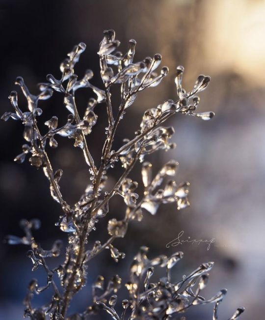
~ Gold and Gray ~
144 notes
·
View notes
Text
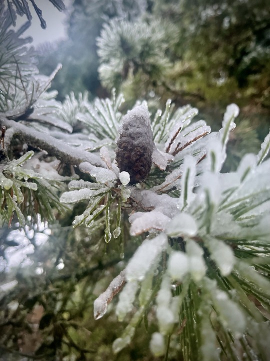
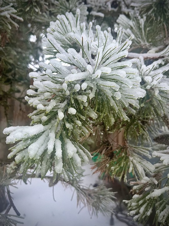
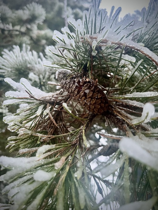
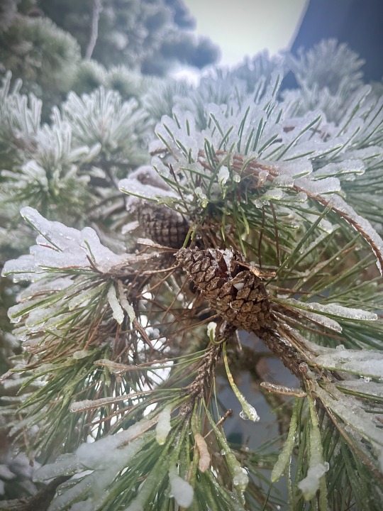
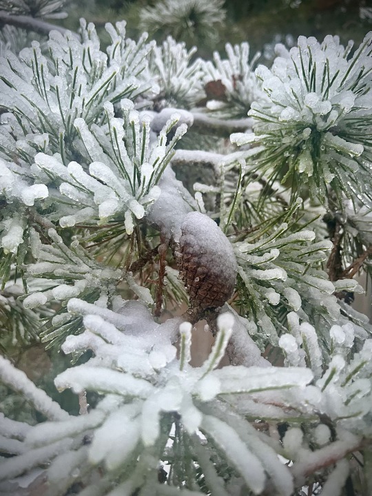
Ice Storm - January 2024
#ice#oregon#the great pnw#photographers on tumblr#pnw#oregonexplored#original photography#realoregon#storm#freezing rain#pine trees#pine cones
49 notes
·
View notes
Video
So,remember your car also needs to stop on it too.
Source
225 notes
·
View notes
Text


Ice
23 notes
·
View notes
Photo

80 notes
·
View notes
Text
This is why I had to take a pickaxe to the ice around my car's tires today.
That is solid ice burying my wind spinner.
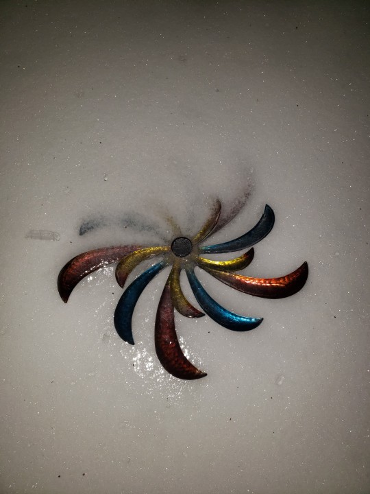
32 notes
·
View notes
Text
6 notes
·
View notes
Text
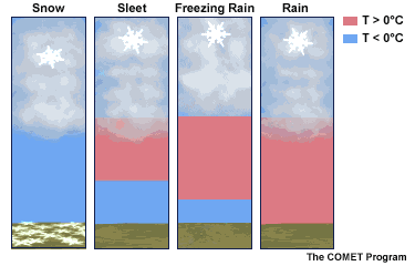
Winter Weather: Precip Types
Since I have some down time, I figure this would be a great chance to discuss the different winter weather precipitation that everyone could see throughout the season. This blog will go into detail on the differences of each type and what makes them different from each other.
source: https://www.weather.gov/jan/winterweathersafety
Introduction
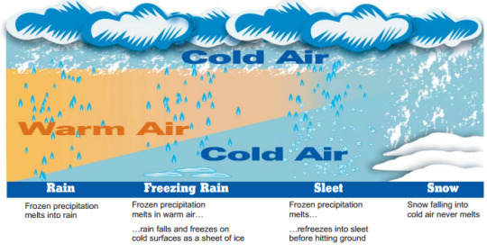
To start, there are four types of wintry precipitation that can occur at any given point in the atmosphere pending on temperature profile. These wintry weather precipitation type includes rain, sleet, snow and freezing rain. Notice that hail is not included since that is associated with severe thunderstorms and is developed by a slightly different process (will discuss this at a different time). The one thing that all the wintry precipitation types start off is snow, but that also depends on other factors that we will get to later on. As we looked at the graphic, the difference between the all the wintry precipitation types starts with the presence and depth of the warm layer. In order to determine this, requires a deeper analysis of the atmospheric profile with the use of skew-t diagrams or soundings.
Skew-T diagram of a rain profile.
Rain
The first wintry precipitation that we will go over is rain. Unlike the other wintry precipitations, rain can be associated with thunderstorms and tropical systems. Rain can also occur during anytime of the year and is probably one the easiest precipitation types to forecast when it comes to winter weather. The white line in the skew-t diagram represent where the temperature being at 0 degrees Celsius (C) or 32 degrees Fahrenheit (F) which is the point where water freezes. In the skew-t diagram, temperatures from the surface to about 700 mb (3 km) in the atmosphere is entirely above freezing. With the combination surface temperatures being above freezing and a very deep warm layer, this will result in rain.

Skew-T diagram of a snow profile.
Snow
Heading into our next wintry precip type, this is not as easy to forecast when it comes to totals, but is very easily identifiable when analyzing the skew-t diagram. For snow, the entire atmospheric as to remain below freezing. Similar to the previous skew-t diagram, the white line represent where the freezing mark is located. In this case, the entire sounding remains below freezing which is an indicator for snow. However, that is only part of the equation for this. The other two factors are moisture and the snow growth zone (SGZ). If these two are not present, then snowfall could be severely limited. For the SGZ, temperatures between -12 degrees C to about -18 degrees C is consider sufficient for snow to developed. As for moisture, will prefer to see relative humidity values at 80% or greater. If the atmosphere becomes dry, then that could also alter the snowfall totals throughout the forecasting period. As for predicting snowfall ratios, I will not go into great detail, but will say that depends on depth of the SGZ, moisture, wind and local geography. All of these play a role into how determining snowfall ratios and why the 10:1 ratio is a poor indicator for snowfall totals.

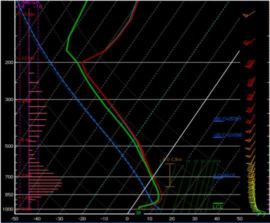
Skew-T diagram of a sleet/freezing rain profile.
Sleet/Freezing Rain
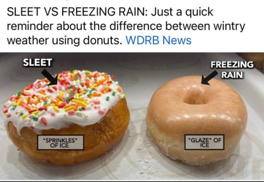
For the last two, I am going to discuss them within the same section. The only difference between the two is dependent upon the depth of the warm layer. For sleet and freezing rain, these two are consider the worst of the wintry precipitation types of the group since they both contain ice. Between the two, sleet is better as sleet are ice pellets that will collect on the ground and will take longer before accumulating on trees and power lines.
For freezing rain, that is supercooled water that will freeze as it comes into contact with an object. The major issue with freezing rain is that it weights a lot heavier and does not take a lot to bring down tress and power lines. Freezing rain accumulations of 0.50" or more is major. Anything between 0.10' to 0.25" is considered significant. The other issue with freezing rain, and can be an issue with sleet as well, it makes traveling very difficult and hazardous as there is very little traction between the tires and the surface of the road.
Conclusions
I am hoping with these examples in mind, it proves not only a better insight on winter weather precipitation types and the differences between them. I am also hoping this provides more insight on why winter weather forecasting can be difficult as well. While the examples above were broken down individually, it is not uncommon to see some sort of combination of them.
3 notes
·
View notes
Text
chunk of ice makes it nice..
175 notes
·
View notes
Photo

~ Feeling Blue ~
75 notes
·
View notes
Text


18 notes
·
View notes
Text


[I've seen in the freezing rain, people lined up around the block.]
3 notes
·
View notes
Text

Freezing Rain
8 notes
·
View notes
Last Seen Blogs

bolaekspedisi
Untitled

jeanfrancoisgeschwind
Jean-Francois Geschwind | Jeff Geschwind

lisabonmodel
Lisa Bon


sekloso8070
KAKI SEX