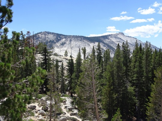
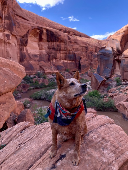
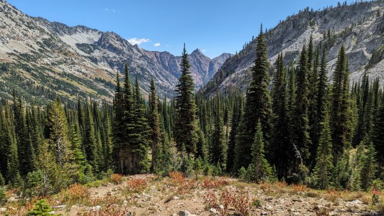
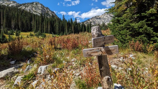
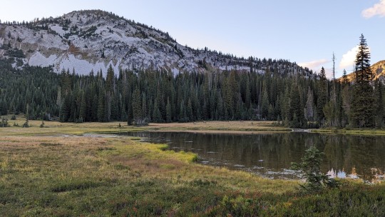
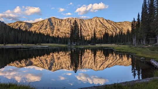
#granite creek trail
Text

Mount Rainier National Park Archives Photo of Civilian Conservation Corps crews working on Westside Road in the 1930s (top). NPS Photo of the Westside Road next to Tahoma Creek in 2015 (bottom).
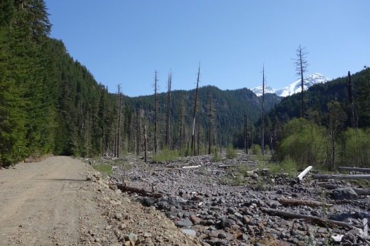
Like the Wonderland Trail encircling Mount Rainier, an “around-the-mountain" system of roads was envisioned for Mount Rainier National Park during the 1910s to early 1920s. It was only partially achieved during the following decades with the creation of SR123/410 on the east side of the park and Stevens Canyon Road in the south. Westside Road, as its name implies, was intended to span the west side of the park from Nisqually Entrance to Mowich Lake. However, budget constraints and the rugged topography of the mountain prevented completion of Westside Road and it was left as a 13-mile-long spur road. Repeated flood damage from Tahoma Creek eventually closed Westside Road to vehicles after the first three miles. Built from 1926-1934, Westside Road is still considered part of the Mount Rainier National Historic District due to its association with the park’s early master planning.

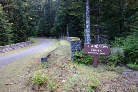
Mount Rainier National Park Archives Photo of St. Andrews Creek Bridge. NPS Photo of the St. Andrews Creek Bridge in 2014.
One of the historic structures along Westside Road is St. Andrews Creek Bridge, built in 1930-1931. St. Andrews Creek Bridge includes two set of stone stairs that descend to the creek from the northeast and southwest corners of the bridge. The 115-foot-long, 34-foot-wide bridge is a reinforced concrete-filled spandrel arch veneered in native granite.
Have you hiked or bicycled over St. Andrews Creek Bridge along Westside Road?
#Historic Mount Rainier#mount rainier national park#Mount Rainier#Westside Road#St. Andrews Creek Bridge#history#architecture#park planning
21 notes
·
View notes
Text
I went on the most amazing camping and hiking adventure in Colorado this weekend! Super long post and beautiful pictures are under the read more.
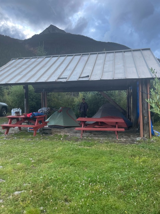
On Thursday, three of my friends and I packed up the car and drove up to Silverton. We set up camp and then went for a big meal at a local establishment. Gotta carb up to prevent altitude sickness!
We were all expecting it to be chilly and wet, but it was actually a bit too warm in the tents.
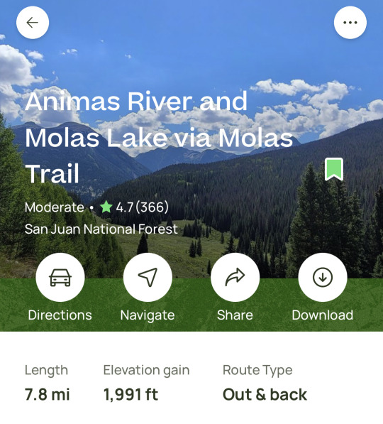
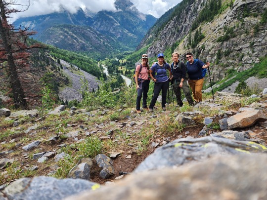
On Friday, we hiked down to the Animas River. This was a great warm up hike! I loved getting to hear and see the train while we were hiking! It was a tough hike back to the top.
We got back, showered (our campground had hot showers!!), and grabbed some pizza and beer!
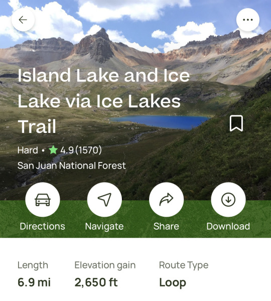
Saturday morning started out earlier and chillier. We had to get up early, as Ice Lakes is the most popular hike in southern Colorado (according to a ranger we met on trail on Friday).
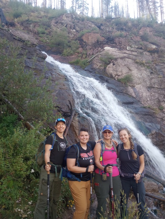
I felt disheartened and nervous. The hike on Friday was so hard that I got nervous about the steeper hike on Saturday. I was way more in my head and psyched out than I normally get. I was grumpy until we saw a waterfall and took a super cute group photo.
The trail got steeper and harder when we hit the forest and beyond the tree line. I kept thinking, we’ll take a real break after the next hill is over, but the hill never really stopped.
Finally, we made it up to Island Lake. As everyone on their way down assured us, it was totally and completely worth the climb! It was so incredibly gorgeous. The pictures turned out beautiful and it’s always twice as pretty irl.
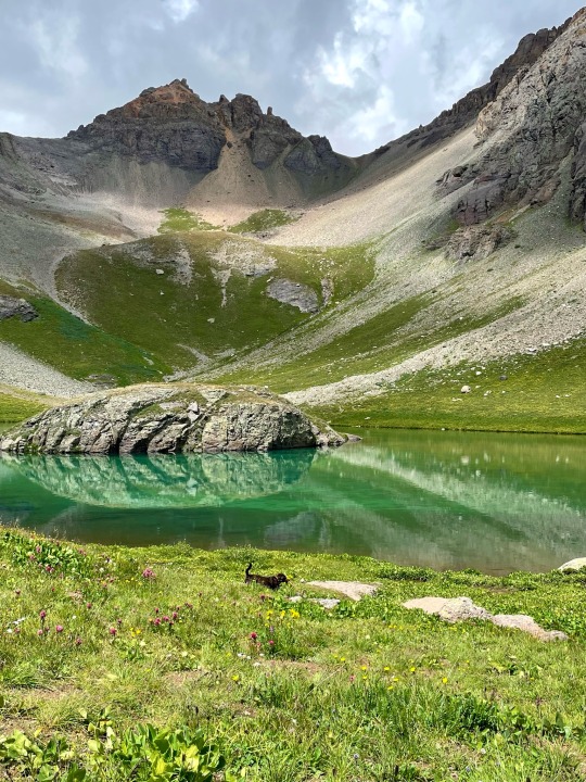
We hung out there for a few minutes before traversing the short route to Ice Lake. I came around a bend and started crying at the view. It was the prettiest thing I’ve ever seen and I had worked so hard to get there. I couldn’t get over it and probably walked about a mile with a stupid-huge grin on my face.
The connecting trail took us over an exposed cliff face. Those don’t bug me, but I had to pull out my patient, calm teacher voice to coach my friend across. We all made it!
Ice Lake was just as pretty as Island Lake. The color of these lakes was unreal! We stopped to fill up our water bottles and eat some snacks.
The route down from Ice Lake was very steep. I’m so glad we went counter-clockwise! There was a steep, granite section and a creek crossing (one of many of the day). It started raining and thundering right as we hit the basin.
Ridiculously, people were still climbing up at this point. Some wearing jeans, some with only one water bottle, and all of them who didn’t understand the danger of being above tree line in a thunderstorm. It reminded me of the tourists on Camelback.
Sometimes I wish I could just teleport back. Just as I was hitting that point, we saw/heard a marmot (my favorite animal) and I remembered why the hike back is worthwhile. Did you know they chirp like a dead smoke alarm? I didn’t!
We were well below tree line before it started really pouring. My new raincoat worked great, but at this point, my knees were trashed and I was grumpy. I speed-walked the rest of the way back!
After the hike, we showered and warmed up and broke camp. We drove down to Durango for dinner. All I wanted was nachos but when we got to the restaurant, I found out they were sauerkraut and corned beef. Massively disappointing. I ended up with overcooked wings.
On Sunday, we dilly-dallied around Durango and hit up the Durango Coffee Company. I love it there!
None of us were ready for our time in the mountains to end, so we really took our time driving back. As we were driving through New Mexico, we stopped at this place called the Bisti Badlands! It was a mini badlands. We didn’t have the time or the water to go far, but we stuck it on the list of places to explore. Pictures definitely don’t do this one justice.
We were welcomed back to the valley with a beautiful rain storm! Desert rain smells so much better than mountain rain.
I had the best group ever! We laughed so much and never got tired of each other. It was cool to pair off in different ways depending on the car, the trail, or the tent. We came back with tons of inside jokes, which is the mark of a lot of fun.
#personal fitblr#queer fitblr#i love hiking#i love camping#southern Colorado is the loml#I’m still so wildly happy about this trip
21 notes
·
View notes
Text
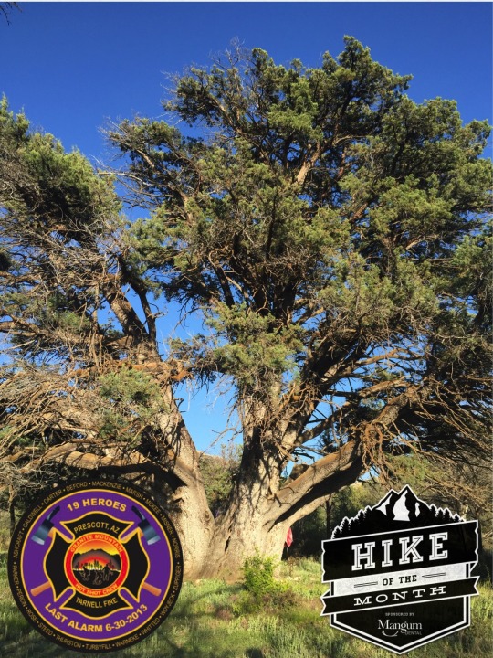
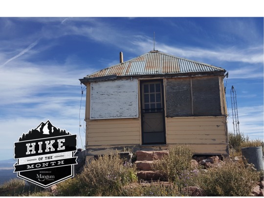
February 2024 Mangum Dental Hike-of-the-Month
Grandfather Juniper Trail - In Memory of the Granite Mountain Hotshots
#38 Upper Pasture Trail to #39 White Rock Spring Trail
Distance: 3 – 4.5 miles
Difficulty: Easy to Moderate due to rough terrain
Elevation gain: minimal
Mangum Dental Hike-of-the-Month is reprinted from July 2016 and describes a hike to the Grandfather Juniper, a legendary tree with local fame. The Juniper tree may be the largest known Juniper in the world with a circumference measuring over 26 ft. at the base. The tree is estimated to be 1000 years old and was named one of Arizona’s “Magnificent 7” trees for 2015. Despite these amazing statistics, the tree is special for another reason. The plaque at the base of the tree tells the entire story. In short, this tree was spared from the Doce Fire in June 2013 through the valiant efforts of the Granite Mountain Hotshots from the City of Prescott Fire Department. Later that month, responding to another urgent threat to homes and communities, 19 of the 20 hotshots tragically lost their lives. This hike is dedicated to their memory and this tree is a representation of how much we miss our 19 heroes.
Directions: From the intersection of Williamson Valley Road and Iron Springs Road, travel west on Iron Springs for 6.8 miles to Contreras Rd. (between mile marker 8 and 9). Turn right on Contreras Road and head north .7 miles to a parking area on your right. Those with low clearance vehicles will want to park here and start the hike. Moderate to high clearance vehicles can follow the rough road to the left (north) out of the parking area (Road 9261U). The road follows a fence for another .7 miles to the trailhead.
The hike: A gate and a sign designate trail #38, Upper Pasture Trail. Follow this old road for slightly less than 1 mile to the well-marked junction of trails #38 and #39, White Rock Springs Trail. Turn left or north onto trail #39 and hike for just over ½ mile. As the trail nears the turn-off for the tree, there will be a short stretch of quartz rock along the path then the trail drops into a creek bed. Look to the left for a trail marker and follow the single-track trail that heads west. This short path will lead to the Grandfather Juniper, marked with a beautiful monument and plaque dedicated to the Granite Mountain Hotshots.
Mangum Dental has been serving the Prescott-area dental needs since 1978. We strive to provide exceptional patient care while rendering outstanding compassionate service.

2 notes
·
View notes
Text
youtube

Granite Falls Rebuild - No CC, Outdoor Retreat Only
Available on the gallery ID: quiescence90
Or download the tray files from SFS
Lot info follows.
1. Granite Falls Campground (Campground) - Includes three tents to sleep up to 8 sims, and 2 bathrooms
2. Rabbit Trail (Green Getaway) - A single-bedroom cabin
3. Walleye Creek (Riverside Retreat) - A family cabin for parent sims with 2 children
4. Lakeview Lodge (Forest Hideaway) - Another family cabin for parent sims with 3 children, including one toddler
5. Camp Grizzly (Lakeside Retreat) - Furnished for teens to young adults but I added an extra room for chaperones of child campers
6. Granite Falls Lookout (Granite Falls Forest) - A sort of rangers’ HQ with a random watchtower cause I wanted one
7. Hermit’s Hut (Deep Woods) - To replace the hermit's house in the hidden lot
#TS4 Download#TS4 World#TS4 Vacation World#TS4 Outdoor Retreat#TS4 Granite Falls#TS4 Lot#TS4 Residential#TS4 Rental#TS4 Community Lot#TS4 Park#TS4 National Park#jqbasesave#Youtube
20 notes
·
View notes
Text
My Favorite Spot
For 25 years, Ronin Demele worked as a wilderness ranger. In his book, Pacific Crest Trail: Mountain Encounters of a Wilderness Ranger, Demele has gathered 30 short essays based upon his experiences. I appreciate this essay because it serves as a reminder that our favorite spot along the PCT doesn't have to be in the heart of the High Sierra or the North Cascades. It can be a magical place in the midst of nature, immersed in the trees, flowers and animals of the wilderness.

Cover image - Pacific Crest Trail: Mountain Encounters of a Wilderness Ranger
I have my favorite spot along the Pacific Crest Trail . . . where vistas unfold and caused me to sigh in wonder whenever I hiked past this scenic point. The location is up at about 7,000 feet along the trail in the northern Trinity Alps.
In a beautiful sloping meadow surrounded by red fir, I followed a break in the forest and crossed a downed log. A small granite pebble path led me to a large meadow facing east. In the middle of this green oasis of wet grass, red columbine and purple-blue penstemon flowers,, I came upon granite stone blocks of what looked like an ancient sculpture project -- rocks naturally arranged to delight all who passed the small wind- and water-sculpted granite, many the size of living room furniture. Like chairs and sofas strewn in perfect harmony with many angles of artistic interest, smooth grey surfaces placed for aesthetic effect.
As I approached this rock monument, I saw lime green rock lichens mixed with black and red ones covering the north shaded corners of exposed granite. Looking down, with the sun's afternoon rays bouncing off the rock, my eyes were treated to sparkling quartz crystal and mica reflections.
To add grace to glory, the rocks allowed me four steps up on top of this sculptural arrangement. On top, a perfectly flat, smooth rock with a concave shape awaited to accommodate my butt. Around and below me was a circle of light white granite, absorbing and reflecting the day's heat. I settled in.
Soon I heard chip-chip-chip-chip, caw, caw, and chook-chook-chook-chook-chook bird sounds coming fron the surrounding forest.
My eyes bathed on the rows of mesmerizing ridges far out across the sky, rippling perhaps fifty miles beyond. Larger still, and right in front of my landscape and dominating the mountains in all directions was a wonder twice the height of me now -- a volcano with a white hat, snow-covered year-round, and towering above all. The mountain in seen from every high peak around it and from valley dwellers 200 miles away. The Fuji of California, the peak punctures the sky . . . Mount Shasta.
I climbed down from my perch and smiled, and retreated back along the PCT. I thought about why I hike. Many times when I hike in the mountains, I want to get somewhere . . . a lake, a peak, and creek, or a meadow, but if I wanted to be somewhere, I stopped to let the place get to me. So I stopped and sat on a log. This log was grey and solid . . . perhaps a healthy snag until a windy winter storm dropped it there. As I sat, I heard a short chip-chip sound of a Williamson woodpecker.
Out on a large white fir, he surged down into a remaining snag twenty feet away, near the remaining brittle stump of my log. Then, I saw it was a she with young mouths to feed, second later, shooting out again and straight up into a large fir with lime green lichens ringing the trunk. Then, just as fast, shot a finch reaching into her tiny circular home in the same snag only feet away, perhaps feeding her brood.
Thuuuuurrrrrr, echoed above, as a thunderous sound vibrated the ghostly snag nearby. I spied a pileated woodpecker, a rarity around here. Quickly he was gone, a fast flight deeper into the forest . .. not to be seen again that day.
Below, as I looked to the ground around my log seat, black ants and large flies explored the green shoots of a corn lily growing alongside the granite pebbled trail; now some were heading for my boots. I was so used to being recognized as being human in a human-made world that I was reminded that other worlds exist, and this day it was wilderness, and it had come to me.
6 notes
·
View notes
Text
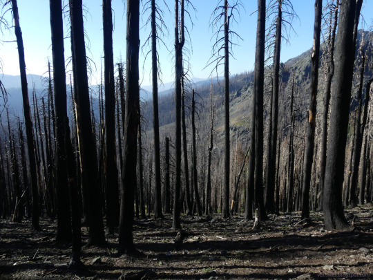
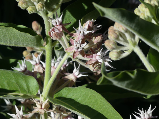

Shasta-Trinity National Forest, California
The second day backpacking this loop was a long stretch of hard to find trail through devastating burn from a couple years ago. Some great flowers and spots of pristine creek, but a hard day.
#hiking#backpacking#Trinity Alps Wilderness#KlamathNF#ShastaTrinityNF#California#PNW#burn#nature#landscape#lake#milkweed#travel#outside#hike#mountains#Klamath National Forest#Shasta-Trinity National Forest
3 notes
·
View notes
Photo

Often the mark of a true professional is not how well they perform when everything goes right, but how well they perform when everything goes wrong. Coco Pommel illustrated that fact a while ago in my Royal Equestria Security Force, RESF, dreamscape.
Coco Pommel stared silently down at the collection of wreckage that was strewn across a large table. Through the headphones she was wearing came the voice of Rarity her Operations Officer.
"Darling, be honest with me. What happened and how bad is it? Over." The encrypted satellite link gave the unicorn's voice a pitch that wasn't there when she was talking to you face-to-face, but there was another element. Genuine concern for her operative.
The earth pony closed her eyes and took a deep breath, then slowly let it out before speaking. "The chute on the primary cargo pod failed to properly deploy ma'am. To make matters worse it struck the edge of a cliff face; then the pod flipped and fell another 300 meters or more into a very steep and rocky ravine. In the process it violently struck several rocks. Then it tumbled into a creek and became submerged at the bottom of the ravine. It took me and my contacts over 4 hours to retrieve it and bring back to my cabin."
Coco crossed her arms and cocked hips a bit as she tilted her head slightly the other way as she continued her status update. She was standing in the dining room of a mountain cabin she was renting. With her was her 2 griffin contacts. To any pony or griffin who met her wandering the trails of the Scar Claw Mountains she just looked like another young, slightly affluent, female hiker. Hundreds of similar looking tourists came to the Scar Claws during late spring to early fall to take in the beauty of mountains. It was early October but the weather was still quite mild. As such the mare was wearing a tank top along with cargo shorts, sunglasses, and light hiking boots.
"The outer casing of the cargo pod ruptured in several locations as result of numerous impacts. It's to testament to ruggedness of the materials used to make the pod that it didn't utterly fail on impact considering it fell over 1100 meters before striking hard granite. The impact set off all of the shock watches in the container. Praise Celestia the satellite radio we're using was in the secondary cargo pod."
The mare picked a rifle scope and slowly started turning it over in her hands. "Unfortunately the contents inside the pod are a total loss. The optics on the rifle and the backup scope are ruined. Either from the shock of the initial impact. The further strikes against rocks as it flipped and tumbled into the ravine. Or from water entering the optics when the pod ended up submerged in the stream for over an hour. The impacts obviously destroyed water seals in the scope bodies."
Setting the scope back down on the table she picked up the rifle. "At first glance the rifle appeared okay. However upon a more closer and detailed examination of it I've determined it's effectively useless."
She set recoil pad of the butt stock on the floor and stared at the muzzle. "There's been serious damage done to the crown of the muzzle." She shouldered the .338 magnum rifle. "The aluminum chassis now has slight warp to as result to impact. Also the elevation knob on the cheek rest shattered and the rest itself is now cracked." She worked the bolt action of the rifle. It was much stiffer than it should be. She proceeded to pull the trigger. It moved but the sear didn't release. "Also it appears the trigger pack has sustained some form of damage. Sometimes it releases the sear; other times it won't. Worse it'll sometimes release prematurely." She squinted at the rifle receiver for a moment. "And I think the receiver is no longer true to the barrel."
Coco tossed the rifle onto the table. "It's a write-off ma'am. Also the tripod mount has a crack in the housing where the legs join. Over."
There was several seconds of silence on the other end. Finally Rarity spoke. "Darling. You're the officer on the scene. Can you carry out the mission? The soonest I can arrange another drop is 72 hours from now, and that will be too late for the operation. Dear. Can you procure kit from the locals? Over."
The earth pony scratched the back of her head one hand, tussling the multiple shades of her light turquoise blue green mane. Her face scrunched up a bit as she juggled multiple variable in her head. "I can try ma'am, but I'll have to be discreet about it." She glanced at the 2 griffins who'd remained silent and still through all this. "Also not to offend our hosts, but I'm not sure they have access to this level of equipment. I'm probably going to have modify the plans for the final operation. Also I will need to get some practice in with ersatz kit before carrying out the operation. Give me 24 hours to see if I can come up with an adequate substitute ma'am. Over."
"Understood darling. Please inform me within the next 24 hours about your options. If by that time you're unable to secure necessary kit I'm going to abort the operation and you will start your transit from the area. Over."
"Understood ma'am. I'll keep you informed. Signing off. Over."
Coco slowly removed the headset and closed her eyes. She took a long, slow, deep breath and then let it out. Opening her eyes she looked at the 2 griffins. "Okay. I still have a job to do, but if it's going to be successful I'm going to need your help."
To be continued.
29 notes
·
View notes
Text
Fifth Wheel Campgrounds with Breathtaking Views
Embarking on a journey with your fifth wheel camper offers a unique blend of adventure and comfort, allowing you to explore nature's wonders while enjoying the convenience of a home on wheels. One of the key aspects that can elevate your camping experience is the choice of campground. In this blog post, we will delve into some of the most stunning fifth wheel campgrounds that offer breathtaking views, promising an unforgettable getaway for avid campers.
1. Yellowstone National Park:
Topping the list of fifth wheel campgrounds with awe-inspiring views is Yellowstone National Park. Renowned for its geothermal wonders, wildlife, and expansive landscapes, Yellowstone provides an unparalleled camping experience. Choosing a fifth wheel campground within the park allows you to wake up to the sight of bubbling geysers, majestic waterfalls, and herds of roaming bison. Be sure to explore iconic attractions like Old Faithful and Grand Prismatic Spring while relishing the serenity of nature.
2. Glacier National Park:
For those seeking a mountainous escape, Glacier National Park in Montana is a prime destination. With its towering peaks, crystal-clear lakes, and abundant wildlife, this park offers a truly majestic backdrop for your fifth wheel camping adventure. Many campgrounds within the park provide easy access to scenic trails, allowing you to hike or bike while surrounded by breathtaking vistas of glaciers and alpine meadows.
3. Big Sur, California:
The rugged coastline of Big Sur, California, is another gem for fifth wheel campers in search of mesmerizing views. Campgrounds perched along the cliffs offer panoramic scenes of the Pacific Ocean meeting the dramatic cliffs. Sunset views along the California coast are unparalleled, providing an ideal setting for a peaceful evening at your fifth wheel campsite. Explore nearby attractions such as McWay Falls and Bixby Creek Bridge for an enriching coastal experience.
4. Zion National Park:
Utah's Zion National Park beckons with its towering red rock formations, slot canyons, and diverse ecosystems. Choosing a fifth wheel campground within or near the park allows you to wake up to the sheer magnificence of Zion's canyons and mesas. Take advantage of the park's extensive trail network, and embark on hikes that lead to viewpoints offering breathtaking panoramas of the Virgin River and surrounding red rock landscape.
5. Acadia National Park:
Nestled on the rugged coast of Maine, Acadia National Park offers a unique blend of coastal beauty and lush forests. Fifth wheel campgrounds within the park or nearby provide a comfortable base for exploring the granite peaks of Cadillac Mountain, the scenic loop road, and the serene Jordan Pond. Capture the essence of Acadia's diverse landscapes, from rocky shorelines to dense woodlands, all from the comfort of your fifth wheel camper.
Conclusion:
Choosing a fifth wheel campground with breathtaking views can transform a camping trip into a memorable adventure. Whether you prefer the geothermal wonders of Yellowstone, the mountainous landscapes of Glacier National Park, the coastal beauty of Big Sur, the red rock splendor of Zion, or the diverse charm of Acadia, each destination offers a unique and awe-inspiring experience for fifth wheel enthusiasts. So, pack your bags, hit the open road, and immerse yourself in the splendor of nature from the comfort of your fifth wheel camper.
0 notes
Text
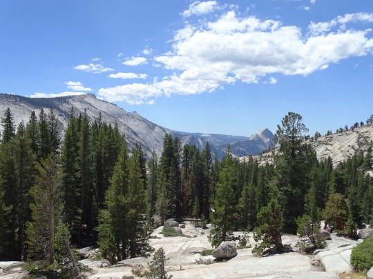


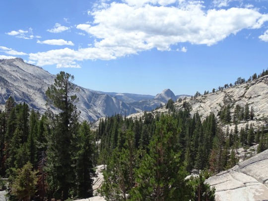

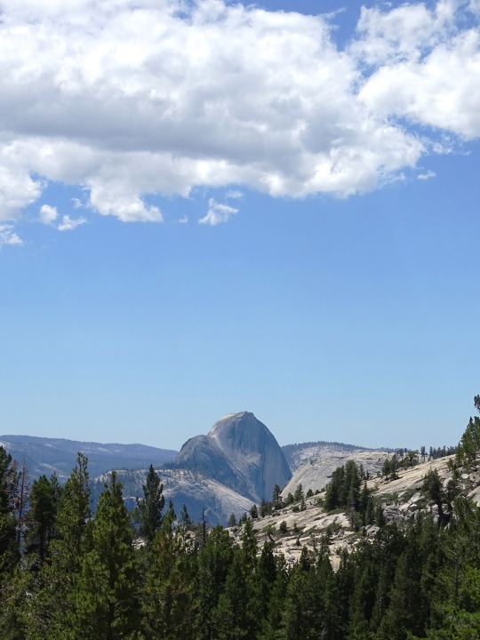
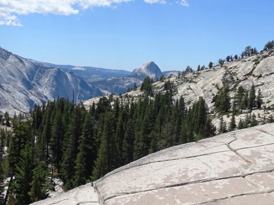

Yosemite National Park, CA (No. 9)
Clouds Rest is a mountain in Yosemite National Park, located east-northeast of Yosemite Village, California. Although there are many peaks in the park having far greater elevation, the proximity of Clouds Rest to the valley gives it a very high degree of visual prominence.
The summit can be reached by a 7.2-mile (11.6 km) trail hike from Tioga Pass Road or a 13-mile (21 km) trail hike from Happy Isles by way of Little Yosemite Valley. There are also several technical routes available.
Clouds Rest is an arête; a thin, almost knife-like, ridge of rock formed when glaciers eroded away solid rock to form Tenaya Canyon and Little Yosemite Valley. The northwest face, mostly solid granite, rises 5,000 feet (1,520 m) above Tenaya Creek.
Lafayette H. Bunnell, a medical doctor with the Mariposa Battalion, notes that his party named the summit Clouds Rest because they returned to camp to avoid a snow storm after seeing "the clouds rapidly settling down to rest upon that mountain."
Source: Wikipedia
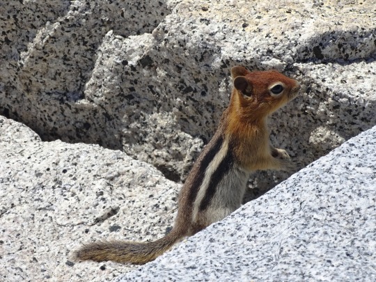
#Golden-mantled Ground Squirrel#Yosemite National Park#Sierra Nevada#Mono County#geology#flora#California#summer 2022#tourist attraction#landmark#landscape#countryside#USA#nature#forest#woods#fir#pine#rocks#travel#original photography#vacation#granite#blue sky#clouds#alpine lake#Olmsted Point#trail#Clouds Rest#Half Dome
1 note
·
View note
Text
Coconut Creek, FL: Your Ultimate Vacation Destination

Are you looking for the perfect getaway that combines natural beauty, outdoor adventures, and a touch of relaxation? Look no further than Coconut Creek, FL! Nestled in the heart of sunny South Florida, this charming town is quickly becoming one of the best vacation destinations for travelers seeking a diverse and unforgettable experience.
Coconut Creek offers a unique blend of outdoor activities and cultural attractions. The city is home to the beautiful Butterfly World, the largest butterfly aviary in the world, where you can immerse yourself in the vibrant colors of thousands of butterflies. For nature enthusiasts, the Fern Forest Nature Center boasts serene hiking trails and a chance to encounter Florida’s native wildlife.
If you’re a golf enthusiast, Coconut Creek has you covered with some of the finest golf courses in the area. Enjoy a round of golf surrounded by lush landscapes and warm, tropical breezes.
So, whether you're into outdoor adventures, cultural exploration, or simply lounging on the beach, Coconut Creek, FL, has something to offer every traveler. With its perfect blend of natural beauty and cultural attractions, it's no wonder that Coconut Creek is quickly becoming the ultimate vacation destination.

Your kitchen is the heart of your home, and choosing the right kitchen cabinets can transform it into a space that exudes elegance and modernity. When it comes to kitchen cabinets, White Shaker Kitchen Cabinets are a timeless choice that can elevate the aesthetics and functionality of your kitchen.
White kitchen cabinets are known for their clean and sophisticated look. They brighten up any kitchen, making it feel more spacious and inviting. The Shaker style, characterized by its simple, clean lines and recessed panel doors, adds a touch of classic charm while remaining incredibly versatile for various kitchen designs.
These cabinets are not just about aesthetics; they also offer practicality. The Shaker design provides ample storage space and a timeless appeal that will never go out of style. Whether you have a traditional or modern kitchen, White Shaker Kitchen Cabinets blend seamlessly with any decor.
Pairing White Shaker Kitchen Cabinets with granite or quartz countertops is a match made in heaven. Granite countertops bring natural beauty and durability, while quartz countertops offer a sleek and low-maintenance option. The combination of white cabinets and stone countertops creates a stunning contrast that can make your kitchen the focal point of your home.
In conclusion, if you’re looking to enhance your kitchen’s beauty and functionality, consider White Shaker Kitchen Cabinets paired with granite or quartz countertops. Their timeless elegance and versatility make them a top choice for homeowners seeking a modern and stylish kitchen. We hope this article is helpful for you, and you may consider White Shaker Kitchen Cabinets for your next kitchen renovation project.
White Shaker Kitchen Cabinets
2875 S Congress Ave Suite H, Delray Beach, FL 33445
(561) 430–4867
youtube
0 notes
Text
2023 A Year in Review:
Skating on Ken's Lake // pickup hockey // brisk mornings
Work at Mill Creek Animal Hospital // puppy kisses and sad times
Trashion show // all the friend makeouts
Lake Powell trip- North Wash to Trachyte with Hannah, Jeff C and Mike C // mud tussocks and giggles
Bad box bleach set + teal manic panic beauty school drop out with Nara
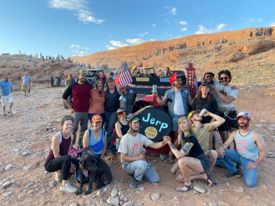
Jerp art performance at Jeep Week with Sam N + Moab crew
Julie visits Moab in the spring - surprise Jocelyn addition // San Rafael packraft with pups on spring's first flows
Hallie visit to Comb Ridge with Ryland // quiet nights and pottery sherds
Dolores River flowing! First overnight trip with Hannah, Jeff C and extended Alpacka crew. Euro fondu pot // dogs are angels
Solo Escalante float with Sprocket dog // four days of peaceful low flow jubilation
Learning from strange crushes // rejection is sexy and toxic
Ongoing plant identification in the La Sals // superbloom!
A wonderful season of work: Hammond Canyon with Wilderness Volunteers// SUWA projects// two long bridges// Trail Mix buddies// not enough alone time// all the log outs - Luke, Jacob, Rachel and Isaac
Muddy Creek with Zoe, Maddie and Olivia // slot canyon babes
Long solo and friend gravel rides
Sold the house // feelings of loss and longing, but also relief
APA RoundUp paddle trip to California with Duncan// feeling obsolete in the packraft ww world//solo hike in Trinity Alps to granite heaven
Muumuus and Mimosas- my 6th annual?
SLC city weekend seeing Remember Sports, thrifting, and mountain biking with Maddie, Audrey and Rachel
Sold the Toyota Pickup // lost identity
Montana Red Meadow Pass bikepacking loop with Maddie and Olivia // perfect temps and champagne gravel// fill your belly of berries
Birthday backpack in the Weminuche// 15 miles in 5 days with the old furball// learn to enjoy the pace and place// anniversary photos
Julie returns to Moab for late summer! Hot hot biking//water daze
Mom and pop visit in the early fall//coworker end of season farewell bbq//beautiful mountain colors//comb ridge camping
Elk packet with Jamie and Sam H // 24 mile roundtrip with a rear quarter // humans are meant to do this
Solo trip of favorite landscape linkup // Dark Canyon -> Cataract Canyon -> Henry Mountains -> Lake Powell -> Bears Ears hike/packraft/bikepack/bikeraft linkup
San Juan packraft trip with Hannah and Jeff C + his college buddies// Han's bad back and chilly temps// good company
A quick shot to the very rainy PNW coast// surfin', soggy and splashin' with jellyfish//Julie, Will, Pete, Nara, Xander and pups
Early backcountry ice at Clark Lake! Jonny and Ian hike-in mission
RAR intro to bikepacking weekend was a smash hit// new SLC bike buddies//love the feeling of teaching and sharing knowledge
Home right before Thanksgiving, off to Costa Rica! Solo bikepack along the Nicoya Peninsula surfing all along the way.
Christmas in Detroit to the New Year
Books Read:
"Grievers" by adrienne maree brown
"Black Sun" by Rebecca Roanhorse
"The Solace of Open Spaces" by Gretel Ehrlich
"Teaching a Stone to Talk" by Annie Dillard
"Fire on the Mountain" by Terry Bisson
"Earth Apples" collection of poetry by Ed Abbey
"Children of Time" by Adrian Tchaikovsky
"Killers of the Flower Moon" by David Grann
"Let My People Go Surfing" by Yvon Chounard
"You Just Need to Lose Weight and 19 Other Myths About Fat People" by Aubrey Gordon
"Braiding Sweetgrass" by Robin Wall Kimmerer


0 notes
Text
Top 10 Unisex Travel Backpacks for Every Adventure
When it comes to wanderlust, having the perfect travel companion can make all the difference. Unisex travel backpacks have become a popular choice among adventurers, offering a blend of style, comfort, and functionality suitable for every journey. At Uppy Bags, we understand the importance of finding the ideal travel backpack, and we've curated a list of the top 10 unisex travel backpacks that cater to diverse needs.
Osprey Farpoint 40: Designed for both urban exploration and backcountry trekking, the Osprey Farpoint 40 combines durability and versatility, making it an excellent choice for any adventure.
The North Face Borealis Backpack: The North Face Borealis is a unisex backpack that seamlessly transitions from city streets to mountain trails.
Eagle Creek Global Companion: With a focus on organization and security, the Eagle Creek Global Companion is perfect for those who need a reliable companion for international travel.
Patagonia Arbor Grande: Blending sustainable materials with a stylish design, the Patagonia Arbor Grande is a unisex backpack that's as eco-friendly as it is functional.
Deuter Transit 50: Ideal for longer journeys, the Deuter Transit 50 offers ample storage space and a comfortable carrying system, ensuring a smooth travel experience.
Arc'teryx Brize 25: For day trips and short getaways, the Arc'teryx Brize 25 stands out with its minimalist design, lightweight construction, and durable materials.
Timbuk2 Wander Pack: With a focus on easy access and organization, the Timbuk2 Wander Pack is a unisex backpack that caters to the needs of both urban explorers and outdoor enthusiasts.
Cotopaxi Allpa 35L Travel Pack: the Cotopaxi Allpa 35L Travel Pack is perfect for those who want to make a statement while exploring the world.
Granite Gear Crown 2 60L:, the Granite Gear Crown 2 60L is a unisex backpack designed for backpackers and hikers seeking durability and comfort.
Conclusion:
At Uppy Bags, we believe that your journey deserves the best, and these top 10 picks combine style, durability, and functionality to ensure you're ready for every adventure that comes your way. Explore our collection at www.uppybags.com and embark on your next journey with confidence.
0 notes
Text
March 2024 Mangum Dental Hike of the Month
Hyde Mountain Trail #6 Fire Lookout Tower
Prescott, Arizona
Distance: 4.4 miles round trip
Elevation Gain: 1500 feet ( The elevation of Hyde Mountain is 7,272 feet and the highest point in the Santa Maria range)
Difficulty: Moderate to High
Parking: No fee
Directions: From Outer Loop Road and Williamson Valley Road, head North on Williamson Valley Road for 13 miles. Turn left on Camp Wood Road, continue for 15.4 miles to FR95, and turn right. Continue for 0.2 miles to FR95C, turn left, and continue 2 miles to the trailhead.
This hike combines a full-day adventure to parts less traveled and a breathtaking 360-degree view of our beautiful surroundings including Sedona, Humphreys Peak, and Granite Mt. However, it is not for the faint of heart, less experienced, or pavement-only drivers! It has a consistent vertical grade, many loose rocks along the trail, and is best accessed with a crossover, SUV, or pickup truck. Nonetheless, for those up to the challenge, the rewards are abundant: a beautiful drive, incredible views, and a huge sense of accomplishment!
The start of this hike is at the end of FR9825C. The trailhead is well marked but may take a moment to find it at the beginning. Once on the trail, it is well-worn and is shared by off-road motorcycles so watch the ruts. The trail is an uphill climb and maintains a steady upward grade throughout the hike. Keep an eye out for interesting geology and past efforts to supply the lookout tower. At about the 1-mile mark, you will come to a livestock gate followed by a trail crossroads. After passing through the gate we encountered several cattle during the rest of the hike. The next half-mile is under the tree canopy and crosses a seasonal creek that may pose a hazard during heavy inclement weather. As we emerged from the trees, the views continued to astound and spurred us to the top. Communication antennas came into our view and eventually the lookout tower. After the upper saddle sign, the trail is not as well-defined and wide, but still distinguishable. Once at the top, the rewards were both an emotional sense of triumph as well as a circumferential view that was stunning and magnificent.
Mangum Dental has been serving the Prescott-area dental needs since 1978. We strive to provide exceptional patient care while rendering outstanding compassionate service.


1 note
·
View note
Text
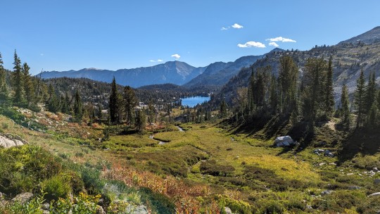
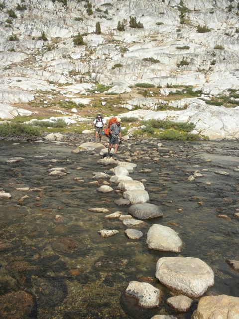
Eagle Cap Circumnavigation (3/4)
I woke up on Mirror Lake feeling like I'd gone to bed too late and woken up too early. It had been a quiet enough night, and I had certainly been tired enough, but I'd struggled to stay asleep throughout the night anyway. I drug myself up and out of the tent as the first rays of light hit the granite slabs around me and started packing things up. As I packed up and prepared myself for another long day of trekking through the wild Wallowa country, I was finally able to take time to really appreciate everything that I'd seen and done the previous day.
It's been my experience that the longest days in the wilderness are usually the most memorable, but also the ones that don't leave you a lot of time for reflection at the end of the day. Now, pausing for a few minutes over a cookpot full of oatmeal, it was wild to think that I'd started the previous day all the way back at Crater Lake, navigated two stunning passes, saw six alpine lakes, and slept at Mirror Lake, all with the rest of the Wallowa range ringing me around, lumbering across the skyline every time I climbed up high enough to see.
I had a choice to make before I left camp: did I follow the East Eagle Trail up and over the west shoulder of Eagle Cap and then down the south side of Horton Pass? Or did I take the longer route over Ivan Carper Pass, past Minam Lake, and then over Frazier Pass? In both cases, I knew part, but not all of the route. I'd hiked up to the top of Horton Pass from the north three times before - it's the standard route to the summit of Eagle Cap - but I'd never continued down the other side of the pass. Lindsey and I had hiked over Ivan Carper Pass and down to Minam and Blue Lakes before, too: but we'd turned around and returned to a base camp in the Lakes Basin instead of continuing further south. Either route would be a mix of the familiar and the unfamiliar. Either route would eventually get me to Hidden Lake: it was a question of how hard I wanted to work for it.
Ivan Carper Pass was one of Lindsey's favorite places, and a part of me felt like I should observe her absence from this trip by climbing up there and taking in the view in her place. That, and thinking back to and being energized by thoughts of the previous day's adventure ultimately motivated me to take the long way, via Minam Lake.
As you exit the Lakes Basin to the west, the trail almost immediately takes on a more rugged character, and you can see in front of you the ridge you eventually need to surmount. It's an intimidating way to start your day, to say the least.

One of the things that makes Ivan Carper Pass another of my favorite spots in the Wallowas is that it's the only pass that gives you an unobstructed view down into the Lakes Basin. As gorgeous as Glacier Pass is, the north side is mostly in the trees and never really gives you the opportunity to see the full sweep of the basin. Horton Pass provides some amazing views back down the Lostine and Hurricane drainages, but the bulk of Eagle Cap blocks your view east for the most part. The only other place to view the entire basin in its full beauty is from the summit of Eagle Cap and, while that summit would have been a relatively minor "side trip" for me at this point, I was, for once, going to pass it up in exchange for a wider circumnavigation. So, I'd have to "settle" for the view from Ivan Carper Pass.
The higher you climb, the more some of the most impressive peaks in the range come into view, including the Matterhorn. There are very few alpine climbing experiences in Oregon that can beat camping at Ice Lake and then scrambling up the limestone shoulders of the Matterhorn. I've done this twice now and hope to do it again someday. I took a minute to reflect on my previous climbs as the summit came into view to the northeast, hanging over the Hurricane Creek drainage like a huge, white knife.
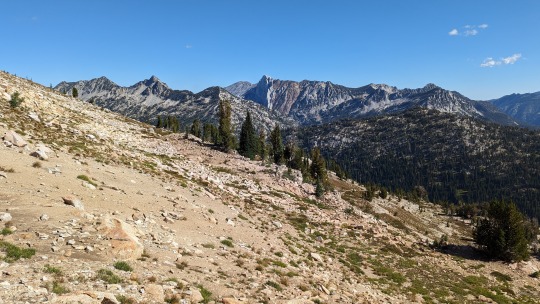
I reached the top of the pass quickly enough (early morning energy, I guess?), and though the view to the west is a bit obscured by trees, it's still a great glimpse into this slightly-less-popular corner of the Wallowas, including Brown Mountain (it's the brown one) and gorgeous Blue Lake (in this photo, hovering just left of center).

Lindsey and I had dayhiked to Blue Lake previously and found it to be a wonderful potential future camping spot. Fixed on getting to Hidden Lake today, though, I'd be bypassing the spur trail that led up to it to save myself a few hours of hiking.
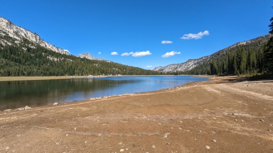
The descent down the west side of Ivan Carper Pass is pretty straightforward, and before too long I was taking a longish break at Minam Lake. Another reservoir, it's beautiful nonetheless, and easy to access when you have an empty bottle you want to fill before a long water-less stretch of hiking like the one I was facing down.
While I was sitting on a log and snacking in the trees just above the lake, another solo hiker came absolutely crashing down the trail. I think he was surprised to see me where I was, and he immediately turned and disappeared down the trail to the south. This would not be the last time we crossed paths, but it was definitely the funniest.
I continued south, along the Minam River, for a few miles. When I passed the intersection with the Blue Lake Trail, I was once again in uncharted territory (for me, at least). The walls of the valley were painted with fall colors, and I took some time to enjoy the new-to-me views while the terrain was relatively straightforward.

At first, I thought I'd missed the turnoff to Frazier Pass because I'd been distracted by the views. After doubling back and forth a few times, though, I came to the conclusion that I'd missed the turnoff because there was no turnoff.
About this time, the hiker who'd crashed past me earlier came back into the picture. He, too, was struggling to figure out how to find Frazier Pass. How hard could it be to find? It was a whole pass, after all. But neither of us could manage it. We took turns tromping through off-trail marsh, calling out directions to each other, falling into that comfortable strangers-helping-strangers behavior that seems automatic in the wilderness and doesn't seem to exist at all much anywhere else.
Eventually, after a solid twenty minutes or so of wandering, we managed to identify a trail that seemed to lead to the pass about a quarter mile past where the marshes had (it seemed to me, at least) eaten any sign of a turnoff from the main Minam River Trail.
Now, Hawkins Pass was difficult but beautiful. The same with Glacier Pass and Ivan Carper Pass. On previous trips to the Wallowas, I would have said the same about Polaris and Tenderfoot Passes. Frazier Pass was a muddy, hot, difficult-to-follow mess that resembled a game trail on the west side more than a developed human trail. The grade, in many places, was so steep that it was hard not to fall over backward. I leaned over further until my pack was almost directly on top of me and dug in.
I'm sure part of the difficulty here was just my flagging energy after days of climbing and hiking further than I was used to. But another part was definitely the looseness and steepness of the trail. Say what you will about the rugged Wallowas, the trails themselves are almost always straightforward (except for the occasional human error, as I'd made earlier in the trip). Frazier Pass was not that. Frazier Pass reminded me of some of the "off-trail" routes I'd scrambled in the Trinity Alps. It was hard, and what was worse, when I reached the top there was no real view at all, just a steep drop down into the next valley.
The descent here wasn't much better than the ascent had been: the extremely steep, loose trail led to me tweaking my right ankle twice, and slipping and nearly falling down at least ten times before it finally leveled out a bit and gave me a bit of a view out ahead.
Eventually, I reached the creek at the bottom of the valley (I thought this was East Eagle Creek, but my map doesn't give it a name), and it was, finally, easier going for the last bit before the turnoff to Hidden Lake. This meadow-like terrain was something I'd be seeing a lot more of on my way out tomorrow.
Because I hadn't had enough routefinding challenges already, where the turnoff to Hidden Lake was supposed to be was a huge tangle of crushed, twisted, and broken trees. It was clear that an avalanche had ripped through here during one of the last few winters. Forest Service rangers with saws had clearly attempted to clear it at one point, but it looked hopeless. Instead of simply crossing the creek and proceeding up the Hidden Lake trail, I spent fifteen minutes or so following various game trails and (probably) improvised human trails before finding a way across the creek and then up and around the fallen trees. The actual Hidden Lake Trail was, blessedly, waiting for me.
It would be another 800 foot climb up to the lake's basin. At this point, not entirely sure it was possible to be more tired than I was, shrugged and started climbing. This section of trail actually reminded me quite a bit of the hike up to Ice Lake, below the Matterhorn. It was a beautiful alpine amble, with the "backsides" of Hawkins Point and Glacier Peak as a backdrop...unfortunately, lost in my thoughts and the view, I didn't really take any photos of this section.
I had originally considered stopping for the night at Moon Lake, a picturesque, smaller lake a few hundred feet below Hidden Lake. By the time I got to Moon Lake, though, I was fully in the zone and felt that to stop even for a minute at that point would mean not starting again until the next day, so I kept on, pushing up a few final switchbacks that led into the massive and impressive Hidden Lake basin.
Even in September, this basin was laced with small, running streams: some were outflows from the lake itself, while others seemed to just be fed from snowmelt that ran down from the surrounding peaks.
I wandered for awhile, taking in a place that was in many ways unlike the areas of the Wallowas that I already knew, but still had that glacier-scooped quality to it. Above all else, the basin felt wild to me in a way I couldn't put my finger on. This would turn out to be an accurate enough impression, but we'll get to that.
Even by my standards, I spent a long time casing the lake and its environs for a good camping spot. While there were lots of spots around, none of them were particularly flat or particularly protected, and all of them looked like they weren't frequented often by humans.
Eventually, I settled on a spot to the east of the lake proper, in the midst of a stand of pines that towered over my tent spot like a huge teepee. I had a view from there across the meadow and the lake to the cirque wall to the west. I settled into my evening routine, stopping time and again to enjoy the views.
Then, right as I sat down on my crash pad to enjoy a pre-dinner snack, the earthquake started.
At least that's what I thought it was at first: an earthquake. It turns out that when four six-hundred-pound elk cows come dead-sprinting into the meadow you're camping in, it feels a bit like an earthquake.
I've seen elk in the wild before, but only a few times, and only briefly: usually, I get a glimpse as they're running from me and that's it. These cows, however, weren't running away from me, they were running toward me. Then they stopped just on the other side of the lakelet in front of me.
They were maybe fifty feet away from me at this point, and hadn't seen or smelled me yet. Ignorant of my presence, the four cows started playing with each other, spinning and leaping in place, until two of them eventually started playing what looked very much like a game of tag. I've never seen animals so large move so fluidly and in such a playful way. I was awestruck. At this point, I want to describe the scene in some poetic or allusive way, but it's more direct to just say that it was one of the most incredible things I've ever seen. I was so stunned, as a matter of fact, that one of the elk managed to splash her way through the lakelet to about twenty-five yards away from me before I realized I should probably do something.
I know nothing about elk behavior, but I knew it would likely be bad to let the elk get surprised by my presence while at close range. Not wanting to ruin the incredible tableau, I hesitated for a moment, but by then the lead elk was within about fifteen yards and it felt like I was about to be in trouble. Slowly, with my arms above my head, I stood up and said "Hey." She saw me right away and reacted about how you'd expect an elk to react: she stopped dancing through the water, gave me a look that seemed to say "Yeah, so what?" and then slowly walked back through the lakelet to the other elk. All four of them conspicuously turned their backs on me before walking off into the trees, as though to say "We're leaving, but only because we feel like it."
Once into the trees, all four elk started galloping again. The branches breaking under their hooves sounded like gunshots.
I stupidly sat back down and tried to return to my snack after this, but was quickly interrupted again. Because it was September. Rutting season. And here came the bulls.
They were a good ten minutes behind the cows, but also clearly what the cows had been running from when they burst into the meadow in the first place. Luckily, I heard them before I saw them. If you know what an elk bugle sounds like, it's a highly effective warning. If you don't know what an elk bugle sounds like, you're liable to think the Ringwraiths have come to deliver Sauron's wroth. Fortunately, I had enough experience with elk to recognize the bugle. Shortly after, two enormous bulls came into the meadow from the same direction the cows had come from.
The bulls were similarly awe-inspiring, but they were not in a playing mood, and they were clearly aware of me right away. Not knowing much about elk behavior and aware that I was, in some sense, intruding unintentionally on their mating dance, I did what seemed best: I took a walk. I got up again, and headed west along the lake at a decent clip, planning to just let the scene play out and to return to my camp after it was all over.
The upshot to this little walk was that I got some amazing views of the meadow in the early-evening light, and by the time I got back to my camp, the bulls seemed to have moved on.
For obvious reasons, it was a long time until I fell asleep that night. I had seen something incredibly special, but the experience also confirmed for me the wildness of the place where I'd chosen to pitch my tent. Every time a deer passed near my tent for the rest of the night, I jumped, imagining an elk or something even bigger just outside the tent in a way I haven't for years. I woke up multiple times to the sounds of elk bugling in the dark to the east, below the lake basin.
All in all, the rough night of sleep was more than a fair trade for getting to see the elk in action, but it was going to be a sore difficult slog back to the car the next morning. I started wondering if it would be better to call it a wrap after this amazing (and amazingly challenging) backpack and head home without driving to Strawberry Mountain.
#traveling#hiking#backpacking#the wallowas#photos#camping#eagle cap wilderness#mountains#eastern oregon
0 notes
Text
A Sierra Storm
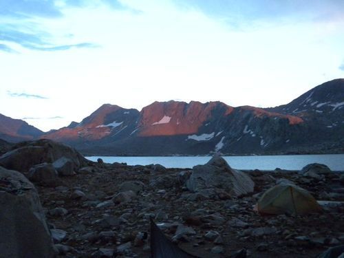
This past week in Northern California has been unsettled with nightly thunderstorms in the mountains. After a quiet fire season, we are now dealing with several dozen fires. While I am not in the mountain now, it made me think about some prior lightning encounters.
A summer storm in the Sierra is hardly a unique mountain experience. Yet I find them disconcerting … underscoring our vulnerability and insignificance. I’ve been known to make promises in the midst of the alpine pyrotechnics that I still need to make good on. This story shares one particular episode just north of Muir Pass, on the stony shores of Wanda Lake.
RH
The National Weather Service calculates that my odds of being struck by lightning any given year is literally one in a million. Just about the same as my odds of winning a gold medal in the Olympics. As I sat tucked on my Thermarest pad trying to minimize any direct contact with the ground, I could feel the tension throughout my body. My racing heart, shallow breathing, and knotted stomach. Another flash illuminated the tent followed almost immediately by the demoralizing explosion of thunder. Our little foxhole felt so incredibly vulnerable.
Flash. BOOM.
I stole a glance at Howard and Jim. We were each mouthing the numbers as we counted between the flash and the thunder. For a while we had been able to count and joke. For the past eternity – perhaps ten minutes – we were happy to get to “1001” or “1002”.
Flash. BOOM.
A little longer. Maybe the storm is passing. Several rumbles chase each other down the valley, tripping and tumbling as they go.
Flash.BOOM
My body tightened. I just hoped that it wasn’t my time yet. You have to be fatalistic in these storms. You are completely powerless. Impotent. A minor actor on an immense stage.
We had started early to make the first climb into Evolution Valley in the cool of first light. That seemed so long ago now. We made steady progress as the trail paralleled that series of beautiful meadows that follow the meanders of Evolution Creek. After some half dozen miles of this leisurely stroll the trail climbed steeply into another hanging valley, the Evolution Basin. We made an extended stop at Evolution Lake to do laundry and wait out the most intense part of the day. At 10,800’, trees are scarce and the sun fierce. Through the mid-afternoon the skies had remained perfectly clear offering no hint of things to come.
Grey granite walls touch
Translucent blue waters that
Reflect the heavens.
Flash… 1001 … 1002 … 1003 … BOOM
The lightning and thunder brought me out of my reverie and back to the present. I stretched my legs quickly and pulled the sleeping bag around me to preserve the warmth. This was the quiet between. The waiting.
Flash … 1001 … 1002 … BOOM
Flash. 1001 BOOM
“Damn,” I muttered. Jim suggested that we should count faster.
As we had passed Sapphire Lake I can remember thinking, as I eyed the skies, “Probably not the best time to be heading into such an exposed world.” Ah, the wisdom of hindsight.
About 6:45 p.m. we topped the bench that dams Wanda Lake. Just, and I mean precisely at that moment, as we took our packs off the rain began. The first few drops gave us the illusion that we had ample time to select a suitable tent site. That was not the case.
Almost immediately the rain transitioned from drops to sheets and with it a chilling wind swept across the lake. The rocky landscape offered little protection and a few totally inadequate tent sites, ones we would have scoffed at any other time.
The leader of a Sierra Club outing group camped nearby amidst a jumble of rocks, motioned to us that there was a flat space near them. Even as efficient as we were at erecting the tent after more than a week on the trail, we were pretty wet by the time we had the tent up and packs somewhat protected. Then the lightning had begun.
In this high country
With lightning in a barren land
I feel so naked.
Frankly there is little I find more terrifying in the high country than lightning, that massive electrostatic discharge caused by unbalanced electric charge in the atmosphere.
“Separate,” yelled the Sierra Club trip leader.
Flash BOOM.
We huddled in the tent. The thunder reverberated off the surrounding peaks. It was the hall of the mountain king with tympany pounding and cymbals crashing. The rain alternated sleet, hail, and rain. I took my sleeping bag and dry clothes from my pack sheltered (somewhat) in the vestibule. Jim and Howard’s resources were under pack covers well outside the tent. We put on my clothes and covered our legs with the sleeping bag as the temperature dropped. The sweat and precipitation that had dampened us, now began to chill us . The wind buffeted the tent bending the tent wall toward us.
Flash… 1001 … 1002 … BOOM.
We waited.
Flash … 100BOOM
Too close.
Fortunately, the whole episode lasted about an hour. Not an atypical Sierra storm. It was twilight by the time the storm was spent. In the waning evening light we made a quick dinner, appreciated the illuminated peaks around Wanda Lake, and watched (rather ironically) the stars as they appeared. No cards tonight. Perhaps a few prayers.
2 notes
·
View notes
Text
Beautiful 3BD 2BA Home For Sale in League City
https://www.realtybymonica.com/2023/10/02/beautiful-3bd-2ba-home-for-sale-in-league-city-2/

Welcome to this beautiful well-maintained home with an open floor plan that is perfect for entertaining. It boasts covered front AND back patios, allowing for relaxation and entertainment opportunities. The kitchen features granite countertops, stainless steel appliances, breakfast bar, and ample cabinet space.The Living Room features a fireplace, engineered hardwood floors, and crown molding that adds to the home’s appeal. The study is complete with French doors that offers versatility as it can easily be converted into a fourth bedroom. One of the highlights of this property is its location and has no back neighbors. In addition to this, a storage shed in the spacious backyard provides ample room for all your storage needs. Walking distance to acclaimed Clear Creek Independent Schools and you’ll also have access to fantastic neighborhood amenities, including a refreshing community pool, park, splash pad, and miles of scenic walking trails surrounding the beautiful lakes of Tuscan Lakes.
0 notes
Last Seen Blogs

thesmilecorner
★[js]★

nomeniko
mostly milgram

darthsofa
Untitled

ndrcw-blog
it's locked

vincent-razzo
Smoke and Mirrors