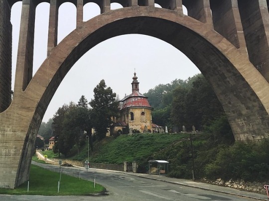
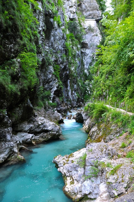
#krnsko
Photo

Noch paar Bilder aus der Skoda Stadt Mlada Boleslav und Krnsko.😊👍🏻(08/09.10.2022) #krnsko #abarth #puntoevo #fiat #mladaboleslav #skoda #skodaauto #škoda #czech #weekend #travel #wochenende #viadukt #krnsko #jungbunzlau #reise #schön #look #great #historisch #history # (hier: Mladá Boleslav) https://www.instagram.com/p/CjgA04uN6Fk/?igshid=NGJjMDIxMWI=
#krnsko#abarth#puntoevo#fiat#mladaboleslav#skoda#skodaauto#škoda#czech#weekend#travel#wochenende#viadukt#jungbunzlau#reise#schön#look#great#historisch#history
0 notes
Text

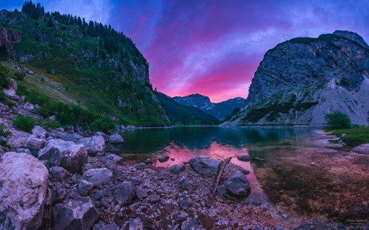
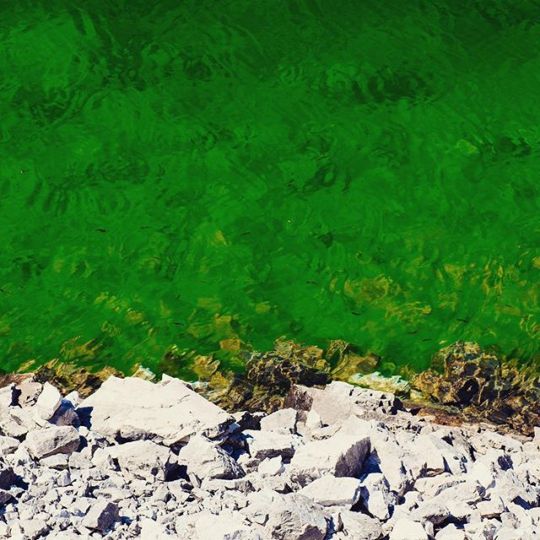
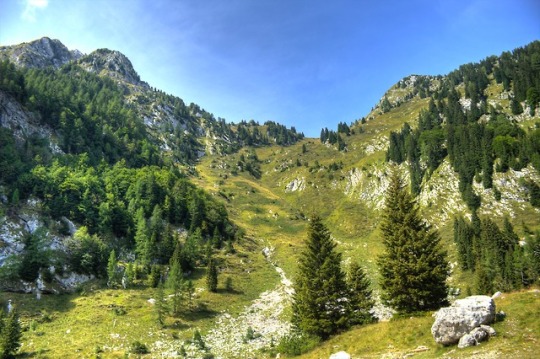
Colorful Summer Sunrise on Krnsko Lake, Slovenia by Nikolai Sapronov
#sunrise#mountains#lake#vibrant#colors#sky#clouds#summer#travel#landscape#nature#naturecore#curators on tumblr#uploads#slovenia
5K notes
·
View notes
Photo
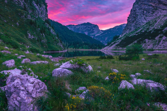
#slovenia#slovensko#mountains#krnskojezero#krnsko#julian alps#fuji#xf10#fujixf10#fujifilm#summer#hiking#trekking#triglav national park
58 notes
·
View notes
Photo

ČD_475.101_Krnsko_Central Bohemia_Czechia by ferdahejl https://flic.kr/p/2j4Gd6a
0 notes
Photo


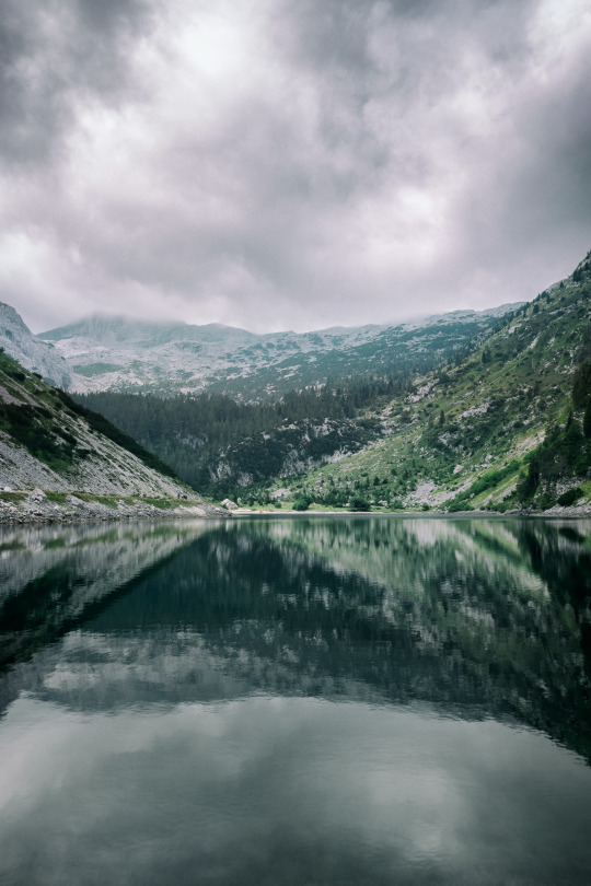
LAKE KRN (Slovene: Krnsko Jezero), Slovenia - situated at an elevation of 1,391 meters in the Triglav National Park, Lake Krn is well worth visiting in the winter when it's so calm and tranquil. (photos: Teddy Verneuil)
17 notes
·
View notes
Video

flickr
754.049-5 ČD, Os 9500, Chotětov – Krnsko by Jan Fabián
0 notes
Photo
Natural pattern.⠀ krnsko lake⠀ °⠀ °⠀ °⠀ °⠀ °⠀ °⠀ °⠀ °⠀ °⠀ °⠀ #krn⠀ #krnskojezero⠀ #slovenia⠀ #slovenija⠀ #bepslabor⠀ #WintersVibez⠀ #creativecontentbuilders ⠀⠀ #igslovenia⠀ #slovenia_ig⠀ #ifeelsLOVEnia⠀ #slovenia360⠀ #thisisslovenia⠀ #visitslovenia⠀ #topsloveniaphoto⠀ #sloveniawithlove⠀ #instatalent⠀ #artofvisuals⠀ #patterns⠀ #textures⠀ #designinspiration⠀ #texture⠀ #patterns⠀ #naturetextures⠀ #natureshots⠀ #naturescolors⠀ #colorsofnature⠀ #naturetextures⠀ #patternsbynature⠀ #naturalpatterns http://bit.ly/2QAOOIn
0 notes
Photo
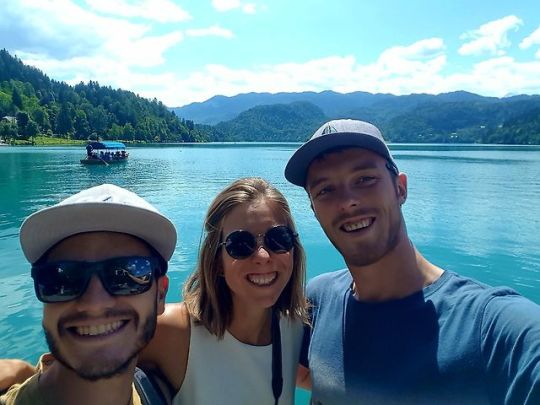

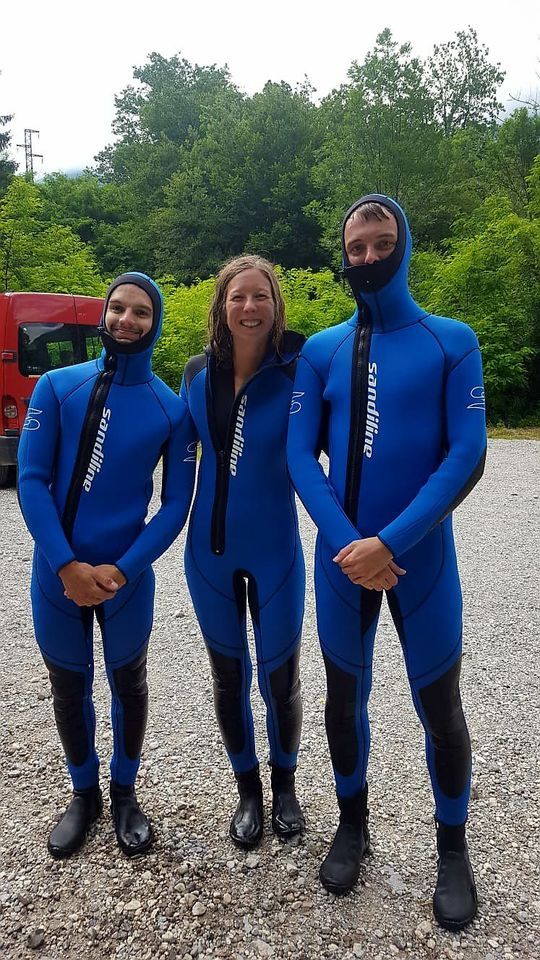

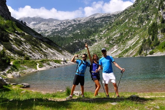

18-24/06/18 Lacs Bled et Bohinj, parc Triglav et montagnes de Slovénie
Une semaine bien remplie dans la nature de Slovénie avec mon frère Eliot qui nous rejoint pour quelques jours de kayak, canyoning, petites rando sympas et initiation au voyage en van ;)
On visite surtout le nord ouest du pays, la ou se trouve le parc national Triglav, toutes les rivières sont magnifiques, on a beaucoup de chance avec la météo et les slovènes sont très sympas. Bref, c’était top !
0 notes
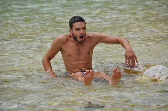
Photo


Une journée qui commence mal. Ce matin on décide de rejoindre un parking pour randonner en direction du lac de Krnsko Jezero. En voulant nous garer, nous restons coincés sur place, la roue avant droite enfoncés dans un mélange de terre meuble et de cailloux pointus. Heureusement, des slovènes qui travaillaient sur des bâtiments non loin sont venus à 6 pour nous débloquer ! Suite à quoi, nous avons trouvé une petite place un peu plus bas sur du bitume et à plat. Notre pneu a tout de même souffert dans la bataille puisqu’il est maintenant entaillé… Pour l’instant ça roule !
Au final nous avons pu commencer la randonnée aux alentours de midi. Après 700 mètres de dénivelés positifs (heureusement notre séjour à La Réunion nous avait préparé à ce genre de randonnées), nous arrivons dans un hameau niché au creux des montagnes.. Nous traversons une vallée pour atteindre le lac. Celui-ci est le plus haut lac de Slovénie. La vue magnifique accompagne notre repas.
0 notes
Text
Ve středu 2. října krátce po 16. hodině přijala tísňová linka středočeských hasičů oznámení o zavaleném dělníkovi v hlubokém výkopu pro kanalizaci v obci Krnsko na Mladoboleslavsku.Operační důstojník na místo vyslal jednotku ze stanice Mladá Boleslav – velitele čety, prvovýjezdovou cisternu s lezeckým přívěsem, lezeckou skupinu a automobilový nosič kontejnerů se speciálním kontejnerem s technickými prostředky na stabilizaci.
systém pro zásahy při závalech a pro stabilizaci staticky narušených staveb
Ve Středočeském kraji je vybudován systém pro zásahy při závalech a pro stabilizaci staticky narušených staveb. Stanice Mladá Boleslav je jednou z pěti speciálně vybavených stanic v kraji. Technický kontejner s bednícími deskami, trámy, stabilizačními tyčemi, lany, nářadím a dalším nezbytným vybavením byl zařazen do výjezdu v květnu roku 2018.Zároveň byl poplach vyhlášen také dobrovolným hasičům obce Bezno. Operační důstojník prověřoval i možnost nasazení sacího bagru ze Záchranného útvaru HZS ČR nebo místních soukromých společností. Současně s hasiči k události vyjela Policie ČR a zdravotnická záchranná služba, která na místo povolala také vrtulník.
Před příjezdem hasičů se snažili zavaleného muže vyprostit jeho kolegové. Velitel zásahu po příjezdu na místo konstatoval, že dostupnou těžkou techniku není efektivní povolávat. Rozhodl o nouzovém zajištění výkopu a ručním vyprošťování zraněného. Hasiči na dně výkopu muže po celou dobu záchranných prací resuscitovali. Po více než půlhodině mimořádně fyzicky namáhavé práce měl dělník vyproštěnu horní polovinu těla a jednu nohu. Přes maximální nasazení všech zúčastněných lékař před půl šestou konstatoval úmrtí.
This slideshow requires JavaScript.
Hasiči dokončili stabilizaci výkopu a muže zcela vyprostili. Následně tělo ohledal koroner a Policie ČR. Člen týmu posttraumatické péče HZS Středočeského kraje na místě mimořádné události poskytoval první psychickou pomoc kolegům zesnulého.
Před 21. hodinou bylo místo předáno stavební firmě, která zabezpečila okolí výkopu. Hasiči se pak vrátili na základnu. Okolnosti a příčinu vzniku této tragické události vyšetřuje Policie ČR – útvar Služby kriminální policie a vyšetřování.
kpt. Ing. Jaroslav Gabriel
HZS Středočeského kraje
Zavaleného dělníka zachraňovali mladoboleslavští hasiči se speciální technikou Ve středu 2. října krátce po 16. hodině přijala tísňová linka středočeských hasičů oznámení o zavaleném dělníkovi v hlubokém výkopu pro kanalizaci v obci Krnsko na Mladoboleslavsku.Operační důstojník na místo vyslal jednotku ze stanice Mladá Boleslav – velitele čety, prvovýjezdovou cisternu s lezeckým přívěsem, lezeckou skupinu a automobilový nosič kontejnerů se speciálním kontejnerem s technickými prostředky na stabilizaci.
0 notes
Text
Pot iz Savice na Krn je po mojem mnenju ena najlepših trail poti v Sloveniji. Začetek poti žal ni tako obetaven, saj je mulatjera na Komno precej zoperna za tek. Naprej od Doma na Komni pa vse do Krna pa bi bil pravi greh ne teči. Žal pa se je meni točno to pripetilo. Zaradi pretiravanja s treningi se mi je spet vnela ilotibialna vez (a.k.a. tekaško koleno). Dobra stvar te poškodbe pa je ta, da “nagaja” le pri teku, pri hoji pa ne. Tako sva sklenila, da bova pač hitro hodila. Na poti med Bogatinskim sedlom je bilo na poti tudi še kar nekaj snega, ki sem ga izkoristil kot obkladek za mojo poškodbo. Tukaj je pot tako super za tek, da sem se moral prav siliti, da nisem tekel.
Bogatinska vratca
Veliki Lemež
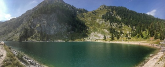
Proti Krnskemu jezeru
Krnsko jezero
Planina na Polju
Pogled nazaj
Krn
Skorajda ves čas po snegu
Na Krnski škrbini
Na vrhu Krna
Proti Peskom
Sestop po snežiščih
Snežišč kar ni zmanjkalo
Od Krnskega jezera do Krnske škrbine sva skorajda ves čas hodila po snegu. Na srečo je bil sneg dovolj mehak, snežišča pa dovolj položna, da je bil vzpon popolnoma varen. Vrh Krna pa je kopen. S Savice do Krna je naneslo 20 km poti, za kar sva potrebovala 4 ure hoje. Zaradi počasne hoje je bolečina v kolenu nekoliko popustila. Tako da sva nazaj grede skorajda ves čas lahko tekla. Sestopila sva čez Batognico po poti čez Peske. Sestop so nama močno olajšala obsežna snežišča. Na planini Za Lepočami sva se nazaj pridružila poti iz Krnskega jezera ter sestopila nazaj čez Komno. Kljub počasnemu tempu, sva ušla nevihtam. Nabralo pa se je 39 km poti in 2470 višinskih metrov vzpona.
https://video.relive.cc/39513450212_garmin_1527950687358.mp4
GPS sled: https://goo.gl/C6vYFk
GPS sled
Obe poti na Krn
GPS profil
S Savice do Krnskega jezera, avgust 2009
S Savice na Krn, november 2012
S Savice na Krn, december 2015
Komna, februar 2009
S Savice na Krn Pot iz Savice na Krn je po mojem mnenju ena najlepših trail poti v Sloveniji. Začetek poti žal ni tako obetaven, saj je mulatjera na Komno precej zoperna za tek.
0 notes
Photo

Krnsko Jezero by happyfreesoul777
0 notes
Photo

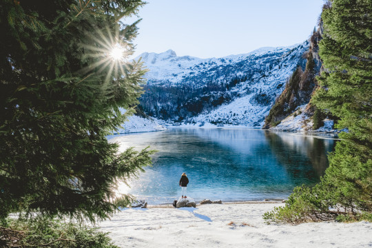
Krnsko Jezero
#lake#water#cold#nature#summer#mountain#high#hiking#trekking#natural light#alpine#natural world#natur
0 notes
Text
Krn Lake (Krnsko jezero), Julian Alps, Slovenia via https://t.co/QEMC0b3jpB #hiking
Krn Lake (Krnsko jezero), Julian Alps, Slovenia via https://t.co/QEMC0b3jpB #hiking
— Hiking Gurus (@hikinggurus1) October 16, 2017
from Twitter https://twitter.com/hikinggurus1
October 16, 2017 at 04:09AM
via HikingGurus
0 notes
Text
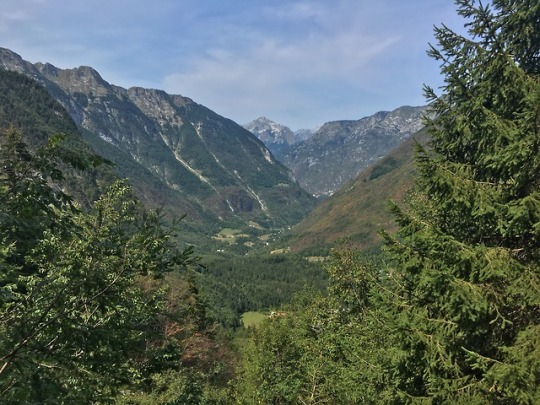
Slovenia Day #9. 8-23-2017
Ales described today to us perfectly, and it was exactly the challenging day he'd described. 4 hours up, 4 hours down, loose rock, amazing views. We were awake with no problem for a planned early start, since no one had slept all that well anyway (except Dan and his Aleve PM). Strong coffee, scrambled eggs and bread (not toast) and we were hiking by 7:10am. We set off through a small stand of pines that felt like the forest where Hansel and Gretel would have lived, then through a pasture and down towards a rectangular lake (Lake Krn or Krnsko Jezero). There was a light ground fog that swirled around in a magical fashion. It was a serene and beautiful start to the day. There were three locals that left the hut at the same time as us with full packs, amazing how much faster than us they were! But they were dressed in bright colors and it helped to pick out the trail along the mountain. Without trees, this hike was unusual because for 4 hours up you could see where you were going, and from the top and nearly ALL the way down, you could see the parking lot where we'd finish! We stayed pretty focused and didn't take a lot of breaks on the way up, but we had to turn around periodically and view the lake as we climbed. At the top we were nearly at 7000 ft, and in the swirling clouds it was even more mysterious and beautiful. We reached the pass around 11a, more WWI artifacts and bunkers - tomorrow we'll go to the museum in Kobarid and learn more about the military history of the area. From the pass, we could see the parking lot where we'd end our hike, but we took a right and traversed along a ridge to reach the hut where we'd eat our lunch. We walked very carefully, leaning into the mountain as it was a steep drop to the left with nothing that would have broken the fall for a long long way! It was just 5 minutes to the hut. There we had some coffee and dropped our packs so we could scramble up to the top of the Mt Krn. The clouds were really swirling - it'd be completely socked in, and then it would quickly clear. We had great views all around - Italy, Kobarid (where we're staying tonight), the Soca River. We scrambled back down, and all but me explored a cave - not a fan of tight little spaces, especially high up on a mountain! Back at the hut, we ate the sandwiches they'd made for us at the overnight hut. This hut was more remote and rustic - no running water of course (pour water from the bucket to flush the toilet) so no three minute showers here! There was a young couple staying there for three months as the caretakers - they've been doing this for several years and were very friendly and the guy appeared to be fluent in many languages. After lunch, I napped a bit while others visited, and just after 1p we headed down the mountain - little switchbacks with steep slope. Mainly rocks and gravel so lots of slipping - you would tense up when you heard the sound of sliding gravel behind you so we were careful to leave space between ourselves. It was mainly overcast which was wonderful - with the southern exposure it would have been brutal to have complete sunshine. We met a lot of hikers with daypacks, and a guy and his mountain bike. Ales chatted with him a bit and they were pointing up the mountain. I couldn't imagine riding up OR down on any of these trails. I asked him if he'd ridden up to this point and he had the audacity to look at ME like I was the stupid one as he said "no!" We slogged along, taking a few short breaks. It wasn't terribly hot, but it was warm without much of a breeze. As we got lower we could hear the ringing of the cow bells from the fields, and the occasional church bell from the villages below. There were dozens of paragliders soaring above us, and I'd occasionally pause in my plodding to watch them. Several swooped low enough to yell down to us, and we'd all yell "aaaayyyyyyeeee" back up at them. It looked like fun, but nothing I'd ever try. With the exposed mountain face and all the activity, it was tough to find a space to pee - an occasional large bolder was the best you could do, so you had to choose to not worry about the hikers above or below you, or the paragliders in the sky. We strolled past the cows and some sheep, letting ourselves in and out of the pastures with the gates in the fences. Eventually we came to the road that we'd been staring at for hours and the trail walked along that for a few hundred meters of pure flat bliss - but then the trail turned into another cow pasture and over those dreaded rocks and gravel again. At that point, one of my stumbles resulted in me dragging my knee on the gravel, so we took a break in the shade of a tree and Ales brought out some magic spray that stopped the little bit of bleeding after I'd rinsed the dirt out. So far it's been our worst injury - hope that luck continues! At one point in this pasture, there was a little friendly cow (I think they're used to people traipsing through their pastures). Ales patted it on the back, and as Tam went by she let it lick her hand - it must of loved that taste of salt as it then followed us for a bit! Kind of cute with a little one, but there were also some massive cows with huge horns nearby - made me feel like we shouldn't be messing with any of them! After 3.5 hours, we reached the hut at the bottom of several trails. We had a celebratory beer and a couple bags of chips and a lot of laughs. There were two cute German girls who had hiked up from the village below without much of a plan. As we were ready to leave, we convinced Ales (didn't need much convincing, but I wondered if it was against REI rules - probably was) to bring them along and gave the a ride back to their car. Then we continued to the little village of Kobarid - Hotel Hvala, our home for the next two nights. Our room is interesting! Sort of like a suite in that we have two rooms, which allows us to expand our stuff - this is our 8th accommodation on this trip, so we've become quite disorganized!!! We also think it might be what constitutes a handicapped room here in Slovenia - the shower is just in the corner of a massive bathroom - with no barrier or curtain, which was quite a mess as we both took long showers after our two tough days of hiking and the <3 minute shower at the mountain hut! Anyway, we cleaned up and went down to the hotel restaurant where they had prepared a seafood feast for us. In addition, Tomas had a bottle of chilled "Becherovka" a liqueur from Czechoslovakia, and even the waiters were enjoying shots of that. We were served fresh mussels on pasta for the starter, and a platter of several types of fish (sea bass and trout), octopus, prawns, salmon, squid - Jeff impressed all with his ability to debone the fish. It was all amazingly good, even that which was just a bit outside of my comfort zone. We washed it all down with carafes of local chilled white wine. Awesome end to a spectacular day!
0 notes
Last Seen Blogs

lonelywhalien22
don't wanna stay in the dark

elvannns
Elvannns

glamoxury
agora é 22h11

radiomojave
left my heart in the sierra madre

cap-ironman
Everything Left Unsaid