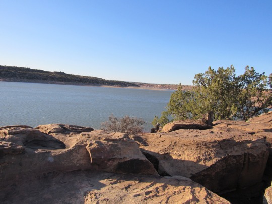
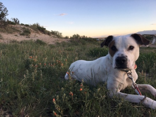
#lake pueblo state park
Text
Beautiful hike this morning 😍 2.8 miles no problem 💪🏼 spouse and I are gonna start going once or twice a week as we get more used to it, planning on trying for 5 miles next time since we both had such an easy time with this one 🥰

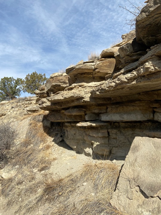


#hike#hiking#fitblr#healthblr#fitspo#health#personal#fitness#exercise#update#lake Pueblo#lake Pueblo state park
36 notes
·
View notes
Photo
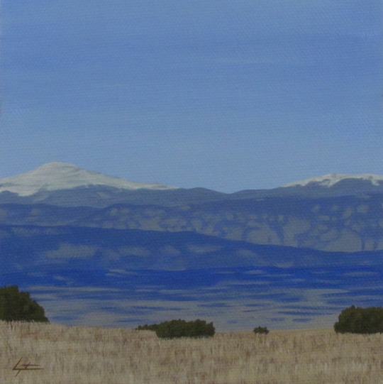
Pikes and Almagre
Acrylic on canvas 6x6".
Charles Morgenstern, 2022.
Pikes Peak and Almagre Mountain seen from Pueblo, Colorado.
#colorado#mountains#landscape#artwork#painting#illustration#acrylic#pikes peak#almagre mountain#pueblo#lake pueblo state park#drawing#nature#outdoors#wilderness#environment#southwest#desert#trees#sky#tetramodal#charles morgenstern#art#artists on tumblr#illustrators on tumblr#hiking#realism#design#summer#spring
59 notes
·
View notes
Text
Kansas: Scott Lake State Park
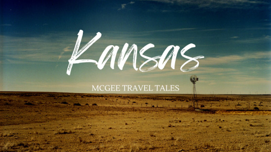
View On WordPress
#El Cuartelejo#El Quartelejo#Historic Scott Lake State Park#Kansas#Keystone Gallery#National Historic Landmark#Native American Site#Pueblo People
2 notes
·
View notes
Text
Lake Pueblo boat accident: 1 person dead, another missing after boat overturns
Lake Pueblo boat accident: 1 person dead, another missing after boat overturns
CNN
—
One person is dead and another person is missing after a boat carrying more than a dozen people overturned in Lake Pueblo State Park in Colorado, park officials said.
The boat overturned around 7:30 p.m. Sunday with 13 people onboard, according to a social media post from Colorado Parks and Wildlife’s Southeast Region. Three adults and eight juveniles were rescued from the water, which…
View On WordPress
#accident#boat#Colorado#continents and regions#dead#destinations and attractions#lake#missing#North America#overturns#parks (green spaces)#person#points of interest#Pueblo#southwestern united states#state parks#the americas#United States
0 notes
Conversation
U.S. Daily Precipitation Records Tied/Broken 7/25/22
Bettles, Alaska: 0.6" (previous record 0.5" 1988)
Tongass National Forest, Alaska: 1.54" (previous record 1.3" 1969)
Apache National Forest, Arizona: 0.8" (previous record 0.7" 1987)
Baker Butte summit, Arizona: 1.1" (previous record 0.9" 1992)
Gilroy, California: 0.01" (previous record 0" 2021)
Modoc National Forest, California: 0.1" (also 0.1" 1990)
Dillon, Colorado: 1.01" (previous record 0.54" 1952)
Fraser, Colorado: 0.91" (previous record 0.75" 2012)
John Martin Reservoir State Park, Colorado: 1.71" (previous record 0.92" 1958)
Kit Carson, Colorado: 2.04" (previous record 0.73" 1968)
Unincorporated Pueblo County, Colorado: 0.76" (previous record 0.69" 1973)
San Isabel National Forest, Colorado: 1.3" (previous record 0.9" 2008)
Trinidad Lake State Park, Colorado: 0.58" (previous record 0.55" 1990)
Unincorporated Washington County, Colorado: 0.59" (previous record 0.41" 1998)
Unincorporated Washington County, Colorado: 0.49" (previous record 0.22" 2020)
Payette National Forest, Idaho: 0.1" (also 0.1" 2003)
Dwight Township, Illinois: 1" (previous record 0.85" 2011)
Kankakee, Illinois: 2.43" (previous record 1.49" 1995)
La Motte Township, Illinois: 3.14" (previous record 2.01" 1936)
Rich Township, Illinois: 1.34" (previous record 1.21" 2010)
Fairplay Township, Indiana: 1.68" (previous record 1.6" 1936)
Hoosier National Forest, Indiana: 1.48" (previous record 1.39" 1978)
Shakamak State Park, Indiana: 0.87" (previous record 0.74" 2009)
Tell City, Indiana: 2.47" (previous record 1.24" 1979)
Vincennes, Indiana: 4.77" (previous record 2.95" 1900)
Vincennes Township, Indiana: 6.54" (previous record 1.38" 2011)
Washington Township, Indiana: 6.2" (previous record 2.05" 1964)
Clifton, Kansas: 1.95" (previous record 1.94" 1981)
Eskridge, Kansas: 2.5" (previous record 2.18" 2004)
Hillsdale State Park, Kansas: 2.25" (previous record 1.68" 2010)
Ionia Township, Kansas: 2.14" (previous record 0.88" 1973)
Logan, Kansas: 1.5" (previous record 1.26" 1981)
Manhattan, Kansas: 2.89" (previous record 1.04" 1909)
Manhattan Township, Kansas: 2.03" (previous record 2" 1974)
Wamego Township, Kansas: 2.4" (previous record 1.42" 1973)
Unincorporated St. Mary's County, Maryland: 2" (previous record 1.91" 2011)
Prairie Township, Missouri: 0.9" (also 0.9" 2010)
Alberton, Montana: 0.02" (previous record 0.01" 2014)
Billings, Montana: 0.7" (previous record 0.66" 1925)
Unincorporated Rosebud County, Montana: 2.47" (previous record 1.3" 2007)
Turkey Creek Township, Nebraska: 1.14" (previous record 1.02" 1977)
Egg Harbor Township, New Jersey: 3.15" (previous record 1.27" 1975)
Carson National Forest, New Mexico: 1.2" (previous record 0.5" 2021)
Unincorporated McKinley County, New Mexico: 0.9" (previous record 0.85" 1994)
Señorita Divide summit, New Mexico: 1.7" (previous record 1" 1991)
Angelica, New York: 1.53" (previous record 1.48" 2008)
Aurelius, New York: 1.49" (previous record 1.16" 1961)
Blenheim, New York: 0.42" (previous record 0.41" 2009)
Canandaigua, New York: 1.43" (previous record 1.27" 2008)
Geneva, New York: 1.05" (previous record 0.75" 2017)
Ithaca, New York: 1.11" (previous record 1" 1929)
Letchworth State Park, New York: 2.1" (previous record 1.8" 1995)
Little Valley, New York: 1.96" (previous record 1.76" 1949)
Lowville, New York: 1.52" (previous record 1.16" 1900)
Newcomb, New York: 1.11" (previous record 0.96" 2017)
Norwich, New York: 1.5" (previous record 1.37" 1967)
Pinckney, New York: 1.27" (previous record 0.8" 1911)
Poland, New York: 1.97" (previous record 0.9" 2010)
Saratoga Springs, New York: 1.79" (previous record 1.09" 2011)
Wellsville, New York: 2.5" (previous record 1.44" 1975)
Wethersfield, New York: 2.37" (previous record 2.27" 2008)
North Canton, Ohio: 1.17" (previous record 0.86" 1999)
Steubenville, Ohio: 1.02" (previous record 0.84" 1977)
Warren Township, Ohio: 1.45" (previous record 1.13" 1968)
Hogg Pass summit, Oregon: 0.3" (previous record 0.2" 1983)
Malheur National Forest, Oregon: 0.1" (previous record 0" 2021)
Mt. Hood National Forest, Oregon: 0.1" (also 0.1" 2009)
Willamette National Forest, Oregon: 0.1" (previous record 0" 2021)
Bradford Township, Pennsylvania: 1.95" (previous record 1.18" 2010)
Franklin, Pennsylvania: 2.1" (previous record 1.97" 1935)
Ridgway, Pennsylvania: 1.7" (previous record 1.51" 1968)
Tionesta Township, Pennsylvania: 2.06" (previous record 1.97" 1967)
Warren, Pennsylvania: 2.51" (previous record 2.04" 1968)
Washington Township, Pennsylvania: 0.94" (previous record 0.81" 1977)
Unincorporated Edgefield County, South Carolina: 3.81" (previous record 1.3" 1975)
Wind Cave National Park, South Dakota: 0.71" (previous record 0.66" 1998)
Peru, Vermont: 1.18" (previous record 1.16" 1975)
Ashland, Virginia: 1.67" (previous record 1.31" 1916)
Unincorporated Campbell County, Virginia: 1.21" (previous record 1.03" 1946)
#Storms#U.S.A.#U.S.#Colorado#1950s#1960s#1990s#1970s#Illinois#1930s#Indiana#1900s#Kansas#1980s#Missouri#Montana#1920s#Nebraska#New York#1910s#1940s#Ohio#Pennsylvania#South Carolina#South Dakota#Vermont#Virginia#Alaska#New Mexico#Arizona
2 notes
·
View notes
Text
Day 9 Thursday
Bandelier to Conchas Lake State Park, New Mexico
What a difference four hours can make! Last night the temperatures fell to the low twenties and by 8:00 had warmed up to a cozy 36. But by the time we were ready for our hike it was close to 50 degrees.
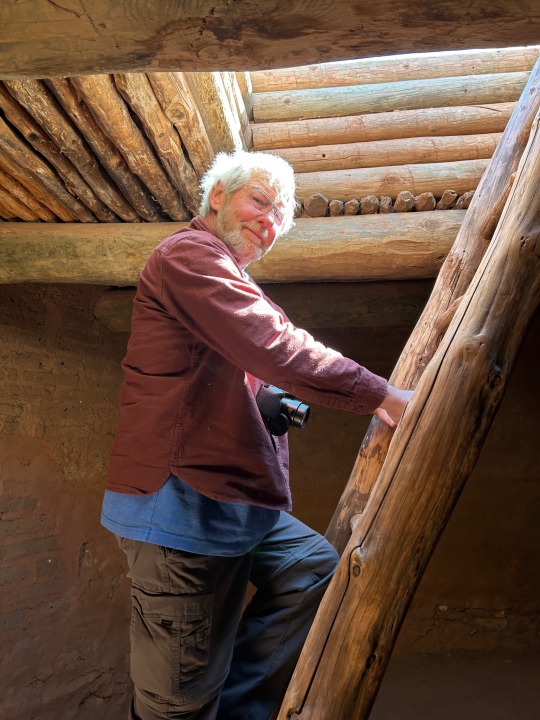
We had a nice hike to the overlook of Frijoles Canyon and Tyuonyi Pueblo. We saw the remnants of houses where people lived over a thousand years ago. At the overlook we could see where there had been a thriving village long ago.


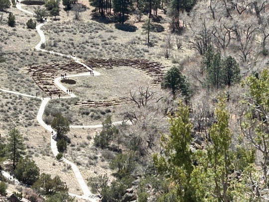
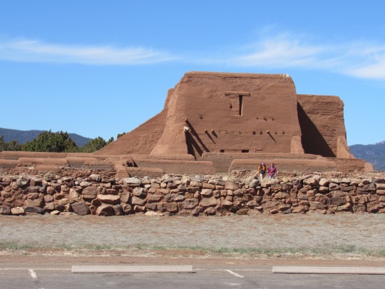
Then we were on to our next stop and National Park site 115 for me. 😀 This stop was Pecos National Historical Park. Here there is a varied history from Pueblo and Plains Indians, Spanish conquistadors and missionaries, Mexican and Anglo armies (including a Civil War battle), Santa Fe Trail settlers, railroad, Route 66 and modern travelers. We explored the Pecorino Mission church. It really was a step back in time.

Then on to our stop for the night. It was a two hour drive during which we discovered a new meaning of being the middle of nowhere! Most of the time we saw no cars, no houses, nothing but endless fields of grass and scrub trees. When we got to Conchas Lake State Park, we found it barely inhabited but at least the temperature was around 70, although it was quite breezy. So maybe we will get blown away instead of freeze to death.

Today’s Miles: 193
Total Trip Miles: 2699
States: New Mexico
0 notes
Link
Lake Pueblo State Park #hikingtrails, #nature, #naturephotography, #hiking, #wanderlust, #hikingadventures, #hikingphotography, #landscapephotography, #rockymountains, #coloradohikes, #hikingcolorado, #naturelovers, #getoutside, #mountains
0 notes
Video
youtube
LAKE PUEBLO STATE PARK (PUEBLO RESERVOIR) - COLORADO
Avec ses 4500 acres d'eau de surface, le Parc d'État du Lac Pueblo (également connu sous le nom de Réservoir de Pueblo) est le lieu par excellence du sud du Colorado pour les amoureux du soleil et les amateurs de sports nautiques. C'est d'ailleurs l'un des parcs les plus populaires de cet état.La pêche est exceptionnelle ici et les vues dans ce paysage aride du sud du Colorado sont spectaculaires. Le lLc Pueblo compte près de 400 terrains de camping répartis dans trois zones différentes du parc. Pour les conditions actuelles et plus d'informations, veuillez visiter le site Web du lLac Pueblo : https://cpw.state.co.us/placestogo/Parks/lakepueblo***************AUTRES VIDÉOS DE CE ROAD TRIP:https://www.youtube.com/playlist?list=PLlRroQCNvchsdvRQOTUATm7OU6BabhYIFABONNEZ-VOUS ► https://www.youtube.com/c/SouthAngelVideo?sub_confirmation=1SUIVEZ NOUS : • BLOGGER ► http://southangelvideo.blogspot.ca/• INSTAGRAM ► https://www.instagram.com/annestrasbourg/• FLICKR ► http://www.flickr.com/photos/anne_strasbourg/collections/• TWITTER ► https://twitter.com/AnneStrasbourg
0 notes
Text
Kayaks capsize in strong winds killing two adults and child airlifted
Kayaks capsize in strong winds killing two adults and child airlifted
Two adults died and a chid was hospitalized after kayaks flipped in the Lake Pueblo State Park (Picture: Getty Images)
Two adults were killed and a toddler was hospitalized after several kayaks flipped due to high winds and big waves in Colorado.
A kayak holding an adult and child capsized at Lake Pueblo State Park on Sunday afternoon when gusts reached 35 to 45 mph and waves became large,…
View On WordPress
0 notes
Text
A Dane in the Desert, Part I: In Search of Zion


By Anders Tornsø Jørgensen
Over the last week my travels led me to the American Southwest: A very unique, but also a very distinctive part of the United States. I have divided this post into two. The first will focus on my time in Utah with focus on the Mormons, whereas the next will explore my experiences in the Four Corners region, the Navajo Nation and Pueblo culture.
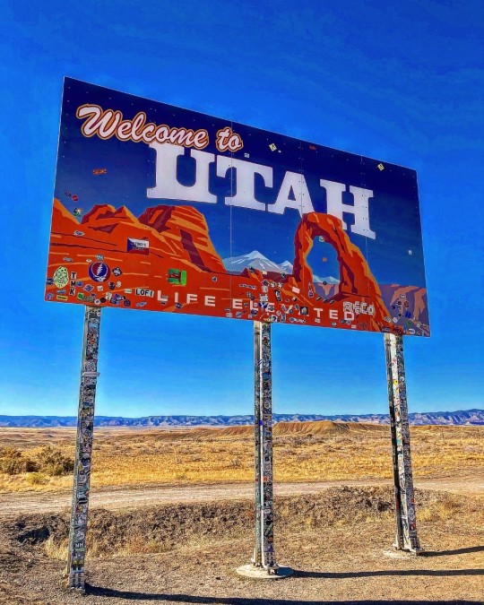
After attending the wonderful annual board meeting of the Museum of Danish America in late October, I packed up my bags and went west with destinations in mainly Utah, Arizona and Colorado in order to explore some national parks and learn something about the Southwest, including its people, its rich history and most importantly: the delicious food.
However, arriving in Denver on day one of this trip, the intern car began sounding weird, and I decided to call our Facilities Manager, Tim, in order to find out what was going on. We decided it was better to spend a night in Denver, and let a mechanic look on it, before proceeding into the Rocky Mountains. Luckily, I have a pair of guardian angels named Mark and Karen, both whom I known from my travels in the United States. They opened their door and welcomed me into their home when I called them. As I woke up the next day and took the car to the mechanic first thing in the morning, it quickly looked like a more serious issues, so Mark and Karen offered to let me use their car while the intern car was being taken care off – a offer which I gladly and gratefully accepted. They did indeed save (and improve as it would later turn out) my trip in many ways. Anyways, after a rocky star, I proceeded from Denver to Arches National Park in Utah, going through mountains and deserts, which for a Dane, but also for many Americans, is pretty exceptional landscapes. Building an interstate in this extremely challenging terrain is one of the engineering miracles that truly fascinates me.
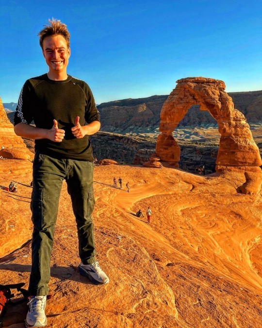
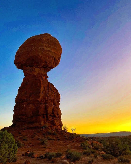
After a five-hour drive, I finally made it to Arches National Park. Seeing those sandstone arches gave me the goosebumps immediately. The vastness and greatness of this land is so amazing, and national parks, but also state parks, is a great way to explore the natural diversity of the United States. As home to more than 2,000 natural sandstone arches, Arches National Park has the highest density of natural arches in the world, including the iconic Delicate Arch, which is featured on several Utah car plates. In 1929, it was established as a national monument, but in 1971, it was re-designated as a national park. Today, Arches National Park is one of Utah’s finest tourist attractions and welcomed 1,238,083 visitors in 2020. The highlight of my visit was the enjoyable hike out to Delicate Arch, which is about 1.5 miles each way, and the late October weather made it a very comfortable experience. Delicate Arch is a 52-foot-tall freestanding natural arch, and if you look at my photo with me in front of it, you can kind off sense the grand size of this wonder. People close to it looks like ants. Another favorite stop on my visit to Arches National Park was Balanced Rock, which I enjoyed during sunset, where the rock becomes saturated in a red-orange color. Balanced Rocks is very easily accessible and definitely worth a stop.
After having spent a day hiking around Arches National Park, I decided to make my way toward Utah’s capital, Salt Lake City. Around 80% of Utah’s population is concentrated around a metropolitan region in the north-central part of the state known as the Wasatch Front, which consists of a chain of contiguous cities, including cities such as Provo, Logan, Ogden, and Salt Lake City. Driving into this area felt very different than the first part of my Utah trip where I could drive for hours without meeting to many people or too many gas stations for that matter.
Before we proceed into Salt Lake City, I’ll like to mention a few but important things about Utah. The uniqueness of Utah among American states is absolute. I find each state to be unique, but Utah is truly outstanding because of a certain religious group. With its vastness of horizon, its beautiful geologic formations and its wide aridity, Utah impresses anybody who want to enjoy Mother Nature at her best. However, Utah is not only home to natural miracles, but also the home of the Church of Jesus Christ of Latter-day Saints, a.k.a. the Mormons, who intertwined in the history of Utah. While Mormons seldomly call themselves Mormons, it will be used for clarity in this post. It has been gradually accepted and assimilated by the church. Latter-day Saints quickly became known as "Mormons" after the church was founded. The word comes from the Book of Mormon, a sacred book of scripture used by Mormons in addition to the Bible.
As of 2020, roughly 60 per cent of Utahns are Mormons. The political and economic power of the church is very strong as evidenced by the fact that the governor of Utah and both of the state's senators are Mormons, and so are all four of its members in the House of Representatives. Furthermore, 89 of the 103 lawmakers in the Utah Legislature are members of the Church of Jesus Christ of Latter-day Saints. The Mormon influence is also strong in Utah symbols. A word like "Deseret" appears a lot in Utah. It does not mean desert, but instead comes from the Book of Mormon (not the musical by Matt Stone and Trey Parker) where it meant honeybee, an animal considered to be self-sufficient and industriousness. As a result, Deseret was actually the proposed name for what would eventually end up becoming the Utah Territory and later evolved into the state of Utah. However, the state symbol of Utah continues to be a beehive and the symbol is represented on both the state seal, state flag, and is why the state is nicknamed the Beehive State.
So why did the Mormons end up in the middle of a desert? After Joseph Smith, the founder of the religion, was killed by an angry mob in Nauvoo, Illinois, a man named Brigham Young took over and led his followers to refuge in what would become Salt Lake City. Here, Young argued, Mormons could practice their faith freely because of its relative isolation. The approximately 1,300-mile journey from Illinois to Utah, known as the Mormon Trail, was harsh and though and plays a central role in the church’s history. One of the reasons to anti-Mormonism was the religion’s practice and acceptance of polygamy, and it caused a lot of problems and distrust between the United States government and the Mormons. For almost 50 years, Utah tried to become a state. However, each time Utah was rejected because of polygamy. Finally, polygamy was abandoned as the price for admission to the union. Actually, most of Nevada, where iconic Las Vegas is located, was originally a part of the Utah Territory, which is interesting when you think about how opposite the two states are: Utah’s worst nightmare would probably be to become “a hub of sin,” where liquor and gambling reigns supreme.
The Mormons also have a Danish connection. The first wave of Danish migration to the United States was led by Mormon converts, who looked for Zion, the kingdom of God, in the United States. As a result, many Mormons today have Danish heritage. Actually, among those who followed Brigham Young to the desert, was a Dane named Peter O. Hansen, who today is considered one of the movement's pioneers. As the religious movement grew, they began to expand their mission work. They soon turned their attention to Denmark, which in 1849 introduced a constitution that guaranteed freedom of religion. The Mormons would send Hansen home to Copenhagen to proselytize among the Danes. While in Denmark, Hansen also worked on translating the Book of Mormon into Danish as the first foreign language. The Mormon mission in Denmark was extremely successful. While the new Danish constitution mandated religious freedom, many followers of new religious movements were harassed by the Danish population, which is one of the main reasons of why about 17,000 Danish converts would make the journey to the United States between 1850 and early 1900s. Like many other emigrants of the time, they come from bottom of Danish society and they do not have the opportunity to finance the long and dangerous journey themselves. But the Mormons actually offered to cover the travel costs, obliging the emigrants to later make their labor available to the church. Town names still demonstrates the success of the early Mormon missions to Denmark – for example, Elsinore, Utah. Also, this Danish heritage is reflected at the Salt Lake City Cemetery, where Danish names appears on various tombstones.
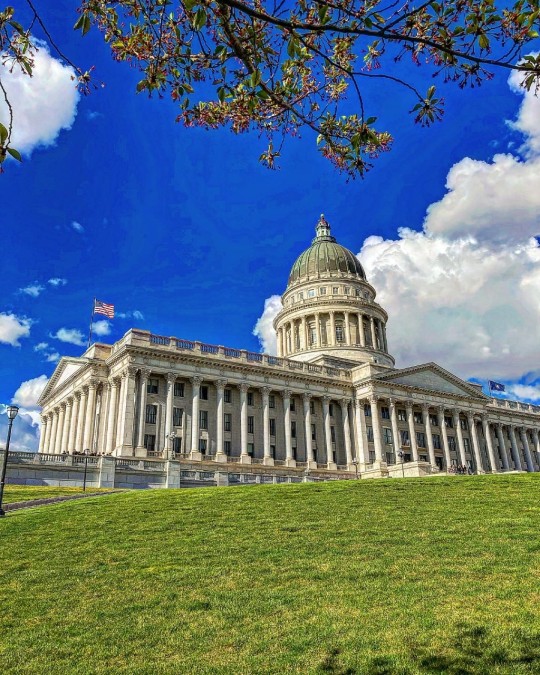
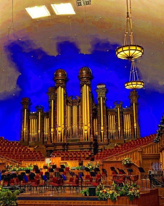
I made it into Salt Lake City, where I visited the Utah State Capitol, which is beautifully located on a hill that overlooks the downtown area – and actually looks a lot like the impressive U.S. Congress in Washington, D.C. Next, I visited the Mormon Tabernacle with its celebrated organ and even more celebrated acoustics. Next to the Mormon Tabernacle is the Salt Lake Temple, which is the chief cathedral of the faith. I also went to the Conference Center, which functions as a meeting hall for the church. It has 21,000 seats! I had a guided tour around the building, and when I mentioned where I was from, the guide showed me a replica of the iconic Christus, a white marble statue of the resurrected Jesus Christ. This iconic statue was made by Danish sculptor Bertel Thorvaldsen. Apparently, the church has made various replicas and placed them around their visitors’ center across the globe.
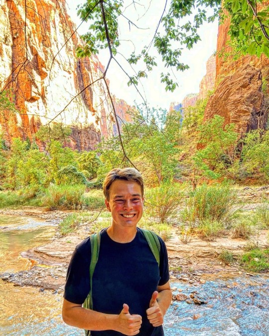
After spending a day in Salt Lake City, I decided to continue to Zion National Park, which I must admit is one of the most magical places I have been. The main highlight of the park is the Zion Canyon, which is a gorge flanked by waterfalls and colorful rock formations, many of which were given their biblical names by the first Mormons who arrived in the area in 1858. However, various Native American tribes had also lived in the area in earlier periods.
What today is called Zion National Park actually started as a national monument in 1909 when President William Howard Taft designated Mukuntuweap National Monument. In the 10 years until it became a national park, it was expanded, and its name was changed to Zion. In many national parks, you can usually drive around in your own car, but Zion closes the road seasonally and instead operates a free bus system, where you can jump on and off at various points throughout the park. I took the bus all the way to the end at the Temple of Sinawava, named after the Paiute tribe’s coyote deity, and then hiked along the Riverside Walk, a 2-mile round trip. It is all paved, but you can easily exit the path and walk along the river, which offers stunning views. At the end of the Riverside Walk you’ll have the option to continue into the Zion Narrows. However, you’ll need water shoes, because you’ll walk in the river. Afterwards, I went up Angel’s Landing, which gives you a perfect view of the Zion Canyon. But be warned: It’s a steep hike, but it’s worth every step.
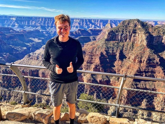
Southern Utah is home to five epic national parks (Arches, Bryce Canyon, Canyonlands, Capitol Reef, and Zion), and as a result, Utah has the third most national parks of any state after Alaska and California, so there is really much to see in this beautiful state. My journey continued to Arizona in order to visit the North Rim of the Grand Canyon, which is the least visited part of this famous national park. According to the National Park Service, only 10 percent of all Grand Canyon visitors goes to the North Rim, so it less way travelled. Several years ago, I went to the South Rim, so it was really wonderful to see how different this part is. I had good time conquering the canyons, and while much can be said about the Grand Canyon, I’ll end with an elegant quote from Theodore Roosevelt, who said the following when he visited the Grand Canyon in 1903:
“The Grand Canyon fills me with awe. It is beyond comparison—beyond description; absolutely unparalleled through-out the wide world ... Let this great wonder of nature remain as it now is. Do nothing to mar its grandeur, sublimity and loveliness. You cannot improve on it. But what you can do is to keep it for your children, your children's children, and all who come after you, as the one great sight which every American should see.”
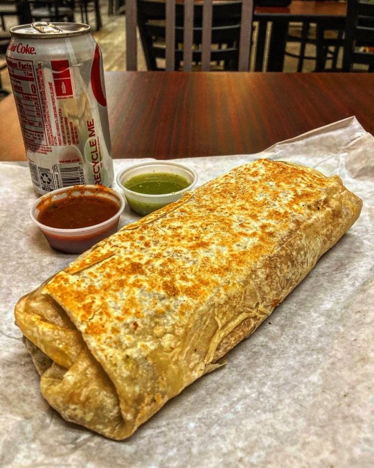
With that beautiful quote I’ll end this first part of my trip. I didn’t have time to describe all the food that I had, but I sure had a lot of great burritos, enchiladas, tacos, and chile, as I drove across this wonderful part of the United States.
On the next part of the part of my Southwestern journey, I will be writing about my experiences at Monument Valley in the Navajo Nation, the Four Corners, Mesa Verde National Park and Great Sand Dunes National Park and Preserve.
1 note
·
View note
Conversation
U.S. Daily Precipitation Records Tied/Broken 12/29/22
Sierra Vista, Arizona: 0.06" (previous record 0.02" 1992)
Unincorporated Adams County, Colorado: 0.74" (previous record 0.31" 2006)
Boulder, Colorado: 1.26" (previous record 0.73" 2006)
Castle Rock, Colorado: 0.93" (previous record 0.82" 2006)
Colorado National Monument, Colorado: 0.5" (previous record 0.49" 1972)
Denver, Colorado: 0.83" (previous record 0.62" 2006)
Unincorporated El Paso County, Colorado: 0.68" (previous record 0.47" 2006)
Fraser, Colorado: 0.49" (previous record 0.29" 2005)
Holyoke, Colorado: 0.63" (previous record 0.23" 2020)
Unincorporated Jefferson County, Colorado: 1.57" (previous record 1.18" 2006)
Lakewood, Colorado: 1.1" (previous record 0.91" 2006)
Limon, Colorado: 0.14" (previous record 0.13" 2014)
Unincorporated Lincoln County, Colorado: 0.44" (previous record 0.2" 2006)
Unincorporated Logan County, Colorado: 0.35" (also 0.35" 2020)
Longmont, Colorado: 1.23" (previous record 0.36" 1951)
Northglenn, Colorado: 1.28" (previous record 0.75" 2006)
Palisade, Colorado: 0.67" (previous record 0.4" 1915)
Pike National Forest, Colorado: 0.47" (previous record 0.42" 2006)
Unincorporated Pueblo County, Colorado: 0.09" (previous record 0.03" 2006)
Unincorporated Sedgwick County, Colorado: 0.36" (previous record 0.12" 1975)
Unincorporated Washington County, Colorado: 0.58" (previous record 0.14" 2020)
Unincorporated Washington County, Colorado: 0.76" (previous record 0.11" 2019)
Unincorporated Washington County, Colorado: 0.49" (previous record 0.13" 2020)
Wheat Ridge, Colorado: 1.35" (previous record 1.02" 2006)
Winter Park, Colorado: 0.61" (previous record 0.52" 1973)
Yuma, Colorado: 0.96" (previous record 0.5" 1898)
Unincorporated Bienville Parish, Louisiana: 1.68" (previous record 1.62" 1978)
Shreveport, Louisiana: 1.88" (previous record 1.18" 2006)
Curtis, Nebraska: 0.47" (previous record 0.3" 2020)
Imperial, Nebraska: 0.55" (previous record 0.4" 1906)
Lexington, Nebraska: 0.27" (previous record 0" 2021)
Navajo Lake State Park, New Mexico: 0.46" (also 0.46" 1972)
Unincorporated Sandoval County, New Mexico: 0.66" (previous record 0.5" 1992)
Fremont National Forest, Oregon: 0.9" (previous record 0.8" 1996)
Modoc National Forest, Oregon: 0.8" (also 0.8" 2003)
Quartz Mt. summit, Oregon: 0.4" (previous record 0.3" 1987)
Taylor Butte summit, Oregon: 0.7" (also 0.7" 1996)
Winema National Forest, Oregon: 1" (previous record 0.8" 2010)
League City, Texas: 2.64" (previous record 2.5" 2010)
Big Water, Utah: 0.2" (previous record 0.06" 2010)
Canyonlands National Park, Utah: 0.47" (also 0.47" 1972)
Natural Bridges National Monument, Utah: 0.87" (previous record 0.8" 1972)
#Storms#U.S.A.#U.S.#Arizona#1990s#Colorado#1970s#1950s#1910s#1890s#Louisiana#Nebraska#1900s#New Mexico#Texas#Utah#Oregon#1980s#Crazy Things#Awesome
0 notes
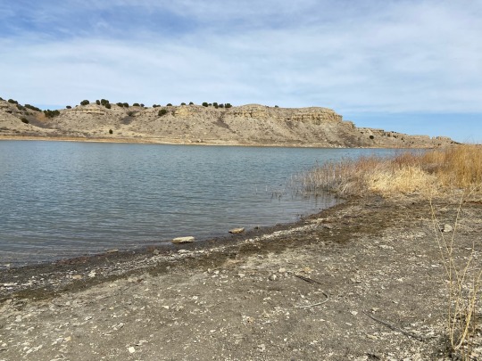
Photo
Pueblo Reservoir
Acrylic and spray paint on canvas 6x6".
Charles Morgenstern, 2021.
Lake Pueblo State Park, Pueblo, Colorado.
#colorado#pueblo reservoir#landscape#artwork#painting#illustration#lake pueblo state park#acrylic#spray paint#pueblo#arkansas river#minimalism#abstract#design#graphic design#drawing#tetramodal#charles morgenstern#water#lake#sky#trees#nature#outdoors#wilderness#desert#southwest#artists on tumblr#art#environment
34 notes
·
View notes
Photo
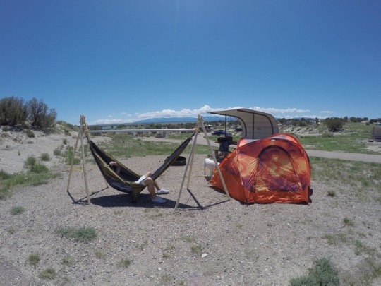

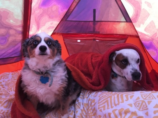

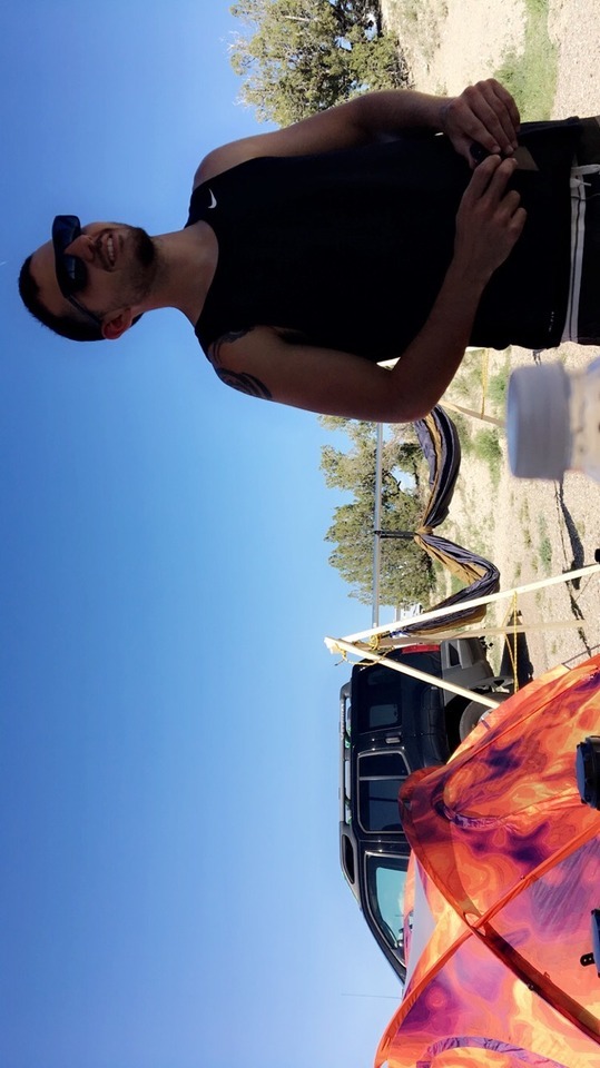


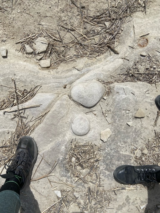
#camping this weekend#I love my lil family#new north face tent#lake Pueblo state park#optoutside#let's go camping
2 notes
·
View notes
Link
Lake Pueblo State Park #hikingtrails, #nature, #naturephotography, #hiking, #wanderlust, #hikingadventures, #hikingphotography, #landscapephotography, #rockymountains, #coloradohikes, #hikingcolorado, #naturelovers, #getoutside, #mountains
0 notes
Last Seen Blogs

epubdownload-blog
Epub Download

kannagimikazukioracles
The Oracle's Words - 神凪の言葉

enlightenedwanderer
Stranger in a Strange Land

flailingart
☕️Shorter Stuff☕️

doctorwhommm
its them aliens again