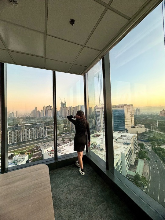
#overlooking
Text

Micah 7:18 (NLT) -
Where is another God like You,
who pardons the guilt of the remnant,
overlooking the sins of His special people?
You will not stay angry with Your people forever,
because You delight in showing unfailing love.
17 notes
·
View notes
Text

Édouard Vuillard, Landscape: Window Overlooking the Woods, 1899. Oil on canvas, 249.2 × 378.5 cm (96 1/8 × 149 in). C/o Art Institute of Chicago.
9 notes
·
View notes
Text
We think a lot of the realities we see have a very different idea of professionalism than us.
7 notes
·
View notes
Text
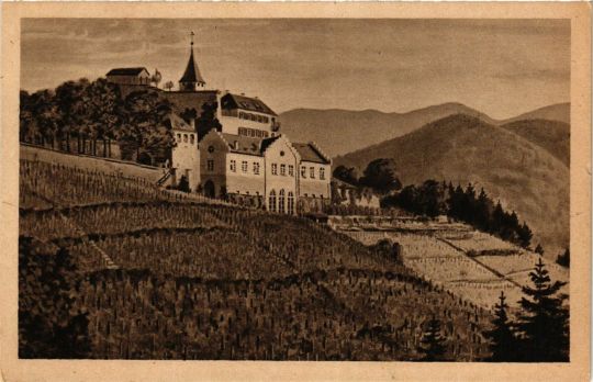
Eberstein Castle overlooking the Murg Valley in Gernsbach, Baden-Württemberg, Germany
German vintage postcard
#vintage#eberstein castle#tarjeta#wrttemberg#old#briefkaart#postcard#germany#photography#postal#eberstein#valley#carte postale#baden-württemberg#german#murg#the murg valley#sepia#ephemera#baden#historic#gernsbach#ansichtskarte#postkarte#overlooking#castle#postkaart#photo
5 notes
·
View notes
Text

I refuse to embrace the struggle any longer so I decided to make peace with my demons. I felt free, and so did they. They no longer have to hide. They no longer have to stay inside.
They watch over me as I sleep every night. Or sometimes struggle to sleep every night. I wonder how I look like through their eyes.
People tell me the next day, "you looked like you had a rough night"
"I got into a fight... with my demons," I respond.
"Wow. But you're here today, so congratulations. You won," they said.
But did I actually win the battle?
#spilled thoughts#photography#spilled writing#spilled words#mental health#words#poetry#quotes#original post#writing#city lights#overlooking#spilled poetry#inner thoughts
5 notes
·
View notes
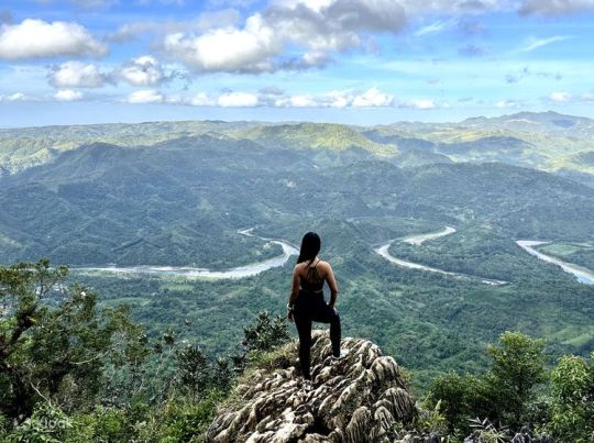
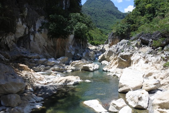
Text
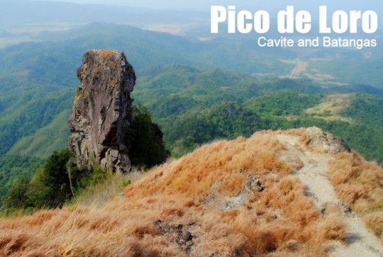
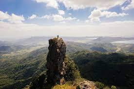
Maragondon, Cavite and Nasugbu, Batangas
Major jump-off: DENR Station, Magnetic Hill, Ternate, Cavite
Minor jump-off: Sitio Fronda, Brgy. Papaya, Ternate-Nasugbu Highway, Nasugbu, Batangas
LLA: 14° 12.855 N; 120° 38.785 E; 664 MASL
Days required / Hours to summit: 1-2 days / 2-5 hours
Specs: Minor climb, Difficulty 3/9, Trail class 1-3
Features: Distinctive spire at the summit, forests, scenic views of Cavite
Mt. Pico de Loro is located in Cavite province, it grants climbers and visitors a breathtaking perspective of Cavite and the state of Batangas as well as the South China Sea. The elevation of Mt. Pico de Loro is 688 meters, or 2257 feet. It is Cavite's highest point. In the province of Batangas, the municipality of Maragondon contains the mountain's northern half, and the municipality of Nasugbu has its southern half. The monolith of Mount Pico de Loro is a 50-foot-tall solitary stone pillar that is located not far from the top. While climbing this monolith involves some bouldering and rappelling, once hikers reach the top of the rock peak, they can be proud of themselves. A spectacular and lifelong memory-making view awaits hikers as their reward.
Pico de Loro refers to "Parrot's Peak." It was rumored that the mountain received its name from its pointed peak, which from a distance resembles the shape of a parrot's peak and is regularly used by seafarers as a marker to turn in the direction of the east in order to reach the historic Manila Bay and Corregidor Island.


9 notes
·
View notes
Text
To better things
3 notes
·
View notes
Photo
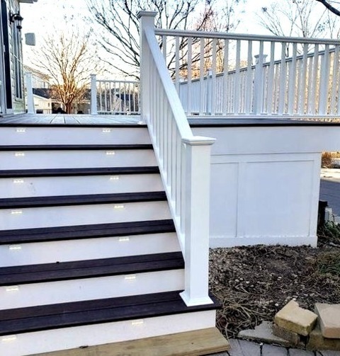
Deck - Uncovered
A sizable, elegant back yard deck in which the fire pit is not covered
2 notes
·
View notes
Text
Scenic Quirino Province

14 notes
·
View notes
Photo

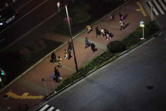
crosswalk
#nightscape#walking#crossing#passing#overlooking#fujifilm#xe1#pentax#super takumar 150mm f4#minolta#auto tele rokkor-qe 100mm f3.5#tokyo#gotanda
8 notes
·
View notes
Photo

Micah 7:18 (NLT) -
Where is another God like You,
who pardons the guilt of the remnant,
overlooking the sins of His special people?
You will not stay angry with Your people forever,
because You delight in showing unfailing love.
#Micah 7:18#where#another#God#like You#who pardons#guilt#remnant#overlooking#sins#His special#people#not stay#angry
57 notes
·
View notes
Text
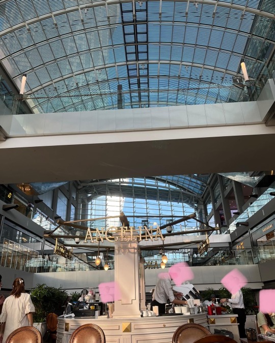


#angelina#petisserie#singapore#marina bay sands#canal#the#shoppes#mbs#pretty cafe#latte art#cappuccino#mocha#a#sunlight#fries#french fries#truffle#truffle fries#white design#overlooking#mall#french#paris#original
24 notes
·
View notes
Text
We are honestly floored by the idea of Overseers having romantic relationships in general. However, we must acknowledge that we are in the minority in this and that no realities present on this platform seem to operate like us in that regard.
5 notes
·
View notes
Text

Satan lands atop Mt. Niphates
“Satan lands atop Mount Niphates, just north of Paradise, the Garden of Eden. He becomes gripped with doubt about the task in front of him; seeing the beauty and innocence of Earth has reminded him of what he once was. He even briefly considers whether he could be forgiven if he repented. But Hell follows him wherever he goes—Satan is actually the embodiment of Hell. If he asks the Father for forgiveness, he knows it would be a false confession; he reasons that if he returned to Heaven, he still could not bear to bow down. Knowing redemption or salvation cannot be granted to him, he resolves to continue to commit acts of sin and evil. He does not notice that during his internal debate, he has inadvertently revealed his devilish nature. He is observed by Uriel, the archangel he tricked into pointing the way. Uriel notices his conflicting facial expressions, and since all cherubs have permanent looks of joy on their faces, Uriel concludes that Satan cannot be a cherub.” …
One of the most poignant and important moments in Paradise Lost comes with Satan’s complex, tangled soliloquy atop Mt. Niphates, his first landing place on our planet. Lines 27-31 set the stage, with Satan on the mountain sometimes looking down at Eden, sometimes looking up at the noonday Sun, his mind pursuing itself through many difficult “revolving” thoughts and attitudes. The soliloquy itself begins at line 32 and ends with line 113.
#paradise lost#john milton#niphates#gustave doré#paradise#overlooking#garden of eden#satan#fallen#fallen angel#earth
17 notes
·
View notes
Photo

RatCity. . Should I animate this? Yay or nay? . . . . . . . . . . . . . . . . . . . . . . . . . . . . . . . . . . . . . . . . . . . . . . . . . . . . . . . . . #sunsetart #sunsetskyline #cityskyline #sunsetcity #cityscapeart #sunsetartwork #ratart #ratstagram #rattus #ratartist #ratartwork #ratlover #rooftops #ontheroof #rat #settingsun #overlooking #stylisedart #stylizedart #cityscapepainting https://www.instagram.com/p/Ci8XOkCKcIW/?igshid=NGJjMDIxMWI=
#sunsetart#sunsetskyline#cityskyline#sunsetcity#cityscapeart#sunsetartwork#ratart#ratstagram#rattus#ratartist#ratartwork#ratlover#rooftops#ontheroof#rat#settingsun#overlooking#stylisedart#stylizedart#cityscapepainting
3 notes
·
View notes
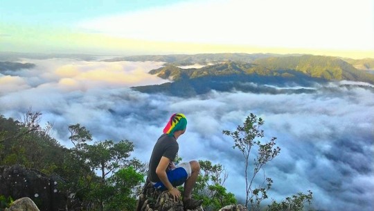
Text

Tanay, Rizal and General Nakar, Quezon
Major jumpoff: Brgy. Daraitan (village centre), Tanay Minor jumpoff: Sitio Cablao Brgy. Pagsangahan, General Nakar LLA: 14°36′48.5′′N 121°26′19.5′′ E, 739 MASL (+600) Days required / Hours to summit: 1 day / 2.5-4 hours
Specs: Minor climb, Difficulty 4/9, Trail class 1-3 Features: Tropical forest, limestone formations, river trek
Mt. Daraitan is a gem at the heart of the great Sierra Madre mountain range which sits near the border of Tanay, Rizal, and General Nakar, Quezon. It offers a relaxing view like Daraitan river, sea of clouds, and picturesque Sierra Madre Mountain range. It is situated in Tanay, Rizal's Barangay Daraitan. Mt. Daraitan rises to a height of 739 meters (2,424 feet) above sea level. The area boasts the best that nature has to offer, from clear rivers and lovely caves—an approximately 100-year-old structure made of pillar and pebble rocks—to a great view of the Sierra Madre mountain range and the lovely Tinipak River. The hike up is a (mostly) straightforward 600-meter ascent that might feel steep to those not used to hiking. There are, however, plenty of holds and the trail is well-maintained.


7 notes
·
View notes
Last Seen Blogs

self-loathing-angel-of-thursday2
Destiel / Ineffable Husbands Brainrot

stupidscav
🇵🇸 SUPPORT PALESTINE & SUDAN.🇸🇩

raghavharsh
Fuck god, believe in yourself

dunmertitty
🌌night shift warrior🐺
whysosadrari
UKY