#scenic byway
Text
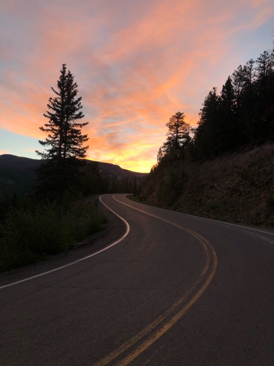
#nature#mountains#hiking#landscape#forest#colorado#sunrise#highway#road#silver thread highway#scenic byway#lake city#road trip#50#100#200#300#400#500#600#700#800
836 notes
·
View notes
Photo

Poudre Falls, Colorado
#cache la poudre river#poudre falls#colorado#scenic byway#nature#outdoors#views#river#waterfall#stream#mountain#my photos#weekend trips
2 notes
·
View notes
Text

365 Things To Do In Scenic Washington State
17 - Discover Chuckanut Drive located near Bellingham. This scenic byway has 21-miles of stunning views and scenery beginning in the fertile Skagit Valley and winding north to the Fairhaven Historic District. This is the only place where the Cascade Mountains meet the sea - expect to see beautiful views of the San Juan Islands, amazing sunsets and thick forest hugging the roadway. (Photo via Bellingham Experience)
#washington#Chuckanut Drive#Bellingham#scenic byway#scenery#skagit valley#cascade mountains#san juane islands#amazing sunsets#sunsets#forest#roadway
1 note
·
View note
Text
Silver Thread Scenic & Historic Byway
youtube
The Silver Thread Scenic Byway is 117 miles long! It goes from South Fork, CO to the Blue Mesa Reservoir near Gunnison…
0 notes
Text
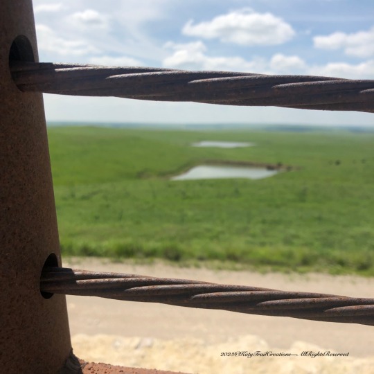
Wide Open Spaces/ThursdayDoors
View On WordPress
#2023#Banjo humor#CancerSucks#Kansas barns#kansas photos#Road trip#Rural America#Scenic Byway#September
0 notes
Photo

Ground Rounds Scenic Byway sign on Bde Maka Ska in Minneapolis. 2009
0 notes
Text
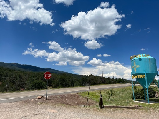
Instagram: jacquiquisdassits
#turquoise trail#cedar crest#new mexico#scenic byway#clouds#brewery#stop sign#sign#signage#road#road trip#mountains
0 notes
Text

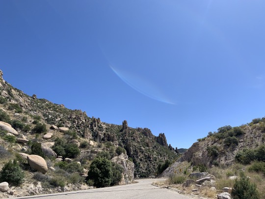
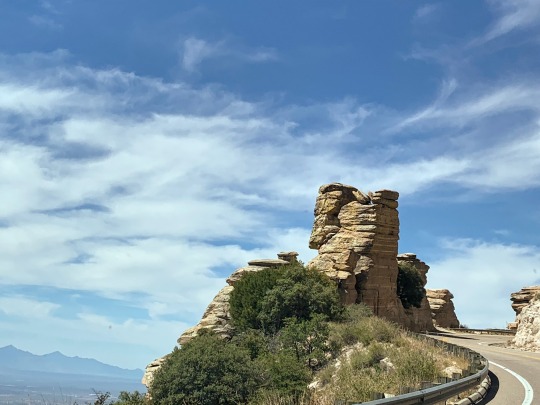
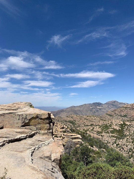


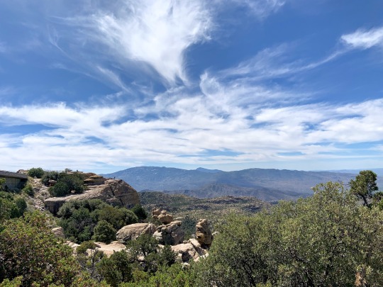

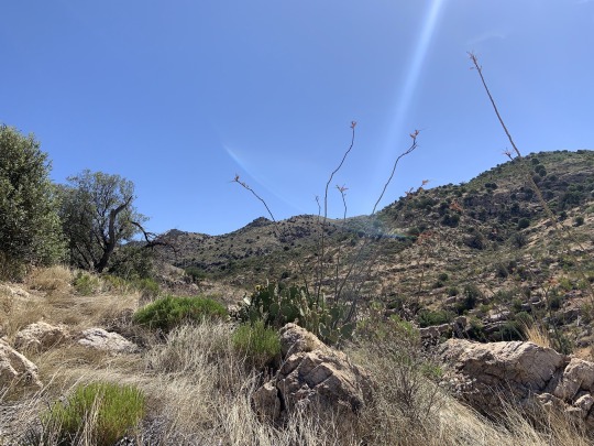
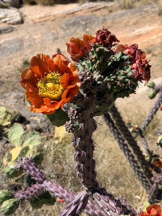
Mount Lemmon Scenic Byway, Arizona (Catalina Highway Scenic Drive)
Very scenic drive, I highly recommend it if you are in the Tucson area 🌵🏜️⛰️
#original photography#landscape photography#Mount Lemmon Scenic Byway#road trip#nature#arizona#roadtrip#vacation#2023#vacation 2023#mine#Catalina Highway Scenic Drive#Tucson#Southwest#photographers on tumblr
156 notes
·
View notes
Text
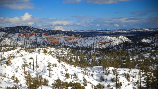
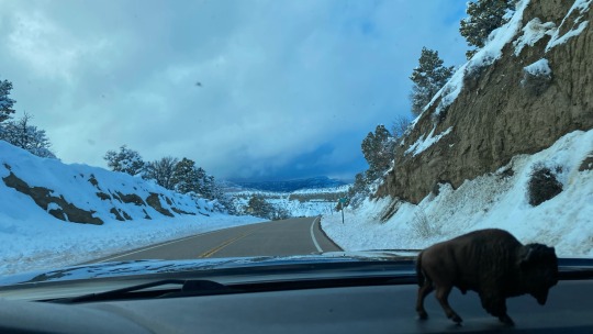
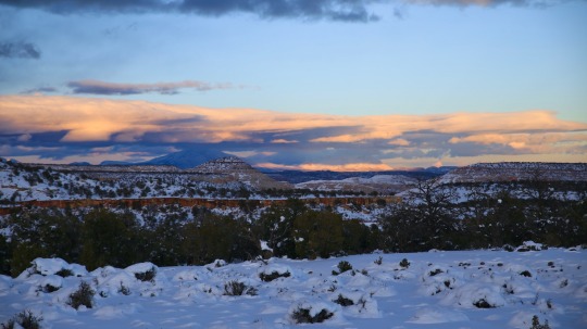
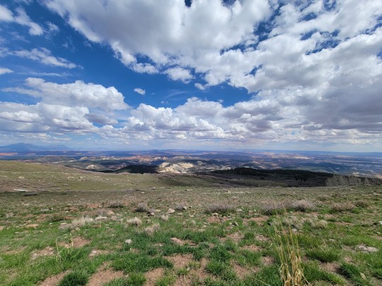
#scenic byway 12#adventure#travel#my photo#southwest#utah#mountains#snow#spring#photography#aesthetic#nature#scenery
134 notes
·
View notes
Text
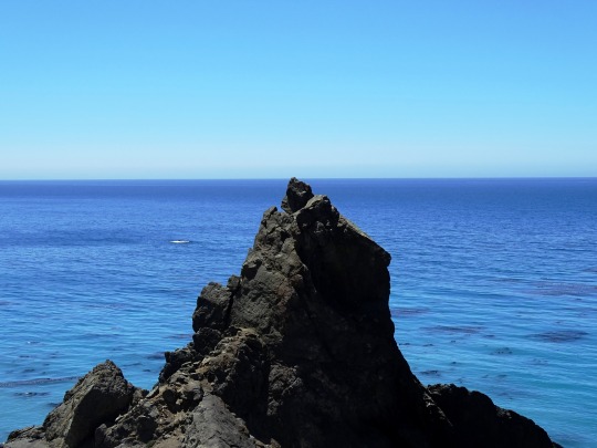


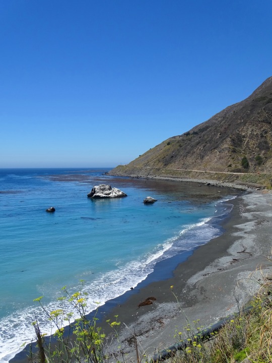
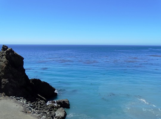
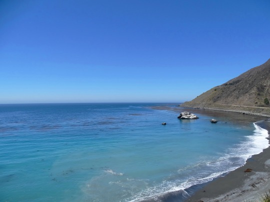
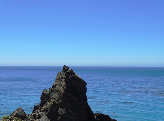
Black Sand Shores, CA (No. 1)
Governor Juan Alvarado granted Rancho San Jose y Sur Chiquito, including the land from Carmel to near Palo Colorado Canyon, to José Castro in about 1848. Castro documented a trail from Monterey to Palo Colorado Canyon used by Native Americans when he filed a map of his purchase in 1853. When the region was first settled by European immigrants in 1853, it was the United States' "last frontier".
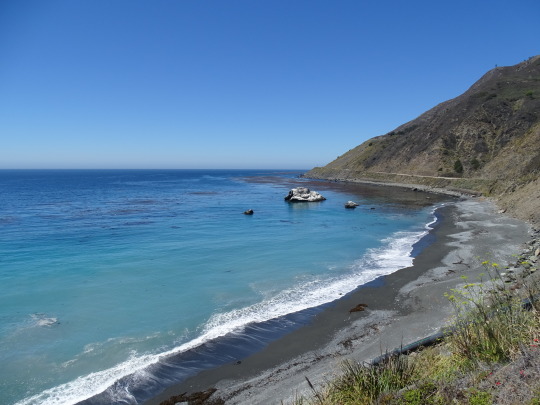
After California gained statehood, the trail from Carmel to Mill Creek (present-day Bixby Canyon) was declared a public road by the county in 1855. But the California coast south of Carmel and north of San Simeon remained one of the most remote regions in the state, rivaling at the time nearly any other region in the United States for its difficult access. It remained largely an untouched wilderness until early in the twentieth century.
Yankee businessman Charles Henry Bixby bought several hundred acres south of Mill Creek and harvested lumber, tanbark, and lime. Without a road, he resorted to using a landing chute and hoist to transfer the goods to steamers anchored offshore.
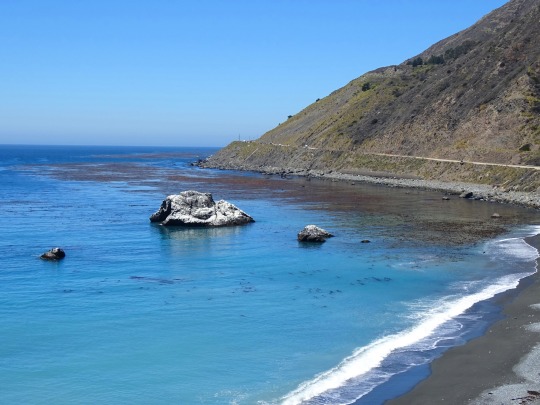
Bixby tried to persuade the county to build a road to Bixby Creek, but they refused, replying that "no one would want to live there". In 1870, Bixby and his father hired men to improve the track and constructed the first wagon road including 23 bridges from the Carmel Mission to Bixby Creek.
Further south, the Rancho El Sur grant extended from the mouth of Little Sur River inland about 2.5 miles (4.0 km) over the coastal mountains and south along the coast past the mouth of the Big Sur River to Cooper's Point. It was largely a cattle operation. There was a brief industrial boom in the late 19th century, but the early decades of the twentieth century passed with few changes, and Big Sur remained a nearly inaccessible wilderness.
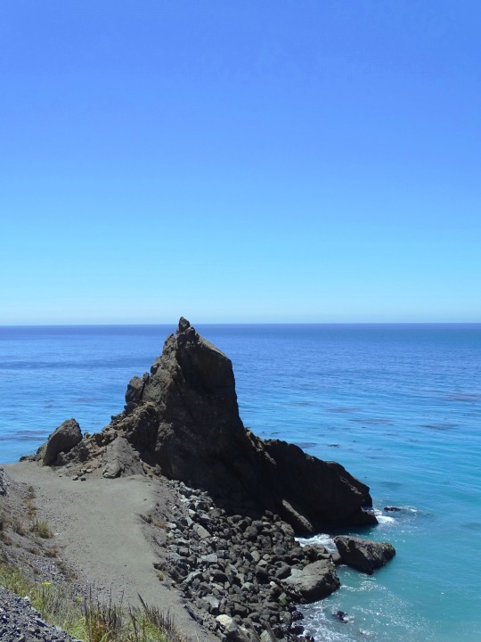
Source: Wikipedia
#Black Sand Shores#California State Route 1#Highway 1#Pacific Coast Highway#National Scenic Byway#Big Sur#Pacific Ocean#travel#original photography#vacation#tourist attraction#landmark#landscape#seascape#countryside#street scene#road trip#summer 2022#California#West Coast#Big Sur Coast Highway#nature#flora#grass#tree#USA#blue sky#blue sea#beach#waves
9 notes
·
View notes
Text
Capitol Reef Overlook - May 23rd 2023
#photographers on tumblr#original phography#nature#american southwest#scenic byway route 12#roadtrip 2023#capitol reef national park#utah#alpine
4 notes
·
View notes
Photo

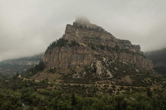
Foggy Cloud Peak Skyway 8.6.22
19 notes
·
View notes
Photo
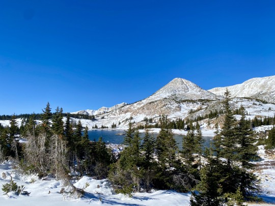
Libby Lake, Medicine Bow National Forest, Wyoming
#medicine bow#libby lake#medicine bow national forest#wyoming#alpine lake#lake#nature#outdoors#hike#evergreen#mountains#snowy range#snowy range scenic byway#scenic byway#my photos#weekend trips
1 note
·
View note
Video

flickr
Light Speed by James Marvin Phelps
Via Flickr:
Light Speed Scenic Byway 12 Red Canyon Dixie National Forest Utah
#Utah#Red Canyon#Dixie National Forest#Travel#Window#Arch#Road#Nature#Landscape#Tunnel#Scenic Byway 12#Traffic#Light Trails#Canyon#Outdoors#James Marvin Phelps Photography#flickr
6 notes
·
View notes
Video
flickr
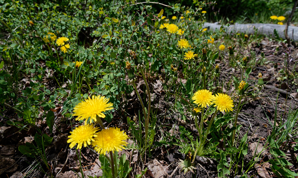
Dandelions in Utah by Mark Stevens
Via Flickr:
A look across a small field of dandelions in Fishlake National Forest. This is at a roadside pullout along Utah Scenic Byway 12. I got down low using the LCD display with LiveView on my Nikon SLR camera to line up and compose this image.
#Aquarius Plateau#Azimuth 282#Blue Skies with Clouds#Canyonlands#Colorado Plateau#Dandelion#Dandelions#Day 3#DxO PhotoLab 5 Edited#Fishlake National Forest#Intermountain West#Landscape - Scenery#Looking NW#Nikon D850#No People#Outside#Partly Cloudy#Project365#Rolling Hillsides#Scenic Byway 12#Scenics - Nature#SnapBridge#Southern Utah and Great Basin National Parks#Spruce Spring#Sunny#Taraxacum#Travel#Wildflower#Wildflowers#Utah
0 notes
Photo
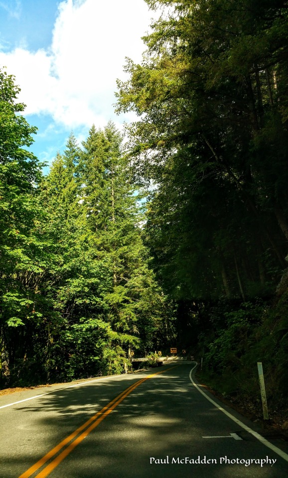
(via Chuckanut Drive Scenic Byway - Washington State)
Paul McFadden Photography
Always in Search of That Next PIcture
FOLLOW: paulmcfaddenphotography.com
0 notes
Last Seen Blogs


nneer5543
제목 없음

emperor-kuzco
Emperor Kuzco

sinaizumi
observation diary

iseemannequins
I See Mannequins!