#snowpack
Text
"A parade of atmospheric river-fueled winter storms in California and other western states has erased the most extreme drought conditions for the first time since 2020 and more water is on the way, forecasters predict.
The U.S. Drought Monitor's latest conditions report shows no part of California is in the Extreme or Exceptional Drought designations that blanketed most of the state last summer.
Most of the central portion of the state is completely free of drought conditions from the latest readings on March 14. Parts of Northern and Southern California are still showing Abnormally Dry or Moderate Drought on the scale, while Moderate Drought conditions are still in place in parts of Siskiyou, Lassen, Modoc, Inyo and San Bernardino counties .

Record snowfall and rain have helped to loosen drought's grip on parts of the western U.S. as national forecasters and climate experts warned Thursday that some areas should expect more flooding as the snow begins to melt...
Jon Gottschalck, chief of the operational prediction branch at NOAA's Climate Prediction Center, said the start of the fire season in the Southwestern U.S. likely will be delayed."
-via CBS News, 3/16/23
And an update from 3/30/23
50% of California is now out of drought completely!
Couldn't find an article about this that didn't have a picture of drastic flooding, rip.
"Drought conditions across California continue to retreat thanks to heavy rain and historic snowfall that has battered the Golden State since late last year.
Data from the U.S. Drought Monitor released on Thursday shows that more than 50% of California is free of any drought classification for the first time since February 2020...
In November, virtually all of California’s Central Valley was deemed to be in an “exceptional drought,” the U.S. Drought Monitor’s worst classification.
As of [March 30th], California’s entire coastline was drought-free and only a small section of the Central Valley was considered “abnormally dry.” More significant drought conditions still exist in the northeastern and southeastern areas of the state...
California’s Sierra Nevada mountains are seeing record snowpack that will eventually melt and fill the state’s reservoirs. On Wednesday, Mammoth Mountain ski resort announced it had set a new all-time snowfall record."
-via KTLA, 3/30/23
#california#united states#drought#california drought#snowpack#mammoth#sierra nevada mountains#water reservoir#water conservation#rain#good news#hope
108 notes
·
View notes
Photo
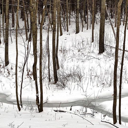
Frozen confluence #winterwoodland #snowpack #frozenstreams https://www.instagram.com/p/CpMWw7pOzis/?igshid=NGJjMDIxMWI=
27 notes
·
View notes
Text
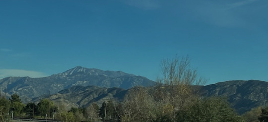
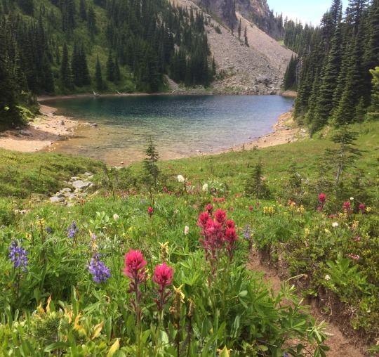
This photo of Mt. San Jacinto was taken on January 15, 2024. Rather alarmingly, there is no (zero, nada, naught, scratch, zilch, zip, bupkis) snow visible on the mountain. Its lofty neighbor to the north, Mt. San Gorgonio, is no better off. While things are improving in northern California, the Southern California PCT is snow-free.
5 notes
·
View notes
Text

Frozen confluence
Wilmarth Farm, Vermont
19 notes
·
View notes
Text
Before and after images show California snowpack replenished by fierce storms
2 notes
·
View notes
Text
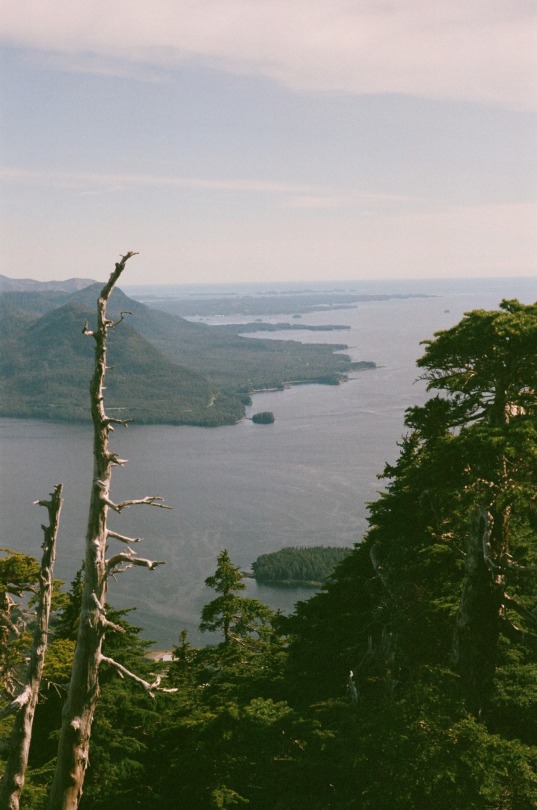
deer mountain, Ketchikan, Alaska
#minolta srt 101#film photography#nature#analog photography#alaska#film#fujifilm#hiking#moody#mountains#pine trees#pnw#snowpack#backpacking
3 notes
·
View notes
Text
Mountain lakes are unique ecosystems whose physical, chemical, and biological properties can vary year to year depending on spring snowpack and ice cover. Mount Rainier, Olympic, and North Cascade National Parks contain over 1,200 mountain lakes and ponds at elevations over 3,200 feet (1000 m). Between 2007 and 2018, scientists monitored conditions in mountain lakes in both above average snow years (2011-2012) and in historical minimum snow years (2015). During years with less snow, lakes become ice-free earlier and have warmer summer water temperatures, giving rise to other ecosystem changes linked to temperature such as lower dissolved oxygen, higher total dissolved nitrogen, higher chlorophyll, and higher abundance of cladoceran zooplankton. Conversely, in years with higher snowpack and a shorter ice-free season, lakes were colder and clearer with more dilute ions as well as lower algal biomass and zooplankton abundance. By looking at a variety of snowpack values, scientists are able to address questions about how climate effects mountain lakes and foretell future conditions in Mount Rainier and other Pacific Northwest parks.
Learn more about this research in “Summer ecosystem structure in mountain lakes linked to interannual variability of lake ice, snowpack, and landscape attributes” published in Limnology and Oceanography, available online at https://aslopubs.onlinelibrary.wiley.com/doi/10.1002/lno.12188.
Additional reports about Mount Rainier National Park water quality available at https://go.nps.gov/1tprha.
NPS/M. Schmitt photo of Upper Palisades Lake at Mount Rainier National Park. ~kl
#Rainier Science#mount rainier national park#water quality#mountain lakes#alpine lake#snowpack#climate
51 notes
·
View notes
Link
California on track for record snow year as storms cause chaos across state
Feb. 28, 2023 - Axios
California is being hit with more severe winter weather — as forecasters warn more heavy rains and snow will continue to slam the West Coast through Wednesday.
The big picture: Schools and roads across Northern California remained closed, as the National Weather Service said the region faced "two more rounds of heavy snow" and dangerous blizzard conditions combined with wind gusts up to 60 mph in the Sierra Nevada until at least early Wednesday.
Additional snowfall of 4 to 7 feet was expected along the Sierra Nevada, with snowfall rates in excess of 2" per hour, according to the NWS — which warned travel "will become very dangerous to impossible at times" in the mountains.
The Sierra Avalanche Center issued an advanced avalanche warning for the backcountry around Lake Tahoe. Another "much stronger storm" was arriving Monday, bringing "continued gale-force winds," colder temperatures and up to 6 feet of snow by Wednesday morning, it noted...
San Bernardino County declared a local emergency Monday after some 5 feet of snow that fell in five days at Lake Arrowhead left some residents and people in vacation homes trapped...
By the numbers: Rainfall over the weekend totaled up to 11.51 inches at Pine Mountain Inn and 4.92 inches in downtown Los Angeles, and snow peaked at Mount High, which received 93 inches, per the NWS.
Meanwhile, the UC Berkeley Central Sierra Snow Laboratory has recorded 460 inches of snowfall this season as of Monday — 100 inches more than the seasonal average...
***Update to this article, as of Mar. 1, 2023, the Central Sierra Snow Lab has received 531 inches of snow, just from this last storm!***
#orgone#orgone energy#orgonite#snow#winter storm#bizzard#sierras#sierra nevada mountains#tahoe#big bear#san bernardino#california#snowpack#record snowfall#weather#rain#record rainfall#free energy#planetary healing#geo-restoration
7 notes
·
View notes
Text
AntStack’s Frontend Bundlers Minified
Frontend web development has truly evolved at an extremely rapid rate, it’s pretty impressive that we have moved from writing HTML to almost no HTML at all and mostly writing JavaScript (JSX)! All that advancement is made smooth and possible by programs working behind the scenes to take our code and give it to the world, Bundlers give us a lot however no one talks much about them, lets ‘minify’ these complex programs and make sense of how they have evolved over the years and helped us while also seeing their state today.

0 notes
Text
Seeking Spring's Secrets: Intriguing Intricacies

View On WordPress
#coexistence#Garter Snake#George Genereux Urban REgional Park#harmless#herpetologist#herpetology#hibernaculum#living being#marvel#moisture#mystery#naturalists#Organism#Plains Garter Snakes#Richard St. Barbe Baker AFforestation ARea#Saskatchewan#Saskatoon#snake#snakes#snowpack#spring#temperature#WEather#Wonder
1 note
·
View note
Photo

Winter’s melting #oakleaves #snowpack #springmelt https://www.instagram.com/p/CqWtwwGu35n/?igshid=NGJjMDIxMWI=
3 notes
·
View notes
Text
California's Snow Pack -- January 1st
California’s wet season is off to a relatively slow start, despite El Niño conditions that often mean a rainy winter. Overall, there’s been about a third less precipitation across the state so far than the average for this time of year, according to rainfall totals through the end of December.
More worrisome is the state’s snowpack, which state officials said on January 2nd is just 25 percent of what it typically is at the turn of the new year. The unusually warm weather in December meant that precipitation was more likely to fall as rain than as snow, experts say.
That 25 percent figure is the lowest for California in a decade, and a huge change from a year ago. By January 2 last year, a series of atmospheric rivers — storm systems named for their long, narrow shape and the prodigious amount of water they carry — had built the snowpack up to almost twice the 30-year average.
“The dry fall and below-average conditions today shows how fast water conditions can change,” Sean de Guzman of California’s Department of Water Resources said in a statement.

Looks pretty bleak doesn't it!
The implications for PCT hikers is significant unless there is change in snowpack in California.
3 notes
·
View notes
Text
Epic River Rafting with Record-Breaking Snowpack will be Exhilarating
Brace yourself for an exhilarating ride as this year's unprecedented snowpack levels intensify the excitement of river rafting adventures. Prepare for unmatched thrills and breathtaking experiences on the water.
Unprecedented thrills this year at the Grand White river rafting with record-breaking snowpack
Brace yourself for an exhilarating ride as this year’s unprecedented snowpack levels intensify the excitement of river rafting adventures. Prepare for unmatched thrills and breathtaking experiences on the water.
BY KAZEEM ADELEKE, ARTCENTRON
The anticipation is high as this year’s snowpack in the…

View On WordPress
#Canyonlands National Park#Cataract Canyon#Desolation Canyon#Green River#Outdoor Activities#River Rafting#Snowpack#Westwater Canyon#Whitewater Rafting
0 notes
Text
youtube
NASA satellite images show change in CA snowpack
ABC7 News Bay
May 2, 2023
Satellite images from NASA show how the snowpack in California has changed over the recent months. Video shows how much snow has melted in the state over the last couple of months.
1 note
·
View note
Text

riding the thermals to three thousand feet
#Alaska#analog photography#film photography#minolta srt 101#nature#35mm photography#bald eagle#bird photography#avian#mountaineering#backpacking#get outside#snowpack#pine forest#hawks#bird of prey#moody#solo travel
2 notes
·
View notes
Text

Image of Snow Water Equivalent chart from Natural Resources Conservation Service’s Paradise SNOTEL station.
Cool & Snowy Spring at Mount Rainier
The official start of spring was March 20. Weather at Mount Rainier has been cool and snowy, hardly spring-like. How cool? Compared to the average temperature of the period of record (1917-2021), May was an average of 5°F cooler at the Paradise COOP weather station. How snowy? During most of the winter of 2021-22, Snow Water Equivalent (SWE) at the Paradise SNOTEL station was below normal (see graph above). Except for a brief period, January 6 to January 25, this year's SWE (black line) hung below the average (green line) nearly the whole winter. By April 1, 2022, the SWE was more than 10" below normal. Then winter staged a comeback - a strong one.
Later season storms of April and May piled up snow (and thereby increased the SWE) so that by May 8, the 2022 SWE line crossed the normal line and just kept shooting up. The Paradise COOP weather station measures the height of newly-fallen snow and the total snow depth over winter, among other parameters like temperature. Snow depth was also below normal most of the winter.
This is what the “April Comeback” looked like in snow height: A storm deposited 30" of snow at Paradise between April 3 and April 5. Another deposited 37" between April 8 and April 12. Slightly less ferocious storms later in April piled up an additional 30" of snowfall. Snow kept coming in May and by the first day of spring we had a quite robust snowpack height of 169.9" (124% of average). This additional snow can be seen related to its weight in water on the graph of SWE. As you can see from the wiggly line at the end, cool temperatures and occasional snowfall has kept the SWE line from diving as it usually does this time of year.
Be careful if you arrive during one of our recently-often storms. It still feels like winter at Mount Rainier National Park. But that’s a good thing! The plants sleeping below that snow will appreciate the abundant water source into the coming summer.
~sh/kl
18 notes
·
View notes
Last Seen Blogs