#watson lake
Text
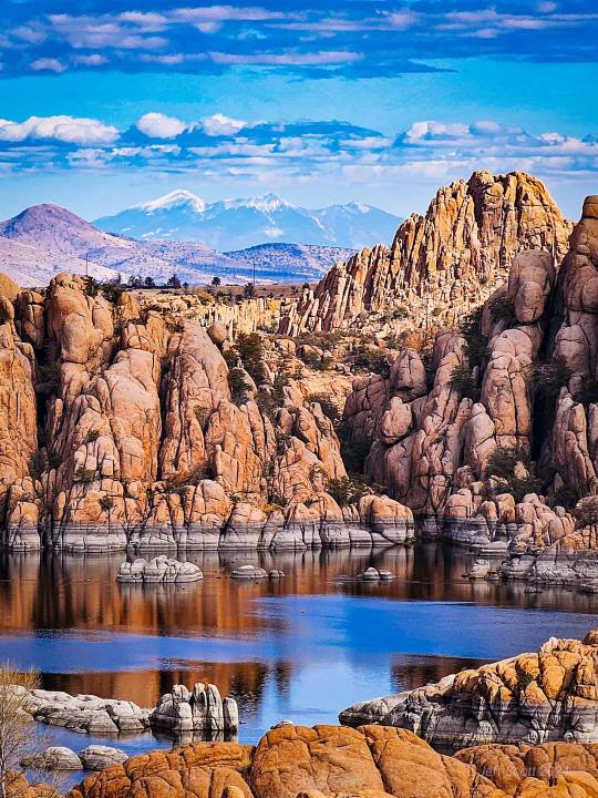
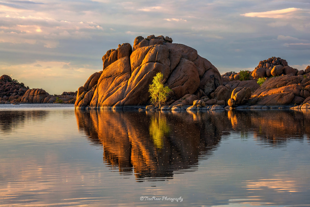
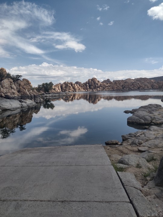
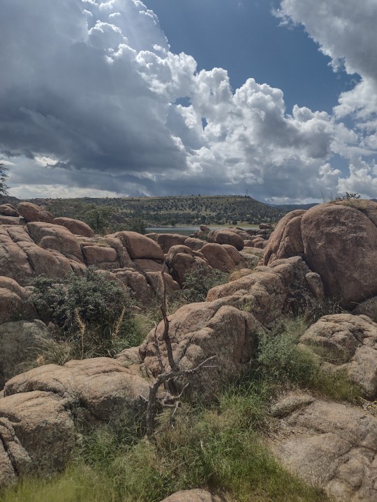
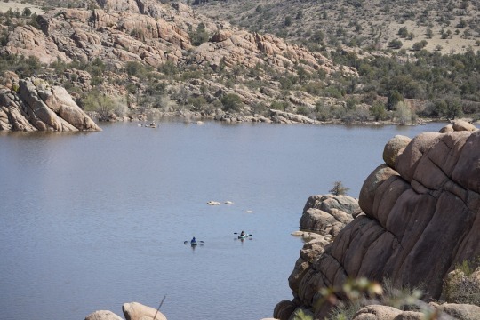
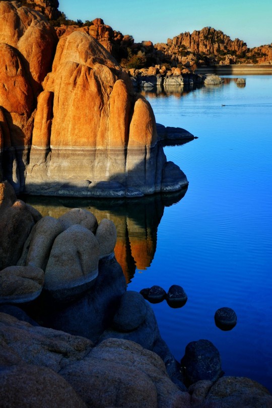
Watson Lake with San Francisco Peaks in the distance. Outside of Prescott, Arizona
40 notes
·
View notes
Text
Watson Lake conservation officers are seeking public assistance regarding four black bears shot and abandoned south of Watson Lake.
Three of the abandoned bears were found around Aug. 19 between Contact Creek in the Yukon and Iron Creek in B.C.
he bears were shot and left on the side of the Alaska Highway at kilometres 911, 912, and 932.
Two of the bears were found in the Yukon and two were found in B.C.
Environment Yukon has put out posters seeking the public’s assistance.
They note it’s illegal to waste any part of a big game animal suitable for human consumption.
Watson Lake conservation officer Logan Donovan explained in an interview this morning they will have to await the results of necropsies to answer some questions, such as the ages of the bears. [...]
Continue Reading.
Tagging: @politicsofcanada
#cdnpoli#Watson Lake#Yukon#conservation#flora & fauna#animal death#crime and punishment in canada#animal abuse#British Columbia
34 notes
·
View notes
Text


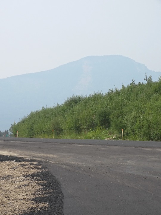


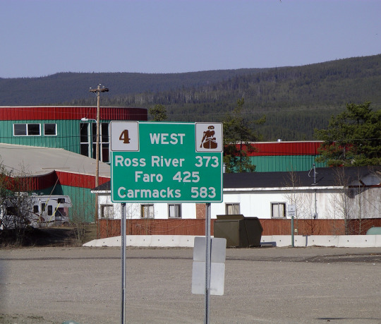
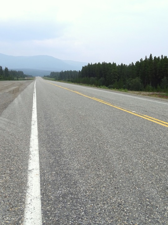
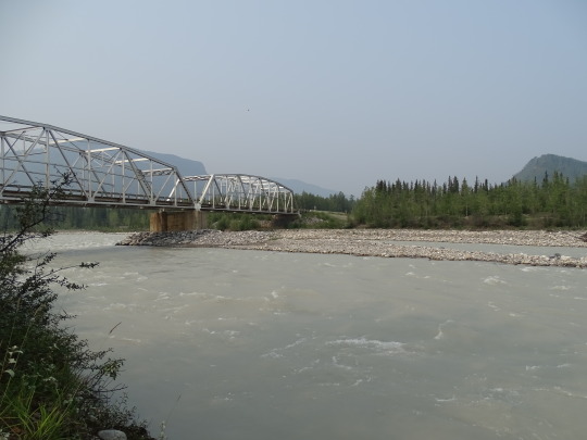
Alaska Highway, CDN (No. 4)
The original agreement between Canada and the United States regarding construction of the highway stipulated that its Canadian portion be turned over to Canada six months after the end of the war. This took place on April 1, 1946, when the U.S. Army transferred control of the road through Yukon and British Columbia to the Canadian Army, Northwest Highway System. The Alaskan section was completely paved during the 1960s. The lower 50 miles of the Canadian portion were paved in 1959, but the remainder was largely gravel. While the entire route is now completely paved (mostly with bituminous surface treatment), as late as the mid-1980s the highway still included sections of winding dusty road sandwiched between high quality reconstructed paved segments.
The Milepost, an extensive guide book to the Alaska Highway and other highways in Alaska and Northwest Canada, was first published in 1949 and continues to be published annually as the foremost guide to travelling the highway. The settlement of Destruction Bay was originally a work camp for the highway.
The British Columbia government owns the first 82.6 miles (132.9 km) of the highway, the only portion paved during the late 1960s and 1970s. Public Works Canada manages the highway from Mile 82.6 (km 133) to Historic Mile 630. The Yukon government owns the highway from Historic Mile 630 to Historic Mile 1016 (from near Watson Lake to Haines Junction), and manages the remainder to the U.S. border at Historic Mile 1221. The State of Alaska owns the highway within that state (Mile 1221 to Mile 1422).
The Alaska Highway was built for military purposes and its route was not ideal for postwar development of northern Canada. Rerouting in Canada has shortened the highway by about 35 miles (56 km) since 1947, mostly by eliminating winding sections and sometimes by bypassing residential areas. The historic milepost markings are therefore no longer accurate but are still important as local location references. Some old sections of the highway are in use as local roads, while others are left to deteriorate and still others are plowed up. Four sections form local residential streets in Whitehorse and Fort Nelson, and others form country residential roadways outside of Whitehorse. Although Champagne, Yukon was bypassed in 2002, the old highway is still completely in service for that community until a new direct access road is built.
Source: Wikipedia
#60th Parallel#Summit Lake#Watson Lake#Alaska Highway#street scene#travel#original photography#vacation#landmark#landscape#countryside#summer 2023#flora#nature#woods#forest#mountains#Canada#Yukon#bridge#Alaska-Canadian Highway#ALCAN Highway#Alaskan Highway#the North#no traffic#tourist attraction#British Columbia#Racing River Bridge#river bank
9 notes
·
View notes
Video
flickr
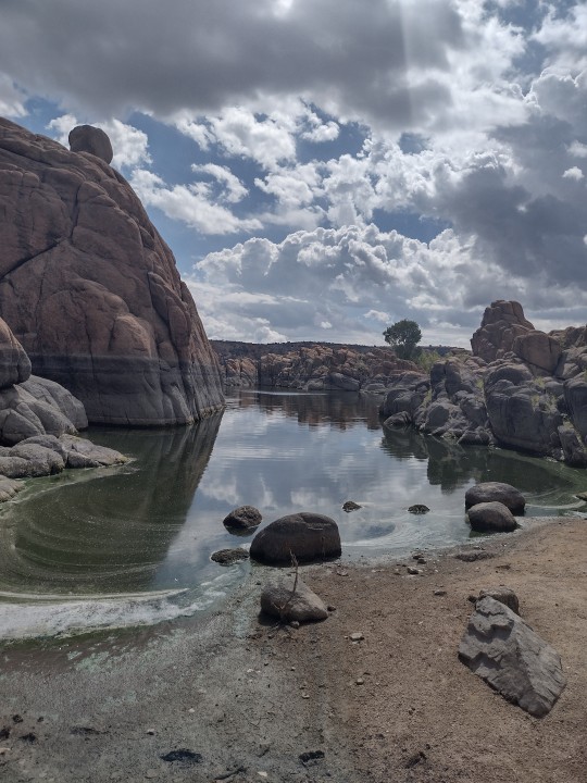
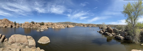
Evening Shimmer by Theresa Rose
Via Flickr:
"Evening Shimmer:" Magical evening light creates reflections that shimmer in the water at Watson Lake. Cottonwood fluff garnishes the water's surface as white specks. For a moment, time stood still.
#flickr#theresa rose#photographer#rock formation#reflections#watson lake#cottonwood#landscape#nature
8 notes
·
View notes
Text

43 notes
·
View notes
Text

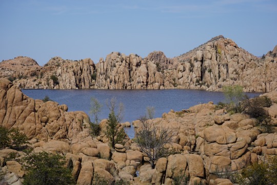
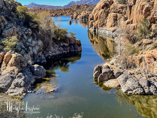
Watson Lake, Yukon
3 notes
·
View notes
Text
Road Trip Day 7-Final Day
Destination Prescott, Az
This was the final day of driving before we headed back to Phoenix and we wanted somewhere to stay outside the Grand Canyon, so we chose Prescott.
So...this was poor planning on my part but we didn't actually see the Grand Canyon. There are two sides you can visit, the west rim, closer to Vegas and the National park. Silly me, I assumed both were National Parks...which I have a pass for...nope. The west Rim is where the skywalk is and is on a reservation. We drove out there, it was a beautiful drive, lots of Joshua trees. The road was beautiful, like something out of a postcard.
When you get there, the actual canyon is a ways off and fenced off. There's a welcome center, restaurants, souvenir store, etc. Tickets just to see the canyon are over 50 bucks. Per person. Had hubs and my kid insisted on see more than the canyon wall in the background I suppose I would have but they were also appalled at the price. After the fact I learned you can get cheaper tickets online. Ce la vie. Despite that, it was a nice drive. The second half was long, back to the highway 50 miles and along a forgotten back highway somewhere in Arizona. In a flood zone, in the rain. Thankfully we didn't get stuck. We got to Prescott late, ordered Chinese and went to bed.
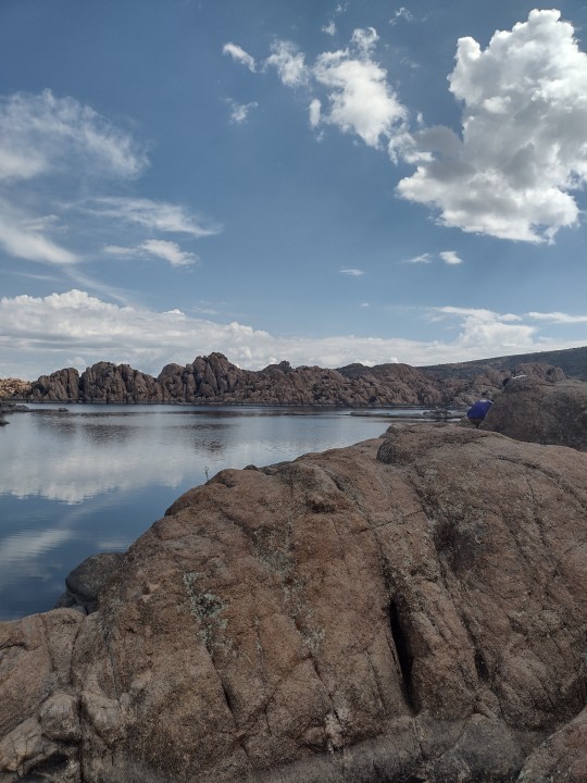
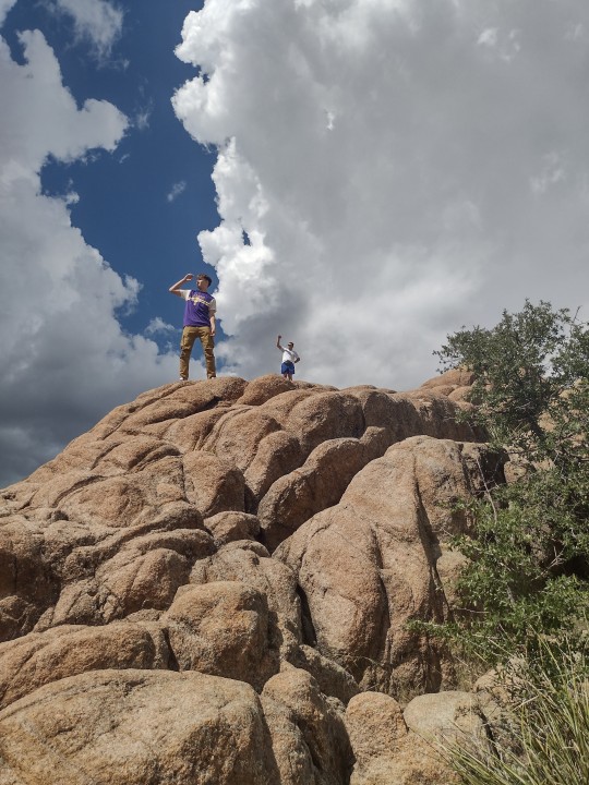
The next morning, before heading back to Phoenix, we went to Watson Lake, which is just amazing. The lake is surrounded by rocks and formations. I didn't do much climbing but hubs and my kid did.
Afterwards we drove an hour and a half back to Phoenix. I would have liked to show everyone Flagstaff on the way but no one wanted to sit in the car anymore.
All in all the trip was amazing. There were some mishaps, we didn't get to see everything we wanted to. There was a bit of bickering, a few tears but it was an awesome experience. I'm a little sad it's over.


0 notes
Text

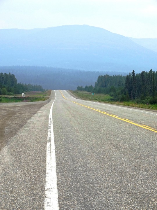
Map of Yukon's municipalities. (Cities/Towns) Original Post:
#map#maps#geography#canada#canadamaps#yukon#city#town#dawson#mayo#carmacks#faro#Haines junction#Whitehorse#teslin#watson lake
1 note
·
View note
Text
Spring 2023
0 notes
Text

April 2023
1 note
·
View note
Text
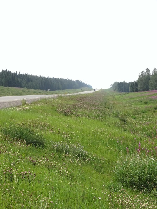
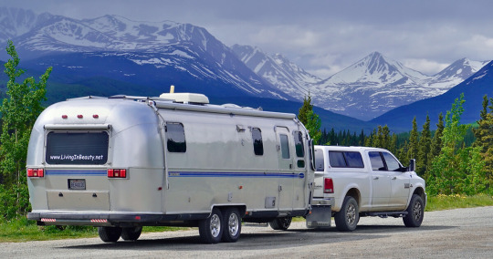
Airstreaming to Alaska - Chapter 11: Yukon
Long dusty roads. Midnight sun. Thick wildfire smoke. Rivers rising to the breaking point. Cell signal outages. Moose crash hot zones. Every morning we untangled our weary bones from the mosquito net to resume the ongoing discussion, "Should we turn back"
Posted December 4, 2022 – Narrated by Carmen
To listen to the podcast, click the play button
Chapter 11 of the “Airstreaming to Alaska” series.
“This is the Law of the Yukon, that only the Strong shall thrive;That surely the Weak shall perish and only the Fit survive.Dissolute, damned, despairful, crippled and palsied and slain.This is the will of the Yukon – Lo, how she makes it…
View On WordPress
#Airstream#Airstream Blog#Airstream Life#Airstream Travel Blogs#Airstreaming#atlin#Beaubeaux#Full-time Airstreaming#Full-time RV Living#Full-Time RVing#Living in Beauty#living simply#Living the Dream#simple living#teslin#watson lake#whitehorse#yukon
0 notes

Text
WQW #31: Mountains - Nature's Peace
WQW #31: Mountains – Nature’s Peace
August 17: Earth: Mountains, Rocks
Writer’s Quotes Wednesdays (a Photo or Writing Challenge)
Featured Bloggers for WQW #30: Lakes
Thank you to those who linked.
HEAVEN’S SUNSHINEHOURGLASS POETRYKEEP IT ALIVELADY LEELOVING LIFENEW2WRITINGSECOND WIND LEISURETRAVEL WITH MEWIDE EYED WONDERINGS
IT’S EASY TO PLAY ALONG WITH #WQW
This weekly writing challenge runs from Wednesday through Tuesday at…
View On WordPress
#WQW#Alwayswrite.blog#Cell Pic Sunday#Granite Dells#Marsha Ingrao#Museum of Indigenous People#Sierra Nevada Mountains#Water Water Everywhere#Watson Lake#Willow Lake
0 notes
Text


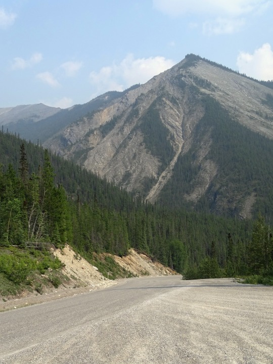

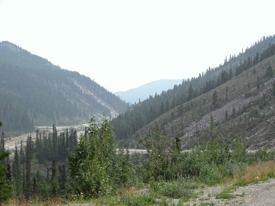
Alaska Highway, CDN (No. 3)
On September 24, 1942, crews from both directions met at Mile 588 at what became named Contact Creek, at the British Columbia-Yukon border at the 60th parallel; the entire route was completed October 28, 1942, with the northern linkup at Mile 1202, Beaver Creek, and the highway was dedicated on November 20, 1942, at Soldier's Summit.Replica log bridge at Aishihik River crossing
Although it was completed on October 28, 1942, and its completion was celebrated at Soldier's Summit on November 21 (and broadcast by radio, the exact outdoor temperature censored due to wartime concerns), the "highway" was not usable by general vehicles until 1943. Even then there were many steep grades, a poor surface, switchbacks to gain and descend hills, and few guardrails. Bridges, which progressed during 1942 from pontoon bridges to temporary log bridges, were replaced with steel bridges where necessary. A replica log bridge, the Canyon Creek bridge, can be seen at the Aishihik River crossing; the bridge was rebuilt in 1987 and refurbished in 2005 by the Yukon government where it functions as a popular tourist attraction. The easing of the Japanese invasion threat resulted in no more contracts being given to private contractors for upgrading of specific sections.
Some 100 miles (160 km) of route between Burwash Landing and Koidern, Yukon, became nearly impassable in May and June 1943 due to permafrost thawing under the road and destroying the layer of delicate vegetation that held the road together. A corduroy road was built to restore the route, and corduroy still underlies old sections of highway in the area. Modern construction methods do not allow the permafrost to thaw, either by building a gravel berm on top or replacing the vegetation and soil immediately with gravel. The Burwash-Koidern section, however, is still a problem as the new highway built there in the late 1990s continues to experience frost heave.
Pincers on Japan and Look to the North, both 1944 productions, were National Film Board of Canada documentaries that depicted the construction of the Alaska Highway.
Source: Wikipedia
#Watson Lake#Alaska Highway#street scene#travel#original photography#vacation#landmark#landscape#countryside#summer 2023#flora#nature#woods#forest#fireweed#wildflower#mountains#Canada#Yukon#bridge#Alaska-Canadian Highway#ALCAN Highway#Alaskan Highway#the North#no traffic#reflection#tourist attraction#Muncho Lake Provincial Park#British Columbia#caribou
13 notes
·
View notes
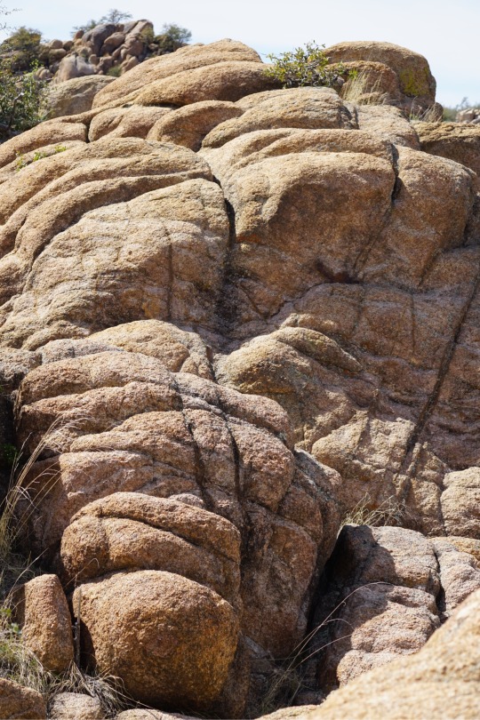
Photo

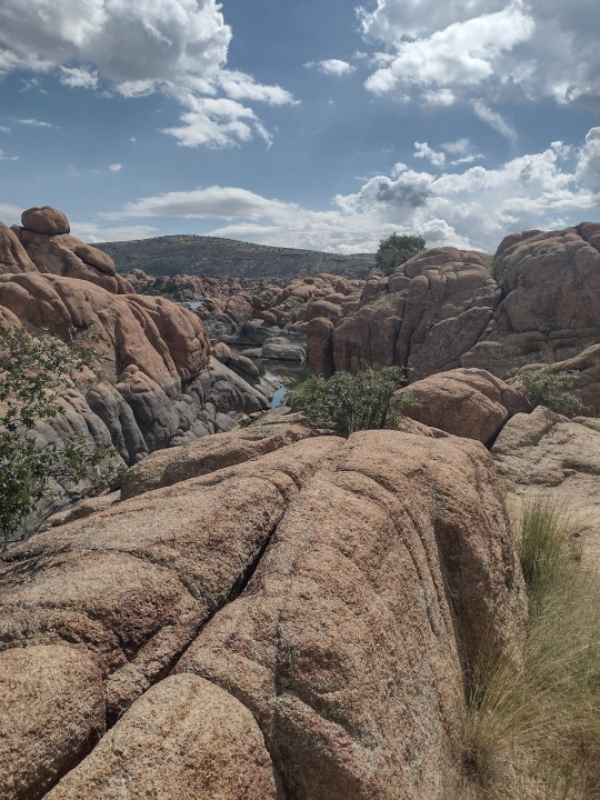
“Feeling Small”
Watson Lake in Prescott, Arizona
By Valerie Millett
23 notes
·
View notes
Last Seen Blogs

desafiovip60-blog
Desafio Vip 60 dias da Cris Senna Funciona

baixxar
baixxar.com

hkana
hkana

askphantomsunandmoon
Ask Phantom Sun and Moon

lookslife12
...