
alwaysunderconstruction
Always Under Construction
16267 posts
Don't wanna be here? Send us removal request.
Last Seen Blogs

mannyhogarts
thong girl, wrong girl.

loveposthot
NSFW

fuckyeahtrumanblack
HEAD.CARS.
BENDING.

ffcd
Fuchigami to Funato CD catalog

sadidaz
OVO
Text

Guayaquil, Ecuador, sits on the upper stretches of the Guayas River estuary, adjacent to a 235-square-mile (608-sq.-km) network of tributaries and mangrove forests. Since the 1970s, commercial shrimp farms have become commonplace in the estuary, leading to mangrove deforestation. This presents a conflict for Guayaquil, which benefits from shrimp exporting but is the planet’s fourth-most vulnerable city to future flooding due to climate change.
-2.208180°, -79.942960°
Source imagery: Maxar
181 notes
·
View notes
Text
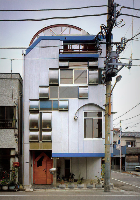
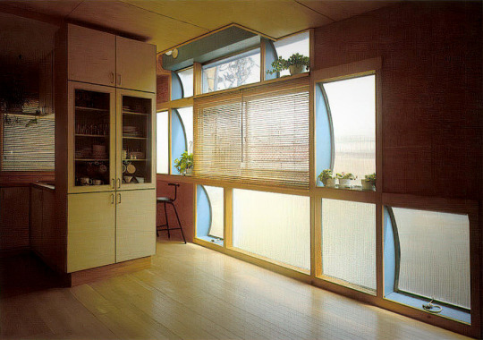

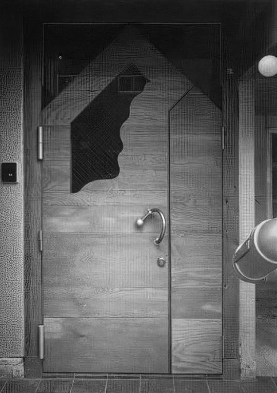


1145. Kenzo Unno (Umi Architectural Atelier) /// Maruyama House (House to Watch the Fireworks) /// Sumida City, Tokyo, Japan /// 1986-87
OfHouses presents: Japanese Fields OfHouses, part VII.
(Photos: © Shinkenchiku-sha. Source: ‘Jutakutokushu’ 10/1987; 'SD' 10/1987; 'Jutakukenchiku' 04/1988; Umi Architectural Atelier Archive.)
—
This project will be published in our upcoming book: ’Japanese Fields | OfHouses.’
88 notes
·
View notes

Photo

Edificio Celanese Mexicana (hoy sede de la SEMARNAT), av. Revolución 1425, Campestre, Álvaro Obregón, Ciudad de México 1968
Arqs. Ricardo Legorreta y Roberto L. Jean
Celanese Mexicana building (now SEMARNAT headquarters), av. Revolucion 1425, Campestre, Alvaro Obregon, Mexico City 1968
371 notes
·
View notes
Text
'sean o'casey community centre, dublin, ireland, 2008' by sheila o'donnell in breaking ground: architecture by women - jane hall (2019)
224 notes
·
View notes


Text
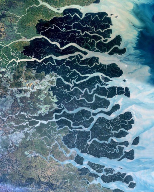
The Sundarbans is a region that covers 3,900 square miles (10,000 square km) of southern Bangladesh and a small section of Eastern India. This region is densely covered by mangrove forests and contains the largest natural reserve for the Bengal tiger. Over the past two centuries, approximately 2,600 square miles (6,700 square km) of the Sundarbans’ land has been developed.
21.950000°, 89.183333°
Source imagery: NASA
349 notes
·
View notes

Photo
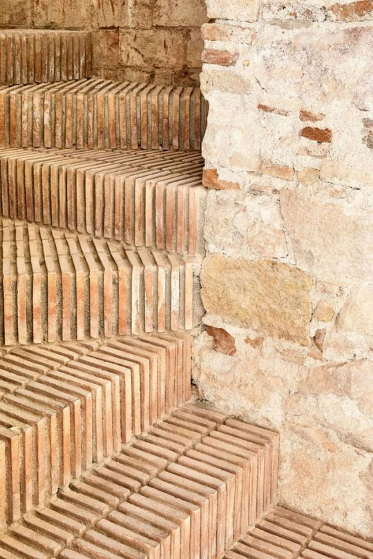
Architectural Brick Stairs Pattern
Follow Souda on Tumblr
533 notes
·
View notes

Text
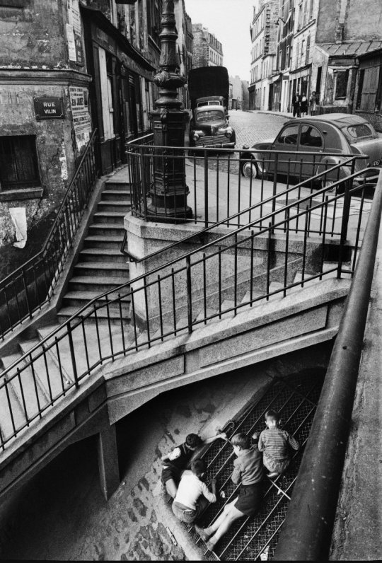
Sous les escaliers de la rue Vilin. Photo par Willy Ronis, 1959. - source Paris sera toujours Paris.
43 notes
·
View notes
