travelling-around-this-world
Travelling Around This World
my trips
92 posts
Don't wanna be here? Send us removal request.
Last Seen Blogs

macaroni-with-the-chicken-strips
completely adulterated multi-fandom chaos

tinhotmoingay
Tin Hot Mỗi Ngày

violetanastasia
VioletAnastasia

sshbpodcast
A Star to Steer Her By - A Star Trek Podcast
Text
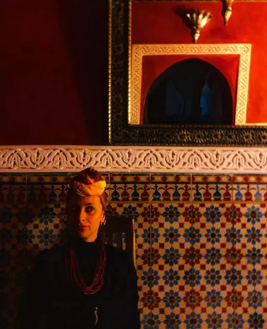
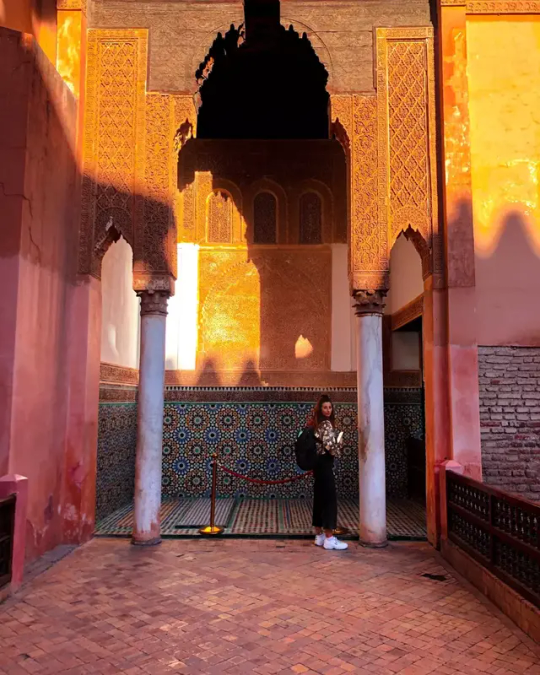
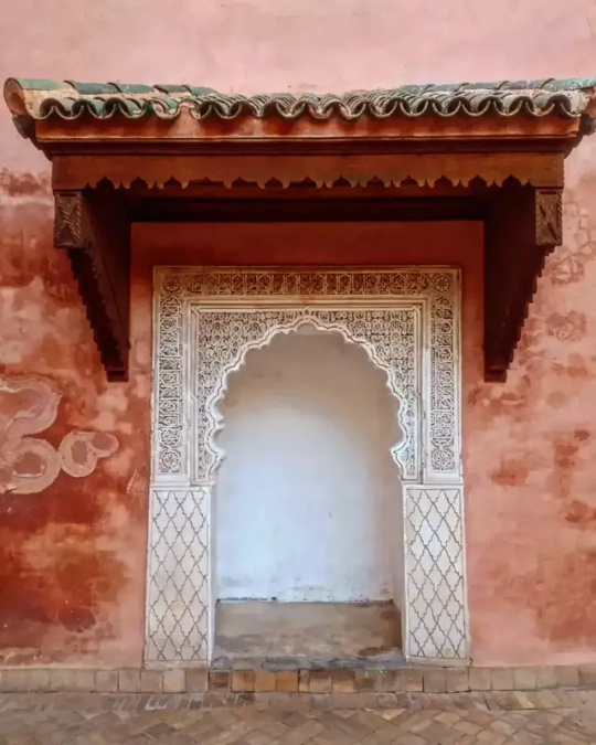
FES, MEKNÈS, CHEFCHAOUEN 🇲🇦 4 Days
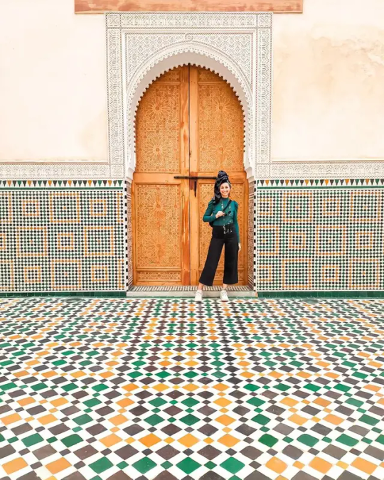
The oldest of the four "imperial cities" of Morocco (the others are Marrakech, Meknes and Rabat), Fes was the capital of Morocco several times in the past, the last of which ended in 1912, when most of Morocco came under French control and Rabat was chosen to be the capital of the new colony. Today Fes is the third largest city in Morocco after Casablanca and Rabat.
Fes is often referred to as the spiritual capital of Morocco. It was once one of the most important places of scholarship in the world, containing within its walls the bastion of Islamic teaching. The University of Al-Karaouine was founded in 859 AD and is the oldest continuously-operating university in the world.
WHAT TO VISIT
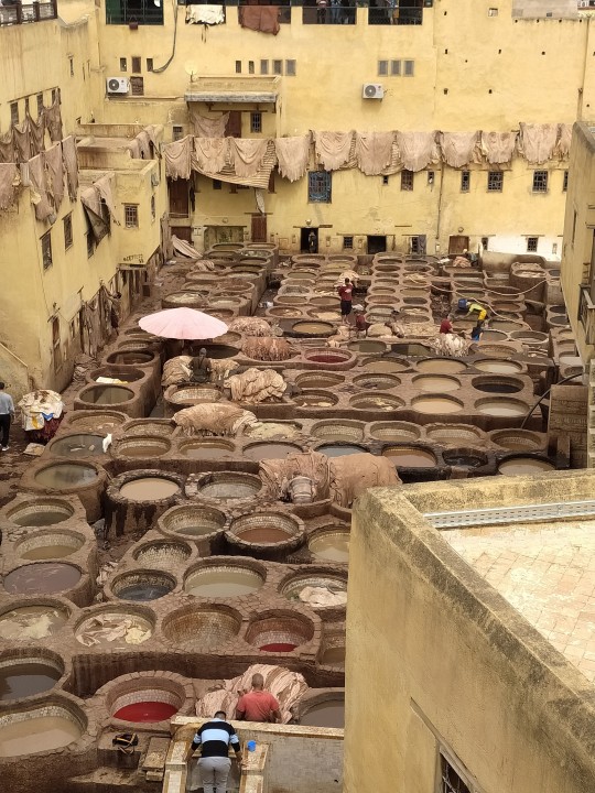
CHOUARA TANNERY
Colorful Moroccan slippers, bags, and jackets are just some of the leather goods available in Fes. But before shopping, be sure to check out the world-famous tanneries to see the traditional dying of animal skins
The ancient MEDINA
WATER CLOCK
UNIVERSITY
The Kairaouine Mosque is known to be the world’s oldest university and is the second-largest mosque in Morocco. It is one of the most important religious buildings in Fes, and as such, only Muslims are allowed inside.
Explore the SOUKS
The souks are the very soul of any Moroccan city, and the ones in Fes are some of the most impressive. Step back into a medieval time of dusty walled streets, where the only transport is donkey and cart. It’ll be an assault on the senses, with sellers shouting prices and striking hard bargains, aromatic smells coming from every direction, and textile displays in all colors of the rainbow.
NEJJARINE FONDOUK
Right amid Place Nejjarine, surrounded by metalworker workshops, you'll find the Nejjarine Museum in an old fondouk (khan or caravanserai), which has been transformed into a museum exhibiting the diversity of traditional Moroccan wooden arts and crafts
VISIT THE BAB BOUJELOUD (BLUE GATE)
The Bab Boujiloud is the iconic blue gate that marks the entrance to Fes el Bali (Old City). You can also check out the Bab Chorfa, another impressive gate framing the Medina.

WHERE TO STAY/WHERE TO EAT
We stayed at Riad Dar Omar
Here some places where to eat:
Cafè Clock
Restaurant Sahra
DAILY TRIPS FROM FES
MEKNÈS 📍
Only 65 kilometers southwest of Fes, and connected by regular trains, Meknes is a favorite day-tripping destination for visitors to the city.
This imperial city, made the ruling capital by Sultan Moulay Ismail in the 17th century, is home to a compact medina area that offers a more relaxed sightseeing experience than the crowded medinas of Fes and Marrakesh. This allows for easier viewing of the alleyway architecture.

Neighboring the medina is Meknes' imperial district, home to the grand Bab al-Monsour, one of the most ornate surviving gateways in North Africa, and the Mausoleum of Moulay Ismail, with its fine tile work and stucco-decorated interior.

Meknes is also the closest city to Volubilis, Morocco's best Roman-era ancient site. The rambling hilltop site, only 32 kilometers north of Meknes, is home to half-toppled temple buildings, still-standing columns along a colonnaded street, and intricate mosaic floors.
If you start early enough from Fes, it's easy to combine both in one day. Daily trip for 25€ each.
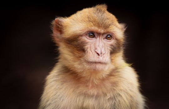
2. IFRANE NATIONAL PARK 📍
Ifrane National Park is located in the northcentral part of Morocco. It is situated in the central part of the Atlas mountain range. The park covers an area of 193.05 square miles (500 sq km).
The mountainous national park is blanketed in many parts with the Atlas cedar trees. Wetlands, high-altitude forests, and endemic habitats are part of what make the national park such a vital protected area.
The altitude of the park ranges from 4,590 to 7,874 (1,300 to 2,400 m) above sea level. The higher mountains are located in the neighboring Toubkal National Park which features the famous Mount Toubkal.
Approximately a tenth of the world’s population of Atlas Cedar is located here in the park. The ecosystem is also home to the endangered Barbary Macaque with approximately 25% of the entire global population found here in Ifrane. Daily trip for 25€ each.
3. CHEFCHAOUEN 📍
Chefchaouen is a small town in Morocco with a rich history. Nestled in the Rif mountains, this old town is known for its beautiful surroundings and architecture, but what makes it stand out are the striking and varying shades of blue walls – it is one of The Most Colorful Cities Around The World.
Moulay Ali Ben Moussa founded the town of Chefchaouen in 1471. It began as a small fortress to fight the Portuguese invasions of Morocco. The Ghomara tribes, Moriscos, and Jews settled down in it after the Spanish Reconquista in 1492. Later, in 1920, Spain seized the old town, and it became a part of Spanish Morocco. Then, finally, Morocco declared its independence in 1956, and Chechaouen rejoined it once again.

The Reasons Why The City of Chefchaouen in Morocco is Entirely Blue:
The Jews
The color blue is representative of the sky according to Jewish belief. Jewish communities, therefore paint things blue and use blue-colored fabrics, especially prayer mats.
People believe that the Jewish refugees spread the blue fever to the entire ‘medina’ in 1930. The practice of painting walls blue was introduced by the Jews to stick to their religious practices. However, older residents say that the majority of the buildings within the medina used to be white until fairly recently. They stress that only the Jewish part of the medina used to be painted blue.
The Mosquitoes
A part of the residents believes that the blue shades repel mosquitoes. Their reasoning is that the insects do not like being in the water, although they live near the water. The blue walls almost look like flowing water, and they believe that this aspect keeps away the mosquitoes.
It is certainly possible that residents saw fewer mosquitoes in the Jewish part of the town, and so they decided to attribute it to the color and paint their houses blue as well.
Daily Trip from Fes for 30€ each.
0 notes
Text
Marrakech Express 🇲🇦 3 Days
Marrakech known as the Pearl of the South or the red city, is a city in Morocco at the foot of the Atlas Mountains. Located at the crossroads of the Sahara and the High Atlas, it is a home to nearly 1.5 million people, Marrakech is the 4th largest city in Morocco after Casablanca, Rabat and Fez.

Marrakech has given its name to the entire kingdom of Morocco. The city was established in 1062 by Youssef Ibn Tachfine, first king of the Almoravid line.
The city offers a kaleidoscope of experiences to adventurous travellers. Ancient architecture, a rich culture, delicious food and lively souks all enchant travellers. But there’s more to Morocco than just Marrakech.
WHAT TO VISIT
Jardin De Majorelle
This wonderful botanic garden took off in 1980 by becoming a blue dream, with the helps of many artists and botanists sent by the fashion designer Yves saint-Laurent, who became the new owner of this place.
Majorelle garden is a small natural paradise with thousand colors which includes several species of plants, some of are on the verge of extinction. in this paradise we also find goldfish strutting between jasmine flowers, orange trees, fuchsias and bougainvillea.

Jamâa El Fna Square
Recognized by UNESCO's Oral World Heritage of Humanity. Jamaâ el Fna is the unmissable place of Marrakech, the living heart of the city and which is for a large part a constituent of its charm and its popular identity. Jamaa el Fna Square is a place where the oral parthony of the city of Marrakech and all over the country is expressed with storytellers from all walks of life, snake charmers, groups of Berber musicians and others, acrobats and others.
Saadian Tombs
The Saadian Tombs represents one of the only remains of the Saadian dynasty that reigned over the golden age of Marrakech between 1524 to 1659, it is located next to the mosque of Kasbah.
The Sultan Moulay Ismail in the early 18th century had indeed decided to remove all traces of the magnificence of this dynasty and demanded the destruction of all remaining buildings and vestiges. Although he dared not, however, commit the sacrilege of destroying their burials.
WHAT TO DO
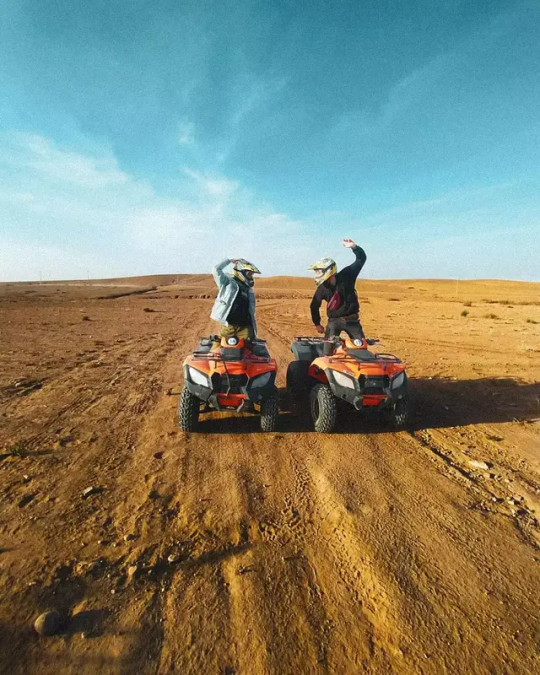
1) Agafay Desert
The Agafay desert is located about 1 hour drive from Marrakech and covers several hundred hectares.
For several years, it has become the place to be if you come to Marrakech.
The landscapes are impressive with rock dunes (not sand dunes!) and a breathtaking view of the mountains during the winter.
We did an amazing QUAD TOUR over there 🏍
2) Hammam
📍Les Bains D'Orient
Going to the hammam in Marrakesh is a very enjoyable tradition, no doubt about it. But what many people don’t realise is that this delightful ritual is much more about hygiene than hedonism. And, more than just something done for pleasure, it’s an obligatory weekly practice in which the majority of the population tends to take part.
In fact, Moroccans go to the hammam as a family, with men on one side and women on the other. With no need to rush, the ideal time for an effective treatment is a morning or afternoon spent in the rooms of this type of Marrakesh spa. Although we should mention that the spa is a somewhat more modern concept, as opposed to the hammam, whose origins go back thousands of years.
To understand and enjoy the hammam in Marrakesh, it’s worth going to one of the more authentic and classic ones. In other words, those not specifically designed for foreign travellers who visit the city
Because going to a traditional hammam in Marrakesh is undoubtedly one of the best ways to understand a very important part of Moroccan daily life and how their social relationships are established.
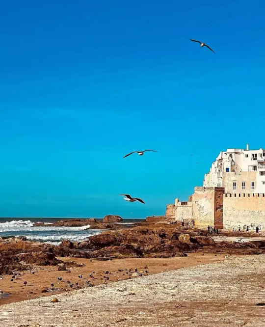
3) Day Trip to Essaouira
A former fishing village in the touristy region of Marrakech-Safi, Essaouira is now a booming tourist destination. It even enticed the production crew of Game of Thrones to film several episodes here. Rich in history, culture and music, Essaouira boasts a range of relaxing and enjoyable things to do and see.
The argan tree is native to Morocco and there are an awful lot of places wher you’ll find argan oil and argan products. In Essaouira, you can visit an argan oil cooperative, where you can witness the products that are so important to Morocco being made. In rooms adorned with argan trees, women use ancient tools to hand press oil from the kernels and complete the elaborate process of creating argan cream. It is indeed more expensive to buy the argan products from here, but it’s definitely worth seeing the process first hand in what is something like an open air museum.
WHERE TO EAT
Naima Cous Cous
Best cous cous in the Medina, it really seems to eat at somebody's place!
Dar Charifa
Elegant riad where to eat Marocco food in a fancy place
The signature dish of Marrakech is tangia, which is not to be confused with the similar sounding tagine. Slow-cooked lamb is placed in a clay urn with lemon, garlic and saffron and then cooked in charcoal until tender.
WHERE TO STAY
We stayed at Riad Dar Colline.
In general, a riad is a building with rooms and common areas around a central courtyard. Of course, riads aren’t a modern day phenomenon. They’ve existed in Morocco for centuries.

Historically, the houses in Moroccan medinas were almost always inwardly focused with a large courtyard at the center. There were two reasons for this: the weather and the culture. Small exterior windows and a central courtyard helped to keep a constant, comfortable temperature inside the home. Moroccans have always valued privacy and don’t like to show off, they prefer houses that look modest on the outside and lavishly furnish them with beauty in every detail on the inside. The ample courtyard at the center also provides a pleasant space for activities with the family.
0 notes
Text
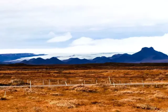
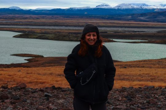
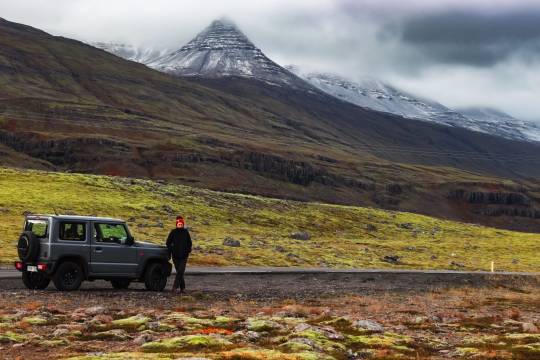
10 DAYS IN ICELAND 🇮🇸

The land of Iceland is plateau with mountain peaks, and ice fields, with a coastline marked by fjords, which are deep inlets carved by glaciers.
HISTORY
The first settlers were Irish religious people who wanted to live a simple life. The country was prosperous in the Middle Ages. They established a national assembly, called Althingi, in 930. Althingi is the world's oldest continuous parliament.
Iceland was part of Norway and then was ruled by Denmark for more than 500 years, but the country became an independent republic in 1944.
The colors in the flag represent three of the elements that make up the island: Red is for the island's volcanic fires; white for the snow and ice fields of the island; and blue is for the surrounding ocean.
TIPS BEFORE DEPARTURE
Make sure to book guesthouses/hostels in advance, they are very expensive. Better to find places equipped with kitchens.
Bring food from home - it's cheaper and healthier, if you have space in you lagguage
Dress with many layers. Weather is unpredictable and better to have always everything with yourself.
Bring your swimsuit: you will find everywhere hot tubs.
Renting a car is for sure the best way for self-travels. Make sure to rent a 4x4.
10 DAYS TRIP
- Reykjavik
Reykjavík is the Capital of Iceland and around 2/3 of the entire population is living here. It is a city of bold contrasts: it is both cosmopolitan and small-town; vibrant and sophisticated; young-at-heart and yet full of history. Many monuments, new and old, are also worth a peek, including the newly built oceanfront music and conference centre, Harpa.
It's the natural starting point to start visiting Iceland; Spending one day in the city is more than enough. You can easily rent a scooter or walk and visit the whole city center.
- We stayed at BUS HOSTEL, as there is a direct public bus from the airoport. It's cheap and close to downtown.
- We tried ICELANDIC STREET FOOD RESTAURANT. It's not super cheap but you have never ending soup refills and waffles for free.
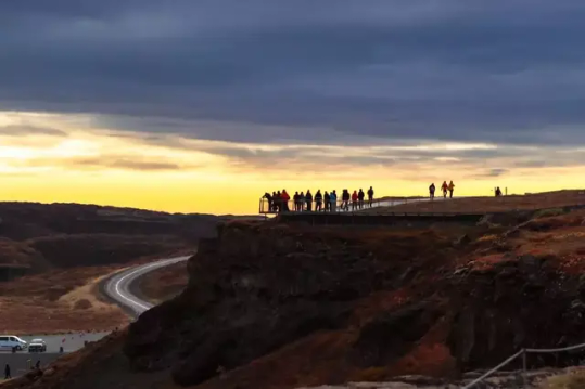
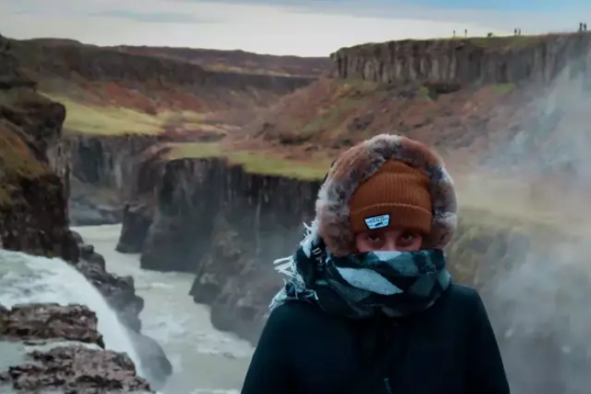
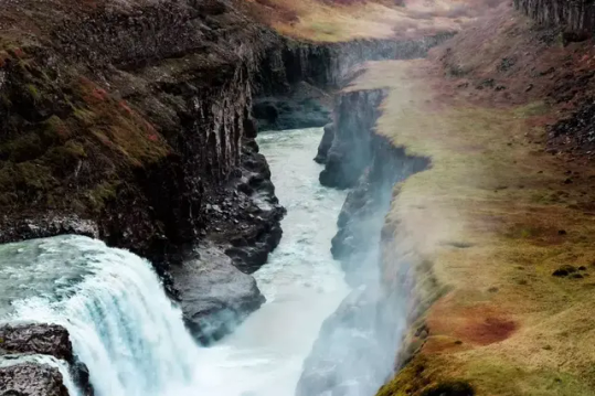
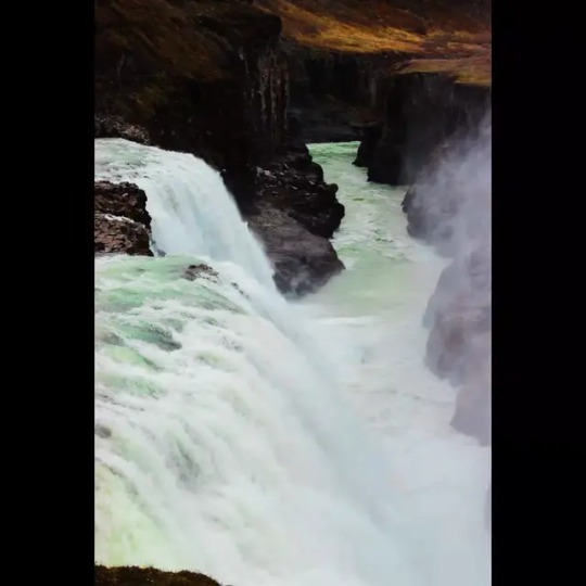
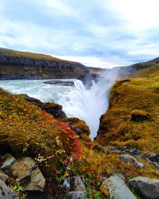
- Gullfoss & Thingvelir
Gullfoss is two separate waterfalls; the upper one has a drop of 11 meters and the lower one 21 meters. The rock of the river bed was formed during an interglacial period. Water flows over Gullfoss at an average rate of 109 cubic meters per second. The heaviest floods have recorded a flow of 2000 cubic meters per second. During the summer, the flow is 130 cubic meters per second. People were eager to exploit the power potential of Gullfoss, and many plans for hydroelectric developments on the river Hvítá have been proposed.
Þingvellir National Park is such a sought after tourist destination and the significance of its history and geology is huge. It is the only UNESCO World Heritage Site in Iceland.
Most visitors to Iceland will, at some point, take the Golden Circle, the most popular tourist route in the country. Images from its three destinations adorn postcards and websites, to the extent that many know what to expect from the tour before they even arrive. The iconic Gullfoss waterfall is famed for its scale and beauty; the Geysir Geothermal Area is home to the rare and spectacular phenomenon of, as the name suggests, geysers; but what about Þingvellir warrants it a place on the list?
The answer to this is multi-faceted. Þingvellir is a place where Iceland’s stark geological processes are playing out right in front of you; it is where the history of the nation truly began and where almost all its major historical turns were made; and, quite simply, it is a beautiful site with a wealth of things to do. No matter your interests, you are sure to find something here that fascinates you.
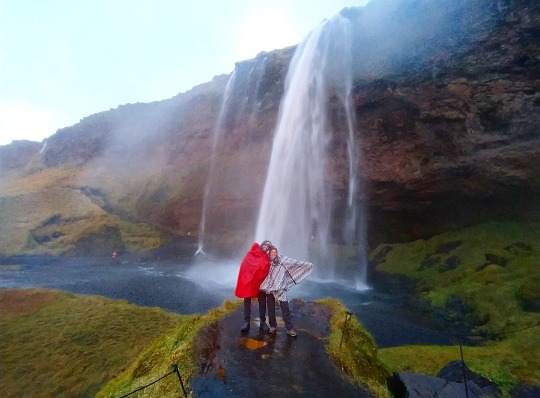
- Haifoss, Seljaiandfoss & Skogafoss
Skógafoss is one of Iceland’s biggest and most beautiful waterfalls with an astounding width of 25 meters (82 feet) and a drop of 60 meters (197 feet). Due to the amount of spray the cascade produces, at least one rainbow is present any time the sun emerges from behind the clouds.
Haifoss is the third highest waterfall in Iceland, about 122 meters high and is located on the edge of the highlands near the volcano Hekla in the south of Iceland. The view over this stunning waterfall with the beauty of the icelandic nature in the background makes this place the perfect location for photography.
CAREFUL:
- The cliffs from the viewpoint over the waterfall are very high so use caution when going close to the edges.
- You can only arrive with a 4x4
THIS FOR US WAS THE MOST STUNNING WATERFALL OF ICELAND.
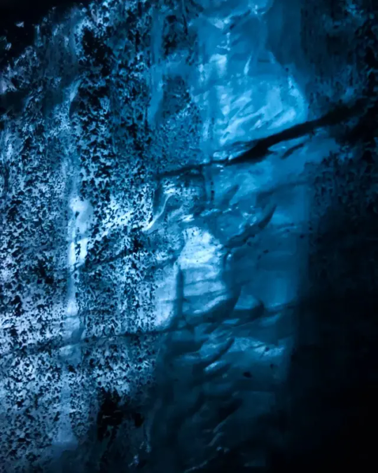
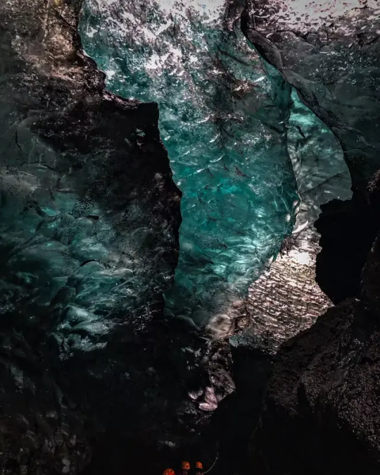
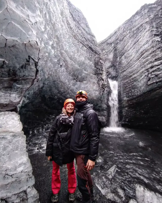
- Black Beach, Diamond Beach & Vatnajökull
Vatnajökull (2110 m) is the largest glacier in Iceland and it’s also the largest glacier mass in Europe. It covers an area of roughly between 8100 sq. km and 8300 sq. km, and it’s about 1000 m thick at its thickest point. Its average thickness is 400 - 500 m, and the total ice volume of Vatnajokull is probably in the vicinity of 3300 cubic km.
- In summer you can explore the area by kayak; In winter, you can hike the glacier and explore the ice caves. The tour takes 2 hours and it costs around 150€.
- Mjoifjördur, Seydisfjordur & Borgarfjordur
Mjóifjörður is an 18 km long fjord, and its name translates as Narrow Fjord.
When arriving to the bottom of the fjord you´ll keep driving along the northern coast till you get to a small village, Brekkuþorp. If you drive about 16 km further out of the fjord you come to Dalatangi. The road to Mjóifjörður is breathtaking, but it’s just open for about five months of the year (depending on the weather). The rest of the year, Mjóifjörður is only accessible by scheduled boat from Norðfjörður.
- Studlagil Canyon, Myvatn, Hverfjall Volcano
Myvatn is one of the largest lake in Iceland, 37 km2 in area. Its shores are indented with many coves and inlets and its surface is dotted with around 50 small islets and skerries. Midges (Chironomidae) are abundant and the ubiquitous swarms of these tiny flies give the Lake its name. The lake itself is very shallow, and the rays of the sun reach the lake bed over its entire surface. The ecology of the lake area is extremely diverse and interesting; one important characteristic of Mývatn, being the prolific growth and abundance of freshwater seaweed.
Hverfjall Volcano has an impressive crater, approximately one kilometre in diameter. Created about 2,500 years ago, Hverfjall is connected to the very active Krafla volcanic system, which has been the cause of 29 eruptions since settlement. The Krafla system is near the Lake Mývatn area, one of the most popular and diverse sites in Iceland.

- Husavik & Akureyri
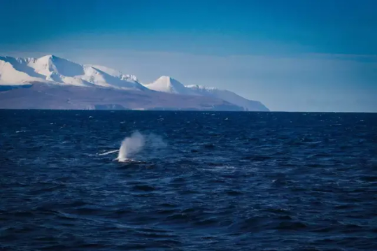
Húsavík is the oldest settlement in Iceland, besides being the largest town in Þingeyjarsýsla district and the service centre for the surrounding area. The town is known for whale watching tours in Skjálfandi Bay and is often referred to as the Whale Capital of Iceland. Up to 23 species of whale, including the Blue Whale, as well as large colonies of puffins can be found in or around the bay. One can experience the gigantic life-size of whales in the local Whale Museum where, amongst others, a 22m long skeleton of a Blue Whale is on display. There are several whale watching companies to choose from in Húsavík and sailing from there in pursuit of these wonderful creatures is an experience no one should miss and will certainly never be forgotten.
- We did our tour with North Sailing, an eco-friendly tour that cost us 70€.
Akureyri is the second largest urban area after the capital area of Reykjavík, with a population of about 18.500. Akureyri is the centre of trade and services in northern Iceland. It is also a town of culture and education, building on a firm foundation.
Akureyri is a popular tourist destination for short or long visits. The town offers a wide range of activities and interesting places e.g. notable museums, the world's most northerly botanic garden, one of Iceland's most popular swimming facilities, 18-hole golf course, the best skiing area in the country, good hiking trails and free city bus.

- Siglufjörður & Fosslaug
Visiting a calm and beautiful HOT SPRING is the choice of many travelers who are looking for peace. If you are planning to visit a peaceful place rather than a crowded beach or hill station then add Fosslaug Hot Spring in your itinerary. Like many hot springs in Iceland, Fosslaug is made with rocks and mud floor. It is located near the river that enhances the beauty of this hot spring. Unlike other hot springs of Iceland, the water of Fosslaug hot springs remains comparatively warm.
- Snæfellsnes
Snaefellsnes is a peninsula that extends from the western side of Iceland. With its rich history and countless landmark attractions, it is nicknamed Iceland in Miniature. One of its infamous sights includes the iconic Snæfellsjökull volcano. The peninsula offers a unique experience to visitors, having a variety of landscape, from mountain ranges and waterfalls, to coastal beach scenery.

WHAT WE VISITED:
SHARKS MUSEUM - where you can actually see how is the sharks meat processed and you can even taste it!
KIRKJUFELL - where a famous scene of Game Of Thrones was shot
BLACK CHURCH
YURI TUNGA BEACH - where you can see SEALS swimming near the shore.
From October to March you would be able to see the Aurora 💚✨ This is the most beautiful show the sky ca offer us!

HOW MUCH WE SPENT IN TOTAL?
If you want to save money, you need to book a lot in advance (we didn't😅). Moreover, we did everything really basic - but Iceland was so expensive anyways 💸
This is the money we spent for each person:
250€ each for the flight to go and back with laugguages included
350€ car rental for 9 days (700€ in total)
150€ each person for food at supermarket and twice rating street food
430€ each for 9 nights in hostels/ guesthouses
220€ each for tours (GLACIER + WHALES)
180€ gasoline (360€ in total)
GRAND TOTAL: 1580€ pp
0 notes
Text
NORTH of
ARGENTINA 🇦🇷
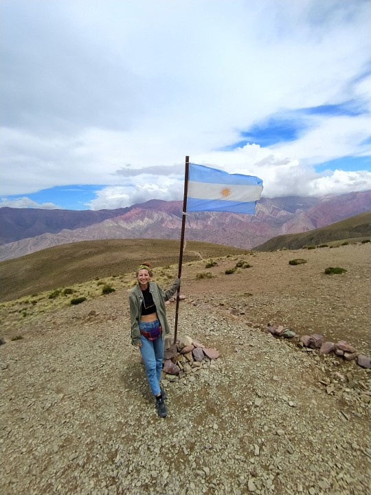
While Northern Argentina is among the least explored areas of the country, it is undoubtedly one of the most rewarding areas to visit. Sitting at the foot of the Andes, it offers spectacular scenery of snow-capped volcanoes, vast salt flats, and otherworldly rock formations.
TILCARA / 2 DAYS
Tilcara is a pleasant town (pueblo) in Jujuy in Argentina. It is the tourist centre of the world heritage site Quebrada de Humahuaca, and in addition to having its own sights to see, it makes a good base for day trips to other towns in the area.

WHAT TO VISIT
PUCARA, one of the ancient pre-spanish Inca settlement
MIRADOR
GARGANTA DEL DIABLO, a 2-hours trekking to a waterfall
WHERE TO EAT
Best place we have been is LAPENAS THE CARLITOS where you can taste regional food with LIVE MUSIC.
From Tilcara, you can easily take a collettivo (shared bus or taxi) and go to HUMAHUACA.
This place is located in the province of Jujuy, Argentina. His name has two meanings, for Huma side, which means head and Huaca which means treasure. It is a deep and narrow groove caused by tectnicos and river movements which led to the formation of multicolored hills mechanics in the world, these colors are due to the different minerals of who are formed. Besides this place it has a great historical significance because it was the scene of many battles during the war of independence. In this area also are indigenous strengths, prehistricas caverns and traces reveal that this place has witnessed the passage of time and to human evolution over thousands of years.
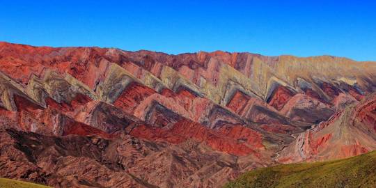
Supposedly the Serrania del Hornocal has 14 different colors in the mountain range, however, according to our guide, people have counted up to 32, as more colors are revealed after it rains. This incredible colorful mountain range is found just 27km from the desert town of Humahuaca, in Argentina’s Jujuy province, and 4,761 meters (15,620 ft) above sea level.
SALTA / 2 DAYS
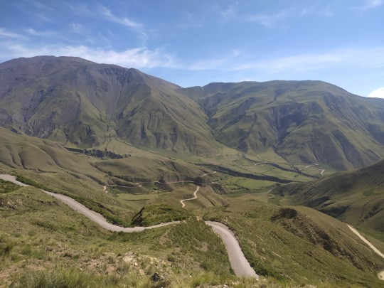
Salta is the name of a city located within the region of Salta in Argentina. The city can serve as a starting point or be your base camp for short day trips. Located in the northwest of Argentina, Salta (the region) is finally getting the recognition it deserves. Competing with other amazing destinations within the country like Patagonia, Salta hasn’t yet hit it big with tourists, which means it’s the perfect time to take a trip there, while it remains truly authentic. The colonial city of Salta is full of incredible architecture, surrounded by natural landscapes such as mountains, valleys, and the all-important vineyards (we will get to those later).
WHAT TO SEE
Get the TELEFERICO SAN BERNARDO and have an amazing view of the city at 1464 mt.
SAN FRANCISCO CHURCH
Plaza 9 de Julio with many bars and wineries
MERCADO CENTRAL for having a good and local lunch
WHERE TO EAT
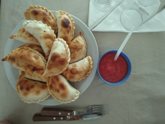
- DONA SALTA is a very nice restaurant where you can taste regional food and especially MEAT, one of the best we tryed
- Try the famous EMPANADAS from SALTA, different from all the others, smaller and more tasty
- Go to a PENAS and enjoy regional food with live and the traditional music. There are a plenty: LA CASONA DEL MULINO was very authentic and suggested by locals.
CACHI / 1 DAY
The etymology comes from the diaguita tongue, in which “Kak” means rock or stone and “chi” or "chin", silence or solitude. It's the white towns, as all the buildings are white.
Cachi is easily one of the most beautiful towns in all of Argentina.
This small town was home to colonial powers in the 18th century. Today it’s one of the most well-maintained, picturesque towns in Salta.
You can visit for the day from the city of Salta on a planned excursion or you can make it your destination.

The road from Salta to Cachi is simply amazing. We did many pit stops for observing condors, taste goat cheese and watching the landscape.
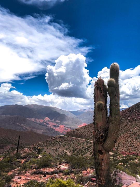
CAFAYATE / 1 DAY
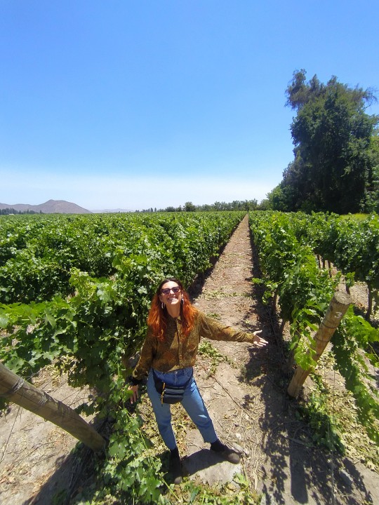
Cafayate is the capital of the Salta province in the northern part of Argentina. It is primarily known for its natural attractions — the valley of the Las Conchas River and the Cuebra de Caafayate Gorge. The region is also famous for its vineyards. You can verify the incomparable quality of local wine during a tasting tour to one of the wineries.

WHAT TO DO
Go to some bodegas and taste some regional wine. You can get the bike and do it by your own!
Visit the natural ANFITEATRO
Explore all the natural sculptures you will find on the way to Cafayate!
MENDOZA / 2 DAYS
Mendoza was settled by Spaniards from Chile in 1561. Throughout the colonial period it remained a sparsely populated frontier area under constant threat of Indian raids. In 1776 it was detached from Chile to become part of the Viceroyalty of the Río de la Plata, and it became a province in 1820. Its development was hindered by its remoteness from the Atlantic Ocean and the Río de la Plata, but that was surmounted in 1885 by the completion of a railway to Mendoza city. Subsequently, a railway (no longer in service) was completed in 1910 that connected Mendoza with the Chilean train system. A highway crossing the Andes at Uspallata Pass connects Mendoza city with Valparaíso, Chile.
WHAT TO DO
Visit the city center
Taste some regional wines from Mendoza
Have the best meat by DON MARIO restaurant
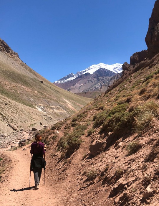
Go for a trekking to l'Aconcagua, the highest peack of the Ande and of the whole South of the World. We did the tour with Andes Vertical. We arrived at the base camp at 3400mt. after 14km trekking.
2 notes
·
View notes
Text
SOUTH of BOLIVIA 🇧🇴
Bolivia shares Lake Titicaca, the second largest lake in South America (after Lake Maracaibo), with Peru. The country has been landlocked since it lost its Pacific coast territory to Chile in the War of the Pacific (1879–84), but agreements with neighbouring countries have granted it indirect access to the Pacific and Atlantic oceans. The constitutional capital is the historic city of Sucre, where the Supreme Court is established, but the administrative capital is La Paz, where the executive and legislative branches of government function.
HISTORY
Although only one-third of its territory lies in the Andes Mountains, most of the nation’s largest cities are located there, and for centuries the highlands have attracted the nation’s largest amount of mining, commercial, and business investment. The country has a rich history. It was once the centre of the ancient Tiwanaku (Tiahuanaco) empire, and from the 15th to the early 16th century it was a part of the Inca empire. After the arrival of the conquistadores, Bolivia was subsumed within the Viceroyalty of Peru, and it provided Spain with immense wealth in silver.
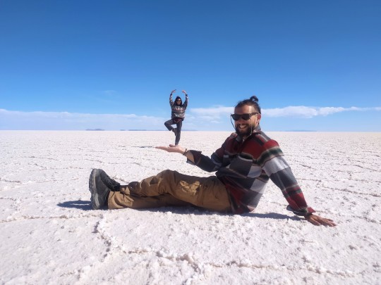
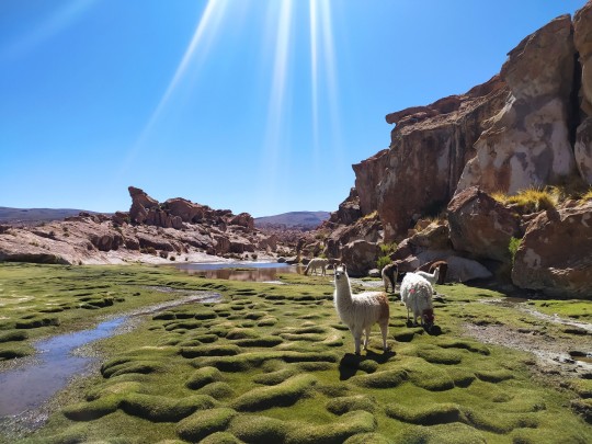
SALAR D'UYUNI and PARQUE NACIONAL EDUARDO AVAROA / 4 DAYS
We arrived to Uyuni directly with a night bus from San Pedro. We stayed at Hostal Le Ciel d'Uyuni that we highly reccomend for the price and the position.
From the City of Uyuni we bought a 3-days-tour to the Salar and the Parque National Eduardo Avaroa. It costs 100€ pp, 3 nights, all included. We did the tour with Andino Travel, one of the best in terms of quality.
It's almost impossible to do the tour by yourself, if you dont have a van or a big 4x4 to sleep inside!

WHAT TO DO
SALAR DE UYUNI
Bolivia’s Salar de Uyuni is considered one of the most extreme and remarkable vistas in all of South America, if not Earth. Stretching more than 12,050 square miles of the Altiplano, it is the world’s largest salt flat, left behind by prehistoric lakes evaporated long ago. Here, a thick crust of salt extends to the horizon, covered by quilted, polygonal patterns of salt rising from the ground.
This beautiful and otherworldly terrain serves as a lucrative extraction site for salt and lithium—the element responsible for powering laptops, smart phones, and electric cars. In addition to local workers who harvest these minerals, the landscape is home to the world's first salt hotel and populated by road-tripping tourists.
ISLA INCAHUASA 1km2 island with more than 7.000 millenial cactus.

LAGUNA COLORADA
Laguna Colorada Bolivia is very special, because not only does it stand out for its miraculous red tinted water, it is home to hundreds of pink flamingos posing for incredible, post-card-like photos. Flamingos flock here for the abundant supply of plankton. There are six flamingo species in the world, and three of them can be seen here: the Chilean, Andean and the James’s Flamingo.

LAGUNA CANADA
LAGUNA NEGRA
GEYSERS
THERMAL POOLS
Amongst the beautiful polygonal patterns of salt and sensational volcanoes of Salar de Uyuni lies the Polques Hot Springs where visitors can bathe in the thermal waters.
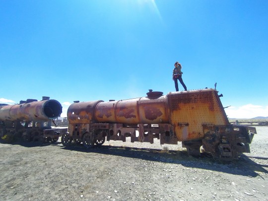
CEMETERO DE TRENES
Most of the trains here date back to the early 20th century and were imported from Britain. Uyuni was originally destined to become a major train destination connecting a variety of cities. Those plans ultimately never came to fruition as both the mining industry lost momentum and also disputes with neighboring countries broke out. The trains are exceptionally worn down because of the mixture of salt and strong winds which give the massive steel structures their weathered look. There are over 100 trains cars there for you to explore and each one has its own unique structure. There’s also lots of graffiti covering these transportation antiquities.
POTOSI / 2 DAYS
Potosí is the example par excellence of a major silvers mine of the modern era, reputed to be the world’s largest industrial complex in the 16th century.
Potosi was founded in the 1500s as a Spanish mining town. Local indigenous people from Bolivia and Peru, as well as African slaves, were brought to Potosi to mine Cerro Rico for Silver. The mines produced so much silver for the Spanish that the term “worth a Potosi” was used to describe something of high value and Potosi was considered the richest city in the world at the time.
The abuse of the mines and the miners left tens of thousands of people dead from many causes. Lung infections are one of the main reasons which reduced, and still reduces, the life expectancy of the miners to between 40-50 years. Child labourers were also very common, and some say they still are.

By the time Bolivia received its independence the mines were empty of all value. These days the government has stopped funding the mines, but about a thousand miners still work as part of a cooperative. They look for less profitable metals such as lead, zinc and copper, with the hopes of maybe finding silver. However, with no health care and dangerous conditions, the miners know their faith but have no other options to earn a living wage in the city.
It is the world’s highest elevated city with more than 20,000 inhabitants and, as said, formerly the home to one of the most important yielding silver mines during the Spanish rule.
WHAT TO VISIT
TAKE THE SILVER MINES TOUR IN CERRO RICO. We did the tour with Koala Tour, where the guides are former miners. It's not a funny tour though.

CLIMB SAN FRANCISCO CHURCH
VISIT LA CASA DE LA MONEDA
GO TO MERCADO CENTRAL
WHERE TO STAY
We stayed at Los Faroles Hostel, one of the Best we've been to.
WHAT TO EAT
You absolutely need to try the KALAPURKA soup, with a lavic stone inside, that allows the soup to stay warm.
PIQUE MACHO a mix of spicy meat
CHAMBERGOS, typical pastry
SALTENA, typical bolivian empanadas
BEST RESTAURANTS: Casona de la Pascualita, El Rincon del Mono, Phisqua Warmis
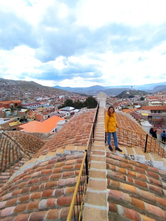
SUCRE / 1 DAY
Welcome to the official capital of Bolivia; the nation’s colonial centerpiece and historical heart. Sucre showcases a glorious ensemble of whitewashed colonial-era buildings, spectacular rooftop terraces and quaint garden patios. A must-see in Bolivia, its pleasantly warm climate and relaxed small town atmosphere entice many a visitor to stay longer than intended.
WHAT TO VISIT
Taste the chocolate at Chocolate para ti, a nice shop where you can taste different types of chocolates. Even though chocolate grows in the Amazon area, it's then produced in Sucre, as the city has a perfect climate!
Casa de la Libertad, the most famous monument pf the Country, where the independence of Bolivia started.
Go to monastero Santa Clara and taste the empanadas still made with a 16th century recepe.
Visit the Mercado Centrale and have lunch there in the upper floor, where you can try all the different local dishes, like the famous Sopa de Maní.
0 notes
Text
NORTH of CHILE 🇨🇱
SANTIAGO DE CHILE / 3 DAYS
Santiago, the capital and largest city in Chile, is located in a valley surrounded by the snow-capped peaks of the Andes and the Chilean Coastal Range. This city offers a lot of attractions that will make you enjoy it in several ways: culture, heritage, bohemian and a lot of history are part of this historical but modern Latin American city.
HISTORY
Approximately two decades of uninterrupted economic growth have transformed Santiago into one of Latin America's most sophisticated metropolitan areas, with extensive suburban development, dozens of shopping malls, and impressive high-rise architecture. The city also boasts some of Latin America's most spectacular infrastructure, such as the Santiago Metro and the sparkling new "Costanera Norte," a freeway system that passes below downtown and connects the Eastern and Western extremes of the city in 15 minutes. Santiago is headquarters to many important companies and is a regionally important financial centre.
Santiago was founded by Pedro de Valdivia on February 12, 1541 with the name Santiago de Nueva Extremadura. Valdivia chose the location of Santiago because of its moderate climate and the ease with which it could be defended—the Mapocho River splits into two branches and rejoins further downstream, forming an island.
WHAT TO DO
Visit Plaza de Armas and la Cathedral
Go up to Cerro San Cristóbal, where you can have the best view of the city
Visit Concha y Toro, the oldest winery of all South America
VALPARAISO / 3 DAYS
Valparaiso (or Valpo) is the 3rd country’s most densely populated areas. Known fondly as the "Jewel of the Pacific," Valparaíso is located on central Chile’s west coast and is one of the country’s most important ports.
HISTORY
The city was built on at least 42 hills, according to some sources. The actual number is up for debate, but with several dozen hills, expect a lot of walking up and down. However, if you don’t want to spend your time hiking, you can take advantage of the funiculars. Around 30 were built between 1883 and 1916, and lots of them are still in use today. These ascensores, as they are known by the locals, remain a practical way of navigating the city’s slopes. They’ve also became landmarks and tourist attractions in their own right.

WHAT TO DO
STREET ART TOUR - Just like Santiago, Valparaíso has its own open-air museum of street art, in Cerro Bellavista. In fact, Valparaíso is considered one of South America’s graffiti capitals, and many streets are bursting with colors and life thanks to vibrant murals.
PABLO NERUDA HOUSE - Pablo Neruda, who won the Nobel Prize in Literature in 1971, is one of Chile’s most famous poets. His home, La Sebastiana, now houses a museum with collections of paintings, glass, and ships’ figureheads, among other things. Its eclectic decor and the stunning view across the city and down across the bay should be reason enough to visit.
CERRO ALEGRE AND CERRO CONCEPTION - even more street art, caffè and tiny colored houses. These 2 neighborhoods were absolutely my favourite. Here you can find a noce seafood restaurant, Mes Amores, and the oldest ascensor of the city, Ascensor Reina
VINA DEL MAR - also known as the “garden city”, Viña del Mar mesmerizes tourists with its daytime and nighttime activities throughout the year. You can enjoy its beaches, its excellent fish and shellfish based food and of course, the music of local and international artists in the International Song Festival, the most important one in Latin America, during February.

PISCO ELQUI / 3 DAYS
The upper Elqui Valley consists of several villages. They all belong to the municipality of Pahuano. The touristic center is Pisco Elqui.
You will feel impressed by the deep contrast between the arid mountains and the fertile valley under an incredibly blue sky. At night you can watch the espectacular starry skies - due to the clear and dry climate we have the clearest skies in the world (the 3rd cleanest in the World)
Pisco Elqui is also the cradle of the famous Pisco, the national drink of Chile. Elqui Valley is also the birthplace of the Nobel Prize Gabriella Mistral.

WHAT TO DO
Try PISCO and visit one of the local company, we went to Dona Josefa, the best and authentic one in the area (and for free!)
Get a tour for night STARS observation or astro-photography! You can get one directly in Pisco Elqui and the price is always between 15 and 25 pesos. We did our tour with friends.
Explore the valley by bike! It's super fun and it worths the price - we did a 6 hours tour with e-bikes through the whole valley. The cost was 35 pesos pp.
HOW TO GET THERE
Once you arrive in La Serena bus terminal, you get a local bus (via Elqui is the name of the company) and in 2 hours you will arrive in Pisco. The cost of the ticket is between 4 and 7 pesos pp. You dont need to book it in advance. The Last ride is at 18.30.
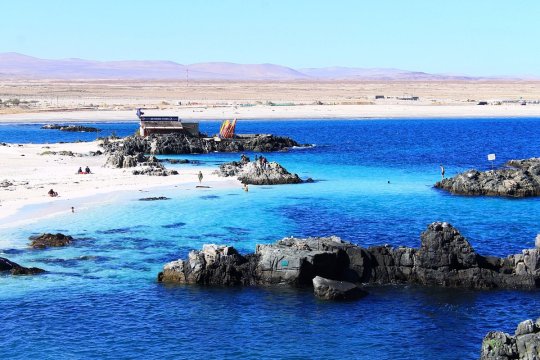
BAHIA INGLESA / 2 DAYS
There is nothing really to see in Caldera. We got two days to rest a bit. The only thing that worths the visit is Bahia Inglesa.
Located south from Bahía Inglesa, it is known as one of the best beaches in the country. Dive into its turquoise waters and get a tan on its fine white sand. You can find camping spots and some cottages with an amazing ocean view.
Once you are there, you absolutely need to try OSTIONES, fresh and alive seafood 😋
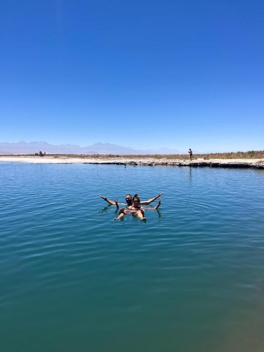
SAN PEDRO DE ATACAMA / 4 DAYS
Large areas of sand that look like a painting. This is just one of the wonders that the Atacama Desert gives us, with a Sea of Dunes (Mar de Dunas) that enchants with its mysterious forms in the most arid place in the world. It's been 400 years that it's Not raining!
Located in the north of Chile, near the city of Copiapó (Atacama region), the area is one of the largest dune fields in the country, with an area of 335 square kilometers. Research suggests that these dunes were created by the strong winds that gathered over the last thousands of years, making these large amounts of sand come together and form a unique spectacle.
WHAT TO DO
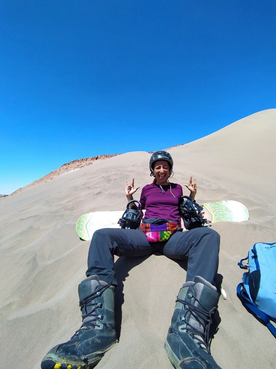
You can't miss SANDBOARD, a unique experience at 2700mt. We booked our tour with Sanboardatacama.cl. and it was one of the most difficult but funniest sport!
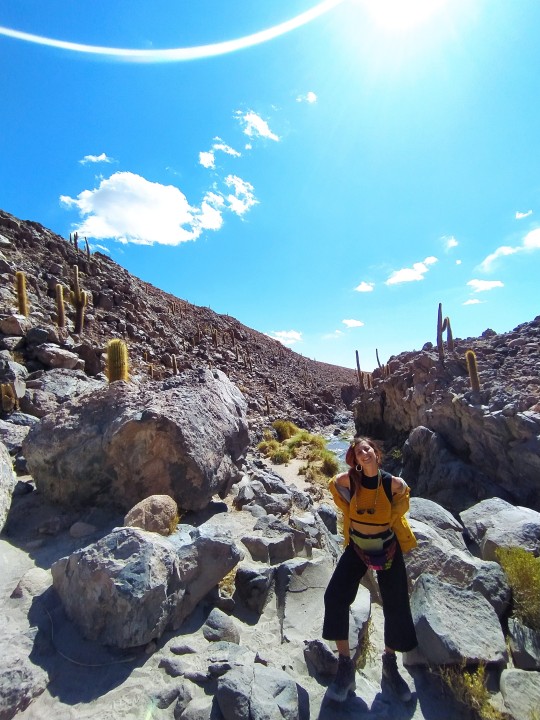
On our first day we visited VALLE DELLA LUNA by bikes. We needed first to book the tickets for the park online. Then we rented bikes for 8 pesos each and we rode for 35km in the park. it's not the simplest but it's for sure super adventure! You can also enter with car, of you have it, or get a tour with some agency.
The Valley of the Moon is one of the most visited places of San Pedro de Atacama. It is characterized by its enormous dunes, valleys and hills of salt, rock and sand. Valle de la Luna (Moon Valley) and Valle de La Muerte (Death Valley) are located in the Atacama Desert, and they make up an otherwordly landscape with their amazing geological formations, which have been eroded by the passage of time.

Once you are in San Pedro, you need to spendere at least 2/3 days visiting the desert around, about 500km long. You can do it with tours or renting a car.

SAN PEDRO DESERT TOUR STAGES:
CASCADA ESCONDIDA
CACTUS CANYON
MACHUCA where you can see many flamingos
GEISERS EL TATIO at 4500mt.
SALAR DE ATACAMA
LAGUNA CEJAR, a salted lake (like the dead sea)
IMPORTANT INFO
HOW TO MOVE IN CHILE
Best way to move from one place to another is buses: they are cheap and cover long distances even at night
WHAT TO EAT IN CHILE
- EMPANADAS of every kind, fried or in the oven
- CAZOELA with different types of meat
- PEBRE
- SOPA DE MARISCOS
- OSTIONES VIVES
0 notes
Text
COSTA RICA 🇨🇷
Costa Rica is a country located in Central America that is ranked as one of the most visited international destinations. One of Costa Rica’s main sources of income is tourism. Costa Rica is a democratic and peaceful country and it has not had an army since the year 1948.
Although the country is small and it covers only 0.03 percent of the surface of the globe, it proudly shelters 5 percent of the existing biodiversity in the entire world. Twenty six percent of the country is composed of conservation and natural protected territory.
Furthermore, 2018 has become a magnet for meeting tourism with the opening of the National Congress and Convention Center (CNCC), which can welcome some 4,600 people to its meetings.
FUN FACTS 🔥
It's one of the happiest countries in the world
There is no army!
There are over 500,000 species of wildlife.
Of the 500,000 species, 900 of them are birds
Gallo pinto is a breakfast staple.
There are over 200 volcanic formations
Costa Ricans have a high life expectancy
Its the country with more biodiversity in the World
PURA VIDA
Pura vida, meaning “pure life”, is not only a common greeting, it’s also a state of mind. Pura vida encapsulates the laidback, friendly and welcoming vibe of Costa Ricans.
Everybody will tell you PURA VIDA 💫
1 DAY IN SAN JOSÉ
San Jose is the capital of the Republic of Costa Rica; it is the head of the province. The city is the political and economic center of the country. It crowds together more than half of the commerce and the services. It receives his name in honor to Jose of Nazareth, presumed father of Jesus of Nazareth.
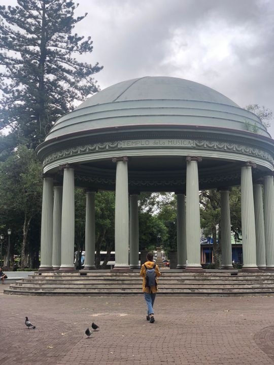
The central corner of San Jose was founded the 7th of December in 1848. The population arises around 1737-1738.It has been Costa Rica's capital three times: in 1822, from 1823 to 1834 and from 1838 to the present time.It is a city with a very interesting mixture of history and modernity; although the center of the zone is almost vacated it becomes a crossing site during the day for more than a million people, which generates a road chaos and an increase of the contamination levels.
IMPORTANT INFO ABOUT SAN JOSÉ:
One day it's enough for visiting the city
We stayed at HOTEL SURA
Card payments are accepted everywhere
Barrio Amon and Barrio Escalante are the nicest one to walk through
You can easily walk everywhere
Lolita is the perfect place to go eating and to do happy hour
Make sure to rent a 4x4 car. We rented it at Budget 🚙
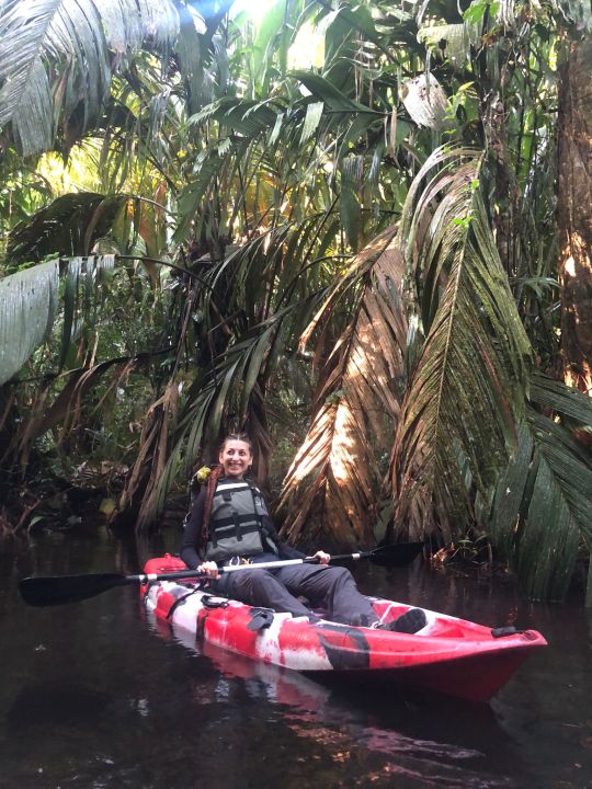
2 DAYS IN TORTUGUERO
Tortuguero National Park (TNP) is located northeast of Costa Rican territory and is one of the main tourist icons of Costa Rica since it is internationally recognized for protecting the most important green turtles nesting beach in the Western Hemisphere.
Away from the city and made up by an extensive network of rivers and canals, the access is possible only through small boats: this way the Tortuguero National Park is, a place unlike any other; where small communities surrounding Protected Wilderness Area, as Barra del Tortuguero and San Francisco, still retain their traditions and also enjoy the benefit of having the bicycle as their main transportation method, making the travel a true encounter with Caribbean culture.
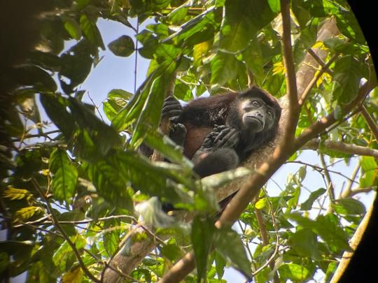
🌴🐒Flora and fauna
• 734 plant species.
• 442 bird species.
• 138 mammal species (101 genera y 32 families).
• 118 reptile species (76 genera y 22 families).
• 58 amphibian’s species (27 genera y 11 families).
• 460 anthropoid’s species.
IMPORTANT INFO ABOUT TORTUGUERO:
We stayed at Hotel Icaco, right in front of the beach
You can arrive directly at La Pavona Embarcadero by car and let the car there (it's safe) - you dono have to book the boat in advance
The ride by boat takes 45 minutes
Once there make sure to do the guided KAYAK TOUR (or canoe) - It takes 3 Hours and it really worths, as you can see different types of animals 🛶
Try the restaurant Taylor's - If you Want a really nice (but quite expensive) dinner. It's the only dinner in the restaurant we did.
Watch the sunrise at the beach
2 DAYS IN LA FORTUNA
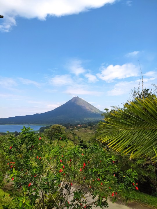
The La Fortuna region has always been beautiful, but it has not always been this calm. On a clear day, the majestic Arenal Volcano can be seen looming over this peaceful town. La Fortuna’s history is intimately connected with the region’s volcano. Now dormant, there was a time when it was awake and ferocious! On the morning of July 29th, 1968, Arenal Volcano violently erupted — spewing ash, rocks, and gas for three consecutive days. As the smoke cleared, the villages of Tabacón, Pueblo Nuevo, and San Luis were found buried under the debris, with 87 people dead.
Out of this tragedy, La Fortuna (The Fortune) was born as the central town in the Arenal Volcano area. The region has become a successful travel destination, and (like the whole of Costa Rica), is a champion of sustainability. As for Arenal Volcano, it’s now dormant, so you can enjoy its beauty up-close in the Arenal Volcano National Park without being in harm’s way.
IMPORTANT INFO ABOUT LA FORTUNA:
We stayed at ESSENCE AND SPA ARENAL, super cheap hostel but full of services: yoga, pool, laundry, spa and a delicious vegan cuisine
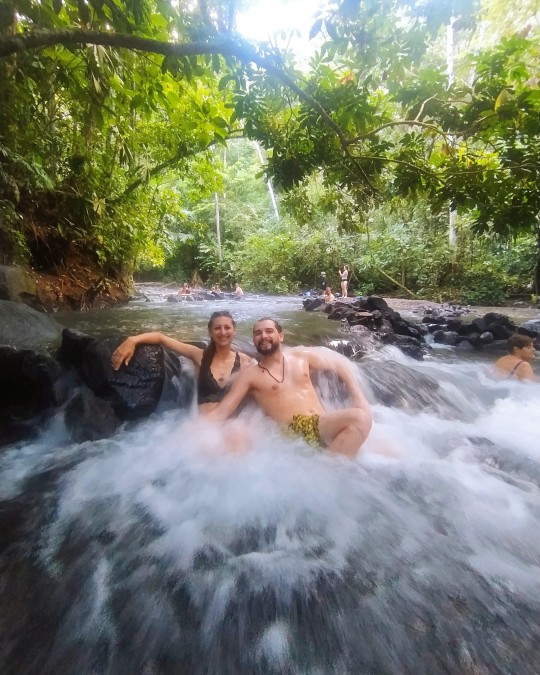
Make sure to try the HOT SPRINGS. There are also FREE hot Springs on the way to the hostel. Just 10 dollars for the car keepers are required
Walk around and hike the Volcano in the National Park 🌋
Try SODA MIMA and SODA LA COCINA DE MAMÁ. Soda are little trattorie, the best way to eat local, a lot and at a really good price - Skip restaurants!
2 DAYS IN MONTEVERDE
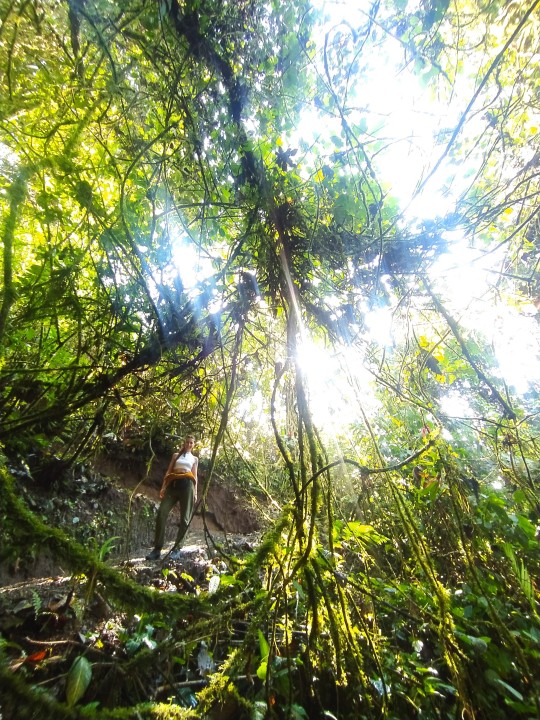
Monteverde is a small town in the mountain ranges of Costa Rica and a major destination for ecotourism in the country. About 3 hours from San Jose, it is one of our top recommended destinations in Costa Rica. Monteverde is the best place to experience a cloud forest. Cloud forests were given their name because you will see a thin veil of clouds just below the canopy. The clouds eventually dissipate into water on the leaves and drip down, watering the plants below. It is breathtaking to see from above.
The three main reserves that protect the sustainability of the cloud forest covered mountains in this part of Costa Rica are the Monteverde Reserve, the Santa Elena Reserve, and the Children’s Eternal Rainforest. A quarter of a million tourists from all over the world come here to explore these biodiverse highlands. There’s a total of 755 tree species there, which means, that one square mile, The Monteverde Cloud Forest can have more species of trees than the entire Unites States of America. Visit Monteverde to experience what Costa Rica is all about: incredible biodiversity and environmental preservation.

IMPORTANT INFO ABOUT MONTEVERDE:
We stayed at GREEN TREE B&B, an amazing tree house - a unique experience to try
The road to Monteverde is hard - make sure to have a 4x4
On the road to Monteverde you will drive along the LAKE ARENAL. Make sure to do a stop there!
The entrance to the BOSQUE NEBULOSE is 25 dollars - it's a lot but it really worths, as you can do different trails and walk the whole day☁☁
2 DAYS QUEPOS/UVITA
MANUEL ANTONIO
The magic of the beach and the greenery of the forest come together in one place, and the result is a natural paradise. Not in vain the Manuel Antonio National Park is the Protected Wild Area that receives the largest number of national and international tourists.
In addition to beaches, the Park offers a very humid tropical forest where species of flora and fauna in danger of extinction coexist, a mangrove, marine environments, islands and a lagoon of 14 hectares.
In a short trip you can cross several paths that will take you through a primary forest. You will also have stunning views of the sea and you can enjoy the wildlife that is possible to find at any time.
UVITA
Just 1 hour from Manuel Antonio, Uvita is a small town that is easy to get around as it has paved roads throughout. The town has the main entrance to the national park and the beach, there are several restaurants, info centers, tour companies and the cheap hostels and cabinas. For someone who isn’t renting a car, you can stay in town with no problem and be in walking distance to supermarkets, restaurants, the beach, etc.

👉IT'S MUCH BETTER TO STAY IN UVITA THAN IN QUEPOS - less traffic, cheaper and less turists
IMPORTANT INFO ABOUT UVITA:
Stay at CASCADA VERDE HOSTEL, best hostel we've been in Costa Rica!
Go to Playa Uvita and Playa Hermosa - and watch the sunset from there ☀
Do the Dolphins and Whales Tour 🐬🐳
Eat a Palmito pizza in El Hornito Restaurant
2 DAYS CORCOVADO
Corcovado National Park is one of the most unique and biodiverse places on the planet and visiting the Peninsula is a real treat for the nature lover. It contains over five percent of the world’s animal population just within that small area, making it a popular ecotourism destination. For example, the national park is said to contain the entire ecosystem of insects that is found between Panama and Mexico. Additionally, National Geographic describes it as the “most biologically intense place on Earth in terms of biodiversity.”
Corcovado National Park is the backpacking experience of a lifetime. It encompasses the only remaining old growth wet forests on the Pacific coast of Central America, and 13 major ecosystems including lowland rain forest, highland cloud forest, jolillo palm forest, and mangrove swamps, as well as coastal marine and beach habitats.
There is a good chance of spotting some of Costa Rica’s shyest and most endangered inhabitants here; Baird’s Tapirs, Jaguars, Scarlet Macaws, Harpy Eagles, Red-backed squirrel monkeys and White-lipped Peccaries.
IMPORTANT INFO ABOUT CORCOVADO:
We Stayed at Baya Drake at Corcovado and DRAKE INN - super cheap, with bar, restaurant and swimming pool
Thanks to the hotel, we planned 1 day excursion in the Corcovado National Park. It costs 100 dollars per person but it really worths 🙏
You can arrive to Bahia Drake by boat or with a 4x4. By boat it takes 45 min and it costs 20 dollars
You can reach Corcovado only by boat! The ride is really hardcore - get ready!
0 notes


Text
SEVILLA, GRANADA 🇪🇸

Sevilla is a city in the southern parts of Spain. A river called the Guadalquivir River goes through Seville. The city of Seville is the capital of the Spanish autonomous community Andalusia and of the province of Sevilla. People from Seville are called Sevillanos.
With its charming squares, picturesque neighbourhoods and impressive historic architecture, Sevilla is one of those cities that will sweep you off your feet within moments andI was instantly drawn by the city’s magnetic vibe.
Orange parfume everywhere, tapas, Rioja, Flamenco, Mudéjar architecture, people living the city at any time, sun, hot... Sivilla is all this in a city!
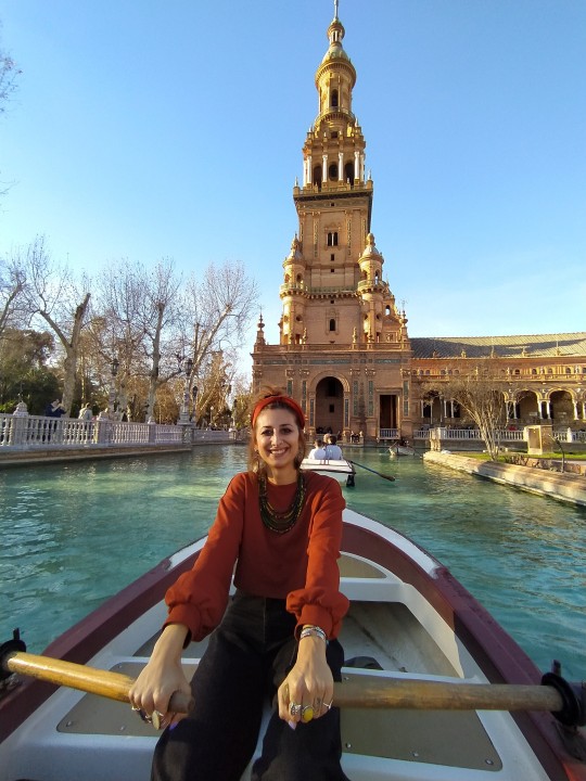
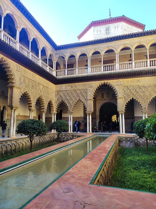
Sevilla was founded as the Roman city of Hispalis in the 8th century A.D. on the banks of the Guadalquivir river. The city was later ruled by the Moors for more than 800 years, signs of which are more than evident till today. The city became an important trading centre after the discovery of the Americas (Christopher Columbus left for his maiden voyage to the Americas in 1492 from a nearby port whilst Ferdinand Magellan began his voyage to circumnavigate the globe from Sevilla in 1519), ushering in Sevilla’s Golden Age, a period of immense wealth and the city blossomed as a cultural centre. During this period under the Castilians, the city developed rapidly. Many magnificent buildings were constructed, much of it in the Mudéjar (a blend of Moorish/Arabian and Gothic influences) and Gothic styles, such as the Seville Cathedral and the Real Alcázar (Alcázar Palace). More architectural wonders, such as the impressive Plaza de España, were constructed in the 1920’s when the city hosted the Ibero-American Exposition.

What to see/do
Plaza de Espana: Several bridges connect the square with the main buildings. Several scenes from the Star Wars movies, The Phantom Menace and Attack of the Clones, were filmed at Plaza de España. From here you can get a boat and di a tour around the square
Sevilla Cathedral: built in the 15th century on the site of an ancient mosque. The mosque’s minaret, La Giralda, was kept and converted into a bell-tower. It's the third largest in the World.
Alcázar Palace: a true architectural gem. With its elaborate Mudejár style, it truly is a sight to behold. This is the Courtyard of the Maidens inside the palace.
Barrio Judio and Barrio Santa Cruz: little touristic but you will find very good tapas!
Mercado de Triana for a real paella and Triana neighbourhood for having some drinks at night.
If you have time, don't miss a Flamenco show!

Granada is the soul of Andalusia, a place of breathtaking beauty at the foot of the Sierra Nevada Mountains. This mystical city was the capital of a Moorish kingdom from the 13th until the 15th centuries.
To the Moors, who arrived from North Africa, the lush setting of Granada was like heaven on Earth. The Nasrid Dynasty reigned with a splendor unlike anywhere in the medieval world. The hilltop fortress of the Alhambra Palace was a paradise of greenery, rose gardens, and endlessly flowing fountains. After flourishing for centuries, Granada became the last bastion of the Moors in Spain when the Catholic Monarchs captured the city in 1491. Although now predominantly Christian, Granada has inherited rich Islamic, Jewish, and Gypsy influences. The Renaissance Catholic cathedral was once a mosque. The Albaicín (old Moorish town) and the Alcaicería (spice market) have an authentic Arabic flavor. Colorful Gypsy culture and fabulous flamenco dancing is found in the caves of the Sacromonte quarter.
What to see/do:
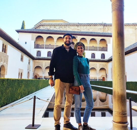
The Alhambra stands majestically on a fortified hilltop with the snow-peaked Sierra Nevada Mountains as a backdrop. An absolute must-see attraction in Granada, this UNESCO-listed World Heritage site was the residence of the Moorish rulers of the Nasrid Dynasty for 250 glorious years, from the 13th to the 15th centuries.

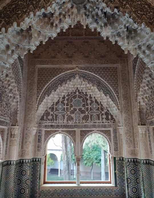
The complex of palaces was the Moors' last stronghold in Spain. A veritable museum of Islamic architecture, the Alhambra is surrounded by ancient defensive walls and appears from afar to be an impenetrable fortress.
The Alhambra complex consists of four groups of buildings in carefully landscaped grounds. The Alcazaba is the original 13th-century Moorish fortress, the oldest part of the Alhambra. All that remains of the Alcazaba are the ramparts and the towers.
The Nasrid Palaces are the most splendid buildings of the complex, with marvelous accommodations and public spaces used by the Sultans of the Nasrid Dynasty. Typical of secular Moorish buildings, the Nasrid Palaces are plain on the exterior but sumptuous on the interior, with decorative tile work and peaceful courtyards.
The Palace of Charles V was built in the 16th century after the conquest of the Moors and was used by the Spanish emperor as his summer palace.
Beautiful and serene Moorish gardens surround the Generalife Palace, which was used as a leisure villa by the sultans of Granada. The grounds feature shady patios, fountains, fragrant roses, and flower-adorned terraces overlooking the places of the Alhambra and the mountains.
If you spend the night in Granada, I will suggest to stay in Broz Hostel (very clean and cheap) and to go eating to Avila Tapas Bar, one of the best we have tried in Spain during the trip!
From Granada we drove through the Sierra Nevada to desierto de Tabernas, one of the most unknown deserts of the world, the only desert in Europe and still you've seen it in your favourite Clint Eastwood western movie, Indiana Jones and many more..

Sergio Leone decided to shoot his Clint Eastwood movies of the Spaghetti-Western genre here. Westerns, such as ‘A Fistful of Dollars’, ‘For a few dollars more’, the Good the Bad and the ugly, were all filmed here (not in Arizona!). Typical Western towns were built , which you can still visit today and which are typical representations of the conquest of the American Wild West: Studios Fort Bravo is the one we decided to visit.
5 notes
·
View notes
Text
PORTO 🇵🇹
Porto is the most ancient city in Portugal. The original name was Porto Cale, given by the Romans...

On a brief visit to Porto, there are some places that cannot be missed. In the words of many visitors, this city has something mystical that is difficult to describe and which varies according to the place, time of day and light.

Whatever it is, it certainly has to do with its people, known to be generous and easy-going, as well as the River Douro and its heritage on both banks, with its bridges and monuments, the tiles, the flowering balconies and the shopping streets. The historic centre of Porto and the River Douro on the Gaia side, where the Port Wine lodges are located, are classified as World Heritage.

S. Bento Station, with its atrium lined with tiles, is an ideal starting point. Just ahead is the Cathedral, not to be missed, whose precinct offers the first view of the river, the cascading houses and the opposite bank. From there you descend by steps and mediaeval streets to Ribeira, with its café terraces and picturesque corners. It's worth staying a little to get a flavour of the atmosphere and take in the river with the D. Luís Bridge and the opposite bank. Once you’ve seen the outline of the cascading houses and church towers, you will want to see the gilt interior of the Church of S. Francisco. Nearby, you can see more tile-fronted churches and monuments, and visit the Palácio da Bolsa (former Stock Exchange palace). The tram leaves from next to the river for a trip that goes to Foz (the mouth of the Douro), where you can take a stroll and fill your lungs with the sea air. Avenida da Boavista starts here, and not far away is Serralves, with its gardens to stroll or rest in and its contemporary art exhibitions.
The city is painted with many Azulejos, one of the first thing that comes up into our mind when thinking about Portugal.
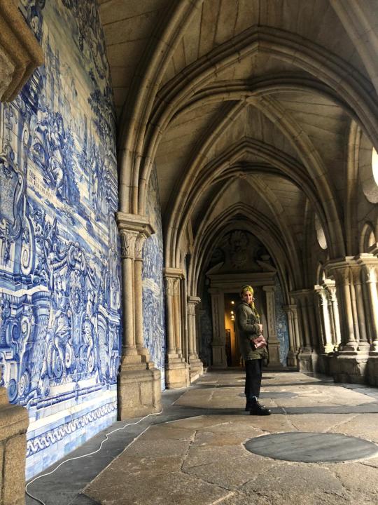
Azulejos date as far back as the 13th century, when the Moors invaded the land that now belongs to Spain and Portugal, but they secured their foothold in Portuguese culture between the 16th and 17th centuries. The word azulejo stems from Arabic roots, meaning ‘small polished stone’. Originally they were fairly simple structures cut into geometric shapes in neutral tones.

If you think art can only be found in galleries and museums than think again. In Porto art is everywhere!
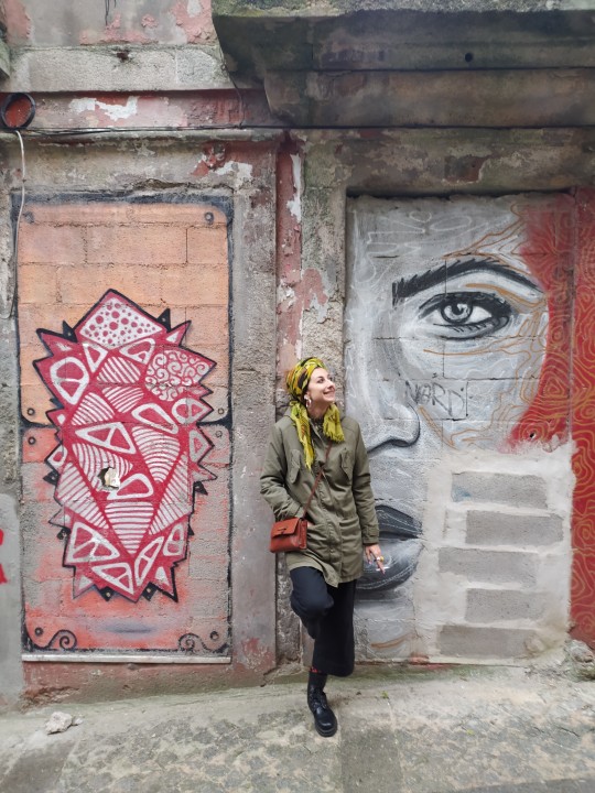
In the last few years Porto’s walls, shop fronts and abandoned buildings have come to life as they are being decorated with amazing street art by some of the best street artists in Portugal.
You cannot miss the markets. There are severa in the city:
- Mercado Bom Successo, fancy but full of good quality products.
- Mercado Bolhao
- Mercado Ferreira Borges
You can't find lot of street food as in many other European cities, but restaurants are cheap and you can easily find good dishes to try.

The architecturally imposing Casa da Música, with its full programme of cultural events, is on Rotunda da Boavista, an area that is good for shopping. In between are the Crystal Palace gardens, with another panoramic view of the river, and the Soares dos Reis Museum. Another garden, full of sculptures, is Cordoaria, surrounded by churches and other monuments. It’s worth climbing the Clérigos Tower for a different view of Porto.
There‘s still a visit to be made to the south bank of the river to go to a Port Wine lodge and taste some Port in its unique setting. From Ribeira, cross the D. Luís foot bridge and you’ll see them. The bridge is 385 long and was build by an architect who worked closed to Gustave Eiffel. One of the most beautiful views over Porto can be had from Gaia. And you can also take the chairlift, which follows this side of the river.
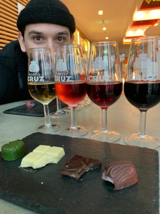
Portugal’s cuisine is always a winner with tourists, but this is even more true in Porto and Northern Portugal. You can be sure of a good meal, accompanied by fine wines from the Douro or the fresh Vinho Verde typical of the region, in any restaurant, from the finest to the most popular.
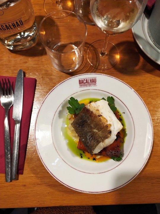
-I will suggest you to go to Bachalau restaurant and taste some dishes made with this tipical fish.
-If you want to eat fish without spending a lot of money, go to La casa do Pescator
-Do a porto degustation at Sandman and remember to book in advance!
-Francesinha is something absolutely to try! It's a fried toast with ham, meat and sausage, covered by layers of cheese and served with eggs. Absolutely my favourite!

-Pasteis de Nata
1 note
·
View note
Text
OMAN🇴🇲
Much of the country’s interior falls within the sandy, treeless, and largely waterless region of the Arabian Peninsula known as the Rub Al'Khali. The region is still the domain of bedouin nomads, although today it is also crisscrossed by oil and gas pipelines.
In contrast to the stark interior, the coastal regions are much more hospitable. Oman’s lush northern coast lies between the sea and inland mountains. This verdant, fertile region is known for its grapes and other produce, as is the Dhofar region in the country’s south. The capital,Muscat, lies along the northern coast. Blending modern and traditional architecture, the city commands a view of the Gulf of Oman and serves as a port and commercial centre.
Significant modernization did not begin until after the coup in 1970 that brought Qābūs ibn Saʿīd to power, at which point Oman rapidly began to develop an advanced economy. The once insular country now actively encourages tourism, and travelers come from afar to enjoy its hospitality and unspoiled landscapes.
Because of the low precipitation, vegetation is sparse except where there is irrigation, which is provided by an ancient system of water channels known as aflāj (singular: falaj). The channels often run underground and originate in wells near mountain bases. The aflāj collectively were designated a UNESCO World Heritage site in 2006.
Oman is a tribal society, although tribal influence is gradually declining. Its predominantly Ibāḍī Muslim population observes social customs that—though still conswevativw by Western standards—are markedly less strict than those of neighbouring Saudi Arabia. Women n particular have enjoyed relatively more freedom in Oman than elsewhere on the Arabian Peninsula. Social interaction remains largely segregated by gender, however, and most Omani women—particularly those in rural areas—dress in a conservative, time-honoured fashion. Traditional attire for women, although varying slightly from region to region, is characterized by brightly coloured fabrics and jeweled adornments and consists of a dress (thawb) over loose-fitting slacks (sirwāl). A long, flowing scarf known as a liḥāf (or generically as ḥijāb) covers the head. Similarly, most Omani men wear the dishdashah, or thawb, a traditional woven cotton robe, and male headgear consists of a light turban of cotton or wool, known as a muzzar. Many men continue to carry a short, broad, curved, and often highly ornate dagger known as a khanjar (sometimes called a janbiyyah or jambiya), which is worn tucked in the front waistband.
Mealtime serves as the centre of most social gatherings. The typical Omani meal consists of rice, spiced lamb or fish, dates, and coffee or tea. Incense—notably frankincense, which is native to Oman—is burned at the end of the meal
10 DAYS ROAD TRIP
What to see/do
1. Muscat
Muscat, Arabic Masqaṭ, town, capital of Oman, located on the Gulf of Oman coast. The town long gave its name to the country, which was called Muscat and Oman until 1970.
What to see:
Mutrah souq
Fish market
Mutrah fort
Sultan Palace
Grand Mosque
Royal Opera House

2. Al Hamra
This venerable village at the foot of the Hajar Mountains is one of the oldest in Oman, and it is interesting for its well-preserved row of two- and three-storey mud-brick houses built in the Yemeni style. There are many abandoned houses in the upper parts of the village, which make for an atmospheric stroll, especially at sunset when the honey-coloured buildings appear to melt into one.
Visitors are welcome, and there's a museum devoted to domestic pursuits (Bait Al Shait) that helps open up the inner life of this 400-year-old community. As with most rural villages in Oman, it's best to explore on foot.

3. Al Hoota Cave
As the only cave in the Arabian Peninsula open to visitors, Oman’s two million year-old Al Hoota Cave offers an incomparable experience for travellers. Within the cave is a fascinating ecosystem consisting of various rare species, making this natural wonder a symbol of Omani beauty.
Extending over 4.5 km (2.8 miles), Al Hoota is located at the foot of Jabal Shams, Oman‘s highest mountain. The cave has been formed and shaped by natural process over millions of years, creating stalactites hanging from the ceilings and stalagmites reaching up from the floor. Silence engulfs you as you enter the cave, stepping foot into its impressive chambers.
4. Trekking/Hiking
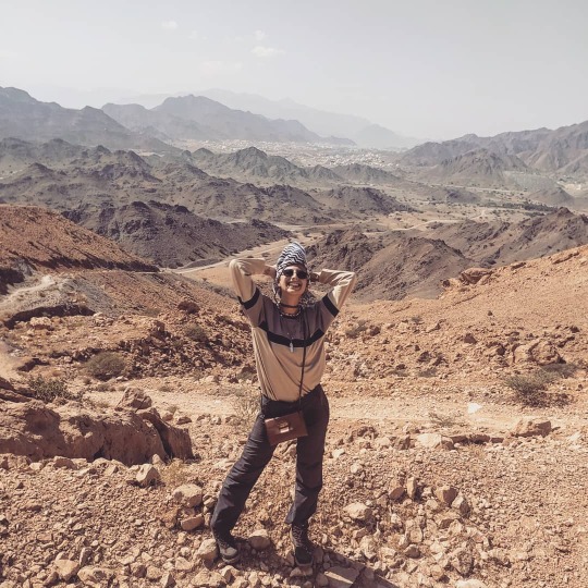
There are so many trekkings to do in Oman! We are not pros, but we decided to do anyways an easy one - Sa’al Mountain. it is a great place to explore especially if you are in Muscat due to its close proximity to the city. The trek to the top (aka Sa’al Stairs) is a short and challenging trek, but with amazing views of the surrounding mountains and wadis to the West and South, and the industrial area of Muscat to the North and East.
5. Bahla
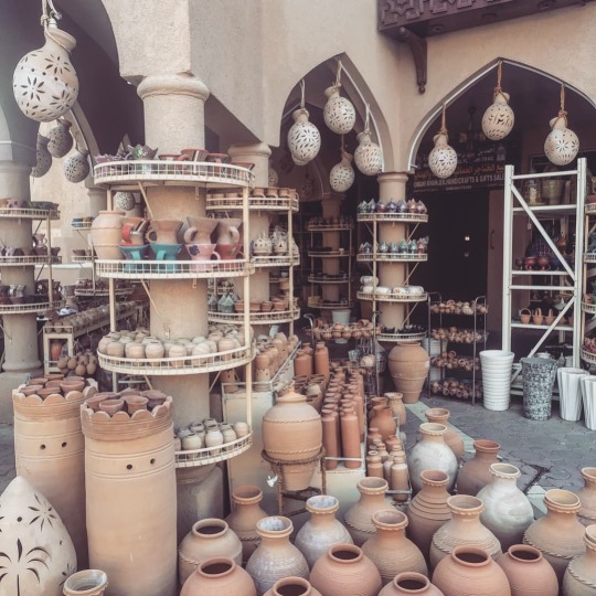
The first-ever Omani town to be declared as a UNESCO World Heritage site, Bahla is a small Oasis settlement situated in the Dakhliya region of Oman. Although the settlement is constituted of traditional vernacular houses, the fortification wall, a market, the Falaj system and a mosque, it is most popular for the Bahla fort. It is one of the oldest forts in Oman tracing back to the 13th century. The small town is also popular for its pottery and silver artefacts sold in the old souq.
6. Nizwa
Nizwa is an ancient city in the Ad Dakhiliyah region of northern Oman and is one of the oldest cities in Oman. It was once a center of trade, religion, education and art. Set amid a verdant spread of date palms, it is strategically located at the crossroads of routes linking the interior with Muscat and the lower reaches of Dhofar thus serving as the link for a large part of the country. Today, Nizwa is a diverse prosperous place with numerous agricultural, historical and recreational aspects.
7. Wadi Bani Khalid
We visited Wadi Bani Khalid after a night in a Bedouin tent in the Wahiba Sands desert.
After we turned off the main road we drove through a series of tiny villages then up and over stunning rocky mountains to this Oman desert oasis.
8. Desert Camp
@Nomadicdesertcamp
That was one of the best experiences we had: sleep in the bedouins' tents, eat and drink tea with them around the fire at night, walking on the dunes at sunset, watch the stars in the sky and ride a camel at sunrise.
9. Raz Al Jinz
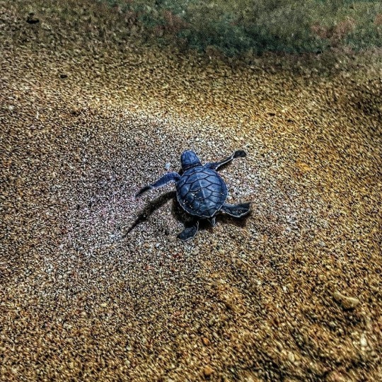
Reached from the Wahiba Sands via the stunning water pools and shady canyon of Wadi Bani Khalid, Ras Al Jinz is a small sandy bay where greenback turtles come ashore to nest all year round (though the principal nesting season is July to September).
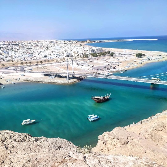
10. Sur
Sur City also is known as Oman city considered one of the most Omani ancient cities.it was introduced as the meeting point across the Indian Ocean, the Arabian sea and the Omani sea playing a vital role in forming a commercial business bridge between the Arabian Peninsula, India, South East Asia, and African continent.
Sur City port which is one of the oldest ports in the world played a very important role in forming the trade with more than one hundred and fifty sailing ships daily during the eighteenth and nineteenth centuries.
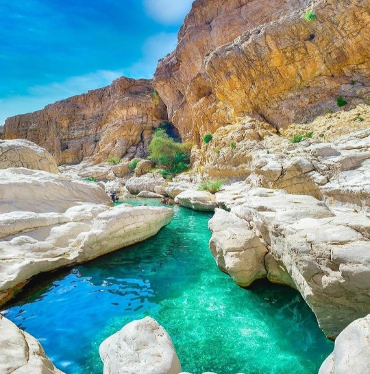
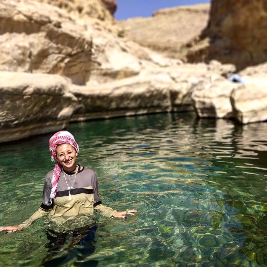
11. Wadi Shab
Wadi Shab Oman is one of the most popular gorges in the Sultanate.
A deep canyon, emerald water and a waterfall in a cave. The experience of hiking and swimming is unforgettable.

What to eat
Shuwa - kebab meat
Dates - 33 different types
Kahwa - Omani coffee
Omani bread
Meshkak - grilled meat on sticks
Mashuai - grilled fish with lemon
Halwa - dessert
Curiosities/Tips
- Driving in Oman is super easy: roads are huge, there is not a lot of traffic, highway is free and gasoline is super cheap (9 OMR for full petrol!)
- People are extremely nice, super friendly and they always smile, offer you a cup of coffee and chat. The best hospitality we could receive! Just remember to dress properly and behave kindly, always. Better to have always long sleeve t-shirts and trousers, both for women and men.
- Everything is super affordable for backpackers. You can find nice guest houses around 30/40€ a night for 2 persons and you can easily have a proper meal with 4/5 OMR. It's always good to have cash with you.
- Nature in Oman is for sure the most stunning thing. It's incredible how many wadi, mountains and wild beaches you can find on your way. There are always wild animals walking along the streets (camels, foxes, goats..) but the most wonderful thing is the light: it's incredible how fast it changes from day to night. I think here I saw some of the most beautiful sunrises and sunsets of my whole life.
0 notes


Text
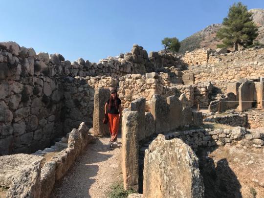
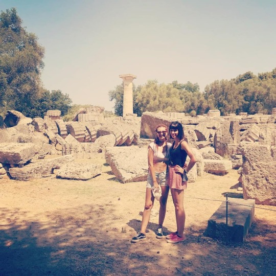
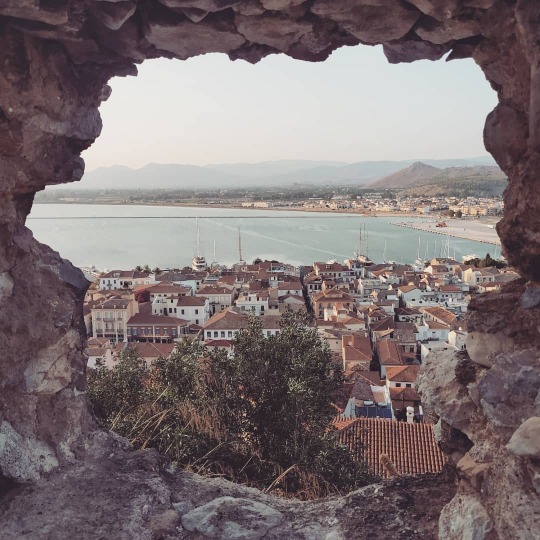
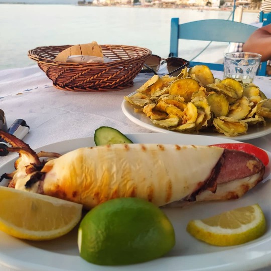
PELOPONNESE🇬🇷
Attached to the rest of Greece by the Isthmus of Corinth, the Peloponnese is a peninsula with ancient cities and natural sights that are ingrained in the world’s shared memory.
The region has one UNESCO World Heritage Site after another, from the Bronze Age tombs of Ancient Mycenae to the Great Theatre of Epidaurus, in immaculate condition at 2,300 years young.
It’s a sign of the abundance of ancient wonders in Peloponnese that you can follow in the footsteps of the traveller and writer Pausanias, who visited many of the locations on this list almost 1,900 years ago.
What to see:
-Corinth

-Mycenae
-Olympia
-Kalamata
-Navarino/Metone/Corone
-Foinikounta Beach
-Nemea (wine area) 👉 I really suggest a wine taste at KTIMA BAIRAKTARIS

-Naufplio
-Simos Beach

-Athens

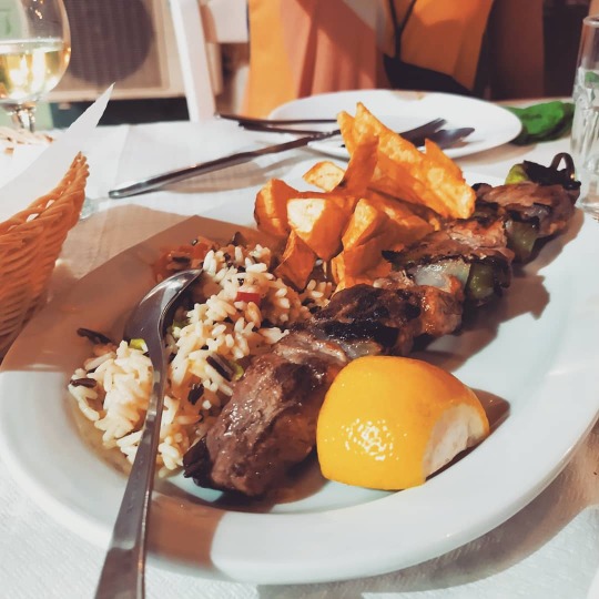
What to eat:
Top 10 dishes to try in Greece
Steeped in history and lapped by the Mediterranean sea, Greece is home to some of the finest ingredients in the world. Sample them in a traditional Greek dish along with a glass of ouzo.
1. Taramasalata
A mainstay of any Greek meal are classic dips such as tzatziki (yogurt, cucumber and garlic),melitzanosalata (aubergine), and fava (creamy split pea purée). But the delectable taramasalata (fish roe dip) is a must. This creamy blend of pink or white fish roe, with either a potato or bread base, is best with a drizzle of virgin olive oil or a squeeze of lemonlemon.
2. Olives and olive oil
Greeks have been cultivating olives for millennia – some even say that Athena gave an olive tree to the city of Athens, thus winning its favour. Greek meals are accompanied by local olives, some cured in a hearty sea salt brine, others like wrinkly throubes, eaten uncured from the tree. Similarly, olive oil, the elixir of Greece, is used liberally in cooking and salads, and drizzled over most dips and dishes. Many tavernas use their own oil.
3. Dolmades
Each region in Greece – in fact, each household – has its variation on dolmades, whether it's the classic vine leaf parcel, or hollowed out vegetables such as tomatoes, peppers and courgettes, stuffed and baked in the oven. The stuffing often consists of minced meat with long-grain rice, or vegetarian versions boast rice flavoured with heady combinations of herbs like thyme, dill, fennel and oregano. Pine nuts can also be used.
4. Moussaka
Variations on moussaka are found throughout the Mediterranean and the Balkans, but the iconic Greek oven-bake is based on layers of sautéed aubergine, minced lamb, fried puréed tomato, onion, garlic and spices like cinnamon and allspice, a bit of potato, then a final fluffy topping of béchamel sauce and cheese.
5. Souvlaki
Greeks are master of charcoal-grilled and spit-roasted meats. Souvlaki, chunks of skewered pork, is still Greece’s favourite fast food, served on chopped tomatoes and onions in pitta bread with lashings of tzatziki. Gyros, too, is popular served in the same way. At the taverna, local free-range lamb and pork dominate, though kid goat is also a favourite.
6. Fresh fish
Settle down at a seaside taverna and eat as locals have since ancient times. Fish and calamari fresh from the Mediterranean and Aegean Seas are incredibly tasty and cooked with minimum fuss – grilled whole and drizzled with ladholemono (a lemon and oil dressing). Flavoursome smaller fish such as barbouni (red mullet) and marida (whitebait) are ideal lightly fried.
7. Courgette balls (kolokythokeftedes)
Sometimes a patty, sometimes a lightly fried ball, be sure to try these starters any chance you get. The fritter is usually made from grated or puréed courgette blended with dill, mint, or other top-secret spice combinations. Paired with tzatziki, for its cooling freshness, you just can’t lose. Try our courgette fritters with tarragon aioli or spiced pea & courgette fritters with a minty yogurt dip.
8. Octopus
Along harbours, octopuses are hung out to dry like washing – one of the iconic images of Greece. Grilled or marinated, they make a fine meze (appetiser), or main course stewed in wine.
9. Feta & cheeses
When in Greece, fresh cheese is a joy. Ask behind market counters for creamy and delicious feta kept in big barrels of brine (nothing like the type that comes in plastic tubs in markets outside of Greece). Or, sample graviera, a hard golden-white cheese, perfect eaten cubed, or fried as saganaki. At bakeries you’ll find tyropita (cheese pie) while at tavernas, try salads like Cretan dakos, topped with a crumbling of mizithra, a soft, white cheese. Try feta in traditional Greek spanakopita or a fresh and colourful Greek salad.
10. Honey & baklava
Greeks love their sweets, which are often based on olive oil and honey combinations encased in flaky filo pastry. The classic baklava involves honey, filo and ground nuts. Or try galatoboureko, a sinful custard-filled pastry. A more simple sweet is local thyme honey drizzled over fresh, thick Greek yogurt.
Of course GYROS PITA can't be missed!
2 notes
·
View notes
Text
TENERIFE 🇪🇸
Tenerife’s landscape is what really blew me away; with black sand beaches that slope inwards towards lava-carved verdant forests and sleepy untouched towns, and upwards to the island’s central peak: the sometimes snow-capped Mount Teide.
Teide forms the island’s pyramid shape and gave Tenerife a name that translates to ‘White Mountain’. A lot of the best things to do in Tenerife can be found at Teide!
With nine different microclimates, the landscape is incredibly diverse. I figured I’d write something to encourage more tourists to explore it!
What to see:
-TEIDE
National Park is Europe’s most visited national park, with around three million visitors every year flocking to the UNESCO protected volcanic landscape in the centre of the island.
The park’s crowning glory is ‘Papa Teide’, as the volcano is known by locals.
Ride the cable car up to its peak, which is almost 12,000 ft above sea level. You’ll be rewarded with jaw-dropping landscapes that feel more like Texas than Tenerife.
-PUERTO DE LA CRUZ & LA OROTAVA
-LOS GIGANTES
-PARCO RURAL DI ANAGA
-SAN CRISTÓBAL DE LA LAGUNA
-BENIJO BEACH
-MASCA
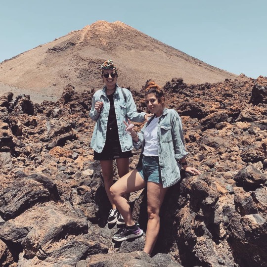
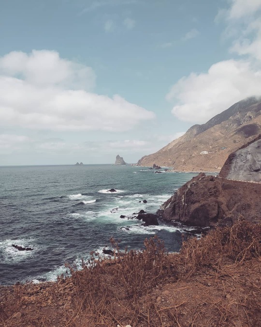


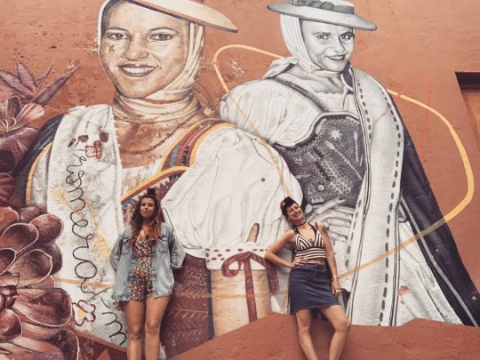


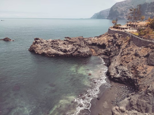
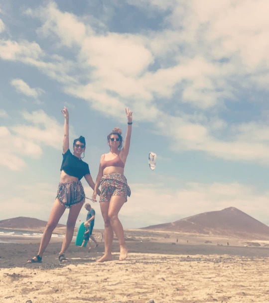
Where to eat/What to eat:
So much and good fish to eat! We spent almost all nights trying all the restaurants in La Caleta (Costa Adeje). Here the best two places for local and amazing food:
- Restaurante El Caldero
- Rincon del Varadero
What to do:
- SURF in Playa de las Americas
- WINE TASTE near La Orotava @Bodegas Monje
Around 8,000 hectares of Tenerife is dedicated to wine production and the destination has five wine trademarks – a lot, considering its size!
I loved learning all about the traditional cultivation methods and the state of Tenerife’s wine scene today at the wine museum.
0 notes
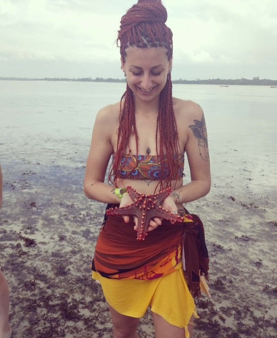

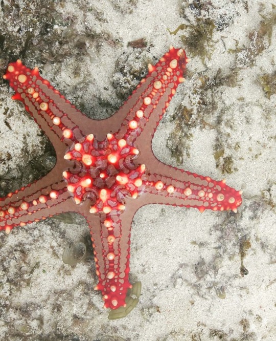


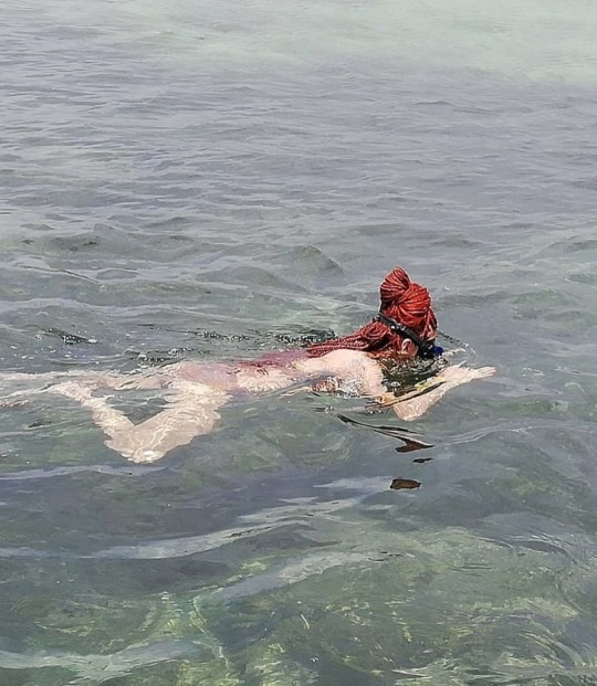


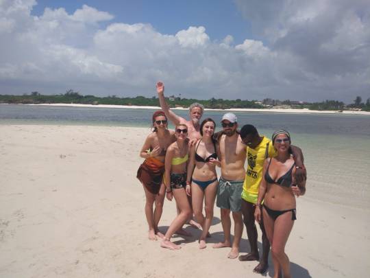
Text
KENYA 🇰🇪

WATAMU
Watamu is a small town located approximately 105 km north of Mombasa and about 15 km south of Malindi on the Indian Ocean coast of Kenya. It lies on a small headland, between the Blue Lagoon and Watamu Bay. Its main economic activities are tourism and fishing. The shoreline in the area features white sand beaches and offshore coral formations arranged in different bays and beach: Garoda Beach, Turtle Bay, Blue Lagoon Bay, Watamu Bay, Ocean breeze, and Kanani reef and Jacaranda beach. They are protected as part of the Watamu Marine National Park. The Marine Park is considered one of the best snorkeling and diving areas on the coast of East Africa. It is also rated the third-best beach in Africa, for its crystal clear water and silver sand beaches. In order to assist the managing authorities namely Kenyan Wildlife Service, in protecting the Park, local community groups, the tourist sector and environmental groups have formed a unique organisation,Watamu Marine Association.


What to see:
- The town

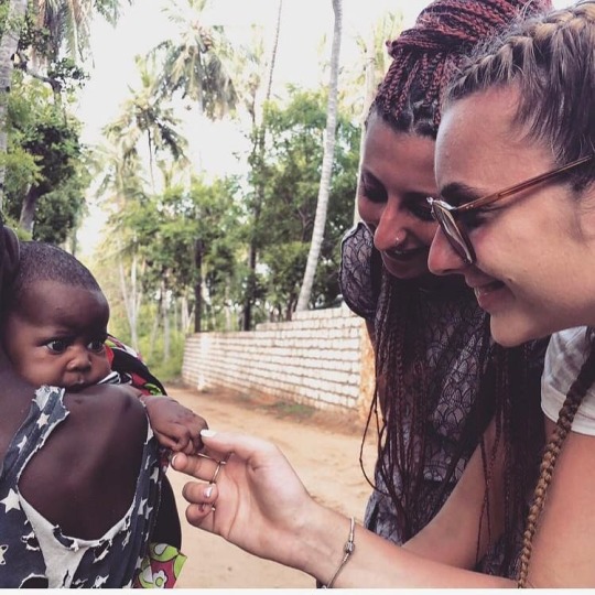
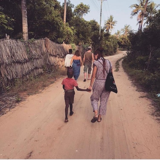
- Mida Creek - see more pictures in the next post


- Gede
SAFARI
Tzavo East Park - see more pictures in the next post
2 days in the Savana, sleeping in the Masais' tents.

MALINDI
Malindi (known as Melinde in antiquity) is a town on Malindi Bay at the mouth of the Galana River, lying on the Indian Ocean coast of Kenya. It is 120 kilometres northeast of Mombasa. The population of Malindi was 207,253 as of the 2009 census. It is the largest urban centre in Kilifi County.
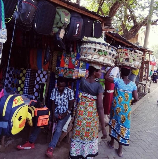
MOMBASA
Mombasa is located on Mombasa Island and sprawls to the surrounding mainlands. The island is separated from the mainland by two creeks: Tudor Creek and Kilindini Harbour. It is connected to the mainland to the north by the Nyali Bridge, to the south by the Likoni Ferry, and to the west by the Makupa Causeway, alongside which runs the Kenya-Uganda Railway.
NAIROBI
The capital Nairobi is situated between the cities of Kampala and Mombasa. As Nairobi is adjacent to the eastern edge of the Rift Valley, minor earthquakes and tremors occasionally occur. The Ngong Hills, located to the west of the city, are the most prominent geographical feature of the Nairobi area. Mount Kenya is situated north of Nairobi, and Mount Kilimanjaro is towards the south-east.
0 notes