
z-j-zhang
Z. J. ZHANG
Photography Student in the UoW
44 posts
Don't wanna be here? Send us removal request.
Last Seen Blogs

astertrash
💫astertrash💫


windduelund70
Ozzie Mozzie Mosquito Zapper: Mosquito Protection at Its Best

jinkalewajinkalak
Untitled

bashfulbubblytea
Bubble Tea Lover
Link
Personal new website is still being updated and perfected.
0 notes
Photo
New Portfolio
0 notes


Photo

Project Time Plan from Feb to May
0 notes

Video
Printing
0 notes
Photo
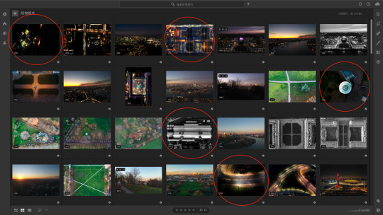
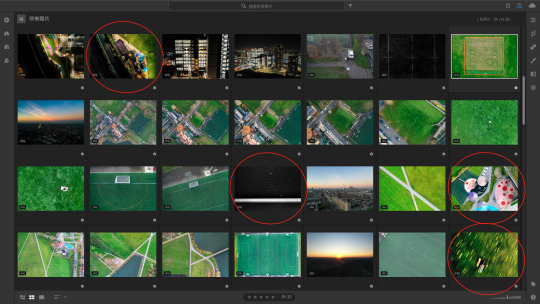
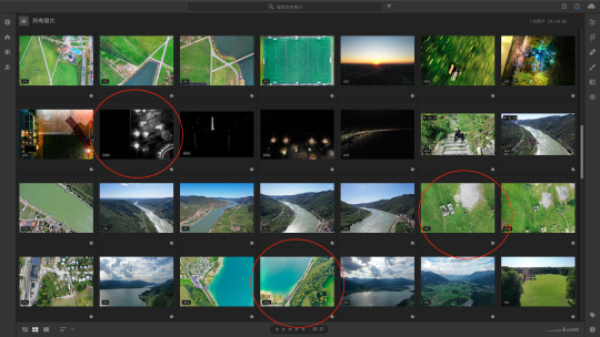
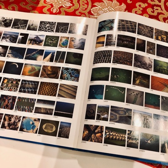
Contact Sheets
The red circle is the final work I choosed temporarily.
0 notes
Photo
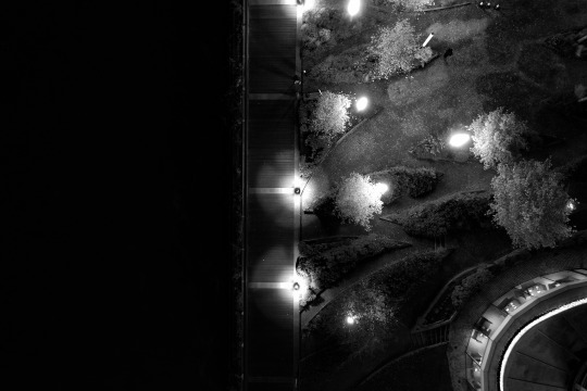
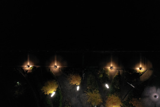

Pre-Final photos 2
0 notes
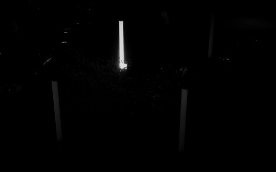
Photo


Pre-Final photos 1
0 notes
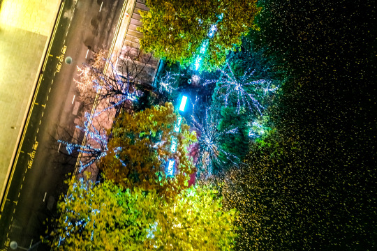
Photo

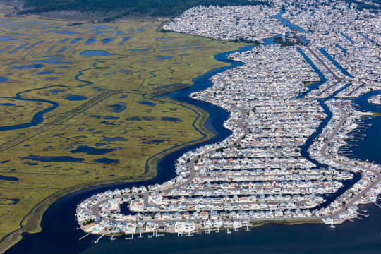

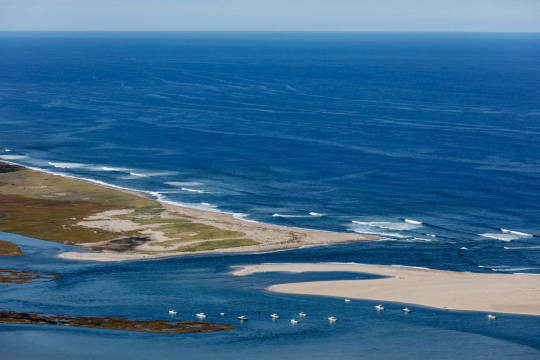

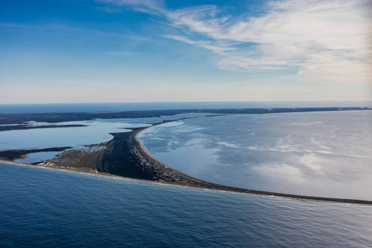
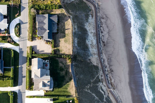

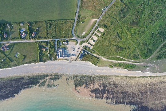
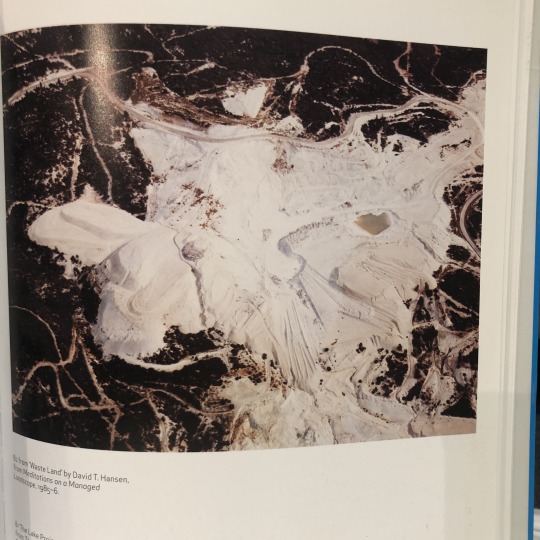
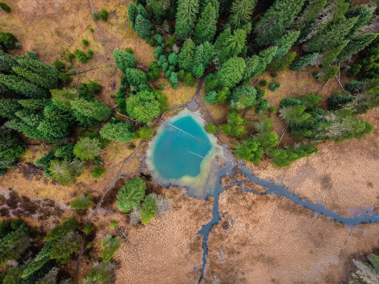
I like these pictures because Alex reveals with his camera to show the situation which is climate change after global sea level rise. As he said “On the shoreline of the Atlantic coast from Maine to Florida, rising salt water will impact over 100 million people. As a result, our nation will spend unimagined fortunes to adjust both gradual and abrupt disruptions of rising ocean waters...”
0 notes
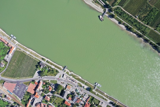
Photo
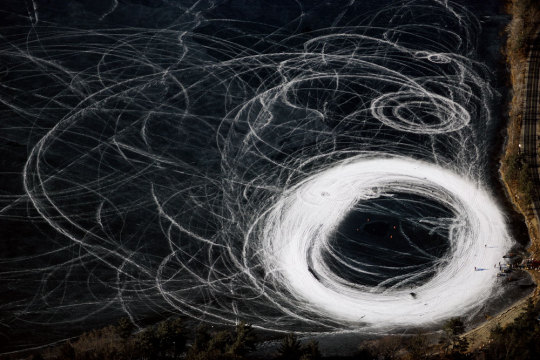


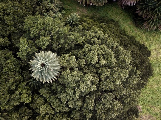
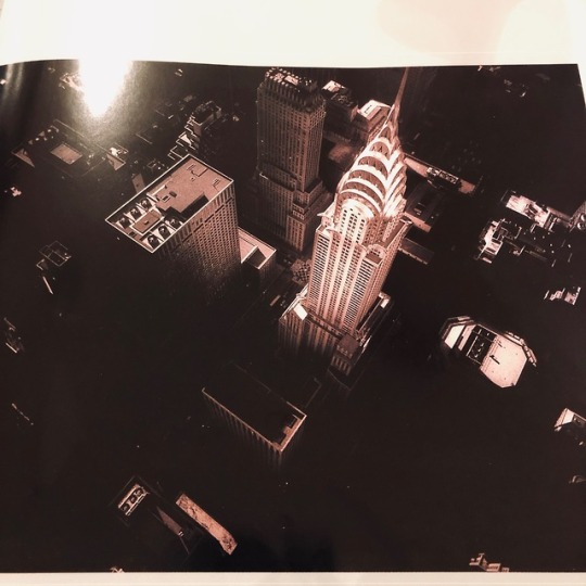
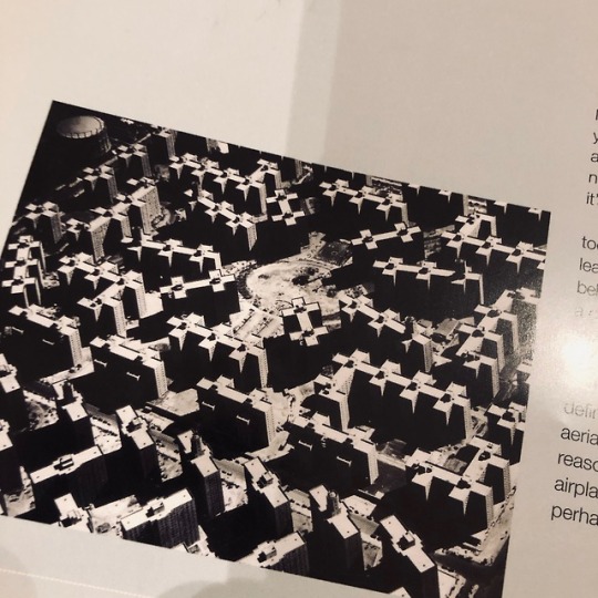
I found this artist called Alex MacLean, he is a pilot and aerial photographer. He has flown his plane over much of the United States documenting the landscape. Trained as an architect, he has portrayed the history and evolution of the land from vast agricultural patterns to city grids, recording changes brought about by human intervention and natural processes. His powerful and descriptive images provide clues to understanding the relationship between the natural and constructed environments.
0 notes
Photo

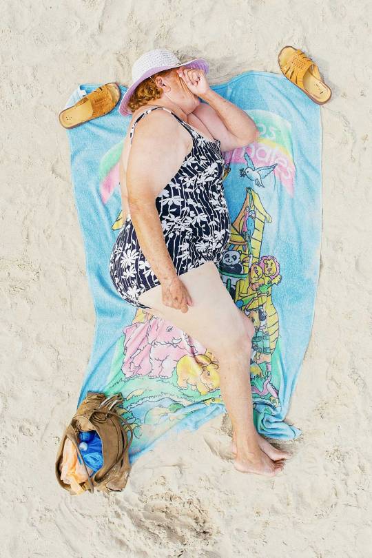
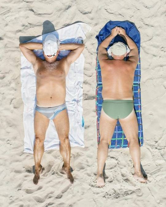
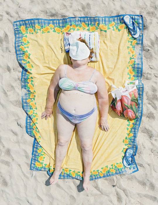
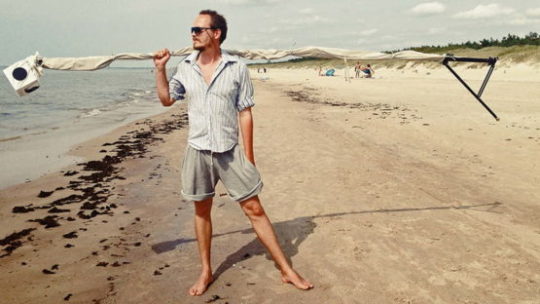
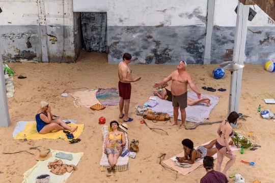

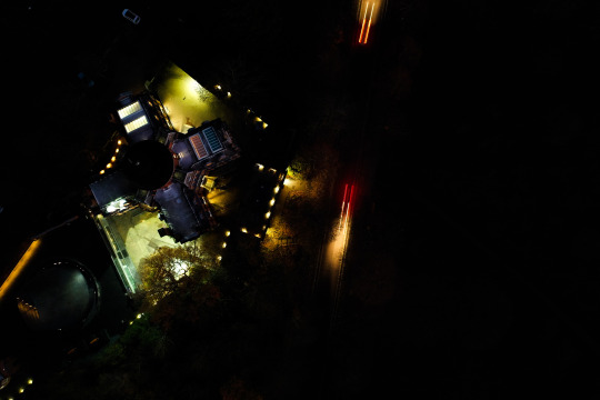
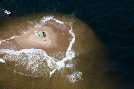
“Comfort Zone” was shot on a beach on the Baltic coast using a contraption of Tadao’s own invention. With his camera attached to a shoulder-mounted rig and a long metal pole he was able to pass by his subjects unobserved, photographing them in repose as they lap up the sunshine. I think I could use this photography style to take same similar pictures.
0 notes
Photo
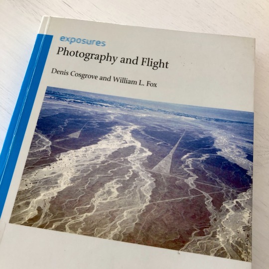
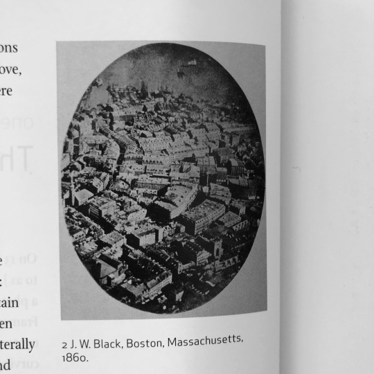


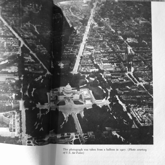
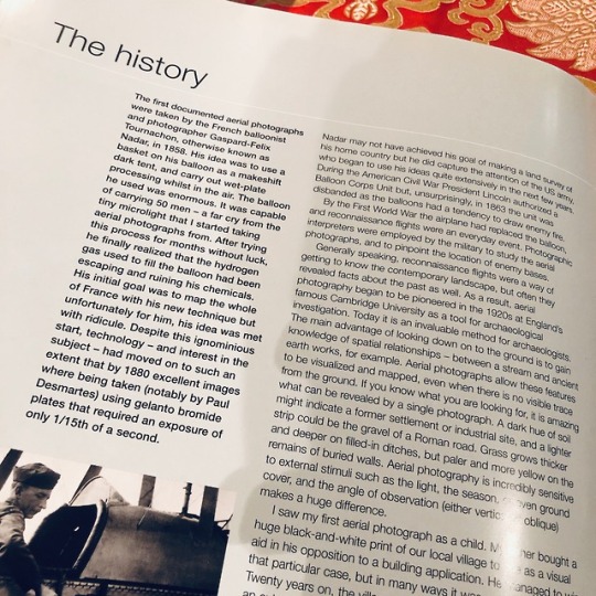
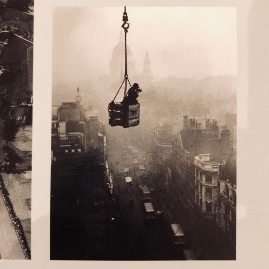
I found this book called “Photography and Flight”, this book tells the earliest history of aerial photography. On 13th October 1860, the photographer James Wallace Black accompanied the balloonist Samuel A. King, and took a photography from high over the city of Boston, Massachusetts. It shows the streets and city blocks curving away towards the city’s North End, the peninsula framed by the Charles River and the Harbour. To be sure, people were fascinated by the novelty of early aerial photographs, and fascination with such images has not dwindled.
on the other hand, this book also tells the “Aerial Photography as Art”. As with photography more generally, neither the airborne camera nor the images it recorded lent themselves to being placed within the hierarchical conventions that, despite the challenges of avant-garde artists, continued to dominate art practices and criticism in the early twentieth century. But despite their reservations, the Italians were among many artists who recognized that powered flight radically challenged conventional modes of seeing and experiencing space, and offered wholly new perspectives on familiar objects, revealing forms and patterns impos- sible to see from the ground. Inevitably, the creative potential of aerial photography soon attracted artists, and today there is a distinct genre of art that uses the air photograph as its medium. Humans are, in short, pattern-fixated, and take great aesthetic pleasure from discerning pattern, seeing it stretched and broken and reformed. While the biological study of vision as pattern recognition suggests that it may be related to survival needs, within the history of art the interest has been in how these patterns work compositionally in picture making, and it was in the very years that the camera was first mounted on aeroplanes that Modernist artists began to create images that sought to foreground shape and pattern over the conventional forms of figurative representation. In later life, the post Impressionist Paul Cézanne became fascinated by such geometrical forms as cones, spheres and cylinders, and the Cubist painters Pablo Picasso and Georges Braque experimented with images in which surface patter dominated over conventional perspective depth, seeking to deconstruct the conventional' artistic vision and ways of representing objects in space. While it would be wrong to claim that the aerial view - and especially aerial photography-generated Cubism, we have already remarked on the fascination that these artists had with powered flight and the new ways of seeing that it offered. One of the things that aerial photography does remarkably well is to reveal and even create pattern at varying scales on the earth's surface. Unless viewed stereoscopically or taken from an oblique angle in sharp shadow, it also flattens the image, emphasizing surface. When aerial photographers deliberately seek out, frame and create pattern rather than seeing their work as serving purely documentary purposes, they approach the conventional realms of art. As both photography and flight have evolved into a wider spectrum of technology and become aerial and remote sensed imaging, so artists in the late twentieth and early twenty-first centuries have constantly broadened their definition of aerial art, suggesting that our understanding of patterns and their meanings is likewise expanding Obviously, the aerial photographer can concentrate on creating images that seek to satisfy conventional aesthetic concerns: capturing sublime images such as a volcanic crater, high mountain peaks seen from above or dramatic views of a coastline; artists can make picturesque images of rolling cornfields in late summer, or conventionally beautiful images of the patterns created by nature itself or by human activity, such as the striated lines of sand dunes or hillside terraces in the Alps or on Java. Such work is conventional and very popular, as the success of Arthus-Bertrand reveals. But the most memorable artworks in aerial photography recognize that the medium offers far greater creative opportunities than the picturesque conventions of representing natural and human landscapes.
0 notes
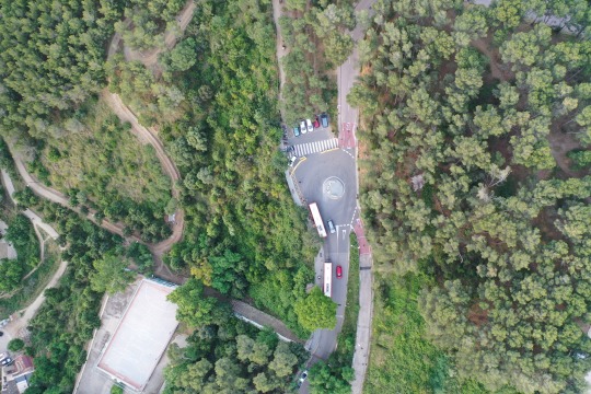
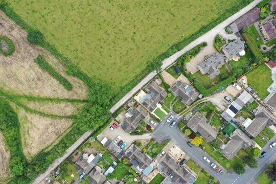
Photo
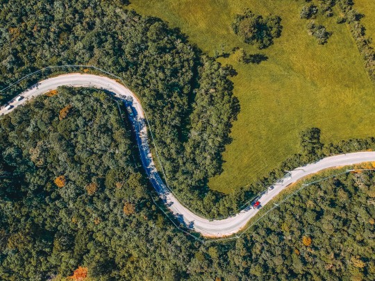
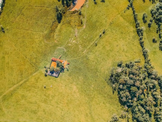


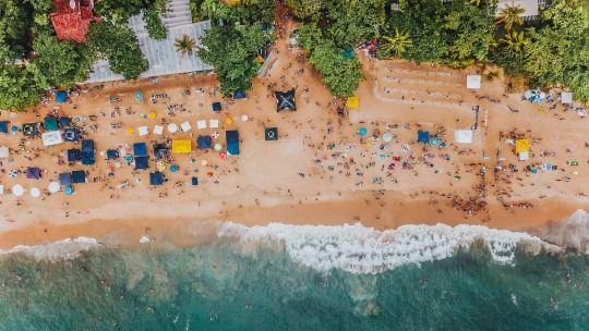

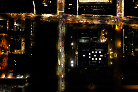
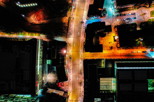
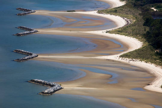
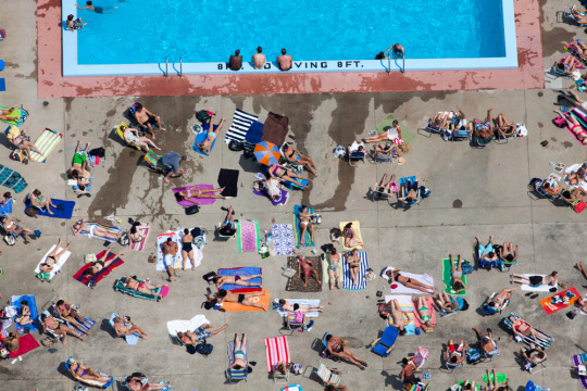
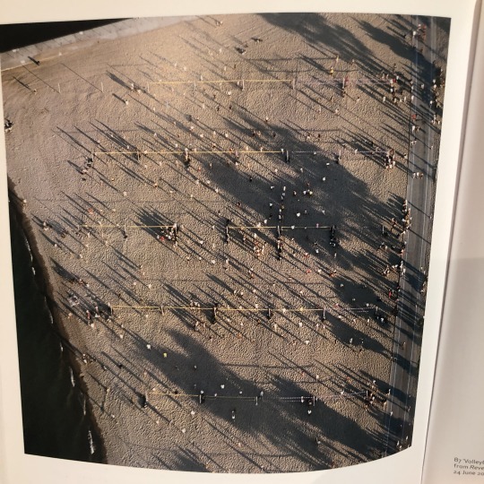
I like these pictures so much, they are perfect display what is the “bird view” look at.
1 note
·
View note
Photo
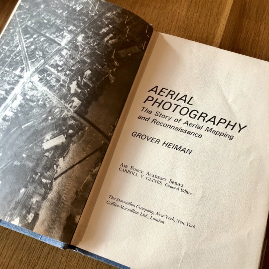


I have found a book which called Aerial Photography: The Story of Aerial Mapping and Reconnaissance. It’s talk about since the dawn of conflict between men, military commanders have always wanted to be able to “see over the hill.” Those who held the highest hill invariably had the commanding position, could see with their own eyes what their enemies were doing and could move their own forces to counter an attack or to plan their own attacks.
The invention of the telescope and advancement in optics in the sixteenth century enabled the commander to see farther and to gain a larger panorama of the battlefield. Still escaping him, however, was knowledge of what the enemy was doing beyond the range of eyesight from the highest hill. This knowledge is generally termed “intelligence” and the effort to obtain this information is called “reconnaissance.”
In time, two inventions would offer him this capability “the air vehicle”, starting with the balloon, and the camera. Then, as battlefield expanded, the invention of the airplane would further extend the vision of the military commander so that he could observe activities on continents. Finally, in1957 man would conquer space and the combination of spacecraft and photography would allow him to observe the entire globe and beyond.
Because the day is divided into daylight and dark, the commander equally sought to gain the same reconnaissance capability in darkness which he had in daylight. Through this effort came such remarkable inventions as radar, infrared photography, and the development of night photoflash bombs that light up Nature’s darkness with the power of millions of candles.
0 notes
Photo


I have found a photography book in the library which called “Aerial: The Art of Photography from the Sky”. I think that can help me understand the history and current situation of aerial photography more systematically. as the same time, I will find some ideas of my project from this book, to learn more outstanding aerial photography works.
0 notes