
dasnusantara
DAS Nusantara
Welcome to DAS Nusantara, a blog for introducing the richness of river basins (Daerah Aliran Sungai) throughout Indonesia. Here, you can explore information about various river basins, including maps, data, and other important information related to river basins. Our goal is to increase awareness about the importance of river basins and to preserve them so that they can continue to provide benefits to the environment and communities around them. Please explore our site and discover the beauty and value of every river basin in Indonesia.
27 posts
Don't wanna be here? Send us removal request.
Last Seen Blogs

mosaoo12-blog
Untitled

devonodevv
eyyyy lmao

schooltildeath
death before decaf

pirdinoeva
şizofren işte

irisannallen
maybe we were meant to be together.
Text
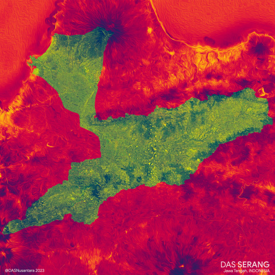

SERANG River Basin, Central Java, Indonesia
2 notes
·
View notes
Text
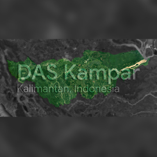
KAMPAR River Basin, Sumatera
#Daerah Aliran Sungai#Drainage Basin#floodplain#river basin#watershed#wilayah sungai#hydrology#map#nusantara
0 notes
Photo

(via DAS Rokan)
0 notes
Text

The Ciliwung River meanders surrounded by densely populated settlements which are most often affected by flood runoff from the river in Jatinegara District, East Jakarta
2 notes
·
View notes
Text

The Ciliwung River divides the Bogor palace complex which is part of the Bogor Botanical Gardens
1 note
·
View note
Text

The urban forest which is part of the University of Indonesia complex (left) and the Ciliwung river which meanders between densely populated settlements in the city of Depok, West Java
0 notes
Text

Cilaki river, West Java, Indonesia
1 note
·
View note
Text

Sindangbarang sub-distric, West Java, Indonesia
2 notes
·
View notes
Text

Cape of Ujung Genteng, West Java, Indonesia
1 note
·
View note
Text
Ciletuh Geopark, West Java, Indonesia
1 note
·
View note
Text

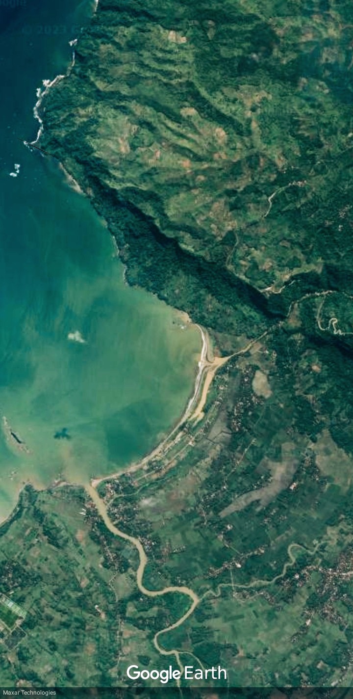
Pelabuhan Ratu SubDistric and mouth of the Cimandiri river, West Java, Indonesia
1 note
·
View note
Text

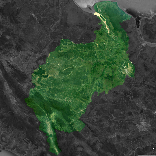
BERAU River Basin, East Kalimantan, Indonesia
7 notes
·
View notes
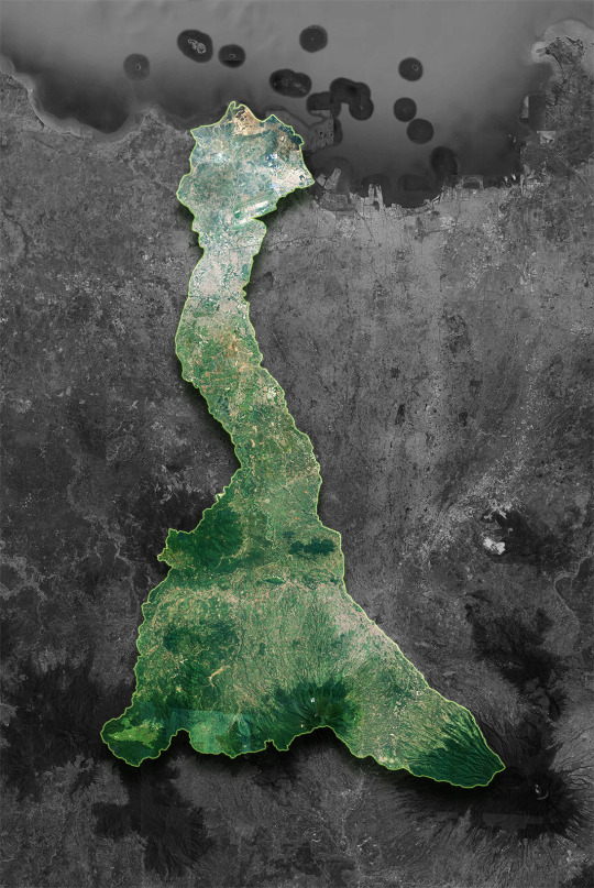
Text

BONGKA River Basin (3,342 km²) | Central Sulawesi - Indonesia
5 notes
·
View notes
Link
This image from Japan’s ALOS satellite was captured over part of southern Borneo, an island in Southeast Asia.
Politically, the island is divided between Brunei, Malaysia and Indonesia. The area pictured covers part of South Kalimantan province in Indonesia’s territory, with the city of Amuntai in the upper-central section of the image. The network of white lines show manmade constructions such as houses lined up along rivers and roads. Dark blue shows swamps.
False-colour images in infrared provide detailed information on vegetation, such as plant type and health. This information is particularly useful for agricultural monitoring.
Zooming in, we see that the majority of the land in this image is sectioned off into plots. Notice how most of the image is red, while plots near or in the swamps are yellow and orange. This indicates a different crop, possibly rice. Meanwhile, brighter red indicates thicker vegetation.
Mountainous Borneo is home to one of the world’s most diverse rainforests, and its natural resources have tremendous social and economic value at local, national and global levels.
These resources have diminished in recent years through logging, plantation development, mining and forest fires. But Earth-observing satellites are helping to monitor and evaluate the impact of the island’s development.
2 notes
·
View notes
Link
This radar Envisat acquisition highlights Indonesia’s Kalimantan region in the southern part of tropical Borneo in South East Asia. Borneo, the world’s third largest island, was once covered in dense rainforests. However, in the 1980s and 1990s these forests were cleared for their timber at an alarming rate. Soon after, the global demand for palm oil increased and what was left of Borneo’s forests started being cleared for palm plantations (visible as square green patches). This image was acquired on 23 April 2009 by Envisat’s Advanced Synthetic Aperture Radar (ASAR) instrument.
1 note
·
View note
Text
Cisadane River Basin, Java - Indonesia
4 notes
·
View notes
Link
The European Union activated its Emergency Copernicus satellite mapping service a couple of hours after the earthquake in Indonesia to assist authorities. Copernicus has also produced grading maps showing the impact of the damage covering ten areas of interest. The tailor-made service continues to closely monitor the situation and provide assistance in the aftermath of the disaster.
2 notes
·
View notes