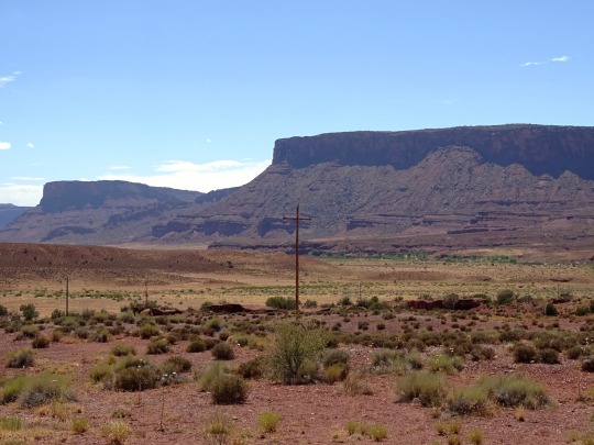
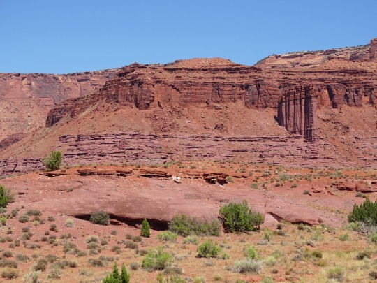
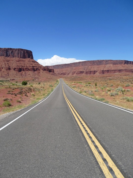
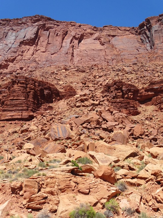
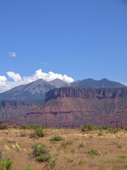
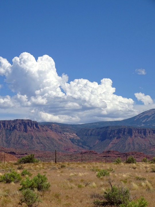
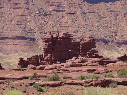
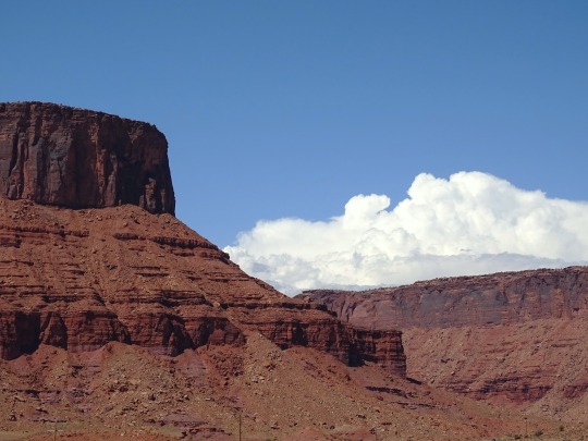
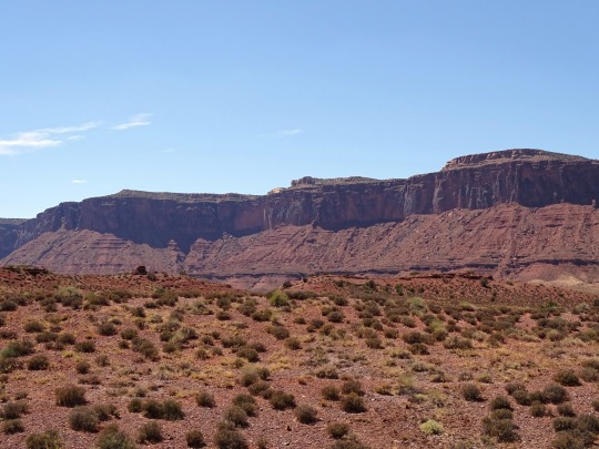
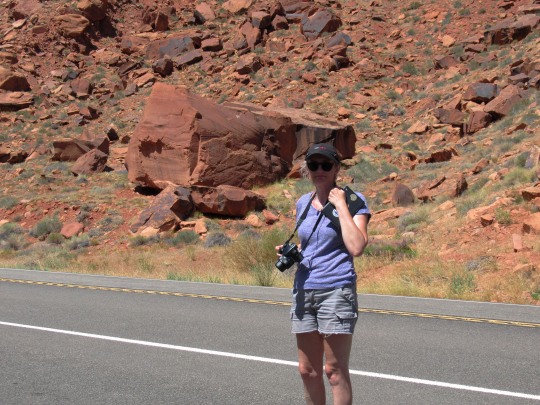
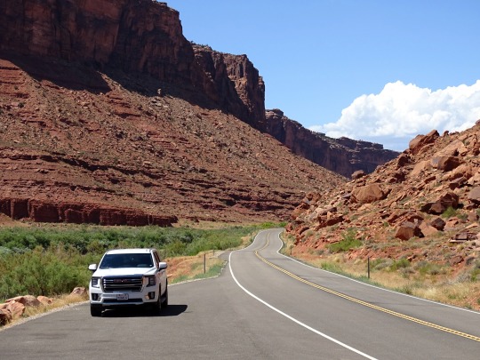
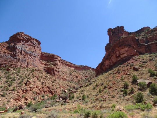
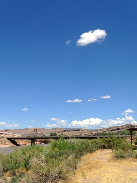
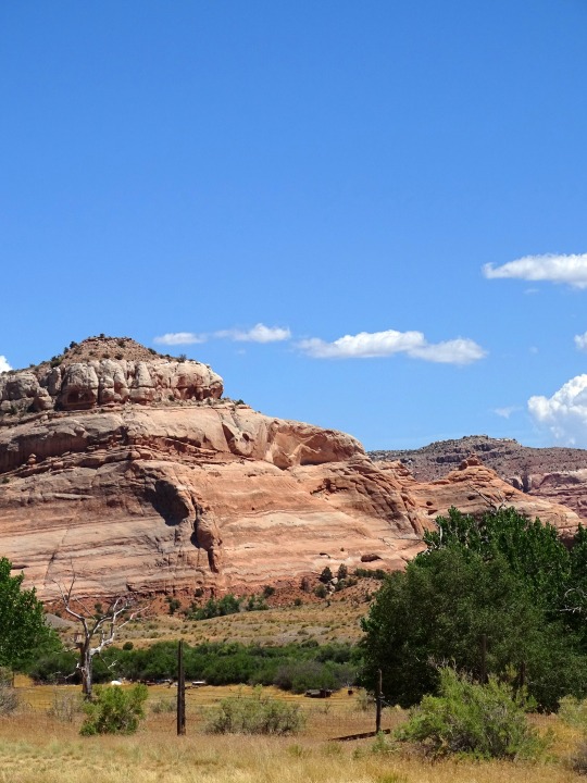
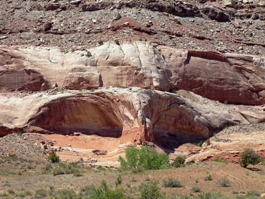
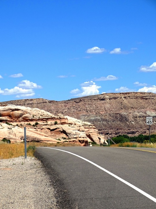
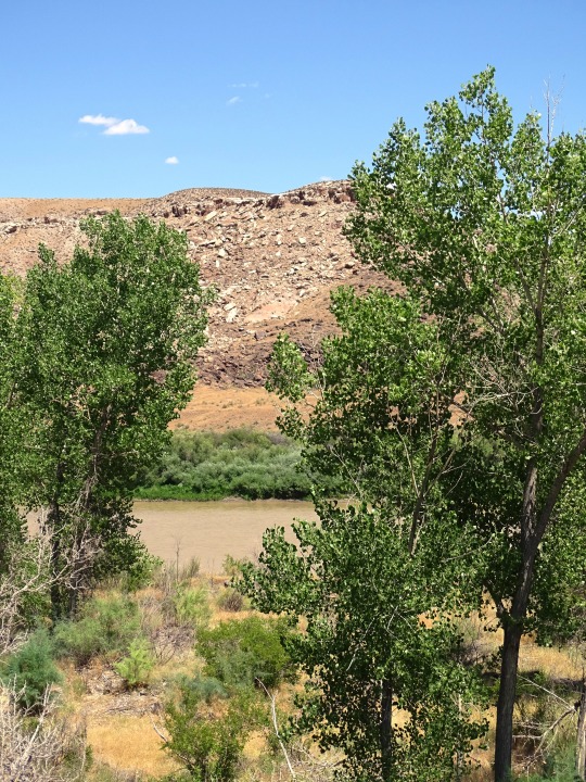
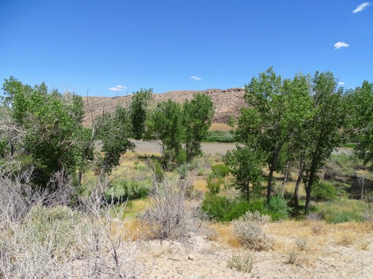
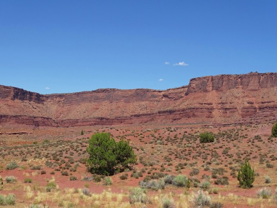
#Hwy 128 Scenic Byway
Photo
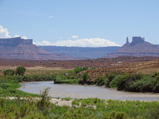
Oasis
What do you think about my pic?
#Hwy 128 Scenic Byway#Upper Colorado River Scenic Byway#Utah 128#Dinosaur Diamond Prehistoric Highway#Colorado River#Utah#geology#mesa#landscape#countryside#valley#river bank#water#desert#travel#USA#Western USA#summer 2022#original photography#landmark#tourist attraction#vacation#photo of the day#What do you think about my pic?#flora#grass#bush#blue sky#clouds#Colorado Plateau
27 notes
·
View notes
Text
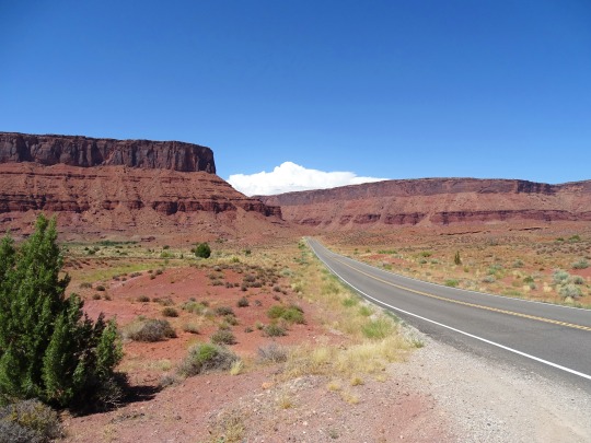
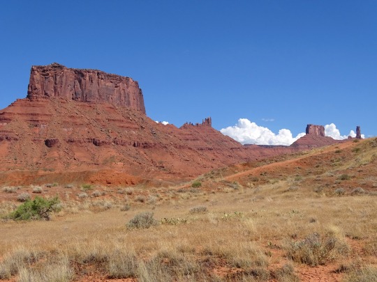
Moab, Utah Scenic Highway 128
Moab, Utah Scenic Highway 128. #MoabUT #Moab #MoabUtah #RoadTrip #RoadTrips #RoadTrip2021 #FamilyFun #Scenic #ScenicDrive #Road
Moab, Utah has spectacular scenic roads. Come on a road trip with us as we drive through Moab Scenery, Scenic Byway HWY 128 and drive along the Colorado River. We will drive along the red cliffs and Colorado River of Southern Utah as we make our way to Moab, Utah. We will take you from Highway I-70, down Byway 128, stop at The Red Cliffs Lodge, then onto the town of Moab. Along the way we will…
View On WordPress
#highway 128#Moab#Moab road trip#Moab things to do#moab travel#moab travel tips#Moab UT#Moab utah#road scholar travel#road trip#road trip ideas#Road Trip National Park#road trip usa#road trip utah#road trippin#Road Trips#roadtrip
0 notes
Text
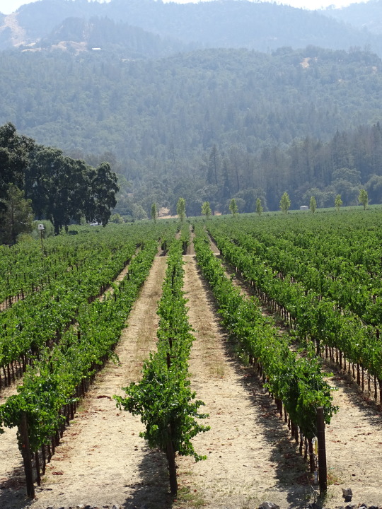
Blaska put 438 miles on a Harley Davidson Sportster (the Iron 1200 model) in four days of riding from San Franciso north through Marin County to wine country in Sonoma and Napa Counties last week (4/9-13/19). (We began our story here.)
Sonoma Highway, aka California Hwy 12, is that county’s main winery thoroughfare, albeit more spread out than neighboring Napa County’s California Hwy 29 cheek by jowl vineyards and bumper-to-bumper traffic.
Indeed, that is the particular beauty of this place: the neatly tended agriculture mixed and matched with the wild of the forested mountains. Interspersed with modest red barns and opulent tasting rooms. All gardened with a profusion of blooming flowers, azaleas, wisteria, midnight blue lobelia, all manner of succulents, roses, and my favorite, the orange California poppies that grow wild here. We saw no tulips or daffodils.
The HD Sportster Iron 1200 on Mt. Veeder Road, Napa County
Temperatures were consistently in the high 60s except for a cloudy and cool Thursday, which dictated a day to visit the tasting rooms with the lovely Lisa. A culinary note: even the hamburgers come with a side salad of fresh greens with a light vinaigrette. Eating healthy is a phobia here.
So is exercise. No matter how steep the climb, there were bicyclists as gaunt as Ethiopian refugees churning up the hillsides, noses down, helmets just above the handlebars.
Trees here were allowed to grow right up to the sides of the roads; few side roads have shoulders, which makes almost every road a scenic byway.
This slideshow requires JavaScript.
Day One threw us west toward the Pacific Ocean and California Hwy 1. It’s cooler out there, windier, fewer trees, more bald mountains. We drove through Bodega Bay — stopped at the successor restaurant to the one in which Hitchcock’s “Birds” was filmed (the original burned down). Then on to Jenner, five miles north.
I asked the proprietor of a modest eatery on a cliff overlooking the ocean (great portabello mushroom sandwich) what was the town’s principal business. She answered “bird watching.” Hitchcock chose wisely.
The way back took us over California Hwy 116, as twisty as a twizzler through majestic California redwoods so close to the pavement one could reach out and touch them, save for an instinct for self-preservation. The towns along the way — places like Monte Rio and Duncans Mills — are little more than a fire department and a tavern, unpretentious as a chicken dinner fund raiser.
The road parallels the Russian River, which is its own viticultural area (much like Medoc in Bordeaux). Korbel brandy and sparkling wine and Rodney Strong are vinted here.
The following day I traveled east across the Mayacamas mountains along Trinity Road. More twists combined with a crumbled road surface turned my knuckles white underneath the fingerless leather gloves. Where I could take my eyes off the next blind curve I marveled at the ingenuity of building mega-homes this far up; some of the driveways had to have been 20 degree-rises or more.
on California Hwy 1
Trinity Road took the HD Iron 1200 to the more manageable Mt. Veeder Road and ultimately to the Silverado Trail, well into Napa County. On a whim, veered east onto Highway 128 (aka Sage Canyon Road), maybe my favorite. Wide and freshly poured pavement, few signs of human intervention (beyond the dam on Lake Hennessey) and almost zero traffic. Nirvana!
Pulled off the side of the road to sit on a hillside to hear the rushing stream well below, largely hidden by spruce and oaks. The only thing missing was my lovely Lisa, who just doesn’t ride.
Her choice and mine. Blaska postponed the wine tastings until after each drive but there is an element of danger in motorcycling. Mistakes are less forgiven, nothing between you and the idiot in the next lane but a layer of leather, no seat belts or airbags.
All part of the thrill of life
.
Riding the vines of California; Part #2 Blaska put 438 miles on a Harley Davidson Sportster (the Iron 1200 model) in four days of riding from San Franciso north through Marin County to wine country in Sonoma and Napa Counties last week (4/9-13/19).
0 notes
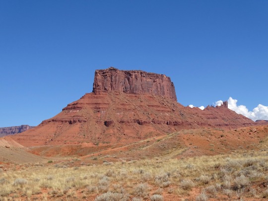
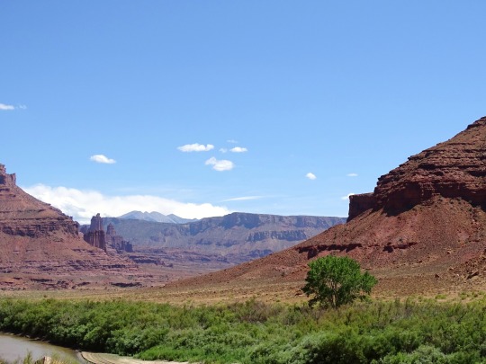
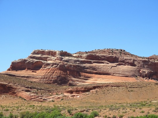
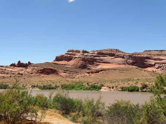
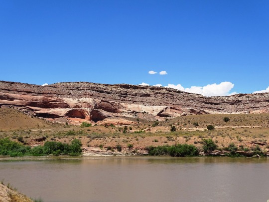
Photo


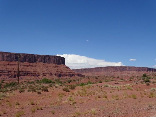

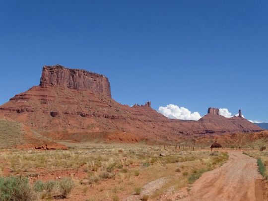
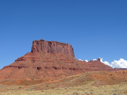
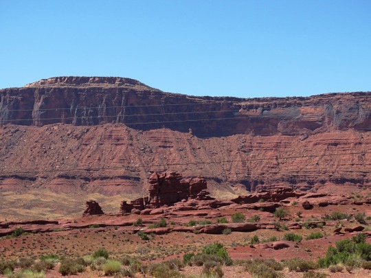
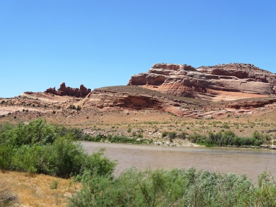
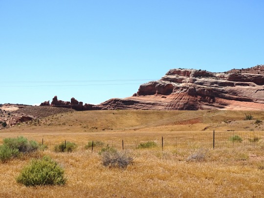
Hwy 128 Colorado River Scenic Byway, UT (No. 12)
Traveling 34 miles (55 km) west of Dinosaur, Colorado, the Dinosaur Diamond encounters the small city of Vernal, Utah. Vernal borders the western end of the Dinosaur National Monument; other notable attractions nearby include Steinaker State Park, Red Fleet State Park, Flaming Gorge National Recreation Area, and the Ashley National Forest.
Continuing along the Dinosaur Diamond, US 40 and US 191 converge within Vernal, heading west for 30 miles (48 km) to the city of Roosevelt. Roosevelt is located on the edge of the Uintah and Ouray Indian Reservation. Heading 29 miles (47 km) to the west is the county seat of Duchesne, located within the reservation. Nearby Duchesne are Starvation State Park and Kings Peak (the highest point in Utah), which is part of the Uinta Mountain range. The Uinta Mountains are one of the few mountain ranges in the contiguous United States which run east–west, and are the highest range to do so.
Within Duchesne, US 40 and US 191 diverge, and the DD continues 55 miles (89 km) south along US 191 over an unnamed mountain pass, through the small town of Helper, and into the larger city of Price. The numerous attractions surrounding Price include College of Eastern Utah Prehistoric Museum, Manti-La Sal National Forest, Huntington Lake State Park, Scofield State Park, and Ninemile Canyon which features numerous petroglyphs. Also nearby is the Cleveland-Lloyd Dinosaur Quarry, a prehistoric mud trap which claims to be the densest concentration of Jurassic dinosaur fossils in the world.
Traveling 63 miles (101 km) southeast along US 191, the DD encounters the city of Green River. Notable features surrounding Green River include the San Rafael Swell, Green River State Park, and Goblin Valley State Park. Also nearby is Crystal Geyser, a rare (but man-made) cold water geyser caused by the expansion of carbonized "soda pop" water within. Within Green River, US 191 converges with I-70 for a short while and diverges again, south towards the city of Moab, 55 miles (89 km) from Green River.
Just south of the junction of US 191 and SR-128, the city of Moab features a number of nearby attractions. Arches National Park, Canyonlands National Park, Dead Horse Point State Park, and the Newspaper Rock and Potash Road petroglyphs.
Leaving Moab, the DD continues north along SR-128 to its terminus with I-70 in Cisco. Traveling east along I-70, before completing the "diamond" back in Grand Junction, Colorado.
Source: Wikipedia
#Dinosaur Diamond Prehistoric Highway#Hwy 128 Colorado River Scenic Byway#Utah 128#Hwy 128 Scenic Byway#Upper Colorado River Scenic Byway#USA#National Scenic Byway#road trip#desert#geology#nature#landscape#countryside#nice drive#cliff#canyon#mesa#original photography#travel#Utah#vacation#summer 2022#SR-128#blue sky#clouds#red rock#rock formation
11 notes
·
View notes
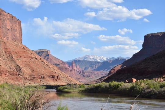
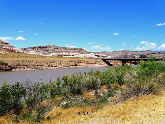
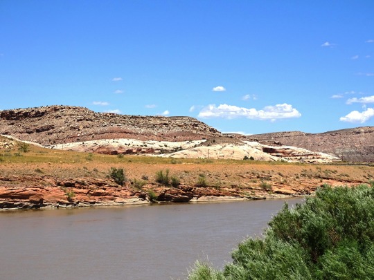
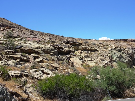
Photo

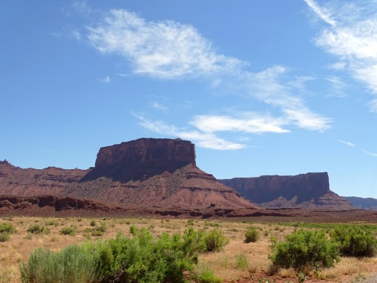
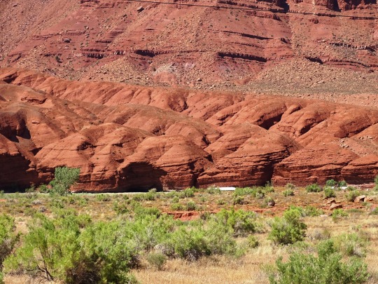
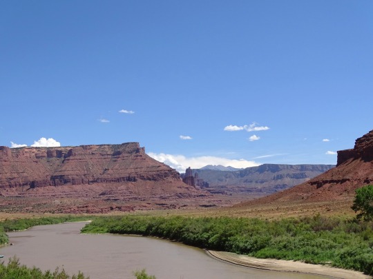
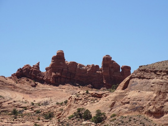
Hwy 128 Colorado River Scenic Byway, UT (No. 10)
This spectacular route along the Colorado River gorge begins at the Colorado River Bridge on the north end of Moab. Spending a day exploring this section of the river gorge will provide you with jaw dropping scenery and take you to the sixth-longest natural rock span in the United States, world famous movie locations, beautiful picnic and bouldering areas, a Film Heritage Museum, a large variety of hiking trails including one that goes to the breathtaking Fisher Towers, historical points of interest, guided horseback riding opportunities, outdoor dining, a brand new mercantile (opening in 2020) and a ghost town.
Utah State Route 128 (U-128) is a 44.6-mile-long (71.7 km) state highway north of Moab. The entire length of the highway has been designated the Upper Colorado River Scenic Byway, as part of the Utah Scenic Byways program. This road also forms part of the Dinosaur Diamond Prehistoric Highway, a National Scenic Byway. Residents of Moab frequently refer to SR-128 as “the river road”, after the Colorado River, which the highway follows.
The highway was originally constructed to connect rural cities in eastern Utah with Grand Junction, Colorado, the largest city in the region. Part of the highway was merged into the Utah state highway system in 1931; the rest was taken over by the state and assigned route number 128 in 1933. Today, the highway is used as a scenic drive for visitors to the area.
The highway crosses the Colorado River at the site of the Dewey Bridge, listed on the National Register of Historic Places. This bridge was the longest suspension bridge in Utah until April 2008 when it was destroyed by a fire.
Source
#Dinosaur Diamond National Scenic Byway#Hwy 128 Scenic Byway#SR-128#Hwy 128 Colorado River Scenic Byway#Upper Colorado River Scenic Byway#National Scenic Byway#original photography#landscape#countryside#USA#travel#vacation#summer 2022#geology#desert#Drinks Canyon#Utah#flora#tourist attraction#landmark#street scene#highway#road trip#cliff#Fisher Towers
16 notes
·
View notes
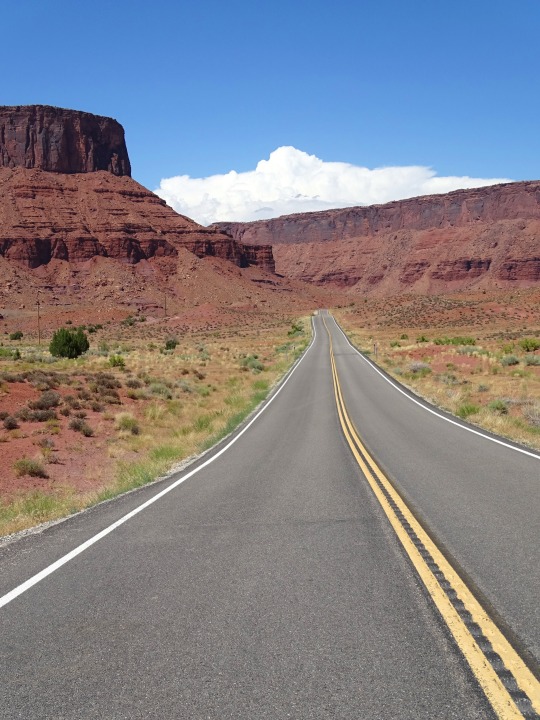
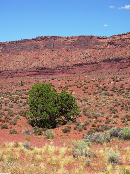
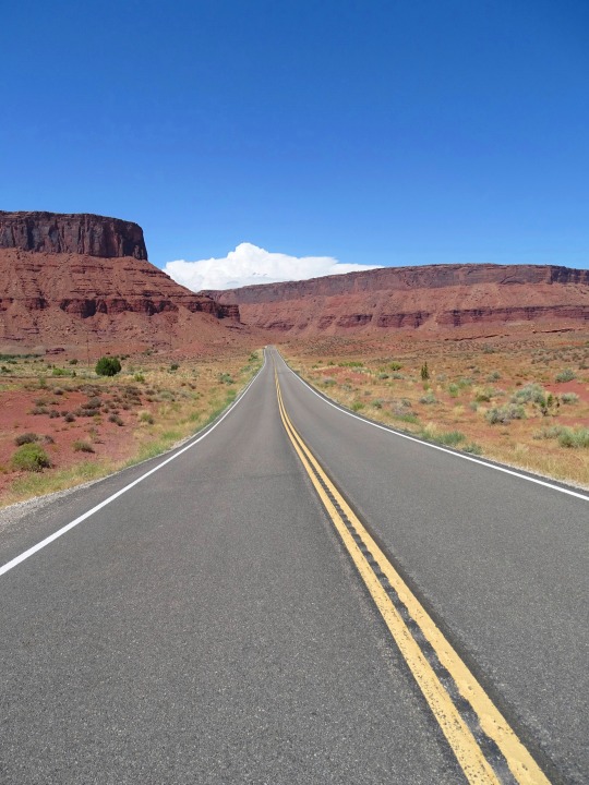
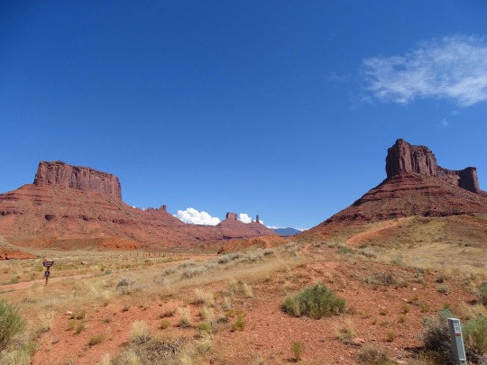
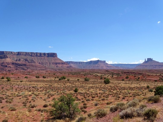
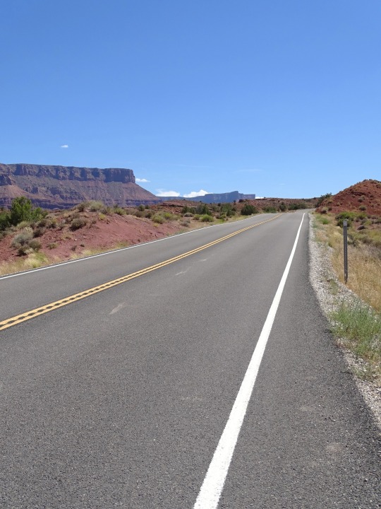
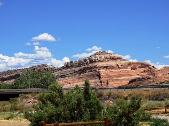
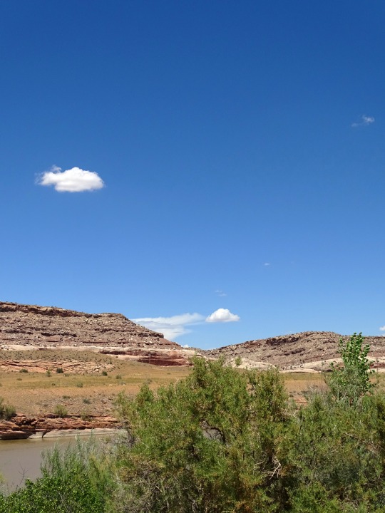
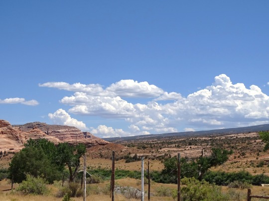
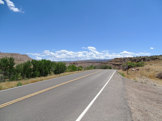
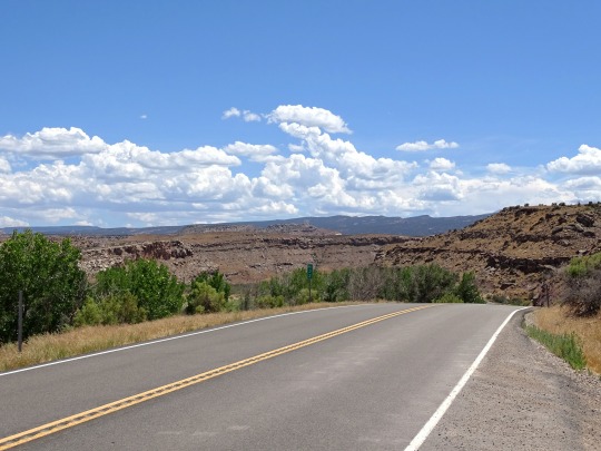
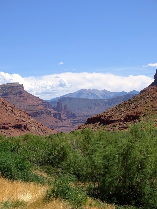
Photo
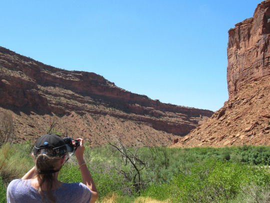
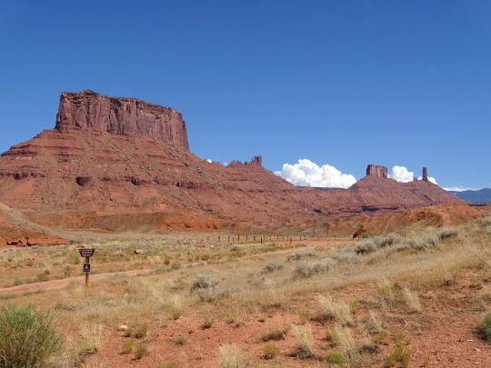
On the Road
What do you think about my pic?
#Hwy 128 Scenic Byway#Utah 128#Upper Colorado River Scenic Byway#USA#street scene#empty road#highway#landscape#countryside#Utah#travel#road trip#original photography#summer 2022#Western USA#river road#Mountain West#tourist attraction#landmark#canyon#SR-128#gorge#sandstone wall#geology#photo of the day#What do you think about my pic?
7 notes
·
View notes
Photo


Hwy 128 Colorado River Scenic Byway, UT (No. 14)
The first route through this portion of Utah was the Old Spanish Trail, a trade route between Santa Fe, New Mexico and Los Angeles, California. The trail was in common use before the Mexican–American War in 1848. Although the trail serves a different route than I-70, they were both intended to connect southern California with points further east. I-70 generally parallels the route of the Old Spanish Trail west of Crescent Junction.
The Utah State Road Commission took over US 40 from Kimball Junction to Colorado in 1910 and 1911, and assigned the SR-6 designation to this route by the mid-1920s.[26] In late 1926, the American Association of State Highway Officials (AASHO) assigned the designation of US 40 to this cross-state route, consisting of most of SR-4 and all of SR-6. (The SR-6 designation remained until the 1977 renumbering; SR-4 became SR-2 in 1962 and was eliminated in favor of I-80 in 1977.)
The road connecting Colton on SR-8 (US 50, now US 6) with SR-6 (US 40) in Duchesne became a state highway in 1910. The southwest end was moved from Colton to Castle Gate in 1912, and in 1927 it was numbered State Route 33. Few changes were made to the roadway, and in 1981 it became part of US 191.
Access between Moab and Castle Valley was originally via a pack trail called the Heavenly Stairway. This trail, named for a dramatic descent of over 1,000 feet (300 m), was described as beautiful, but difficult to navigate. Isolated from Utah's population centers, this area depended on Grand Junction and other cities in Colorado for both everyday supplies and a market for agricultural products. Moab residents pushed for a road to be built along the riverbank. By 1902, the trail was replaced with a toll road, called King's Toll Road, after Samuel King. King was an early settler who also operated the toll ferry used prior to the construction of the Dewey Bridge. Rocks inscribed with "Kings Toll Road" can still be found along the roadway. While the road did improve travel, it was not built high enough above the river level and was often flooded.
Source: Wikipedia
#Hwy 128 Colorado River Scenic Byway#Hwy 128 Scenic Byway#SR-128#USA#Dinosaur Diamond National Scenic Byway#National Scenic Byway#road trip#mesa#desert#geology#cliff#original photography#summer 2022#Utah#tourist attraction#landmark#landscape#countryside#blue sky#clouds#flora#Upper Colorado River Scenic Byway#Colorado River#Colorado Plateau#Drinks Canyon#Fisher Towers
6 notes
·
View notes
Photo
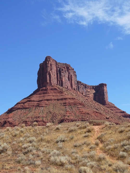
Hwy 128 Colorado River Scenic Byway, UT (No. 13)
The segment within Colorado was designated the Dinosaur Diamond Scenic and Historic Byway by the Colorado Transportation Commission in 1997. The segment within Utah was designated the Dinosaur Diamond Prehistoric Highway by the Utah State Legislature in 1998. The highway was approved as a National Scenic Byway in 2002.
National Scenic Byways must go through a nomination procedure, and must already be designated as a state scenic byway in order to be nominated (However, roads that meet all criteria and requirements for national designation but not state or designation criteria may be considered for national designation on a case-by-case basis).
To be considered for designation "a road or highway must significantly meet at least one of the six scenic byways intrinsic qualities". The qualities are scenic, natural, historic, cultural, archeological, or recreational. A "corridor management plan" must also be developed, with community involvement, and the plan "should provide for the conservation and enhancement of the byway's intrinsic qualities as well as the promotion of tourism and economic development". The final step is when the highway (or highways) is approved for designation by the Secretary of Transportation.
Source: Wikipedia
#Convent Mesa#Parriott Mesa#Hwy 128 Colorado River Scenic Byway#USA#Hwy 128 Scenic Byway#Upper Colorado River Scenic Byway#vacation#Utah#Utah 128#desert#canyon#cliff#geology#landscape#countryside#travel#National Scenic Byway#Dinosaur Diamond Prehistoric Highway#landmark#tourist attraction#road trip#summer 2022#original photography#nice drive#flora#red rock#rock formation#Colorado Plateau
2 notes
·
View notes
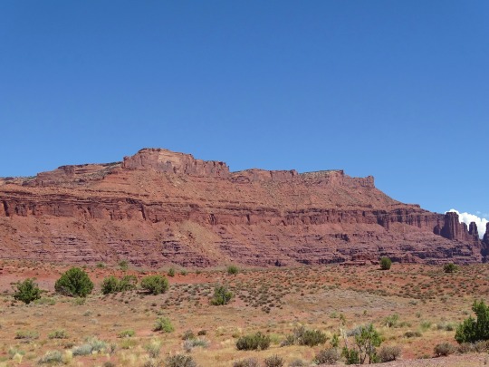
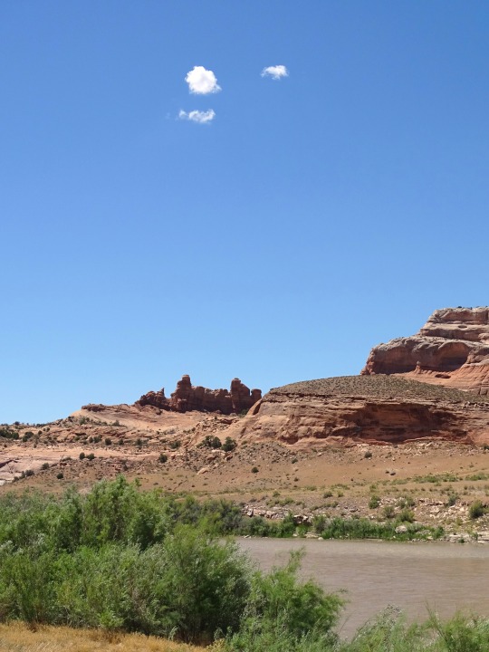
Photo
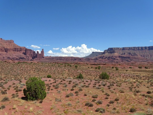
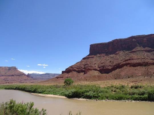
Hwy 128 Colorado River Scenic Byway, UT (No. 11)
The Dinosaur Diamond is a 486-mile (782 km) scenic and historic byway loop through the dinosaur fossil laden Uinta Basin of the U.S. states of Utah and Colorado.[2] The byway comprises the following two National Scenic Byways:
The 328-mile (528 km) Dinosaur Diamond Prehistoric Highway in Carbon, Duchesne, Emery, and Grand counties, Utah; and
The 134-mile (216 km) Dinosaur Diamond National Scenic Byway in Garfield, Mesa, Moffat, and Rio Blanco counties, Colorado.
The highway forms a diamond-shaped loop with vertices at Moab, Helper, Vernal and Grand Junction.
Notable features along the Dinosaur Diamond include Dinosaur National Monument, the Flaming Gorge National Recreation Area, Canyonlands National Park, Arches National Park, Natural Bridges National Monument, Colorado National Monument, and several national forests.
The path of Interstate 70 (I‑70) in Colorado is derived from two previous highways, U.S. Highway 6 (US 6) and US 40. US 40 was an original piece of the U.S. Highway system commissioned in 1926. The portion now numbered US 6 came about in 1937 when the route over Vail Pass was paved. The first route through the path of I-70 in Utah was the Old Spanish Trail, a trade route between Santa Fe, New Mexico, and Los Angeles, California. The trail was in common use before the Mexican–American War in 1848.
Source: Wikipedia
#Hwy 128 Colorado River Scenic Byway#Upper Colorado River Scenic Byway#Hwy 128 Scenic Byway#National Scenic Byway#SR-128#street scene#desert#geology#flora#nature#cliff#red rock#rock formation#landscape#countryside#tourist attraction#landmark#Utah#USA#summer 2022#original photography#Dinosaur Diamond Prehistoric Highway#Fisher Towers#travel#vacation#road trip
2 notes
·
View notes
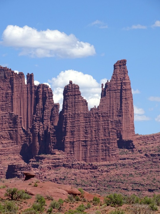
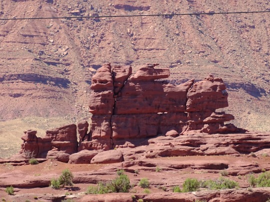
Photo

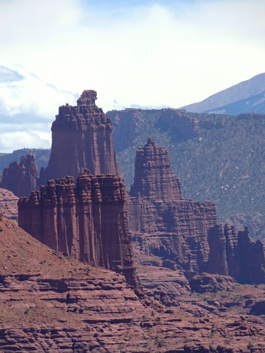
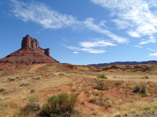
Hwy 128 Colorado River Scenic Byway, UT (No. 8)
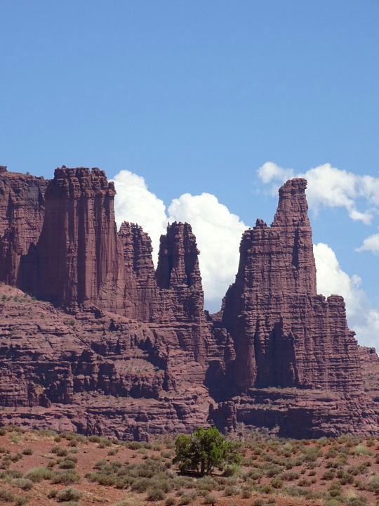
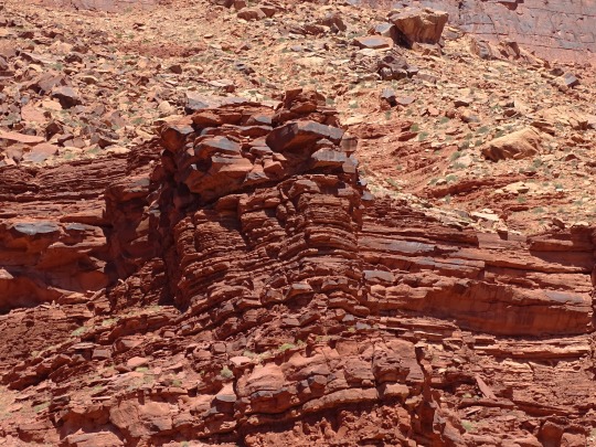
Fisher Towers are a series of towers made of Cutler sandstone capped with Moenkopi sandstone and caked with a stucco of red mud located near Moab, Utah (38.7240°N 109.3083°W). The Towers are named for a miner who lived near them in the 1880s. The Towers are world-renowned as a subject for photography and for its classic rock climbing routes.
The nearest town is Moab, Utah about 16 miles (26 km) to the southwest. The area is generally accessed from Fisher Towers Road off of Route 128 which runs along the Colorado River between I-70 and Route 191. Castleton Tower is visible approximately 6 miles (9.7 km) to the southwest from different parts of the Fisher Tower's area.
The Towers lie just south of a larger mesa which they are emerging from on a geological time scale. 1,000 feet (300 m) north of the main formation there is a tower which has only partway emerged from the mesa. The Towers are composed of three major fins of rock that run from the northeast closer to the mesa out to the southwest and into a desert valley. The fins are between 1,000 and 2,000 feet (300 and 610 m) long and separated from each other by about 1,000 feet (300 m). Each fin contains multiple towers, a number of which have been named.
Source: Wikipedia
#Hwy 128 Colorado River Scenic Byway#Upper Colorado River Scenic Byway#Hwy 128 Scenic Byway#National Scenic Byway#Utah 128#SR-128#travel#Highway#street scene#desert#landscape#countryside#geology#canyon#cliff#red rock#rock formation#flora#nature#Colorado River#Utah#USA#Colorado Plateau#Dinosaur Diamond Scenic Byway#Fisher Towers#sandstone#GMC Yukon#rental car#road trip#tourist attraction
3 notes
·
View notes
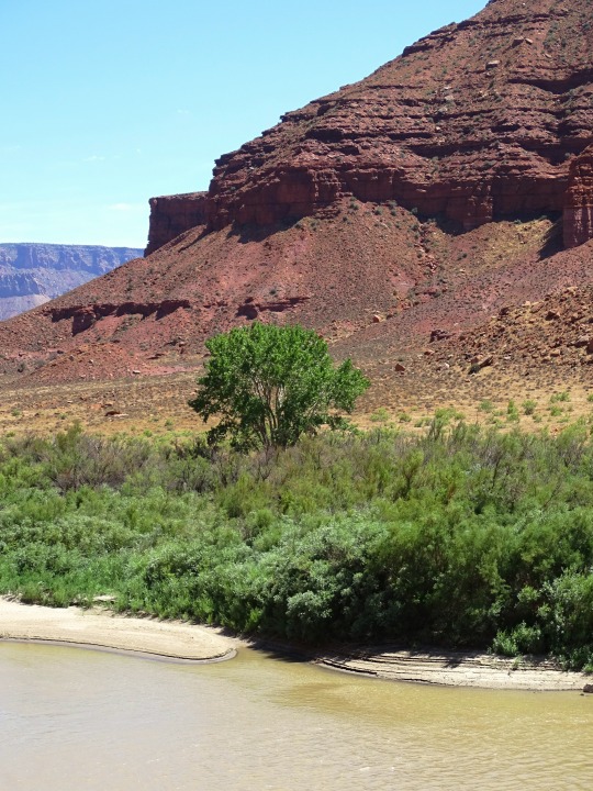
Photo

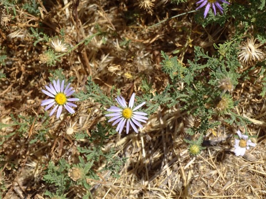
Hwy 128 Colorado River Scenic Byway, UT (No. 5)
Dewey Bridge
The Dewey Bridge, built in 1916, originally carried SR-128 across the Colorado River. The bridge featured an all wood deck measuring 502 feet (153 m) long, 10.2 feet (3.1 m) wide from support to support and 8 feet (2.4 m) wide from rail to rail. The bridge also consisted of two metal towers, a run of seven cables on each side of the bridge deck, and cable anchors.
In 1912 Grand County unsuccessfully petitioned the state to finance the construction of a bridge. In 1913, the ferry was out of service for a time because ice in the river struck the ferry, causing it to sink. This raised the level of urgency for a more reliable river crossing. Grand County held a municipal bond election, and was able to raise $25,000 (1913, approximately equivalent to $550,000 in 2008) to finance the construction of a bridge. The county employed the Midland Bridge Company of Kansas City, Missouri, to build it. Plans originally called for the bridge deck to be 12 feet (3.7 m) wide, but with the bonds not producing the expected yields, the deck width was scaled down to 8 feet (2.4 m). In 1916, the bridge was dedicated with a strength test by having approximately 70 attendees attempt to cross the bridge at once. The total was seven wagons, two people on horseback and several on foot. The bridge was designed to support the weight of six horses, three wagons, and 9,000 pounds (4,100 kg) of freight.
On the day of its completion, it was the second-longest suspension bridge west of the Mississippi River. The longest was the Cameron Suspension Bridge, also built by the Midland Bridge Company, who used the same base plans for both bridges. The Dewey Bridge remained the longest suspension bridge in Utah until it was destroyed by fire in 2008.
As part of a tribute, a reporter for The Daily Sentinel interviewed locals and visitors about their first experience crossing the bridge. Many recalled how nervous they felt as the bridge would creak and sway under load. One stated, "A lot of people lost a lot of mirrors on that bridge". Drivers with wide vehicles had to fold in their side mirrors to safely cross, as the bridge deck was only 8 feet (2.4 m) wide.
Source: Wikipedia
#Dewey Suspension Bridge#Dewey Bridge Campground#Colorado River#Hwy 128 Colorado River Scenic Byway#Hwy 128 Scenic Byway#Utah 128#Upper Colorado River Scenic Byway#National Scenic Byway#landscape#USA#Utah#desert#countryside#engineering#tourist attraction#landmark#river bank#flora#nature#original photography#summer 2022#red rock#rock formation#Symphyotrichum Spathulatum#Aster spathulatus#road trip#wildflower#Dinosaur Diamond Prehistoric Highway
4 notes
·
View notes
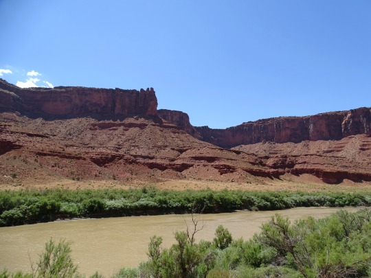
Photo
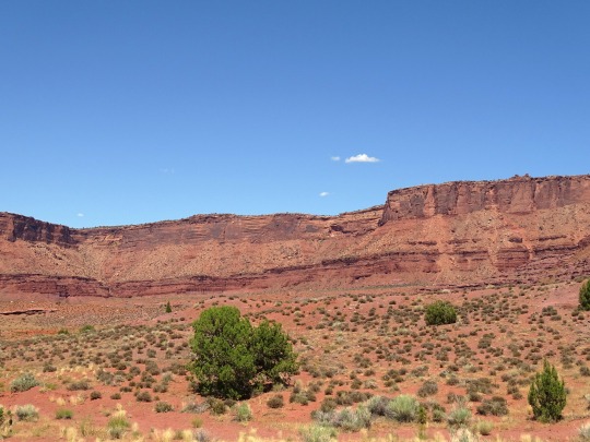
Hwy 128 Colorado River Scenic Byway, UT (No. 4)
Access between Moab and Castle Valley was originally via a pack trail called the Heavenly Stairway. This trail, named for a dramatic descent of over 1,000 feet (300 m), was described as beautiful, but difficult to navigate. Isolated from Utah's population centers, this area depended on Grand Junction and other cities in Colorado for both everyday supplies and a market for agricultural products. Moab residents pushed for a road to be built along the riverbank. By 1902, the trail was replaced with a toll road, called King's Toll Road, after Samuel King. King was an early settler who also operated the toll ferry used prior to the construction of the Dewey Bridge. Rocks inscribed with "Kings Toll Road" can still be found along the roadway. While the road did improve travel, it was not built high enough above the river level and was often flooded.
Source: Wikipedia
#Hwy 128 Colorado River Scenic Byway#Hwy 128 Scenic Byway#Utah 128#National Scenic Byway#Upper Colorado River Scenic Byway#highway#USA#street scene#landscape#countryside#blue sky#desert#clouds#nature#flora#summer 2022#original photography#Utah#Western USA#travel#vacation#Colorado River#rock formation#red rock#a great drive#river bank
4 notes
·
View notes
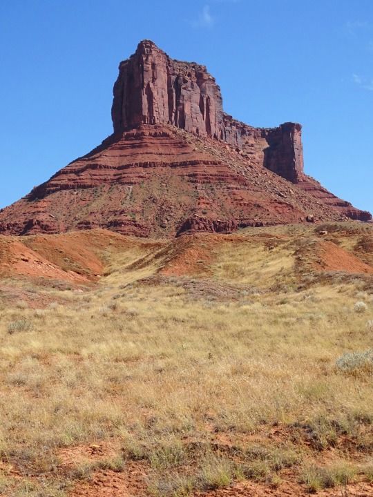
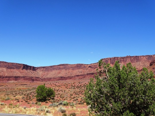
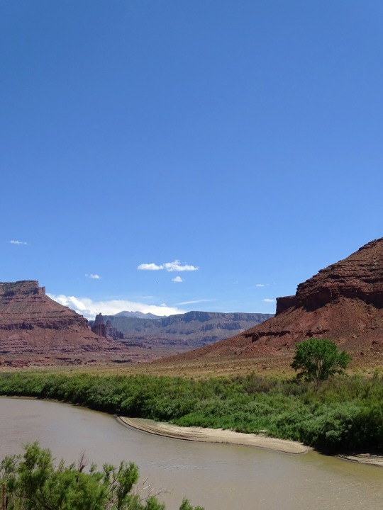
Photo
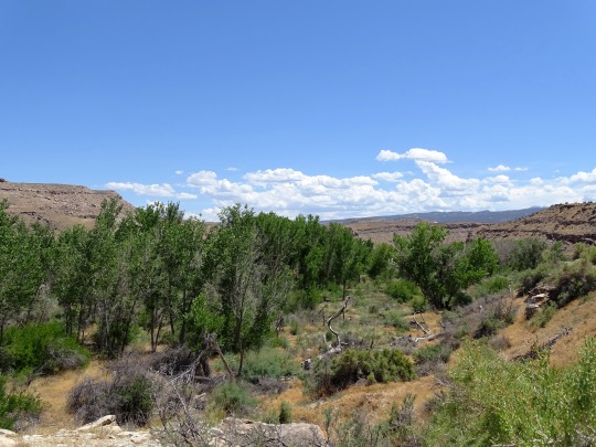
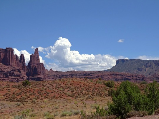
Hwy 128 Colorado River Scenic Byway, UT (No. 3)
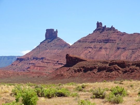
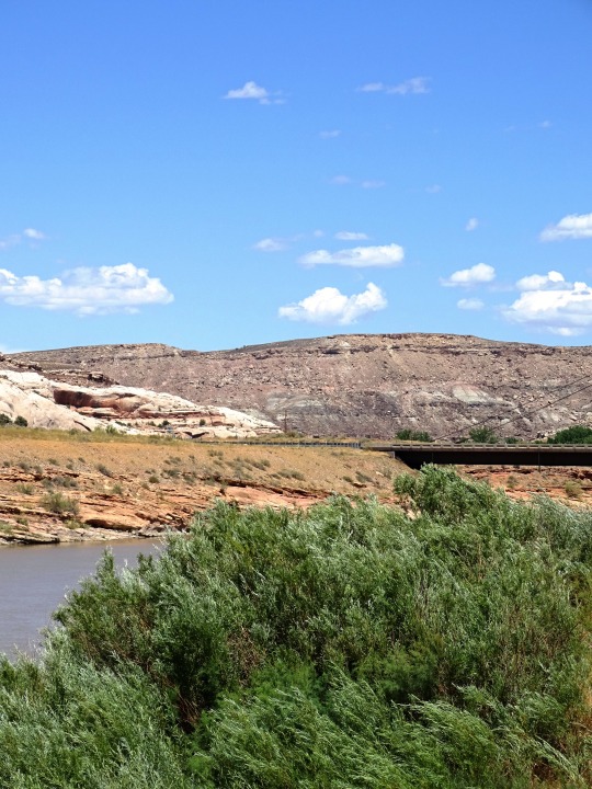
The gorge widens where the highway passes by Castle Valley and Professor Valley, which have been the shooting locations for many western films (including Wagon Master and Rio Grande) and television commercials. Near the east end of the valley the highway crosses Onion Creek, a stream sourced by springs that contain naturally occurring minerals that produce a strong odor in the water. At the east end of the valley the highway has a view of the Fisher Towers, a set of dark red spires. After leaving the valley, the road winds farther up the river gorge until arriving at the Dewey Bridge, named for Dewey, a nearby ghost town.
After the bridge, the road follows the northern bank of the river for a few miles then exits the Colorado River gorge. At this point the highway proceeds across desert towards the Book Cliffs to terminate at Interstate 70 (I-70) near Cisco. Cisco is a ghost town along the main line of the Denver and Rio Grande Western Railroad, founded as a water re-filling station for steam locomotives. The last 3 miles (4.8 km) of the road parallel the railroad and is an old routing of US-6/US-50, in use before the construction of I-70.
Source: Wikipedia
#Hwy 128 Colorado River Scenic Byway#Utah 128#landscape#countryside#Hwy 128 Scenic Byway#Upper Colorado River Scenic Byway#summer 2022#National Scenic Byway#Colorado River#desert#hills#nature#flora#tree#blue sky#clouds#original photography#street scene#nice drive#road trip#tourist attraction#landmark#Dinosaur Diamond Prehistoric Highway#river bank#Western USA#Utah#Utah Route 128#Highway 128
2 notes
·
View notes
Photo


World Soil Day
One annual celebration people will be forgiven for not participating in (or even knowing about) is World Soil Day. Yes, soil—as in that sticky brown stuff that gets walked all over into prized cream carpets. Sadly, it is the ignorance about the importance of soil and the degree to which people take advantage of all that it offers that have led to a drastic reduction in its quality all over the world.
These are precisely the problems World Soil Day aims to battle, as few things could be more important to humans, the inhabitants of Planet Earth, who could never hope to survive without the land.
Soil is, without a doubt, one of the most significant parts of the ecosystem. Contributing to people’s food, water and energy and playing an important part in reducing the impact of climate change, soil is a vital part of life.
For all of these reasons, it’s high time that World Soil Day became known to more people than just scientists concerned about the welfare of our planet. So it’s time to get ready to learn about and celebrate this important day!
History of World Soil Day
In 2002, the International Union of Soil Sciences (IUSS) made a resolution proposing that the 5th of December be World Soil Day. The idea for the day was to make it possible to celebrate the importance of soil as a critical component of the natural system and as a vital contributor to human well-being.
Later, 2015 was also declared to be the International Year of Soils, in hopes of raising as much awareness as possible about the enormous role that soil plays in food security and, therefore, the very lifeline of humans. Unsurprisingly, so far it’s mostly been the global community of 60,000 or so soil scientists who have been the ones who are celebrating the day the most.
The chances of rather ordinary people exchanging ‘Happy Soil Day’ cards in the near future remain minimal. But that doesn’t mean that people can’t learn to appreciate the important role soil plays in human lives (even if it is darn hard to scrub off the carpet when those nearest and dearest feline friends leave muddy footprints on their way to the kitchen!).
Getting average people involved in becoming more aware of soil and taking part in its health is what this day is all about.
How to Celebrate World Soil Day
As it turns out, there are a number of things that average, regular people can do that can greatly help the soil they live off of to remain in good condition. It’s easy to get started with observing World Soil Day beginning with these ideas. Or for those who are super creative, they can come up with their own!
Get Educated About Soil
The best way to celebrate this day is to do exactly what scientists the world over so badly needs: to get educated. An enormous amount of damage is done to the planet every year–not due to ill will, but to ignorance. This is because many average people simply do not know enough about the earth to know when they are causing damage to it, sometimes damage that cannot be repaired.
Consider these resources for getting further educated on the issues related to World Soil Day:
Kiss the Ground (2020)
This 90 minute documentary film featuring Woody Harrelson, Patricia Arquette and Tom Brady tells the important story of the soil being a viable solution to the world’s climate problems.
Symphony of the Soil (2012)
Filmed on four different continents, this documentary features farmers, scientists, and ranchers who draw from ancient knowledge to pay respect to the importance of the soil.
The Biggest Little Farm (2018)
Telling the story of one family’s attempt at farming, this documentary shows the way the little farm with depleted soil turned into a productive organic farm using regenerative agricultural practices.
Laguna Blanca (2012)
Revealing how a farm in Argentina went from a single-crop, low-producing industrial farm to a multi-faceted area capable of production as well as lush greenery that houses many different wildlife.
Participate in a Soil-Friendly Activities
One of the first fun ideas average people can participate in is to plant a rain garden. For those who may not know what a rain garden is, it’s a shallow depression in the yard or garden that rainwater can easily flow into. This helps reduce soil erosion and promotes healthier soil.
Another important soil-friendly activity is composting. In order to stay rich in nutrients, soil needs access to fresh minerals which can come from dried leaves, dead plant parts, grass clippings and more. Keeping a compost heap in the backyard, filling it and turning it regularly not only improves the growing soil, but also reduces the amount of waste put into a landfill.
Read Kids Books about Soil
Got little family members, friends or school children who want to be educated on how important soil is to the lives of humans? Then try reading some different books with them about it! Here are a few to get started with:
The Magical World of Soil Biodiversity, by a variety of authors (2021).
You Wouldn’t Want to Live Without Dirt, by Ian Graham (2016).
The Good Garden: How One Family Went from Hunger to Having Enough, by Katie Smith Milway (2010).
What’s Sprouting in my Trash? A Book About Composing, by Esther Porter (2013).
Landscape and Plan for Less Erosion
It is a good idea to reduce to a minimum the amount of flat or paved surfaces on a property, such as driveways and patios. This is because the water flowing over these types of surfaces has a tendency to gain momentum which causes more erosion than it normally would once it reaches the soil.
For those who absolutely must have that patio, they should consider having it built with paving stones so rainwater can flow directly downward into the soil instead. It’s a much healthier (and prettier!) way to get that walking path in the garden.
Place a Rain Barrel
Another simple way to go about conserving soil (and in this case, water as well) is to have a rain barrel placed somewhere strategic where it can easily collect rainwater that is flowing off of the roof, which can then be used to water the grass and the plants.
Whatever you decide to do, remember that even the smallest gestures can make a big difference to Mother Nature!
Source
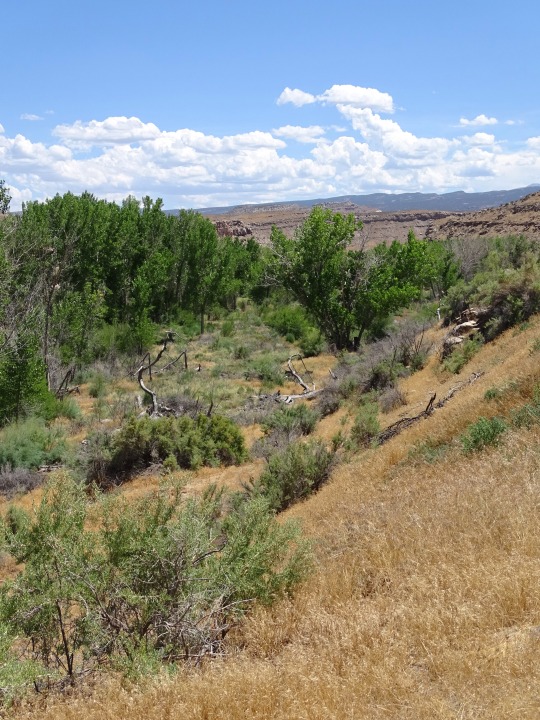
#Ram's Gate Winery#California#Nevada#Dinosaur National Monument#Utah#Mesa Verde National Park#Yosemite National Park#Louis M. Martini Winery#HALL Wines St. Helena#Sevier Lake#Sevier Desert#summer 2022#landscape#countryside#flora#geology#Hwy 128 Scenic Byway#Upper Colorado River Scenic Byway#World Soil Day#WorldSoilDay#5 December#original photography#tourist attraction#landmark
2 notes
·
View notes
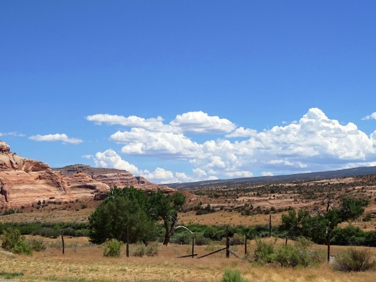
Photo
Far Away
What do you think about my pic?
#Fisher Towers#Hwy 128 Scenic Byway#Upper Colorado River Scenic Byway#original photography#Dinosaur Diamond Prehistoric Highway#Drinks Canyon#Cutler sandstone#Moenkopi sandstone#landscape#countryside#clouds#USA#Utah#geology#flora#nature#bush#mountains#Colorado Plateau#summer 2022#tourist attraction#landmark#photo of the day#What do you think about my pic?
3 notes
·
View notes
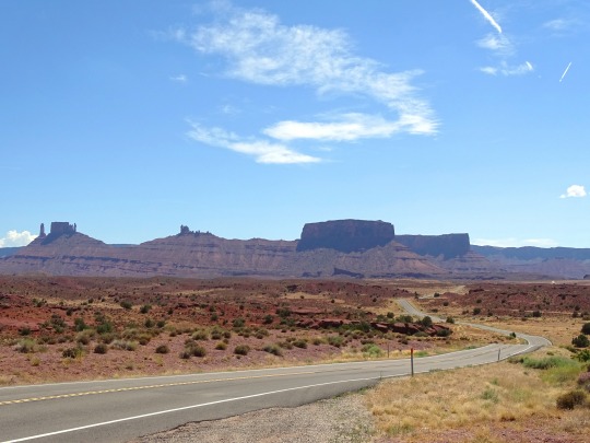
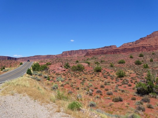
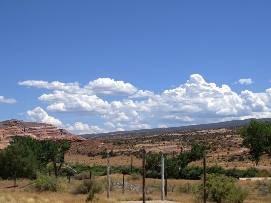
Photo

On the Road Again
What do you think about my pic?
#Hwy 128 Scenic Byway#Upper Colorado River Scenic Byway#Utah#travel#summer 2022#highway#geology#desert#Colorado Plateau#vacation#USA#original photography#photo of the day#tourist attraction#landmark#blue sky#clouds#What do you think about my pic?#a great drive#road trip#flora#nature
3 notes
·
View notes
Last Seen Blogs

cosmicwhoreo
ANK

nicolechavesii
Diseño Interactivo

peacocknaboo
Peacocknaboo


unbelievably-dumb
Error