
explorationstation
Be Adventurous
Hikes across the United States featuring me and my dog
33 posts
Don't wanna be here? Send us removal request.
Last Seen Blogs

ubiratamvega
Criações do Homem


oldestsoul
music for the soul

yellowmintea
Music Nerd

daebraeksan
hyperspecific content for me
Text
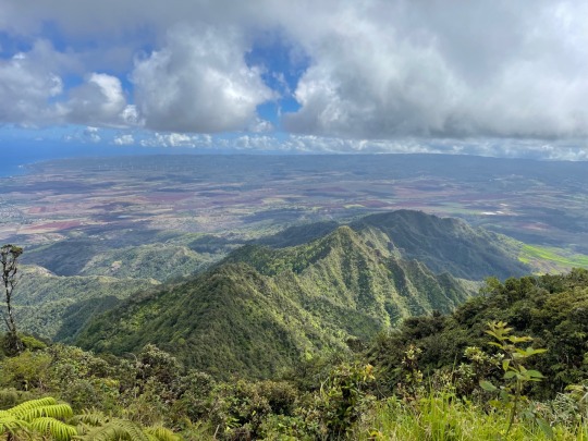
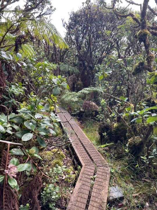
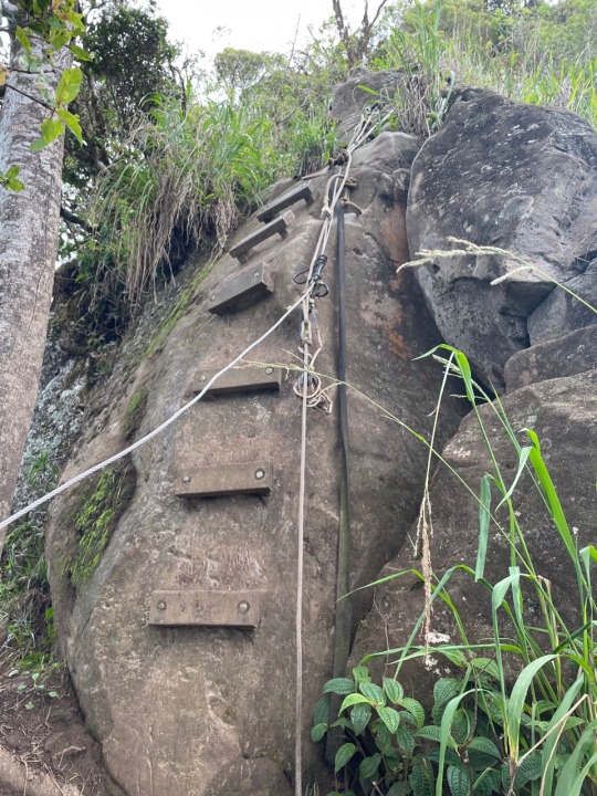
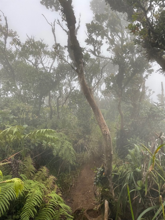
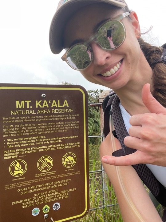
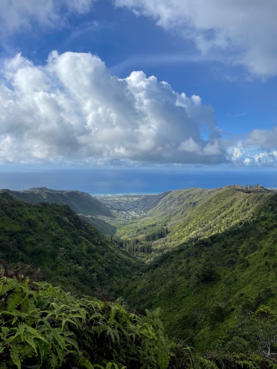
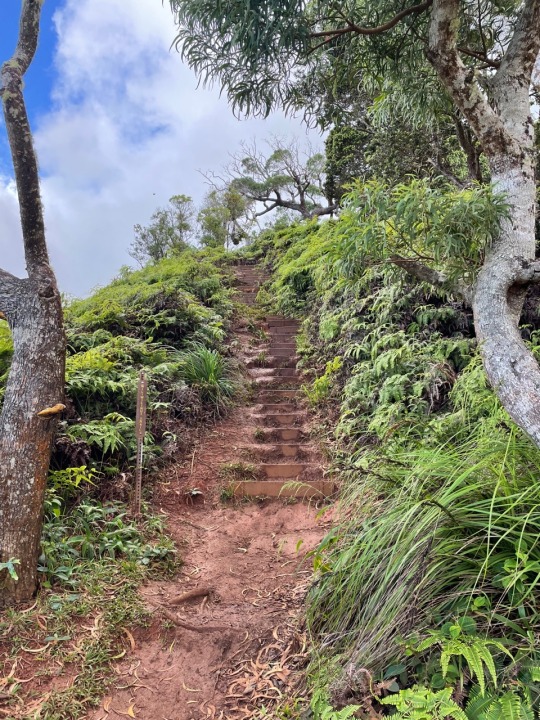
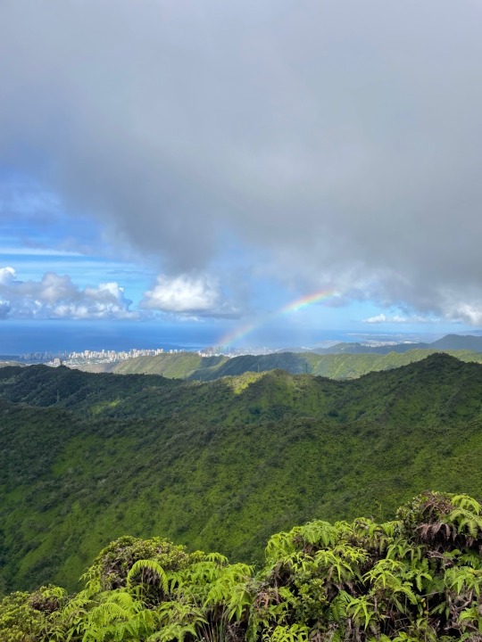
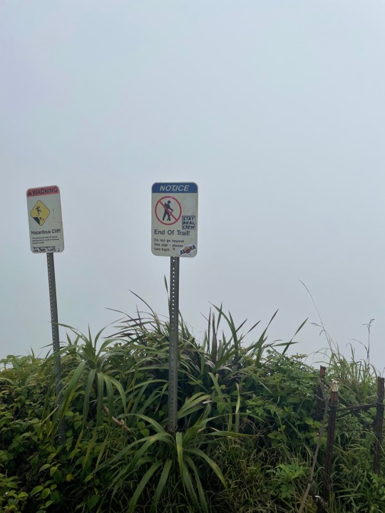
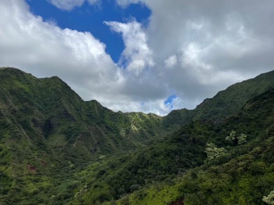
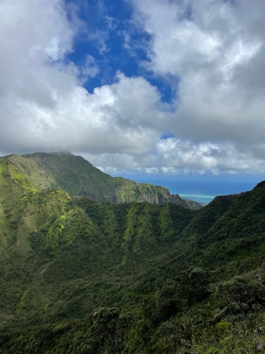
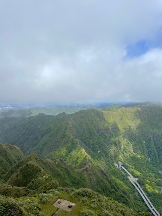
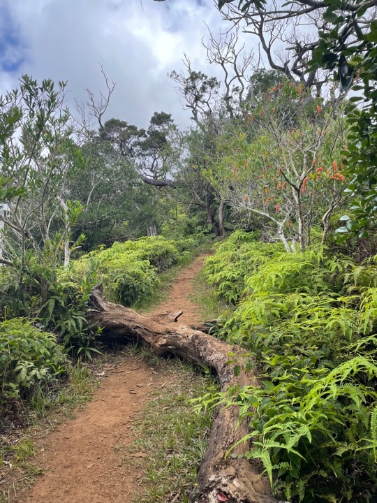
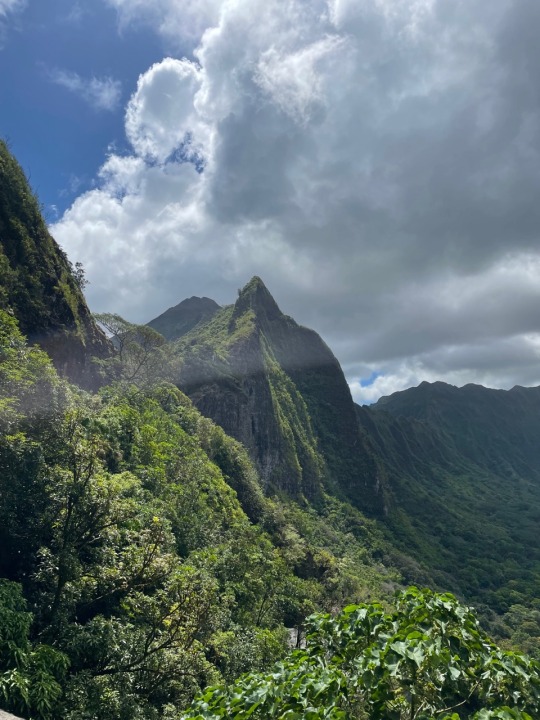
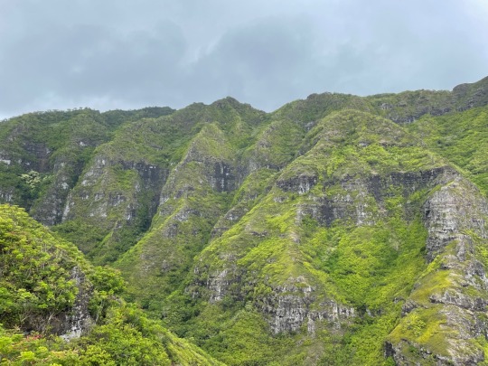
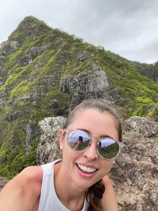
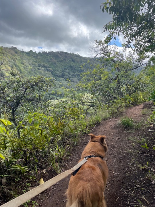
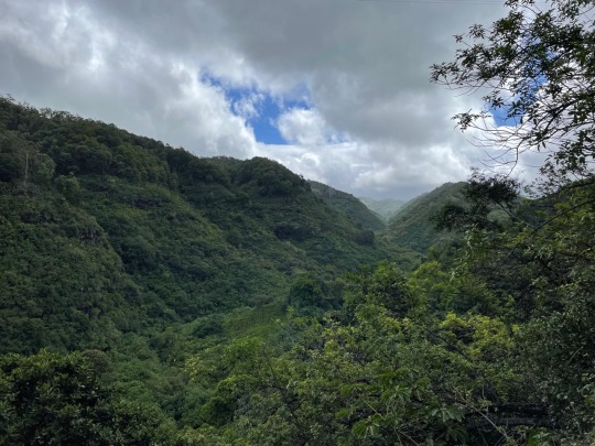
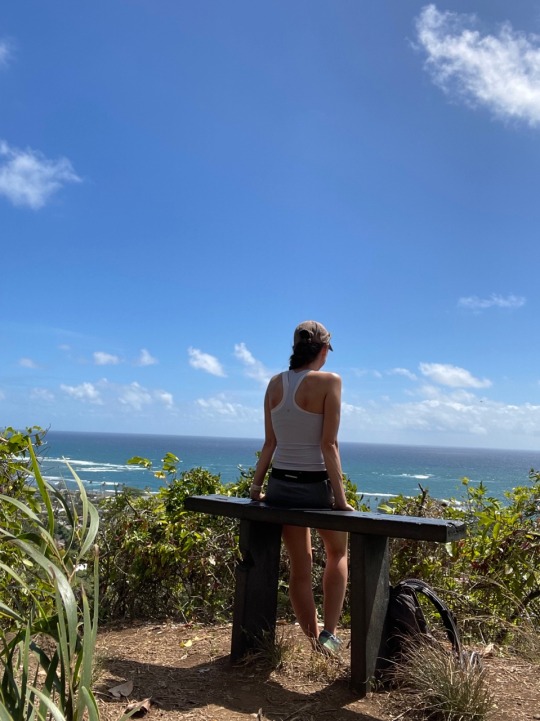
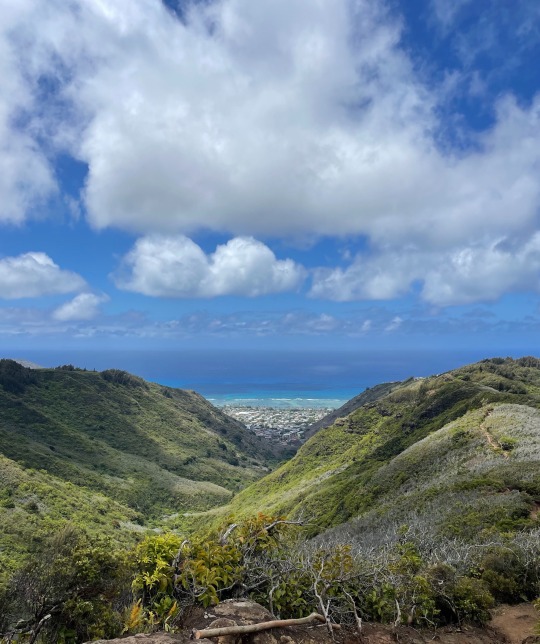
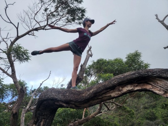
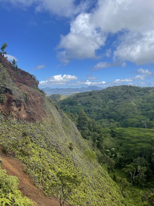
Trail: Mt. Ka'ala Waianae, HI
Distance: 8.4 miles
Elevation: 3,354 ft. (Summit 4,026 ft.)
Time: 5 hours 3 minutes
What: The highest peak on Oahu with a pretty intense elevation gain. The views were beautiful but quickly disappeared behind incoming clouds. Quite eerie descending in the cloud cover and I was thankful for my microspikes. I killed my legs on this one, but would definitely do again in the future.
0 notes
Text
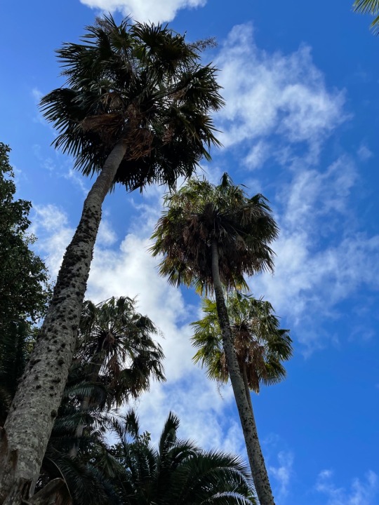
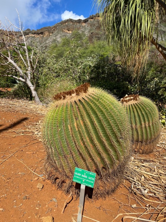
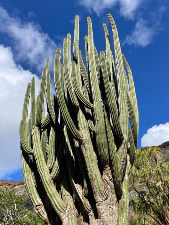
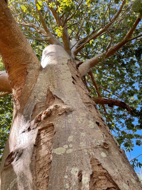
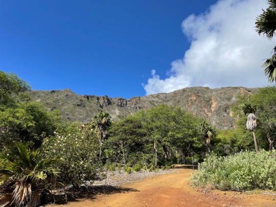
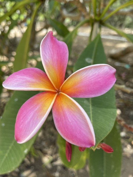
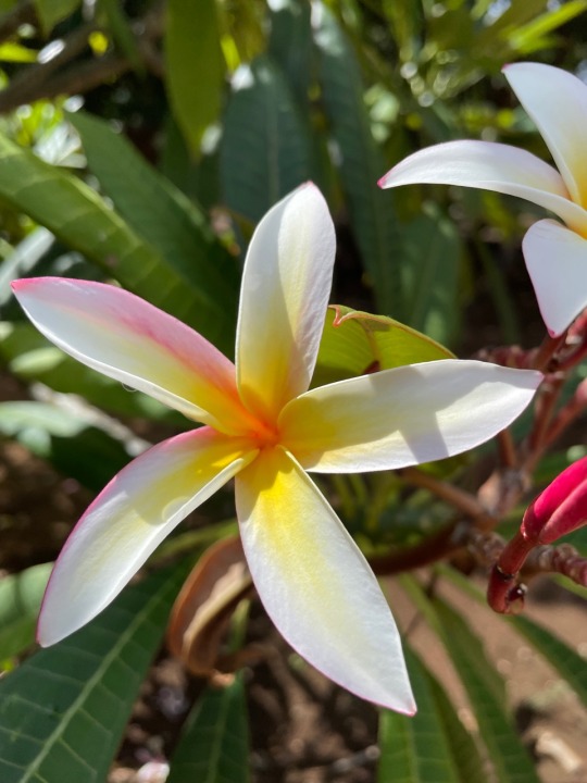
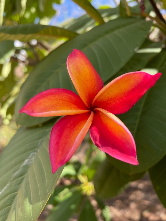
Koko Crater Botanical Gardens
Distance: 2 miles
Elevation: 275 ft.
Time: 52 minutes
What: A free garden full of plants from around the world as well as Hawaii. Not the most strenuous hike, but a nice change of pace and serene morning.
0 notes
Text

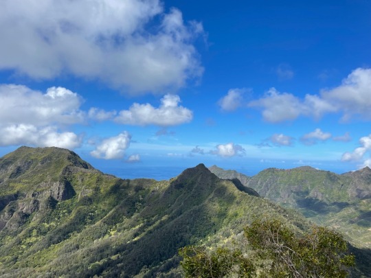
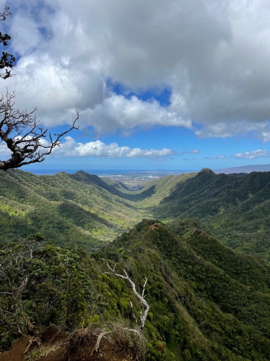
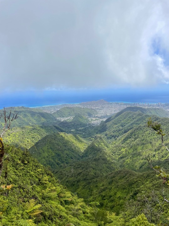
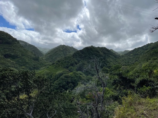
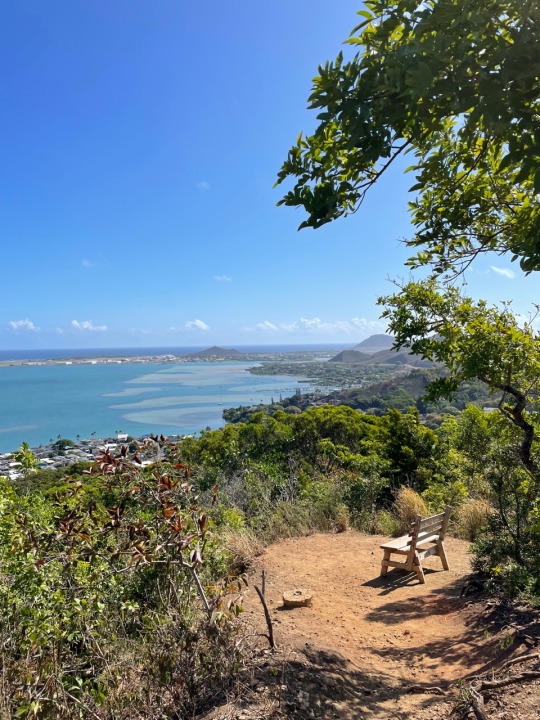
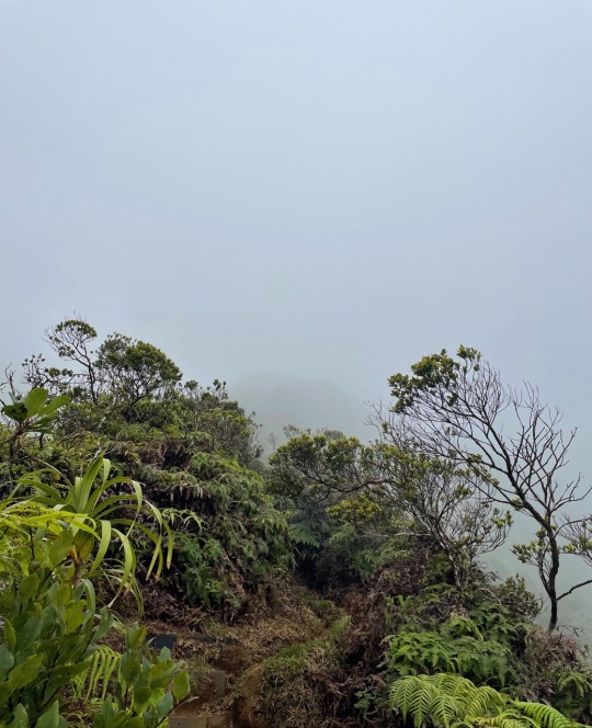
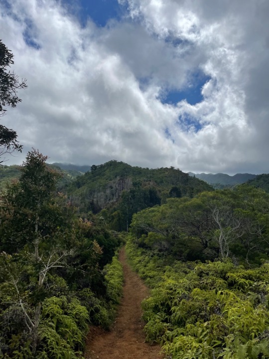
Trail: Wiliwilinui Ridge Honolulu, HI
Distance: 5.2 miles
Elevation: 1,651 ft.
Time: 2 hours 34 minutes
What: Another more feasible ridge hike near town. I completed this a day after rain so it was quite muddy towards the top. The top of these ridges are almost always shrouded in clouds, but on a clear day you would have a 360 view of the southern part of the island. I'll have to come back on a clearer day to enjoy the views.
0 notes
Text
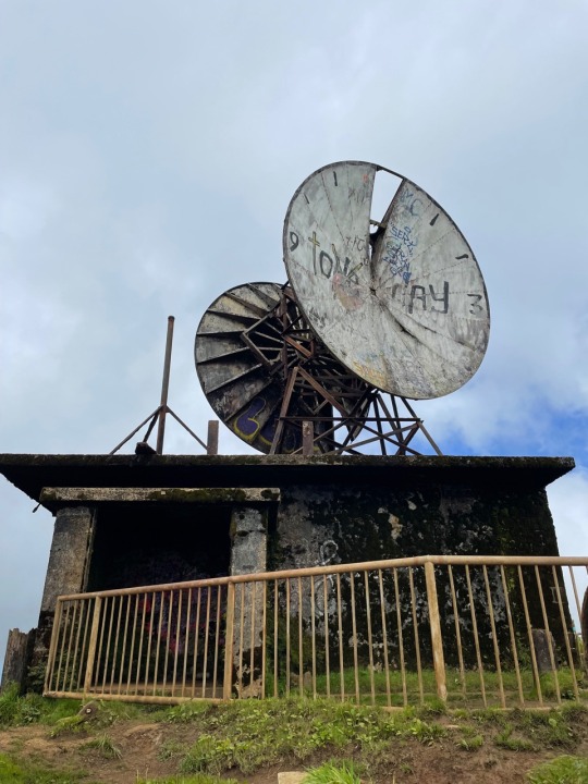
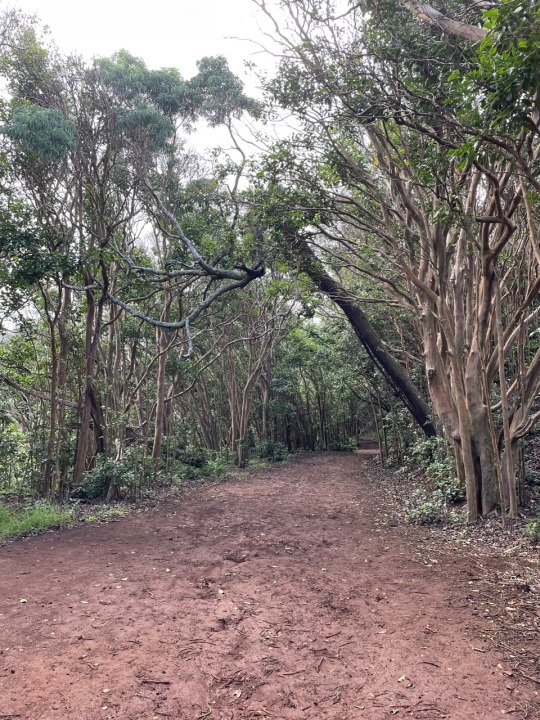
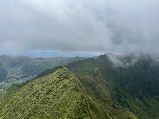
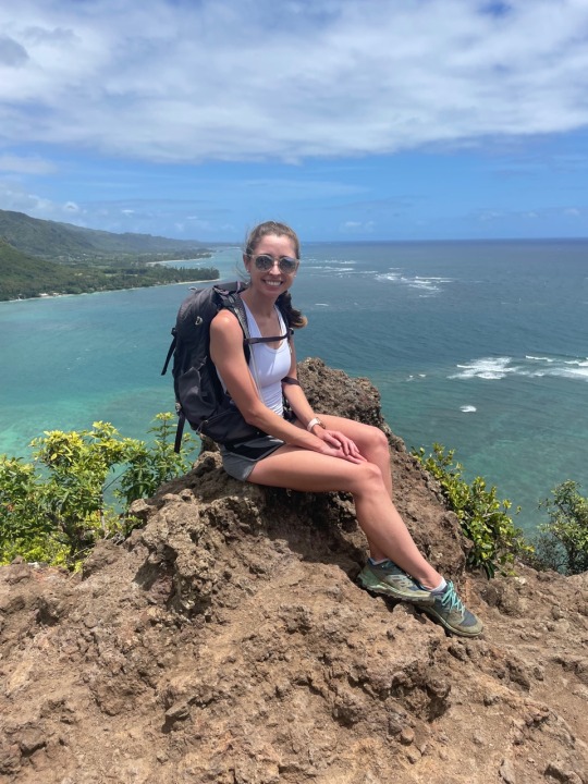
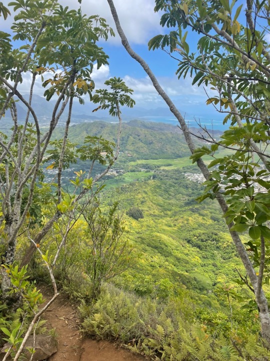
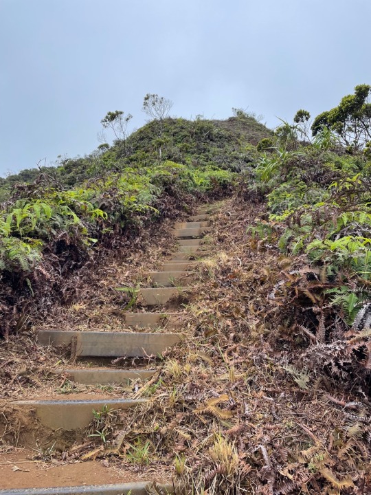
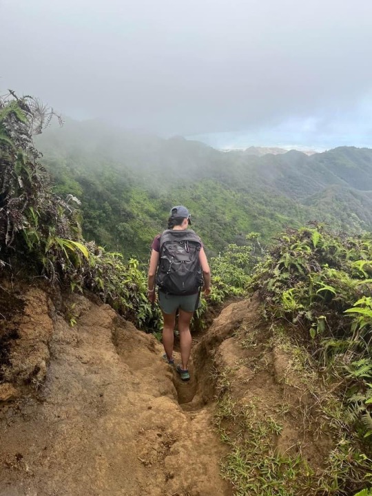
Trail: Moanalua Valley to Haiku Stairs Kaneohe, HI
Distance: 10.21 miles
Elevation: 2,998 ft.
Time: 4 hours 58 minutes
What: The Haiku Stairs are patrolled by a security officer with potential $1,000 fine if caught, so I took the back way. This hike starts on a nature trail for 3 miles that is mostly paved until the fork. From here the trail becomes steep and rocky/muddy. I did this hike the day after rain, so there was much more mud making it slightly more difficult. The hard work was worth the views at the end.
1 note
·
View note
Text

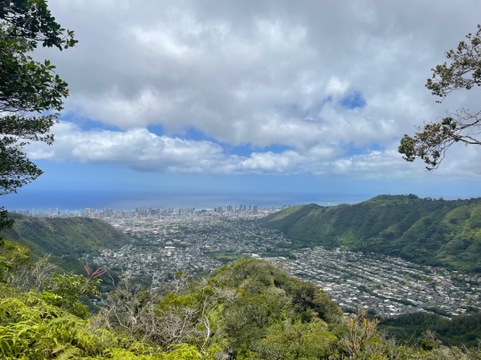

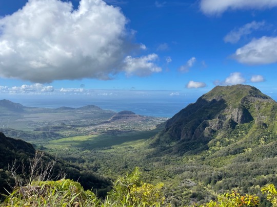
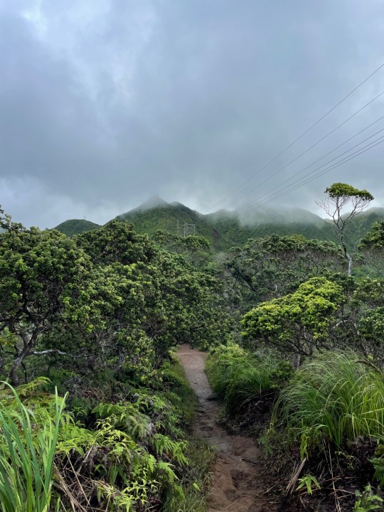
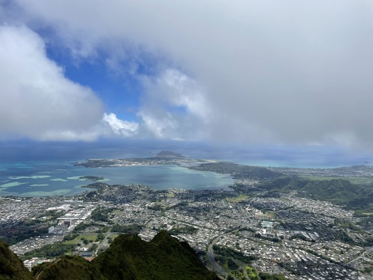
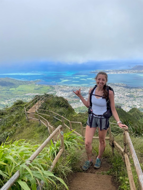
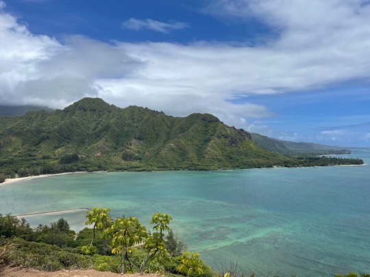
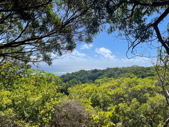
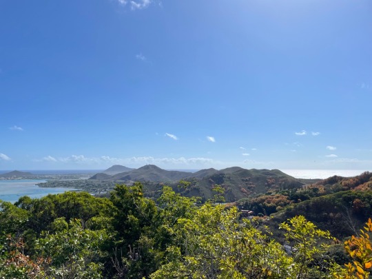
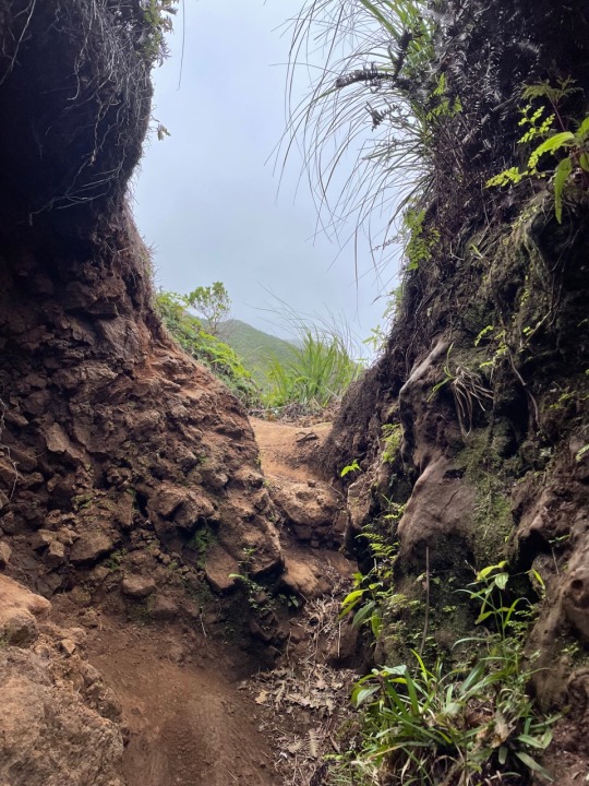
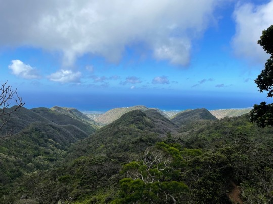
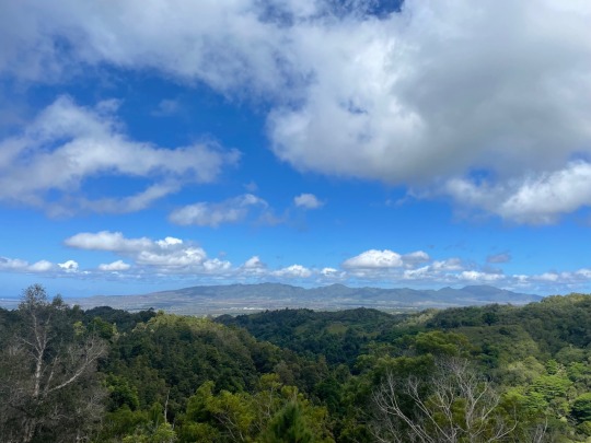
Trail: Mount Olympus Awaawaloa via Wa'ahila Ridge Trail Honolulu, HI
Distance: 6.22 miles
Elevation: 2,692 ft.
Time: 3 hours 50 minutes
What: Quite a difficult hike, but not the hardest I've done. Steep incline and scrambling with only little mud on a luckily mostly clear day. The wind is brutal at the top of this ridge, but it's all worth it. The views at the end are amazing with practically a 360 degree view of the southern part of the island. You can see downtown Honolulu, Diamond Head, Ka'au Crater, K1, Olomana, and the Kaneohe/Kailua Bay Area.
0 notes
Text
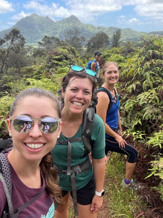
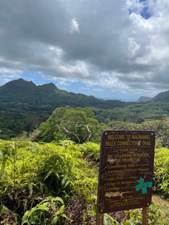
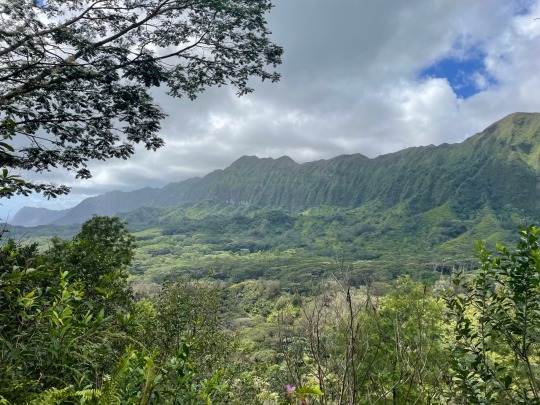
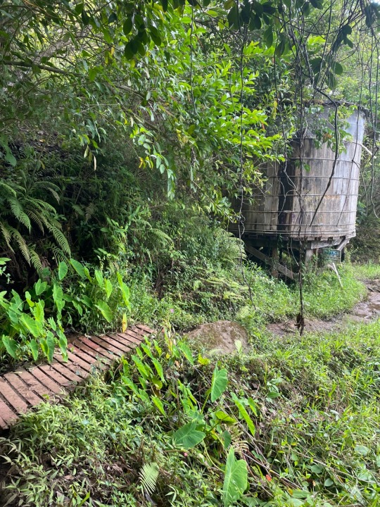
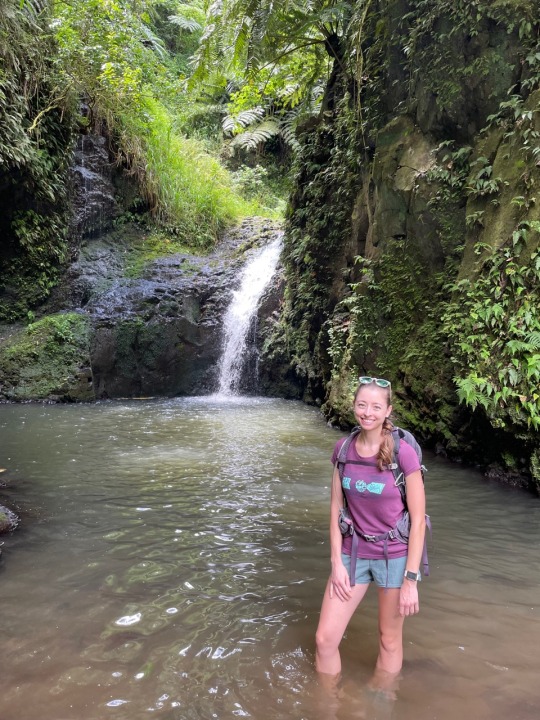
Trail: Maunawili Falls via Pali Highway Kailua, HI
Distance: 8.58 miles
Elevation: 1,692 ft.
Time: 4 hours 45 minutes
What: The original trailhead is under construction for another year so you must take the back way. Not a difficult hike in regards to steep incline with just a few sections that get the heart rate up. The waterfall was empty when we arrived with just 2 other groups arriving after us. Cold waters greet you for a quick way to beat the heat and you can even jump from the falls as the middle drops pretty deep. Something I will likely do again before the trailhead opens back up and tourists flock to the falls. A bonus is you have a view of Olomana for the majority of the hike.
0 notes
Text
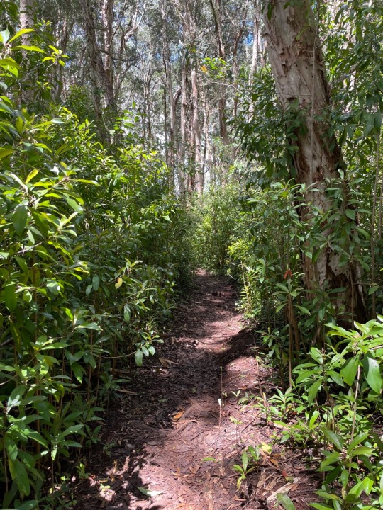
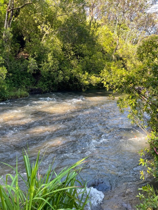
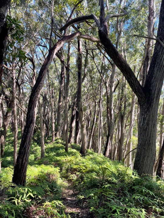
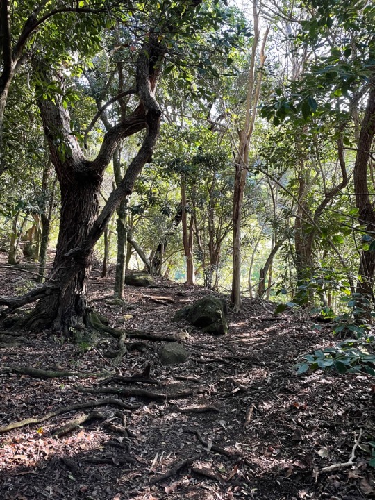
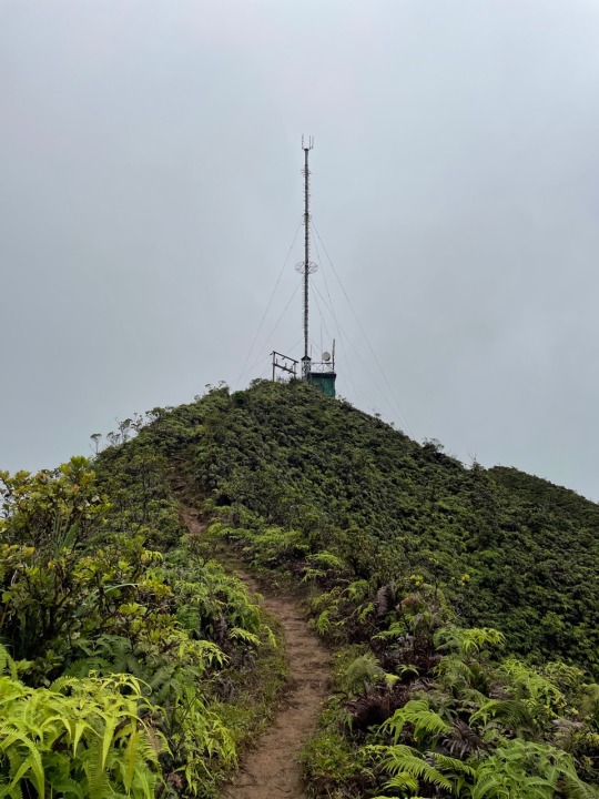
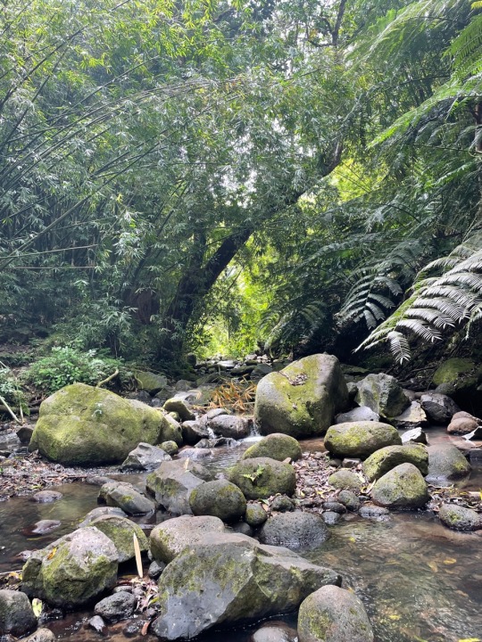
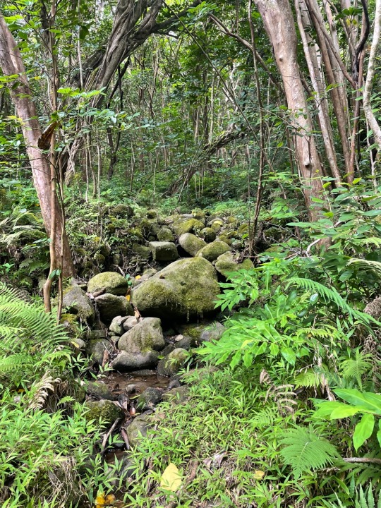
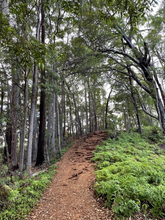
Trail: Wahiawa Hills Wahiawa, HI
Distance: 5.6 miles
Elevation: 2,034 ft.
Time: 3 hours 35 min
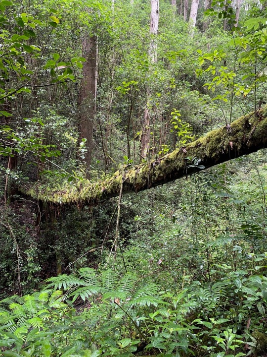
What: A difficult hike inland with steep incline, mud, and multiple river crossings. This hike is usually only 4.5 miles, but at the third river crossing I had to turn back due to unsafe conditions to cross. No amazing view points, but beautiful scenery that changes with each turn.
0 notes
Text
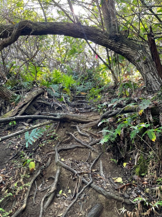
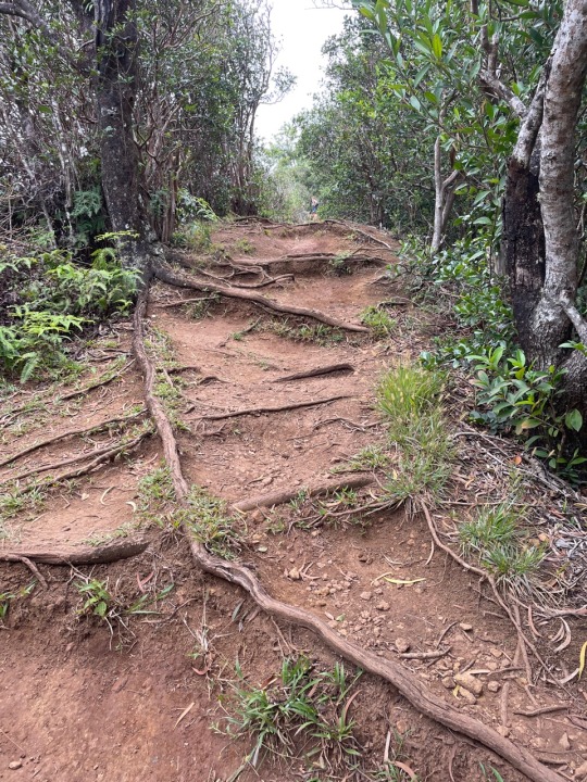
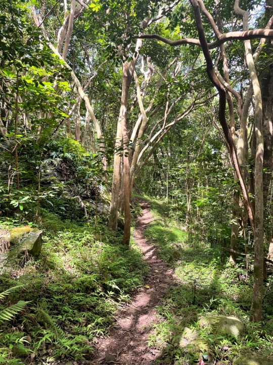
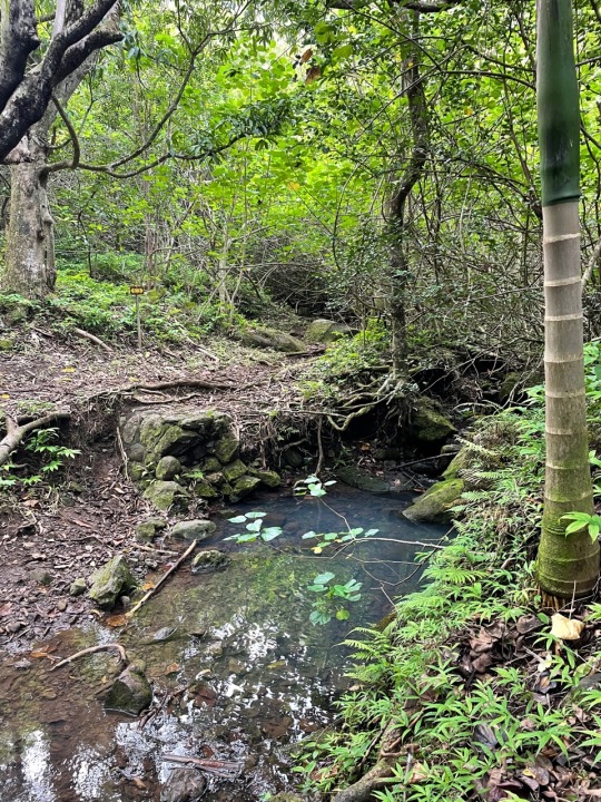
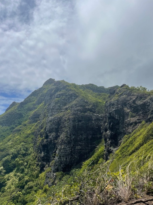
Trail: Kahekili Trail Ka'a'awa, HI
Distance: 2.09 miles
Elevation: 1,173 ft.
Time: 1 hour 46 min
What: A tricky hike with a variety of both loose rock/dirt and root heavy trees with mud. Beautiful views that change with each emergence from the dense jungle. Skies were overcast, but I still felt drained by the time I was on my descent. Made a quick stop at the beach before driving home. I would definitely do this again.
0 notes
Text

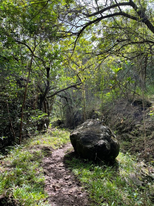
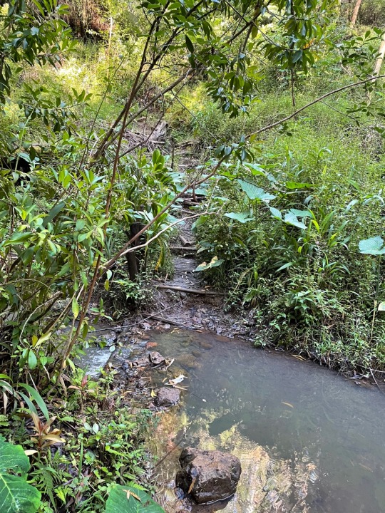
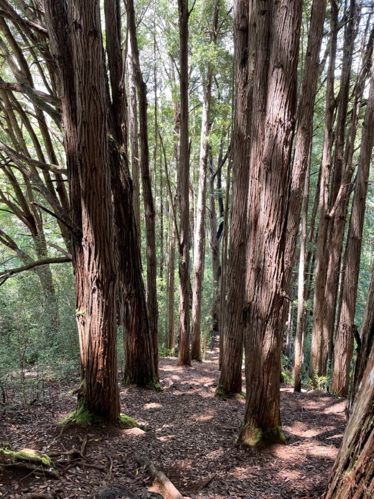
Trail: Waimano Trail: Lower Section
Distance: 5.47 miles
Elevation: 516 ft.
Time: 2 hours 48 minutes
What: This trail is the beginning of the Koolau Summit trail that I did not attempt due to incoming rain and winds from Hurricane Darby. This was more of a walk with occasional incline and finishes at a picnic table before the start of the summit. A neat easy hike for a recovery day.
0 notes
Text
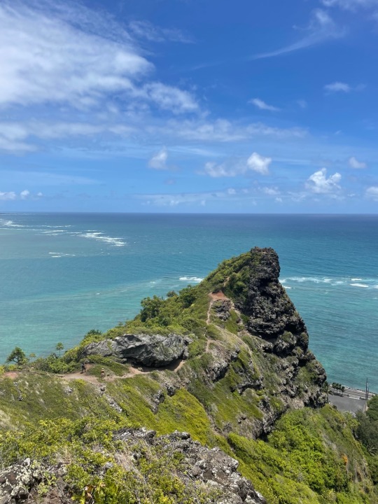
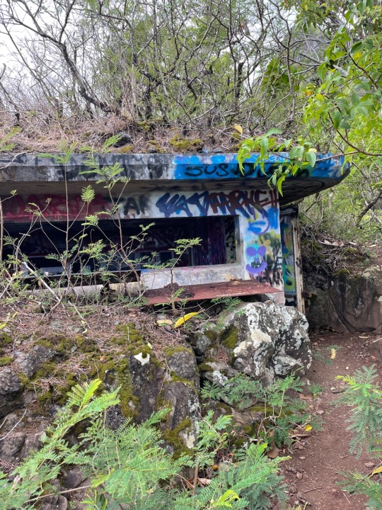
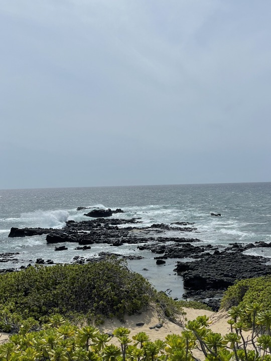
Trail: Crouching Lion Hau'ula, HI
Distance: 0.4 miles
Elevation: 216 ft.
Time: 1 hour (including lunch break at top)
What: This hike is listed as closed on all hiking apps and government websites, however they do not patrol this area and people frequently do this hike. Many people have died here so heed warning signs and know your limits. Views are beautiful at the top despite the wind and there are plenty of spots for a lunch break. You will need traction for the hike down so slippers are not recommended.
0 notes
Text
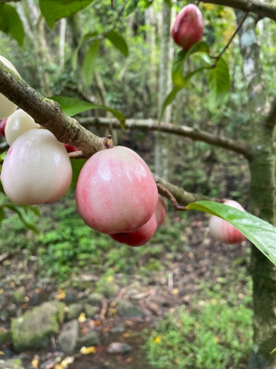
Trail: Maakua Ridge Trail Hau'ula, HI
Distance: 3.7 miles
Elevation: 919 ft.
Time: 1 hour 45 minutes
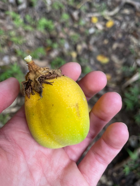
What: A quick loop with minimal views, but gets the heart going. Very quiet and serene with little traffic early in the day. There are lots of low hanging trees and downed fruit along the way. There was a very nice local that gifted me three avocados as I headed to the trailhead. Please respect the residents and park at the beach park down the street.
0 notes
Text
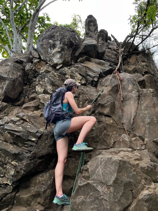
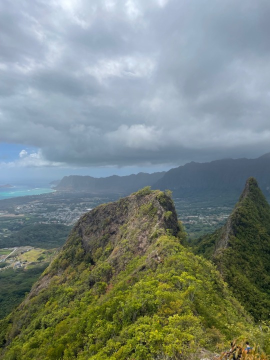
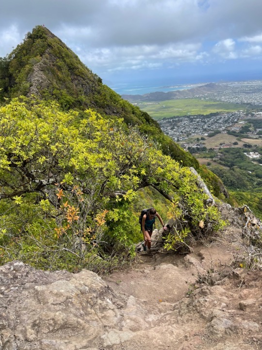
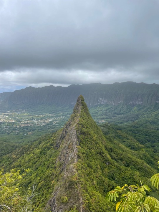

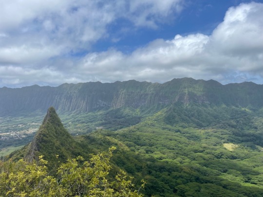
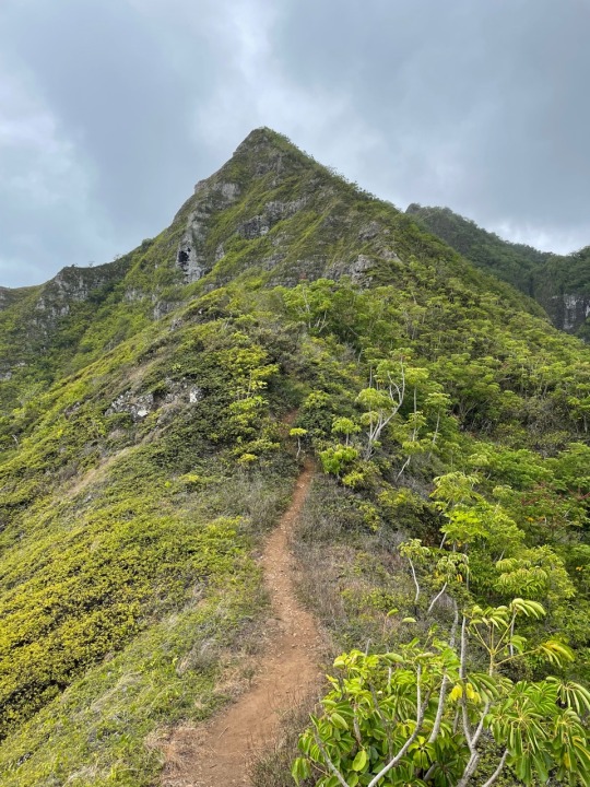
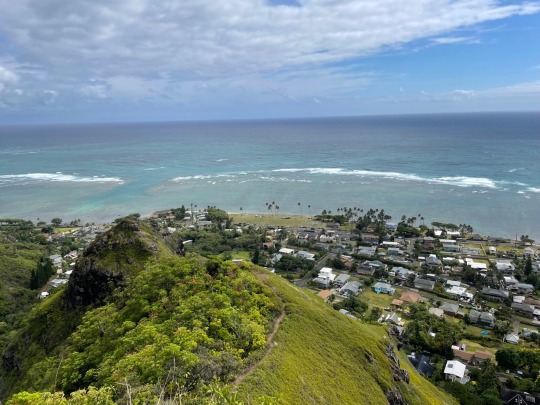
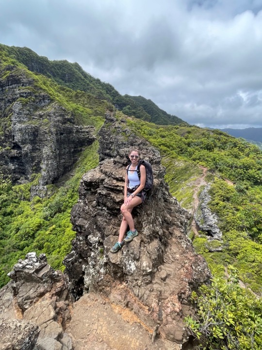
Trail: Olomana Trail Kailua, HI
Distance: 3.34 miles (2nd peak only)
Elevation: 1,814 ft.
Time: 3 hours 19 minutes
What: Some of the best views of the windward side, but also a risky and somewhat dangerous hike. We completed only 2 of 3 peaks as the last ascent involves very technical rock climbing and we know our limits. Many people have died or been seriously injured on this hike so it's important to know your limits. I will most definitely do this hike again.
0 notes
Text

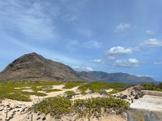
Trail: Ka'ena Point Trail Waialua, HI
Distance: 5.63 miles
Elevation: 324 ft.
Time: 1 hour 47 minutes
What: Ka'ena Point is considered a sacred site and local legend says souls jump from the cliff into the spirit world. This area is very exposed and windy. I would consider this more of a walk as a good portion is on a primitive road until you hit the sands of the point. Best done early or late and bring plenty of water.
1 note
·
View note
Text
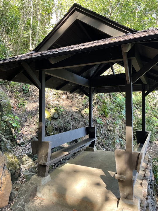
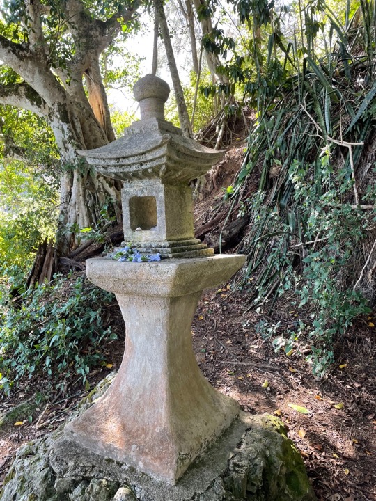
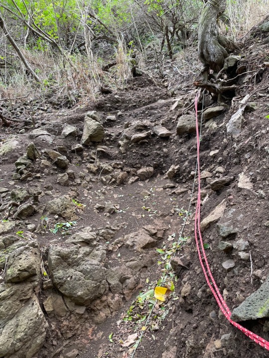
Trail: Friendship Gardens and Oneawa Hills Kaneohe, HI
Distance: 2.9 miles
Elevation: 1,189 ft.
Time: 2 hours 27 minutes
What: This hike starts in the beautiful gardens next to a quiet neighborhood. After the garden lookout the trail becomes quite steep with multiple rope sections. Not the best views at the very end and will do other hikes instead for the views.
1 note
·
View note
Text
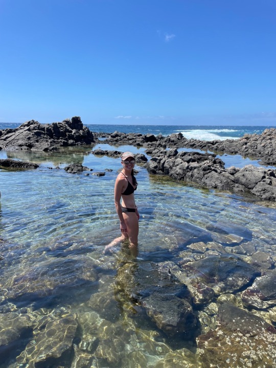

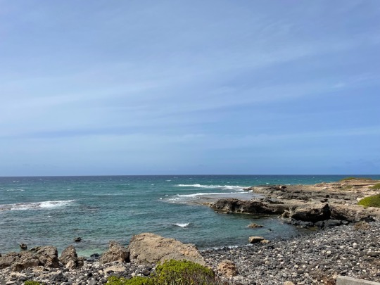
Trail: Makapu'u Tide Pools and Pele's Chair Waimanalo, HI
Distance: 2.25 miles
Elevation: 428 ft. (Mostly the staircase back up)
Time: 2 hours 30 minutes (not including time at the pools)
What: These tide pools are technically closed due to the proximity to the ocean and chance to be dragged out, however they are not monitored. I joined a hiking group on a different route than All Trails has posted, but would not recommend for someone with weak ankles or difficulty scrambling across lava rock. Next time I will likely take the easier route. Worth the workout and was rewarded with a cool swim at the end.
1 note
·
View note
Text
Trail: Hawaii Loa Ridge Trail Honolulu, HI
Distance: 5.01 miles
Elevation: 1,463 ft.
Time: 3 hours 42 minutes
What: One of the more feasible ridge hikes near town. There was cloud cover at the top so views at the summit were not great, but still worth the workout. I will probably go again on a clearer day.
1 note
·
View note
Text

Trail: Manana Ridge Trail Pearl City, HI
Distance: 4 miles (full hike is 6.9)
Elevation: 900 ft.
Time: 1 hour 55 minutes
What: Reviews of this trail recommended only going to the picnic table 2 miles in due to overgrown trail and unsafe conditions. Views were still beautiful and not a bad climb considering this was a ridge hike. There is also a waterfall off this trail if you have the time and energy to drop in (extra 1.5 miles).
1 note
·
View note