
Last Seen Blogs


Text
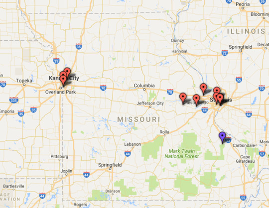
Fragility Assessment by Country
Fragility Assessment by Country
https://jhyneman.carto.com/builder/0d66467a-1faf-11e7-b850-0e05a8b3e3d7/embed
View On WordPress
0 notes
Photo
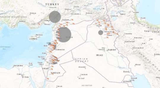
Time-Enabled Syria Crisis Map Click the link below to view the webmap:
0 notes
Text
Comparing Coliseums with Imagery
Map Comparing Coliseums using Imagery - How different are they? #GIS #Maps #Data
Below is a map created using images from two different altitudes:
The top two images are at 8,003 ft.
The bottom two images are at 2,513 ft.
View On WordPress
0 notes
Text
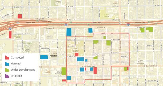
Map of San Diego's East Village Building Developments since 2006
Map of San Diego’s East Village Building Developments since 2006
View On WordPress
0 notes
Text
Jim Harbaugh Effect: Changes in his first year to transform Michigan Football
Jim Harbaugh Effect: Changes in his first year to transform Michigan Football

Below are 4 things I noticed that Harboaugh changed when he took the head coaching job at Michigan.
Recruiting.
Moving from regional to national focus. Harbaugh completed a nine-day, seven-state blitz of satellite camps, including several in the heart of SEC country.
Brand – Then came “Signing of the Stars,” the national signing day event filled with pomp, circumstance and celebrity. Partnering…
View On WordPress
0 notes
Text
Do what’s scary, everyday, every moment (or at least most of them).
Do what’s scary, everyday, every moment (or at least most of them).
The obstacle is the way.
View On WordPress
0 notes
Text
Summary of 16 Laws of Success
Summary of 16 Laws of Success
About: The work was originally commissioned at the request of Andrew Carnegie at the conclusion of a multi-day interview with Hill, and was based upon interviews of over 100 American millionaires across nearly 20 years, including such self-made industrial giants as Henry Ford, J. P. Morgan, John D. Rockefeller, Alexander Graham Bell, and Thomas Edison.
Personal Introduction: As I transition into…
View On WordPress
0 notes
Text
for Work/Life Decisions: You Explore the possibilities because you can't steer a parked car.
for Work/Life Decisions: You Explore the possibilities because you can’t steer a parked car.
I’m reading Rob Bell’s latest book about creating a life worth living. I’m about 1/3 through the book and the idea below is especially meaningful.
“The one thing that unites people I know who are on satisfying and meaningful paths is that they kept trying things, kept exploring, kept pursuing new opportunities, kept searching until they discovered their ikigai….
“Ikigai is a Japanese word for…
View On WordPress
0 notes
Text
Art of Possibility - On Influence
Art of Possibility – On Influence
This morning I read a chapter about Inviting people into something you’re excited about. Asking them to join you in something you love. The book is called the Art of Possibility it is about transforming professional and personal life with insights written by a world famous music conductor.
The author writes about his experience courageously asking a famous musician to come play at his show. He…
View On WordPress
0 notes
Text
Predicting Poverty by Satellite #GIS
Predicting Poverty by Satellite #GIS
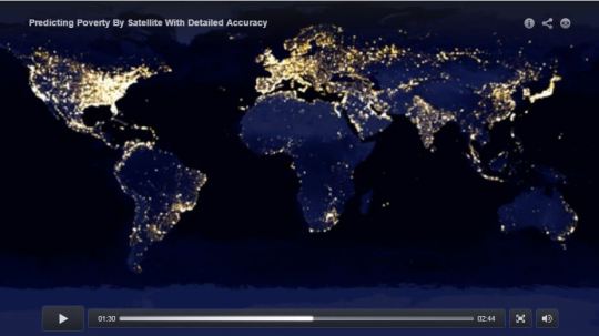
Michelle Hampson of the AMERICAN ASSOCIATION FOR THE ADVANCEMENT OF SCIENCE writes,”By combining satellite images and sophisticated machine learning, researchers have developed a new technique to estimate the poverty level of distinct villages in developing nations, according to a study featured in the 19 August issue of Science.” They’re developing a method that could supplement or replace…
View On WordPress
0 notes
Text
Three things you must do to thrive in the future of GIS
Three things you must do to thrive in the future of GIS
Last week I attended the Esri User Conference and I learned one BIG thing: The day of printed static maps as solutions are gone. The future belongs to data insights. GIS is no longer about maps – it’s about creating spatial insights.
Your value going forward is based on how well you:
can ask the “WHY” of your data. Not just show it (static map), but ask good questions of it.
can identify…
View On WordPress
0 notes
Text
GIS Visualisations for Humanitarian Business Intelligence
I wrote a new blog about 4 GIS Visualizations for Humanitarian Business Intelligence #GIS
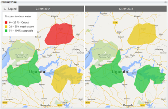
For seven year I’ve searched for the best ways to use GIS at an Humanitarian NGO.
GIS touches so many areas of our work including fleet tracking, GPS tagging, disaster response coordination, and more. One area I think is incredible valuable is visualization.
GIS gives us ability to see things and understand things better than before and better than if information was in tables (excel), graphs or…
View On WordPress
0 notes
Text
GIS for community Impact in Senegal
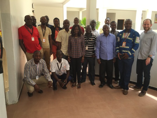
Last week I trained 19 Monitoring and Evakuation Specialists in Senegal. It was a productive trip and I was inspired by their desire to integrate GIS into Monitoring and Evalaution practices.
They challenged me to develop a framework for integrating GIS into M&E.
I know there are some great resources available through the MEASURE IMPACT project and I will be posting some here soon. Here’s a…
View On WordPress
0 notes
Text
How to Make Better Decisions with GIS
My New Post: How to Make Better Decisions with #GIS #NGO #AID #Data
Improved Decision Making with GIS Strategies for a Practitioner
Technology is a great resource to help us do our work better. One exciting technology is GIS (geographic information systems). GIS helps us understand, track and manager information geographically. This is important because our work is location based.
Incorporating geospatial information, such as geographic coordinates enriches all…
View On WordPress
0 notes