#Seabreeze2023
Text
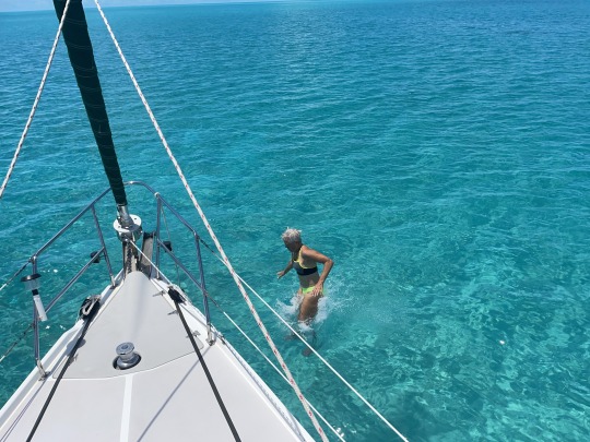
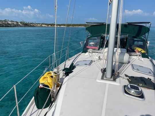
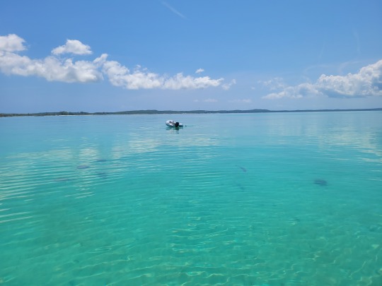
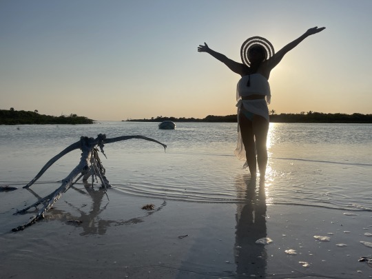
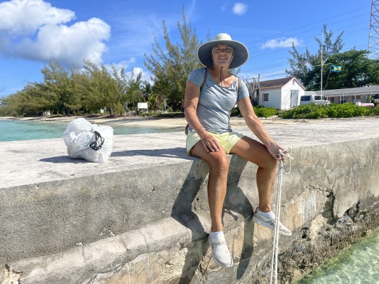
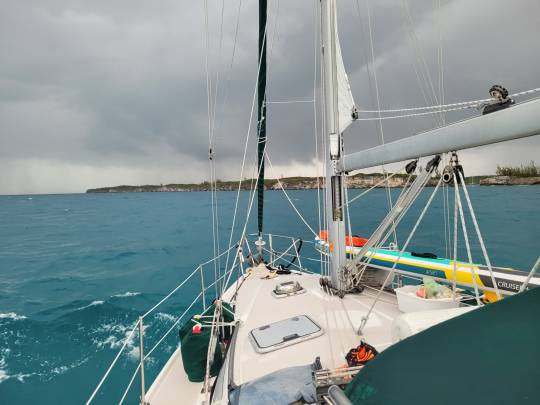
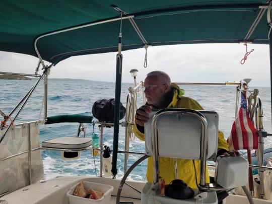
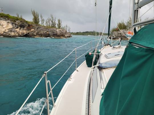
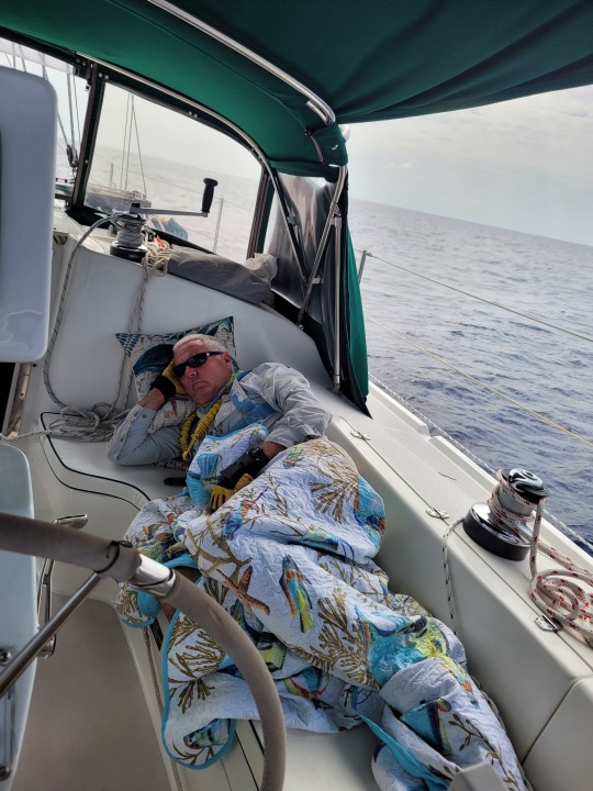
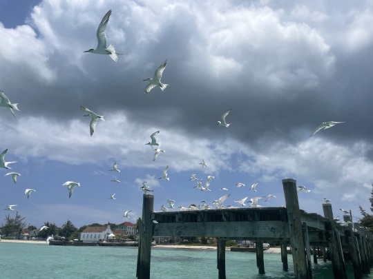
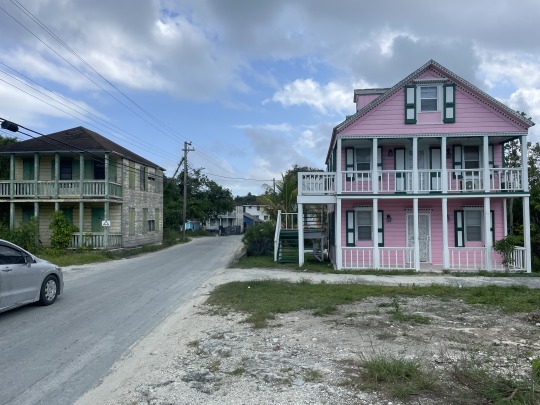
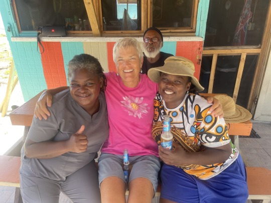
2023 Bahamas Cruise, Part 18, Apr. 12. Weather hold on Long Island.
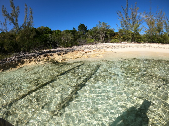
What do you do when the water is this clear and calm? Jump in!
Bahamas are not all beaches, pina coladas and “green flash” sunsets.
After these two flat calm days, the next two days we were surrounded by storms from a stalled cold front. Miami flooded with 8” of rain in two days. Yet, we never really got rain.
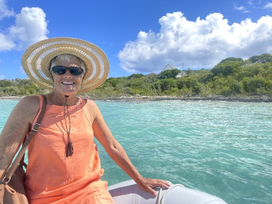

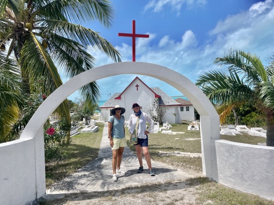
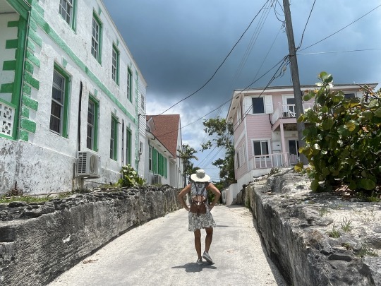
Easter Sunday, I dropped off Nancy at the closest dinghy dock to St. Joseph’s Anglican/Episcopal church in Thompson Bay. You can just barely see it in the background behind her. Around fifty people were in attendance. She had met most of them during our time on the Island. A much more reserved service, than last years service in Black Point. No tambourines, no kids choir, and a third the time. Fifty/fifty men and women, where Black Point was a high majority of women.

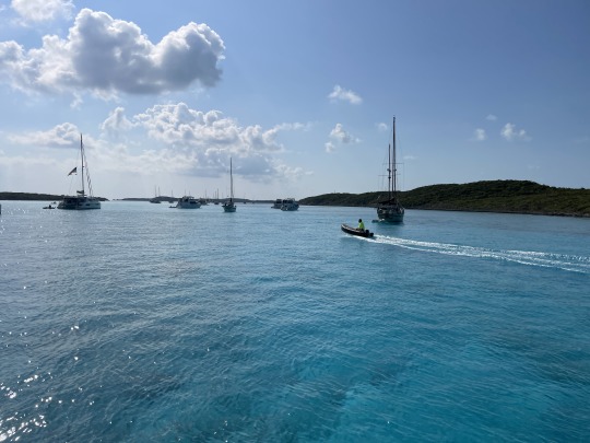
After dropping Nancy off, I swung by the Thompson Bay Yacht Club. Cruisers over time have set up a small picnic area on shore here, dubbed TBYC. No one was here. Only two of us are anchored in the bay now.
Then I headed back to the boat for boat chores. Took the trash to shore. Filled the water tank using our water maker. Trickle charged the start battery and fixed a thing or two.
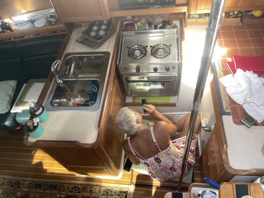
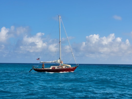
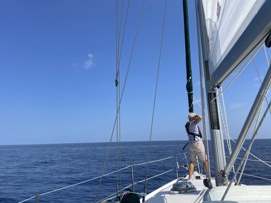
Nancy called on the VHF radio for a pick up at Basil’s dock. Once we got back to the boat, we lifted the anchor and headed north. Great wind from the west for sailing on a beam reach. Nancy baked bread while the boat was heeled 10-15 degrees to starboard.
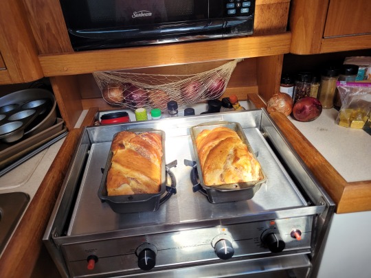
Fresh Coconut cinnamon bread!
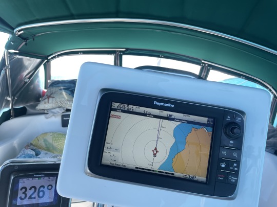
Just before the two loaves of Coconut cinnamon bread came out of the oven we sailed over the Tropic of Cancer northbound. Coordinates are displayed on the top left of the chart plotter, N23 26.031 Actual Longitude of the Tropic of Cancer North 23 degrees 26 minutes and 10 seconds.
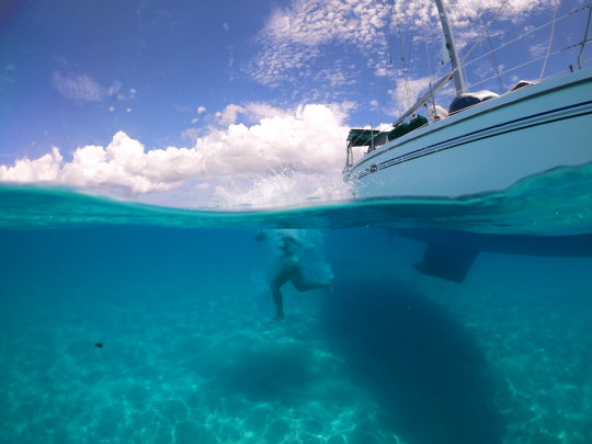
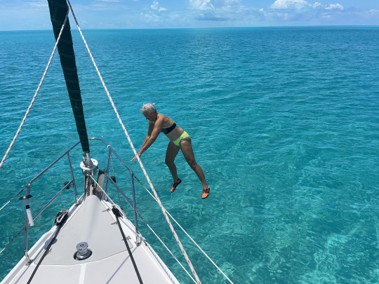
We anchored off of Simms Settlement on Long Island. That is where you see Nancy jumping off the boat. She paddleboared along the shore. While I made water on the boat.


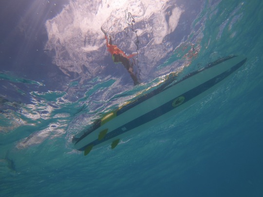
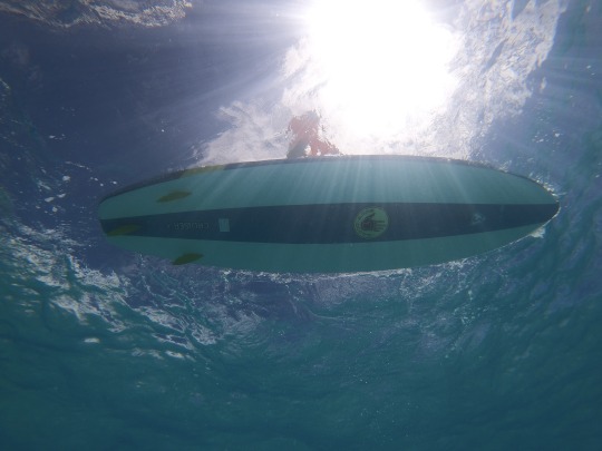
Nancy caught mid flight playing around and cooling off some.
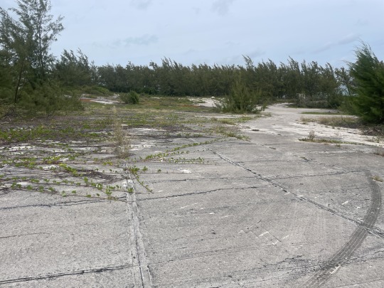
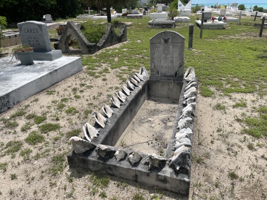
The next day we dinghied to Simms Government Dock where the mail boat comes in. With a west wind blowing the dinghy against the sharp rocks. I sent Nancy on walk about, while I oared around in the dinghy. She visited the prison and several graveyards. The prison and most buildings in town had outhouses near them. Not sure if either the outhouse or prison have been used in recent history. Think Mayberry RFD, Bahama out island style.
Just before we left for shore another monohull sailboat pulled into OUR anchorage. This is OUR anchorage damn it! As soon as we got back to the boat we pulled anchor and went north around the next point. I had gotten lazy and forgot to check the charts. We went from 7 ft. depth to 5 ft. in a couple of seconds. Oops! I went to idle and started the turn back to deep water. Too late…..squeakkkkk. We had skidded to a stop in pure white sand. Quick check of the shore for current tide. Looks kind of low. Pull up weather app. we are close to low.
Had this been a sailing YouTube channel. All sorts of drama could be made up. Water was flat calm. First dropped the 55 pound anchor and twenty feet of chain that weighs 1 lb. per foot. The chain laid over the top of the anchor in a pile. Had some snacks and a beer. Went swimming. Walked chest deep around the boat. Nancy jumped off the boat and hit bottom doing so. Wind changed 180 degrees and picked up enough to move the boat when we floated free. So pulled in the pile of chain with the anchor suspended above the sand.
Couple of hours later…..we floated free after dark. Waited until 7 ft. showed on the depth finder. Then drop the anchor and chain, then went to bed. Next morning we snorkeled around the boat.
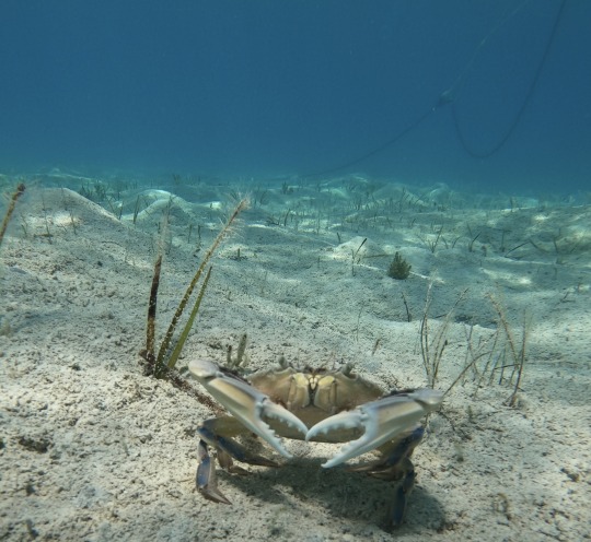
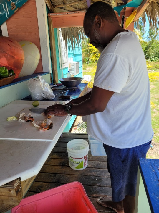
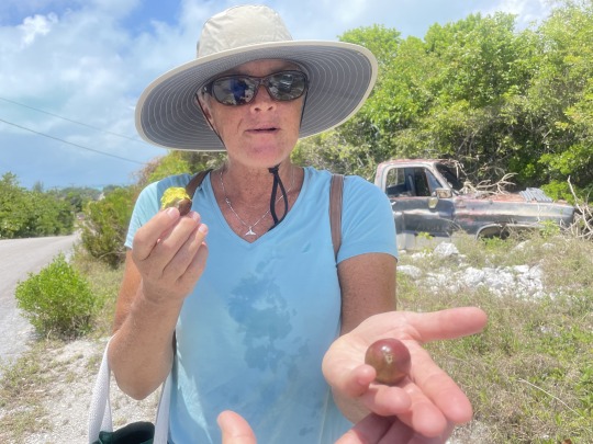
This blue tip crab put up his dukes, when I stopped by. Reviewing weather, anchorages and possible plans we decided to sail back to Thompson Bay. Then rent a car and tour the north end of the island. Wind was on our nose, so we only sailed an hour; then motored to Thompson Bay. In between rain storms we took 4 jerry jugs to Long Island Petroleum for diesel and gas. Had a great talk with Walter Fox the part owner.


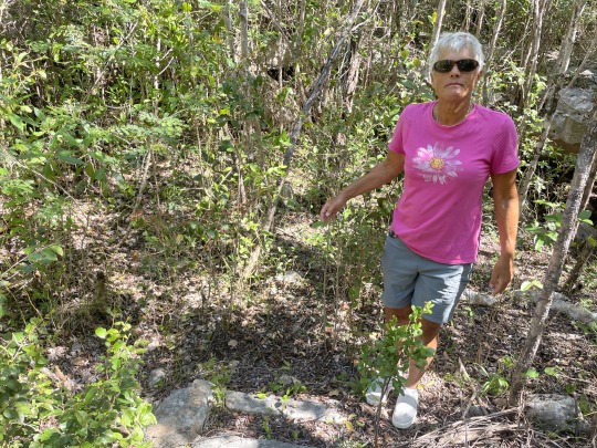
On Wednesday when the weather seemed to break. We hiked over the island to the ocean side, then south along the beach for a mile. Then back across the island to the “Sou’ side” (Sound side) of the island. Round trip walking was a little over 3 miles.
We were hot and tired with nothing but photos to show for our beach hike. We are surprised that little to no shells on the reef side of the island. Today though we were both looking for Ambergris. Found lots of tar balls, but no ambergris.

On the way to the dinghy we stopped at the “Sou’ side” bar for a cold Kalik beer and cracked chicken. Then back to the boat.
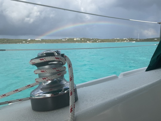
Rainbow over Salt Pond at the end of the day.
S/V Sea Breeze, Thompson Bay, Long Island, Bahamas.
9 notes
·
View notes
Text
2023 Bahama Cruise, Part 13, March 30 Long Island.
.
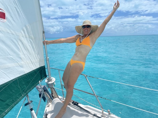
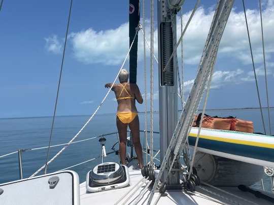
Nancy makes a fine “Figurehead” for our sailboat. Good thing the autopilot doesn’t get distracted with her on the bow, like I do.
Before I forget it, must say I am just in awe of the early sailors who navigated these islands before GPS exact positioning. When out of sight of land this looks all the same. When sailing, sometimes you can go in a straight line making navigation easier. Even then over a longer passage, the boat speed changes all the time. When you are tacking back and forth into a wind and the speed is constantly changing, no way to guess your position, course or destination.


There were several Bahamian fishermen baseing out of Water Cay. Some had bigger boats and anchored off of the island. Those are the motherships and tow several powerboats for the guys to cover more territory during the day.
One guy decked over the front of a small skiff and made a cuddy cabin. He has a homemade grill on shore. Plus he sets up a generator on shore to keep some large freezers cold. He may stay out here a week or two before he goes to town. These guys work all day every day, no matter what the wind is doing. Tough people.
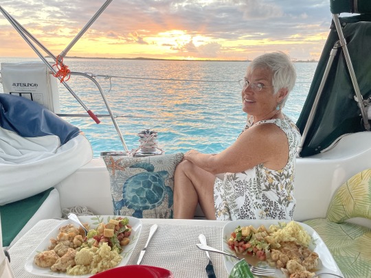

The Chef on board uses what ever is available to whip up something new and exciting for every meal. Our first night at Long Island, Nancy pan seared lobster and fresh fish that “Cheval” had given us. No green flash in this anchorage but we still get a fantastic sun set. The Chef sounds the Conch horn as the sun settles into the west.
Just as we were anchoring several boats were commenting on the mosquito issue. Oops, turn around and get a little further in the bay for the night. We can always move closer for the protection from the up coming winds. Good holding in silty sand.

We woke up to the sounds of Roosters crowing on shore. That makes Nancys day. No mosquitoes, but we closed the boat early and went to bed, so we never gave them a chance to invade. In the morning when Nancy went up to do her yoga on the bow. We had been swarmed by termites during the night. Apparently they are attracted to our lights on deck. Only about 20 boats all spread out in the anchorage, so maybe I will turn off some lights tonight.
After morning chores of cleaning the cabin, checking the engine, cleaning the bilge and topping off the Starting Battery. Nathalie swings by on her paddleboard. She and Nancy paddle to shore. Nancy carries a VHF handheld and can call for help if needed.
In the afternoon we made a quick run to Long Island Petroleum dock. They sell gas to cars out front, or gas /diesel to boats pulling up to the dock. Super nice sisters born on the island. After buying 4 gallons of diesel at $6.12 a gallon we dinghied back to the boat. While making water for an hour. Nancy could hear water running in the bilge. I can’t hear things well anymore. After poking around we realized the brine overflow line had come lose from the water maker. Super briney water had been poring all over the water maker. Turned it off and poured a gallon of fresh water over the whole thing. I will work on it tomorrow.

A weak cold front is moving south to hit us tonight. Should stall over the Bahamas later. No rain just nice blowing wind.

We are anchored in Thompson Bay north of Salt Pond.
Nathalie, Nancy and I went in to Basil’s dock. This gentleman allows the cruisers to tie their dinghies to his dock and walk into town. Unfortunately, several cruisers don’t know the simple rules at his dock. The water is not for cruisers, it cost him money. Please don’t lock your dinghy to the one ladder blocking it. The Blue Barrel that says “No Boater trash” is not for boaters trash.
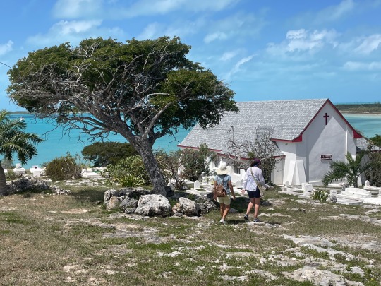
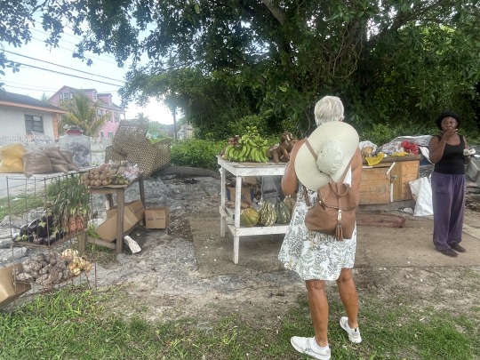
We checked out the grocery store and had a long talk with the owner, Mr. William Miller. Then we walked to St. Joseph’s Church. There were some huge Lignumvitae trees in the church yard. This island has many growing in the wild.
The large tree on the left is a lignumvitae tree. Lignum Vitae, means “tree of life” and is the national tree of the Bahamas. Some interesting facts about the wood. It is one of the heavier woods in the world and sinks in water. It is very oily and has been used for centuries in ships.
The first three chronometers on ships used bearings and gears made of this wood due to the oil factor. Later, propeller shaft bearings were made out of it. Including the shaft bearing of the WWII submarine USS Pampanito. To bring the history of ships and Lignum Vitae full circle, the first nuclear powered sub, USS Nautilus, had an aft main shaft bearing composed of this wood.
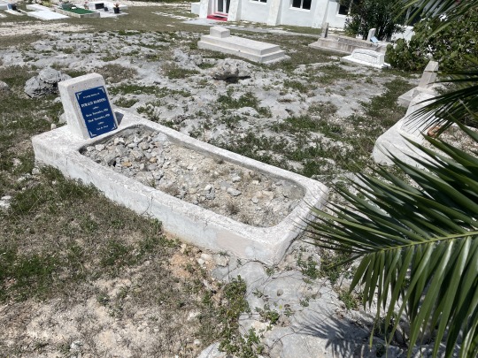
This is Dorald Harding’s grave, born in 1910. He is literally buried between a rock and a hard place. Notice the spelling of his first name. Another unique spelling on a grave was, “Elthie Harding” 1919-1992.


Love the yard art of an old stern from a Bahama racing sloop “Beerly Legal”. Next door was a functional class C racer, “Beerly Legal”.


Basil’s dinghy dock, with instructions painted at the top of the ladder.

Here I am shredding a coconut by hand on the aft deck. Nancy made a wonderful Flan with shredded coconut in it for the nights dinner party aboard “Time Out”.
S/V Sea Breeze, Thompson Bay, Long Island, Bahamas
8 notes
·
View notes
Text
2023 Bahama Cruise, Part 12. March 27. Water Cay, Jumentoes, Ragged Islands, Bahamas.
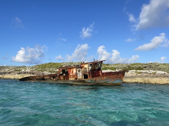
Was this the end of a great day or a bad day? Obviously it was a bad day, since their boat sank. But it was also a great day, since they could have been 5 miles SE in 7,000 ft. of water when it sank.
The day started early in George Town, Exuma. Off the hook by 0730. Conga line of boats departing since this was the first low wind day all week. Five boats including us leaving out the south entrance of Elizabeth Harbor. Above is a beautiful boat named “Ruby”, looked like two guys having the trip of a lifetime. No autopilot, have to work on deck to raise and lower sails. Very manly.
Winds were stronger on our route and directly on our nose, than what I had figured. We had to tack far off course to get the wind to sail to our waypoint. Time was running out on us making Hog Cut at the top of high tide. Kicking myself for not anticipating this and leaving an hour earlier. We might miss the top of the tide by two hours at this pace.
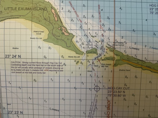
We draw 4’ 9” with out provisions. Always assume 5’ with provisions. The chart is in meters. So at 1.5 meters we are aground. Aground with our wide wing keel is a real problem. Sometimes a thin fin keel sailboat can power through some soft mud or sand. Not a wing keel like ours. Chart has notes of “Strong Current, poor holding” which equates to scoured rock and not soft sand. Raking your keel across hard rock, makes horrible sounds. Followed by horrible sounds out of the Captain!
Wind is in our face and the current is ripping at us, as well. Which is good! We have maneuverability while still going slow. Plus we might be able to get free and float back the way we came if we ground.
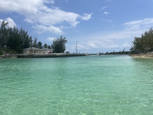
We thread our way through the shallows and out onto the Bank.
During the day we have a nice sail to Water Cay, winds and wave increase as the day goes on. We start wearing our harnesses and tether to the cockpit jackline. By the end of the day, swells are 3-4 ft. on the beam. Like Nancy said, “It was a gradual increase so you get use to it.”
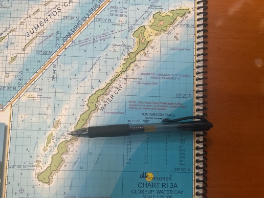
The tip of the pin is where we anchored for 5 days. The wreckage in the top photos is almost due west of us on the chart. I lucked out when anchoring next to “Cheval”. The sun set between two of the islands and we had a clear shot of a disappearing sun on the horizon. We both saw the famous “green flash” two nights in a row. The interesting thing I realized, was the person sitting the lowest saw the “green flash” just before a person standing next to them”.

You know we are getting “out there”, when the chart notifies you that “all positions are approximate” and “portions are unsurveyed”.
David and Natalie on “Cheval” have been waiting a month for us to bring them some boat items. We have been talking to them on What’s App. So we were able to get some fresh greens and vegetables for them in George Town. When we arrived it was Christmas in March.

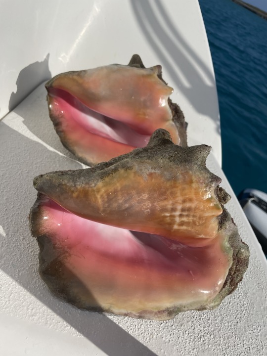
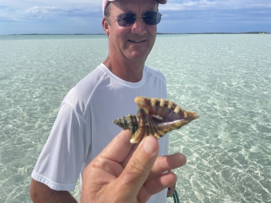
Nancy went paddle boarding the first morning. A bit windy and lots of current. She checked the anchor on the way back from paddleboarding and snorkeling. Her finds today included a dead milk conch which we kept, a very dark red thick lipped Queen Conch. We are finding more of these around here, than in the Exumas. These are locally called “Samba Conch”. The shell in the middle has a deformity at the bottom. Probable bitten off by a turtle and grew back to the side.
I cleaned the conch and it went into the freezer.

The Houston’s had come up from Double Breasted Cays to meet us here. Around 8 boats in the anchorage by the second day. David has only ever seen one other boat when he was there. Most were big Cats. I think more people are getting Starlink and now will venture further from civilization.
“Cheval” was kind enough to let us tap in to their Starlink. Makes cruising much nicer being able to check weather and emails. Plus the occasional phone call on What’s App. Depending on how the two boats swung at anchor, sometimes we got signal upstairs. Sometimes only one of us would get a signal.
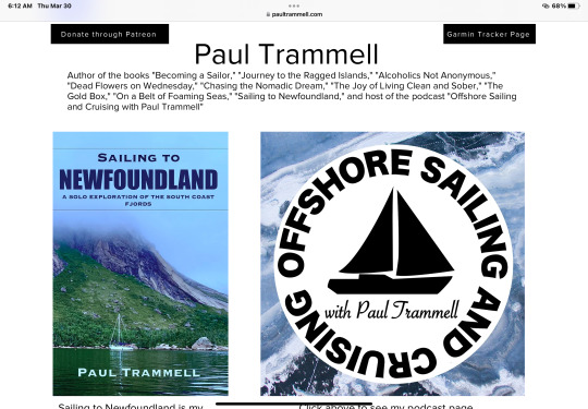
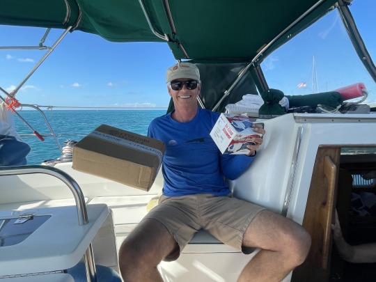
Paul Trammell on “Wind Flower” dropped anchor the next day. So he and crew member Lucy, stopped by at “Cheval” that afternoon while Nancy and I were there. Paul has written about 5 books and does a pod cast on sailors. The last episode he did, Ep. 135, was of David and Natalie. So we were able to listen to some of it the next day.
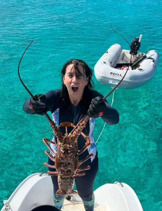
David invited me to go with them spear fishing during the slack tide on Saturday. The Natalie usually tows their dinghy around, while David does the spearing. She helps spot the fish to be speared and keeps an eye out for sharks.
David speared two lobster and shot a Hogfish that got away. After moving to slightly shallower water, David shot a Grouper that ran under a coral head. The timer started, tic…tic…tic…
As soon as you hit a fish, they give off vibrations in the water. It is the dinner bell gong for sharks. The sharks ARE coming. The only question is, how far do they have to come? Tic…tic…tic.
David worked and worked on getting the Grouper out of the coral head. Tic…tic..tic.
Every trigger fish within 100’ came running and were sticking their nose under the rock trying to get something to eat. The excitement in the water was building. This also gives off vibrations for the sharks to home in on. Tic…tic…tic.
Any time now. I concentrated on keeping an eye on the coral head, incase the Grouper tried to sneak away. I was towing the dinghy and needed to keep it as close to David as I could. But not to be in his way when he surfaced, yet close enough he could get the wounded fish out of the water as soon as possible. TIC…TIC…TIC.
Then it all happened at once. David pulled the Grouper out of the hole. Zooming to the surface, then holding the fish above the water. I swung the dinghy over to him. Looking back down and around, I see the shark. He is casually swimming away. David has the Grouper in the boat. He and Natalie are saying, “Shark let’s go”. They both are getting in, as I keep an eye out for the shark.
Sharks are so fascinating to see. The threat is over, the wounded and bleeding fish is out of the water. The shark never went into attack mode. Which is apparent when their pectoral fins start angling down. This was probably a Reef Shark from what David and Natalie said. It was at least 6-7 feet long. Natalie had seen it circle us twice while I was concentrating on the Grouper.
Most fish on a reef are either down low and not doing a lot of swimming. Or a school of fast fish on the surface. The Shark just has a presence. Large, bold, confident; silently cruising off the bottom in mid depth. They may swim out of sight. Now you are looking all around. Cause they can show up from another direction at any time.
Once the Shark disappeared from sight, I worked my way over the side of the dinghy. It is never real easy, usually several splashing fin kicks to get all the way over the tubes. Of course I am motivated. To misquote the movie Jaws, “You’re going to need a solid boat”. Sitting in an inflatable boat with an hungry and inquisitive toothy critter circling unseen below is a bit unsettling.
We called it a day. David was worn out from all his diving. They had enough meat that they dinghied over later with a bag of filets.
Nancy, Natalie and I walked around on Water Cay the next day. Surf was pounding on the sound side.


Nancy and I swam along the shore later. This was my first time spearfishing in 50 years. It is legal in the Bahamas to spear lobster. Nancy found two, but I was only able to get one out of the hole. Changing spears for doing this in the future.
We did pick up 2 Samba Conch which I cleaned on the stern. Now we have 3 conch and a lobster in the freezer. I had a run in with an eight foot Bull Shark, but will leave that story for another day. The sight of the Bull shark is seared into my old memory bank.

Thursday the wind kicks up so we motor sailed to Long Island on Wednesday.
S/V Sea Breeze
Water Cay Jumentoes, Bahamas.
7 notes
·
View notes
Text
2023 Bahamas Cruise, Part 4, Mar. 10-12. Morgans Bluff to Normans Cay, to Sandy Cay to Lee Stocking Island.
This is, Natalie, our friend from Islamorada. She and her husband left one week before us and went directly to the Jumentos as quick as they could. She is holding a really, really large Crawfish, at least by Florida standards. But these are kind of common this far south in the Bahamas. Deep water canyons allow them to grow to this size without being caught.
Q: What is the easiest job in the world?
A: Bahama Minister of Tourism.
All they have to do is post some pictures like this!

Our time time in Andros was short and we are looking forward to coming back, but we need to make haste heading south. Cold fronts are still coming down, the water is 75 degrees and chilly. We were under way at 0538 weaving our way through the anchorage. When we first showed up five days earlier we were the eighth boat in the anchorage. Three were “cats”, one Hatteras yacht, and three other sloops. Four were buddy boating. One of the cats was from Tavernier, the next town up from ours.
As we left there were about ten boats, with only two cats in the bunch. One was an old trimaran. No fancy mega yachts here. No chartered catamarans. Pretty quiet group and little drama.

Windy App is my go to for wind and wave prediction. Friday was the smoothest ride across the Tougue Of The Ocean (TOTO). It would be a bit lumpy at daybreak but getting better as the day went on. We have been beat up before crossing TOTO into steep short spaced waves. See the photo below of our buddy remora boat in March of 2023 crossing TODO.
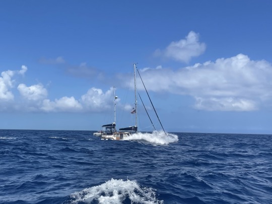
This year the crossing was smooth. We just set a straight line for Normans Cay 73 nautical miles away. The day started out a bit chilly at the helm and we made notes to bring some warmer clothes for sailing the nightshift.

Resting with foul weather gear on to stay warm, note the smooth water in the background.

This is a screen shot of our chartplotter while crossing TODO. Our boat is depicted bottom center with a red icon over it. Just to the left shows a depth of 8500 ft.. To put this in perspective, if you stacked 45 Empire State Buildings on their side. They would still not break the surface.
By the time we finished the day crossing White Bank south of New Providence the seas were glassy calm. Winds had been mostly on our nose and seldom more than 30 degrees off all day.

Beans were cooked in a pressure cooker while underway. Pressure cookers save a tremendous amount of propane fuel.
This year we bought a Hot Spot from Aliv to use in the Bahamas. It is working great. It allowed me to check the weather as we approached Normans, I changed my plans on anchoring right off the island. Winds were due to pick up after midnight from the SW. So I tucked further off shore behind a sand boar hoping to break some of the waves. This would also give us a quick departure in the morning.

We woke early with the boat pitching on the anchor in 2 ft. waves. Today would be a 32 mile sailing day on a beam reach to Sandy Cay. There are few places to hide from SW - W - NW winds in the Exumas. Sandy Cay was our favorite.

Taking turns on the helm and resting. Lots of sailboat activity on this route today. We were the “privileged vessel” with wind coming over our starboard rail. So I tacked a bit further upwind allowing the “burdened vessels” to clear any sand bores and run their course.

Nancy resting on the upwind side of the boat in the sun. By attaching her tether from the jackline in the cockpit around a winch and then back to her. This helps secure her in place as the boat heels over.

A shot from the lee rail at 6 kts.
Our anchorage was fairly calm, with only two other boats nearby. We dropped the dinghy and took a quick bath at the stern. Water is still chilly at 78.5 F. When we woke in the morning our anchor was in sight 30 feet away directly on our left. Currents and wind have that effect here. Neither is strong enough when they oppose each other, to straighten out the anchor chain.
Game plan for the day is head outside for Lee Stocking Island after topping off jerry jugs in Staniel.

Using two of the diesel jerry jugs on the deck we put 8 gallons in the tank assuming we had burned 10 gallons since Andros. Nancy is using the “jiggle hose” to siphon the diesel out of the jugs. We also ran the watermaker for an hour as soon as the solar panels could keep up.
We ran the gauntlet of boats anchored between Big Majors Spot and Little Majors Spot. At least 40 boats were anchored in here hiding from the SW winds.

The fuel dock at Staniel Cay Yacht Club is first come - first serve. We were number 3 in line. It took almost 2 hours to get our 8 gallons of fuel. Boats were taking 40 minutes each. Once it was our turn we tied up, Nancy ran the trash to the trash tailer. I pumped 4 gallons in each jerry jug, then quickly walked to the office to pay. Nancy met me there. We were off the dock in 10 minutes.
The Exuma Sound is 5000 ft. deep, but was smooth all day as we motored to Adderly Cut.

Adderly Cay with its unique stone marker passing down our starboard side.

Dana helming through Adderly Cut and hooking a left behind Lee Stocking Island.

Our son, Lars, recently bought a PDQ 34 power cat. Only 106 were ever made, and we just found one tucked behind Lee Stocking Island. Named “Headway”, it was flying a “Great Loop” flag on the bow. Which is a circle with the Mississippi on the West side and the Intercostal Waterway on the East side. The Great lakes connecting them on the North, and the Gulf of Mexico on the South.

Absolutely stunning sunset, unfortunately we were a hair north and could not see a green flash due to the tip of Normans Pond Cay.
Picture perfect ending to finish our first week back in the Bahamas.
S/V Sea Breeze, Lee Stocking Island, Exuma, Bahamas.
10 notes
·
View notes
Text
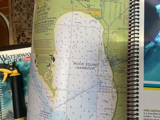
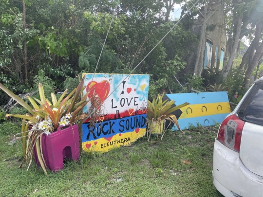
2023 Bahama Cruise, Part 25. May 6. Rock Sound, Eleuthera Island.

We went back north 5 miles to New Bight, Cat Island to hide from some north winds. Swell was hitting the beach very bad the first day. Walked to the grocery store and picked up some mangoes and three coconuts on the way back.

Winds dropped to zero, so Nancy took out her hoverboard for a paddle. I was able to do a dinghy run for propane.

I didn’t want to tell Nancy, but something crawled on her back while she was swimming back to the boat. Later Nancy and I took 3 of the young boys for dinghy rides and a quick trip on the paddleboard.

After this beautiful day we pulled anchor and headed north 3 miles to Fernandez Bay.

Ended up with 9 of us anchored here and some swell coming from the west. We are pretty used to it, so no problems. I have a habit of finding Cuban “Chugs”. These are the homemade rafts Cubans use to get to the US. Towards sunset I saw something floating in. Calling over to the Catamaran (from Key Largo) next to us. I told him to go to his bow. There was a section of a Cuban Chug about to hit him. He fended it off his hull and let it drift to the beach.
Winds were absolutely dead calm as we motored 15 miles up the west coast of Cat Island to Alligator Point. A mother Dolphin and a very young calf swam near us. I always wondered how Dolphins learned to ride the bow wave of a boat. When they do, they don’t expend much energy swimming. It was plainly obvious to me that baby Dolphins hitch a ride on the side of their mother riding the pressure wave off of her. So they learn from day one, how to utilize the pressure wave.
It was so calm I headed to the south side of the point. Nancy had to stand watch on the bow pointing out shallow coral heads for the last two miles (see photo above).She immediately put her paddleboard in after anchoring. However the current coming out of Pigeon Creek to much to paddle into. So she explored the beaches.


With time to spare we pulled anchor while we could still see the coral heads, and headed around the west end of Alligator Point then back to the north side of Alligator Point. Thus avoiding some winds and swell coming the next day.
Question: Why is it named Alligator Point? Don’t think they ever had Alligators here.
Anyway, we took the dinghy to Pigeon Creek. The current was running hard out to sea. But I saw a couple prospective photo shoot sites. Below are the results of great location, light and model.


The next day we ran the dinghy up Pigeon Creek about half way. Winds were picking up from the south, so we headed up 1.5 miles to Bennett Harbor.

We did a garbage run to the government dock. I put Nancy on the cement boat ramp. No one was around, since the mailboat was not in. Nancy being Nancy, starts talking to a guy who steps out of his house. John Gordon allowed Nancy to leave the trash in his garbage can. John just moved back to Cat Island from Orlando. He is a go getter.
Before day break on Saturday we lifted anchor and headed to Rock Sound, Eleuthera, about 50 miles.

I have seen two water spouts on the last two days. Here is a photo of a small water spout over Little San Salvador Island.

Approaching Rock Sound from the west we stopped to evaluate a storm over the harbor. Six or so dolphins swam in front of the boat. Dolphins here are very small. Two of the moms had infant calves with them. Must be calving season.
S/V Sea Breeze, Rock Sound, Eleuthera, Bahamas.
5 notes
·
View notes
Text
2023 Bahamas cruise, Part 20. April 22. Cat Island, not Cat Cay!

Cat Island at the highest point of all the Bahamas, Mountain Alvernia 206 ft. above sea level. The mountain is worthy of being named after. On Monday, I got a ride back from the car rental by “Alverni”.
When we we’re approaching Cave Cay from the west, we heard a faint VHF call to/from “Bay Wind” a buddy boat from last year. I was able to find them on the AIS (Automatic Identification System). No answer on VHF when we called, so I emailed them where we were at and our plans.

They emailed back and we said we were headed to Cat Island in the morning. After looking at the weather, they changed their plans from heading to George Town, Exuma. To meet us in Cat Island. During the evening a wind blew up from the South West. Above are photos from the exact anchorage a year ago when we last saw them.

We weathered a huge lightning storm during the night. All the portable electronics go in the microwave, incase of a lighting strike. Later we heard friends of George and Lisa were hit by lighting that night in Nassau.
George and Lisa had moved north to Black Point in the afternoon when winds starting picking up. So we left Galliot Cay cut at daybreak with both an out going tide and a tailwind. Flat calm and we had a current helping us. Flat calm 50 mile run to New Bight, Cat Island. Winds were light and behind us as we motored at 5.3 knots. Raise the main sail. No increase in speed. Bang…bang…bang. Lower the mainsail.
Winds seem to pick up. Raise the mainsail. Bang….bang…bang. Tie the boom hard to a midship cleat to stop the banging. Still no increase in speed. Lower the mainsail. We do that 5 times.
The ugly side of cruising. Throwing our cans in the ocean.
We hate seeing bottles thrown on the side of the road here in the Bahamas. But as humans we produce trash. What do we do with it?Cruising you are a little more tied to your trash and where it goes. On some islands we walk our bag of trash down a road to the dump. It will be burned at some point. Some islands we pay a couple of bucks for someone else to do the dirty work. But our trash still ends up on a small island to be dealt with. Some trash burns, but cans and bottle’s don’t.
We collect our cans into a canvas bag Nancy sewed up. While snorkeling we collect bottles in the anchorage and put them in the bag.
One of the accepted methods to deal with cans and bottles is to dump them in the deepest part of the ocean where no one will see them.
Is that really the answer? Just because no one will see them? Above you will see the method that we have used. Taking paring shears, I cut an extra hole in the top. Then 2 in the bottom, 90 degrees from the ones on the top. As we sail over 5,000 ft. of water we throw them over to sink within 200 ft. of being thrown overboard.
A squall developed close aboard, while the mainsail was up. Small squall, and we were right at the end of it. Wait….wait…HARD TO PORT. Nose into the gust of wind. After 3 minutes turn and run towards Cat Island. That worked out well. It almost looked like I knew what I was doing.


Notice how skillfully I color coordinated my shirt with the ocean color of the day.
Trolled a triple plastic skirt behind the boat. The rig was made for us by Neil from Wales. The other rig he made us, was a cedar plug. When we trolled it a month ago it was cut off by some toothy fish within 15 minutes.
This 30” Cow Dolphin hooked herself and never pulled out the drag. Not sure how long this fish was dragged behind the boat, until Nancy saw it back there. Seas were calm enough we got the Dolphin on the boat. Now what do we do? No place to work killing or cleaning the fish. By wrapping its head in a cloth they stop flopping around. Stick a knife in its brain, or at least somewhere close. Then proceed to filet it at ankle level and not drop the slippery fish or knife over the side.
Mission accomplished. Been 50 years since I caught a Dolphin. It was enough for 2 dinners for the two of us. Shortly after putting the same rig out we caught a smaller Dolphin. But we released it and stowed the fishing rig.
George had caught a similar size Dolphin, plus fought something large for an hour before it popped the line. Guessing a large tuna or wahoo.
The first morning at Cat Island took our trash to the old government dock, then across the street to a place for trash. George and Lisa met us for a day of walking around New Bight.

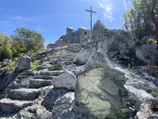


Here Nancy is walking up the 12 stations of the cross trail, to the “Hermitage”. In 1906 after a hurricane damaged several churches in the Bahamas. Father Jerome was sent to design and help build churches here. After several years and multiple beautiful churches he retired to Cat Island. At his request he was awarded the highest point in the Bahamas, 206 ft. Mt. Alvernia. Two acres of land at the top of the mountain were sold by the descendants of slavery to the Catholic Church.
Father Jerome built the Hermitage in 1936, it looks larger than what it is. Everything is 3/4 scale, so watch your head!
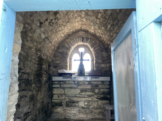


The Hermitage.

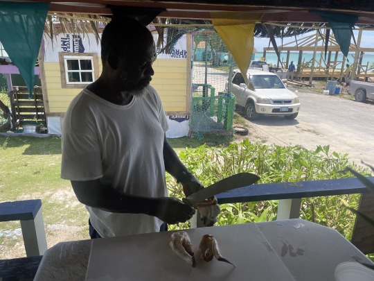

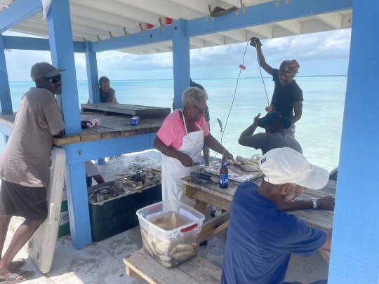
Here is Duke Moss at work. He owns “Dukes Conch shack”. Nancy and I ordered the “Tropical conch salad”. Which is a pineapple and mango conch salad. George and Lisa went with the traditional conch salad but spiced up.
Duke takes your order, then walks across the street and out into the water. He has a pen full of live conch there. After retrieving what he needs, he walks them back and stands on the outside of the conch shack. Duke quickly cleaned the conch, making it look super easy. He confessed to us, that this was the first conch he ever cleaned. We called him on that statement. Actually it was the first conch he cleaned today. These guys are natural jokers.
Duke was in the Royal Bahamas Defense Force for a few years. Then tried “Fishing” in Cat Island. “Fishing” means both conching and fin fishing. Then he worked on the mailboats. In between trips he would fish. After a while some old timers showed him how to up his game.


Bahamian rebar!
These guys were building a food shack. Many had burned down a couple of years ago. The main wooden beams were placed in holes with cement footers.
Who needs a wheel barrow? The dry cement is poured on the road and water mixed in by shovel, then they carry it over to the forms by bucket. To reduce the amount of cement needed and give it some structure. They throw conch shells in the holes with the cement. Bahamian rebar!
Two degrees of separation on Cat Island. We had watched a YouTube video made by “Charlie Bahama” about Cat Island. He had interviewed an old guy who played Rake and Scrape on an accordion. While eating at Dukes. I spot the old guy across the street. So we go over and talked to “Pompey” Johnson.
We get on the subject of schools and sports, when I remember a guy we met in Bimini a couple of months ago was from this island. I describe him to “Pompey”. He says, “you talking about Kirk”? Yeah, that was his name. “Pompey” points down the road to the guy mixing the concrete, and says, “thats Kirks dad”. So we go down and talk to him a bit.
Sea Breeze New Bight, Cat Island, Bahama.
3 notes
·
View notes
Text
Bahamas 2023. Pre departure.
We leave March 5 to the Bahamas
Lots of work before we go play in the Bahamas. In January we took the boat 10 miles north to a marina in Key Largo. The primary goal was to replace a Dripless Shaft Seal as preventive maintenance. This can only be done out of the water. The bottom paint was holding up pretty well. But now was the time to go ahead and redo the bottom paint. Previous paint was an ablative paint colored black. We used the same brand of ablative paint but changed the color to blue this time. Changing color helps you tell how far you might be sanding or how much paint has been scrubbed off over the years.
Nancy cleaned and waxed the hull once the bottom paint was done.

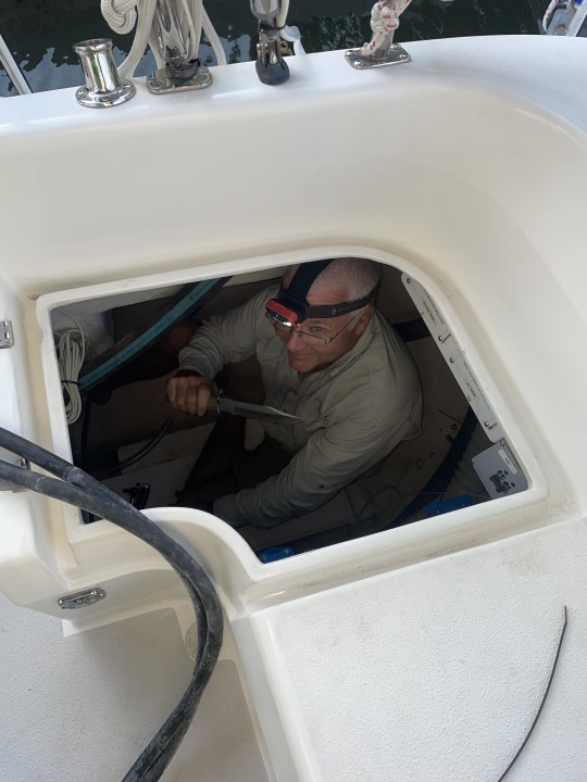
Due to tides we spent two nights at anchor waiting to get into the marina. I used this time to periodically spray PB Blaster on the rusty bolts holding the prop shaft to the transmission.
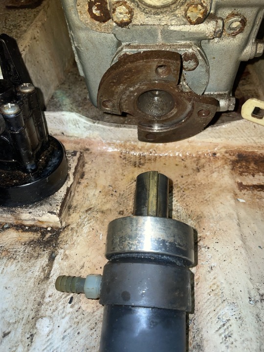
Here I have decoupled the prop shaft in preparation of removing the old Dripless shaft seal.
Nancy shines up the prop.
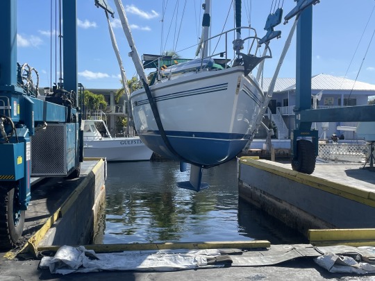
The boat has a new bottom paint and is shined and ready to splash.
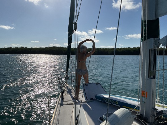
We spent two nights on the anchor. Yoga on the foredeck in the morning.
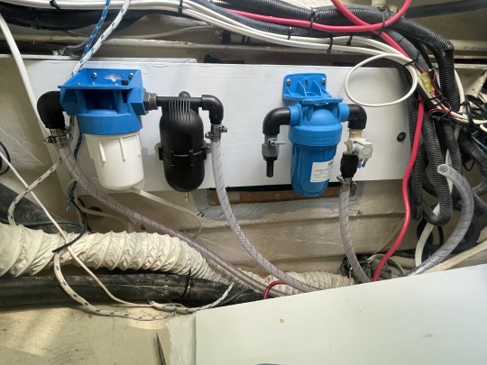
The big addition this year for cruising the Bahamas is a water maker. We bought a Schenker 30 Zen water maker. It should make 30 liters an hour, or 7.9 gallons an hour. We were very frugal with our water usage last year. But our hygiene suffered, and the boat would not get salt washed off unless it rained. It was getting pretty crusty.
You will never get a watermaker to be cost effective. But it will allow you to cruise in places where water is not available. Getting older this will save some wear and tear on us. “Jugging water” is strenuous and can be dangerous during the transfer from dinghy to boat.
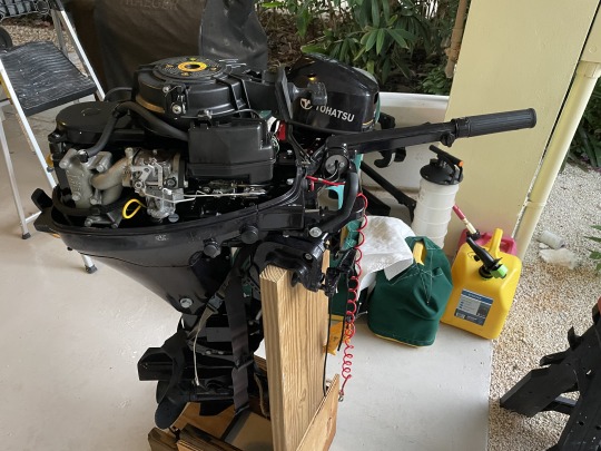
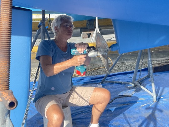
Checking the dinghy engine which has not been run since last year in the Bahamas. It does run but is rough. Changed spark plugs but that did not fix the issue. Next thing to check is the carburetor. Starting with the easiest and least invasive, then digging deeper. After tearing down the carburetor multiple times and putting it back together before testing. I got it down to 20 minutes start to finish. It seems to be working but until we use it for a day locally, I will not have any confidence in it.
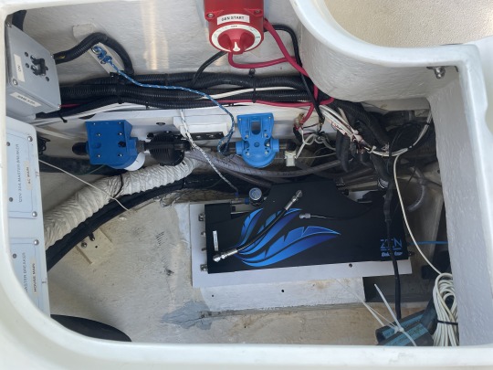
I needed professional help getting the electrical lines run for the watermaker. My mechanic Marcel finished that up Sunday February 26. By that evening I had lowered the actual watermaker down the hatch and laid it in place. Very little remains to be done now. Until we test run the watermaker and check for leaks the boat is completely in disarray. To access the bilge area for the intake and waterpump the aft cabin mattress has to be pulled out into the main cabin. Once we pressure test the watermaker and put the mattresses back, then we can start doing the final provisioning of the boat.
The Schenke Zen 30 is bolted down and pressure test on March 1. Now we can put the mattresses back into the aft cabin. Which allows us to start moving around the cabin and putting in all the provisions.
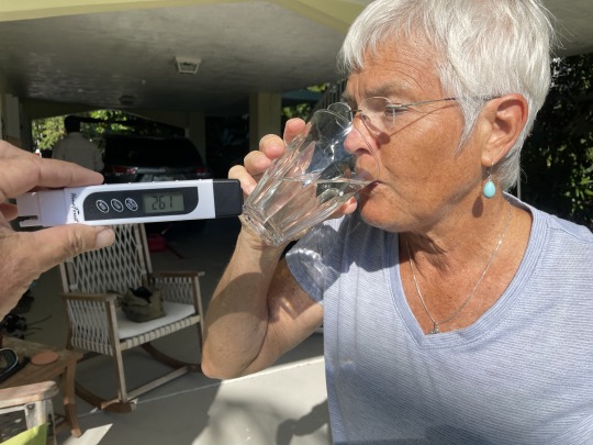
Nancy is drinking the out put from the watermaker. Our little multimeter tester shows great water. Nancy does the ultimate taste test, and the lagoon water passes the test. Absolutely amazing that we can turn yucky harbor saltwater into fresh drinking water.
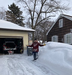
While we are getting ready to leave March 4 (Saturday), Nancy’s relatives are dealing with a blizzard in Fargo N.D.. This time of year we are in the middle of “Spring Low tides”, we could not leave if we wanted too since the channel depth is so low.
A local friend and his wife, left a few days earlier in their Catamaran but a navigation component failed. So they had their replacement AIS shipped to our house on Wednesday. We will try and meet up with them south of Georgetown Exuma a week or so after we leave.
Saturday morning at daybreak on the 4 th, we navigated out the channel at our house. Very leisurely sail 5 miles at 3 kts. where we anchored on the back side of Tavernier Key.
While at anchor I set the “Jack lines” in place. Our Jack line is a web belt 3/4” wide rated to 4,200 breaking strength. It runs from the very back of the boat to the very front of the boat down both sides. If we have to go on deck ANY time when it is dark while underway. We tether ourselves to the boat. If we are underway and seas are rough we will also tether ourselves, via the jack lines to the boat. Nancy has an Inflatable Life Jacket and a Kong tether.
Since I will be the one to handle any problems on deck. I wear a foam life Jacket that served me will in Water Tribe events. It has 2 knifes, flares, signal mirror, VHF radio, whistle, multiple lights, strobe and a Personal Locator Beacon. I wear a Kong tether and a sailing harness under the life jacket. If sailing at night we both tether into short jacklines that I installed in the cockpit.
Alarm is set for 0400, we will depart the anchorage and head perpendicular to the reef. Hopefully avoiding all of the lobster trap buoys and lines. Once we hit 250’ depth we will be clear of all traps. Then we will head for South Riding Rock. So about 70 miles across the Gulf Stream on a rumb line of 078 degrees. It would be nice cross on to the Bahama Bank during daylight but not mandatory.

Seas are predicted to be 1 foot with a 10 sec. period between them. Which makes for a calm crossing but not great for sailing. I assume we will motorsail the majority of the way. Another 56 miles puts us at the mouth of North West Channel. Great place to anchor Monday night. Then a quick 20 mile run to Morgan Wells, Andros Island Tuesday.
After clearing customs we will work on getting a Wi-Fi hot spot device and can then pick up internet. Till then don’t expect to get any updates until Wednesday at the earliest.
SV Sea Breeze, Tavernier Key, Florida Keys.
4 notes
·
View notes
Text
2023 Bahama Cruise, Part 29. May 14. Hatchet bay, Eleuthera.

Nancy walking two miles back to town after snorkeling with the seahorses on Mother’s Day. Still smiling after another tour that can not be found in the tour pamphlets.

We anchored on Saturday evening with threats of storms over night and Sunday. Never got rained on. We are anchored in “Hatchet Bay” on the right side of the photo. Sweetings Pond with the Seahorses is the pond on the left of the photo.

After taking our trash to town. We walked around the town on Mother’s Day, Sunday morning. Things are quiet on Sunday mornings in the settlements. We walked up to the Queen’s Highway and turned east or left.
A driver stopped his car and talked to us. He was the owner of the restaurant where everyone, including us, parks their dinghy. The sign above the trash barrel was pay $3 in the office. The office was closed. When this guy introduced himself, he said he owned the restaurant. So we paid this guy our $3 for one bag of trash. He also offered to drive us to the Sweetings Pond Seahorse Preserve for $20.
We enjoy our walks and declined the offer. After we were half way to the pond. A guy stopped in his pick up truck and offered us a ride. So Nancy and I jumped in the back of his pick up truck. Looking at the boxes of roofing nails in the bed of the truck, we assumed he was a roofer. After he pulled off across from the dirt road to the pond. We bailed out of the back of the truck and thanked him. With typical Bahama out island hospitality. He said, “That is why we are here, to help you out”. This guy was a Roofer, not a person in the tourism hospitality trade. But a genuine out island person always willing to help. Just about every Bahamian owned car honks or waves. The rental cars have a different license plate. Don’t expect a honk or way from them.
This is the dirt road leading to Sweetings Pond. Good enough for a rental car, but not good enough for your personal car.

This is a proposed Preserve. The water is probably a bit more saline than the ocean and accounted for us floating so high in the water.

With our sandals and footwear, versus fins, per the rules. We had a bit of a time getting to the bottom to see the seahorses up close.

This pond was cut off from the open sea 6,000 years ago. The level changes with each tidal change. But the visibility is poor.
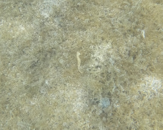
This is a Lined Seahorse (Hippocampus erectus). They are considered a “Vulnerable species”. These were not as obvious or as plentiful as we were led to believe. They were in the grass and usually head down foraging. This is probably a female, note the lack of the belly pouch.

You can just barely see the eye on this seahorse. Judging by the belly this is very possible a pregnant Male Seahorse. Who knew that “woke” seahorses where leading the way of males becoming pregnant? Actually the female becomes pregnant and then sends the eggs over to the male that raises them in his brood pouch.
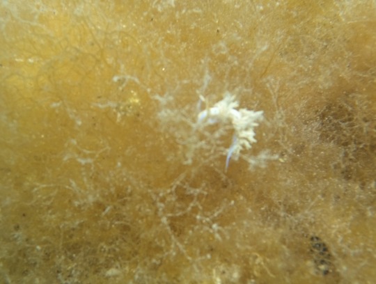
The more interesting organism in the pond were the multitude of nudibranchs. Specifically Fringeback Dondice (Dondice occidentalis) They were everywhere and working along the top of the grass. Much more prolific than the seahorses.

Since my photo was so bad, I stole this off the internet.

This is the bright red file clam (Ctenoides Scraba) that was very abundant in the pond.


After walking back to town we saw that the car ferry from Nassau was in town. Top left photo has cars backing up onto the ferry.
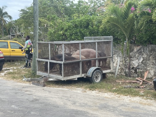
The pigs in a trailer, are they coming or going, who knows? Can they swim? If they can’t swim, will we see them at dinner?
This apparently is a communal cooking bread oven of days before. Makes sense, stays hot for hours, using less fuel than each house cooking bread in their private oven.
Next we pull anchor and head 16 miles west for the infamous “Current Cut”. You have to time it for 1+15 to 1+30 minutes after the tide change in Nassau. If we hit it wrong, we may be fighting a 6-8 kt. current in a boat that only goes 6 knots.
S/V Sea Breeze, Hatchet Pond, Eleuthera Island Bahama
4 notes
·
View notes
Text
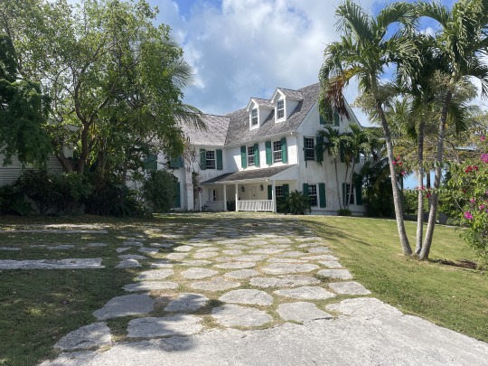
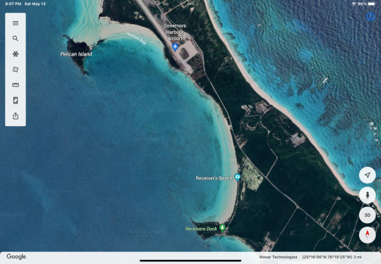
2023 Bahama Cruise, Part 28. May 12 Governors Harbor, Alabaster Beach, Eleuthera.

This is the chart blow up of Governors Harbor, to give you an idea of the area. Against advice on the chart and our friends who were here a couple of days earlier. We anchored inside the harbor. Our anchor dug in well, and we recklessly never dove it.

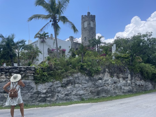
After a quick trip to the grocery store for a dozen eggs and another bottle of Coconut Rum. We walked around the harbor shore line. We visited the old cemetery near the water. It was well kept with some very old Grave Stones. Behind the cemetery was the St. Patrick’s Anglican Church, built in 1848.

Just around the corner from the church was this beautiful building. It is the “Haynes Library” built much later in 1897. Notice the huge concrete buttresses at the corners, facing 45 degrees from the building. The ones in the back go almost all the way up the second floor. This library was built to withstand a Hurricane. Hurricane Andrew came nearby in 1992 as a Category 3 Hurricane.

Cupid’s Cay makes the outer hook of the harbor. Not sure if it was a separate Cay originally or not as the name would suggest. But today it is connected to the mainland by a substantial causeway. Cupid’s Cay was the home of the first Bahama Parliament in 1736.

On Cupid’s Cay was the first U.S. Consulate to the Bahamas in 1789.
This is a hotel rental on the Cupid’s Cay. This reminds us of old Key West. We walked back to the dinghy and then moved to the boat for the night.
The next morning we did a quick walk through the better part of town. These were well kept up old houses that you can rent. Grounds were green with landscaping and well kept. Really reminds us of Old Key West.


This walk took us over the top of the ridge about 142 ft. high. The ends up going through a carved out are to keep it from being so steep. There was an cement cistern reservoir at the top to supply water pressure to the neighborhood.

From the top we could see both coast of the island. Once we finished this short walk it was back to the boat and move anchorages. Governors Harbor left a good impression with us. Part of it was like most of the settlements. Parts were going high class rentals. Lots of history in this town.


As always the few people we met were very nice and friendly. Apparently there are no snakes on this Island. The chickens and rosters have run amuck. The crowing starts early and is continuous for hours before daybreak.
This is Alabaster Bay. It is 6 miles north of Governors Harbor.
On Monday 13th, we hike 3.7 miles round trip. First across the island to the abandoned US Navy Base. Right turn and a 1 mile plus hike down the beach. Lunch at “The Deck” then continuing clockwise out to the Queen’s Highway and home.
In 1950 this USNavy Base was started as an experimental SOSUS (Sound Surveillance System) having 6 hydrophones deployed off shore. Then in 1958 it became a missile tracking site for US missiles launched from Cape Canaveral. Typical of USNavy bases on islands, they concrete the sides of hills to catch the rain water at the bottom. See photo above, there were several of these. The base was closed in 1982. During its tenure, usually only the Base Commander was actually in the military. The other personnel worked either for Pan American Airways (Pan Am) or Radio Corporation of America (RCA).
In 1957 the base became the Eleuthera Auxiliary Air Force Base (AAFB).

Being a sailor I can’t help but drag a large clump of net and floats up to the high tide mark. It would be a nightmare if you fouled your prop in the open ocean with something like this.

This is “The Deck”. A bar and grill on the oceanside. It is owned by Mark Robert a descendent of the original settlers at Hope Town Abaco.
Bacon Cheese Burgers in Paradise. We learned a new trick. When flies are giving you a problem, light a can of sterno. Even after you put it out they stay away for several minutes.
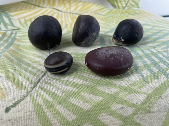
This is all the treasure we collected on the beach. The most prized of the different sea beans, is the “Hamburger bean” (front left).
It was a slow hike back to the boat after the huge lunch. Nancy cut my hair and beard. After a short recovery time from the lunch. We pulled anchor and sailed north to Hatchet Bay. We tried to out run some storms coming up from the south. Didn’t work out so well.
Using Standard WaterTribe rules. We reefed early. If reefing even enters your mind, then you should go ahead and reef (pull in) your sails. Since we did, the gust from the storm never materialized.
This very well could be a hairy entrance., it is 80 ft. wide and has rock cliffs. Large amount of current to get in and out of this small cut. We had 2 ft. swells and 12-15 kt. winds.
We came into the bay and put out a “Security call” on VHF announcing our entry into the bay. The mailboats and car ferries never say when they are approaching or exiting the harbor. We assume they have a VHF, but they seldom ever answer.
We entered during the top of the flood tide, so no current was evident. We put our anchor down in the north end of the harbor. Only 8 cruisers here. Three left the next morning.
S/V Sea Breeze, Alabaster Bay, Eleuthera, Bahamas.
4 notes
·
View notes
Text
2023 Bahama Cruise, Part 1. March 5.
We left on the top of the tide, day break Saturday March 5. Spent a peaceful day behind Tavernier Key. Woke up at 0330 and were under way by 0400 Sunday morning. Nancy was up on deck with the spot light looking for crawfish trap buoys. Overcast skies prevented the mostly full moon from helping us see. Once we were clear of the reef and possible buoys we turned for South Riding Rock, Bahamas.
About an hour off shore the sun finally rose. Crossing the Gulf Stream was about as calm as could be expected. We just motored the whole way with little to no wind. When there was a touch of wind, of course it was directly on the nose.

Nancy was getting an early nap in case we decided to sail late into the night. You can see how smooth the Gulf Stream was, very few white caps. During the first half of the crossing we had up to 35 degrees of crab into the Gulf Stream just to maintain course.
I got my nap in also, still wearing Life Jacket, sailing harness and gloves. In case I have to respond on deck on a moments notice.
As we closed on to the Bahama side of the Gulf Stream where the current is the weakest, we had to change course and speed to dodge a freighter. All together there were three freighters coming from two opposite directions that we were weaving through. So when you change the geometry avoiding one freighter, you change the geometry of the other two as well. But there was enough clearance we were still good on the other two freighters.
Eleven hours after crossing the Florida Reef we crossed on to the Bahama bank. It was actually glass calm by that point.

Standing guard next to our compass is a statue of “The Saint of the Sacred Heart”. We found that on the beach at Long Key State Park, Florida Keys a year earlier. There was a nearby deserted Cuban refugee boat on the beach. We figured it had safely overseen the Cubans crossing the Gulf Stream.
As we safely crossed the “Stream” this time, I realized this was the 4 th time this statue has safely crossed. It crossed with us both ways last year, now once this year, plus with the Cubans.
South Riding Rock is not much to see. Just amazed at the early sailors, who did not have the luxury of Global Positioning and detailed charts.

We only saw glassy smooth seas for two days last year while in the Bahamas. First day this year and we are seeing the bottom crystal clear in 25 feet of water. Above are where the local Bahamians catch Crawfish. They are know as “casitas”. Usually they are 4 ft. x 8 ft. pieces of corrugated metal weighted down by concrete blocks. Each diver may keep track of 500 to 2,000 of these.

Chugging along at 5.5 to 6 kts. Running at 2,000 rpm for 72 miles. We crossed onto the Bahama bank around 1615 and planned on anchoring around sunset. Plan was to anchor the next day after an easy 50 mile day crossing to the east side of the “Bank”. Winds were forecast to pick up the next night, while we would be anchored on the bank. We had each gotten a nap in during the day, so we decided to press through the next 50 miles.

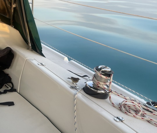
Around 1700 as Nancy was down below making a Curry Chicken and rice dinner. An exhausted little bird landed on the boat. We were 25 miles from the nearest land with only an hour of daylight left. There is very little fresh water available on these islands. Had we not been there, I am sure he would have shortly flamed out and ditched in the ocean.
How many times have birds landed on top of our boat without us knowing? Just taking enough of a break to continue on. A boat in the same area last year, had an owl land on their boat.
After it flitted around the cockpit a little bit. It seemed to settle down for the night. Then all of a sudden it flitted to the edge of the cockpit and slid out of sight onto the deck. Nancy looked for it just before dark and did not find it on deck.
We assumed it had flown off into the sunset, and wished the little fellow well!

After a great dinner we took turns on watch as the other person slept in the cockpit. We traveled 132 miles total the first day, anchoring around 0130 in the morning.

We anchored in 15 feet of water on the “Bank” one mile off the route coming through North West Channel. Two other sailboats had pulled off the route, short of where we like to anchor. Multiple motorboats, sailboats and a Island Freighter were all buzzing through North West Channel at 0100 in the morning. Busy place in the middle of the night. This is a natural coke point for boats crossing the “Bank”.
BIRD UPDATE: While Nancy was at the helm for the anchoring. I went forward to the anchor locker and opened it up. With my headlight on bright white, I retrieved the anchor snubbing lines, stood up to run the anchor chain out by the windless. As the chain started to rattle up out of the locker. Something jumped up, then fell back on the pile of chain. Somehow the little bird had found its way into the chain locker and ridden 25 miles further east than we had last seen it on deck.
The bird was in total shock now, due to the headlight and chain being jerked out of the locker. I was able to scoop it up and put it back in the cockpit for the night. We quickly anchored and went to bed.
Waking up before sunrise, I started thinking about the bird and how to give it some fresh water for its journey.
Nancy woke up and went into the cockpit after sunrise to check on the little guy. He was already gone. At least it had a good nights rest before flying off. We were now either 25 miles closer or further away from his destination. Not sure if we helped him or not.
BIRD UPDATE #2: Even though Nancy thought she had looked all around the cockpit and could not find the bird. I found the little bird a while later, after I started moving more gear around. Unfortunately, it was dead. It died peacefully, at least it had not faltered and drown at sea.

With only 24 miles to Morgans Bluff for us to clear into the Bahamas, we had a leisurely start to the day. Calm winds and glassy smooth water. We turned on the new water maker and it worked great. Even though our 22 gallon aft tank was only half empty. This was clean water and the water maker needs to be run once a week. So it took 2 hours to fill up. But it was very quite and the solar panel was able to keep up with the electrical draw e en this early in the day with low sun angles.
North West channel can get very rough when winds funnel the large waves off of the “Tongue of the Ocean” (TOTO) into this funnel shaped area, that goes from thousands of feet deep to 20 feet. Today the current was flowing off of the “Bank” into TOTO. Winds were only a foot in TOTO but with these two conflicting forces the waves were steep for a half mile. Kind of a mini “Rage”.
The photo above is Nancy doing so reading as we followed the reef line south to Andros. Winds were calm again and smooth seas. During deep water crossings we bring in our solar light that stays on the bow while we are anchored. I just happened to find it sticks down nicely into the top of the windless. So here it is getting charged for the next nights operation.

Our anchorage on Monday afternoon 1530, Morgans Bluff, Andros.
This blog is long enough, so I will end it here.
SV Sea Breeze, Morgans Bluff, Andros, Bahama.
3 notes
·
View notes
Text
2023 Bahama Cruise, Part 27. May 11 Tarpum Bay, Ten Bay, Eleuthera.
Royal Terns taking flight from the fishermans dock.
After anchoring north of Tarpum Bay and making water we repositioned the sailboat closer to the settlement of Tarpum Bay. No, that is not a typo. The name changed a couple of times and is named after the large gamefish that used to be found here, Tarpon. They just spelled it differently.


The settlement showed great potential as we approached with our dinghy. The mandatory large church, some artist painted buildings and seemingly well kept houses were visible from a distance. A swing over the water, for tourist to take photos in.

We stopped at the fisherman hanging out near the dock. Four guys just chilling.
All over town are nicely hand painted signs saying wear mask and social distance. They no longer require mask or social distance here. As artistic and nicely worded as the signs are, they will still be here 20 years from now. Things don’t happen fast in The Bahamas.

Shoreline photo of the town and the beautiful St. Columba’s Anglican Church built in 1849.

This town has a solid ridge of rock running parallel to the beach. Many of the roads crossing the ridge have been carved down through the rock to make them less steep.

A couple of the houses are painted up. They are usually are rentals.
Note the use of conch shells on the garden wall.

One eclectic modern castle was built by a British couple on the top of the rock ridge.

I love the old tabby and lime houses, as long as there are not beer bottles a foot thick on the inside. It certainly reminds you of how old the city is, and how hard people had it.

The cemetery was very interesting, again it is along the beach where digging a grave was easy, and grave face east. Just goes to show you different uses of conch shells.

We bought some home made candied peanuts on the side of the road. The lady’s son had woven old style fishing traps and selling them for $100. Just pretty hard to get something back home that big.

Nancy found a Pickle ball court in Tarpum Bay! Who’s ready to play?

Sailing north to Ten Bay Beach, we watched a beautiful beach and a green flash sunset while cooking a flank steak on the grill. We thought we would be the only sailboat in sight. Just as the sun set a catamaran pulled in for the night.


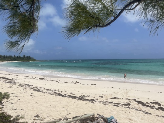
Ten Bay Beach.

This is the beach at Ten Bay with Nancy paddleboarding down the coast.
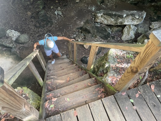
Using my GPS and coordinates I found on the internet for the cave. Nancy and I walked a half mile to Ten Bay Cave or “Bat Cave”. The trail leading from the road was overgrown, with several small trees fallen across it. Having been warned that the mosquitoes are thick at the cave entrance and to be prepared to enter the cave when we got there. We stopped on the trail to change sun glasses for clear lens glasses and get out the lights. Too late, the mosquitoes are thick in the bush as well. Should have gotten ready in the open daylight at the road.

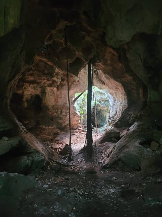
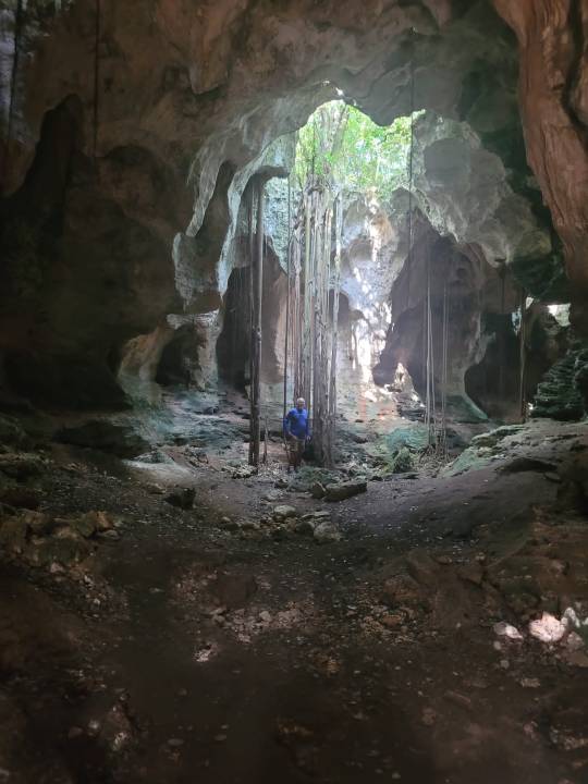
This is a huge cave with multiple entrances. The cave has steps carved out of the rocks, leading to a rickety and 12 foot rotten ladder. This is definitely not on the normal tourist pamphlets.
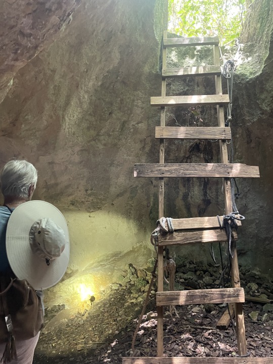
Being the gentleman, I let Nancy go first.

Notice Nancy is out front…..
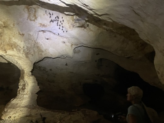
Bats hanging by their toenails.
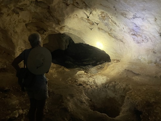
Many of the leafnose bats were flying about. As deep and convoluted as this cave was, we staggered ourselves out with one of us keeping the entrance in sight. You guessed it, I stayed closest to the opening and Nancy ventured deeper into the cave.

This is a close up, from the internet, of the Leaf nosed Bat found in this cave. After looking at its nose, you understand the name. Apparently it helps funnel in the smell of the food to their nose.
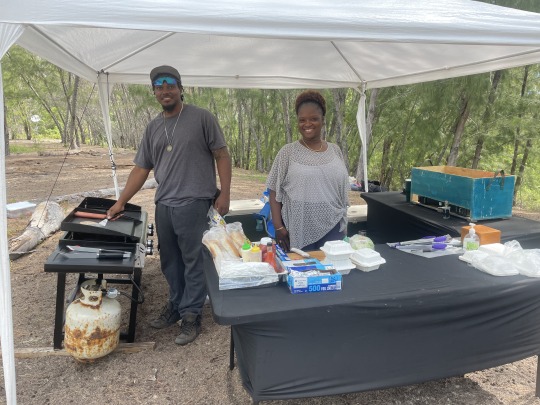
This is Phil’s Kitchen. A tent set up on the beach. We ate a hotdog and a cheeseburger washed down with cold Kalik beer. Then we pulled anchor and headed to Governors Harbor, Eleuthera for the night.
S/V Sea Breeze, Ten Bay, Eleuthera, Bahamas
4 notes
·
View notes
Text
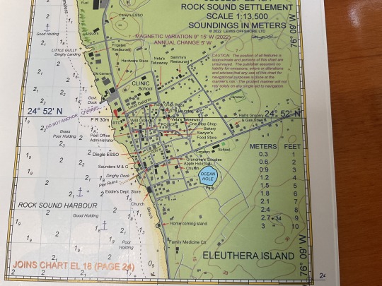
2023 Bahama Cruise, Part 26, May 11 Rock Sound, Eleuthera.

Nancy is trimming sails on our way up the west side of Eleuthera. The Puritans named the island Eleuthera in the 1700’s. Which is a derivative of the Greek word, “Eleutheros”, meaning Free or Freedom.

Saturday, filet mignon night. Thanks Dush and Kelly!
To bring you you up to date. We had arrived outside the Rock Sound Harbor, Eleuthera on Saturday and decided to anchor off of a long beach. Instead of going the last couple of miles to Rock Sound Harbor. Because there was a huge rain storm over the harbor. We had to anchor a ways off shore to find good sand to anchor in. We had good protection from the waves and a cool night with the winds.
Anchoring further away from land usually assures mosquito free nights. Rigged the boat for quick closing with multiple rain showers expected. Since the threat was rain and not mosquitoes, we remove the screens and added a draw string to the hatch handle. No need to go on deck half asleep, to lower the open hatches. Just pull down on the draw string hanging down into the cabin to close the hatch.
But the first day it was too windy for Nancy to paddleboard. I spent 3 hours making water, reading etc.
Sunday Nancy paddled to shore and I met her using the dinghy. We both walked the beach looking for shells. We found several Murex shells. Then snorkeled back to the boat. Very few corals of fans. So we made the decision to go anchor off of the settlement.
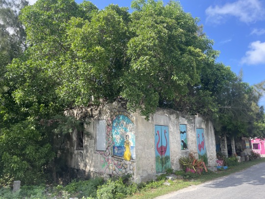
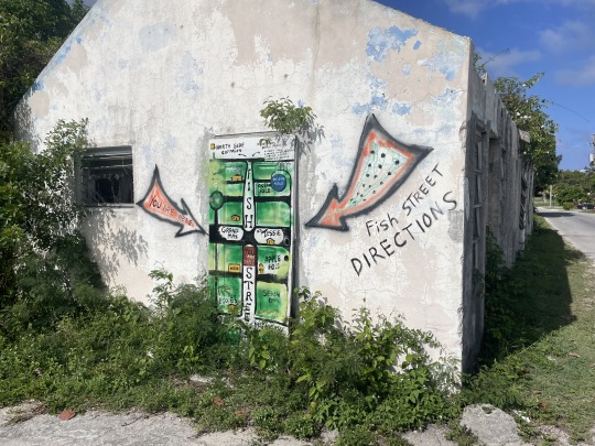
As we started walking up Fish Road, we came across some cute art work. There are so many abandoned houses in the Bahamas. Some over a hundred years old. Some only a couple years old, just never finished. This art work really brightened up the city. Using the abandoned house elevated it from being a blight to a beautiful object.


Just up the block, we ran into Warren who is the artist. He is recently retired from being a nurse in Nassau for 42 years. He has a passion for cleaning up his hometown. “Grand Ma’s” was his grandmothers ice cream store, but she has passed on. Now it is his art store. Warren dropped the wet paint brush he was painting with, to talk to us. Giving us a tour of his works. Super nice guy full of energy.

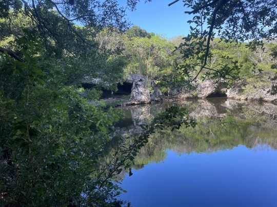
The dark round hole at the bottom of the photo is “Ocean Hole”. Number one tourist destination at Rock Sound. It is confirmed to be over 110 ft. deep. But rumored to be around 700 feet. Warren told us to take bread for the Snapper.


Apparently the Mangrove Snapper and Grouper were stocked in there by local fishermen as well as Parrotfish. The parrot fish died when the trees around the hole were cut down and fell in the water.
Dye was put in the hole at some point and it showed up in the ocean nearby. Proving that it is connected underground to the ocean and a new source of water.
We walked around town for an hour and saw most of it, so back to the boat for dinner.
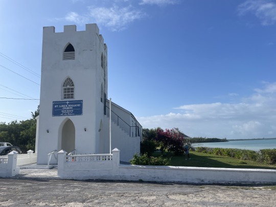
The next morning we walked to “The Boiling Hole” and “Cathedral Cave”. Passing by the beautiful St Luke’s Anglican Church built 1863. For most of the settlements we have seen on Eleuthera the old churches are built at the waters edge and not on top of the hills overlooking the town. Usually they are very prominent and the first thing you see approaching from the sea.

The next biggest tourist attraction is a ten minute walk out of town to the cave and Boiling hole (photo above). The caves are not the ones on the far shore. They are another 5 minute walk through the bush.

Luckily the old wooden ladder was not too rotten. Only a couple of steps had broken. Interestingly many mosquitoes hang just outside the cave. I was thinking the bats were not doing their job. But several species here are actually fruit bats that migrate, and have not acquired a taste for mosquitoes.

We were lucky the bats had apparently migrated back and were flying around in the cave. This cave has many large openings in the ceiling, so plenty of light. Actually no need for carrying flashlights.


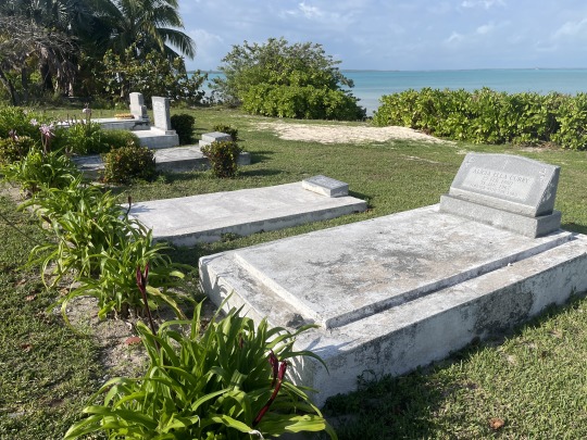
On the way back we realized that there was an old cemetery that was completely abandoned and overgrown next to the road and beach. Such a shame. Again the graves are pointed east. Above is the only one with a head stone. Most were just mounds of rock. This one was 1905?
From the caves we walked 30 minutes across the island to the supposedly “pink beach”. Pretty, but no sea shells. Nancy took a quick dip.
Half way back, we stop and talk with Rose. She is feeding stay dogs called “Pot lickers”. She shared some hog plums with us. Nancy had already gone out into the bush and picked half a dozen mangoes.

The fisherman had come in with their gill net full of grunts. Each settlement has a dock with a covered stand for the fisherman to use while cleaning fish. We made multiple trips to the gas station filling jerry jugs with either diesel or gas. Our tanks are full and are carrying 12 gallons of diesel and 12 gallons of gasoline on deck. This may be our last place to fuel up before we make it home.
Cruisers rate the settlements by there grocery stores. Rock Sound has the cheapest grocery store that is fairly large. This was much more industrious then the settlements on Cat Island. Again most of the younger folks have moved away for jobs. When they retire they move back. This leaves a void of workers. That is where we see the Haitians getting a foot hold.
Honestly I must say, if you have never been to Rock Sound you need to go.
If you have ever been to Rock Sound, you don’t need to go again.

Now that procuring fuel is going to be tough we are making a point of sailing more and motoring less. So we sail ten miles to the next settlement of Tarpum Bay.
S/V Sea Breeze.
3 notes
·
View notes
Text
2023 Bahamas Cruise, Part 22. April. 26 Rake ‘n’ Scrape, Cleaning graves finding a cave. New Bight.

Bo-Hog and the Rooters do an impromptu gig. On the Accordion is Bo Hog himself, Alfred “Pompey” Johnson. On the drum is Duke Moss owner of Dukes Conch stand, where this happened. On the right is Ishmael, he is playing the hand saw.

The drum is home made. It is heated over a stove to tighten the drum skin just before playing. So beware putting it on your lap. The handle of the saw is placed at the hip and the tip is held with one hand. By flexing the saw and raking the saw with a large screwdriver different tones can be made.
Ishmael spent 40 years off the island but came back 9 years ago. Now he farms his back yard and does a/c repair. Great guy to talk with.
There were 9 of us cruisers from 4 boats enjoying the music. Nancy passed the tip container around at the end of the set. She gathered up $62 for the band.
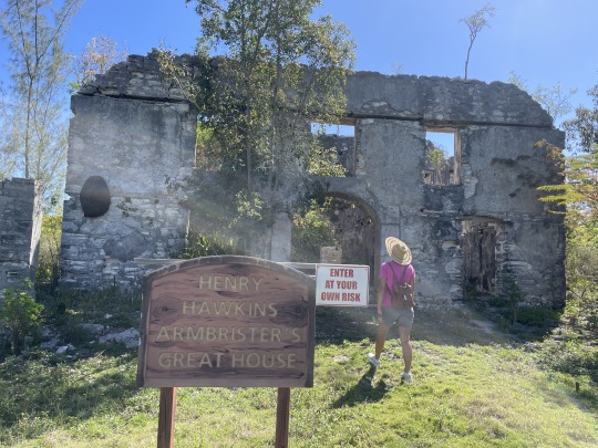

Pompey said he needed help the next day clearing brush around his ancestors graves. So Nancy and I volunteered to help him. We walked down to Henry Hawkins Armbrister plantations Great house, built around 1760. There was a slave uprising here and “Pompeys” ancestors burned the house down.
Henry was a revolutionary Loyalist living in Georgia and of Scottish descent. When he left for the Bahamas to resettle taking his slaves with him.
Interesting to note. No rebar in the old houses. New houses have rebar that spalds and breaks the houses down. The old tabby houses will still be standing when most of these new building fall down in the future.
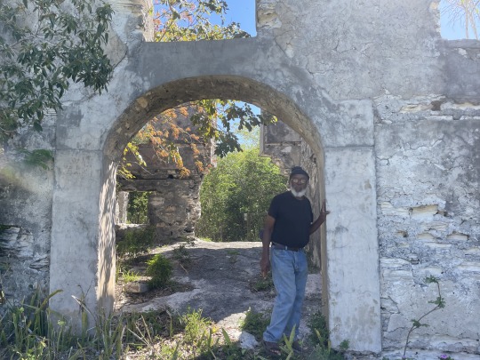

This is “Pompey” showing us the old great house. He is carrying a machete for clearing the graves. He finally walks us about 500 ft. up hill. Then out through a winding foot path in the scrub brush. There are three graves down in a natural pit about 3 ft. deep. Two are of adults and one is a baby. No grave markers.
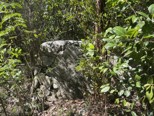

This was the most prominent grave. Standing about 3 ft. tall with a coat of concrete on the outside. Around the back a gaping hole was in the side of the grave.

The next grave is wider but level and low. The third grave was the size of a baby and had only the outline at ground level. You can see it at Nancy’s feet.
Just east of the graves is a natural bridge about 3 ft. above the pit. Mosquitoes were fierce, so we only chopped down a few small trees. The slave graves commonly had trees planted on top of the grave. Not that we saw planted trees here, these seemed wild.

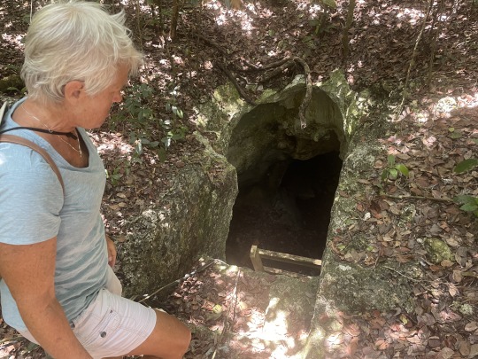
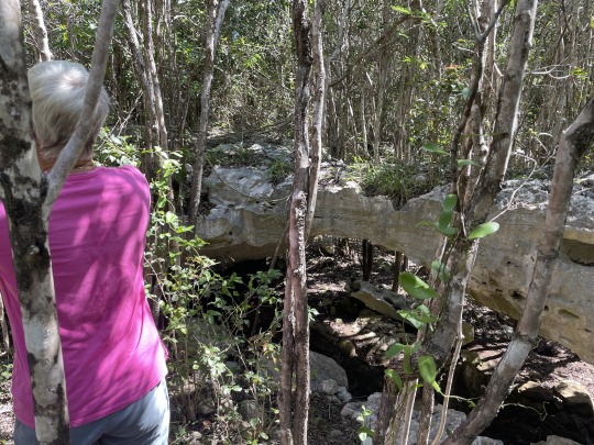
At the Hermitage there was supposed to be a cave that the Hermit used. We knew where a trail led off the road and wanted to go check it out. “Pompey” said his family used to gather sheep into the cave every night. So we found a small cave 5 minutes down the trail.
“Pompey” said his ancestors had sold several acres to the hermit for his Hermitage. Legend has it, that the Bahama Government gave the land to Father Jerome for his service. He actually bought 8 acres on top of Como Hill from the locals. Probably “Pompeys” people. Before Father Jerome died he gave the land to the Catholic church. The Hermitage is actually well maintained. After reading the book written about him, there is a much larger cave in the hill just below the Hermitage. By his Last Will and Testament, he is buried in that cave facing east with his arms outstretched. It has a wooden gate across the door. Father Jerome died on June 26, 1956.
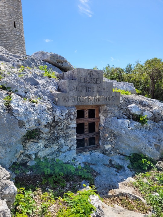
This is the cave Father Jerome is buried in. Winds are due to shift out of the south and pick up. So it is time to pull anchor……
“Pompey” is adamant that we must have one more beer with him before we go. Nancy is crushed between Crystal on her right side and CD on her left side.
CD owns the Fish Fry shack where we ate the Cracked Conch. She also plays the drum for Bo Hog if she is not cooking.
Two degrees of separation on Cat Island. We were telling them about our trip to Port Howe and meeting Prince Hunter. Turns out Prince is CD’s father. While we are discussing this. “Pompey” points at the woman sitting near us and says, “Thats Prince’s wife”. She corrected him quickly, saying they were divorced!
Cat Island is the only out island that ever had a train. Off of Tucker point, south of New Bight are the last iron rails left. The rest of the track was removed for scape iron during WW2 and shipped to England. This train carried sisal and cotton down to the waiting boats tied to the shore.
Sea Breeze, New Bight, Cat Island, Bahama
2 notes
·
View notes
Text
2023 Bahama Cruise, Part 17. April 8. Wemyss, Long Island. (Sharie and James Knowles).

This was our night out on the island. A famous restaurant on the beach is Chez Pierre. A one man Chef restaurant from Montreal. He is notorious for being upset, if you don’t have a reservation and drop in. Even worse is being late for your reservation. It turns out this Island Soup Nazi (Seinfeld episode) has a great reason. He can only cook so fast and staggers the customers out.
Nancy called and took the earliest time slot available. We have been anchored in a beautiful sandy beach cove, just in front of a round yellow house for two days. Nancy paddle boarded around the first day. Then we both got in the dinghy and went around the entire shore line, passing the yellow round house multiple times.
We were trying to get to an old plantation which we could see the only remaining chimney above the tree line. We stopped to asked directions from a guy working in front of his house. Turns out he moved here from Ramrod key in the florida Keys. We were unable to get to the ruins, but enjoyed walking the beach.


We pulled anchor and motored around to Millers Bay, just south of us. Anchoring in the bay directly in front of the French restaurant. We got dressed up and dinghied in to the shore in plenty of time for our reservation. Don’t want to be kicked out, for being late.


We were 20 minutes early and only the Chef and the beach dog were there. Chef was mad for us being early. Actually it is all an act. He was wearing a classic white T shirt and shorts, very island casual. He explained the rules. We were to mix our own drinks behind the bar, (see photo above). Beers were in a refrigerator around the corner. Which is what I homed in on. Keep track of our drinks. “Mind your P’s and Q’s” was a saying in the day. Meaning know how many pints and quarts you drank at the tavern, so you pay for the proper amount.
The next shift of customers came in. Two older couples, Nancy got to talking to them and the conversations continued off and on. Turns out we had been anchored directly off of their round yellow house for two days. They said, nobody ever anchors there! We received an invite to come visit.
We were able to finish our dinner and dinghy back to the boat prior to sunset. Which is why I wanted the early reservation. The sun set as we motored around Whale Head point back to our previous anchorage.
This is Sharie and James Knowles, who invited us into their house and shared many a story with us. They returned back twenty years ago, to the island of his ancestors. The Knowles here owned 2,000 acres. First living in a tent high in the middle of the island. Tried raising sheep. Actually flew 3 sheep in on Bahamas Air to improve the blood line.
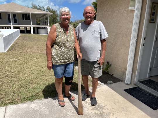
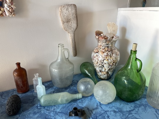
Above they are holding a large wooden pestal. The large tree trunk mortar was out side under a tree. These were used by his relatives only decades ago. She was grinning ear to ear, when she casually handed the pestal to me. As soon as I hefted it up, I knew what it was made of. Lignum Vitae! It must have weighed twenty pounds. So you can see why it sinks in water.

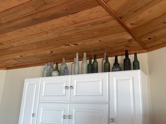
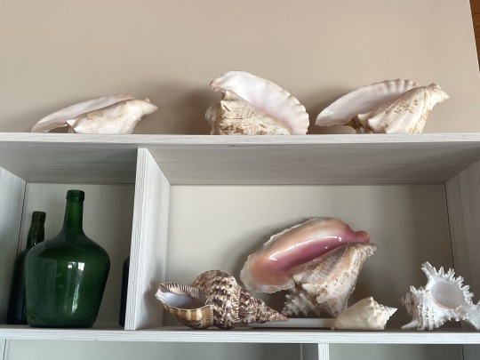
Their passion is traipsing around the island at old plantations and caves looking for artifacts. They have an extensive collection of old bottles and Lucayan artifacts.
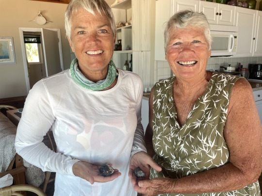
Sharie showed us her collection of whale ambergris. She researched ambergris and became a middle man buying and selling ambergris for fun from the locals. One of her many stories was flying to meet a buyer from France in Nassau. They went to the hotel room where a large piece was examined and bought. It earned the local islander $10,000 US. She just got involved out of curiosity. Treating the locals fairly. The islanders dog is the one who actually found it. Kind of like a truffle dog.

They told us of finding Right Whale skeletons. They have two whale vertebrae over their doors. She told the story of being in a bar when two Bahamians came in talking about the whale skeleton they found. She offered the use of her vehicle to transport the bones for the guy. She showed us a photo of bones stacked in her car floor to ceiling, with the pelvis strapped to the roof. The man sold the bones from in front of his house, eventually earning enough money to buy a car.

Walking through their house was like being in a Museum of Natural History. Above is the skull of a flamingo they found, plus whale baleen to the left.

There was an old cotton mill on their property, which is gone now. They took us on a tour where there is a Lucayan midden. We are sworn to secrecy on the exact location. It has been researched by the University of Florida.
The photo on the right, is inside their garage. They lived in the garage for two years while they built the round house. Reminds me of my folks who lived in one small room, cooking over a camp stove while they built their first house in the Keys. I love the wood mallet on the wall which was used to beat sponges during the curing process.
Sharie also did her research on Conch pearls and became a middle man selling those. Locals would bring her conch pearls and she would pull out a light and jewelers loupe. After examining and rating it, she would pay them a descent price saying they could get more in Nassau. Most took the quick cash and headed to the bar. She mostly did it for fun and good story or two.


The tamarinds at their house are huge. All sorts of things in their yard that they found beach combing. Above are the old metal bouys for nets. Inside the house, were the more rare glass bouys. The photo on the left, is another grey racer snake we saw during the tour. That brings to a half dozen snakes we have seen in the few hours we have spent on shore. Sharie stopped the ATV when she saw a Mangrove Cuckoo in the bush.
On a sadder note. They also found parts of the flotsam while beach combing. From the ship El Faro, lost during Cat 4 Hurricane Joaquin Oct. 1, 2015. Thirty three people lost their lives when the ship went down in 15,000 ft. just east of Long Island. Their house had 17 inch of water in the ground level garage from the hurricane.
What a great couple and a fantastic day spent with them.
S/V Sea Breeze, Wemyss bay, Long Island, Bahamas
4 notes
·
View notes
Text
2023 Bahamas Cruise, Part 16. April 7. Driving Long Island.
April 5th we rented a car and drove south to the end of Long Island. At 0800 start calling SeaSide Car Rental on VHF ch. 16. Many businesses here in the Bahamas handle business by VHF. Turns out she had gone to the airport.
Once we got the car, Nancy stopped at the Beauty Salon. Marcie who we met by chance a couple of days earlier gave her an appointment for the next day. Marcie will not only cut your hair, but set you up with fish or crawfish. As she was doing with her customer at the time. No she does not have the fish actually in the shop. That is the beauty salon in the fish market in George Town, Exuma does that.
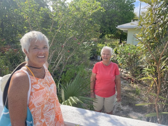
This is Dolly Fox, Marcies Mother in law. Dolly and Basil own the dock that us cruisers are graciously allowed to use. Her son Roger fishes the Jumentoes and Ragged Islands, you can make an appointment for fish at the beauty salon.

Looking through the windshield of the rental car. Don’t you hate getting in a rental car and having to figure out where all the buttons and switches are. This car is driven from the right side, so the gear shift is on your left. My turn blinker is on the left in my truck. Consequently I turned on the windshield wipers all day long before turning. They kindly put a sign at the top of the window, reminding you to drive on the left side of the road. This is most important when turning on to a road from an intersection. The roads in Long Island have many a pot hole. After avoiding a couple of pot holes in a row, it is easy to end up with the old habit of driving on the right side of the road. To make matters worse, the oncoming car might be avoiding pot holes and is not on their side of the road. P.S. After getting in the first time, never saw the “Keep left” sign again.
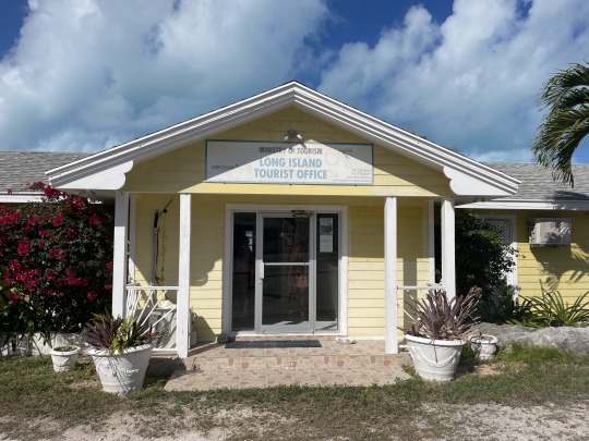
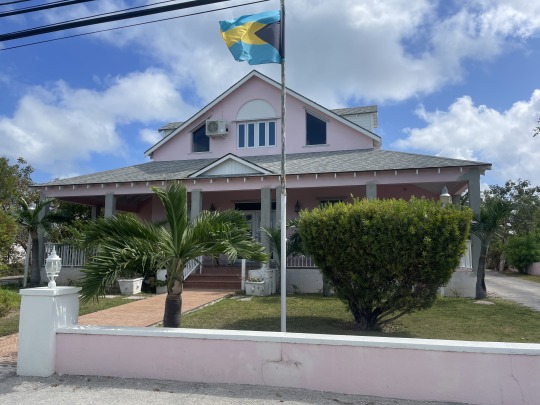
The yellow building above is the tourist information building. After picking their brain and armed with maps we headed south. Of course trying to keep in the left lane.
The building on the right is the Museum of Long Island. Patsy Cartwright, the curator, was a wealth of stories. She told us where to find a flock of 50 flamingos and the map to get there.
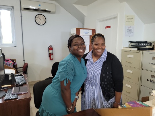
These young ladies run the public library in Buckly. Lauren, on the right, used to work at Gordon’s bar. So when we got there we mentioned her name. More on Gordon’s below.
“Six degrees of Kevin Bacon” or on Long Island, “Two degrees of separation”. There is a little over 3,000 Bahamians on the island . Most are related somehow. We always ask what their last name is. Here Lauren connects us to Gordon’s Bar.

You can’t say you have been to Long Island, if you haven’t been to Hamiltons Cave. Leonard Cartwright gives tours through the largest cave on Long Island. We spent an hour with Leonard while he showed us one of the three types of bats. Blind crickets, termites trails winding down from above. Lucayan pottery, Money Bats which are the large moths we have in the Keys. This cave has been in his family’s property for generations. People would hide from hurricanes here.
Two degrees of Long Island separation: Just spent the day with James Knowles. We mentioned Leonard Cartwright. James says, yeah he is my cousin.

This cave is not on any tourist map. It is in the Dunmore settlement area. Caves in this area were used by the Lucayan Indians. Directions were given to us by Patsy. Sign…what sign? Address…what address? You go past the blue house on the right, look for a house under construction on the left. Next left is the road to the cave.
So here is the real life interpretation of the above instructions we received. There is a blue house about every 2 miles. The house under construction was stopped at least 3 years ago and is now overgrown. Seriously, this island does not have a single address for a building. There are no mail boxes, only PO Boxes. They had a “party line” up until 1992. Salt Pond, one of the bigger settlements only recently received running water. All houses are set up with cisterns.
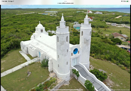
This is St. Peter and St. Paul’s Anglican Church in Clarence Town. Designed by the famous Father Jerome Hawes and built in 1908. It has twin 55’ towers. Which were purposely designed round like lighthouses. I find it interesting that the majority of older churches on the island all face East. The older graves are a good compass since they face east. Ready for the day of resurrection.

When you live in the islands you have to be inventive. I believe this is the local Jiffy Lube franchise. Note the rock on each ramp ready as a wheel chock.

“Slave canal”, there are two canals in town to flood inland ponds with seawater to produce salt. These canals were hand dug by slaves. Probably 5 ft wide and up to 15 ft deep in a few places. There must be hundreds of miles of dry laid rock walls on this island alone. Most done by slaves. The rock walls were used to fence in livestock and mark property boundaries. Some extend out into the water where it is shallow.

The lady at the tourist bureau, told us about the two flamingos at Doctor’s Pond outside Clarence Town. Flocks of flamingos migrate through each year. But one flamingo hurt its wing and can’t fly. One flamingo has stayed over the years to keep it company. The one on the right has its wing hanging down.

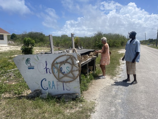
This is Charlie and his roadside straw work stand. Nancy sorted through several baskets and bought a small one for $18. Chickens were running everywhere and she asked about getting some eggs for her basket. No eggs today.
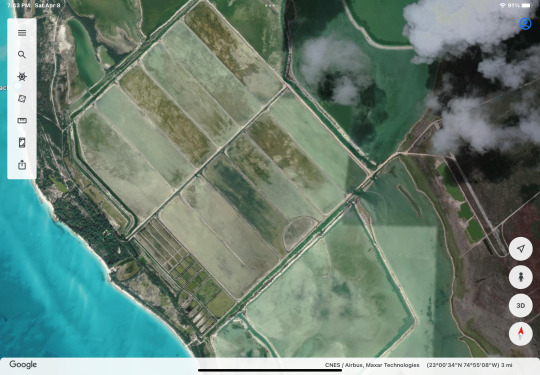
Patsy at the museum told us she saw 50 or so flamingos out at the abandoned salt ponds the week before. With map not drawn to scale, we go off roading with the KIA rental car. Among other things we drive down the abandoned runway on the right side of the photo. Carefully fallowing the map towards a beach with the hope of seeing the flock of flamingos. We are in the middle of nowhere. Only 3,000 people on the whole 57 mile long island. I am worried about the car breaking down. How do you explain where you are, when you don’t know where you are?
Here comes another car at us, on the only section of dirt levee we can pass on. Who would of thought that. We keep going. Turning here and there, looking for the lost flight of flamingos. Then we see a vehicle towards the end of the road. Great, at least if we break down they can help us!
You know what Nancy, that vehicle looks familiar. There are two people. One is wearing a familiar color shirt. I think they were parked on the beach while we were at the blue hole in the dinghy.
Two degrees of Long Island Separation: These two Americans rent a house here for vacation and bonefish from shore each day. We were within sight of each other 21 miles up the coast two days earlier.
Gordon’s Bar and Restaurant at the very southern end of Long Island. Earnest is the proprietor. He recently was in a vehicle accident, that has restricted his ability to run the restaurant.

Cracked Conch with peas and rice, with the Bahamas beer “Kalik”. Kalik is the sound of cow bells clanging during Junkanoo festivals. If you look closely at the label you will see two cow bells.

Two degrees of Long Island separation: This is Lori. She is just volunteering for Earnest and tends the tables. No Bahamian accent. Uh….Lori where are you from? She answers, Jamestown N.D.. She was a nurse in the USNavy. Nancy was a nurse in the USAF. She went to the same nursing college as Nancy’s good friend. Within a year or so of each other.
Nancy mentioned the story about meeting Lori to Marcie during her hair cut. Marcie said they had a Low Country boil at Lori’s house the week before. Two degrees!
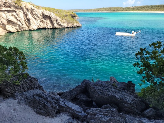
This is the famous “Deans Blue Hole”. The second deepest blue hole in the world at 663 ft. . The white raft in the middle is where people conduct free diving competitions. The only person to scuba dive to the bottom did it in 1992, James King. The Bahamas Cave expert is Brian Kakuk. Here is a link to the youtube video he shot on side passages.
youtube
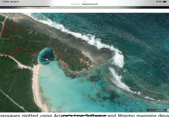
The red lines on the above photo are the caves heading off underground starting at 150 ft. With the blue hole at the top left next to the cliffs.
S/V Sea Breeze, Thompson Bay, Long Island, Bahamas
3 notes
·
View notes
Last Seen Blogs

terratenshi
This Will Not End Well
fixtionvixen
fixtion vixen

the-freewheelin-jake-wild
Take Five.

hrts4lisa
Barbie

preservationofmoments
Take A Picture, It'll Last Longer