vancouverislandtotoronto2023
Victoria to Toronto, via the southwest USA.
26 posts
Don't wanna be here? Send us removal request.
Last Seen Blogs

bonafidesoul
Bonafide Logs

liesweliveby
evidence suggests i am too tired for this shit

killian-whump
Killian Whump

kookaburroww
Kookaburrow
jerrykalman
Jerry Kalman
Text
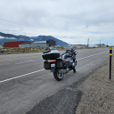
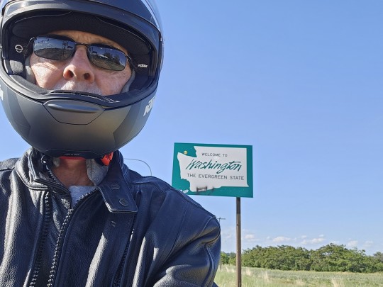
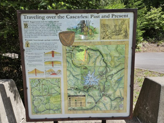
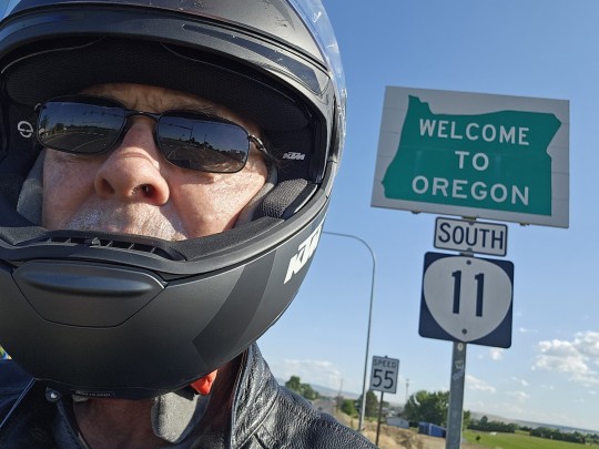
Day 1, Saturday May 27: Ladysmith, Vancouver Island to Victoria BC by land, to Port Angeles, Washington by sea, to Discovery Bay, Olympia and Tacoma, Washington by land again, 314 km.
This will be a busy first day. Early Saturday morning, Janis packs her bags for her flight to Vancouver, and I pack the bike to begin my motorcycle ride to Victoria and the Blackball Ferry docks.
We leave the hotel together for the airport where we say our goodbyes, and she heads for her departure gate and I to Trans Canada Highway 1A to start my ride to Duncan, Cowichan, Malahat and Victoria.
It's a 100 km ride, and I make it in plenty of time. I'm the first motorcycle in line, and I readily clear customs to enter the US. With time on my hands, I retire to a nearby restaurant to have lunch and watch the waterfront. It's a beautiful day, and the harbour is alive with walkers, diners, boats of all shapes and sizes, and sea planes.
I rode this ferry last year, so when they summon us to board, I know the drill - drive to the motorcycle area, strap down the bike, and clear the vehicle deck.
I find a favourable vantage point on the rear passenger deck and as we pull away and Canada starts to fade into the distance, it hits home - all the planning, all the anticipation, all the excitement, it's here, it's now, this is really happening.
It's a beautiful, uneventful 42 km, 90 minute ride across to Port Angeles. Last year, my brother and I got lost and separated, so this year I'm prepared and know exactly where to go when we dock.
I head SE on East 1st Street towards State 101 and the scenic route down alongside Olympic National Park towards Discovery Bay and Olympia.


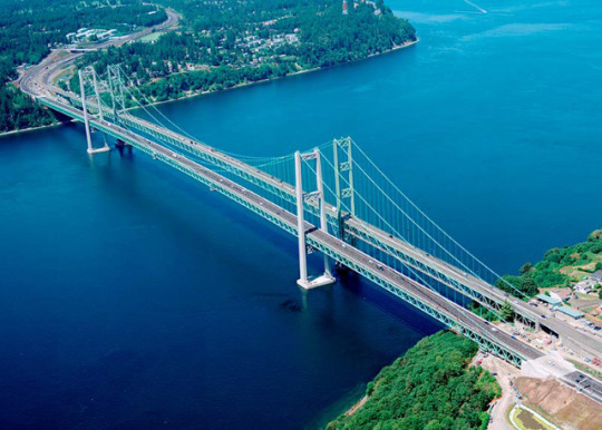
Past Olympia, headed NE at Lacey on Interstate 5, across Puget Sound to Tacoma
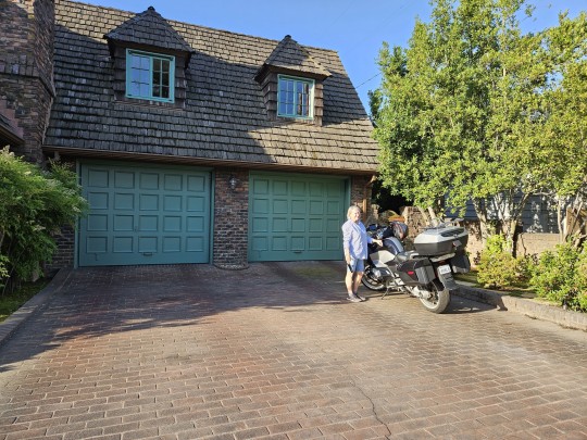
Checked into my luxury room with my own personal bottle opener
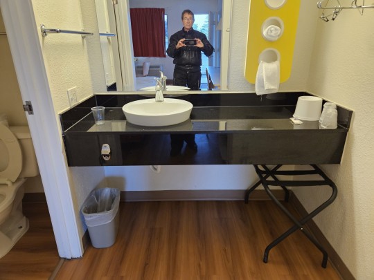
Ooops, forgot this one

2 notes
·
View notes
Text
Day 2 Sun May 28 Tacoma, Wash. to Randle, Morton, Yakima, and Walla Walla, Washington to Milton-Freewater, La Grande, and Baker City, Oregon. 750 km.
A word about Tacoma before we go. It is home to one of the largest ports in the U.S. Covering more than 2,400 acres, the Port of Tacoma has the Port of Seattle beat, which covers over 500 acres.
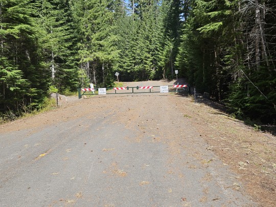
Headed south from Tacoma on US 7 to Randal. From the turned west on Rte 131 to Mt. St Helen's. Well, I can't say I wasn't warned about mountain passes. Scenic and the road put the tail of the dragon to shame. But ultimately a fail. Too much snow. Road closed. Note to file - Garmin doesn't tell you that.


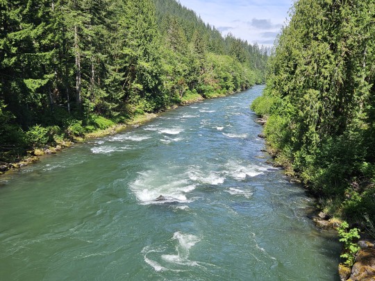
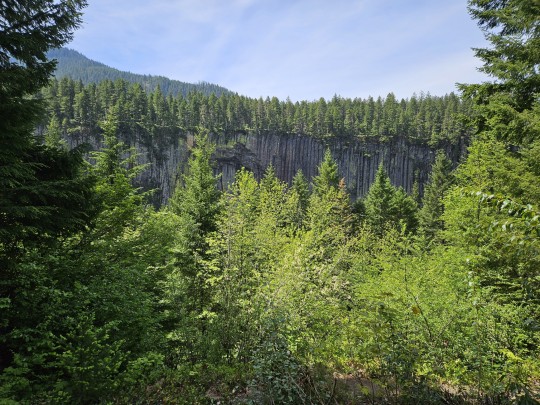
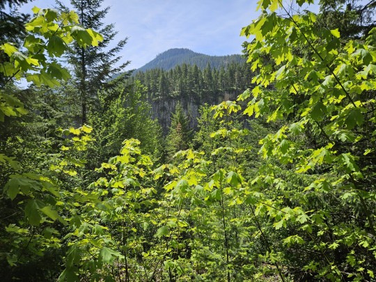
Turned back to US 7 to Morton, where I picked up US 12 to Yakima. Beautiful scenery and gorgeous roads. BTW, this is what clear cutting looks like.


1 note
·
View note
Text
At Yakima, I picked up Interstate 82 to Kennewick. The problem with Interstates is that you don't see the small towns, the farms, the communities, and the people, so you miss all the local flavourful of where you are. It is definitely faster and shorter, though. I opted to swallow the extra 150 km and get off at Kennewick and pick up US 12 to Walla Walla. Somewhere in there, I passed the Palisades and Mt Rainier.


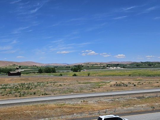
The leeward side of Washington past the mountains is very dry and brown. Thanks to irrigation, however, it is a thriving fruit area with apples, cherries, and grapes. The top of the hills is not irrigated. The bottom is. The difference is stark.

Past Walla Walla I entered Oregon and headed SE on US 204 through the Umtilla National Forest. Beautiful and green and high and snowy. Thank God not on the road. This time, I got through.


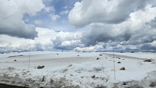
BTW, when you see those red markers beside the highway, you know they get a lot of snow.
Over the mountains and ski hills of Umatilla, I headed for LA Grande, where I picked up Interstate 84 for the last leg of a very long day to Baker City. Much to my disappointment, Baker City is the highest point on the former Oregon Trail and a former gold rush town, not a city named after its bakers and its pastries.

1 note
·
View note
Text
Day 3 Mon. May 29 Baker City, Oregon to Twin Falls and Idaho Falls, Idaho 700 km
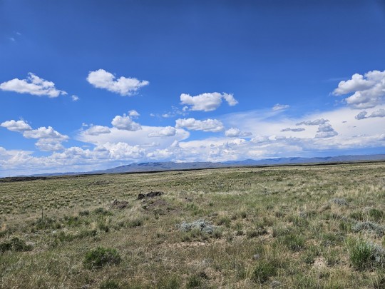
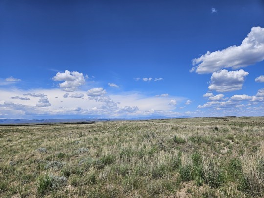
What's become clear is that in order to hit my destinations, I am not going to be able to entirely avoid the Interstates. Case in point, in order to make my 700 km today, I had to take Interstate 84 to Twin Falls. At 80 kph, you don't get much local flavour, and you're certainly not stopping to take pictures. However, you can gather impressions. When I think of Idaho, now I will think of wind turbines, solar farms, transmission lines, irrigation and cattle, cattle, and cattle. I'll also think of the Oregon Trail, which stretches from Missouri to Oregon and 500 miles through Idaho. And always in the distance, scenic mountain ranges, some snow capped, and all sporting fluffy white cloud banks overhead. Without irrigation, it can get pretty brown, but with it, Idaho grows impressive amounts of potatoes, wheat, barley, hay, sugar beets, peas and lentils.

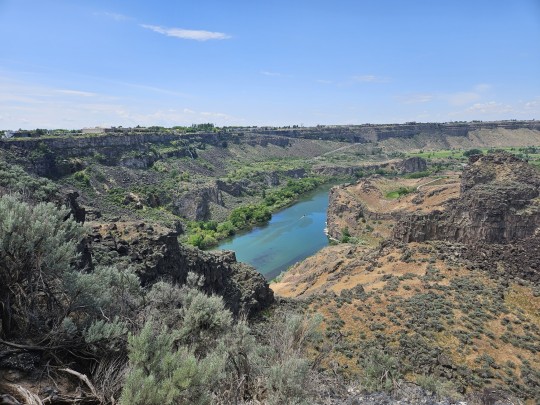
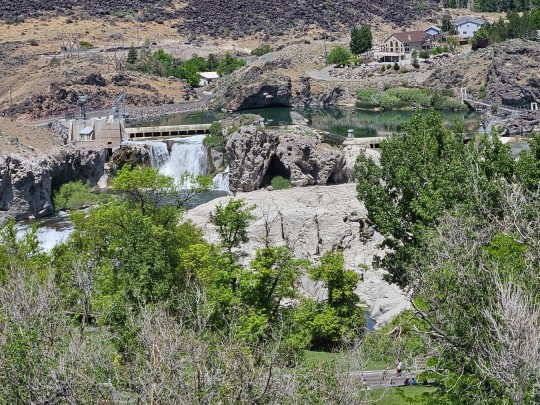


Of the two cities I visited, Twin Falls has a pop of 53,000, Elev. 3,734 ft and is known as the gateway to the Snake River. At its east end, there's Shoshone Falls and at its north Penine Coulee Falls.
Idaho Falls is a city of 66,000, Elev 4,705 ft, and is the commercial, cultural, and healthcare center for eastern Idaho, western Wyoming, and Southern Montana.
I took the scenic route between the two along US 26 and US 20, which took me past the Craters of the Moon, a 600 sq mile lava field that is still regarded as active and likely to erupt again.
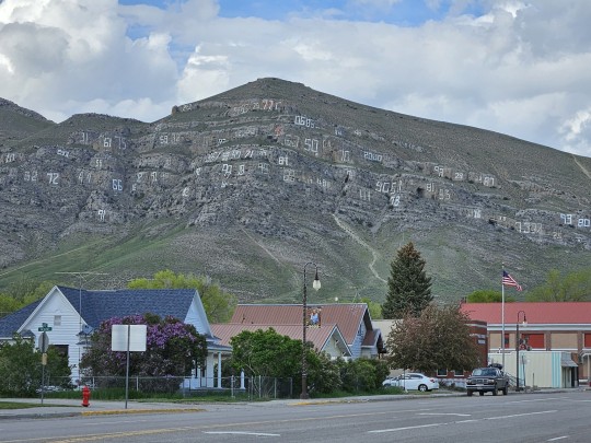
I also passed through Arco, apparently the first town in the world to be lighted by atomic power (1955) by the nearby atomic reactors of the 900 square mile Idaho National Laboratory nuclear testing and storage facility. It also sits beneath a mountain covered in the numbers of its graduating classes.
1 note
·
View note
Text
Day 4 Tues May 30, Idaho Falls, Idaho to Jackson Hole, Wyoming to Salt Lake City, Utah 675 km (including a 60 km detour).
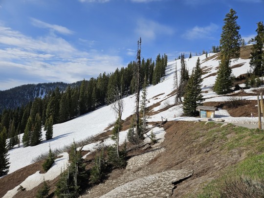
No Interstates today. Rode US 26 the 160 km from Idaho into Wyoming to Jackson Hole. Beautiful climbs and descent on the Teton mountain roads. Found the dynamic setting on my bike. Hooray!
Leaving Jackson via US 26 and US 89 to Evanston. More screaming descents and winding mountain roads. Started to rain shortly after leaving Jackson. Found the rain setting on the bike. More hooray!
From Evanston, I tried to take US 150 to Salt Lake City over Mt Agassiz. 12,428 ft, forget about it. I had to turn back after 30 km, thus my 60 km detour.
My bike settings weren't the only thing that got a workout today. The high mountain passes were cool to cold, but descending down into Salt Lake City, it got very hot. The city is located in a large valley, the Salt Lake Valley, separated by the eastern Wasatch Mountains, a subrange of the Rocky Mountains, and the Oquirrh Mountains to the west.
All in all a great day. Looking forward to Winnemucca, Nevada tomorrow.


Anticipating more low dessert conditions, I am going to miss those distant cloud capped mountains and all those snow capped peaks and verdant green vallleys that I've been seeing for the past two days.

1 note
·
View note
Text
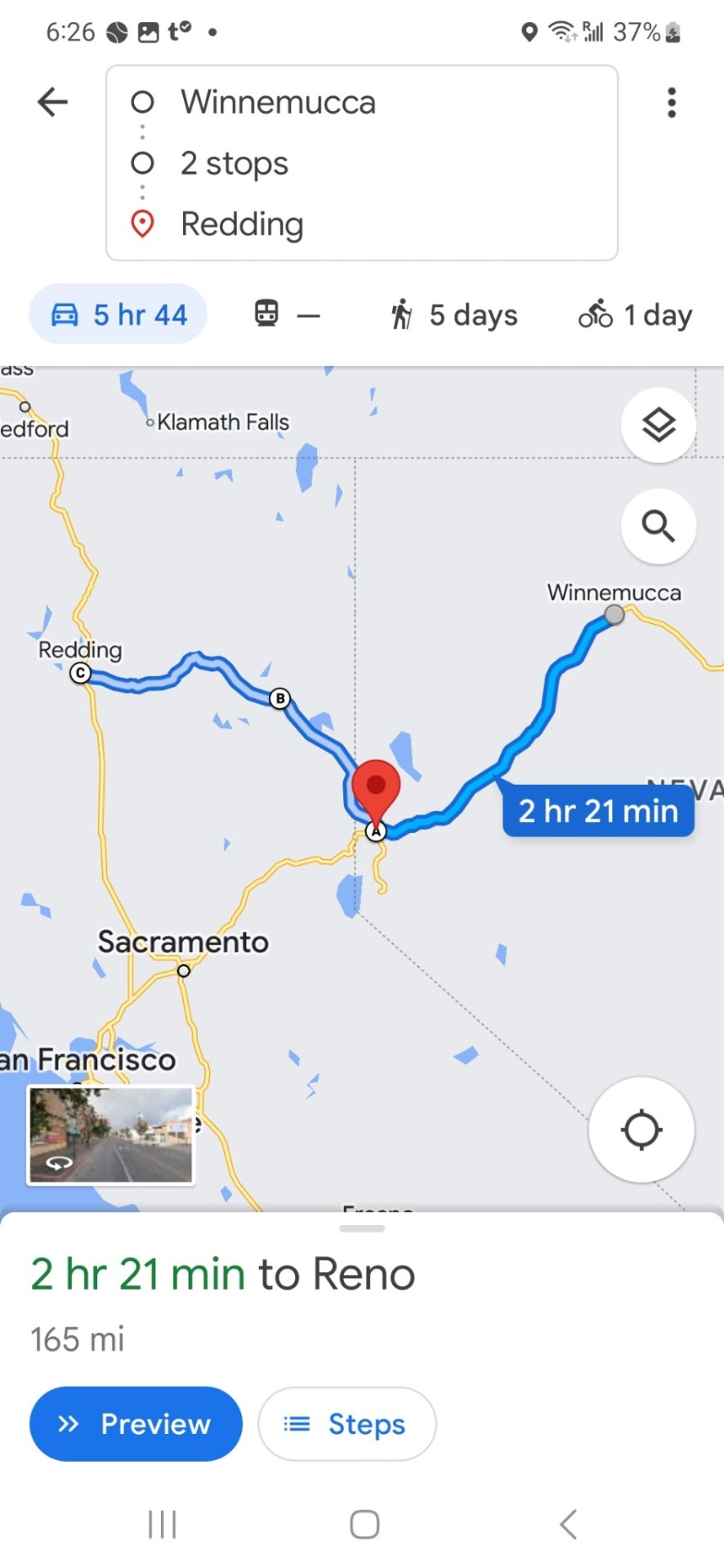
Day 5 Wed. May 31. Salt Lake City to Wendover to Elko to Wimmemucca, 600 km.
Great Salt Lake is the largest saltwater lake in the Western Hemisphere and the eighth-largest terminal lake in the world. Terminal means, although it has three rivers feeding into it, it has no outlet other than evaporation. The result is a briny body of water, saltier than the ocean. The results can be seen and felt all the way to the Nevada border.
When I woke up this morning, I thought I was in Phoenix. A hot, dry desert city surrounded by mountains.
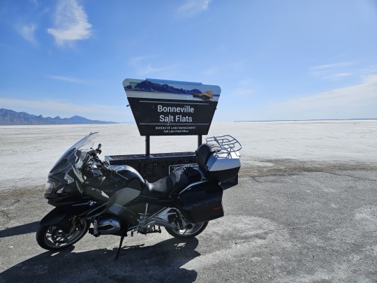
As I drove west to Nevada, however, I saw something I had never seen before. Briny sand and stretching salt flats all the way to the border. Just before reaching Nevada I visited the Bonneyville salt flats raceway where so many land speed records have been set. I couldn't resist, I rode most of the way back at 200 kph.
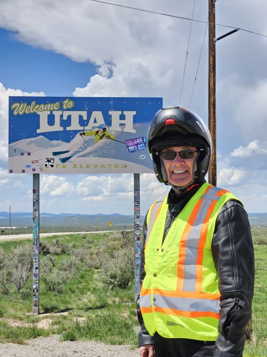
I missed the Welcome to Nevada sign because I stopped into Wendover, Utah for gas. Crossing into West Wendover, Nevada, it was immediately obvious I was in Nevada. Population 4,492, five casinos - and one enterprising pawn shop, although by the look of the sign and the parking lot, it is having a slow month. And even the gas stations have slot machines.
As you hit Nevada, the elevation starts to rise as you climb the Pilot mountain range. I finally made it through a mountain pass today at the Pequop Summit 6,960 ft., nearly 3,000 ft higher than Salt Lake City. The result is much more greenery and comfortably cooler temperatures.
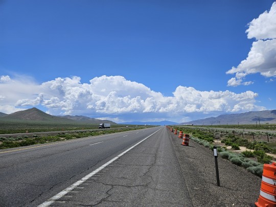
Unfortunately, there is no other way here from there than via Interstate 80. Long, a little monotonous, an 80 mph speed limit, and way too many trucks. But all ended well in Winnemucca, population 8, 431, to a cold beer and a beautiful desert sunset.


4 notes
·
View notes
Text
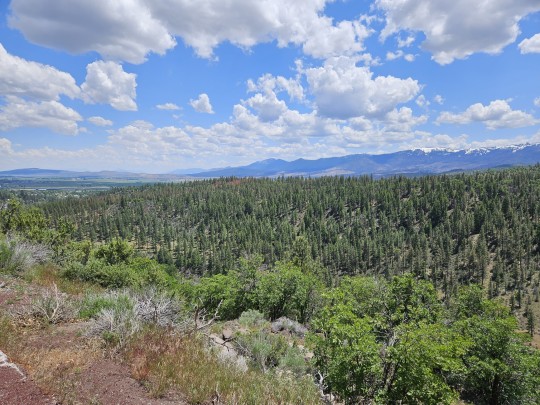
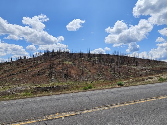
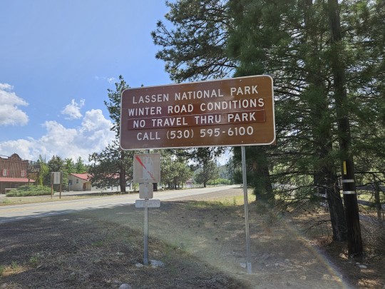
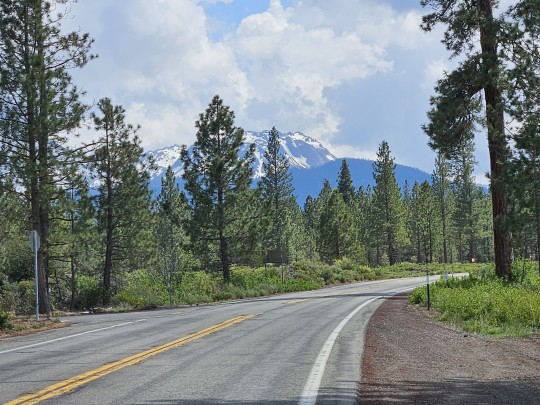
Day 6: Thursday, June 1 - Winnemucca, Nevada to Reno to Susanville, California to Redding. 643 km. Left Wiinemucca (pop 8431, elev 4295') at 7:00 AM and rode I 84 to Reno to visit with my friends Guy and Pat. Did I mention the speed limit here is 80 mph. Got there by 10:00 with almost half my days mileage under my belt. On the way, lots more dessert scrubbrush and scattered ranches. I am constantly amazed how people carve a living out of this topography. As for Reno (pop 265,000, elev 4,505', casinos, tourism and tech.), there's no friends like old (biking) friends. Thanks, Guy and Pat, for an awesome visit. And for the afternoon route tips. Took off for California through the High Eastern Sierra Nevada Foothills on Nev 395 and 44 through Susanville to Redding. As you climb, it gets cooler, wetter, and greener, and you see lots more farms and ranches. Also, there are lots more snow-capped mountains, lakes, trees, and rivers. And unfortunately, signs of forest fires. My ride topped out in Lassen Volcanic National Park (tops out at 10,460') where, fortunately, this time, there was a ride around my third closed off road over a mountain peak.


1 note
·
View note
Text
Day 7 Friday, June 2: Russell Saddle Company, then Lake Shasta, California. to Lodi, California via Sacramento. 380 kms
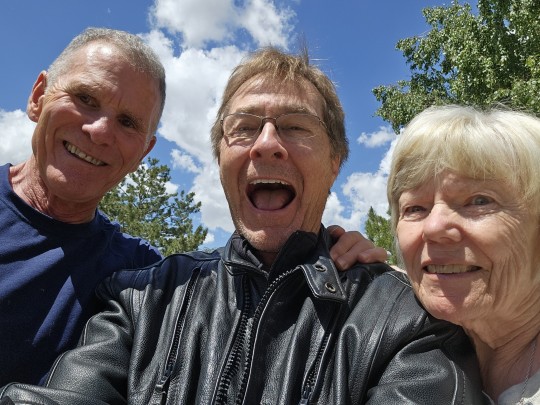
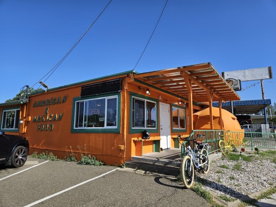
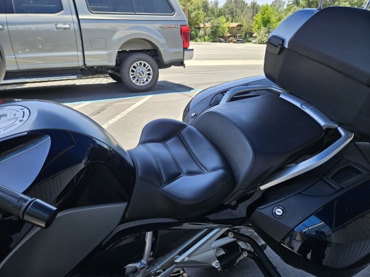
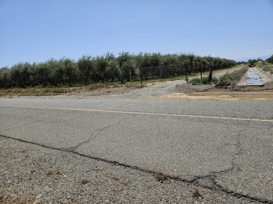
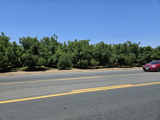
Started day 8:00 AM at the Mecca of motorcycle saddles - Russell Day Long Saddlery. Goodbye to the old and hello to the new. Worked with Mike to make my custom saddle. Took about six hours (including breakfast at the Big Orange) and was ready to hit the road to see my friends Don and Ginny in Lodi, South of Sacramento. The route down I 5 is through the mid valley, so it's hot. And incredibly fertile. Compared to the salt flats in Utah and the scrub brush in Nevada, the route was lined with fruit trees (cheeries, plums, apricots, peaches, and olives, with rice paddies and every kind of vegetable. On top of that, colorful flower bushes line the central median for mile after mile and the coastal mountains trace your ride on the western horizon. Sacramento (pop 525,000) is the capital of California and the 6th largest city in the state. It has lots of traffic and that's all I'm going to say about that. Had a great dinner with Don, Ginny, and friends and got lots of help planning my next two days' routes. Hint - Death Valley is out. Simply too hot this time of year - 38° tomorrow. Will go around it over the mountains instead.


1 note
·
View note
Text
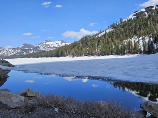
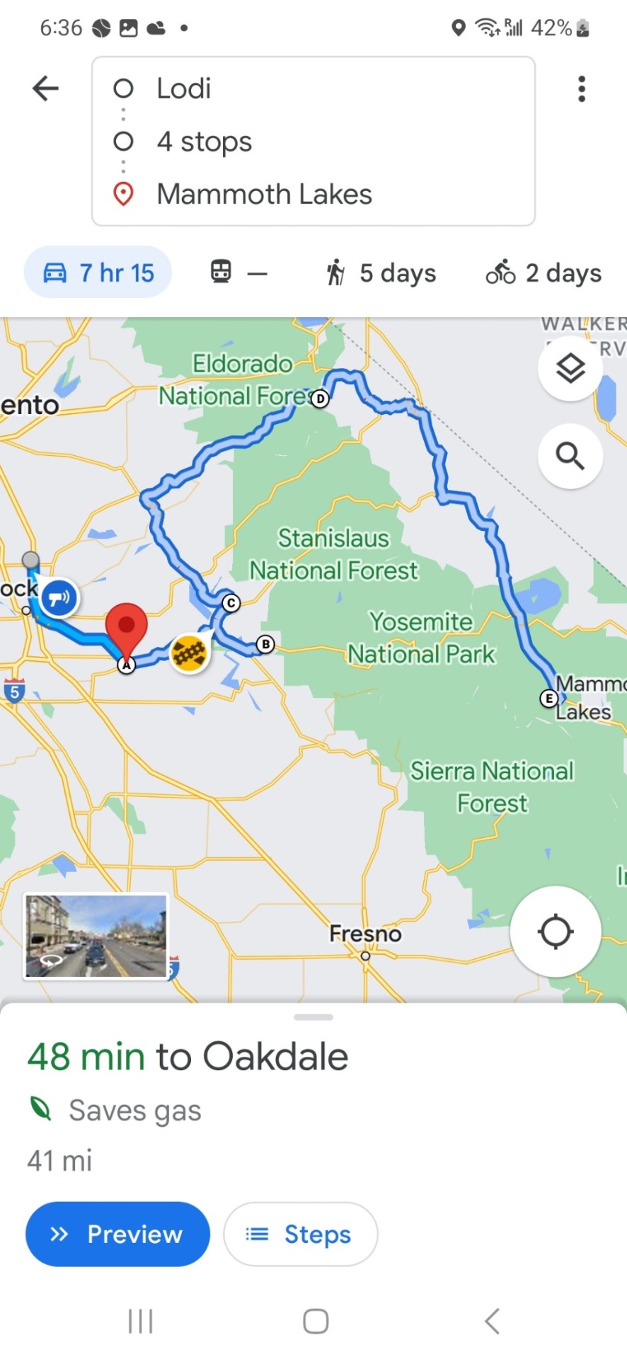
Day 8, Sat June 3, Lodi to Pleasanton to Yosemite/Carson Pass to Mammoth Lakes 566 km
Started my day with an espresso at Don + Ginny's in Lodi, then took back roads (12 + 160) to Rio Vista and Pleasanton to visit Mike and Lou. For much of the route, I thought I was back home in the Niagara Fruit Belt as I was surrounded by cherries, grapes, strawberries, and nectarines.
Mke had ordered me a quad lock for my new phone, so I was able to hook it back up to the bike. Separation anxiety problem solved.
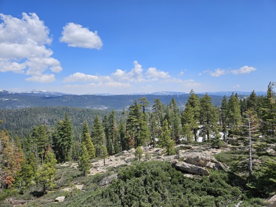
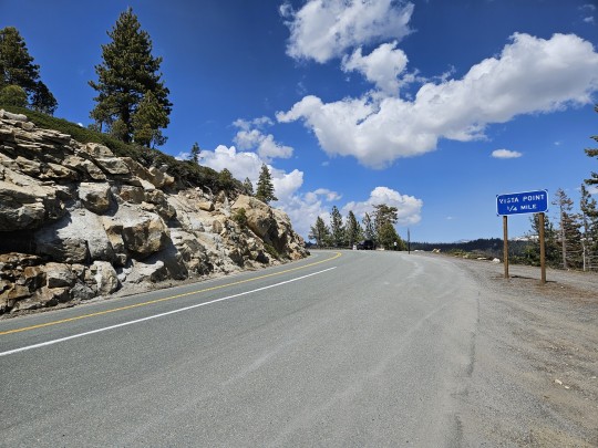
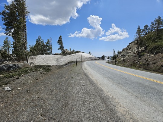
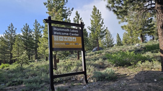
Mike and Lou also helped me plot a route through Yosemite. Tioga (120) was closed, and Sonora (108) was closed, so I had to head north all the way to Carson Pass (88/89) to get through. As you climb to 8,000 ft., the cherry and walnut trees hidden behind oleander hedges fall away and are replaced by ranches, snow lined roads and snow capped mountains and beautiful mountain rivers, and lakes. On the way, I passed Lake Tahoe as I headed to Mammoth Lakes, the ski town (elev 7,881 ft ) at the foot of Mammoth Ski Resort.


1 note
·
View note
Text
Day 9, Sun June 4: Mammoth Lakes to Lone Pine to Darwin, California to Death Valley to Pahrump, Nevada to Las Vegas, 560 km
Day starts in Mammoth Lakes, 8,861 ft and 48°F at the foot of Mammoth Ski Hill (11,053 ft). As I head steadily eastward to Darwin and Death Valley, the elevation falls, and the temperature climbs.
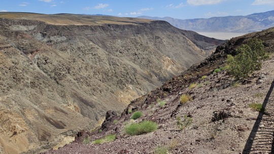
A reminder in Lone Pine of why we can't overly rely on technology and need to retain our reasoning skills (kids, learn those multiplication tables). The road from Lone Pine to Darwin is washed out. No problem, garmin has the answer, the Lone Pine narrow gauge road. As it turns out, calling it a road is a stretch, and calling it an alternative route is a fail as it too is flooded out. It quickly goes from broken pavement to sand, washboard, and pot holes. I am lucky that I have ridden road, mountain, and gravel bikes for so long. Anything less, and I would have gone down one, two or three times. And, of course, I get lost. I kept thinking of the cave divers that carried out the Thailand cave rescue. Don't panic. I figure it out and find my way back to the road and an alternative route. But I am hot, tired, filthy with dust, and two hours behind schedule.
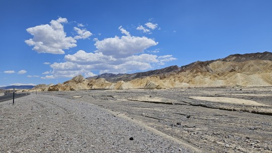
I do make it to Death Valley and begin the descent. 8000 to 6000 to 2000 to -190 ft and 48°F to 110°F. Welcome to hell. Even with paved roads carved out through the harsh landsape, it was an ordeal. How the hell did the homesteaders in covered wagons with no such roads make it through? Unimaginable.
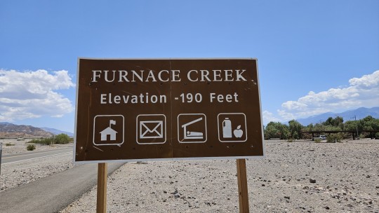
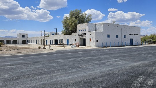
I make it through to through Stove Pipe Wells to Furnace Creek to Death Valley Junction, the latter which is essentially a ghost town. No stores, no gas, no services, no people. Just an Opera House that is closed for temporary (permanent?) renovations.
I hit Nevada at Pahrump (pop. 38,390, elev. 2,697 ft). The road from there to Las Vegas is typical Salt Lake City, Phoenix, desert valley city routine. Harsh, hot, and dry desert valley highway with distant hills in the background. I arrive in Las Vegas to discover I have inadvertently booked a motel on the strip, with a pool. I wash the dust and dirt off my bike, my clothes, jump into the pool and have a cold beer or three (plus some Tequila compliments of my neighbours) at the Taps Bar in the MGM Grand on the nearby strip.
It's been a long, hot, dusty, adventurous day. I am definitely ready for the sack


1 note
·
View note
Text
Day 10, Mon June 5: Las Vegas to Kingman to Seligman to Williams to Grand Canyon to Flagstaff. 632 km
I start an hour earlier today at 6:00 AM to beat traffic and the desert heat and head south for 200 km from Vegas on I 95 then swing east to Kingman and the start of Route 66. I miss the Welcome to Arizona sign in Laughlin, so the picture of me having breakfast in Kingman, Arizona will have to do.
It's hard to believe that before the Interstate 40 was built in 1984 that Route 66 was the major highway between Chicago and Los Angeles. Lots of old replica gas stations and police cars and Burma Shave ads can be seen along the way to remind you of its history. The next stop is Seligman, another major stopping point along Route 66. From 2,001 ft in Vegas to 3,333 ft in Kingman, it is clear that at 5,243 ft in Seligman we are gradually climbing our way to the Grand Canyon (6,804 ft) and Flagstaff (6,909 ft).
Between Seligman and the Grand Canyon, I must first pass through Williams (6,765 ft), which is the Grand Canyon's equivalent of Sunshine's Banff, or Mammoth Ski resort's Mammoth Lakes. It is hard to believe, viewing the vastness of the Grand Canyon, that it was created by the small glimpse that you can see of the Colorado River far below.
The ride from the canyon to Flagstaff is scenic forests and comfortable temperatures given the elevation. One intriguing feature is the many blackened tree trunks. This is caused not by forest fires but by controlled burns that the forest service aggressively carries out, as ridding a forest of dead leaves, tree limbs, and other debris helps prevent destructive wildfires.
Upon reaching Flagstaff, I find once again that my motel has a pool. It's been a long day - it's going to be good.


1 note
·
View note
Text
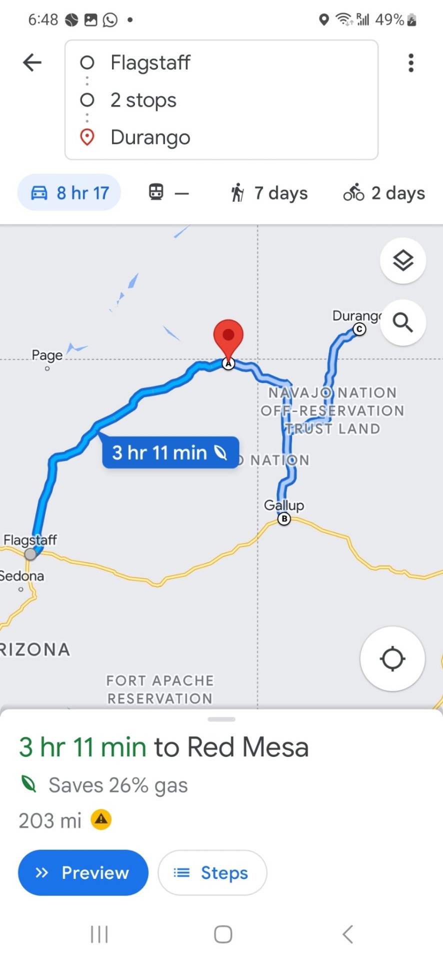
Day 11, Tues June 6: Flagstaff Arizona, Navajo Territories, Gallup New Mexico, and Durango Colorado. 565 km
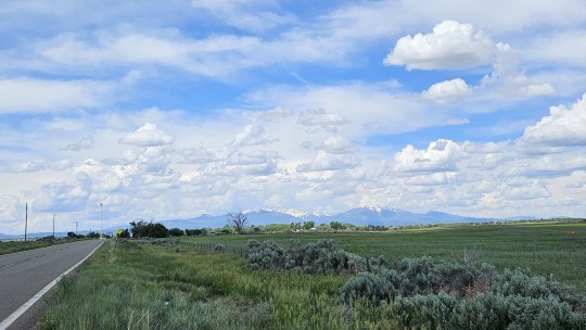
Route 66 intertwines with the Interstate 40 east of Flagstaff, so I turn to Garmin for some back roads. I end up taking the Leupp Road and Hwy 264 through the Navajo Territories. What a morning, what an experience. The Navajo Territories cover 27, 500 square miles over Arizona, Colorado, Nevada, and New Mexico. Unbelievable clouds, scenery, buttes, mesas, and hard dessert landscapes. You have to be tough to carve out a living here. There is so much remoteness, some areas with no power, just a tough, vast, beautiful landscape.
Another early start, I make it to Gallup, New Mexico, in four hours. Arizona does not observe DST. The Navajo Nation, however, does so it caught up with me today and cost me an added hour, so I get there just before noon.
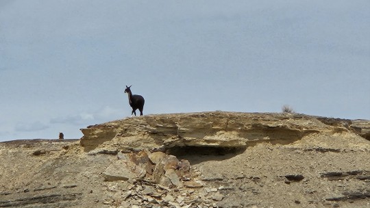
The ride north from New Mexico to Colorado on Hwys 491, 371, and 140 again take me through the Navajo Territories. On the way, I pass herds of horses, sheep, and cows and one classic shot of a male Llama standing on a butte looking over his herd. And over head, the beautiful New Mexico sky.
As I traveled north, I start seeing more irrigation and greenery, enabled in part by perhaps better soil but almost certainly by the higher elevation and cooler temperatures.
As I pass into Colorade (no welcome to Colorado sign, just to the Southern Ute Indian Reservation), the climb continues. No irrigation here. Colorado is just naturally higher, cooler, wetter, and greener.
Beautiful green mountains and valleys, along with distant snow-capped mountains, tell me I have definitely left the desert and entered the highland region.
As I come back from dinner, the clouds start to darken. It's been a long day, and I turn in, to the sound of falling rain.


2 notes
·
View notes
Text
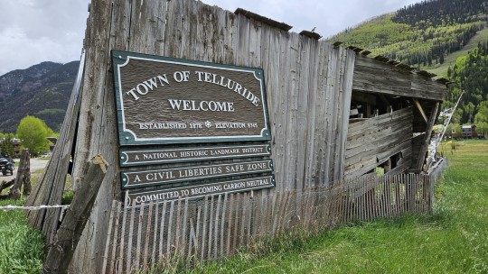
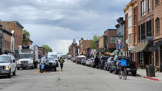
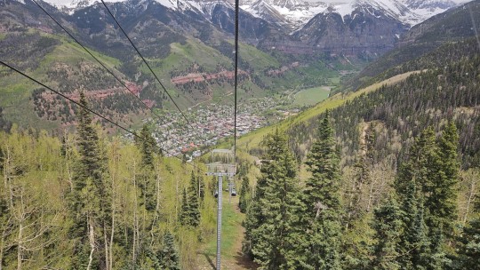
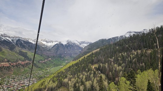
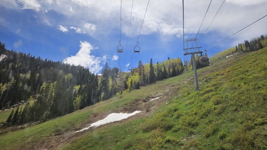
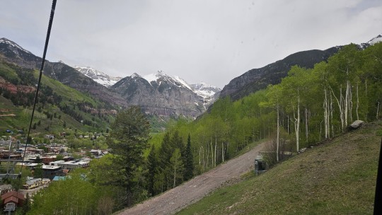
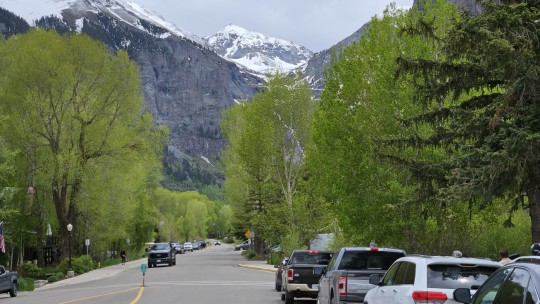
Telluride, what a place. OMG. Nestled in the San Juan Mountains at 8,750', pop 2,595, a spectacular ski resort rounding out at 10,500', the ambiance, the views and the scenery are simply stunning. Telluride is linked to Mountain Village by a spectacular 13-minute gondola ride. Telluride is the "Banff" and Mountain Village the "Sunshine Village" to the adjacent ski resort.


1 note
·
View note
Text
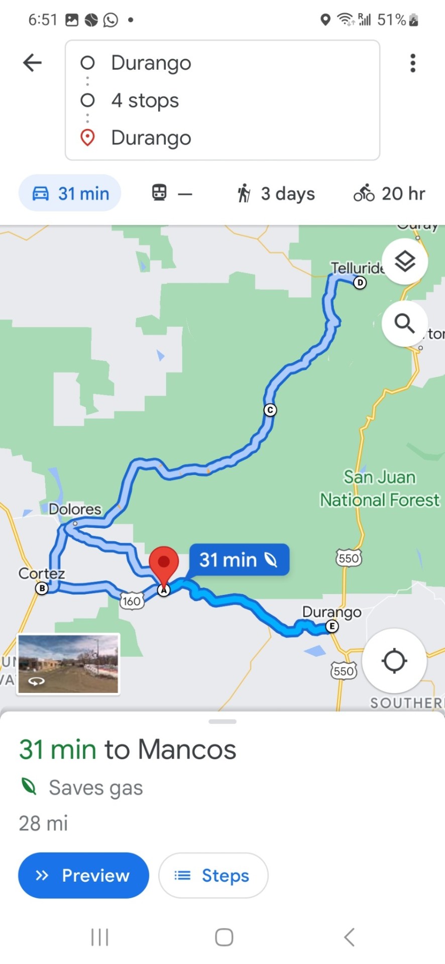
Day 12, Mon June 8: Durango to Mancos to Cortez to Rico to Telluride and back, 366 km
My hotel serves breakfast, so I get to talk to some of the locals. As a result, I switch Telluride from a sidebar on tomorrow's ride to a full day trip today. Right choice. It turned out to be a spectacular day.
Durango sits at 6,522', pop 19,223 and is surrounded by massive mountains (San Juan range of the Rocky Mtns), unbeatable skiing and an historic small gauge railway, a vestige of its silver mining days.
I head out on Hwy 180 to Mancos (7,020', pop 1,221), the gateway to Mesa Verde National Park, home to 4,700 archeological sites and 600 cliff dwellings.
I pass through to Cortez (6,191', pop 8,855) located at the corners of Arizona, Colorado, New Mexico, and Utah.
From.there, I turn north on Hwy 145 to Rico (8,825', pop 347), obviously now a mere shadow from its silver mining heyday. With the elevation climb comes lower temperatures and rain. I find a sheltered awning and scramble beneath to put on my warm clothing and rain gear. As all bikers will attest, there is no such thing as bad weather, just bad clothing choices. Well, almost, as I pull out of Rico, the hail starts. It's not good on a sports bike. I consider turning around, but it drops off, only to start hailing again 15 minutes later as I climb higher towards Telluride. I white knuckle onwards, too close now to turn back.
It turns out to be the right decision. I explore my way through Telluride, then ride over to Mountain Village to catch the gondola ride over the top of the mountain back to Telluride. As it starts raining, I eat lunch on the gondola, enjoy the scenery, and look at the black clouds rolling in. Rather than linger when I get back, I head straight back, kit up, and get on the bike. Within minutes, the hail starts up again. It lasts about 20 minutes, bouncing off my helmet and smashing my knuckles, but finally, I make it back to the lower elevation of Rico where it turns to just plain rain.
Other than the stunning scenery and the winding roads, the trip back after that is comparatively peaceful. I celebrate by stopping in to explore and have dinner in Durango.
Someone was smiling down on me today. A spectacular ride, awesome scenery, a safe return, and $3.00 beer night in Durango. Life is good.


2 notes
·
View notes
Text
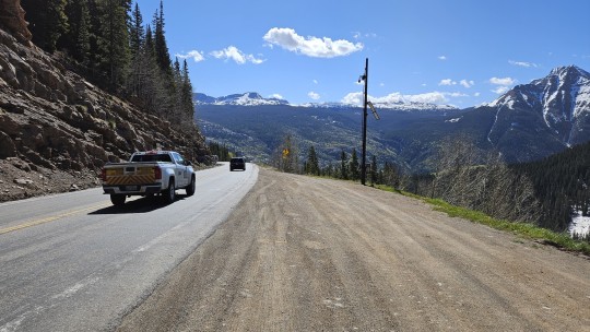
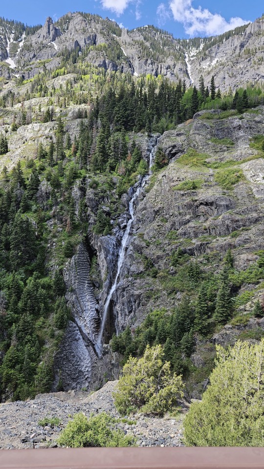
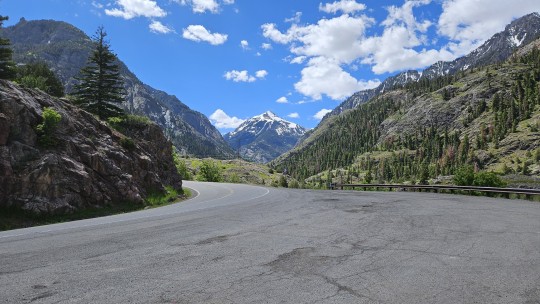
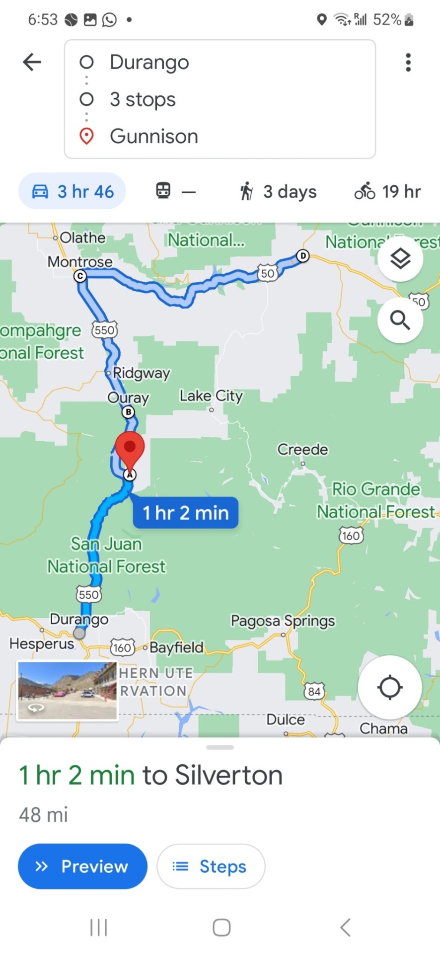
Day 13, Thursday June 8: Durango to Silverton to Ouray to Montrose via Hwy 550, then via 50 to Gunnison. 330 km
I'll be riding over the San Juan Mountains via the Million Dollar Highway today. At 6,522 ft, the road from Durango is a typical river valley, lush and green farms and ranches on the right and on the left, red hilltops, stained by the iron in the soil.
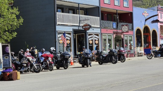
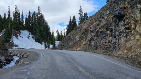
As I start the climb to Silverton (9,318', pop 651), the air gets typically cooler, the hills turn to mountains, and the scenery from lush to spectacular. Silverton was a booming silver mining area back in 1860 but is now mostly a cute and charming tourist town that lays claim to the world's highest Harley Davidson shop.
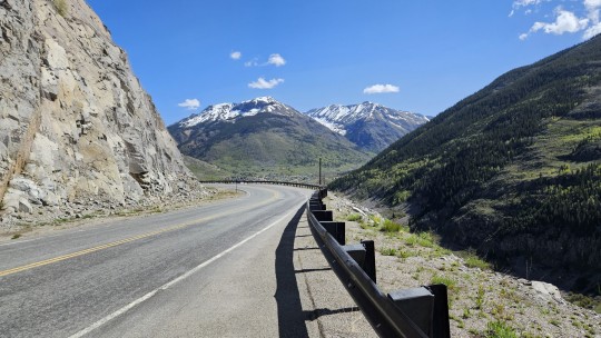
From Silverton, I pick up the section of Hwy 550 known as the Million Dollar Highway. Although the name could legitimately be attributed to the views, it actually stems from the cost. Originally constructed as a toll road by Otto Mears in 1883 to transport minerals, it was to rebuilt in the early 1920s at a purported cost of one million dollars per mile. Its twists, winds, climbs, and descents are both an engineering marvel and a dream to ride. To enable the snow plows to clear all the snow, much of the route has no guardrails, which partially explains why it has also been called America's most dangerous highway. It's also a long way down. Between Silverton and Ouray, I ride over the red mountain pass at 11,018'.
Ouray (7,792', pop 921) was once home to over 30 active mines. Today, its climate, natural alpine environment, and scenery have earned it the nickname "Switzerland of America".
My final leg of Hwy 550 takes me north to Montrose (5,807', pop 20,648), the county seat of Montrose County. Back down from the mountains, it's essentially lower, flatter, hotter, and dryer.
But not for long. As I head east on Hwy 50 towards Gunnison (7,703', pop 6,695) I climb up through the natural playgrounds for fishing, skiing, hiking, biking, motocross, boating and rock climbing, for which this area is known including the Gunnison River, Tomichi Creek and Blue Mesa Reservoir, Curecanti National Recreation Area, Tomichi State Wildlife Area, Sapinero State Wildlife Area, McIntosh State Wildlife Area, and Hartman Rocks.
It's been a short but taxing ride and a long day. Luckily, my hotel has a hot tub, so a long spell there, followed by a couple of local craft beers, I think I see an early bedtime in my future.


2 notes
·
View notes
Text
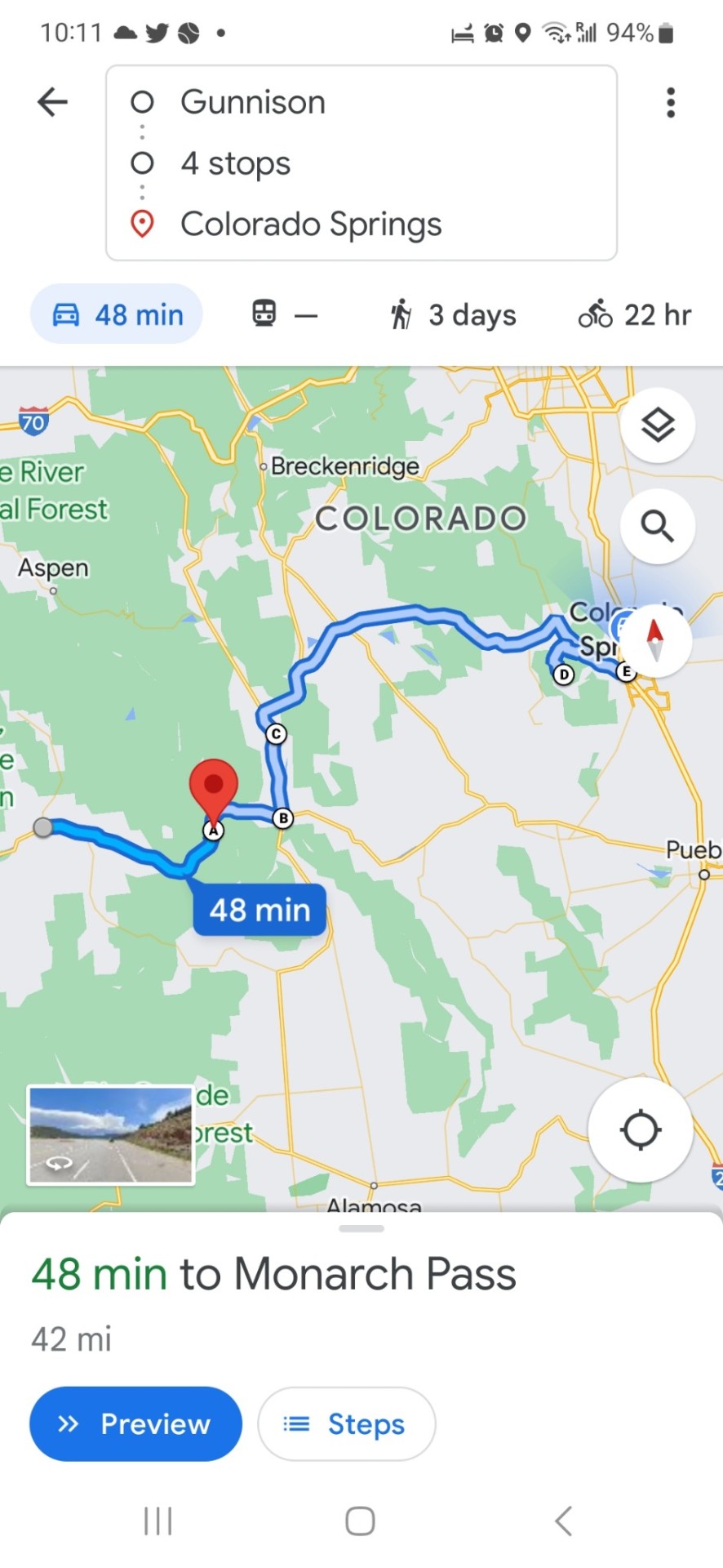
Day 14, Friday June 9: Gunnison to Poncha Springs to Nathrop to Pikes Peak to Colorado Springs 338 km
Today will be all about climbing. As I leave Gunnison at 7,700', I am surrounded by typical mountain valley geography, beautiful rich river valleys on one side, and again backed by low hills on the other.
I head east on Hwy 50 for Poncha Springs. It is there that I will swing north and east on Hwy 285 towards my final destination of Colorado Springs.
While the route starts out flat, that changes quickly. In order to reach Poncha Springs I have to go over the Monarch Pass at 11,312'. It is a gorgeous climb followed by an equally gorgeous descentvas Poncha Springs is actually 200' lower than Gunnison.
The ride on 285 to Nathrop is relatively level as it takes me to the junction of Hwys 285 and 24. If I turn north on Hwy 24, I will be going to Leadville. I turn east owever as I am headed for Pikes Peak.
As I continue on to the base of Pikes Peak, the elevation remains relatively constant except for now a relatively routine climb over Wilerson pass at 9,507'. Much of the ride I am surrounded by rich mountain meadows, expansive ranches, and contented looking range cattle.
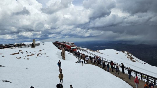
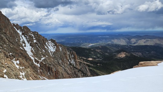
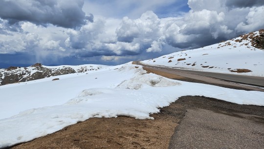
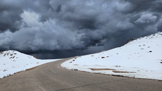
I arrive at the base of Pikes Peak at only 6,400' with a dense cover of threatening black clouds overhead. As I pay my entry fee, I ask what I am in for. The advice I get is " you best hurry up".
I had no real appreciation of what I was in for. I am about to climb almost 7,800 vertical feet (that's 1.5 vertical miles) over 19 miles.
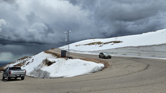
It starts out innocuous enough for the first 2,500' looking like a typical forest mountain road. But as you start to get above the treeline, its true personality becomes apparently - high, steep, windy and cold, with no guard rails.
The guard station near the 11,500' mark is there to tell you to turn back or that you can continue, based upon conditions. It also checks everyone's brakes with a heat gun on the way back down and makes you pull over if they are too hot.
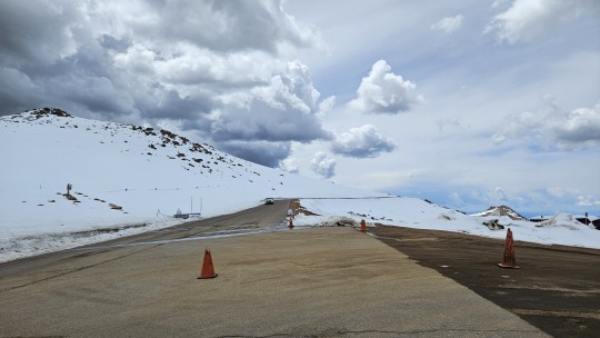
If you can't drive, there is actually a trolley that you can take instead. I make it through and continue to the top. What I didn't anticipate was how the altitude would affect me. I am lightheaded, and I definitely slow it down. One wrong move on this mountain, and there are no second chances.
I do make it through, but I am awestruck. It started raining on the way down, and I ride into Colorado Springs in a downpour.
I am too tired to care. Colorado Springs is a city of 484,000 at 5,994', best known for Garden of the Gods, a massive National Natural Landmark with a biodiversity that sprawls from the grasslands up into the mountains and a popular national playground. But my bike is overheating, I'm wet and tired, and I just want to find my hotel, book a service call for tomorrow morning, drink some cold beer, and rest.
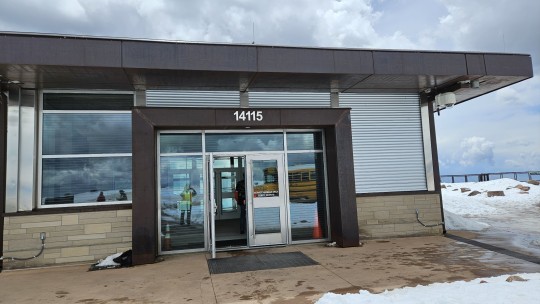
Meanwhile, Pikes Peak, what can I say? Simply mad ass. 14,115' of extreme elevation, steep grades, cutbacks, hairpins, snow, storm clouds, and rain. What a white knuckled blast.


1 note
·
View note
Text
Day 15, Sat June 10: Colorado Springs, Colorado to Raton, New Mexico to Texline, Texas to Amarillo, Texas. 582 km
Well, it's back to Route 66 today as I end my day in one of the infamous route's signature towns - Amarillo, Texas.
But first, I start my day at 8:00 AM at the BMW dealer. It's been 8,000 km of very hard riding, so I think the bike has earned an oil change, top up the fluids, and a tire check. All good, I hit the road at 10:00.
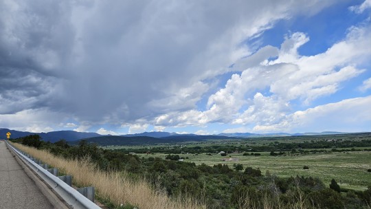
Colorado really is something special. Once again, green fields on my right with mountains in the background, topped by stormy black clouds. And on my left, more rich green fields with blue skies and wispy white clouds. I never fully appreciated the impact of elevation on weather, lifestyle, and even people until this trip.
It's a late start and a long day, so I relent and take Interstate 25 to Raton, New Mexico. If I continue, I will end up in Las Vegas or Santa Fe, but I'm going to Texas, so I turn east on US 87.
Raton, a town of 7,835, was traditionally a stopping off point for travellers using the Santa Fe trail and Raton pass on their way through the Rocky Mountains but now serves mainly as the county seat of Colfax County.
US 87 takes me through the endless yellow and green grazing lands and beautiful blue smokies that typify this corner of New Mexico. Usually, the cattle are fairly sedentary, but I found out today they can actually run as I caught an afternoon glimpse of them today chasing the feed truck. Stampede!
Eventually, US 87 brings me to Texline and the Texas border. After climbing 600' to 6,680' in Raton, I have since fallen 2,000' to 4,692' in Texline. Again, with the higher the cooler and greener, and the lower the hotter and browner thing.
Other than being my gateway to the Texas panhandle, Texline pop 460 is just a quiet little town. What does surprise me, however, is how suddenly the topography changes. Still plenty of ranches and cattle but very noticeably more irrigation, greenery, and farming. It feels actively and well farmed.
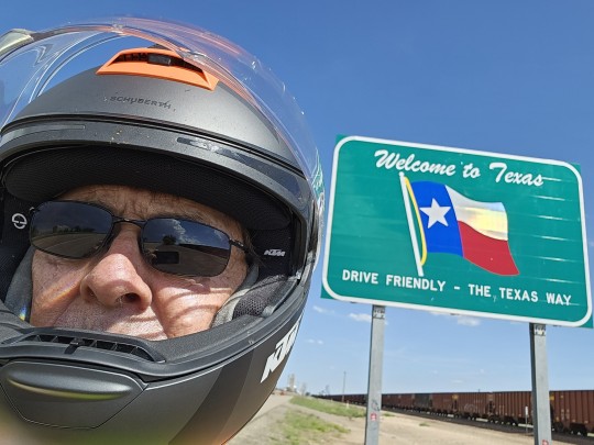
The final leg of my journey detours me through some back roads before rejoining US 87 for the descent into Amarillo (3,678', pop 201,234). Amarillo is the largest city in the Texas Panhandle and is a major meat packing center, nuclear weapons assembly and disassembly hub, and has brought me back to route 66


1 note
·
View note