Last Seen Blogs

stvrni0lojay
Stvrni0lojay 🦇

yixuanjiangbusinessofmedia
Yixuan Jiang| Business of Media

disneytva
Disney Television Animation News
ghozting
💐

jinxedjay
There's nothing left to worry about.
Photo
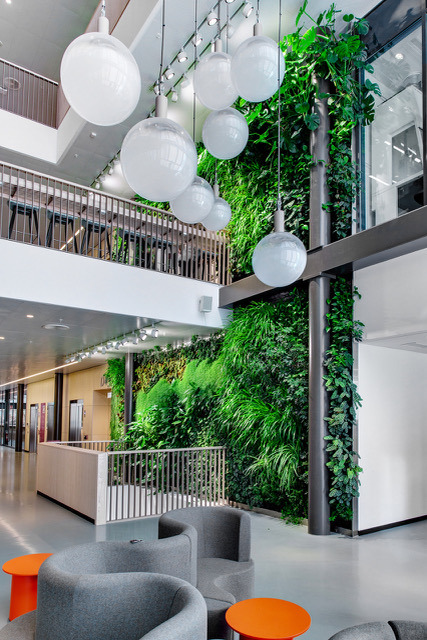


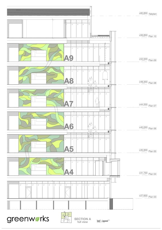

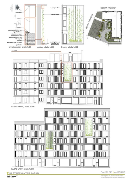
Living walls design and construction at Karolinska biomedicum
Project made in collaboration withDaniel Bell Landskap and Greenworks
< back to home
0 notes
Photo

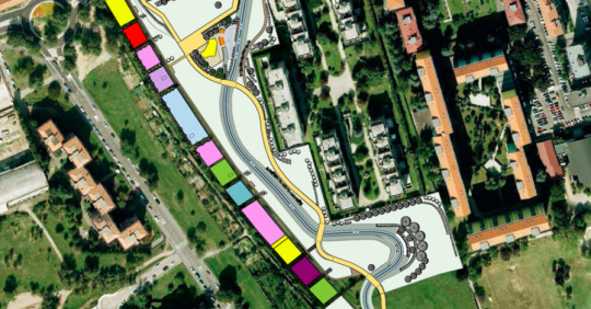

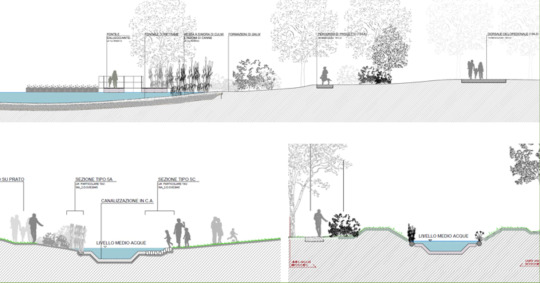

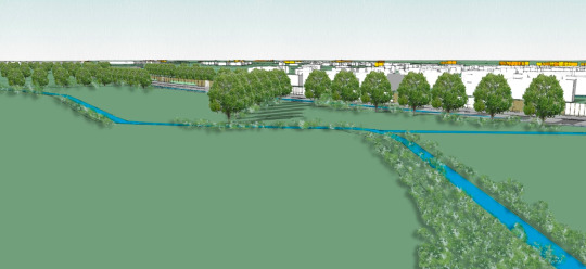
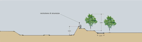
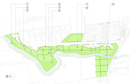
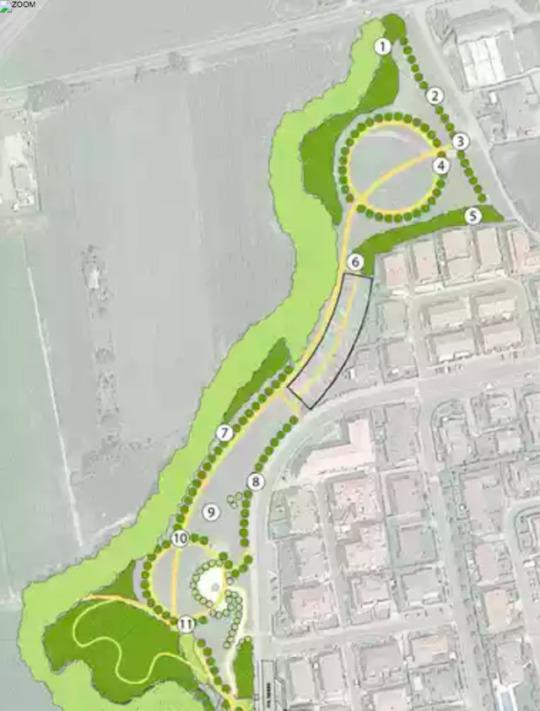
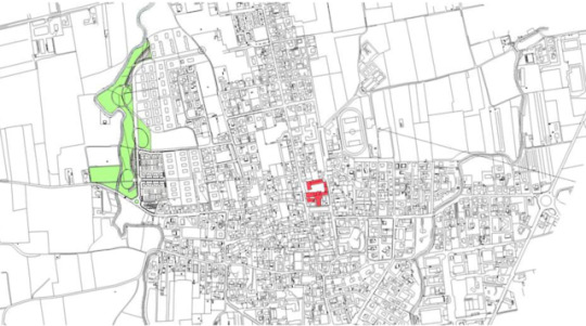
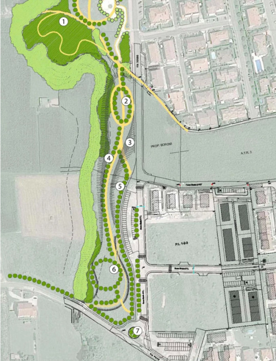
Le vie d’acqua, EXPO Milan 2025
La Via d'Acqua is an environmental landscape redevelopment project that is among the major projects of the 2015 Universal Exposition, configuring itself as a connection of the exhibition site with the territory that hosts it and an essential intervention for the functioning of the site itself: a hydraulic system and connection between the water system of the Villoresi Canal to the north and the water system of the Milan “Navigli” to the south.
A project of great landscape-environmental as well as hydraulic value, which develops from a derivation of the Villoresi canal along the Guisa, Lura and Olona valley systems up to the Expo site; from here, crossing the large parks of the western belt and also redeveloping a territorial system south of Milan, it enters the historic “Naviglio Grande”, in connection with the Darsena and the center of Milan. The route crosses the vast system of existing parks and protected areas, where they can find an ideal location and an opportunity for enhancement and dissemination also further achievements and testimonies relating to the theme of the Universal Exposition "Feeding the planet, energy for life".
The need to bring water to the exhibition site is combined with that of building a permanent irrigation infrastructure to serve the agricultural areas to the west and especially to the south of Milan; furthermore, the construction of the new canal becomes an opportunity to define new scenarios for the landscape and use of this territory, as well as for the promotion and enhancement of existing resources.
Via d’Acqua Sud - from the exhibition site to the Naviglio Grande - approximately 11.35 km of which 3.52 km are ducted and the remaining 7.83 km are open air. The contexts crossed vary landscapes from the dense urbanised fabrics area to the vast open spaces and agricultural horizons of the parks west of Milan (Trenno Park, Boscoincittà, Parco delle Cave). The canal in the long exposed sections becomes an opportunity to redraw urban spaces that are now little characterised or to enrich the vast urban parks it crosses, in others it helps to redefine and redevelop the boundary between urbanised (Baggio) and open spaces (Parco delle Cave) or to improve the environmental insertion of the Olona diverter. The service runway that runs alongside it does not coincide, if not for short stretches, with the main connecting route between Canale Villoresi, Expo Site and Naviglio Grande, but is nevertheless integrated with the existing and planned user networks.
Along the canal there are parks and areas with different characters: the Fontanile (a small lake), the Sorgente (a water square), the Pertini Park (with shady areas and a large salix structure), the Deviatore Park (with a thematic garden and water channels) and finally the area of San Cristoforo where the canal of the Via d'Acqua enters the Naviglio Grande and the cycle-pedestrian ridge connects with the itinerary along the Naviglio and the Via di Mezzo of the Parco delle Risaie.
Project made in collaboration with SAP and Gioia Gibelli
< back to home
0 notes
Photo


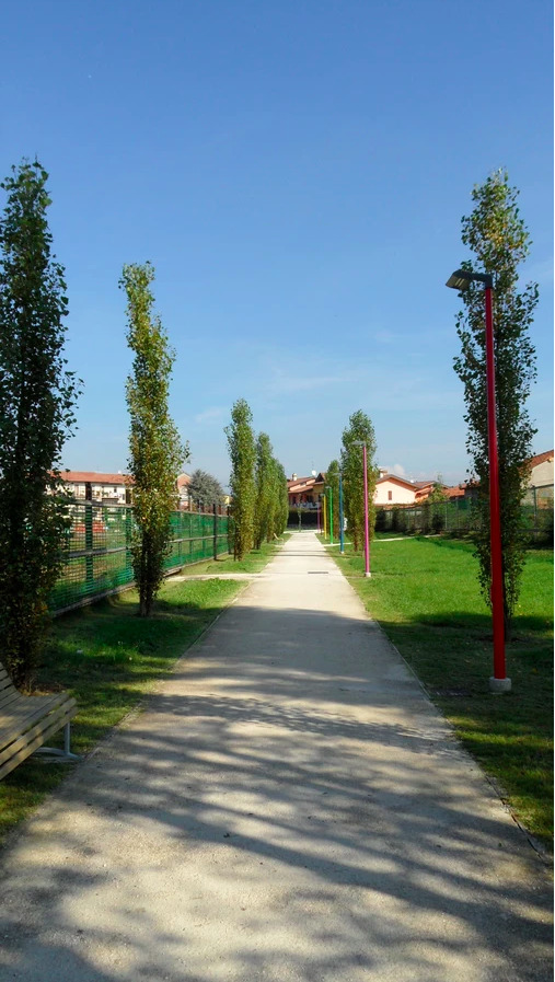
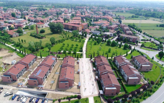
Park Lesina, Presezzo | Italy
Project made in collaboration with SAP
< back to home
0 notes
Photo

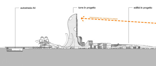
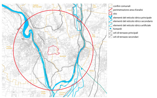


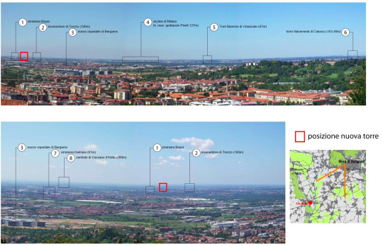

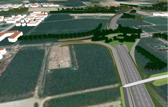
Leolandia amusement park, EIA, Capriate | Italy
This project analyses the landscape impact of the urban variation of Leolandia amusement park. The intervention in analysis consists of an overall redevelopment destined to the creation of a "village" (with hotel, conference center, shopping mall) and an amusement park with different types of attractions.
The analysis defined the landscape impact relevant but tolerable.
This conclusion implies the need of appropriate mitigation and compensation works. It is in fact planned to build a tower that will become a real landmark, the critical aspects of the landscape aspects are mainly linked to this, both on a local and on a super-local scale.
Project made in collaboration with SAP
< back to home
0 notes
Photo
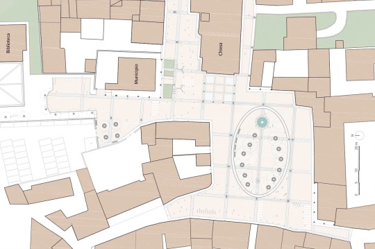
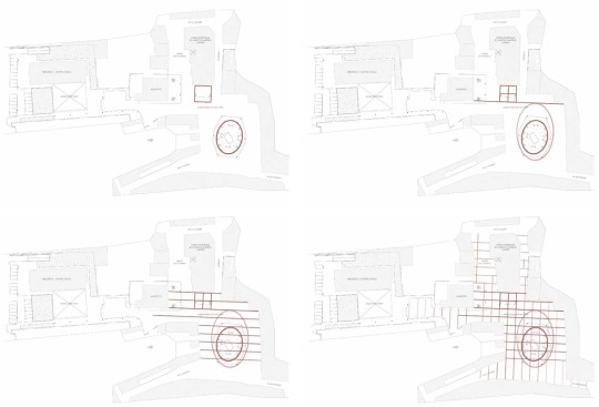

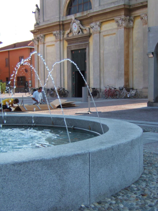

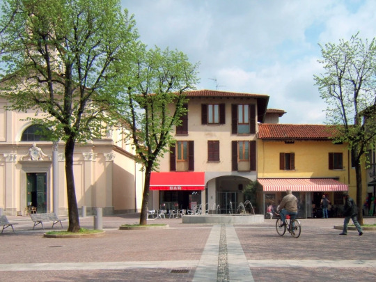

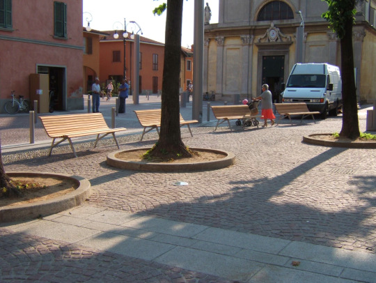
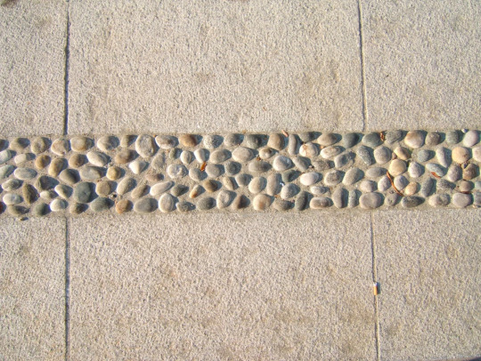
Renovation of the town main square, Ciserano | Italy
The project intends to respond to the need to bring the main square of the town back to purely pedestrian use, through a redevelopment operation of the furnishings and paving, previously mainly in asphalt and porphyry.
The project starts from the idea of a unified redevelopment of the town center. For this reason the project starts from considering necessary the creation of a regular grid, conceived starting from the size of the parvis of the parish church. The churchyard lends itself well to providing an extensible meter to adjoining spaces: in fact, it has a regular shape, attributable to a square, on which, moreover, the most valuable façade of the whole area looks out. Starting from the churchyard, therefore, the mesh is extending along regular paths, describing, in principle, squares of 12 by 12 meters. In reality, this grid then ends up adapting to different spaces, emphasizing privileged directions and axes.
The grid is physically defined by strips of white granite 1 meter wide; in some parts there are cast iron channels for collecting rainwater. The fields between the bands, on the other hand, are paved with red porphyry granite cubes.
Within the grid, a further geometric figure takes on particular importance: it is an ellipse, located right in the center of Piazza Papa Giovanni XXIII. The ellipse design, made of cobblestone, comes from the ideal extension of the raised "island" previously existing and characterized by the presence of a sort of lime trees groove. The design of the ellipse is intended to emphasize the importance of this element: some of the existing lime trees (the most external ones) are left in place while the innermost ones are cutted (the grove was too dense for a healthy development of all the specimens ).
In this ellipse, a complex consisting of two fountains is designed in place of the existing monument that has been removed. One of them is located in the far east of the ellipse and is characterized by an above-ground granite basin. In the center, the basin bears the base that holds a bronze monument; the monument, in turn, is bathed in jets which, starting from the perimeter, are directed towards the center.
The other fountain, located in the ellipse but on the opposite side, instead consists of a granite circle placed at the level of the pavement; jets of water emerge from this disk which, in fact, are the real elements that make up the fountain. The choice of this solution was dictated by the desire to create a reference to the idea of the fountains, present in the surrounding countryside, and a reference to their gushing out of the ground.
The two fountains are connected by a thin cobblestone strip: this material symbolically wants to remember a stream of water, as if born from the "fountain" the water itself reached the main fountain feeding it.
Project made in collaboration with SAP
< back to home
0 notes
Photo

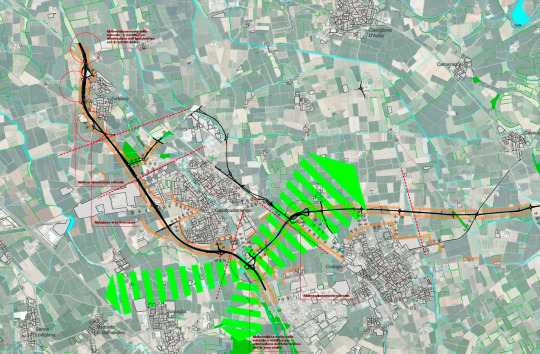


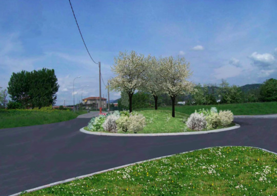
Analysis and mitigation of a new road, Casalpusterlengo | Italy
Project made in collaboration with SAP and Gioia Gibelli
< back to home
0 notes
Photo


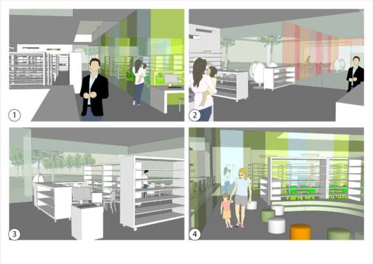
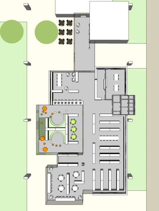
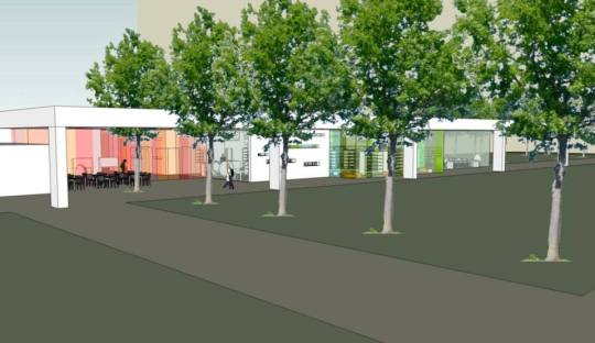

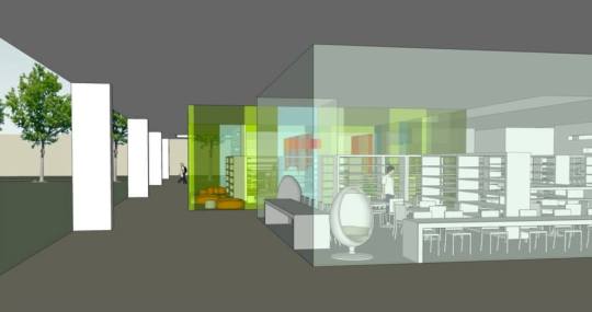

Park and library | Stezzano
Concept for a new public library with park
Project made in collaboration with SAP
< back to home
0 notes
Photo
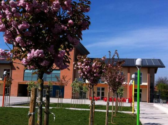


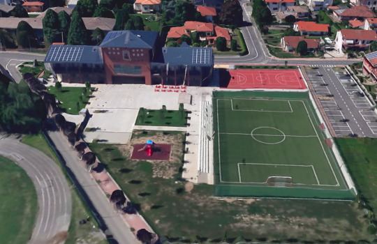
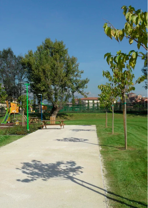
Youth center park | Bonate Sopra
The outdoor space of this youth center are designed to host several functions related to sports and conviviality.
There are:
- a large paved area for community party or dinners (that can be covered with a marquee)
- a football field
- a volleyball / basketball field
- a playground with slings and slope
- a vast lawn for free activities
Project made in collaboration with SAP
< back to home
0 notes
Photo


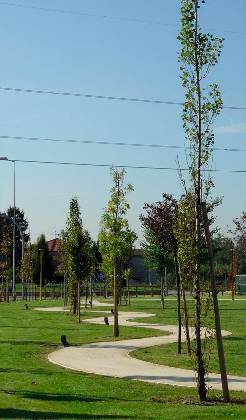
Dordo park | Bonate Sopra
The project concerns the construction of a park along the Dordo stream. The park area is located along the left bank of the stream in the municipality of Bonate Sopra (BG).
The proposed project involves the construction of a large linear park with a strong naturalistic value, typical of the surrounded area.
The project uses three simple elements typical of the local landscape: tree-lined rows, small woodlands and white roads.
These elements are composed together creating the design of the park itself.
The project intervention in addition to re-naturalise the suburban area along the torrent draws the urban margin by mitigating and resolving the current rupture between the countryside and urbanised areas.
The natural connotation of the entire park allows to minimise maintenance and the relative management costs, this is due to the presence of spontaneous meadows, arboreal rows and wooded areas that require minimal care.
Project made in collaboration with SAP
< back to home
0 notes
Photo
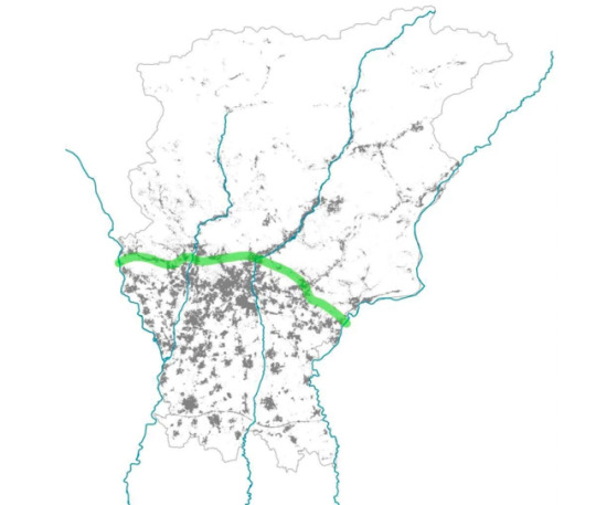
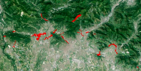

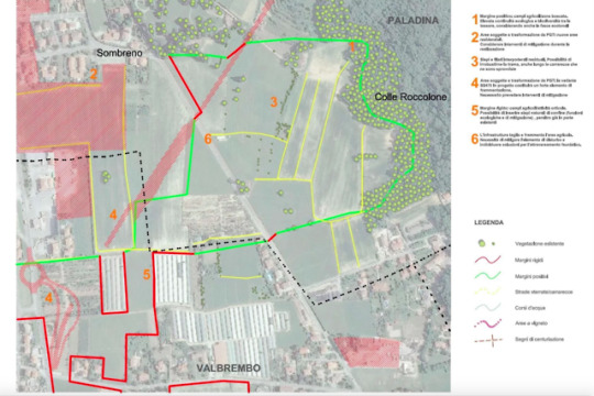
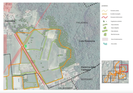
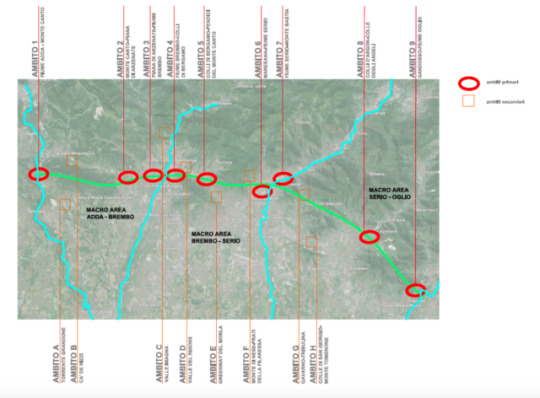
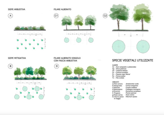
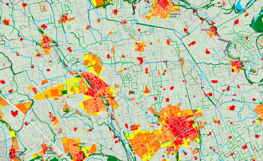
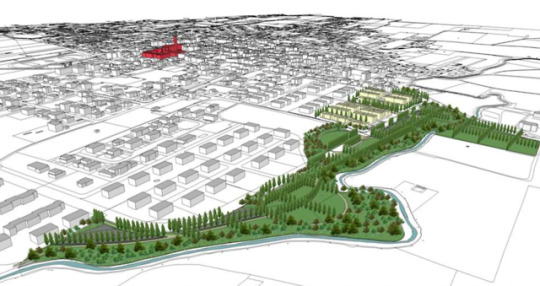
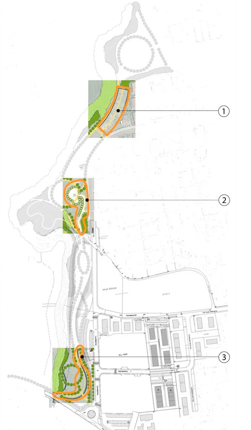
“Arco Verde” Ecological network
Arco Verde is a project for ecological and regional re-stitching, with an overall “linear” development in the upper Bergamo plain of over 35 km.
A feasibility study (2015) which involved a total of 44 municipalities, 6 Local parks, 4 Mountain Communities, 1 Nature Reserve and 4 Regional Parks, identified 17 areas, for which they have already been elaborated preliminary projects of intervention.
The history of Arco Verde begins in 2012, the year in which the project was conceived and was presented at the Cariplo Foundation as part of the call for tenders "Realizing ecological connection". The Arco Verde project carried out a Feasibility Study aimed at creating an ecological continuity band, capable of linking the courses of the Adda, Brembo, Serio and Oglio rivers along an overall “linear ”Of the corridor of over 35 km. The purpose of this "green infrastructure" is to contribute decisively to complete the network of the ecological network of the province of Bergamo, defining an important corridor that connects, in an east-west direction, the four main rivers present in the territory, already identified as Primary Ecological Corridors in the Lombardy Regional Ecological Network document.
https://www.arcoverdebergamo.it/
Project made in collaboration with SAP and other professionals
< back to home
0 notes
Photo


Furnace park | Madone
The “Parco della Fornace” is part of a broader plan that pursues the idea of creating a unitary intervention, which manages to combine the presence of the public park with that of the residence: intervention whose fulcrum is made up from the planned redevelopment of the ancient furnace.
The new park dialogues with the furnace complex, a fundamental historical pre-existence for the territorial context and an essential element of local, personal and community "micro-stories" of the inhabitants.
The project starts from two fundamental assumptions:
the attention paid to the creation or maintenance of optical cones towards the furnace from the streets and through the new residential compartments;
the native deciduous species taken from the vegetation of the wooded strip that borders the nearby Dordo stream, also taking into account the maintenance of some existing poplar specimens.
The park project is based on some basic layouts and compositional elements:
a dorsal path with a north-south position that identifies the distinction between public and residential areas: on it runs a cycle path accompanied by a row of cypress poplars, to emphatize the structural extent;
a route with an east-west position that, crossing the new residential settlement, leads the nearby river park into the urban park, leading to the tree species of the river itself. The layout takes up the design of the ancient country road that crosses the places, preserving and enhancing it. This path is accompanied by flowering apple trees.
Between this route and the furnace area, a large surface accommodates two spaces, one with urban gardens and the other with a play area. All illuminated with lampposts of different colors poles.
In the overall design of the park there are also rows of Morus platanifolia placed in a fan shape in a large triangular lawn; this lawn will be maintained in alternate mowing in order to allow the park's biodiversity to increase.
Project made in collaboration with SAP
< back to home
0 notes
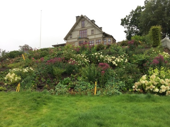
Photo


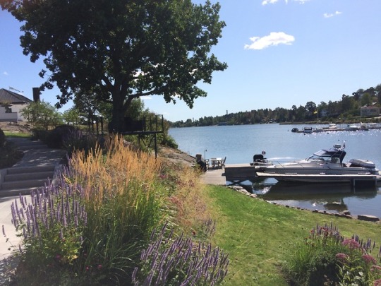
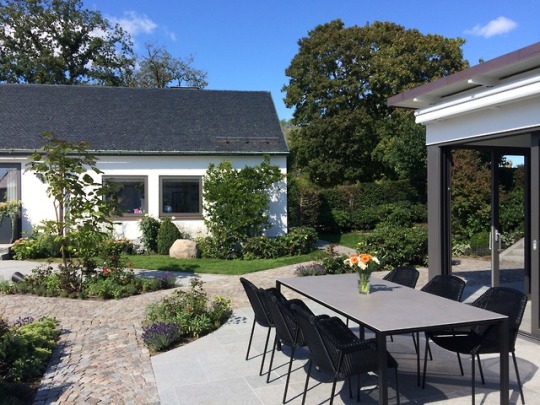
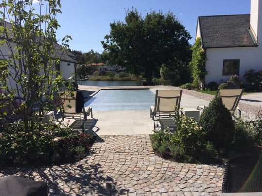


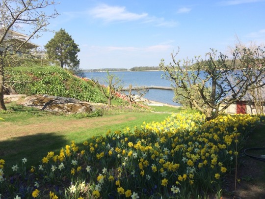
Villa by the water | Djursholm
This private garden by the water have a swimming pool, a viewpoint, a pier and a living wall in the pool house. The amazing designed meadow by the water really give you the feeling of seasons changing.
< back to home
0 notes
Photo

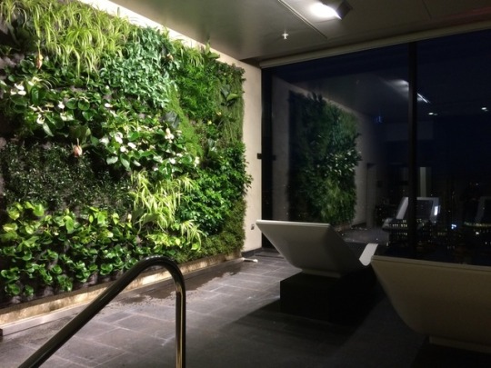


Gothia Towers | Gotheborg
This living wall is located in the Gothia Towers Hotel SPA in Gothenborg.
It is made with tropical plants that can survive to the special micro-climate of the SPA.
< back to home
0 notes
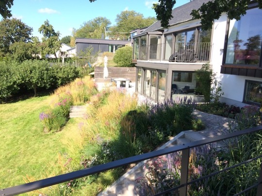
Photo
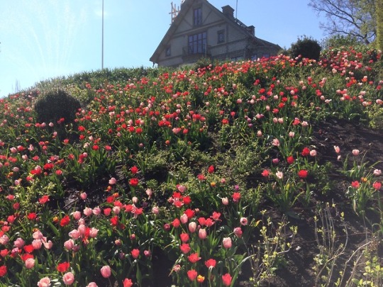
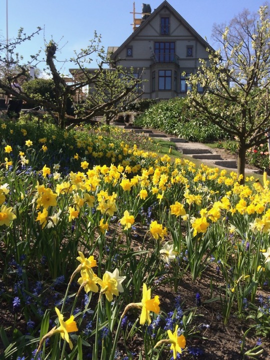
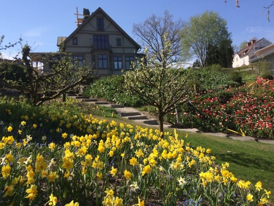

Private garden | Djursholm
This sloping garden for a villa by the water blooms in the springtime showing up the vast variety of bulbs.
< back to home
0 notes
Photo
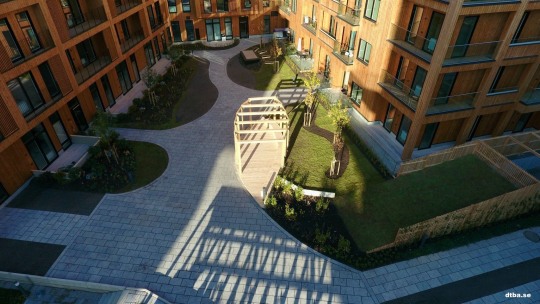

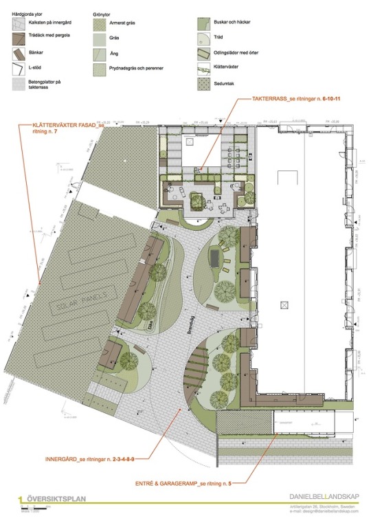


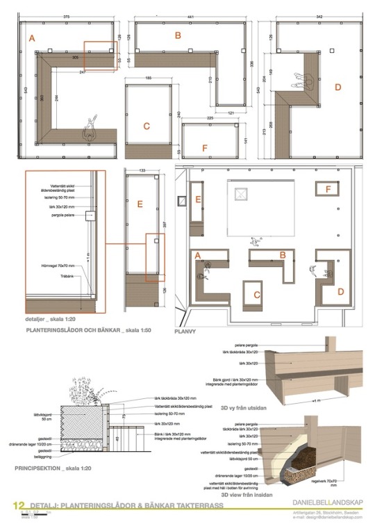
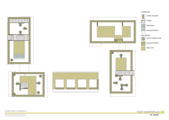
Botanikern | Uppsala
Detailed project for courtyard and common roof terrace in a new housing district in southern Uppsala.
The main courtyard is located above the garage ceiling and have several green areas gently raising from the paved level. A big pergola with wooden deck and bench stands in the center of the yard.
Part of the roof has a terrace with wooden planters and pergolas.
The project involved working with the “Grönytefaktor” (GYF) .
< back to home
0 notes
Photo
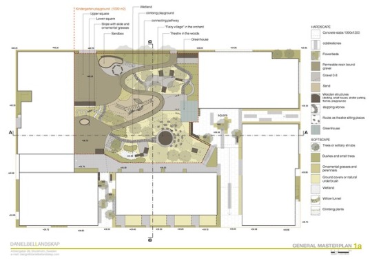
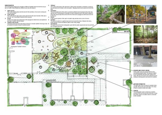
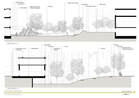
Schoolyard in Slakthusområdet | Stockholm
This is the first phase of a developing process for a new residential block in Stockholm.
The project involved working with the “Grönytefaktor” (GYF) .
The buildings disposition left a big central courtyard. and this place host two square for the residents and a kindergarten yard.
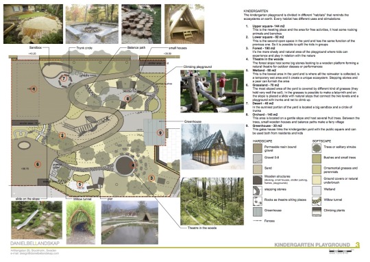
The kindergarten playground is divided in different “habitats” that reminds the ecosystems on earth. Every habitat has different uses and stimulations:
1. Upper square- 144 m2
This is the meeting place and the area for free activities, it host some rocking animals and benches
2. Lower square – 92 m2
This is the second open space in the yard and has the same function of the previous one. So it is possible to split the kids in groups
3. Forest – 190 m2
It’s the more shady and natural area of the playground where kids can
experience and play in relation with the nature
4. Theatre in the woods
The forest slope host some big stones looking to a wooden platform forming a natural theatre for outdoor classes or performances
5. Wetland – 50 m2
This is the lowest area in the yard and is where all the rainwater is collected, is a temporary wet area and it create a unique ecosystem. Stepping stones and a pear can furnish the area
6. Grassland – 70 m2
The most sloped area of the yard is covered by different kind of grasses (they hold very well the soil). In the grasses is possible to make a labyrinth and on the slope is placed a slide with natural steps that connect the two levels and a playground with trunks and net to climb up.
7. Desert – 45 m2
In the sunniest portion of the yard is located a big sandbox and a circle of trunks
8. Orchard – 145 m2
This area is located on a gentle slope and host several fruit trees. Between the trees, small wooden houses and balance paths make a fairy village
9. Greenhouse – 30 m2
This glass house links the kindergarten yard with the public square and can be used both from residents and kids
< back to home
0 notes
Photo
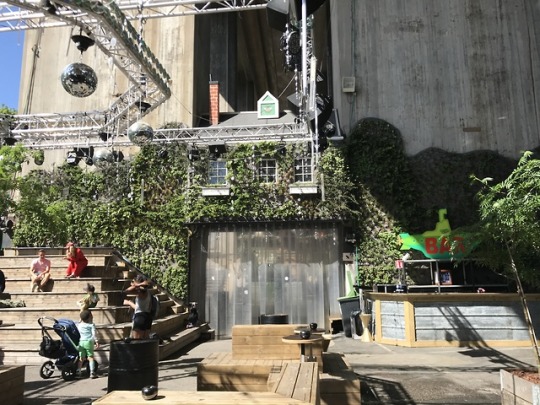
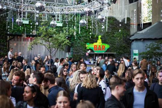
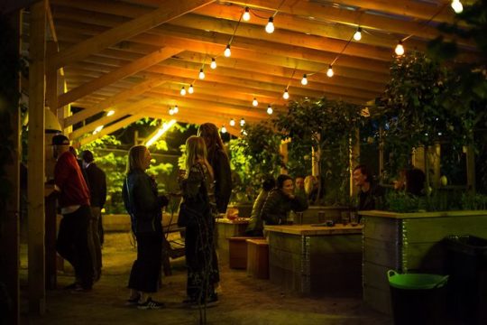


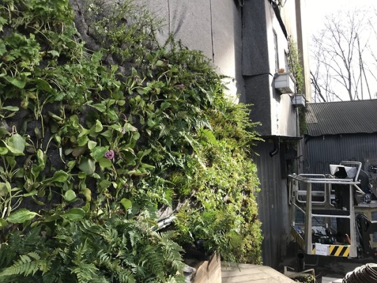

Trädgården Club | Stockholm
Trädgården is one of the most popular clubs in Stockholm.
We’ve curated all the green installation of the club; from a nice citrus garden, to a big cherry tree in the dance area, to a fabulous living wall.
The club is located under a bridge and our living wall covers two big pillars and is the perfect background for the club core area, plus it works as a sound barrier that absorb up to 40% of sound.
< back to home
0 notes