
Last Seen Blogs

xoadauemdianh
xoadauemdianh

maoberr
バーカバーカお前らみんなバーカ!!

denise-d-tokio-hotel-alien
Denise-D. Alien Ŧ

damacpropertiesindubai
Damac Properties in Dubai

no-more-sanitation
Liberation is Key
Photo

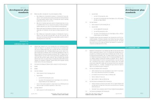
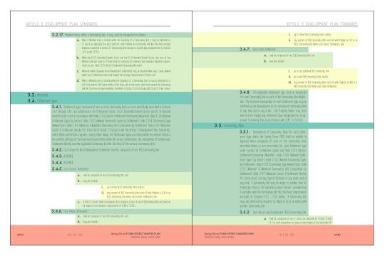
Spring Grove Code Page Readability Tests
In order to generate a multitude of viable options for the Spring Grove Code document redesign, a series of quick graphics tests were undertaken throughout the process as a way to produce new ideas and elements that could help organize the large code document. These tests were viewed not as a finished element, but as a brainstorming activity undertaken at various points throughout the process that could sparks ideas that could be used in the final code design.
Because of the process, this post is continually added to.
0 notes
Photo


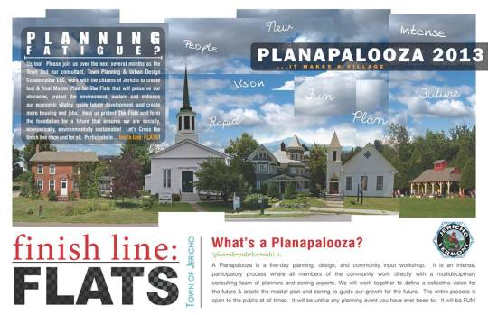
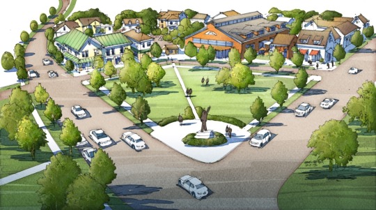
Jericho Master Plan and Form-Based Code
This planning process in Jericho, Vermont began after a series of failed attempts at developing a plan for a largely undeveloped piece of property in the village center. Citizens were burnt out and had a strong desire to see their village remain rural, however there needed to be a way to make sure that any future development would fit with local and historic designs. Therefore, a Form-Based Code, allowing for rural conditions, was a way to make sure that Jericho would continue to be rural and unique in the future. The multi-day charrette process kicked off the process.
In collaboration with TPUDC
#urbandesign#charrette#archtecture#transportationplanning#vernaculararchitecture#GraphicDesign#formbasedcode
0 notes
Photo
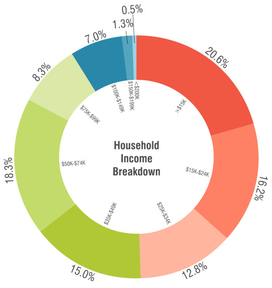
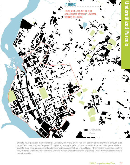
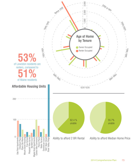


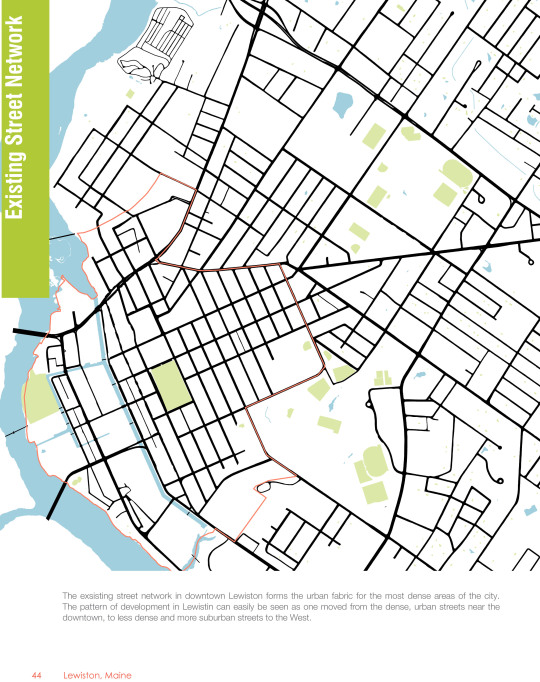
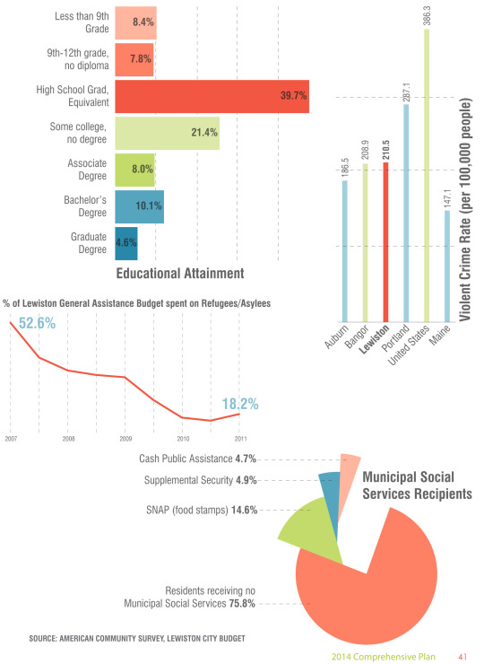

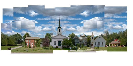
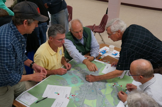
Lewiston, Maine Comprehensive Plan
The Lewiston, Maine Comprehensive Plan was developed to help reverse damage that had been done to the city through urban neglect, tense race relations, and disinvestment. The city has a dense and historic urban core, however it has been subject to years of neglect and demolition. After extensive research and existing condition documentation, the plan was developed to focus on ways to improve the city, both at grassroots and high investments levels. Tools throughout the document show was that citizens can get involved and infographics help make the City's problems and strengths easy to identify.
In collaboration with TPUDC
1 note
·
View note
Photo
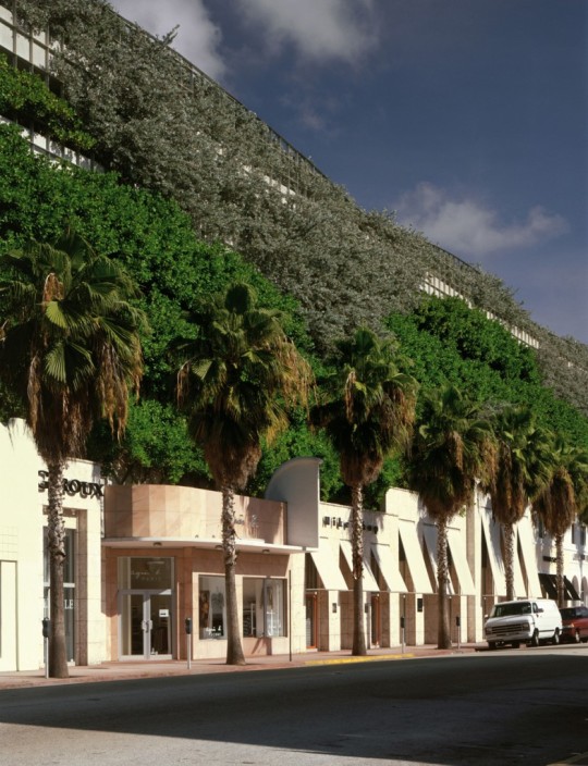
Park Here
This piece for The Wild Magazine explores the way the City of Miami has turned the use and perception of parking garages around by turning them into public spaces, multi use structures, and even art pieces by hiring well known architects to design and build them. It explores the evolution of the concept, as well as how it has let to bringing the idea of a pedestrian-friendly design of the parking garage to other regions.
Click for full text
0 notes
Photo
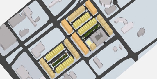


Paseo Gateway Redevelopment Master Plan
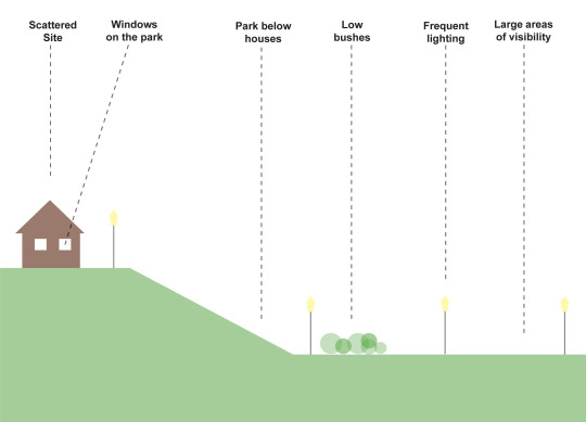
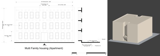
This plan focused on an under utilized area of Kansas City, Missouri that included a failed housing project. The Housing Authority was seeking recommendations that would increase neighborhood safety and desirability. Because funding had not yet been secured, the focus of the project was to provide recommendations that could be implemented now at little cost, and another set that could be configured in the future, requiring and high level of flexibility. The result was a series of block typologies that could be configured as needed as the redevelopment process progressed. Defensible space principles were used throughout in order to increase safety, and as a result the health of residents and the community at large.
In collaboration with my classmates at the University of Kansas
#urbandesign#defensiblespace#architecture#urbaninfill#sustainability#historicpreservation#safetyplanning
0 notes
Photo
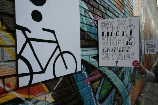


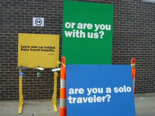

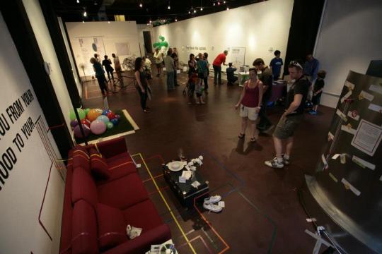
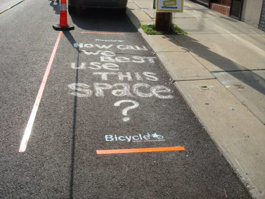


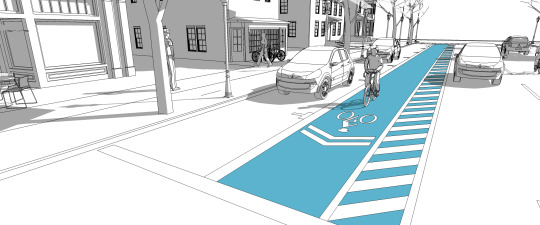
Commute Awareness Tactical Urbanism Exhibit
As part of the Rock Island Corridor project, and in conjunction with the Multi Modal Hub materials, a Tactical Urbanism project was used to raise awareness about commuting options. Various low budget and hands on projects were created to help users physically experience a variety of commuting options, and the benefits of reducing automobile reliance.
In collaboration with my classmates at the University of Kansas
2 notes
·
View notes
Photo
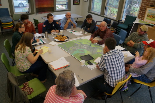

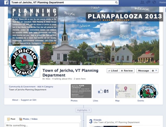


Jericho, Vermont Charrette
The planning process in Jericho began with a five day charrette in which there were various public input sessions, presentations, and topic-specific meetings. The small town West of Burlington had experienced many previous attempts at a cohesive planning process, therefore public percept and pre-event marketing was crucial. During the process, synoptic surveys were taken in order to develop an understanding of regional and local context, Scale comparisons to nearby villages were examined, and many visits to local businesses provided information that would not be found through traditional research. Halfway through the event, a mid way presentation with multiple proposed schemes enable the public to offer feedback that was used to develop the final Master Plan.
In collaboration with TPUDC
1 note
·
View note
Photo


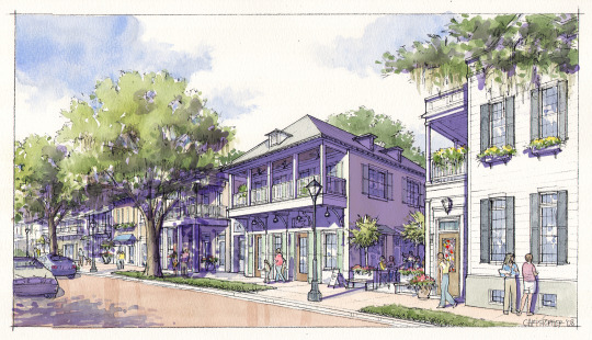
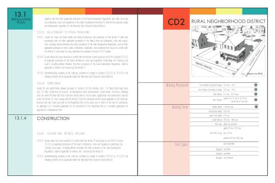
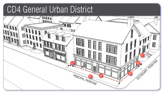
Spring Grove Master Plan and Smartcode
Spring Grove is a 78,000 acre mixed use development located West of downtown Charleston, South Carolina. TPUDC was hired by the developer to create Form-Based development ordinances and Master Plan Regulations for the project that address the owner’s commitment to sustainable development and land use. My work centered around thoroughfare design, document organization and graphics, and client and county relations.
In collaboration with TPUDC
0 notes
Photo

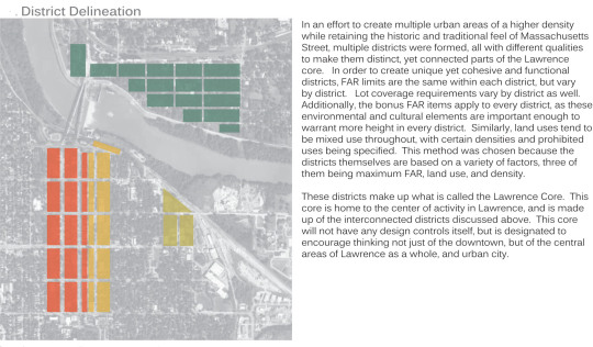
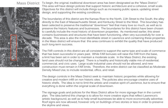
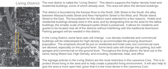

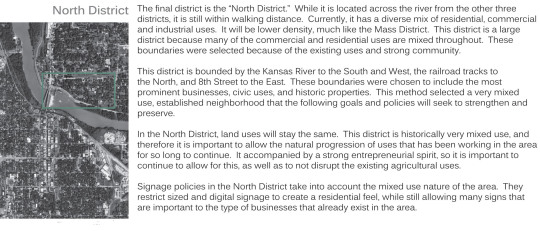
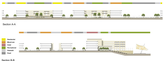
Lawrence CORE Master Plan
This plan addresses a recent growth debate in downtown Lawrence, Kansas, the result of more people wanting to move into the charming, historic and eclectic downtown are for sustainability and cultural reasons. While most agree that living downtown is more efficient, there is a desire to keep the original downtown low density. To address this, the plan creates four urban neighborhoods of varying designs, allowing some to stay as is and some to grow. The result is a interconnected group of urban neighborhood of different character that make up the Lawrence CORE.
1 note
·
View note
Photo

The Last of the Original Modernists
My first piece for The Wild Magazine was the result of a late night call from an editor looking for a piece on the legacy of Oscar Niemeyer. Although he is one of my favorite architects, it was hard to wrap up his influence in short piece. After a lot of work, it came together and remains one of my favorite pieces.
Click for full text
0 notes
Photo
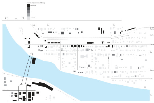
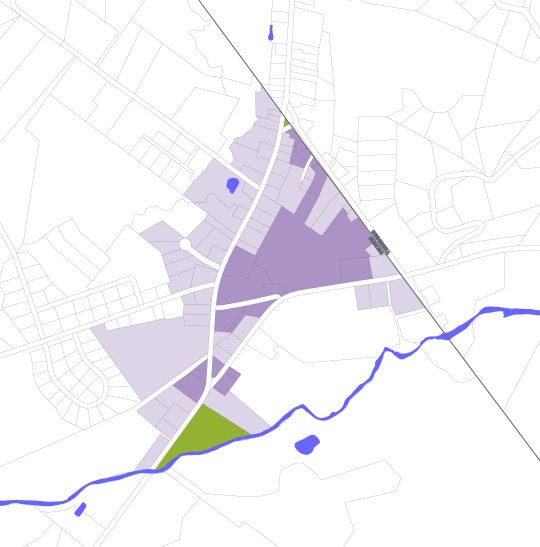
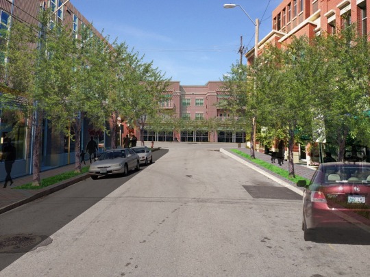
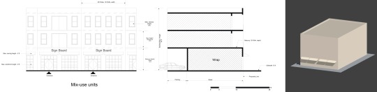
North Lawrence Commercial Intensity Study
North Lawrence, Kansas is a historic community with a long history of small business, entrepreneurship, and a high level of mixed uses. When faced with the possibility of an outsize, corporate development, the community searched for ways to show this history. By showing the length of time that a building has been used commercially, instead of show the intensity of the use as is normally done, development patterns that could not previously be visualized become clear, and hopefully, local patterns will be applied to future development.
0 notes
Photo
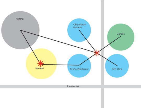
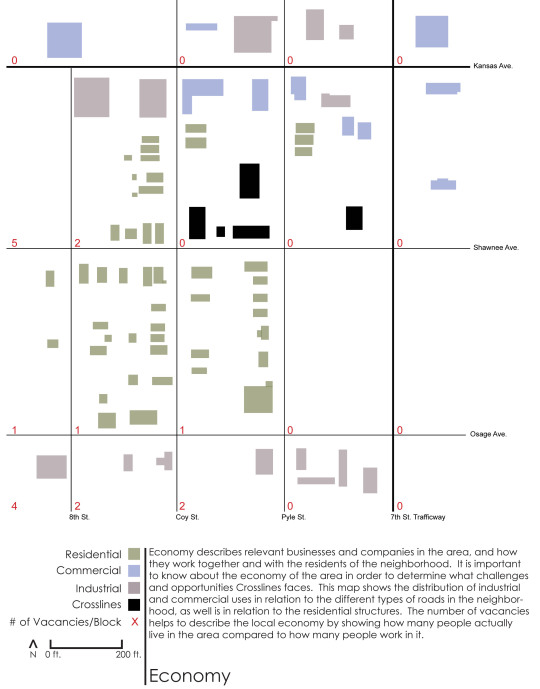


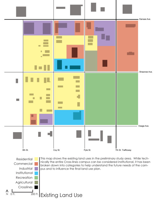
Crosslines Small Area Plan and Logistical Reorganization
Crosslines is a all encompassing assistance organization that provides services to the nearby Latin community thorough a small campus containing a mix of historic and newer structures. While the organization has many resources, it needed help managing the logistics of an providing many services from structures of varying suitability. To start identifying strengths and weaknesses, the surrounding areas were mapped extensively. The Small Area Plan and Logistical Reorganization helped provide design tools for Crosslines to use to streamline their operations and use their campus more effectively.
Click for full text
0 notes
Photo


Three Rivers Market Program Plan
Three Rivers Market is a local food co-op in Knoxville that was moving into a new, urban location. On a fast schedule, this project focused on making quick and clear programming decisions. This concept divided users based on the type and length of trip taken and the amount and type of goods purchased. This enabled those using the market as a corner store to do so quickly, and for those using the space as a full-service grocer have an organized circulation experience, 2010
0 notes
Photo
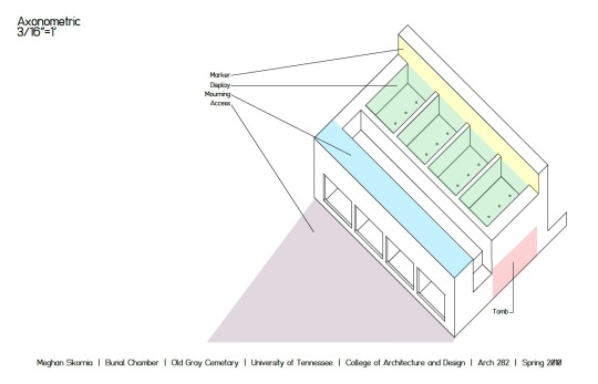
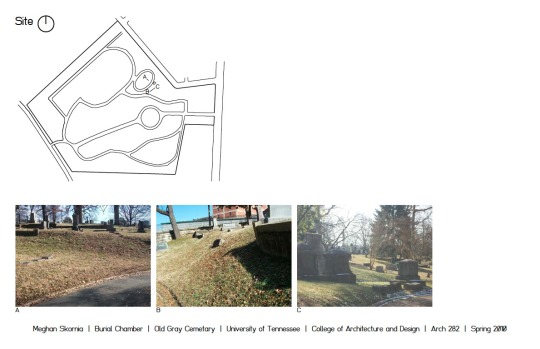

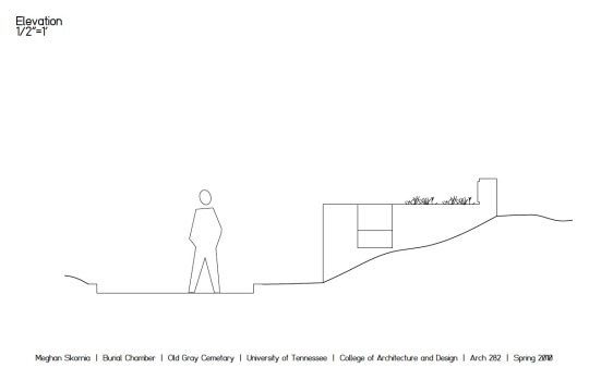

Old Gray Cemetery Burial Chamber
Located in Knoxville, TN, this project was the result of a intensive, week-long design process. Designed to "natural" standards, the chamber is to be inserted and secured in the site by it's precast-design and to use the interned as growing material for the memorial beds, a visual representation of life, 2010
2 notes
·
View notes
Photo

Circle 7 Management Branding
Circle 7 Management is a start-up music management company located in Nashville, Tennessee. The owner knew he needed an identity that would continue to be relevant even as his brand new company grew and changed. In order to address the low budget and often "guerilla" style marketing that a new company must undertake, the brand needed to be applicable to all types of media, both print and digital. The result is a logo that can stand on it's own or be part of a group.
0 notes
Photo

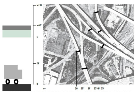
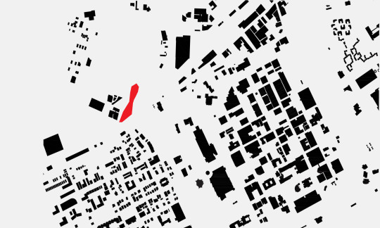

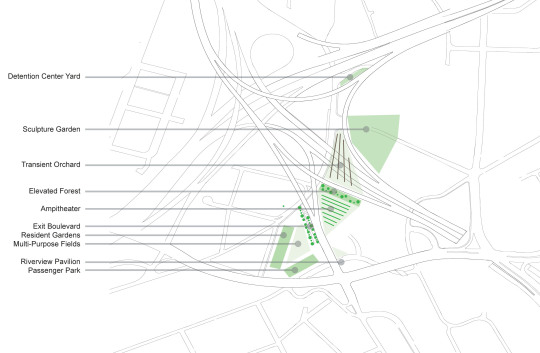

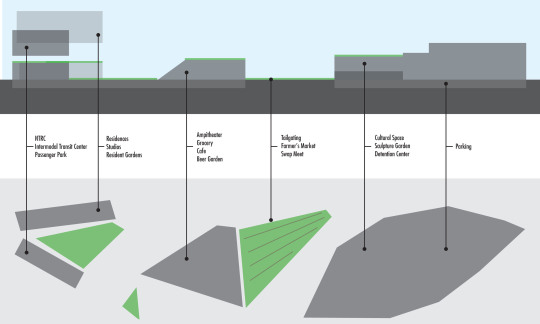
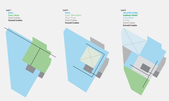
Interstitial Island
The site for this project was an “island” near downtown Knoxville that while adjacent to many established neighborhoods, was desolate due to the intersection of two of the country’s largest interstates. By re-imagining this intersection based on site data, traffic circulation analysis, and sectional resolution, a packed program in combination with a complex parks system was used as a way to tie existing neighborhoods together and create a structure for growth and circulation.
In collaboration with my classmates at the University of Tennessee
0 notes
Photo

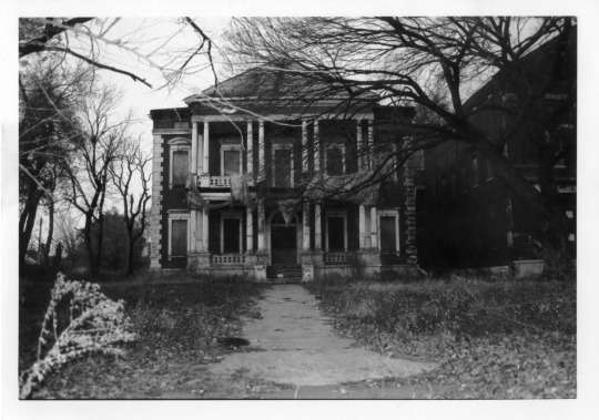
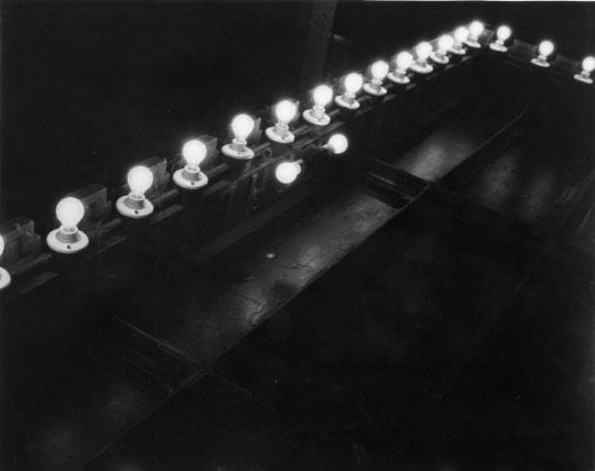
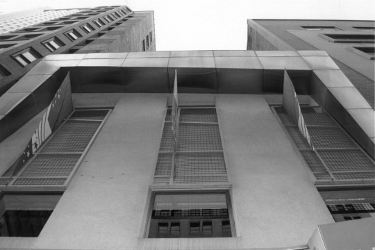

St Louis: Lost River City photo essay
35mm film, 2008
0 notes