npsparkclp
NPS Park Cultural Landscapes Program
The National Park Service's Cultural Landscapes Program is dedicated to the preservation of cultural landscapes. Find out more at Our Program Website
692 posts
Don't wanna be here? Send us removal request.
Last Seen Blogs

shafeeqseo
Shafeeqseo

karina-styles-nelson-blog
Karina nelson Styles

rensitos
✿

saludsevilla
Salud en Sevilla

megasbear
Megas Bear
Text
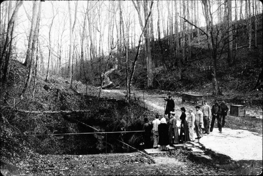


Explore the Mammoth Cave Core Visitor Services Area Cultural Landscape
More than a cave!
The natural features of Mammoth Cave National Park include the longest known cave system in the world, surrounding river valleys, karst topography, and rolling, wooded hillsides. The cultural landscape is also a record of a 12,000-year conversation between people and land spanning the first explorations by prehistoric people, mineral mining, early homesteading, preparations for the War of 1812, and 200 years of tourism leading to development of the national park.
Read the article
In addition to providing an overview of the history and features of the landscape, this article introduces the Cultural Landscape Report (CLR) for Mammoth Cave Core Visitor Services Area. The CLR is a planning document that guides treatment, now and into the future. It aims to balance protection and enhancement of the site’s historic integrity with visitor access and interpretation needs, within a broader framework of sustainable land management.
Discover more about Mammoth Cave National Park
Find more profiles of NPS cultural landscapes
#cultural landscape#cultural resources#NPS#FindYourPark#CLR#Mammoth Cave National Park#cave#history#landscape history#preservation
11 notes
·
View notes
Text
The Cultural Landscape at Harriet Tubman National Historical Park
Our nation has a rich legacy of cultural landscapes – from carriage roads to battlefields, designed gardens to vernacular homesteads, and industrial complexes to river valley settlements. The NPS Park Cultural Landscapes Program promotes the stewardship of significant landscapes through research, planning, maintenance, training, and education.
youtube
This video introduces the cultural landscape at Harriet Tubman National Historical Park and invites viewers to learn more. NPS staff from the park, descendants of Harriet Tubman, and other people associated with the area describe the features and significance of this unique landscape and actions that have been taken to preserve it.
This video, announced on March 10 in honor of Harriet Tubman Day, is the latest in a series of videos designed to facilitate the transfer of knowledge gained through cultural landscape research and communicate unique aspects of a particular landscape’s history and significance.
Watch other videos in the series and find audio-described versions: Cultural Landscape Video Series from the NPS Olmsted Center for Landscape Preservation
#cultural landscape#Harriet Tubman#NPS#National Park Service#Find Your Park#Harriet Tubman Day#Cultural Landscape Report#Historic Preservation#Preservation#History#underground railroad#network to freedom#New York#OCLP
19 notes
·
View notes
Photo

Summer Internship Opportunity
Join the Olmsted Center for Landscape Preservation this summer as a Digital Media Resource Assistant, supported in partnership with the nonprofit American Conservation Experience.
As the Digital Media Resource Assistant, you will create ArcGIS StoryMaps and other digital media products for a national audience that convey a strong sense of place, sharing stories that capture the diverse perspectives shaping our cultural landscape heritage.
Details and Application: Digital Media Resource Assistant
Don't miss the Designing the Parks blog to see what other interns with the Olmsted Center have been doing.
Learn more about the Olmsted Center for Landscape Preservation.
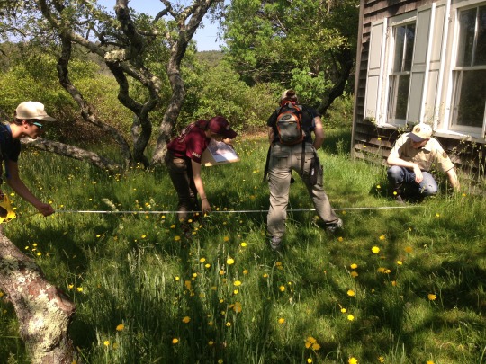
[Image description: A group of Olmsted Center Associates, interns, gather on a rocky mountaintop in Acadia National Park, overlooking an expanse of trees and water below.]
#cultural landscape#OCLP#Olmsted Center for Landscape Preservation#NPS#National Park Service#internship#summer internship#GIS#digital media#historic preservation
22 notes
·
View notes
Photo
Summer 2021 Internship Opportunities
The Olmsted Center for Landscape Preservation (OCLP) has announced several internship opportunities for the summer of 2021.
Three full-time, seven-month internships are supported through the National Council for Preservation Education.
For more information about each position, including desired qualifications, compensation, and project details, and where to apply: OCLP Internship Opportunities
Apply by February 22, 2021!
For a closer look at interning with the Olmsted Center, don't miss the Designing the Parks blog.
#CulturalLandscape#Preservation#LandscapePreservation#internship#summerinternship#summer2021#OlmstedCenter#OCLP#NPS#NPSIntern#Education
34 notes
·
View notes
Photo

Internship Opportunity
Join the Olmsted Center for Landscape Preservation this summer as a Digital Media Resource Assistant supported through the Latino Heritage Internship Program!
The Digital Media Resource Assistant will create ArcGIS StoryMaps for a national audience that convey a strong sense of place and share stories that are inclusive and capture the diverse perspectives that shape our cultural landscape heritage.
If you have interest and experience in cultural resource management and digital media/GIS, check out the full posting and apply through Environment for the Americas: Digital Media Resource Assistant
More Information
Olmsted Center for Landscape Preservation
Latino Heritage Internship Program
Photo: Reflections in the water in front of Stone Cottage at Eleanor Roosevelt National Historic Site, which is one of the places this intern will be profiling through the ArcGIS Storymaps.
#cultural landscape#NPS#internship#Latino Heritage Internship Program#LHIP#OCLP#Olmsted Center for Landscape Preservation#summer internship#cultural resources#gis#map#digital media internship
12 notes
·
View notes
Photo

Preservation Profile: Dennis Lewarch
Since the late 1960s, the Suquamish Tribe of Washington State has organized to demand their legal and civil rights in a path toward self-determination. Along the way, non-Indian partners like Dennis Lewarch have played important roles as allies.
The Park Cultural Landscapes Program recently had a chance to meet (safely) for conversation with Dennis. He shared reflections on serving the interests of the Suquamish as their first Tribal Historic Preservation Officer (THPO), focusing on completion of a Traditional Cultural Place (TCP) nomination for the National Register.
Read the Preservation Profile
More ways to recognize Native American, Alaska Native, and Native Hawaiian history and heritage, during Native American Heritage Month and year-round: Native American Heritage Month with NPS and partners
#cultural landscape#traditional cultural place#national register#grants#Suquamish#Indigenous heritage#Native American Heritage Month#preservation#people in preservation#THPO
7 notes
·
View notes
Photo


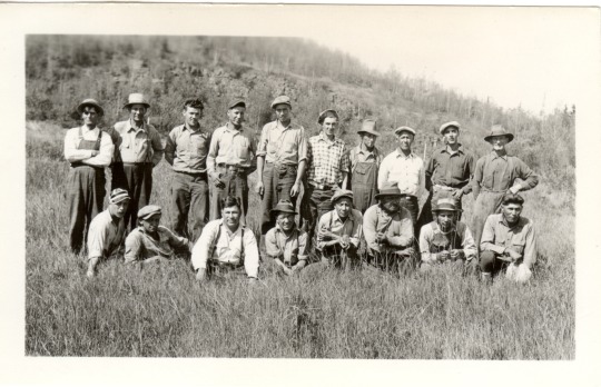
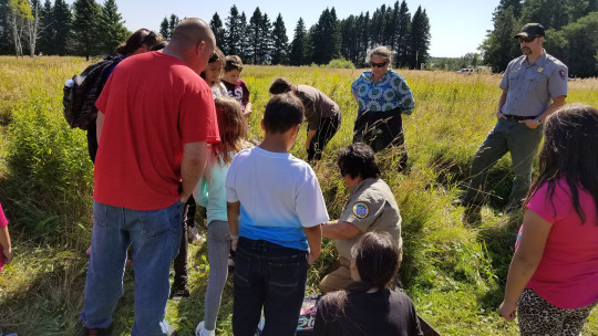
Stewardship at Grand Portage National Monument
The Grand Portage Band of Lake Superior Chippewa and the National Park Service work together at Grand Portage National Monument to support, interpret, and protect the lifeways of the Ojibwe people, including the preservation of historic landscape features of the Grand Portage trail.
The Grand Portage was a vital part of both American Indian and fur trade transportation routes because of the area’s geology, topography, natural resources, and strategic location between the upper Great Lakes and the interior of western Canada. Grand Portage National Monument is in the homeland of the Grand Portage Ojibwe. The Band has long been involved in stewardship of the Monument, where tribe members play a critical role in management, landscape maintenance, and historic preservation.
Discover more about this agreement, ethnobotanical restoration, the role of the Civilian Conservation Corps – Indian Division during the 1930s, and the youth contributions of the Grand Portage Conservation Crew: Stewardship at Grand Portage National Monument
Learn more about Grand Portage National Monument
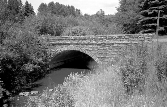
Historic bridge at Grand Portage National Monument before work, date unknown (NPS).
#cultural landscape#NPS#grand portage band#Chippewa#Ojibwe#Native American Heritage Month#stewardship#Grand Portage National Monument#FindYourPark#history#CCC#CCC-ID#ethnobotany#historic preservation#Grand Portage Conservation Crew
10 notes
·
View notes
Photo
Internship Opportunity!
Join the Olmsted Center for Landscape Preservation team this winter (remotely) as a Geographical Information Systems/App Development Intern to help build a web-based mobile app for tree assessment to improve management in the National Park Service.
This individual will build and beta-test a web-based mobile app for tree inventory and condition assessment which will allow for integration of data collection with the arboricultural field manual. They will support and participate in the collection of field data using GIS and develop GIS data structures to capture information through the ESRI Collector. The 1200-hour position is supported through a partnership with the National Council of Preservation Education.
If you have interest and experience in cultural resource management and GIS, check out the full posting and apply through the Handshake job portal (position #4160631) or at PreserveNet.
Details
Direct link to the position announcement: Geographical Information Systems/App Development Intern
Find more about the Olmsted Center for Landscape Preservation: OCLP Internships
What does an internship with the Olmsted Center look like? Don’t miss the Designing the Parks blog for notes from the field.
*Closes November 11, 2020*
#cultural landscape#Olmsted Center for Landscape Preservation#Landscape Preservation#internship#OCLP#preservation#preservationjobs#NPS#National Park Service#GIS#App development#Cultural Resources#FindYourPark
9 notes
·
View notes
Photo
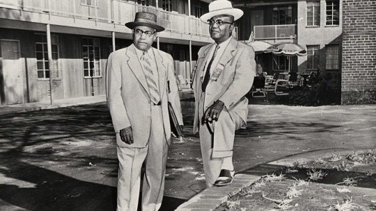


The A.G. Gaston Motel of Birmingham
The A.G. Gaston Motel opened in 1954, built by prominent African American businessman and entrepreneur Arthur George Gaston. As a fixture of black businesses in Birmingham, Alabama, the motel was the choice for headquarters of the local civil rights campaign that shaped the city and the nation in 1963.

Postcard of the A. G. Gaston Motel in Birmingham, Alabama, circa 1960-1969 (From a book of letters sent to Arthur Shores, prominent attorney and civil rights leader in Birmingham, Alabama. With permission of Alabama Department of Archives and History).
In Birmingham, the Alabama Christian Movement for Human Rights (ACMHR), founded by Reverend Fred Shuttlesworth in 1956, was key in organizing resistance to segregation and discrimination within the city. Encouraged by Rev. Shuttlesworth, Dr. Martin Luther King, Jr. and members of the Southern Christian Leadership Conference (SCLC) joined forces with other civil rights figures in Birmingham in 1962.
Leaders from the SCLC took up residence in the A.G. Gaston Motel from April through May of 1963, which became the focus of the Birmingham Campaign planning activities. The hotel was the site of constant activity associated with the campaign, and meetings and press conferences held regularly within the courtyard were extensively documented and broadcast by journalists.
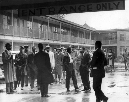
Martin Luther King, Jr. and others outside Gaston Motel in 1963 (Birmingham, Ala. Police Department Surveillance Files, 1947-1980. Collection 1125, Archives Department, Birmingham Public Library).
On May 10, 1963, the A.G. Gaston Motel was the site of the announcement of a compromise between local white business owners, city officials, and civil rights leaders. The truce addressed some of the issues in the original list of demands issued by the Birmingham Campaign. Rather than the originally called for immediate desegregation of lunch counters, restrooms, fitting rooms, and other facilities such as drinking fountains, and the hiring of more black workers, the compromise established a longer timeline to desegregate the city. The negotiations were met by a series of violent attacks, including the tragic bombing of the Sixteenth Street Baptist Church.

Sixteenth Street Baptist Church and Kelly Ingram Park (Historic American Buildings Survey, HABS AL-898, Library of Congress).
Nonetheless, efforts to desegregate the city continued slowly over the following months. These events in Birmingham created significant public pressure that helped lead to the passage of the Civil Rights Act of 1964, signed into law on July 2, 1964, by Lyndon Johnson.
A.G. Gaston modernized and expanded the motel in 1968, adding a supper club and other amenities. Business declined in the 1970s and in 1982 Gaston converted the motel into housing for the elderly, which functioned until 1996.
The City of Birmingham acquired the former motel in 2015 with the plan to incorporate it into the larger Birmingham Civil Rights Historic District. Today, the A.G. Gaston Motel is jointly owned by the National Park Service and the City of Birmingham and is a part of Birmingham Civil Rights National Monument, created to honor the nonviolent protesters that fought against discriminatory state and local laws and practices in the 1950s and 1960s.
For the full article: The A.G. Gaston Motel and the Birmingham Civil Rights Monument
#culturallandscapes#civilrights#african american history#black history month#african american history month#birmingham#alabama#civil rights movement#NPS#national park service#motel#gaston#Martin Luther King Jr.#Civil Rights Act#fred shuttlesworth
17 notes
·
View notes
Photo
Internship Opportunities
Interns, called Associates, are integral to the Olmsted Center for Landscape Preservation team and work under the mentorship of experienced landscape architects, horticulturalists, and planners. Associates engage in an extensive program of trainings, educational opportunities, and field trips to enrich their experience.
Want a closer look? Don’t miss the Designing the Parks internship blog.
These paid internships vary in duration and focus but are typically offered to graduating students and young professionals in landscape architecture, horticulture, historic preservation, history, GIS, or related fields, who seek professional experience in cultural landscape preservation.
2020 Internships and Application Details
These positions are supported through a partnership with the National Council of Preservation Education. For more information about each position, including desired qualifications, compensation and project details, download the full announcements at the link above.
Please send application materials by March 1, 2020.
#internship#cultural landscapes#OCLP#Olmsted Center for Landscape Preservation#CLR#landscape architecture#intern#preservation#nps#National Park Service
17 notes
·
View notes
Photo


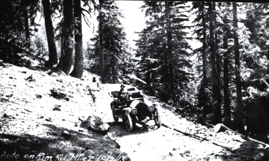
Army Corps of Engineers Road System Added to the National Register
Crater Lake National Park, Oregon
The Army Corps of Engineers Road System at Crater Lake National Park is among Oregon’s latest entries in the National Register of Historic Places.
The National Park Service accepted the nomination on August 12. NPS staff historian Stephen Mark took the lead in writing the nomination, which centered on a previously little-known effort by the Army Corps in highway engineering and construction that happened from 1910 to 1919 in the park.
The Army Corps of Engineers Road System, a precursor to the historic Rim Drive, is significant for its association with the earliest period of highway engineering in Oregon.
As Stephen Mark describes, "Unlike today's roads, this system came into being with hand tools, horse power, and a couple of wood-burning steam shovels."
The road system was the first federally funded and supervised highway project in Oregon and is the only road project in Oregon attributed to the Army Corps of Engineers.
The road system is the fourth historic district listed at Crater Lake National Park, with others at Rim Village, at Park Headquarters and along Rim Drive.
Discover more about the nomination and the history of the road system: News Release: “National Register Listing for Army Corps of Engineers Road System”
Visit the park website to plan your visit: Crater Lake National Park
Find more from the National Register of Historic Places

A car on a road in front of impressive snow banks, almost completely obscuring a house, shows the winter conditions at Crater Lake, 1949.
(NPS/Harpers Ferry Center Archives)
#Historic Preservation#Cultural Landscape#Crater Lake National Park#Historic Roads#army corps of engineers#Oregon#National Register#Rim Drive#Tourism#NPS#FindYourPark#Travel#Road Trip#History#National Park Service
20 notes
·
View notes
Photo


The Wright Company
Brothers Wilbur Wright (1867-1912) and Orville Wright (1871-1948) built their first experimental airplanes in the back of their bicycle shop at 1127 West Third Street in Dayton, Ohio. They formed the Wright Company in November 1909. The Wright Company started manufacturing airplanes in Dayton, and it coordinated the Wright Exhibition Team and Flying School at Huffman Field to help market their invention.
The Wright Exhibition Team operated only briefly from 1910-1911, while the Flying School lasted through 1916. Civilians and military aviators trained at the Flying School at Huffman Field, which was characterized by uneven and sometimes marshy terrain.
“Here we must depend on a long track, and light winds or even dead calms. It is skirted on the west and north by trees. This not only shuts off the wind somewhat but also probably gives a slight downtrend. However, this matter we do not consider anything serious. The greater troubles are the facts that in addition to cattle there have been a dozen or more horses in pasture and as it is surrounded by barbwire fencing we have been at much trouble to get them safely away before making trials. Also the ground is an old swamp and is filled with grassy hummocks some six inches high so that it resembles a prairie-dog town.”
-- Wilbur Wright to Octave Chanute, June 21, 1904, cited in the Huffman Prairie Flying Field Cultural Landscape Report (pg. 13)
The Wright Company started by producing airplane engines and drive trains in their bicycle shop before eventually moving into their new factory.
On September 9, 2019 the Wright Company Factory was officially listed on the National Register of Historic Places.
youtube
Dayton’s identity as a city of innovation and industry allowed the Wright Company better access to skilled workers and machinery. The Wright Company produced approximately 120 airplanes in 13 different models and introduced industrial aviation.
Explore this history through some of the cultural landscapes of Dayton Aviation Heritage National Historical Park:
Huffman Prairie Flying Field
West Third Street Historic District
More:
Dayton Aviation Heritage National Historical Park: Visit the park website to learn more and plan your own visit
“Wright airplane factory placed on national historic registry,” Dayton Daily News, September 16, 2019
The Wright Company Factory Site, National Aviation Heritage Area
Wright Brothers Photograph Collection: Wright State University Special Collections
Wright Brothers Negatives Collection: Library of Congress
What are cultural landscapes?
#cultural landscape#FindYourPark#Ohio#Dayton#Wright Brothers#innovation#invention#aviation#transportation#National Register of Historic Places
15 notes
·
View notes
Video
youtube
The Legacy and Landscape of Harriet Tubman
To help honor Harriet Tubman's first attempt at self-emancipation on September 17, 1849, the Olmsted Center for Landscape Preservation has created a short video highlighting Harriet Tubman, the remarkable landscape of Harriet Tubman Underground Railroad National Historical Park in Maryland, and some of the cultural landscape research they've conducted there to date.
"The Cultural Landscape at Harriet Tubman Underground Railroad National Historical Park" is the latest addition to the Olmsted Center's cultural landscape video series. Each video highlights the unique aspects of a particular landscape’s history and significance, and together they help to communicate the process and outcomes of cultural landscape research.
Find the full series at the link below, or at the Olmsted Center for Landscape Preservation website

Stewart's Canal at dusk, at Harriet Tubman Underground Railroad National Historical Park (NPS).
Discover More
Harriet Tubman Underground Railroad National Historical Park website
Underground Railroad: More on this subject from the National Park Service
Journeying toward Freedom and New Beginnings: A cultural landscape perspective of Harriet Tubman and the Jacob Jackson home site on the Eastern Store of Maryland
Olmsted Center for Landscape Preservation video series (YouTube)
More about NPS cultural landscapes
#cultural landscape#Harriet Tubman#OTD#network to freedom#underground railroad#OCLP#Olmsted Center for Landscape Preservation#NPS#National Park Service#Maryland#history#Jacob Jackson#historic preservation
8 notes
·
View notes
Photo

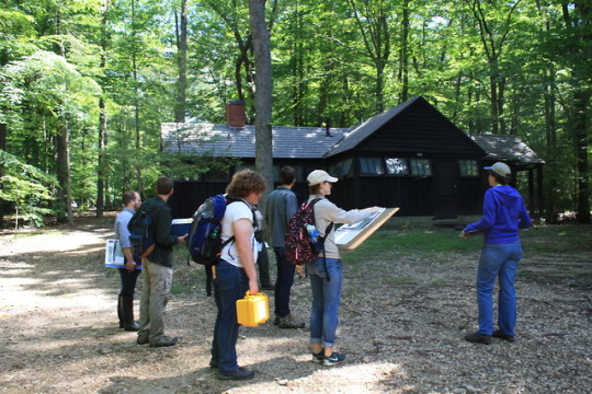


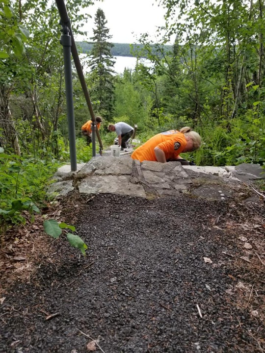
Field School at Prince William Forest Park
September has arrived. It’s the time of year when many people return to classrooms and get ready for the school year ahead. It’s also a great time to reflect on ongoing educational partnerships and the year-round learning that takes place out of the classroom.
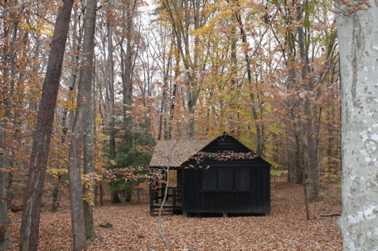
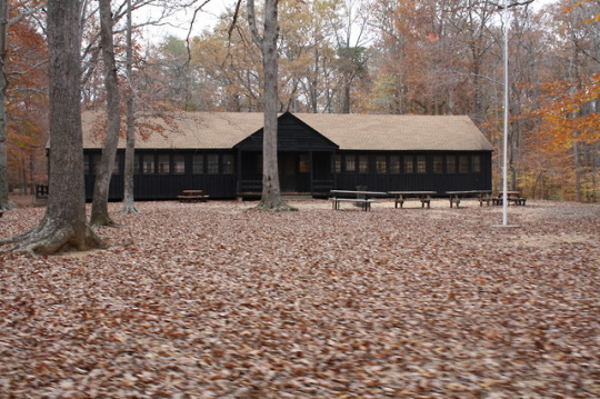
Beginning in summer of 2018, students from the University of Mary Washington participated in a field school to document two cultural landscapes at Prince William Forest Park, Cabin Camp 2 and Cabin Camp 4. The Cabin Camps at Prince William Forest Park were developed in the 1930s as part of the Recreation Demonstration Area program.

The typical four-person sleeping cabin in Cabin Camp 2 at Prince William Forest Park (NPS).
Over several weeks, the students documented existing conditions of landscape features. In addition to the hands-on experience, their documentation will be used to complete Cultural Landscape Inventory (CLI) reports, which are an important tool for the continued management of park cultural landscapes.
The outcomes and lessons learned by the National Park Service, UMW faculty, and students helped shape the 2019 field season and will serve as a model for future iterations of the field school.
Learn more about this educational partnership to document these cultural landscapes and the history of the cabin camps in our latest article: Field School at Prince William Forest Park
More about Prince William Forest Park
Historic Preservation at University of Mary Washington
What are cultural landscapes?
(Thanks to colleagues in the National Capital area for assistance with this article!)
#cultural landscape#education#field school#Prince William Forest Park#Virginia#CCC#camp#preservation through documentation#historic preservation#back to school#NPS#National Park Service
14 notes
·
View notes
Photo

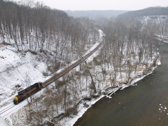
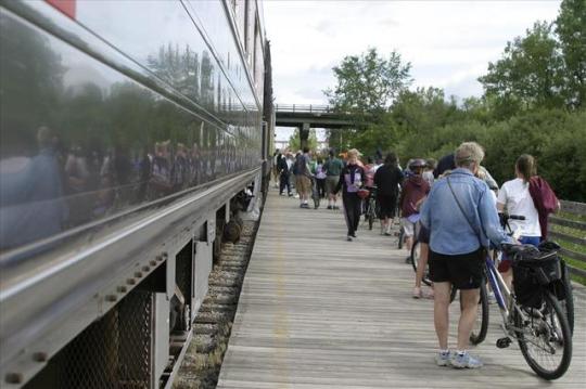


The Valley Railway
Cuyahoga Valley National Park, Ohio
By the 1850s, railroads began to replace canals and riverboats as a more efficient transportation option. The Cuyahoga Valley Railway served as the primary rail transportation for the Valley from 1871 to 1915, and the railway evolved into a part of everyday life for residents throughout Ohio's Cuyahoga Valley.
Along the Valley Railway, new structures were built to accommodate the goods and people moving along the route. Bridges allowed the railroad to cross the ever changing topography. Mills which soon grew into company towns were constructed along the expanding route, as farmers embraced the railroad to ship their products to markets in Cleveland or Akron.
The ultimate end of the Valley Railway’s existence came in 1915 when the B&O assumed complete ownership of what had by that time been renamed as the Cleveland, Terminal and Valley Railroad. Five years later, in 1920, rail companies nationwide were forced to examine their role with the realization that there were cheaper and more efficient modes of transportation capable of carrying loads of coal, heavy ores, passengers and a wide variety of materials via the use of semi-trucks and more powerful locomotives. Because the region – and the nation – was now experiencing the positive commercial effects of alternative shipping methods, heavy reliance on rail service in the Cuyahoga Valley declined.
When interest in the line was renewed as a scenic excursion route in the early 1970s, the Cuyahoga Valley Preservation and Scenic Railway Association was formed. Originally known as the Cuyahoga Valley Line, the scenic railroad now operates as Cuyahoga Valley Scenic Railroad. Although it's just one part of the transportation history of this area, the vital role of the Valley Railway can still be seen across the landscape at Cuyahoga Valley National Park.
Read the full article at nps.gov: Find more about the transportation history of this area, the development and decline of the Valley Railway, and the features of the cultural landscape: Cuyahoga Valley Railway Cultural Landscape
Thanks to Historian Larry Johnson for contributing this article!
#cultural landscape#Ohio#Cuyahoga Valley National Park#NPS#National Park Service#railroad#scenic railroad#transportation#canal#history#preservation#FindYourPark#agriculture#industry
12 notes
·
View notes
Photo

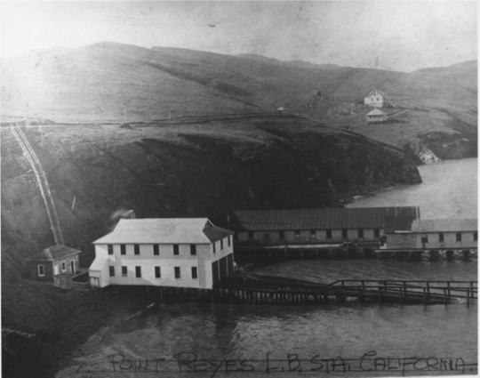


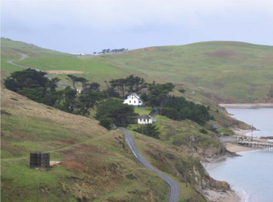
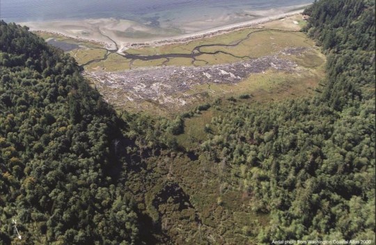
Point Reyes Lifeboat Station Cultural Landscape
Point Reyes has the only surviving lifeboat station on the Pacific Coast with an intact marine railway. The lifeboat station has stood at the eastern tip of the Point Reyes peninsula (part of Point Reyes National Seashore) since 1927. In June of 2019, a crew launched a restored lifesaving boat along the marine railway and into the water of Drakes Bay.
From 1927 to 1968, the Pacific Area U.S. Coast Guard officers and crew members used motorized lifeboats to aid ships in distress. During World War I and World War II, the primary operations of the life-saving station shifted to coastal defense and harbor patrol.
Take a look at our latest article for more about this cultural landscape, including several 360 degree photos that document the landscape and the interior of the boat house: Remembering Maritime Life: The Point Reyes Lifeboat Station Historic District
For more information or to plan your own visit, find the park website: Point Reyes National Seashore
Point Reyes Lifeboat Station Cultural Landscape Inventory report
More about NPS cultural landscapes
#NPS#cultural landscape#Point Reyes National Seashore#Public Lands#maritime history#life saving station#history#WWI#WWII#boat#FindYourPark#National Park Service#California#Drakes Bay
34 notes
·
View notes
Photo
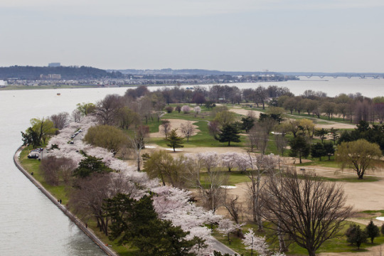
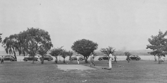
Links to the Past: Public Golf Courses of Washington, D.C.
The three National Park Service golf courses in Washington, D.C. have a fascinating and complex history. Initially built between 1918 and 1939, the courses have hosted numerous tournaments, presidents of the United States, renowned American golfers, and countless local citizens.
The golf courses also played a role in the civil rights movement. Activists successfully protested for equal access to the courses and helped inspire the integration of the city's recreational facilities in 1941.
More: Golf and Civil Rights in Washington, DC
The NPS has completed studies on the history and design of the three golf courses (East Potomac Golf Course, Langston Golf Course, and Rock Creek Golf Course), including treatment guidelines for the long-term stewardship of the courses.
Now, a long-term lease opportunity is available for the golf courses, and the NPS is in search of an operator who’s committed to providing affordable and easy-to-access golfing, to improving facilities and courses, and to preserving the unique histories and landscapes of each of these courses.
For information about developing and submitting a proposal:
News release: “Hole-in-one business opportunity with the National Park Service”
Request for Proposals (RFP)
Proposals must be received by the NPS by 4pm EST on November 27, 2019.

Langston Golf Course, first opened in 1939, is one of three 18-hole golf courses on National Park Service land in Washington, D.C. (NPS).
#land management#lease#partnership#Washington DC#golf#public golf couse#golf course#cultural landscape#NPS#National Park Service#preservation#civil rights#East Potomac Park#Rock Creek Park#Anacostia Park
10 notes
·
View notes