#visualgeomatics
Photo

A Relative Elevation Modelshowing the migration of the Mississippi River
by u/visualgeomatics
290 notes
·
View notes
Photo

A shaded relief map of South America rendered from 3d data and satellite imagery
by u/visualgeomatics
593 notes
·
View notes
Text

Shaded Relief Map of Brazil by visualgeomatics
Visual Geomatics Wall Map Studio
3 notes
·
View notes
Photo

The Mid-Atlantic Ridge rendered from bathymetry data
by u/visualgeomatics
422 notes
·
View notes
Photo
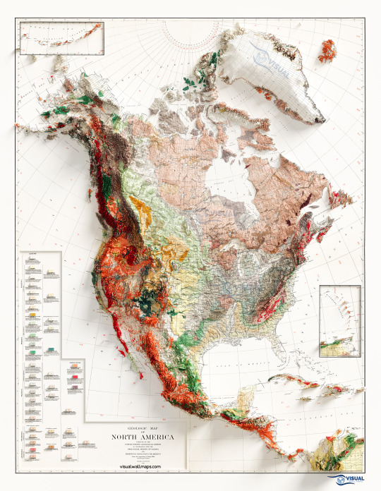
Geological Map of North America rendered with 3d surface model data
by u/visualgeomatics
252 notes
·
View notes
Photo
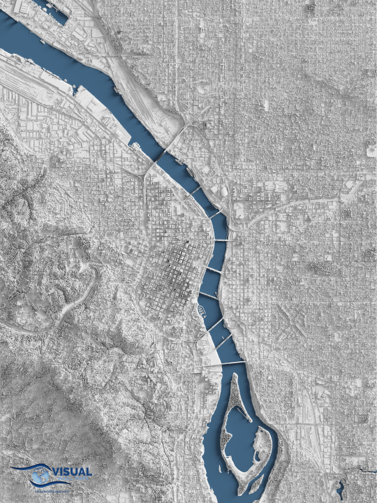
A detailed shaded relief map centered on downtown Portland, Oregon rendered from Lidar data
by u/visualgeomatics
241 notes
·
View notes
Photo
A detailed shaded relief map of Sydney Australia rendered from Lidar data
by u/visualgeomatics
113 notes
·
View notes
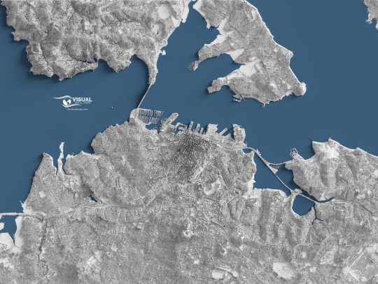
Photo

A detailed shaded relief map of London rendered from Lidar data
by u/visualgeomatics
166 notes
·
View notes
Photo
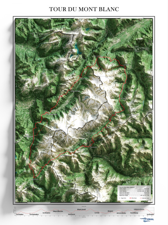
Tour du Mont Blanc (France, Italy, Switzerland) derived from lidar and satellite imagery
by u/visualgeomatics
139 notes
·
View notes
Photo

A shaded relief map of The Mediterranean Sea Region rendered from 3d data and satellite imagery
by u/visualgeomatics
143 notes
·
View notes
Photo

A shaded relief map of the Great Lakes rendered from 3d data and satellite imagery
by u/visualgeomatics
217 notes
·
View notes
Photo

A shaded relief map of South Asia rendered from 3d data and satellite imagery
by u/visualgeomatics
130 notes
·
View notes
Photo

A shaded relief map of The Isles rendered from 3d data and satellite imagery
by u/visualgeomatics
163 notes
·
View notes
Photo

A shaded relief map of Africa rendered from 3d data and satellite imagery
by u/visualgeomatics
200 notes
·
View notes
Photo

A shaded relief map of Europe rendered from 3d data and satellite imagery
by u/visualgeomatics
181 notes
·
View notes
Photo

A shaded relief map of Ireland rendered from 3d data and satellite imagery
by u/visualgeomatics
211 notes
·
View notes
Last Seen Blogs
randcolors
Images Color Palette

sakuraharuno49-blog
Eh. Idk. Place for me to talk about school?
wannywax
masha from russia

kontagio
KONTAGIO

guillaumeroguier
Guillaume Roguier (GRR)