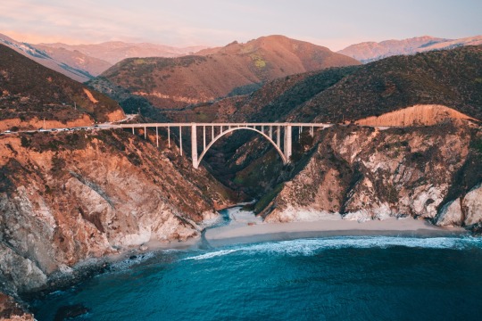
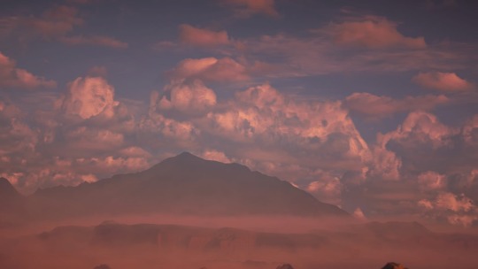
#Bixby Creek Bridge
Text

(by Jules Marvin Eguilos)
#vertical#landscape#x#a#watsf#curators on tumblr#water#ocean#Jules Marvin Eguilos#california#highway#bridge#Bixby Creek Bridge#Monterey#fog
402 notes
·
View notes
Text
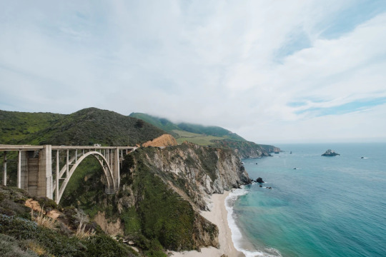
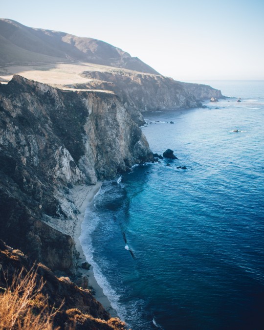
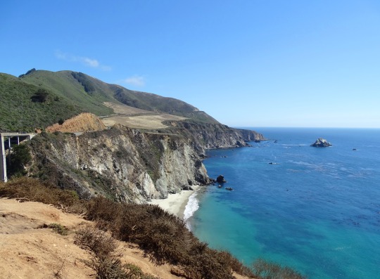
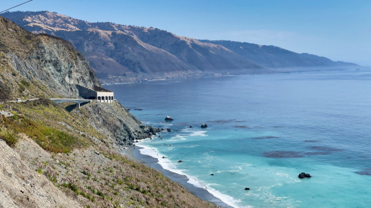
Bixby Creek Bridge, Big Sur, Monterey County, California
Robert Bye
#Bixby Creek Bridge#Big Sur#Monterey County#California#Beach#Bridge#CANature#USA#US#United States of America#United States#North America
9 notes
·
View notes
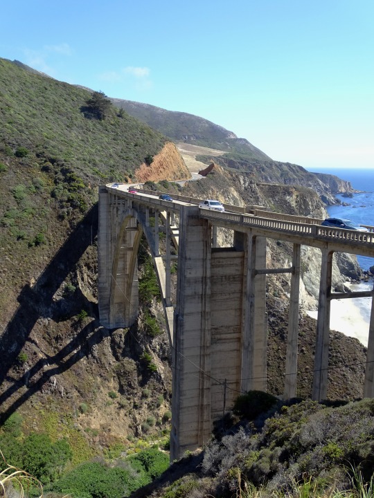
Text

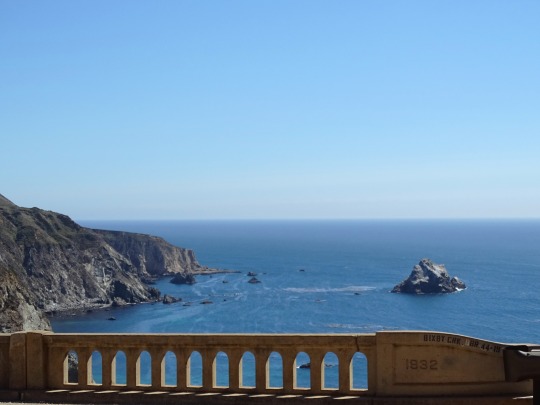
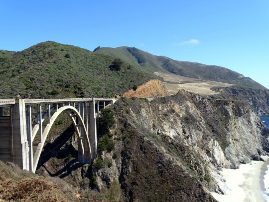
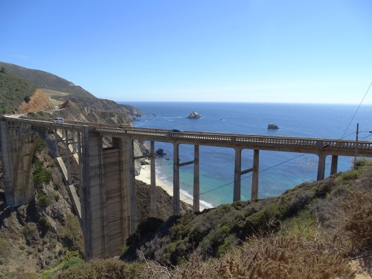
Bixby Bridge, CA (No. 4)
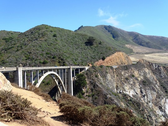
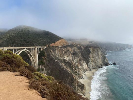
The bridge was already popular before the introduction of smart phones and social media, and visitors to the Bixby Bridge and other Big Sur attractions have dramatically increased since then. Due to the large number of visitors, congestion and slow traffic between Carmel and the bridge is frequently the norm during popular holiday and vacation periods. The bridge was rated as the No. 1 “Instagram-Worthy Destination for 2019 Travels” by the website Travelpulse.com. The California state tourism commission describes the bridge as "a must-see road trip spot for many and probably the most Instagrammed features [sic] along [the] Highway 1 coastline." It promotes the bridge world-wide, including a deal with China's online tourism operator Tuniu that put the bridge on a custom route.
During holiday weekends and most summer vacation periods, the bridge area is "like a Safeway parking lot" according to a local resident. Traffic can come to a standstill as motorists wait for a parking spot. There is a pull out to the north and west side of Highway 1, but when it is full, visitors sometimes fail to completely pull off the highway, leaving inadequate space for passing vehicles.
The area near the bridge has become overwhelmed by visitors. Tourists routinely ignore warning signs to stay off the cliffs, and walk across the narrow 24 feet (7.3 m) wide bridge, although there is no room for pedestrians. There are no toilets within several miles of the bridge, and visitors resort to defecating in nearby bushes. Residents complain about toilet paper, human waste, and trash littering the roadside. On December 29, 2018, two dozen residents and business leaders turned out with signs alongside the northern approach to the bridge to launch a campaign they've named The Big Sur Pledge, encouraging visitors to treat the region with more respect.
Source: Wikipedia
#Bixby Creek Bridge#Bixby Bridge Vista Point#Bixby Bridge#Monterey County#California State Route 1#Highway 1#Pacific Coast Highway#National Scenic Byway#Big Sur#Pacific Ocean#travel#original photography#vacation#tourist attraction#landmark#landscape#seascape#countryside#street scene#road trip#summer 2022#California#West Coast#Big Sur Coast Highway#nature#flora#grass#USA#blue sky#cliff
6 notes
·
View notes
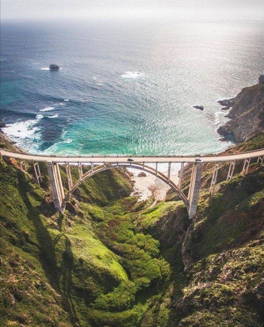
Text
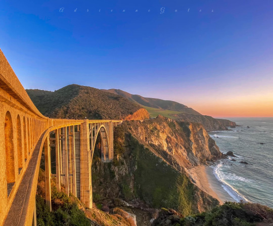
We'll always have Bixby
photo by
Adrienne Gates
5 notes
·
View notes
Text
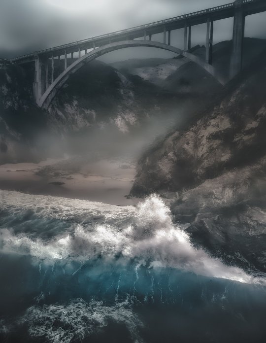
By Ken James : Ken's drone got soaked and wet taking this photo. It was a persistent mist from above and more than a mist from the turbulent waves below. However, sometimes, you just have to take risks to get the shot.
📸 by @Openshutter21
#Ken James#@Openshutter21#Bixby Creek Bridge#California#Rain#Ocean#Blue#Amazing#Beautiful#Nature#Drone#USA#Photography
5 notes
·
View notes
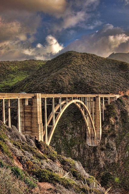
Text
Bixby Creek Bridge
17 notes
·
View notes
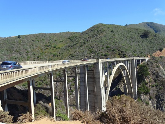
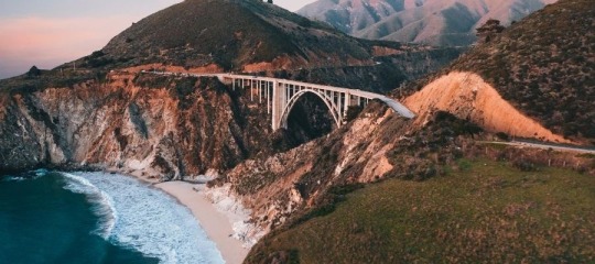
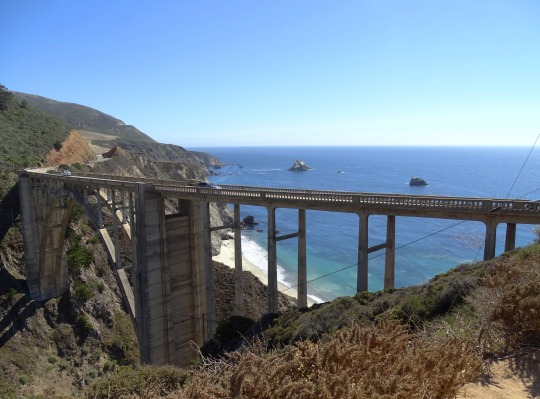
Text
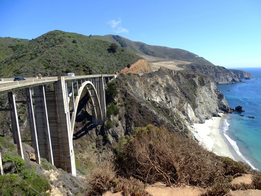
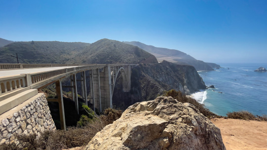
Bixby Creek Bridge, on the Big Sur coast of California, is one of the most photographed bridges in California due to its aesthetic design, graceful architecture and magnificent setting.
It is one of the most popular stops along the famous Big Sur coast in Central California.
#bixby bridge#bixbybridge#bixby creek#California#california coast#highway 1#pacificcoast#pacific coast#big sur#Big Sur icon#photographers on tumblr#photography#fujifilm#travel#landscape#nature#beautiful#canyon#Bixby
36 notes
·
View notes
Video

flickr
Last Light on the Big Sur by dezzouk
Via Flickr:
Gorgeous light hits the Big Sur coastline looking towards Bixby Creek Bridge around sunset
#big#sur#california#bridge#bixby#creek#flickr#light#beach#coast#coastline#nature#photography#landscape#outdoors#outlook#rocks#scenery#scenic#waves#ocean#sand#seascape#cliffs
2 notes
·
View notes
Text
Міст Біксбі Крик, Біг Сур, Каліфорнія
1 note
·
View note
Photo


buckle up folks i’ve been theorycrafting for the Burning Shores and making some maps for interpreting the real world locations of Horizon Forbidden West stuff
For context, I think Thornmarsh is the Bakersfield area and the peninsula where Monterey sits (Bixby Creek Bridge in the Gauntlet Run) is just vertically squished, and the flooded area is indeed the entire Central Valley of CA, a quick google maps search of the location of oil wells in California today + the oil wells just south of Thornmarsh are part of my evidence for this, as we know they move away from fossil fuels in the 2030s during the Clawback so I highly doubt more wells have been drilled, and right now the farthest north wells in CA that are south of San Francisco are in Bakersfield area
What do you think?
#horizon forbidden west#hfw#burning shores#gildun#brin#horizon forbidden west dlc#hfw dlc#hfw dlc theory#burning shores theory#hfw maps#hfw spoilers#horizon forbidden west spoilers
11 notes
·
View notes
Photo

(by Zongnan Bao)
#vertical#landscape#x#a#watsf#curators on tumblr#Zongnan Bao#california#Bixby Creek Bridge#Monterey#big sur#ocean#water#fog
624 notes
·
View notes
Text
Bixby Creek Bridge, Monterey, California. Photo by Ian Schneider.
#rvlivingfulltime#rvlife#rvliving#rv life#rvcamping#rvadventures#camping#rv living#adventure#traveling#travel#campfire#vanlove#vanlife#vanliving#van living#van life#naturephotography#naturepics#travelphotogallery#travelphotography#travelphotooftheday#travel pics#travel photo blog#travel photo diary#travel photography#nature#hikingadventures#hiking#rvfulltime
2 notes
·
View notes
Text


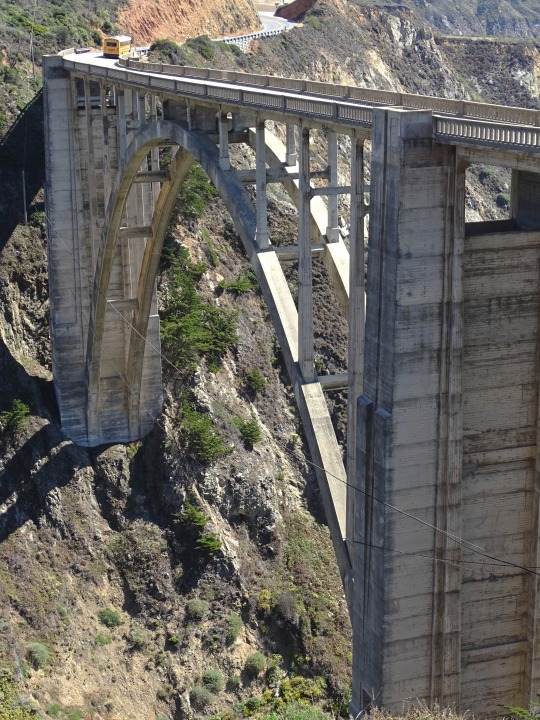
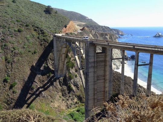
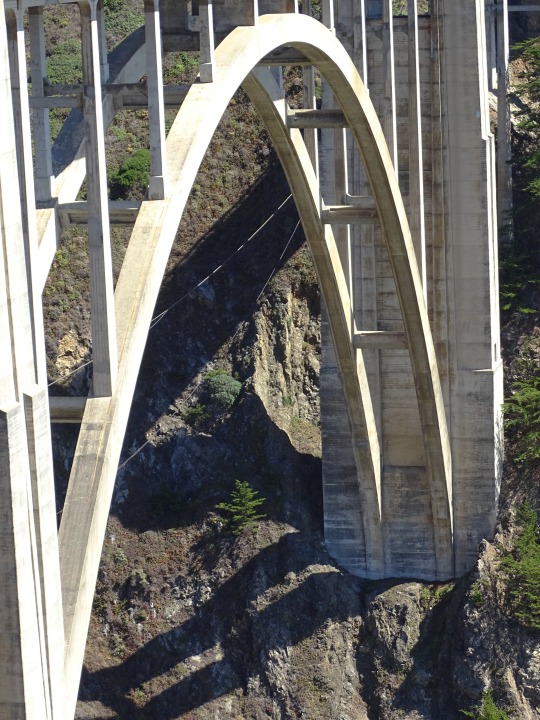
Bixby Bridge, CA (No. 3)
Over 300,000 board feet (700 m3) of Douglas fir timber, used to build a 250-foot (76 m) high falsework to support the arch during construction, was transported from the railroad terminal in Monterey over the narrow, one-way road to the bridge site. The falsework, built by crews led by E. C. Panton, the general superintendent, and I. O. Jahlstrom, resident engineer of Ward Engineering Co., was difficult to raise, because it was constantly exposed to high winds. Some of the falsework timbers were 10 by 10 inches (250 mm × 250 mm).[18] It took two months to construct the falsework alone. When high waves threatened the falsework foundation, construction was halted for a short time until winter storms abated.
The crews excavated 4,700 cubic yards (3,600 m3) of earth and rock. Eight hundred and twenty-five trucks brought in 600,000 pounds of reinforcing steel. Sand and gravel were supplied from a plant in Big Sur.
Construction required 45,000 sacks or 6,600 cubic yards (5,000 m3) of cement which was transported from Davenport, near Santa Cruz, and from San Andreas. Crews began placing concrete on November 27. The concrete was transported across the canyon on platforms using slings suspended from a cable 300 feet (91 m) above the creek.
The bridge was completed on October 15, 1932, although the highway was not finished for another five years. At its completion, the bridge cost $199,861 and, at 360 feet (110 m), was the longest concrete arch span on the California State Highway System. The bridge was necessary to complete the two-lane road which opened in 1937 after 18 years of construction. The completion of construction was celebrated with a ribbon-cutting ceremony led by Dr. John L.D. Roberts, who had conceived of the need for the road.
Source: Wikipedia
#Bixby Creek Bridge#Bixby Bridge Vista Point#Bixby Bridge#Monterey County#California State Route 1#Highway 1#Pacific Coast Highway#National Scenic Byway#Big Sur#Pacific Ocean#travel#original photography#vacation#tourist attraction#landmark#landscape#seascape#countryside#street scene#road trip#summer 2022#California#West Coast#Big Sur Coast Highway#nature#flora#grass#USA#blue sky#cliff
4 notes
·
View notes
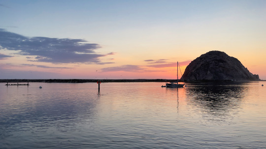
Text
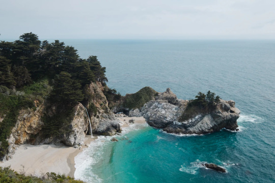
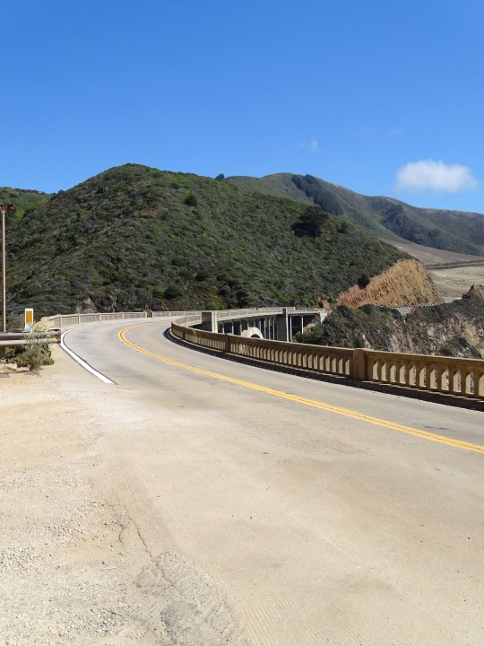
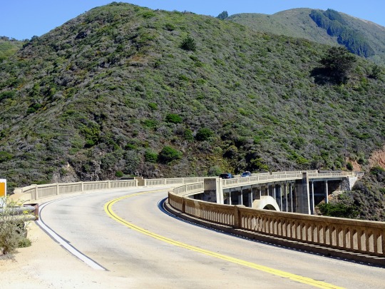
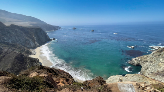
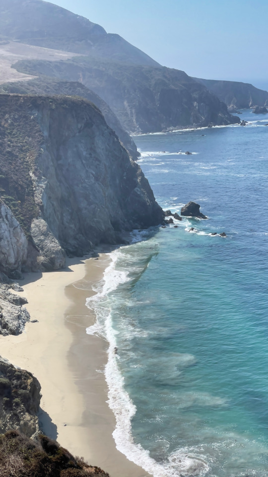
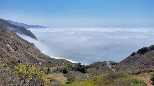
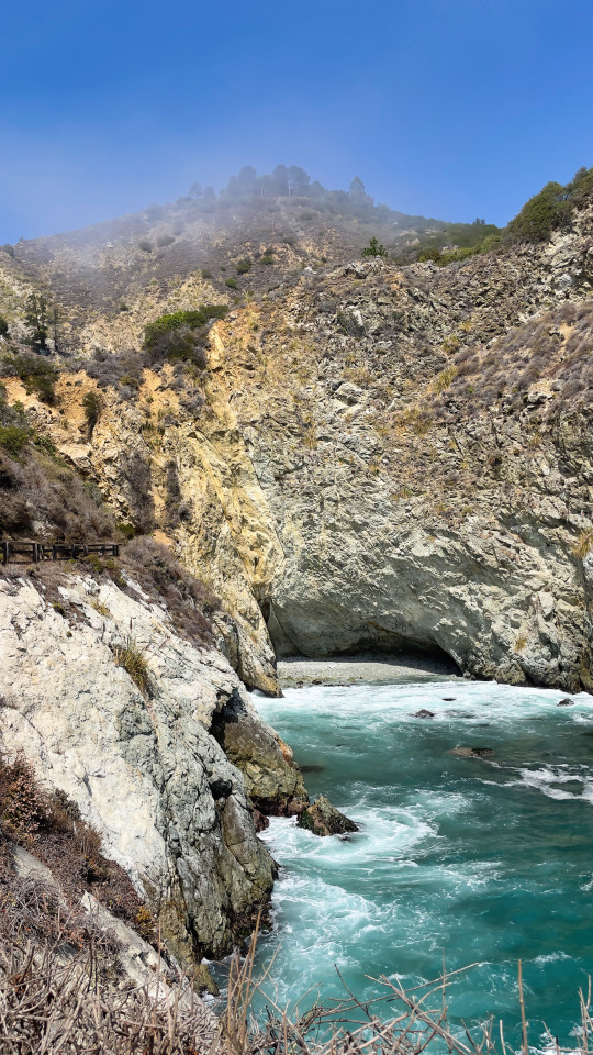
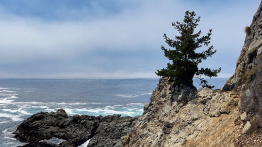
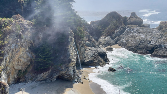
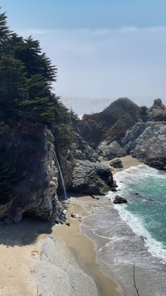
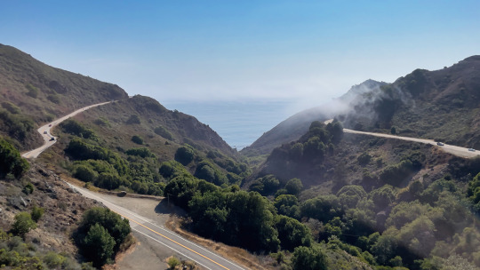
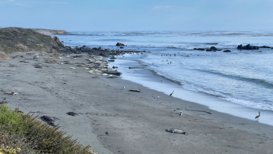
The Pacific Highway 1, Big Sur National Park, CA
The famous Highway 1; is a scenic route along the Pacific coastline. When we were planning our trip to California, driving Highway 1 was a no-brainer. This route provides amazing views and scenic viewpoints along the Highway but also very nice hikes. As we planned one day for this trip, we did a mix of both, stopping at the main viewpoints, like Bixby Creek Bridge, McWay Falls, Elephant Seal Rookery and some hiking. In the beginning, we were a bit skeptical if we could fit everything into one day, but we actually, needed less time than expected and made it down to Morro Bay for the night. We got super lucky with the weather on that day and had the perfect mix of a cloudy and misty morning and also blue skies with perfectly clear views of the coast and the ocean.
Adventure by Taco Club @taco-club-official
Music provided by Free Music for Vlogs youtu.be/Gz-fmy6_pFA
• Contact the artist:
@taco-club-official
Free Music for Vlogs
This Youtube Channel is dedicated to search, catalog, sort and publish free music for vlogs and videos destined to content creators and filmmakers.
3 notes
·
View notes
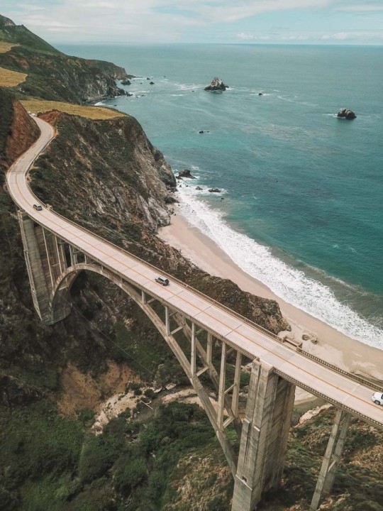
Photo
Big Sur! Bigsby Bridge! • 📍 Place: PacificCoastHighway, California 🎞 Camera: iPhone 11 Pro Max 👁🗨 Valid Tag: #CaliforniaDreaming • ▪️ • 🔳 • ▫️ • ================================= #FueledByWanderlust #GravityHurts #NoTime2Sleep #wanderlust #adventure #Verus_Animus #wanderfolk #pacificocean #verusanimus #roadtrip #roadtrip2022 #bigsbybridge #westcoastbestcoast #sceniccoast #california #coastline #pch #bigsbycreekbridge #unlimitedcalifornia #californiaholics #jocael #wecantify #truespirit #verusanimusapocalypse #elicajune #whoislcn #casiiiano #bigsur #pacificcoasthighway ================================= (at Bixby Creek Bridge) https://www.instagram.com/p/CjDpe0-uEw-/?igshid=NGJjMDIxMWI=
#californiadreaming#fueledbywanderlust#gravityhurts#notime2sleep#wanderlust#adventure#verus_animus#wanderfolk#pacificocean#verusanimus#roadtrip#roadtrip2022#bigsbybridge#westcoastbestcoast#sceniccoast#california#coastline#pch#bigsbycreekbridge#unlimitedcalifornia#californiaholics#jocael#wecantify#truespirit#verusanimusapocalypse#elicajune#whoislcn#casiiiano#bigsur#pacificcoasthighway
4 notes
·
View notes
Last Seen Blogs

kpopgc
KPOP TV
darkdaisys
Disposable Souls

ambiguousims
AmbiguouSim.

consequentialviews
Consequential Reviews

blue-sun08
I'm leaving, find me anywhere else