#Coconino County
Text

Steller's jay / chara copetona (Cyanocitta stelleri) at Picture Canyon in Flagstaff, Arizona. I had dozens of jays keeping me company on my hike.
The white forehead feathers and partial eye ring are characteristic of Steller's in the interior west.
The Spanish common name is a puzzle. Copetón means a shy or timid person, but I don't think there is anything shy about a Steller's jay. Can any Spanish speakers provide a clue?
UPDATE (with big thanks to wordsmith and friend @readsal): The Steller's Spanish common name is derived from copete, meaning pompadour, tuft, or forelock and refers to its striking black crest feathers.
#photographers on tumblr#Steller's jay#Cyanocitta stelleri#Picture Canyon#Flagstaff#Coconino County#Arizona
74 notes
·
View notes
Text

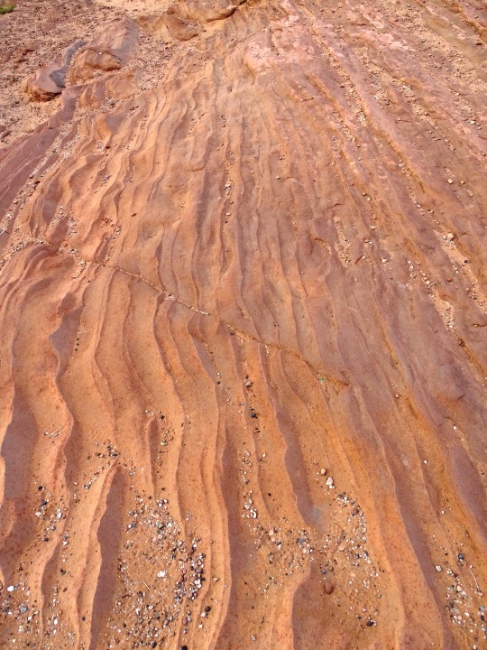
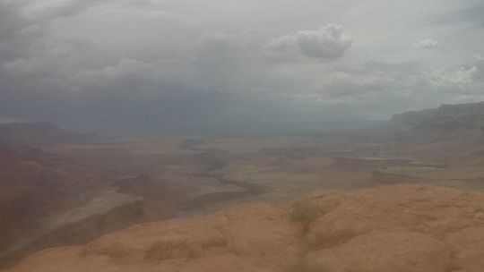
Desert landscape, Coconino County, Arizona, 2020.
169 notes
·
View notes
Text

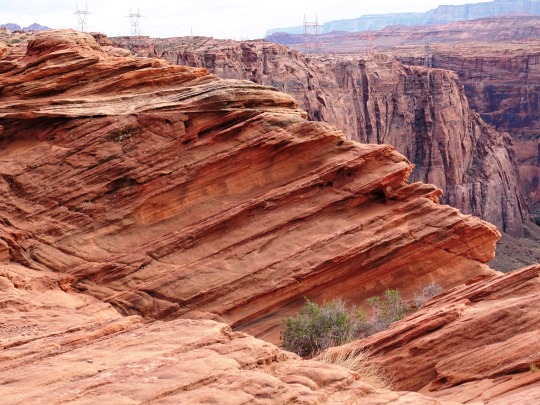


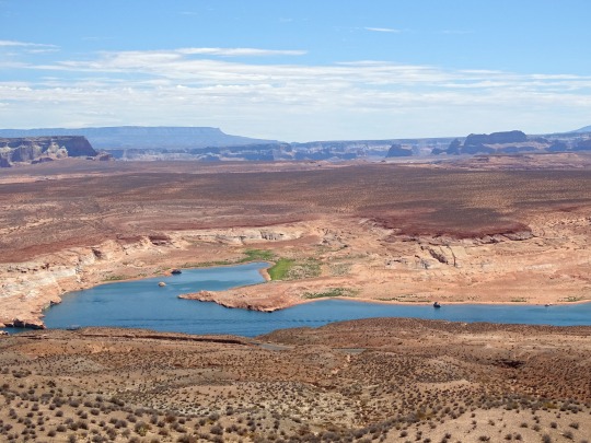
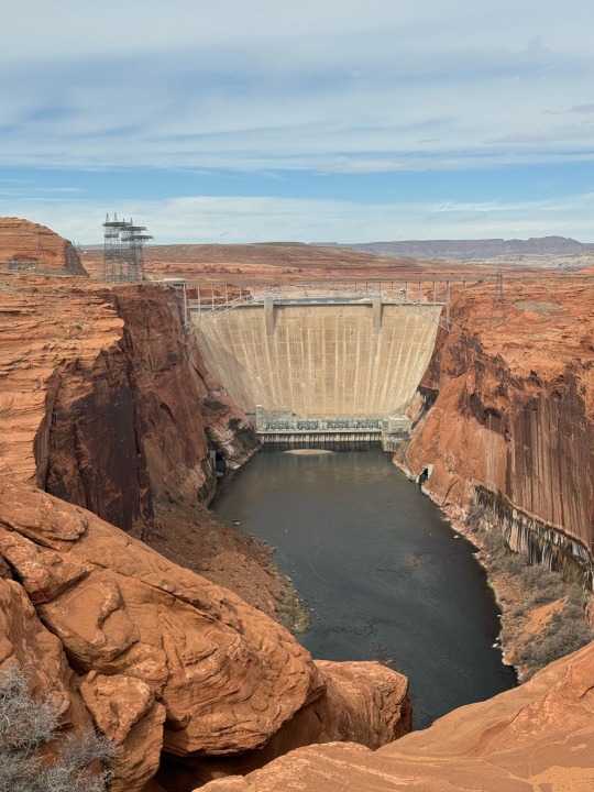
Glen Canyon National Recreation Area, AZ (No. 9)
Dam Overlook Trailhead
This very short walk takes you to a viewpoint on the canyon rim high above the Colorado River. It affords an unparalleled view of the river, the canyon, and Glen Canyon Dam. This scenic view provides spectacular vistas of the Colorado River as it flows through Glen Canyon and of Glen Canyon Dam itself. From the parking area, follow the metal handrail down the uneven rock steps.
Trailhead: From U.S. Hwy. 89, turn west on Scenic View Drive, 1.5 miles (2.4 km) south of Carl Hayden Visitor Center. Take the first road to the right, and park in the parking area at the end of the road. (You may also access Scenic View Drive just south of the Park Headquarters building.)
Source
#Glen Canyon Dam Overlook#Glen Canyon National Recreation Area#Glen Canyon NRA#GCNRA#Coconino County#Southwestern USA#Colorado Plateau#desert#flora#nature#blue sky#clouds#grass#travel#original photography#vacation#tourist attraction#landmark#landscape#countryside#USA#Arizona#summer 2022#red rock#Page#engineering#technology#Colorado River#detail#close up
32 notes
·
View notes
Text
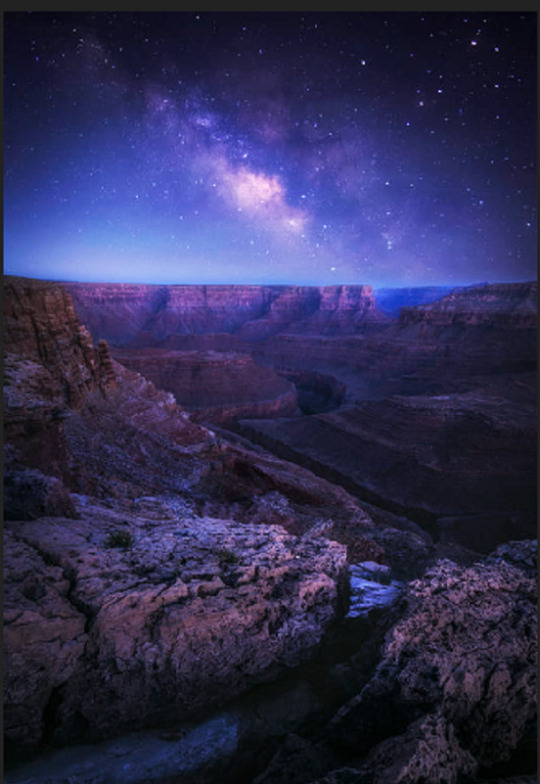
Milky Way was seen over Grand Canyon in Coconino County, Arizona - USA
25 notes
·
View notes
Text


Had a great time at the Tour de Scottsdale this weekend!
#ericruchensky#eric ruchensky#arizona#flagstaff#lawyer#attorney#coconino county#scottsdale#biking#cycling
2 notes
·
View notes
Text
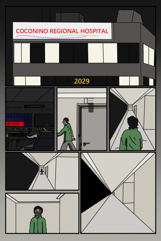
All this for a telemetry box.
#art#digital art#comic#Arizona#webcomic#horror webcomic#labyrinth#maze#Minor coloring error#hospital#telemetry#2029#They're not ignoring the spiking heart rate they already called it in.#coconino county#page 1#Never Only#NO#cw horror#horror
2 notes
·
View notes
Photo
USA, Arizona, Coconino County - webcam
18 notes
·
View notes
Text
Coconino County, Arizona ... FDLS group of polygamist cult are still at it
3 notes
·
View notes
Text

Source: Arizona Geological Survey at the University of Arizona
Upstream of Lees Ferry and the confluence of the Paria and Colorado River lies the canyon of the Paria River. Jurassic-age rocks exposed in the canyon walls (from youngest to oldest: Jn-Navajo Sandstone; Jk-Kayenta Formation; Jks-Springdale Sandstone Member; Moenave Formation & Wingate Sandstone; and Trcp-Petrified Forest Member of Chinle Formation) are largely mantled by Quaterary dune sands (Qd - Holocene), talus and rock-fall deposits (Qtr – Holocene and Pleistocene(?), and landslide deposits (Ql – Holocene and Pleistocene).
For the geologic map with contacts and additional information see Billingsley and Priest (2013) map of Glen Canyon Dam 30’ x 60’ map at https://ngmdb.usgs.gov/Prodesc/proddesc_98793.htm
0 notes
Text
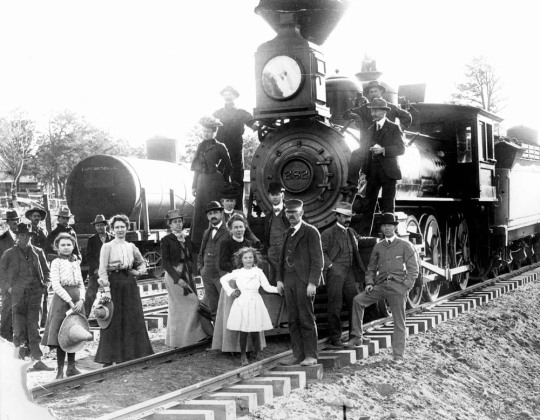
Grand Canyon Railroad
The Grand Canyon Railroad is a 64 miles railroad which connects Williams Arizona to the South Rim of the Grand Canyon. The original 64 mile route was built by the Atchison, Topeka and Santa Fe Railway company in order to construct and promote the Grand Canyon Village. The railroad was completed on September 17th, 1901. in 1901 a ticket could be purchase for the sum of $3.95.
First Train to Carry…
View On WordPress
#Arizona#Coconino County#Grand Canyon National Park#Grand Canyon Railroad#National Register of Historic Places#Railroad
0 notes
Text

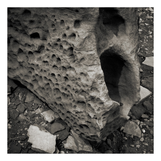
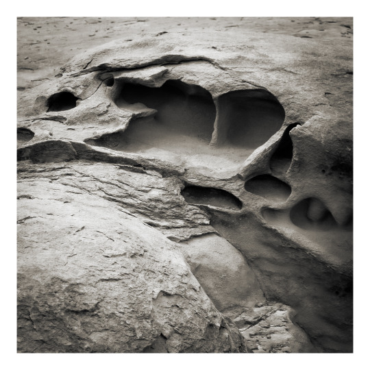

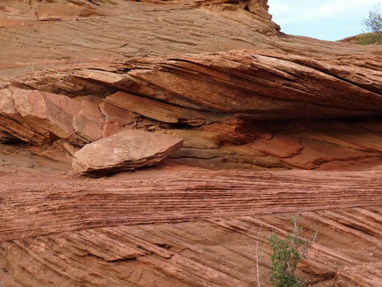
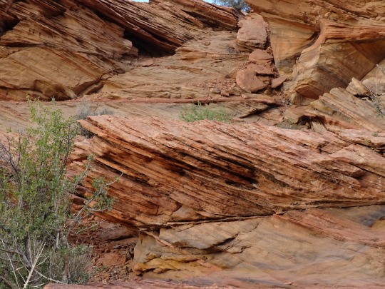
Tafoni.
#photographers on tumblr#tafoni#geology#Moenkopi sandstone#Wupatki National Monument#Coconino County#Arizona
59 notes
·
View notes
Text

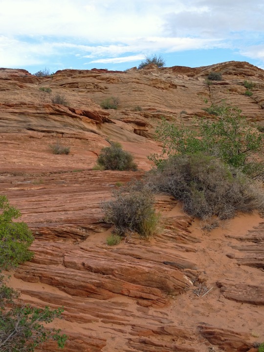
Highways: US 89, Wupatki National Monument, Arizona, 2014.
#landscape#desert#highway#us 89#wupatki national monument#coconino county#arizona#2014#photographers on tumblr
25 notes
·
View notes
Text

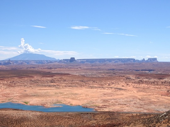


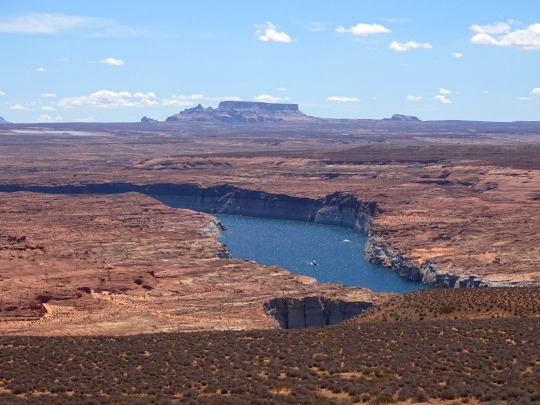

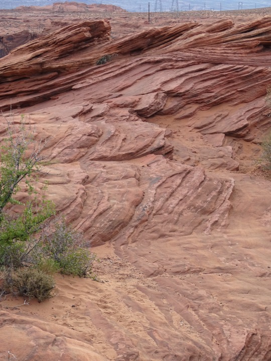
Wahweap Overlook, AZ (No. 4)
Navajo Mountain
On the far horizon, Navajo Mountain looms, a big dome erupting from the canyon landscape - a laccolith, a volcano that never came to be. Reaching an elevation of 10,388 feet (3,166m) above sea level, Navajo Mountain supports several plant life zones: desert scrub, riparian, pinion-juniper woodlands and ponderosa pine forests. It is one of many mountains sacred to the Navajo People.
Tower Butte
Glancing across from left to right many buttes and formations appear. The most prominent on the far right is Tower Butte. Once a part of Romana Mesa, time and the erosive forces of water and weather carved and washed away the materials that connected them. Now this 1600-foot (488m) monolith stands solo and someday it too will crumble and disappear into the landscape.
Source
#Wahweap Overlook#Lake Powell Lookout Point#Glen Canyon National Recreation Area#Glen Canyon NRA#GCNRA#Coconino County#Southwestern USA#Colorado Plateau#desert#flora#nature#blue sky#clouds#grass#travel#original photography#vacation#tourist attraction#landmark#landscape#countryside#USA#Arizona#summer 2022#red rock#Page#Colorado River#detail#close up#Lake Powell
25 notes
·
View notes
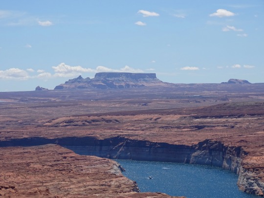
Text


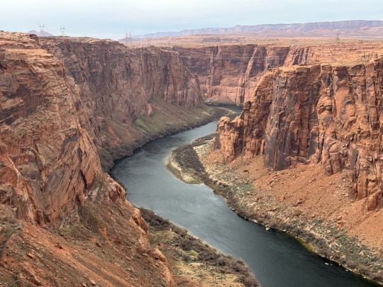
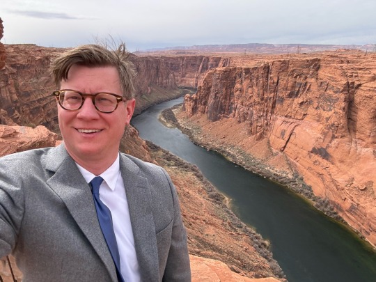
Had a great time working near Horseshoe Bend, Glen Canyon Dam, and in Page, Arizona this week!
#ericruchensky#eric ruchensky#arizona#flagstaff#hiking#lawyer#attorney#coconino county#clouds#horseshoe overlook#horseshoe bend#glen canyon dam#page#pageaz#opt outside#desert#lake powell#lake#lakeside#lake life
2 notes
·
View notes
Text
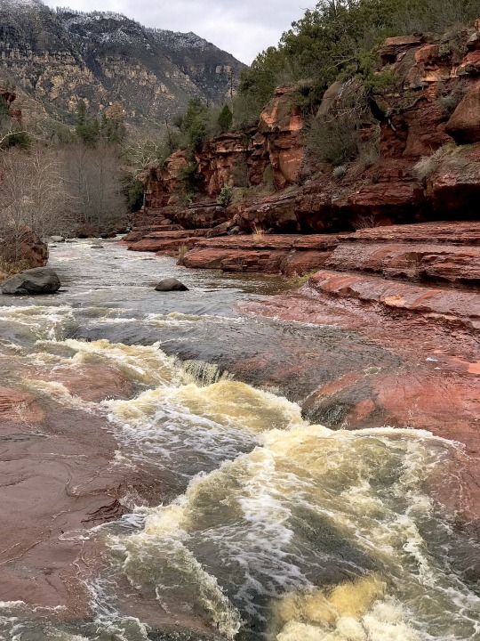
Heavy flow in Oak Creek Canyon near Slide Rock, Coconino County, Arizona.
1K notes
·
View notes
Text

Greater Short-horned Lizard (Phrynosoma hernandesi), family Phrynosomatidae, Coconino County, AZ, USA
photograph by John Ginter
187 notes
·
View notes
Last Seen Blogs
sparkleskulls
These Are My Things, I Love Them

wilted3sunflowers
art hurts

moodangel
Minimalism

lovingcollectiveruins
Untitled

femmilingus
Toya In Wünderland