#glen canyon
Text
Glen Canyon, Utah 🌍
#glen canyon#utah#trees#travel photography#amazing nature#travel#nature#travel destinations#beautiful nature
4K notes
·
View notes
Text

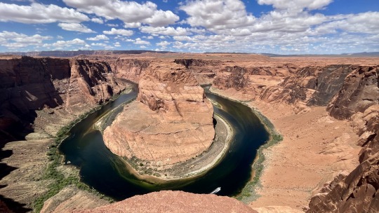
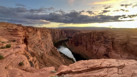
Horseshoe Bend, in Glen Canyon National Recreation Area, Arizona.
#horseshoe bend#desert#colorado river#glen canyon#national park#national park service#travel#original photography#photographers on tumblr#photography#landscape#landscape photography#lensblr#nature#nature photography#wanderingjana
125 notes
·
View notes
Text
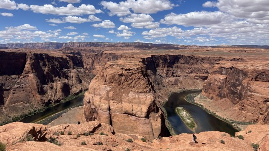
Horseshoe Bend
Page, Arizona
#photographers on tumblr#original photography#pointofview#imperfection#sunlight and shadow#reflections#arizona#glen canyon#horseshoe bend#landscape
39 notes
·
View notes
Text

Obligatory Horseshoe Bend photo.
At Marble Canyon near Page, Arizona.
Update: @amatkins reblogged my post and noted that Horseshoe Bend is actually located in Glen Canyon. Marble Canyon begins further downstream. Notations on USGS topographic maps seem to indicate that Marble Canyon begins at Lees Ferry, at the confluence of the Colorado and Paria Rivers. I'm grateful for the correction. Whenever I'm in canyon country I like to try to relate what I am seeing with John Wesley Powell's account of his 1869 expedition down the Colorado River.
On August 4 he wrote this about this stretch of the river:
"To-day the walls grow higher and the canyon much narrower. Monuments are still seen on either side; beautiful glens and alcoves and gorges and side canyons are yet found. After dinner we find the river making a sudden turn to the northwest and the whole character of the canyon changed. The walls are many hundreds of feet higher, and the rocks are chiefly variegated shales of beautiful colors – creamy orange above, then bright vermilion, and below, purple and chocolate beds, with green and yellow sands. ... At night we stop at the mouth of a creek coming in from the right, and suppose it to be the Paria. ... Here the canyon terminates abruptly in a line of cliffs, which stretches from either side across the river." From The Exploration of the Colorado River and Its Canyons, 1875
#photographers on tumblr#landscape#Horseshoe Bend#Colorado River#Page#Arizona#John Wesley Powell#Glen Canyon
116 notes
·
View notes
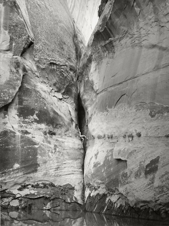
Text
Sneaky
6 notes
·
View notes
Text
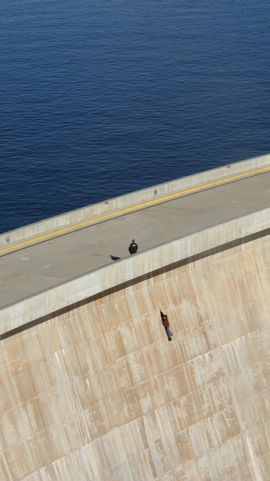
Glen Canyon Dam in Page, AZ
youtube
It took 17 years to fill up the Glen Canyon Dam for the first time. I did some research and put together a short video…
3 notes
·
View notes
Video
Glen Canyon Dam by James Marvin Phelps
Via Flickr:
Glen Canyon Dam Page, Arizona
#arizona#page arizona#dam#glen canyon dam#glen canyon#colorado river#lake powell#usa#southwest#drought#water#glen canyon dam bridge#james marvin phelps photography#hydroelectric#power#flickr
7 notes
·
View notes
Photo

Receding
What do you think about my pic?
#Coconino County#Page#Glen Canyon#Lake Powell#landscape#Arizona#summer 2022#original photography#countryside#water#blue sky#clouds#rain#shore#cliff#Colorado Plateau#photo of the day#tourist attraction#landmark#desert#geology#vacation#travel#road trip#What do you think about my pic?#red rock#rock formation#Southwestern USA#drought
5 notes
·
View notes
Text
Consequences of Glen Canyon Dam Failure
1 note
·
View note
Text
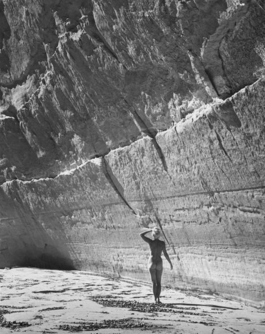
1957 - Katie Lee, goddess of Glen Canyon by Martin D. Koehler
0 notes
Text
Glen Canyon at sunset
Page, Arizona
#photographers on tumblr#original photography#pointofview#sunlight and shadow#sunset#glen canyon#arizona#landscape
18 notes
·
View notes
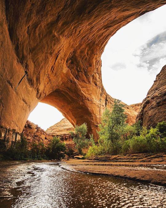
Text

Rainbow Bridge, Glen Canyon, Utah, 1926.
©E.O. Hoppé Estate Collection.
#rainbow bridge#natural arch#utah#glen canyon#lake powell#1920s#geology#sandstone#natural wonders#e o hoppe
1 note
·
View note
Text

Source: Arizona Geological Survey at the University of Arizona
Upstream of Lees Ferry and the confluence of the Paria and Colorado River lies the canyon of the Paria River. Jurassic-age rocks exposed in the canyon walls (from youngest to oldest: Jn-Navajo Sandstone; Jk-Kayenta Formation; Jks-Springdale Sandstone Member; Moenave Formation & Wingate Sandstone; and Trcp-Petrified Forest Member of Chinle Formation) are largely mantled by Quaterary dune sands (Qd - Holocene), talus and rock-fall deposits (Qtr – Holocene and Pleistocene(?), and landslide deposits (Ql – Holocene and Pleistocene).
For the geologic map with contacts and additional information see Billingsley and Priest (2013) map of Glen Canyon Dam 30’ x 60’ map at https://ngmdb.usgs.gov/Prodesc/proddesc_98793.htm
0 notes
Text
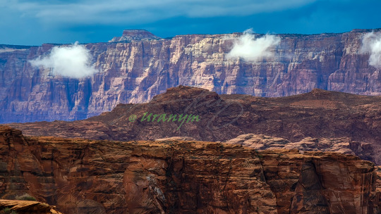
Clouds Between Plateaus Between Storms at Horseshoe Bend
At Horseshoe Bend on a day with passing storms, clouds found there way in between the plateaus and cliffs that form the landscape north of the Grand Canyon.
#Arizona#Page#Lake Powell#Glen Canyon#Grand Canyon#Horseshoe Bend#desert#plateau#mesa#Western Desert#Colorado River#rain#clouds#nature#travel#landscape#west#Summer#day#color#layers#aesthetic#tumblraesthetic#fotografia#tumblrpost#tumblrphoto#photooftheday#wanderlust#picoftheday#photography
0 notes
Text
American Auto Trail-Bicentennial Highway Part 2 (Fry Canyon to Glen Canyon UT)
American Auto Trail-Bicentennial Highway Part 2 (Fry Canyon to Glen Canyon UT)
https://youtu.be/LlntSN1zYbs
This is part 2 of our exploration of the Bicentennial Highway in southern Utah.

View On WordPress
#4K#american history#Auto trail#Bicentennial Highway#Colorado River#Fry Canyon#Glen Canyon#Henry Mountains#Natural Bridges#road travel#slow travel#utah#White Canyon
0 notes
Video
Overlook by James Marvin Phelps
Via Flickr:
Overlook Glen Canyon Dam Page, Arizona
#arizona#page arizona#dam#glen canyon dam#glen canyon#colorado river#lake powell#usa#southwest#drought#water#glen canyon dam bridge#james marvin phelps photography#hydroelectric#power#flickr
4 notes
·
View notes
Last Seen Blogs

vintagegulley
Vintage Gulley

photoboothhirebradforduk
Photo Booth Hire Bradford

jfjdhdgdififhddhidjd-blog
Untitled

rickandmortyc137
Rickety Rickety Wrecked son.
rickandmortyc137
Rickety Rickety Wrecked son.