#6th century Mosaic


Text
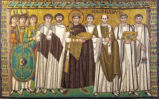

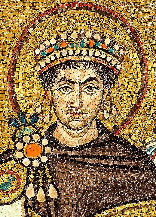
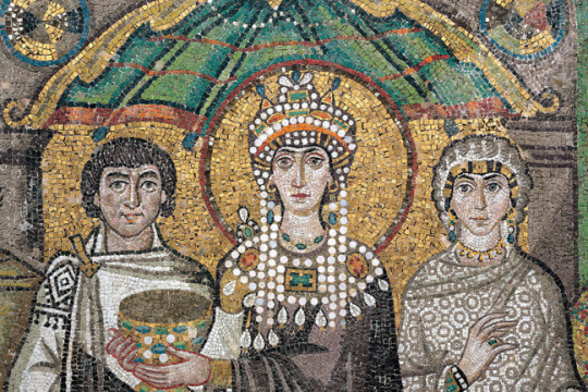
Early Byzantine, The Emperor Justinian and Empress Theodora with their Court Retinues, ca. 547, mosaic (San Vitale, Ravenna)
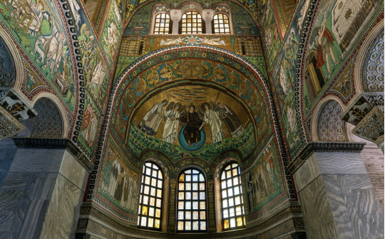
Mosaics in situ (flanking apse windows beneath Christ in Majesty mosaic), details of Emperor and Empress

679 notes
·
View notes
Photo
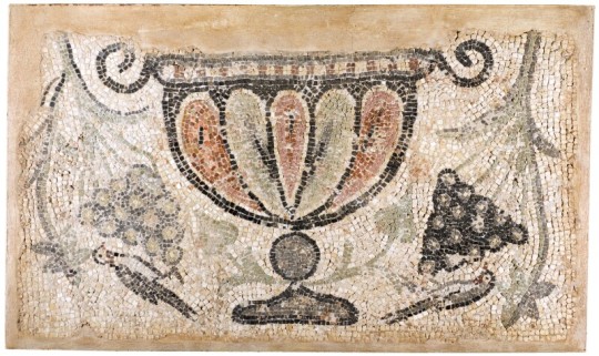
A Byzantine Mosaic Fragment
Circa 5th/6th Century A.D.
Depicting in multi-coloured tesserae a gadrooned vase with voluted handles flanked by hanging vines and two birds each pecking at a cluster of grapes.
78 by 130 cm.
#A Byzantine Mosaic Fragment#Circa 5th/6th Century A.D.#archeology#archeolgst#mosaic#ancient artifacts#ancient art#art#artist#art work#art news#history#history news#ancient history#ancient culture#ancient civilizations
196 notes
·
View notes
Text
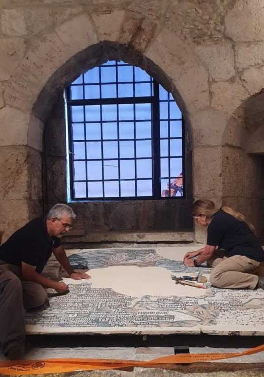
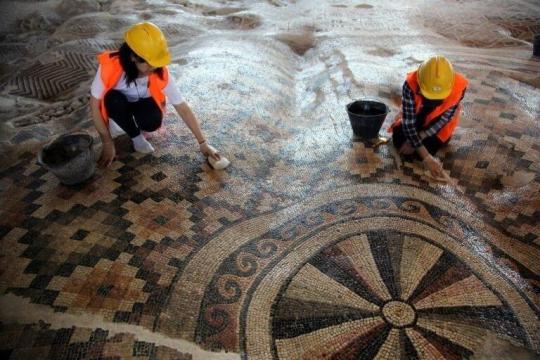
What did Jerusalem’s main road look like about 1,500 years ago?
An archaeological excavation conducted by the Israel Antiquities Authority in 2010 near the Old City’s Jaffa Gate brought to life a 1,500 year-old map.
The Madaba Map is an ancient mosaic map that paves the floor of Saint George’s Church in the city of Madaba, Jordan.
The map, created in 6th-7th centuries CE, depicts the Land of Israel during the Byzantine period.
It clearly shows the entrance into Jerusalem from the west via a central single gate that led to the main street of the city.
In the past, the reliability of the map, which, among other buildings, provides the earliest visual description of the Church of the Holy Sepulchre, has been questioned.
The excavation, located near David Street known to tourists as the terraced shopping street exposed for the first time, archaeological evidence of Jerusalem’s central street from about 1,500 years ago.
The salvage excavation, carried out in the wake of infrastructure works undertaken in the area and funded by the Jerusalem Development Authority, gave the archaeologists and the public a rare glimpse into archaeological remains underlying the asphalt and the paving stones.
Familiar with the Madaba Map, Dr. Ofer Sion, Director of the Excavation on behalf of the Israel Antiquities Authority, suspected that the ancient main street underlay the modern road.
"After removing a several archaeological layers, about 4.5m below modern street level, we were excited to discover the large stone slabs, each about one meter long, that were part of the ancient street.
It’s great to see that today’s bustling David Street preserves the route of the Byzantine-period busy street from 1,500 years ago.”
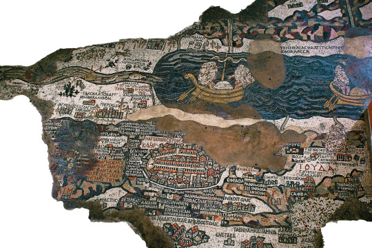
The Madaba Map, whose extant part measures 16x5m, depicts the land of Israel as known to the mosaic artist.
Map encompasses the entire country, with emphasis on Jerusalem and its Christian sites.
It shows that many churches were first constructed in Jerusalem during this period, when city underwent a religious transformation from a pagan to a Christian city.
The churches can be identified by their red tiled roofs illustrated on the map.
© Israel Antiquities Authority
#Madaba Map#Jerusalem#Israel Antiquities Authority#Old City#Jaffa Gate#archaeological excavation#archaeology#ancient mosaic map#mosaic map#Israel#Byzantine period#Saint George’s Church#Church of the Holy Sepulchre#Jerusalem Development Authority#ancient main street#streets#churches#maps#6th century#7th century
7 notes
·
View notes
Text
#MosaicMonday for #LunarNewYear #YearOfTheRabbit:
Mosaic Panel with Rabbit
Roman, from Syria, possibly Emesa (present-day Homs)
5th-6th century
Stone tesserae
68.6 cm × 114.3 cm
[Getty Museum 75.AH.118]
#rabbit#rabbits#mammals#mosaic#ancient Rome#Roman art#ancient art#Syria#5th century#6th century#Getty Museum#Mosaic Monday#Lunar New Year#Year of the Rabbit#animals in art
20 notes
·
View notes
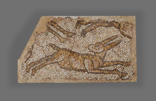
Photo

Roman mosaic fragment of a stag (Syria, 5th–6th century).
Image and text information courtesy The Getty.
Creative Commons Attribution 4.0 International License
110 notes
·
View notes
Text

Hunting scene
* Carthage, Tunisia
* 5th or 6th century CE
* British Museum
London, July 2022
#Roman#mosaics#Tunisia#5th century CE#6th century CE#animals#dog#hunting#boar#British#Museum#my photo
42 notes
·
View notes
Text

#The 'Green Man' mosaic#a Byzantine mosaic from the Great Palace Mosaic Museum featuring a man with acanthus leaf foliage for a beard#modern-day Istanbul#Turkey#c. 6th century AD. [535x674]
4 notes
·
View notes
Text
man the byzantines were really off the shits when it came to mosaics. i've been staring at the medaba floor mosaic for like 20 minutes because it's so gorgeous and detailed. like look at this thing. this is a MAP. a MOSAIC MAP from the 6TH CENTURY AD with LABELS in GREEK. i want to touch it. i want to eat it. it's the sickest shit i've ever seen and it is a map. god damn
#tagamemnon#i want a shirt with this printed on it. i want to go up to people and show it to them#queueusque tandem abutere catilina patientia nostra
2K notes
·
View notes
Text
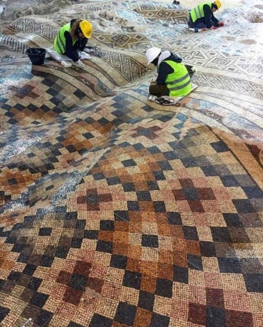
The largest Roman mosaic floor, discovered in 2010, Ant𝚊k𝚢𝚊, Türkiye. Anciet city Antioch
Photos by Cemal Emden/Emre Arolat Arch
9,000 square meter mosaic with colorful geometries. It is the floor of a large Roman public building, damaged during an earthquake in the 6th century.
Antioch, former capital of the Seleucid Empire, was conquered by Rome in 63 BC.
687 notes
·
View notes
Text
Basilica di San Vitale, Ravenna. Mosaic.6th century.
0 notes
Text
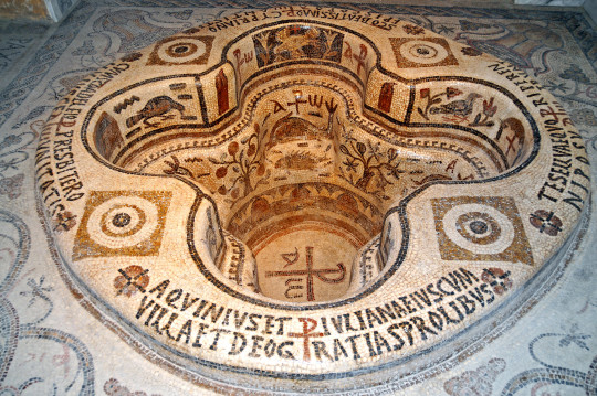
The Demna Baptistry - 6th century AD - in the Bardo Museum. This early Christian baptismal font is richly decorated with mosaics discovered in Demna. It is one of the finest Christian mosaics to have been found in Africa, and even throughout the Roman world.
Photography and text by Dennis Jarvis (CC)
133 notes
·
View notes
Text

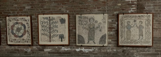

The floor is hella cold but I couldn’t work sitting anywhere else. While I’m reading for my PhD proposal I’m attempting for the fist time to crochet myself a sweater. Crafting is my way to relax after a long day in the lab.
Also, since this is the Archaeology hashtag I’m sharing cute 6th century CE mosaics from the city of Ravenna, which I visited a few weeks ago. I’m a bit of a nerd about late antiquity and the Romano-barbaric interaction, I info-dumped my girlfriend for the whole trip. Bless her she puts up with me and my fascination for the Ostrogoths!
#archaeology#bioarchaeology#anthropology#physical anthropology#art#bioarchaeology of adolescence#bioarchaeology of childhoood#studyblr#archaeology of childhood#study#crafts#crochet
136 notes
·
View notes
Photo

A Byzantine Mosaic Panel
Circa 5th/6th Century A.D.
Decorated in multi-coloured tesserae with a frieze of overlapping palmettes within linear borders.
59 by 120 cm.
#A Byzantine Mosaic Panel#Circa 5th/6th Century A.D.#archeology#archeolgst#mosiac#ancient artifacts#ancient art#art#artist#art work#art news#history#history news#ancient history#ancient culture#ancient civilizations
77 notes
·
View notes
Text
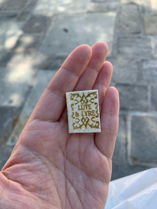
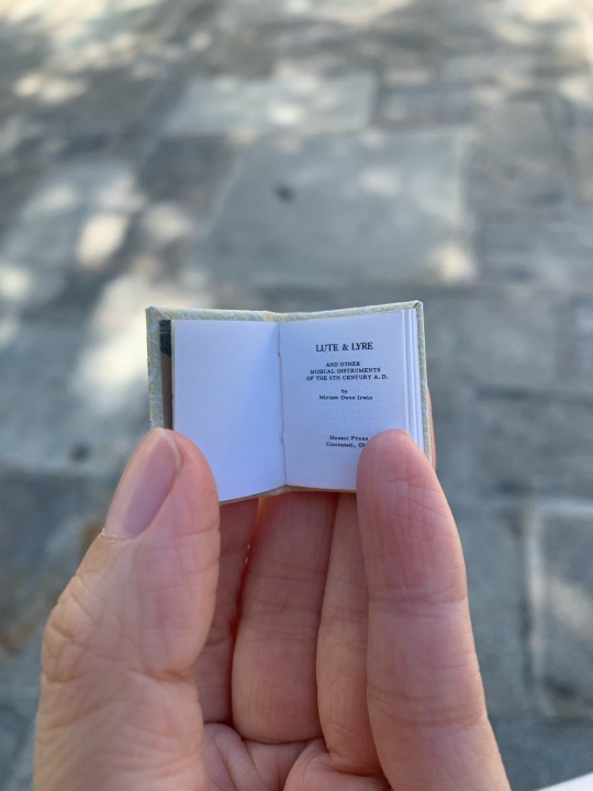
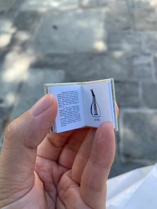
The tiniest book.
The book is Lute & Lyre and Other Musical Instruments of the 6th Century A.D. by Miriam Owen Irwin (in Miniature).
The book is 0.75 x 1 inch in size, wrapped in white leather, with gilt decoration, gilt top edge, and marbled endpapers. Hand bound by Hugo Grummich at the Cincinnati Mosaic Press. It was sold to me by Owl Creek Books (@owlcreekbooks on Instagram).
10-8-2023

#handbound book#miniature books#book binding#bookbinding#rare books#antiquarian books#vintage books#vintage#handmade
62 notes
·
View notes
Text

A 6th century Byzantine mosaic of Christ as the Good Shepherd is in the Mausoleo di Galla Placidia, Ravenna, Italy. With their pure Hellenistic style, the Galla Placida mosaics are considered among the oldest in Ravenna.
19 notes
·
View notes
Last Seen Blogs