#oldmill
Photo

KENT! 💔💔💔 #kent #oldmill #noinjuries #downtownkent #ksu #kentstate (at Kent, Ohio) https://www.instagram.com/p/ClryYFXp4bu/?igshid=NGJjMDIxMWI=
0 notes
Photo

Mill Wheel at Gilreath's Millsite, Hwy 101 Greer, SC #autumnvibes #oldmill #woods #danielsmithwatercolors #kilimanjarocoldpress 8x10 (at Barnes & Noble) https://www.instagram.com/p/CkQwQBRuELR/?igshid=NGJjMDIxMWI=
0 notes
Photo

#fun #familytime today at the #oldmill Asher was a tad nervous about it because the water and uneven pathways. Also the #heights I think. But still turned out an #awesome day! @claydios https://www.instagram.com/p/CkCSK8ctsGn/?igshid=NGJjMDIxMWI=
0 notes
Text
On the Trail: Finding Local Mills in PWC
By: Lisa Timmerman, Executive Director
In 1976, E.R. Conner, III, compiled “A Partial List of Water-Powered Mills in Prince William County, Arranged in Upstream Order on the Respective Streams” using both John Wood’s 1820 map and William H. Brown’s 1901 map for locations. His partial list indicated 50 mills along with a brief history of each structure noting their owners, function, and current state of repair. While he noted many as dismantled, his list featured mentions of mills he was unable to locate and the various mills names – one mill could have several mill names as the property changed. Quantico Creek had three in our direct area: Deneale’s Mill, No. 1 (eastern), Deneale’s Mill, No. 2 (western), and Clifton’s Mill (Mitchell’s, Bohannon’s).
Energy production was extremely important to Dumfries as it attracted plantations, merchants, and commercial businesses. Wind-powered and water-powered gristmills were key to the survival of the early colonial era as those mills grinded grain into grist or meal, which could then be turned into flour for bread or any other consumable item. Wealthy officials or neighboring estate owners constructed “plantation gristmills” for individual or very small usage and “custom gristmills” for groups of neighboring planters. The “merchant mill” was the commercial version, exporting Virginia’s flour in the late 1700s. Millers typically operated adjacent to streams on nearby flat plots with some minor engineering to bring the water to their mill. Millers stored water in millponds, which would arrive at the mill through artificial millraces. When needing additional energy, millers would use wheels to grind grain and limestone or power saws for lumber production.
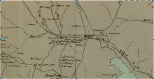
(Brown, William. Map of Prince William County, Virginia : compiled from U.S. Geological Survey and other data and corrected with the assistance of reliable residents of the county, Wash. D.C. : A. B. Graham Photo. Lith., 1901. Library of Congress Geography and Map Division Washington, D.C.)
Deneale’s Mill referred to inventor and miller James Deneale (ca.1765-1821). Besides for owning Deneale’s Mill and Clifton’s Mill, he received five federal patents for his inventions: 1800, “Kiln for drying grain”; 1804, an improved threshing machine; 1806, a “perpetual oven; 1809, a “wheat rubber” machine; and 1820, “Instrument for mapping lands, &c.” Deneale advertised his inventions and news of his mills through the Alexandria Gazette newspaper.
While Conner’s report did not have much information on Deneale’s Mill, the agent in charge of the 1937 Works Progress Administration’s (WPA) Historical Inventory Project of Virginia did. Not only did the agent speak with residents of Dumfries and Alexandria, but they also searched through court records, and traveled south on Route 629, about ½ mile from Dumfries, to visit the actual site. Below is the report:
(First Tract)
John Graham to Burr Harrison, known as “Saw Mill Tract”
1793, Harrison to James and George Deneal
1806, Deneal to Timothy Brundidge
1876, James Davis, Special Commissioner to James Bohannon
J.R. King (Timmerman note: recorded as current owner in 1937)
(Second Tract)
1779, Hugh Devoir
1792, Luke Cannon
1815, James & George Deneal
1826, Francis Dunnington
1877, Frank Wheat et. Als
Still owned by Wheat family, locally known as Deneal’s Mill Tract
Description:
There is nothing left but the walls, a part of which have been hauled away for building purposes, and the broken wheel, and one large mill stone. The road bed has been changed in the last few years and it is quite easy to walk right past the ruins without noticing them. The creek is very shallow here now and the old dam is almost entirely taken away.
The upper mill, which is still called Deneal’s Mill, is a little less than an eighth of a mile from the lower mill which was last operated by the Wheats. There is nothing left of that but a few stones hidden by the thick undergrowth.
Historical Significance:
It is hard to realize, looking at these ruins, by the meagre stream of water, that here once centered so much of the busy life of the old town.
Old maps show the upper mill as “Graham’s Mill” and the map of 1820 show it as “Deneal’s Mill”. It has been over thirty years since the last meal was ground here, the miller at that time being a man named Mitchell who was killed there one night by his clothing catching in some of the machinery. After that time it rapidly fell into ruins. It has also been about the same length of time since the lower mill was in operation.
The water is so low that the rocks in the creek (Quantico) bottom are exposed, worn smooth as sea pebbles by the once swift water. There is a great deal of green carbonate in the rocks and it makes them look lovely.
The Bohannon who ran the mill for a number of years was quite a character and was the grandson of John Bohannon who had a mill some distance from this in the middle of the eighteenth century.
James Deneal was one of the vestryman at Pohick Church and later at Quantico Church. He was prominent in the affairs of the community. The following extract may be of interest:
“Know all men by these presents, that I, James Deneal of the town of Dumfries and state of Virginia, do make, ordain, contribute and appoint my brother, George Deneal of the town of Alexandria, my true and lawful attorney for me, and in my name to sell all my right and interest and title in the inventions of mine and for which I have received an exclusive privilege from the General Government, To wit: a machine for the threshing of grain, also a machine for baking all kinds of bread, called and known by the name of the Perpetual Oven, ratifying, conforming such sales, made by the said attorney, in testimony whereof. I have affixed this seal, the sixth day of December, eighteen hundred and six.”
Oral History Informants: Mr. Walter Keys (Dumfries, VA), Mrs. Richard Wheat (Dumfries, VA), Mr. Charles Callaham (Alexandria, VA)
PWC Court Records: Deed Book 8, folio 103, Deed Book 30, folio 132, Deed Book U, folio 38, Will Book G, folio 292, Deed Book Y, folio 87, Deed Book 31, folio 504, Deed Book 3, folio 231.”
In terms of Prince William County mills, it’s entirely possible to read the primary sources and visit the actual historic sites. What better way can local history come alive than with records and an accurate map?
Note: The Weems-Botts Bibliophiles are targeting Antiheroes for August! Learn about this confusing and contradicting trope while reading three stories featuring everything from vampires to the Witcher. Tickets here!
(Sources: Bedell, John. “Few Know That Such A Place Exists”: Land and People in the Prince William Forest Park, National Capital Region, National Park Service, April 2004; National Parks Service. Virginia Main Street Commodities: A National Register of Historic Places Travel Itinerary: Agriculture and Industry; Grymes, Charlie. Virginia Places: Early Energy Production in Virginia, http://www.virginiaplaces.org/energy/earlyenergy.html; WPA Historic Survey: Town of Dumfries, 1937; “James Deneale to Thomas Jefferson, 2 July 1820,” Founders Online, National Archives, https://founders.archives.gov/documents/Jefferson/03-16-02-0055. [Original source: The Papers of Thomas Jefferson, Retirement Series, vol. 16, 1 June 1820 to 28 February 1821, ed. J. Jefferson Looney et al. Princeton: Princeton University Press, 2019, pp. 70–72.])
#localhistory#community#oldmills#historicmills#destinationdumfries#virginiahistory#oralhistory#maps#oldmaps#archives#records
0 notes

Video
Panoramic Cascade Mountain Views Extreme Privacy / Perched on top of a hill / 1 Acre Amazing Wrap Around Deck Unencumbered Sunsets & Sunrises. #realestate #realtor #oldmill #oldmill district #deschutes river #paddleboard #paddleboarding #flyfishing #mountain biking #home #house #housing #buyer #seller #lakes #cascadelakes #downtownbend #centraloregonlife #centraloregonrealestate #bendoregonrealestate #bendoregon #bend #bendor #bendoregonrealty #highdesertrealty #bendoregonhomeforsale #kenmucha #kenmucharealtor #mtbachelor #realestate #realtor #kenmucharealtor #mtbachelor #realestate #realtor #oldmill #oldmill district #deschutes river #paddleboard #paddleboarding #flyfishing #mountain biking #home #house #housing #buyer #seller #lakes #cascadelakes #downtownbend Under $680,000 Questions: Ken Mucha CELL: 541-948-0494 E-mail: [email protected] Team Birtola High Desert Realty https://www.instagram.com/p/CSs_GYrjeSn/?utm_medium=tumblr
#realestate#realtor#oldmill#deschutes#paddleboard#paddleboarding#flyfishing#mountain#home#house#housing#buyer#seller#lakes#cascadelakes#downtownbend#centraloregonlife#centraloregonrealestate#bendoregonrealestate#bendoregon#bend#bendor#bendoregonrealty#highdesertrealty#bendoregonhomeforsale#kenmucha#kenmucharealtor#mtbachelor
440 notes
·
View notes
Photo
On the easel today… The Old Mill 9 x 12 acrylics on canvas Available… message me, please, if interested. #artforsale #artforsalebyartist #autumn #acrylicpainting #sejpaints #fallfoliage #fallleaves #oldmill #carriagehousestudio #windyacrecottage (at Carriage House Studio of Windy Acre Cottage) https://www.instagram.com/p/CVP7ZlYAA0u/?utm_medium=tumblr
#artforsale#artforsalebyartist#autumn#acrylicpainting#sejpaints#fallfoliage#fallleaves#oldmill#carriagehousestudio#windyacrecottage
1 note
·
View note
Photo
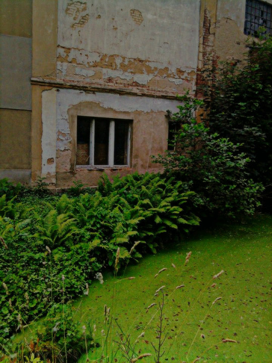
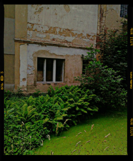
#analog#analogphotography#photography#oldbuilding#analogbuilding#water#naturetakesbackwhatishers#nature#travelling#abandoned#abandonedbuilding#mill#oldmill#village#czechvillage#czechrepublic#photographer#amateurphotographer
1 note
·
View note
Video
Sunday Funday! Got my hiking this weekend and loved it. Feeling refreshed and looking forward to more of the great outdoors 🥾 🌄 #hike #thegreatoutdoors #hiking #norcal #trails #scenic #sunrise #foodie #lotties #icecream #brewery #marin #oldmill #californiahikes #californiahiking (at Mt Tamalpais State Park-East Peak) https://www.instagram.com/p/CDJnvZXAoFu/?igshid=q2vv9zfbxa00
#hike#thegreatoutdoors#hiking#norcal#trails#scenic#sunrise#foodie#lotties#icecream#brewery#marin#oldmill#californiahikes#californiahiking
1 note
·
View note
Photo
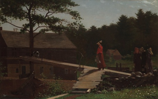
Old Mill (The Morning Bell, 1871), Winslow Homer
20 notes
·
View notes
Photo
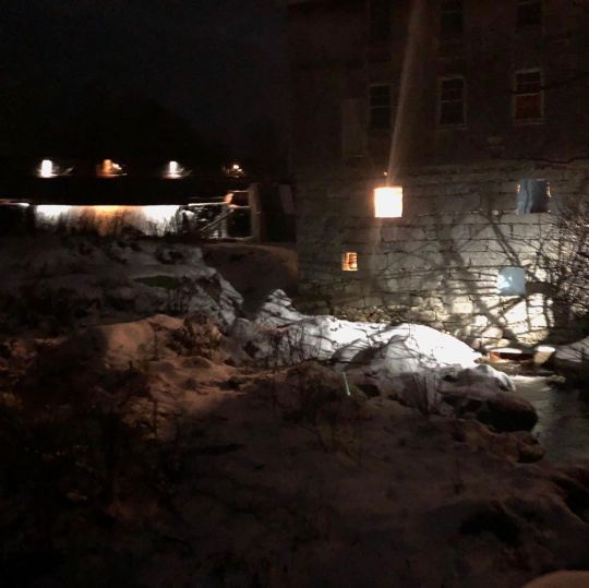
Full Moon Friday Night in Freedom’s Old Mill the Home of the Lost Kitchen #maine #winter #ice #injoyemporium #lostkitchen #thelostkitchen #oldmill #fullmoon #freedommaine https://www.instagram.com/p/B7MlGfsAlyL/?igshid=hw72kmep5zmo
1 note
·
View note
Photo
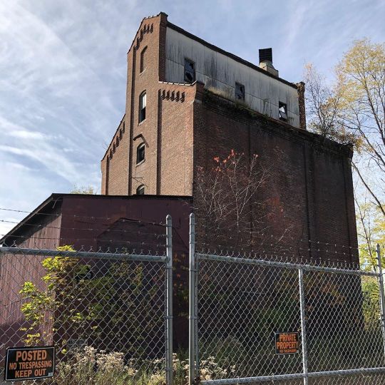
I learned today that Miners Mills has nothing to do with mining, but with this old grain Mill (current version built in 1927) along Solomon’s Creek, owned by the Miner family. Now appears to be abandoned. There in the trees, if you squint, you can make out an old belt that ran from the one bulging to that little bridge-like structure. I don’t know much more than what I learned from an old Citizen’s Voice article, but perhaps I’ll do more research. . . . #localhistory #luzernecounty #wilkesbarre #oldmill (at Miners Mills, Pennsylvania) https://www.instagram.com/p/B4GCq9zh95Y/?igshid=1jx9r4prvboxo
2 notes
·
View notes
Text
Photo By: Don
1 note
·
View note
Text

This Cloud Kinda L👀KS Like A Bat ☁️🦇
#clouds#sky#night#nature#bats#weird#odd#strange#spooky#humberriver#humberriverpath#oldmill#Old Mill Park#Kings Mill Park#toronto#ontario#canada#mypost#myupload#mypicture#mypictures#picture#pictures
3 notes
·
View notes
Photo
Old Mill; vernonia, or. On the road w @nathandorsett "Cant sleep, too tired" dedicated to @the_mystic_wood . #oldmill #vernonia #vernoniaoregon #oregon #traveloregon #traveltuesday #travelphotography #ontheroad #roadtrip #pnw #pnwonderland #getlost #notallwhowanderarelost #abandoned #abandonedplaces #ruins #ruinnation #explore #adventure #postindustrial #postindustrialruins #jsimpson #travelblog #travelblogger (at Vernonia Lake) https://www.instagram.com/p/B20Lot1Bset/?igshid=uog8mexhnvmk
#oldmill#vernonia#vernoniaoregon#oregon#traveloregon#traveltuesday#travelphotography#ontheroad#roadtrip#pnw#pnwonderland#getlost#notallwhowanderarelost#abandoned#abandonedplaces#ruins#ruinnation#explore#adventure#postindustrial#postindustrialruins#jsimpson#travelblog#travelblogger
1 note
·
View note
Video
Tohickon Creek viewed from the grounds @millfleursgardens #tohickoncreek #mill #oldmill #stovermill #highwater #rapids #kayakers #gardens #perennials #rareplants #ptpleasant #buckscountypa https://www.instagram.com/p/BsJZDrrjPpJ/?utm_source=ig_tumblr_share&igshid=12q9ie4y11app
#tohickoncreek#mill#oldmill#stovermill#highwater#rapids#kayakers#gardens#perennials#rareplants#ptpleasant#buckscountypa
3 notes
·
View notes
Last Seen Blogs

milda-ehe
m i l d a < 3

adsin1960smusicmagazines
1960s music magazines have the best ads for the artists

leicastore
Leica Store

legacythesims
legacythesims

rxtii
rt