#dundeady
Text

Dundeady, County Cork, Ireland
51°32'27"N 8°56'41"W
#google#google earth#google street view#google maps#digital collage#2017#dundeady#castlefreke#county cork#county cork ireland#ireland
35 notes
·
View notes
Photo
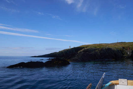

I had a good night’s sleep apart from bang in the middle when I unzipped my tent and alerted the resident dog to my presence. It barked for a full hour and a half!
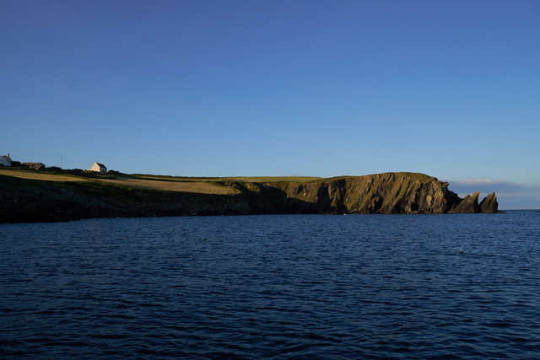
You can just make out the ruin of the main tower of Dundeady Castle peeking over the corner of the bungalow. There is a second smaller tower on the cliff top over looking the cove that is part of a perimeter wall. Presumably the galleys were kept in this cove which gave Galleyhead its name. They would have been used to collect royalties from passing ships and fishing boats for the Barry Roe clan who occupied the castle.
13 notes
·
View notes
Text
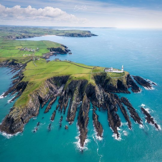
Galley Head Lighthouse 🇮🇪
Il faro è situato su Galley Head all'estremità meridionale del promontorio noto come isola di Dundeady a 133 piedi sul livello del mare, affacciato sul St George's Channel e su due spiagge, Red Strand a est e Long Strand a ovest. Il promontorio è tagliato fuori dalla terraferma dalle antiche mura dell'antica roccaforte normanna di Dun Deidi, importante fortezza del locale Clan O'Cowhig.
#Irlanda #Europa
📸 #scattiDalMondo
0 notes
Text
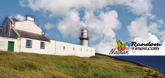
Galley Head Lighthouse | Ireland
Galley Head Lighthouse | Ireland
Galley Head Lighthouse rises an imposing 53m above the roaring Atlantic ocean outside of Rosscarbery, County Cork, on the south coast of Ireland.
It is a charming white lighthouse that sits at the southernmost point of a picturesque headland known as Dundeady Island and is close to the charming market town of Clonakilty, home of the famous black pudding.
The headland is cut off from the mainland…
View On WordPress
#architecture#Europe#human#international#Ireland#lighthouses#lights#local history#monuments#news#people#sea#stories#tourism#world
0 notes
Photo
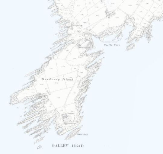
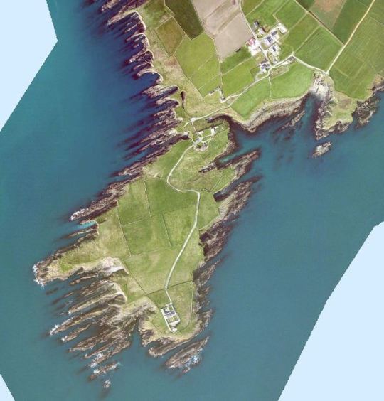
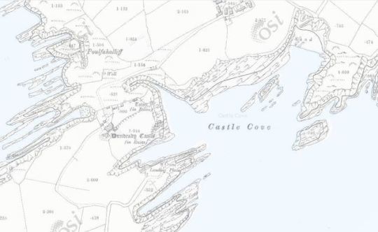

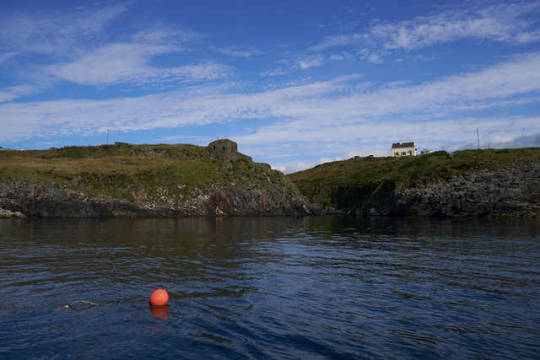
Castle Cove in Dundeady townland just behind the lighthouse was my destination. This is the old 25″ OSI map of Dundeady/ Galley head. Although created over a hundred years ago, you can see these maps are incredibly accurate and still useful. I have drawn an x in red to show where I was moored for the night on the lower satelite image.
10 notes
·
View notes
Photo
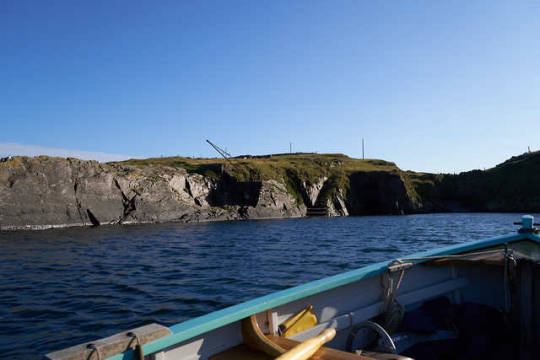
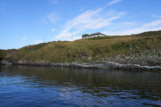
Slightly damp after my mishap in the tidal race, I dropped the sail and mast in the wind shadow to the east of the Galley and rowed into Castle Cove to spend the night. The anchorage I chose was the deep sandy bottomed inlet below the ruins of Dundeady castle and it’s attendant bungalow. This inlet was also used as a landing point for the lighthouse and has a rather fine crane perched above steps that are carved into the shoreline.
9 notes
·
View notes
Last Seen Blogs

rpod79
RPOD

spamanoos
Let's Enjoy Today

toacho
Toacho

your-best-emo
#1 Q!Slimecicle apologist

verenaosiris
“Verena Osiris”