#archeologicalsites
Text
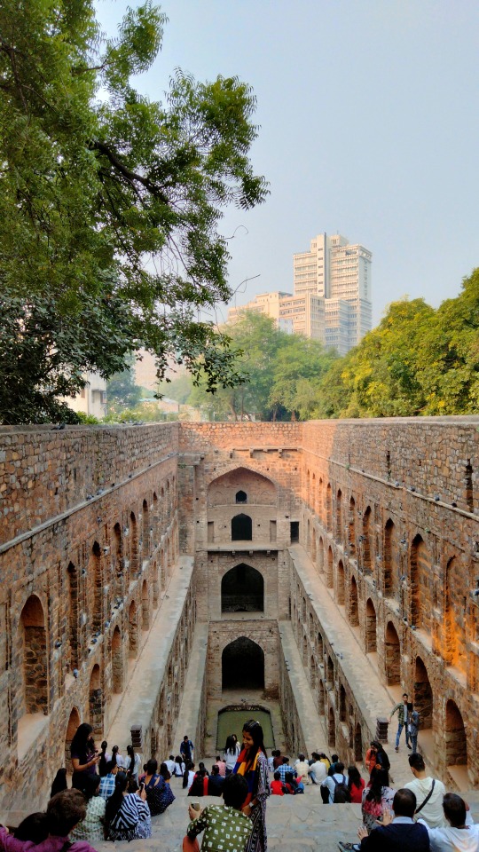

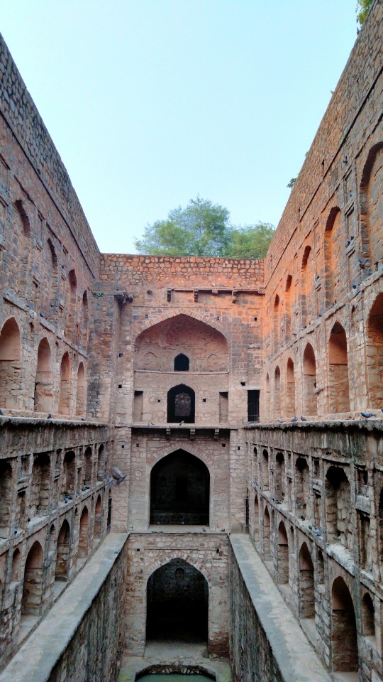

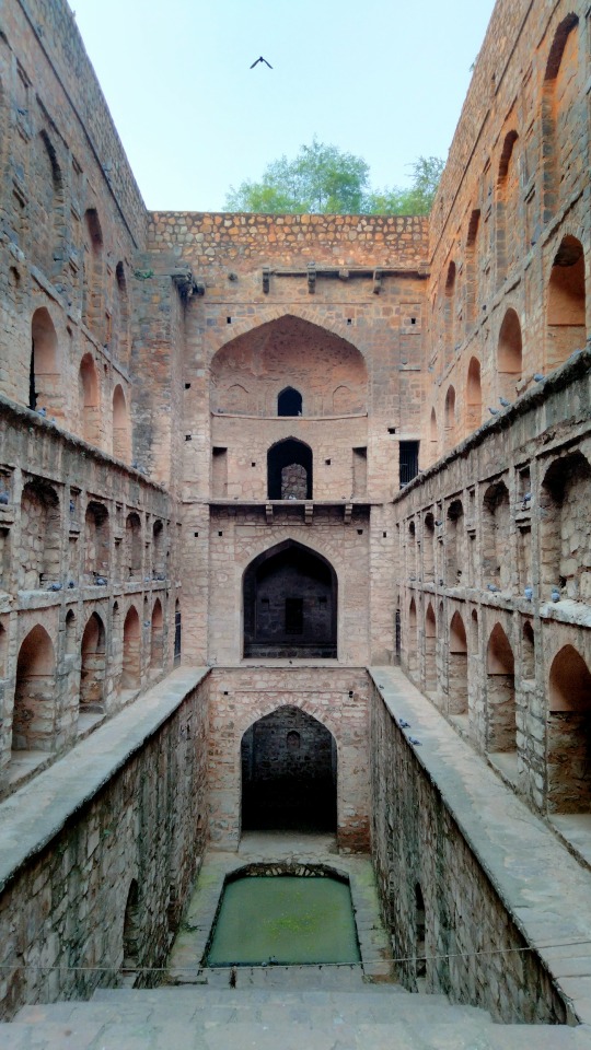
Agersen Ki Baoli | The Alchemist Tales
#agrasenkibaoli#historicallandmark#ugrasenkibaoli#historicalstepwell#archeologicalsurveyofIndia#ancientmonuments#archeologicalsites#historicalplacestovisit#oldmonuments#historicalpics#indianplaces#historicalplaces#monumentsofindia#loves_monuments#historicalplace#historicalarchitecture#oldarchitecture#historicalpix#historyofindia#indianarchitecture#rajeshsuthar#thealchemisttales#alchemisttales#monuments#historical#history#travel#photography
11 notes
·
View notes
Text
SANTORINI | GREECE | IPHONE 14 PRO | CINEMATIC MODE 4K
youtube
#bomtravels#medical#travel#history#culture#beautifulcountry#santorini#greece#beautifulsunset#relax#mykonos#archeologicalsites#wonderfulisland#jeddah#saudiarabia#luxuriousmalls#food#amazingplace#art#music#outdooractivities#museums#Youtube
0 notes
Text
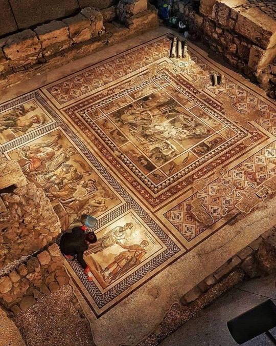
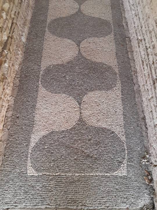
Mosaic uncovered in Antakya, Türkiye- Roman empire circa 300
Hatay Archeology Museum, Türkiye. Photography by Can Okkali
855 notes
·
View notes
Text
The 13 full and fragmentary projectile points, razor sharp and ranging from about half an inch to 2 inches long, are from roughly 15,700 years ago Which is 3,000 years older than the Clovis fluted points found throughout North America.
These slender projectile points are characterized by two distinct ends, one sharpened and one stemmed, as well as a symmetrical beveled shape if looked at head-on. They were likely attached to darts, rather than arrows or spears.
#history#archeology#archeologicalsite#discovery#americas#native american#paleolithic#migration#projectal points
63 notes
·
View notes
Text

Căscioarele (Călărași County), the most famous find from the Neolithic site excavated in the late 1960s on a Danube island named Ostrovelul.
The site has been attributed to the Gumelnița (Karanovo VI) culture, one of the most spectacular phenomena of the eastern Balkans during the 5th millennium BC.
The Gumelniţa culture is remarkable by the richness of its anthropomorphic and zoomorphic representations, but the miniature sanctuary found in the earliest occupation phase at Căscioarele trumps them all.
Although smaller models of houses (believed to be sanctuaries) appeared on other Gumelniţa sites as well, both in southern Romania and in Bulgaria, the Căscioarele specimen has so far remained unique. It has been dated between 4,800 and 4,550 BC and may be seen in the permanent exhibit of the Lower Danube Museum in Călărași.
#romania#eastern europe#balkans#neolithic#historical sites#archeology#archeologicalsite#antropomorphic#zoomorphic#sanctuary#houses#danube#museum#archeologist#finding#history#europe#island
17 notes
·
View notes
Text
Palestine - Jericho, the oldest city ever?
Actually, there’s not really much to see on the excavation site of Jericho. At least it’s not as impressive than other sites in the area. But it claims to be “the oldest city of the world”, as our guide it stated proudly too.
However, the findings and some walls are dated back around 10’000years BCE. This would be as old as the newer founds in Anatolia, like Göbekli Tepe or Karahan Tepe, both i…

View On WordPress
#archeologicalsite#archeology#cablecar#Desert#excavation#jericho#judaendesert#landscape#middleeast#monastry#mountain#mountoftemptation#oldestcity#palestine#renebauerphotography#spring#Travel#Village#walls
7 notes
·
View notes
Text
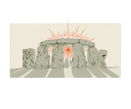
day 22 of folkbruary- stone circle
out of all the stone circles on the isles, i have the most intimate relationship with stonehenge as a result of spending the past year and a bit squatting land nearby in protest of the proposed road expansion and tunnel within the world heritage site. to be in the company of the stones is a truly awe-inspiring experience. the lines between millennia blur, and the space is considered sacred by many across the world. they truly are everyone’s stones, which is why i want to raise the alarm on what our government is up to.
for anyone unaware of what’s going on, the governmental transport body National Highways (formerly highways england) are gearing up to start work on expanding the a303 around stonehenge, which is just one of their many destructive road expansion schemes currently underway. involving the construction of a new dual carriageway, a 4.5km long tunnel, expanding the roundabouts either end and making new flyovers. Despite a high court judge ruling against the project on environmental grounds in 2021, highways are currently handing out contracts to construction and security companies (to take on protesters). autonomous activists continue to hold ground nearby, raising awareness of the environmental impacts of road expansion projects like this.
key issues with this project:
-road expansion & the climate crisis. pretty obvious really. construction companies actively add to carbon emissions with the high use of oil-powered machines, the felling of ancient trees, hedgerows and grasslands and concreting over large swathes of land (most of which is only used in the construction process then sold off as ‘brown sites’ to developers).
-also new roads = new traffic. it’s a documented phenomena, called the ‘induced traffic effect’. if you want to reduce traffic, we should obviously spend this money on improving local public transport schemes.
-a little known fact about the stonehenge world heritage site is that it is the largest untouched chalk grassland habitat in Europe. there are many species native to or reliant upon these plains, such as the adonis blue butterfly, kestrels, hen harriers, etc. that are directly threatened by this scheme.
-UNESCO have warned that they may revoke World Heritage Status if the plans go ahead. In doing so, this opens up the land (especially all the brown sites that they will create with the road project) to developers. Further habitation loss and destruction of sites of archeological interest will follow.
- there’s a chalk aquifer beneath stonehenge that has been supplying humans living on the plains with water since the end of the last ice age. It has also been crucial to the preservation of archeological artefacts in the area. The tunnel plans will bore directly through it, affecting the delicate hydrogeology of the entire site. Untold artefacts will be lost, and carcinogens from the chalk will leak into the local water supply, rivers, etc.
this ended up being a pretty long post, and the first of this nature I’ve made since making this blog, but i couldn’t draw a stone circle without bringing light to the fight on our hands right now. for more information, updates and petitions, check out stonehenge alliance’s website:
#folk february#stonehenge#resistance#environmental justice#activism#stonehenge tunnel#resist anti trespass#artists on tumblr#digital illustration#peapappa#stone circle#call to action#stonehenge heritage action group#stonehenge alliance#environmental action#environmental activism#archeology#archeologicalsite#stonehenge world heritage site#unesco#folkbruary#basil draws
8 notes
·
View notes
Text

#it’s me#i’m girls#macarbe#skeleton#meme#archeologicalsite#archeology#bones#grave#dark#goth aesthetic
3 notes
·
View notes
Text
Chronicles the Anglo-Saxons
Archeological investigation into the Anglo-Saxons documentary
0 notes
Text
Oh to be the head observing the penis room at Karahan Tepe
1 note
·
View note
Text


A trip to Villa di Livia 🥰
1 note
·
View note
Text
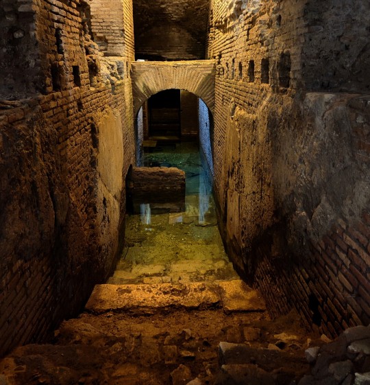
Vicus Caprarius, Rome, Italy
1 note
·
View note
Photo
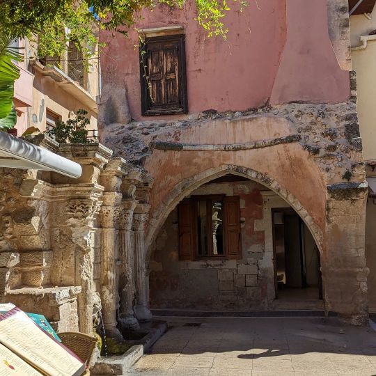
#archeologicalsite #old #amateurphotography Coordinates: 35.369300,24.471500 (at Réthimnon, Greece) https://www.instagram.com/p/CjyiK7UqFqx/?igshid=NGJjMDIxMWI=
0 notes
Text
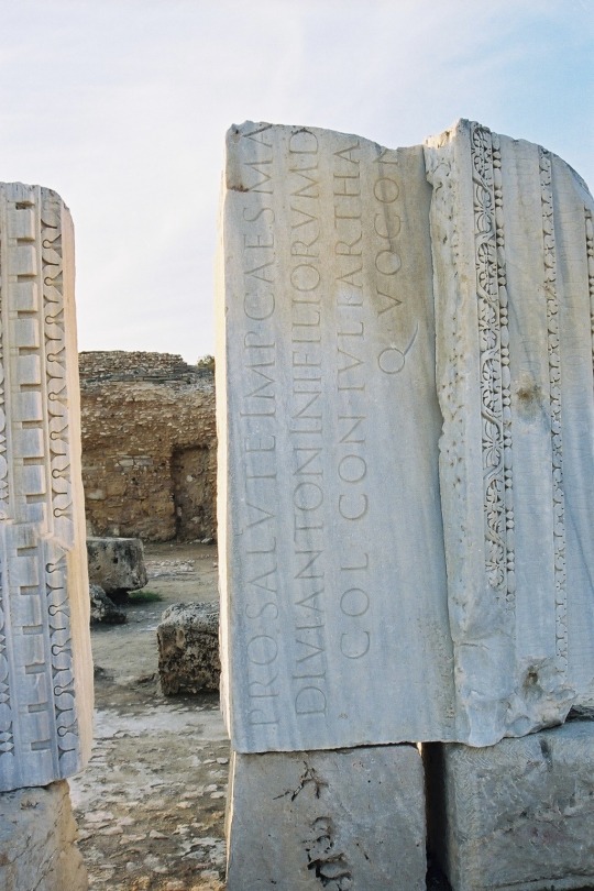
Thermes d'Antonin
0 notes
Text
The site was located using LiDAR (Light Detection and Ranging), a sensing method that uses laser light to measure distances.
The ancient metropolis contained more than 1,000 settlements densely packed together over 650 square miles — challenging the theory that most Mesoamerican settlements were sparsely populated.
59 notes
·
View notes
Photo
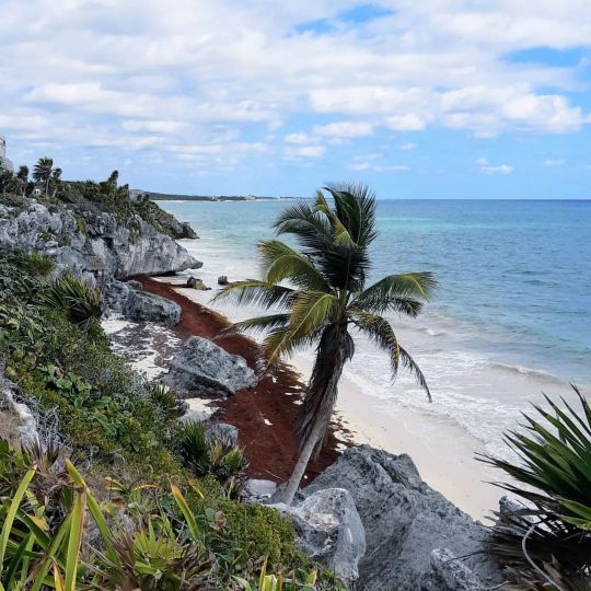
Tulum, ultima tappa prima di ripartire! #tulum #tulummexico #tulumarcheologicalsite #archeologicalsite #mexico2023 #mexico #messico #quintanaroo #quintana #sea #blue #sky #amazing (presso Tulum,Mexico) https://www.instagram.com/p/Coxg-o2oZfX/?igshid=NGJjMDIxMWI=
#tulum#tulummexico#tulumarcheologicalsite#archeologicalsite#mexico2023#mexico#messico#quintanaroo#quintana#sea#blue#sky#amazing
0 notes
Last Seen Blogs

cruisinggrooving
taylor agressively hugged me


smellslikecraiglist
anja (she/her)

angel-eden
Angel Eden

vampstela
Satan fears me specifically