#torontohike
Text
New Year Hike (Toronto)
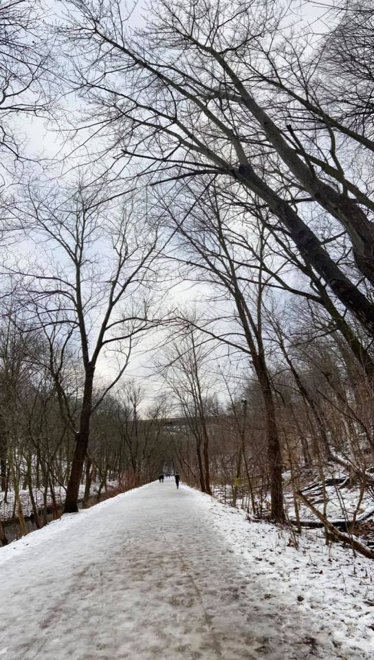
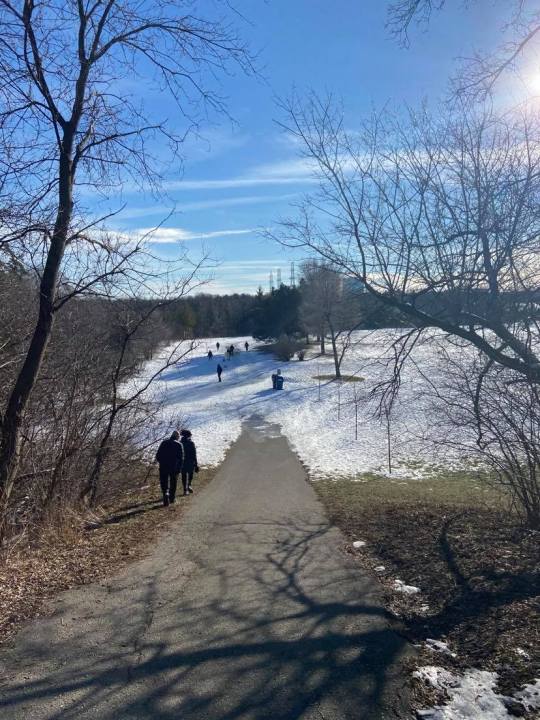
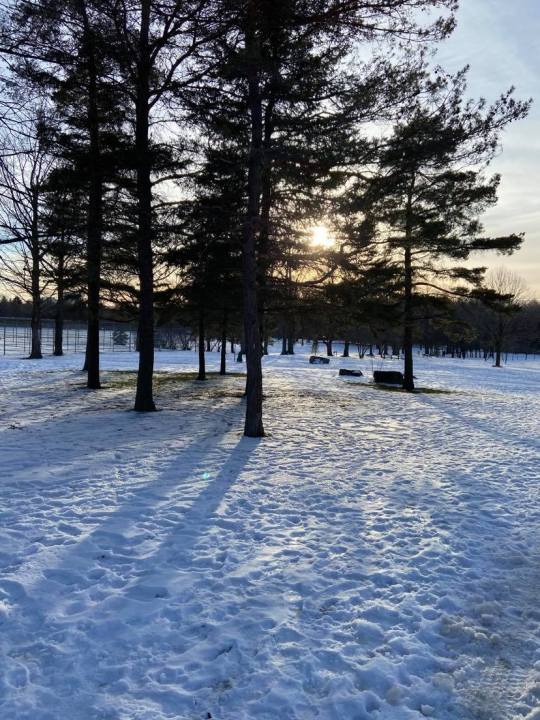
In an incredibly satisfying “end of year wrap”-style, my first hike of 2021 linked up all of my previous hikes throughout the city. It was also probably my longest hike - about 11 kilometres (7 miles). I met a friend and colleague for today’s hike at Broadview Station. It snowed a bit last night so the city was looking beautiful, and temps were around freezing - not too cold!
We walked to Chester Hill Lookout, which I was a bit disappointed in - the lookout view is mostly of the DVP and other highways. From there, we walked up to Todmorden Mills Park.
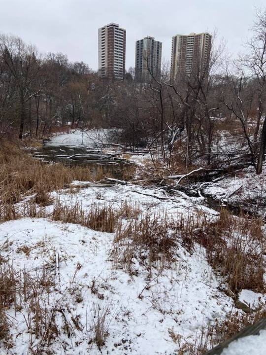
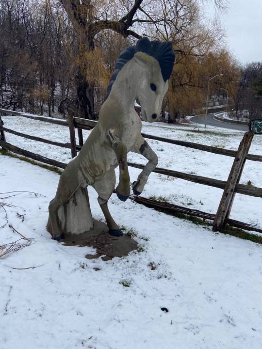
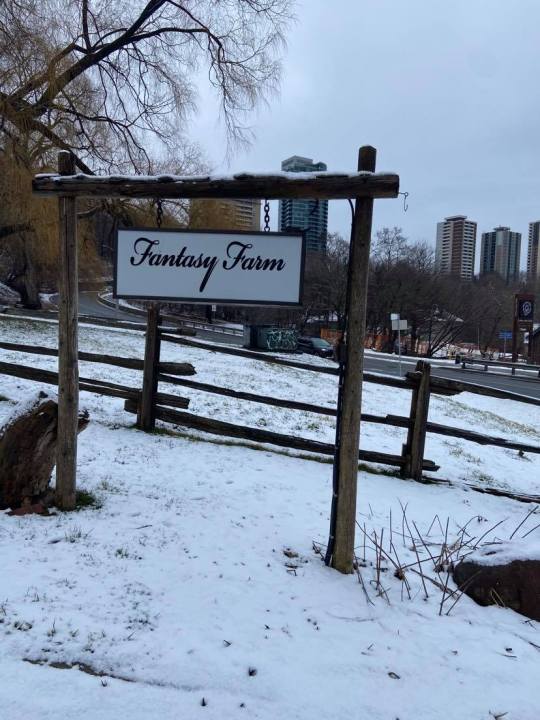
We explored this area a bit and then continued along Pottery Road. I was intrigued by “Fantasy Farm”. The horses were only screaming horror movie to me. I’d like to come back and find out what a fantasy farm entails in the future - the walks in the area are chained off for now.
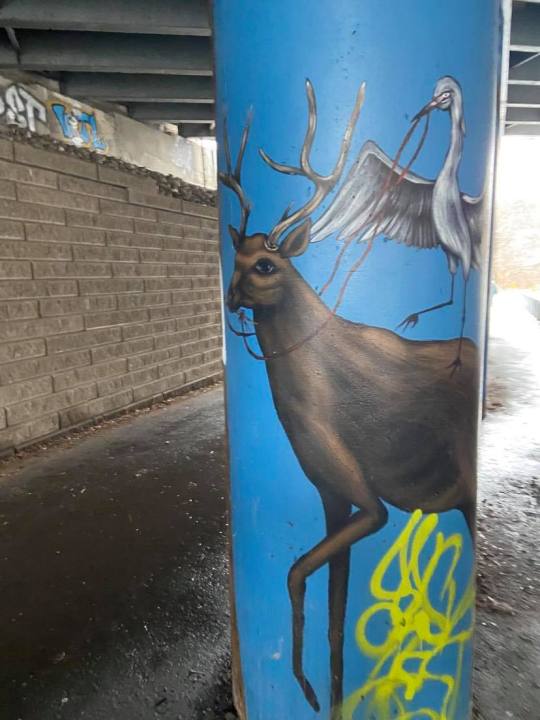
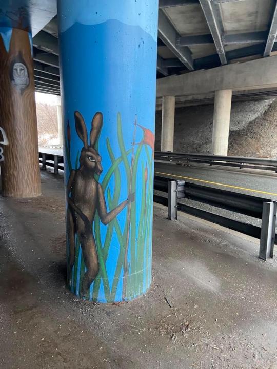
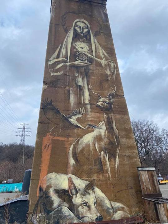
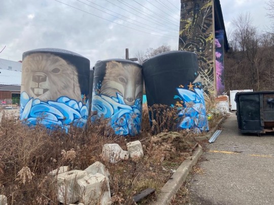
One of the underpasses we walked through had animal-themed pillars:
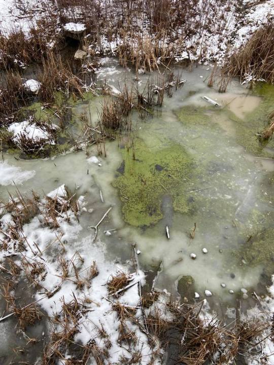
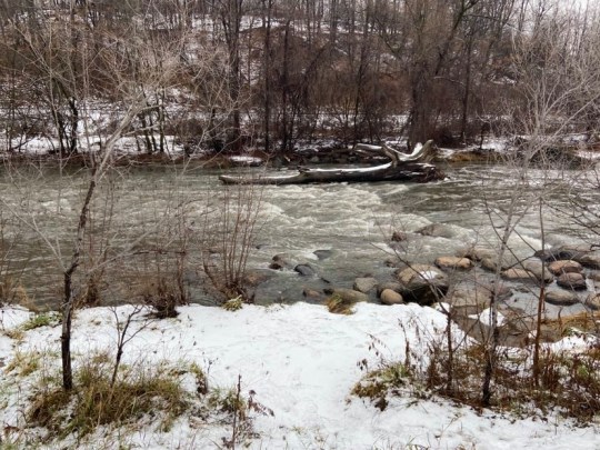
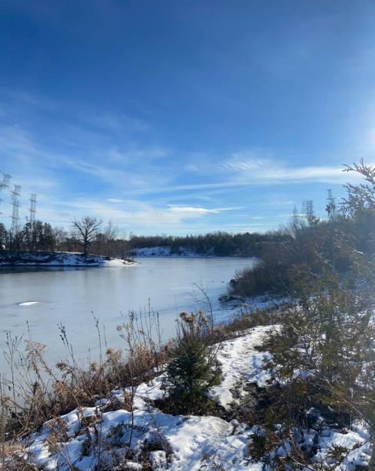
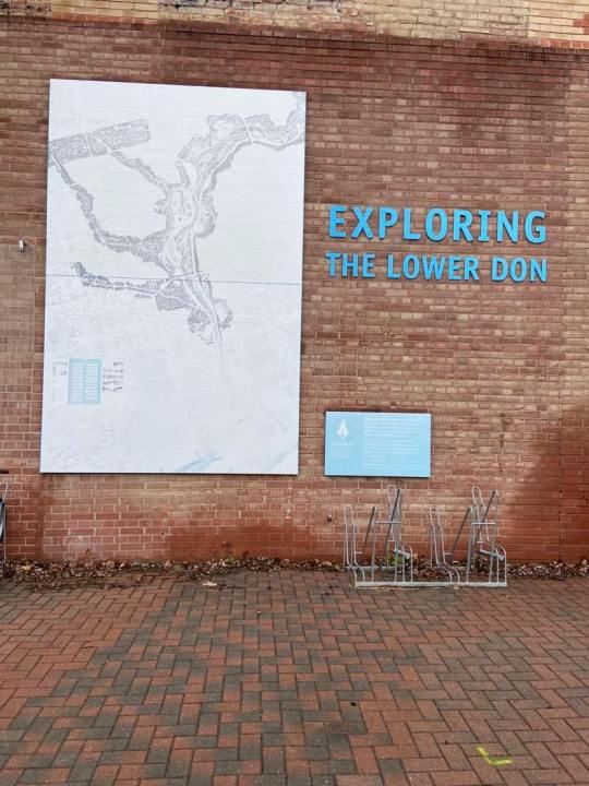
The Lower Don Trail ran through Pottery Road and we took a short detour up this trail to admire the river for a bit.
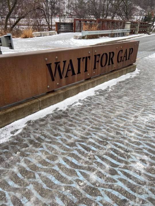
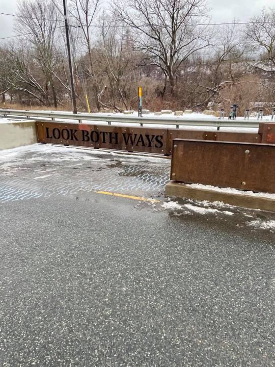
The designs used to encourage safe crossing were clever I felt - the middle section of the road has a path that forces a momentary pause in the middle before completing your crossing. The road also has a fun ecological pattern (blue waves) painted in the crossing sections, instead of the usual yellow lines.
After this detour, we followed Bayview down to Evergreen Brickworks. This was the “aha” moment for me, I hadn’t been able to see this trail (on the opposite side of the road as Brickworks) on my previous hikes. The trail was winding...AND it got us there!
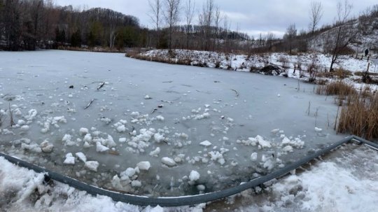
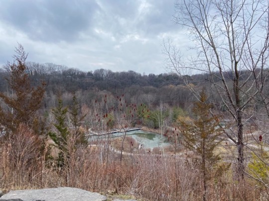
The big pond (resevoir? body of water?) at Brickworks was frozen with a thick layer of ice that was beginning to get a bit slushy.
We passed through Evergreen’s South/West parking lot and followed a trail (neither of us knew where this would lead). There was a wide clearing followed by a very icy trail, and we were suddenly in Beaumont Park - another trail to follow!
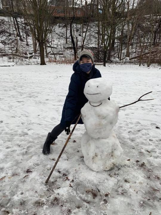
We followed the Park Reserve Drive trail north through David A. Balfour Park. Here’s a cute hockey player I made the acquaintance of.
We exited David A. Balfour Park just below the Mount Pleasant Cemetery via a staircase a bit north of the Vale of Avoca (I’ll never get sick of over the top landmark names).
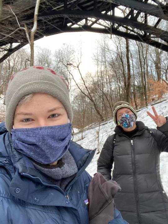
This was us after 3 hours of winter hiking!
#toronto#hiking#torontohiking#torontohike#ontariohike#ontariohiking#ontario#canada#canadaisbeautiful#walktoday#getoutside#newyear#2021#firsthike#winter#winter2021#jan2021#january#cold#holidays#holidayhike#wintersports#winterweather#brrr#ice#fireandice#canadianhike#canadian#park#공원
14 notes
·
View notes
Photo
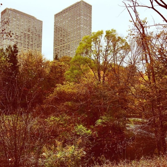
Contrast of a city within a park #Toronto #hiking #torontohiking (at Don Valley Bike Trail) https://www.instagram.com/p/Bpe2Wj6HgsH/?utm_source=ig_tumblr_share&igshid=oqgkzgjbl6t6
1 note
·
View note
Text
David A. Balfour Park, Toronto
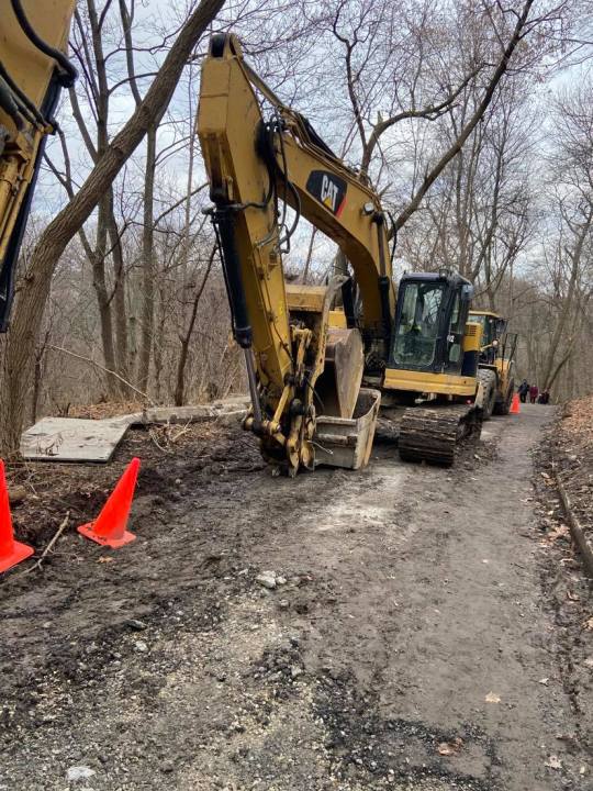
Sometimes it’s fun to just open up a map of Toronto, identify a green space on the map, and pop over for a mystery hike. That was how I ended up at David Balfour Park. The first thing I discovered was that part of the park was under construction, so it takes a bit to find your way in if you’re coming from the North side. The Rosehill Ave part is blocked off, but if you walk up Avoca Ave, you’ll notice a downwards slope with lots of giant construction vehicles on it. I would never have known if I hadn’t seen other people enter this way, but this is actually the current entrance.
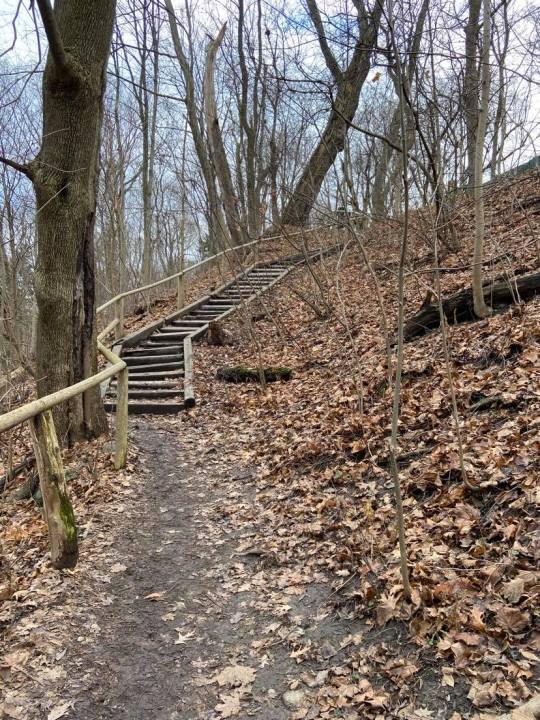
So first impressions - the park is more a “path” or a trail then what you’d generally think of as a park. If you go North after entering from Avoca Ave, the trail features dirt steps. Due to the rain yesterday, it was pretty muddy and slippery (had a couple folks warn me) but there was a wooden handrail for most of this section of the park. It kind of gave me summer camp hiking feels because the wooden features (e.g., the railings and the steps) seemed old and not the sturdiest or most reliable.
I ended up under the Vale of Avoca, a beautiful large car bridge with a pretty intense sounding name, and explored the graffiti and street art for a bit.


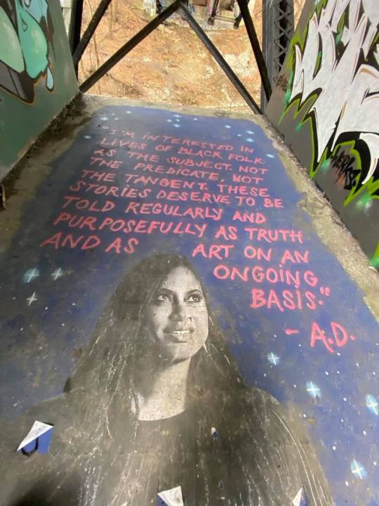
You would need to hike a bit up behind the trail to the higher under-the-bridge area to see this quote.
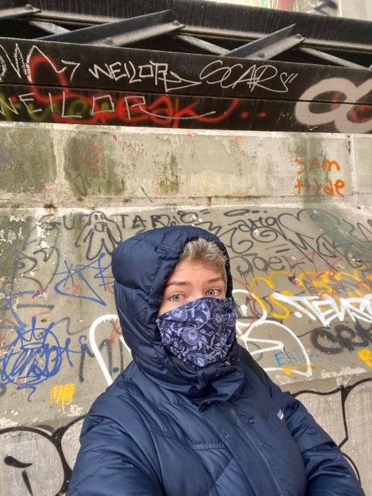
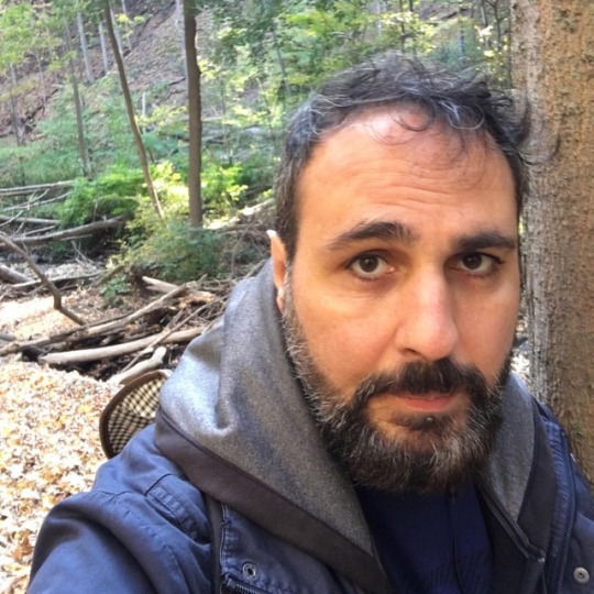
(Rare selfie to give an idea of relative bridge size).
Afterwards, I walked back towards my original entrance and explored the South side of the park. The path here was paved which was nice. It led to another even more imposing bridge which, to my knowledge, doesn’t have a super dramatic LOTR-y name. This one was specifically for trains.

The trail from David Balfour Park left me at Mount Pleasant Rd & Roxborough - careful crossing here as there are no signals - and I was able to continue further down the trail which at this point would be called the “Park Drive Reservation Lands”.

A yes, a discovery walk. What am I supposed to be discovering, though?

So interesting thing, there are all these signs to keep out of the storm water area, but a few meters after this sign the fence just....ends.

The aforementioned storm water area.

Had I the time, I could have continued following trails in this area for an entire day as it would have eventually taken me near the Don River and related trails, which span out for kilometres across the city. My route is highlighted in pink (within the larger map) to give you an idea of the immense spread of trails.
#toronto#torontohiking#torontohike#cityhiking#cityhike#to#tdot#ontario#greenbelt#trails#trail#path#creek#nature#torontonature#naturebathing#dogwalks#canada#canadatrail#canadahiker#canadahiking#canadaisbeautiful#ontariohiking#ontarionature#mycity#hikinglog#naturewalk#winter#winter2020#winterhiking
15 notes
·
View notes
Text
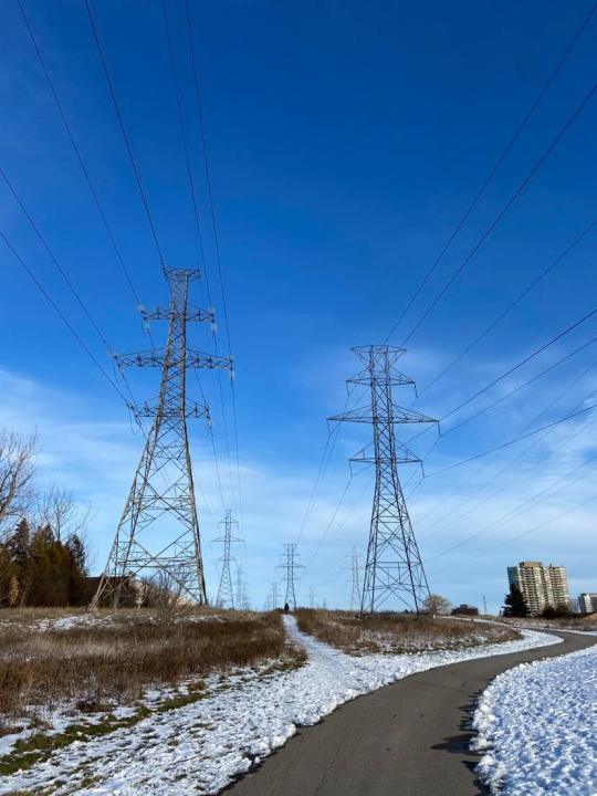
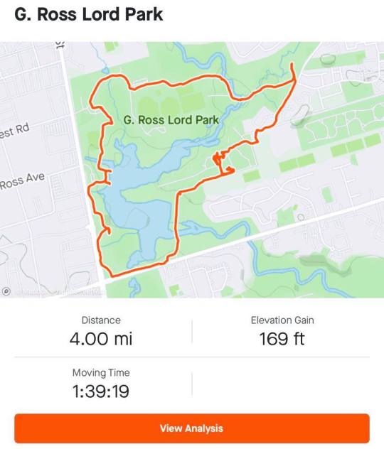
G. Ross Lord Park - North York, ON, Canada
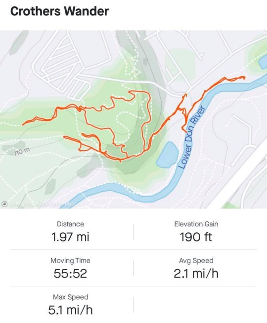
Has anyone tried Strava to track their hikes? I used it for the first time today and I found it really accurate and fun...also, it helped me get back to my car. Let’s dive in. This hike was a bit further out of the city and it was totally worth the trip. Nearby, there’s an Eastern European grocery store (Yummy Market) complete with a prepared foods counter in the back. I stopped here after my hike for some delicious treats to share with my roommates.
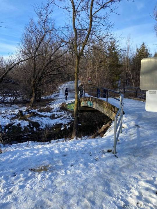
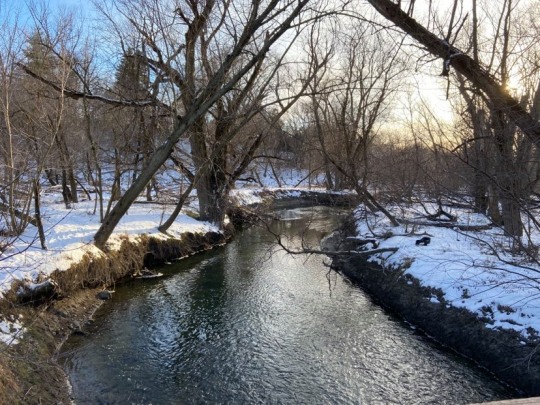
So let’s get into it. I parked near the north entrance of this park (the one closest to the dog parking). There’s a good deal of parking here and it’s free. There are bikes for rent available at a couple park entrances and parking lots. I started my hike by following some other hikers. This resulted in me traversing some very slippery bridges and footpaths, and then suddenly, I found myself completely alone. I guess one challenge of winter hiking is that trails become less clear. I walked down to the water (which is apparently polluted) and surveyed the large icy pond.
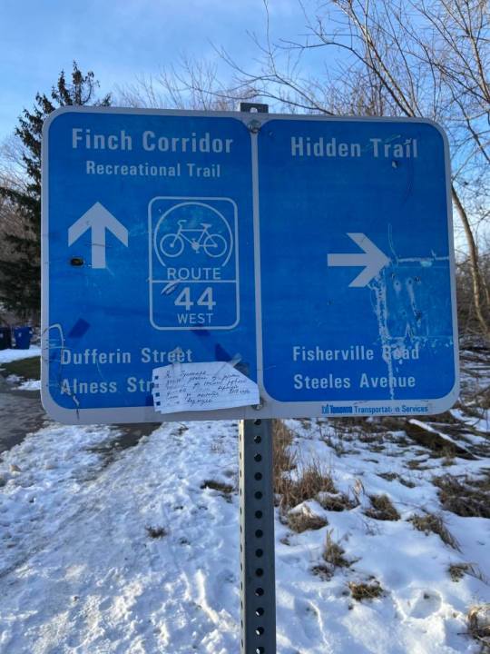
I kept on thinking that if I walked further down the west corridor I’d find people, but I really found none. I did try following groups of footprints and accidentally found myself in an encampment, which I quickly left. I decided I’d walk down to Dufferin and Finch, loop around and see if anything got more “park-y” or lively.
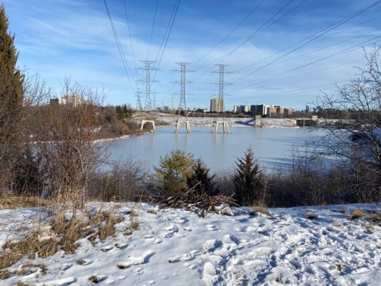
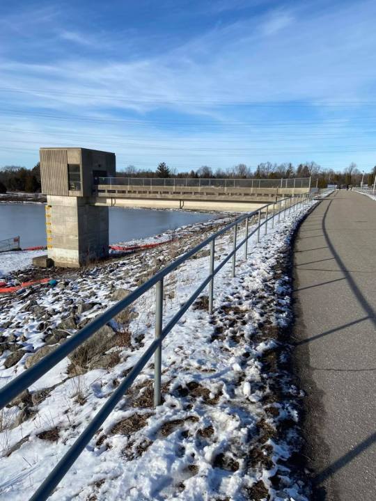
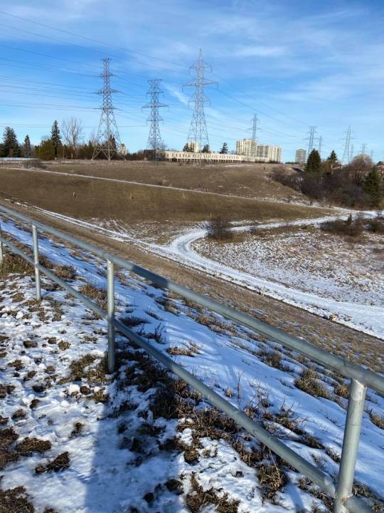
After walking east down Finch, I did spot an actual trail. It still was very industrial in terms of atmosphere. Following this paved way led me up through the park’s dam.
I found the landscapes and architecture here to be very stark, almost Soviet-feeling. I think part of what contributed to my surprise (besides the juxtaposition of nature and machinery) was the amount of people walking along smaller pathways in the distance. It’s hard to capture in images how vast and wide the space felt.
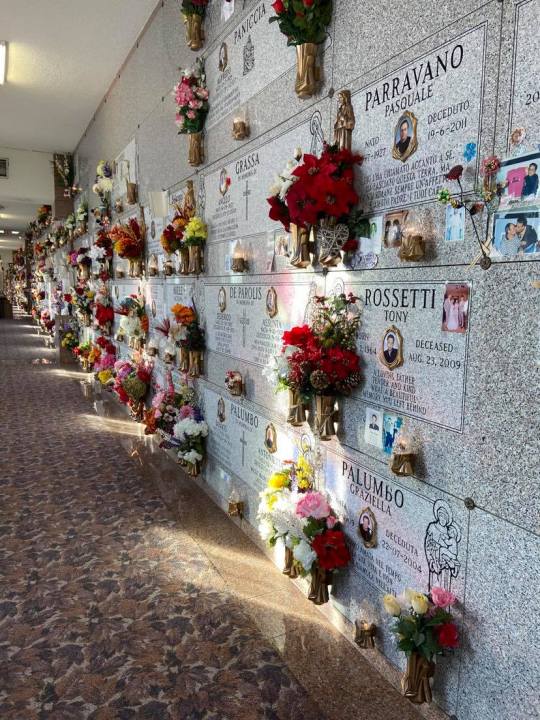
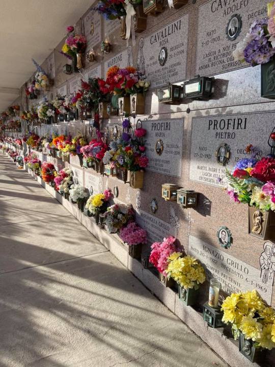
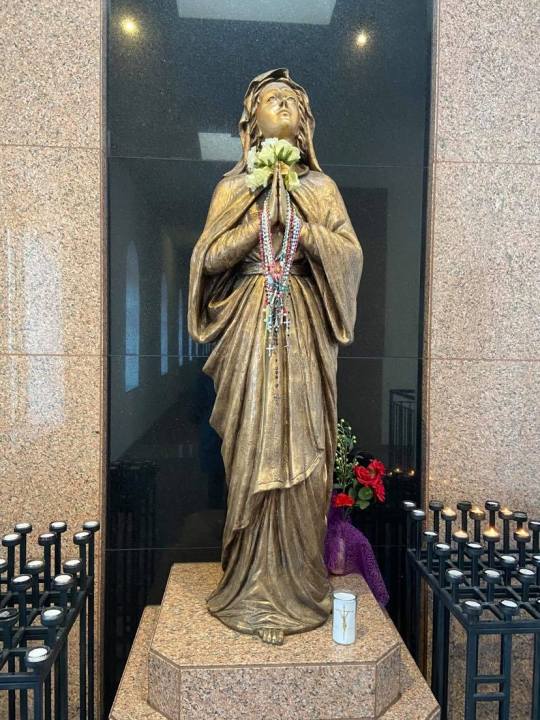
I noticed some very odd striking buildings in the distance. Lots of older folks were traversing by them. I couldn’t figure out what they were and went closer to investigate.
The buildings turned out to be mausoleums that were part of Westminster Cemetery. I admired the ways in which folks showed love for their departed ones. I’ve been reading a lot lately about how we’re desensitized to the sheer impact of COVID because the numbers are too large for our brains to comprehend. Walking through memorial after memorial nicely decorated with fake flowers, pictures, rosaries, and other symbols felt like the inverse of that.
I was able to exit the mausoleum and walk up small unmarked roads that eventually lead me out to Torresdale Avenue, and I followed this up to a park entrance that let me back in on the park’s east end. This was when I finally saw signs of life! People walking, kids trying to sled without sleds (yep that’s right), and families enjoying each others’ company.
One thing I noticed walking through the park was that Eastern European languages were being spoken by many of the walkers. I also heard some Korean. It was refreshing as in quarantine, it’s easy to forget how diverse the larger world is. Some type of Eastern European music was also blasting (from different groups) both when I parked and when I headed back to my car, and it was nice to see people having fun and enjoying themselves in a relatively safe way. The trail had lots of offshoots that I would love to come back and explore some time.
Were I to return again, I would walk the eastern side of the park and explore that more deeply. I do think it was nice to get a lay of the land, even if at moments it felt a bit creepy when it was quiet and uber industrial. The mausoleum is something I definitely wouldn’t have discovered if I hadn’t made the wide loop I did around the park.
Strava stats below! So far it seems like a good exercise tracker. I like that it includes elevation, as well as the ability to input just about any physical activity know to man.
#strava#toronto#torontohike#torontohiking#hiking#canada#canadahike#nature#naturebathing#naturewalk#walk#saturday#2021#newyear#newhike#4miles
1 note
·
View note
Text
Evergreen Brickworks, Toronto, ON
I visited Evergreen Brickworks today and was not disappointed. The former brick factory and quarry (which supplied the building of local landmarks like Casa Loma and Massey Hall) was converted into a beautiful city park opening in 2010. You can read more about the history of the Evergreen Brickworks here. Part of the interest for me is how this park links into the other trails, pathways, and parks that eventually feed into the Lower Don.
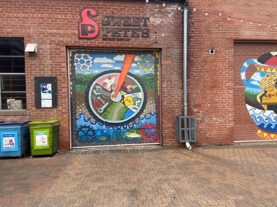
The first thing I noticed upon entering were the murals on the East side of the space:
There was a big line-up for coffee once I got to the central area where the old brick buildings are located...must be good! I noticed a bike rental shop (not currently open) - good to know for future visits.
Before starting my hike, I made a new friend, Stan! Poor little Stanley was shivering although his mom had wrapped him in several warm and stylish layers.

I started by going right on the trail from the starting point of the bricks factory and it took me to the highest point in the park. The trail wasn’t too slippery despite considerable rainfall the day and night prior.
After getting some good high up views, I took a trail that snaked down from the upper trail back down into the former quarry/valley. It fed into the Beltline Trail. Both Brickworks and the Beltline had a fair number of families out walking but not in a crowded way. I felt a quiet comradery and peace seeing so many folks (and pets) enjoying nature together. I walked a bit of the Beltline, and then looped down to a side trail off the Beltline that zigzagged up to Chortley Park.
I find the history of land very interesting (it has a lot to due with the politics of where I was raised, I’ll get into it sometime). When I reached Chortley Park, I remembered the story Alex McLeod (a Toronto-based 3D digital installation artist) had shared in his interview with CBC Arts. I highly recommend a listen, but basically a decadent, lavish palace was built in the space in the 1910s as a house for government officials. It was too expensive to maintain and within 20 years was in disrepair - finally being torn down in the 1960s. And now it’s a park. That’s crazy right? Here’s a read on the palace and its death, with historical images.
One fun interactive “learning object” I found along my way was this holographic sign that is demoed through the video. If you’re from my team and you make it this far (1) I’m shocked and (2) I hope you get a kick out of this cute little graphic.
youtube
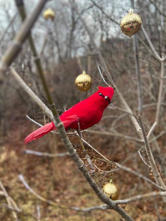
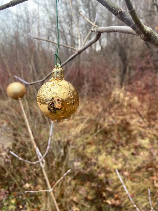
More images from my hike (including some timely Christmas trees):
#toronto#torontohike#cityhike#urbannature#ecology#preservation#landscape#urbanlandscape#canadaisbeautiful#canada#ontario#ontariohikes#ontariohiking#dogs#dogsoftoronto#torontowalk#citywalk#brickworks#cityhistory#cityarchives#history#chortley#chortleypark#hiking#hike#nature#naturebathing#naturewalk#naturehike#tdot
1 note
·
View note
Text
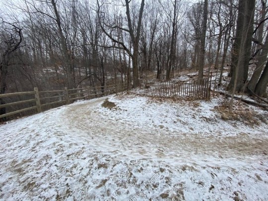
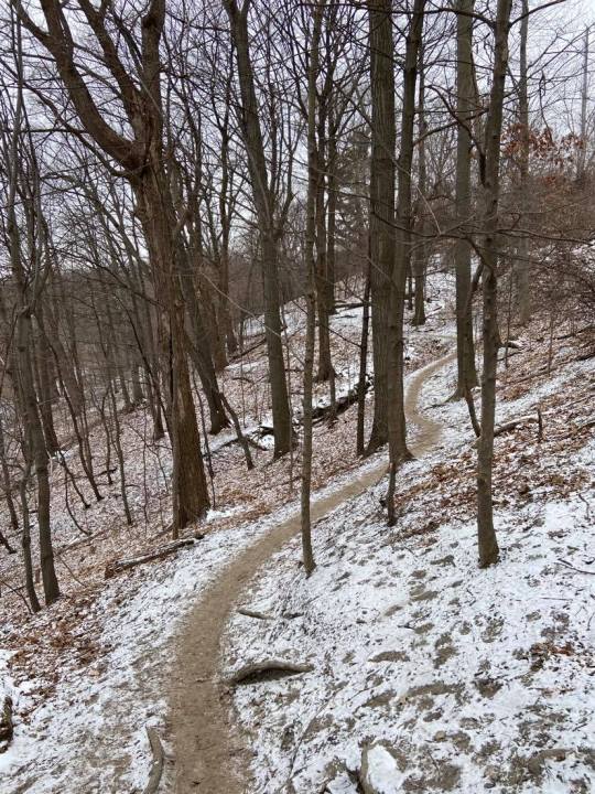
Crothers Woods
Sure, it feels like -17° C (1° F) outside, but that’s no reason for me to end a weekend ritual that has brought me joy during the pandemic! I learned today that eyelashes aren’t the only thing that can ice up in freezing weather...apparently, eyelashes and head hair can too! And now, you know too. :)
Today I drove to Crothers Woods. If you drive by the Loblaws on Redway Road, there’s a little road at the back of it that leads down to a water treatment plant, and you can park there.
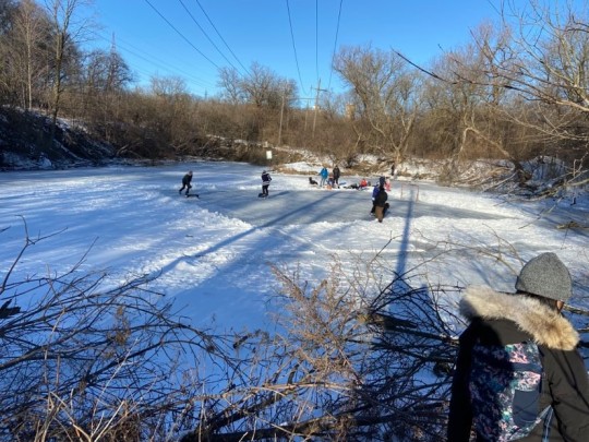
I didn’t realize it at the time, but I’d been at Crothers a couple weekends before - that time I’d followed the now defunct railroad line up from the east edge of Brickworks and wandered around, following the winding Lower Don River. This area is unique in that it has lots of smaller trails and paths where it’s easy to ask yourself “wait is that a trail?” especially in the snow. This also seems to be THE SPOT for mountain bikers.
This scene from that first hike in late January made me giggle. A family chilling on the sidelines while men on skates polish their own little ice rink to perfection.
This time, I was immediately greeted with this helpful map:
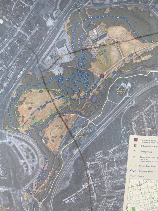
A few reactions to this map:
1) Was question mark really the ideal symbol marker for actual sites? Like, a star or an “i” for info booth wouldn’t have done it?
2) Police dog training facility?! Ok, remind me not to do any graffiti on that side of the tracks. (I’m remembering 1983′s Style Wars, where we see some of the drastically violent tactics the NYPD used to try and stop graffiti and street artists in the city. If you haven’t seen it, check it out - it’s a great look at 80s NYC and it’s free on YouTube.
3) For some reason I find it really funny that they include Loblaws in the map. Guess it’s not going anywhere anytime soon?
Safety:
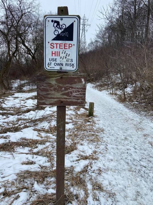
Note that the trails here are narrow and uneven (in part, due to bike tire marks on particularly wet days). There were several times I slipped so this may be a good one for cramp-ons or hiking poles. I own neither of these devices, but I think that’s what they’re for, yeah?
Mountain bikers frequent the area, so I recommend being extra careful as you come around corners, especially on the more narrow and high up trails.
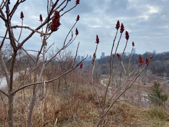
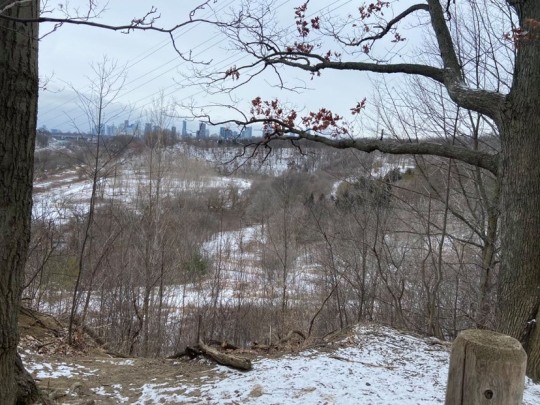
I appreciated the expanse of it. With few on-trail markings, you’ve never quite sure where you’re going to end up. I definitely plan on returning - especially when it’s warmer outside. Below are more pictures from my visit, including a sweet view of downtown Toronto (including the CN Tower).
Strava Pic:
#hiking#canada#canadaisbeautiful#sustainability#winterhike#winterhiking#whygod#socold#canadawinter#ilovecanada#toronto#torontohike#torontohiking#cityhiking#cityhike#snow#february#february2021#thesix#tdot#maps#trails#mountainbiking#ontario#breathoffreshair#wearyourmasks#trees#landscape#cityscape#parks
0 notes
Video
Out for a hike on a gorgeous fall afternoon. #hiking. #brucettrail #toronto #torontohiking https://www.instagram.com/p/Bo4rGaJnO0b/?utm_source=ig_tumblr_share&igshid=1b3t6evklwqb
1 note
·
View note
Photo
Another walk/hike. what #autumn was made for. #toronto #torontohikes #hiking (at Moore Park, Toronto) https://www.instagram.com/p/Bo7Q7keHIVF/?utm_source=ig_tumblr_share&igshid=1jpsw5kkd6n4q
0 notes
Last Seen Blogs

jawali
Runner
jawali
Runner

lobotemi
emi's trash hole

teenagebanditeagleeggs
Unbetitelt

runningthroughmy-veins
missing you comes in waves // tonight i'm drowning