Last Seen Blogs

tubbietommo
TubbieTommo

eaglegoldenblack
Simplemente historias

raccoonrat
Red Panda Fox

discountcoupon7
كوبون خصم

itzgoddesskayy
kay
Text


July 17, 2020
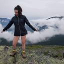
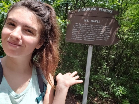
Mount Davis Loop
Forbes State Forest, Pennsylvania
6.1 miles
881 ft Elevation Gain
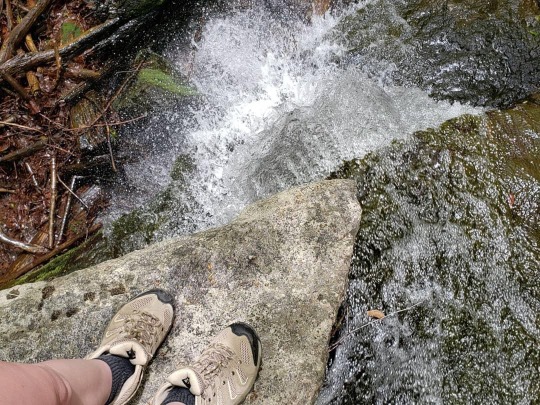
This is my 5th State High Point (NJ, WV, MD, DE and now PA). The hike was pretty simple, I did the longer route because the shorter one is only a mile and to me, not worth it. It must have rained the day before in the area because the trail was pretty muddy, but it still was a beautiful day to summit the highest point in Pennsylvania.
#adventure#adventurer#explore#explore more#hike#hiker#hiking#wild#wild child#wanderer#wander#wanderlust#women who hike#she explores#mountain woman#day hike#opt outside#outdoor blog#outside#outdoors#pennsylvania#pa#western pennsylvania#mount davis#high pointing#hiking blog
0 notes
Text
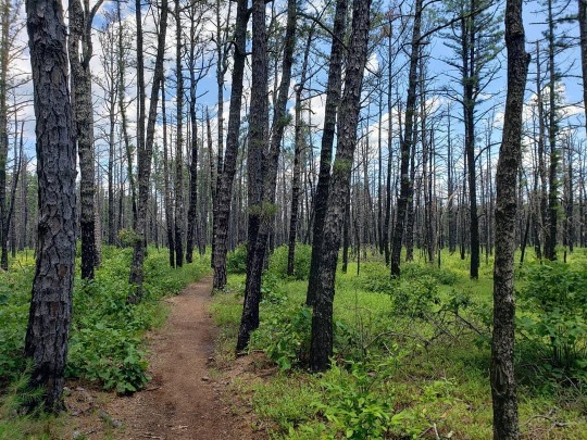

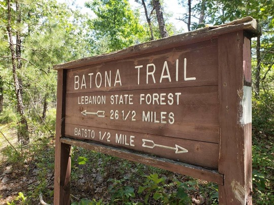
July 12, 2020
Batsto White Trail
Wharton State Forest, New Jersey
4.3 miles
149 ft Elevation Gain
Took advantage of the less humid day and went back into the pines. after the last two hikes that were pretty tough, it was nice to take a stroll though the Pine Barrens.
#adventure#adventurer#explore#explore more#hike#hiker#hiking#wild#wild child#wanderer#wander#wanderlust#women who hike#mountain woman#she explores#new jersey#NJ#south jersey#Pine Barrens#Wharton State Forest#day hike#outdoor blog#outside#outdoors#hiking blog
0 notes
Text


July 9, 2020
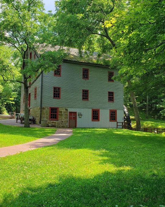
Little Buffalo Loop
Little Buffalo State Park, Pennsylvania
6.0 miles
879 ft Elevation Gain
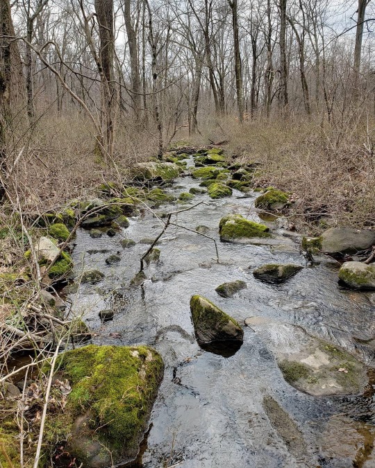
Day 2 hiking over here in Pennsylvania. Today was a much easier hike compared to yesterday, but a little more scenery. Found a little brook that I was able to cool my aching feet in for a while!
#adventure#adventurer#explore#explore more#hike#hiker#hiking#wild#wild child#wanderer#wander#wanderlust#women who hike#she explores#mountain woman#opt outside#outdoor blog#outside#outdoors#hiking blog#day hike#little buffalo state park#pennsylvania#PA
1 note
·
View note
Text
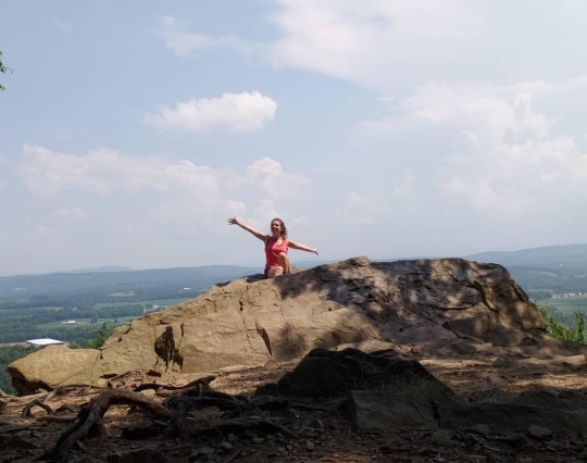
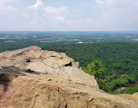


July 8, 2020
Appalachian Trail to Cove Mountain
PA State Game Lands 170
7.1 miles
1,269 ft Elevation Gain
Working over in this area today, I still managed to get a hike in between things to do. My destination was Cove Mountain, but a mile before I reached it, I heard thunder, so being on a ridge, I turned around so I wouldn't be the next "people who get struck by lightning" statistic. On the way, I passed Hawk Rock, which I had all the myself. Dope.
#adventure#adventurer#explore#explore more#hike#hiker#hiking#wild#wild child#wander#wanderer#wanderlust#women who hike#she explores#mountain woman#opt outside#outdoor blog#outside#outdoors#hiking blog#day hike#appalachian trail#pennsylvania#pa#hawk rock
0 notes
Text


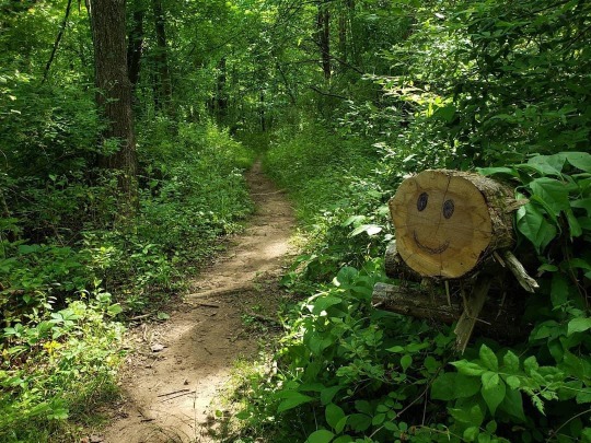
July 5, 2020
North Shore Trail -> East Creek Trail -> Meisle Trail -> Nature Trail -> Goosekill Trail
Belleplain State Forest, NJ
3.6 miles
30 ft Elevation Gain
The humidity was so insane today. Good thing I did a hike with basically no elevation so it was easy to walk, still tough to breathe. Trying to keep it easy on my foot still, so I'm hoping to get some hikes with elevation in the next couple weeks!
#adventure#adventurer#explore#explore more#hike#hiker#hiking#wanderer#wander#wanderlust#wild#wild child#she explores#women who hike#mountain woman#new jersey#hike nj#NJ#south jersey#opt outside#outside#outdoors#outdoor blog#day hike#hiking blog
0 notes
Text


June 26, 2020
Forest Road Trail -> Lost Trial -> Parvin Lake Trail
Parvin State Park, NJ
2.6 miles
25 ft Elevation Gain
Stanley makes the best backpack!
#adventure#adventurer#explore#explore more#hike#hiker#hiking#wild#wild child#wander#wanderer#wanderlust#women who hike#she explores#mountain woman#outdoors#outside#opt outside#new jersey#nj#hike nj#south jersey#parvin state park#hiking blog#outdoor blog
0 notes
Text


June 18, 2020
Cross Park Trail -> Parcourse Trail -> Hill Acres Trail -> Solar System Trail -> Vista Trail
Voorhees State Park, NJ
6.1 miles
735 ft Elevation Gain
It poured rain on me the whole time, but I absolutely loved it. Today was the first hike with rocky terrain and elevation since I got my boot off, and my foot felt great. Hopefully I don't do something stupid and re-break it. Today's hike, like I said, was rainy. Mist came through the woods and it felt dreamlike. I also got to see George's Thrones again which is always cool.
#adventure#adventurer#explore#explore more#hike#hiker#hiking#wanderer#wander#wanderlust#wild#wild child#women who hike#she explores#mountain woman#optoutside#day hike#outside#outdoors#hiking blog#outdoor blog#new jersey#NJ#hike nj#voorhees state park
0 notes
Text


June 15, 2020
Blue Dot Trail
Washington's Crossing State Park, NJ
5.58 miles
482 ft Elevation Gain
So since I am a natural born idiot, I woke my foot about 3ish weeks ago. Obviously I couldn't hike because of it so that explains my lack of posts. I decided to take the boot off a little early and my foot felt great! I wasn't planning on hiking at all today but then work lead my only 10 mins from Washington's Crossing State Park and felt like I needed to put in some kind of miles. Beautiful day out too!
#adventure#adventurer#explore#explore more#hike#hiker#hiking#wanderer#wander#wanderlust#wild#wild child#women who hike#mountain woman#she explores#new jersey#hike nj#nj#washintons crossing state park#optoutside#outdoor blog#outside#outdoors#day hike#hiking blog
0 notes
Text


May 18, 2020
Otter Hole Trail -> Mine Trail -> Roomy Mine Trail -> Highlands Trail -> Hewitt-Butler Trail
Norvin Green State Forest
5.88 miles
1,326 ft Elevation Gain
This was my biggest hike so far this season, my biggest I mean my biggest elevation gain. Along my hike I saw a cave which had an actual mine, and made it to the top of Wyanokie High Point. 360 views at the top and the NYC skyline in the way distance. So happy to get some quality elevation in a hike along with quality views.
#adventure#adventurer#explore#explore more#hike#hiker#hiking#wild#wild child#women who hike#she explores#mountain woman#optoutside#day hike#new jersey#north jersey#nj#hike nj#norvin green state forest#outdoor blog#hiking blog#outside#outdoors
1 note
·
View note
Text

May 10, 2020
Parvin Trail -> Knoll Trail -> Flat Trail
Parvin State Park, NJ
4.2 miles
32 ft Elevation Gain
A Mother's Day walk through Parvin State Park. My sister almost stepped on a snake, but I got to spend the day with the best bitch, my momma <3 who hates getting her picture taken more than anything. Also enjoy this large tree that got uprooted.
#adventure#adventurer#explore#explore more#hike#hiker#hiking#wanderer#wanderlust#wander#wild#wild child#she explores#women who hike#mountain woman#optoutside#new jersey#nj#day hike#hike nj#parvin state park#south jersey#outside#outdoors#outdoor blog#hiking blog
0 notes
Text


May 2, 2020
Cherry Ridge Trail -> Turkey Ridge Trail -> Rattlesnake Trail -> Coal Road Trail -> Lookout Trail
Wawayanda State Park, NJ
7.65 miles
742 ft Elevation Gain
After a month of being in quarantine my body and brain was going to explode, I needed the woods in the WORST way. Today was the first day NJ state parks opened their trails back up to the public so naturally I had to go for a hike. I know we were only supposed to go to a park that was close to where we life but I drove up to Wawayanda. Involuntary taking a month off, I am so out of shape, but it felt good to get back for some decent mileage. I was in a less than popular spot, I only saw three groups of people pass by me, two of which were mountain bikers so practicing social distancing was a breeze. Awesome hike, stopped at Lake Lookout for a break. I am praying that they don't close the park back up, because I am already planning my next hike.
#adventure#adventurer#explore#explore more#hike#hiker#hiking#wanderer#wander#wanderlust#wild#wild child#women who hike#mountain woman#she explores#new jersey#nj#hike nj#day hike#north jersey#wawayanda state park#optoutside#outdoor blog#hiking blog#outside#outdoors
0 notes
Text


April 5, 2020
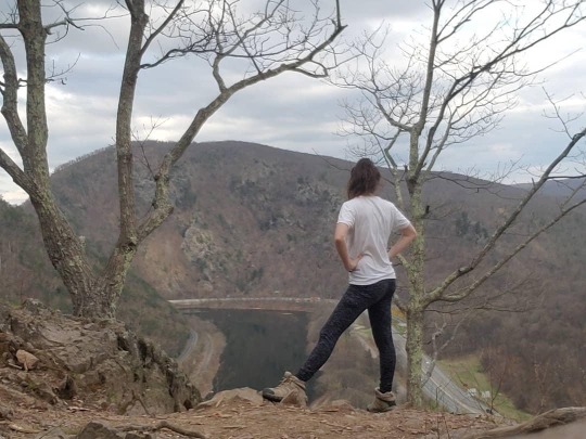
Mount Minsi via the Appalachian Trail
Delaware Water Gap National Recreation Area, PA
5.85 miles
1,233 ft Elevation Gain
I know, I'm sorry, really shouldn't have traveled two hours to go hiking but the anxiety of sitting inside is way too much. I hike alone so social distancing comes with that. this was my first big hike of the season, meaning my elevation gain was more than like 200 feet, and it was amazing to get back to that kind of climb. Was also kind of curious to see how bad Mt. Tammany was after the fire. New plants are growing but I couldn't see much up close since the trail and the parking lot are closed. Never did this hike up to Minis before so my review is that it's way more difficult that the hike up to Tammany. Also the hike getting up to Tammany is a lot shorter. Anyway, despite that the view was very worth it. The Delaware Water Gap is near where I grew up so it always feels like my childhood when I'm hiking around that area. The loop says to take the AT up to the summit and then go back down via the fire road, but I just turned around and followed the AT back down, which I regretted at the end because the whole way up was a huge rock scramble. Good ol' Rocksylvania! So I basically was jumping down boulders the whole time. RIP my knees and ankles. Beautiful day, amazing hike, and more to come!
#adventure#adventurer#explore#explore more#hike#hiker#hiking#wanderer#wander#wanderlust#wild#wild child#women who hike#she explores#mountain woman#Delaware water gap#appalachian trail#AT#day hike#pennsylvania#outdoor blog#hiking blog#outside#outdoors
0 notes
Text


April 3, 2020
Cinder Trail, John's Trail, and Tarkin Bogs Trail
Belleplain State Forest
4.3 miles
20 ft. Elevation Gain
Okay so I have a little rant. I decided to hike the Tarklin Bogs Trail in Belleplain State Forest. My little sister and her friend came along with me. We took the Cinder Trail which was basically a sand, off roading trail to John's Run Trail. We got to a bridge and thanks to Beavers, which really isn't their fault, the path after the bridge got washed out. Thankfully since I'm a bad ass, I made somewhat of a bridge I created from thick branches. After we crossed my DIY bridge we tried to walk the Tarklin Bogs Trail except THERE WAS NO TRAIL. We walked at least a mile through the thick thorn bushes to realize this was too much and turned around. I don't know why the park can put on a map that there is a trail where there is not. Today was no successful, but I'm hoping next weeks hike will be better.
#adventure#adventurer#explore#explore more#wanderer#wander#wanderlust#hike#hiker#hiking#wild#wild child#she explores#women who hike#mountain woman#new jersey#nj#hike nj#belleplain state forest#south jersey#outdoor blog#hiking blog#outside#outdoors
0 notes
Text


March 25, 2020
Upland Trail, Main trail, and Riverside Trial
Hacklebarny State Park, NJ
3.35 miles
510 ft Elevation Gain
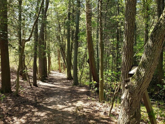
This quarantine thing is hard for a girl who lives like I do. I am so grateful that I am still able to go on my weekly hikes, among all this chaos, it's the one thing I look forward to. So I found myself at my favorite park, Hacklebarney, to remind myself that just because I have to social distance myself from people, DOES NOT mean I have to distance myself from nature.
#adventure#adventurer#explore#explore more#hike#hiker#hiking#wild#wild child#wanderer#wander#wanderlust#women who hike#she explores#mountain woman#outdoor blog#hiking blog#day hike#new jersey#hike nj#nj#hacklebarney state park#outside#outdoors
1 note
·
View note
Text

March 17, 2020
Hollow, Bookside, and Tanglewood Trails
Voorhees State Park, NJ
2.5 miles
Quarantine? What's that?
#adventure#adventurer#explore#explore more#hike#hiker#hiking#wild#wild child#wanderer#wander#wanderlust#women who hike#she explores#mountain woman#day hike#outdoor blog#hiking blog#outside#outdoors#nj#new jersey#hike nj#voorhees state park
0 notes
Text
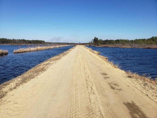

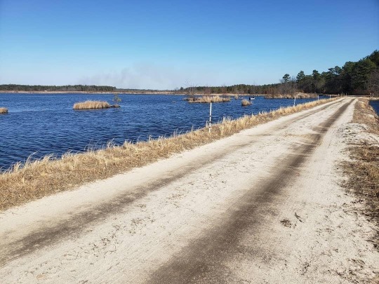

March 1, 2020
Whitesbog Red Trail
Brendan T. Byrne State Forest
5.5 miles
31 ft. Elevation Gain
I took three months (dec, jan, and feb) off to rest and recuperate and today was my first hike of the year! The hike wasn't hard, mainly following a dirt road through some cranberry bogs. Super windy, a little cold, but sunny and not a cloud in the sky!
#adventure#adventurer#explore#explore more#wanderer#wander#wanderlust#hike#hiker#hiking#wild#wild child#women who hike#she explores#mountain woman#south jersey#new jersey#hike nj#cranberry bogs#outdoor blog#hiking blog#day hike#outside#outdoors
0 notes
Text

November 12, 2019
Forest Trail and Creek Trail
Bass River State Forest
1.5 miles
26 ft. Elevation Gain
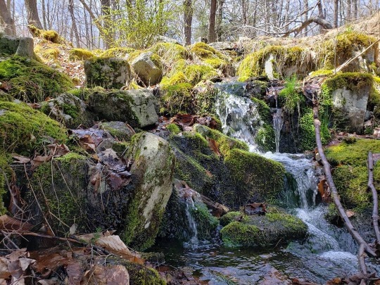
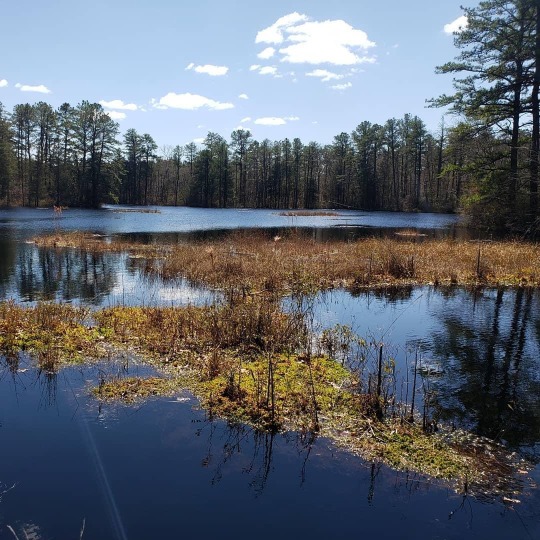
I woke up this morning and was 100% sick. Super congested and the worst headache. Learning that it was super nice out, I ignored how I felt and went out for a short walk. It's really Belanger Creek Restoration Site, but Bass River owns it I think? Anywho, Beavers definitely took over everywhere son parts of the trails were flooded out, but still manageable. It was a short walk and thank goodness it was because as soon as I got home I broke a 103 fever and now I'm dying. Super sick? Yes. Mistake to go outside for a walk? Never.
#adventure#explore#adventurer#hike#hiker#hiking#wild#wild child#wanderer#wander#wanderlust#day hike#south jersey#hike nj#women who hike#mountain woman#explore more#she explores#bass river#outdoor blog#outdoors#outside#hiking blog
0 notes