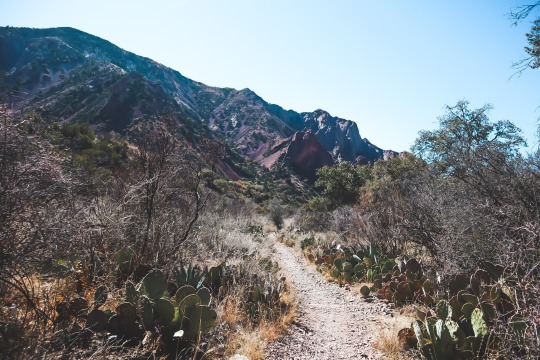
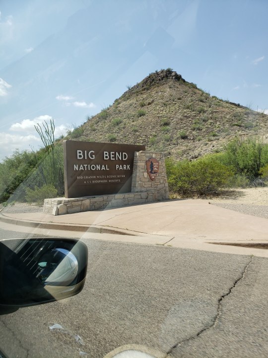
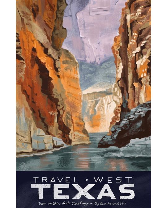
#Santa Elena Canyon Trail
Text

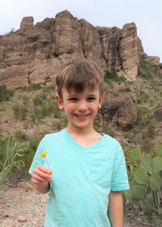
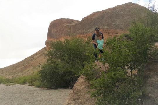
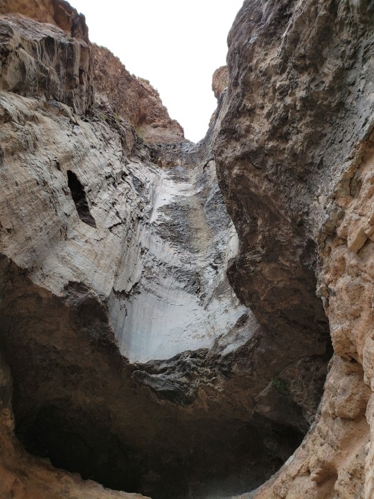
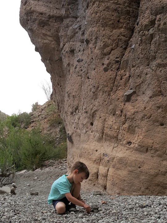
Went to Big Bend National Park in Texas!!!
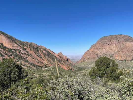
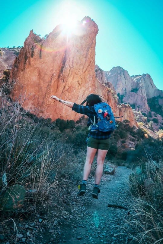
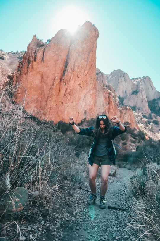
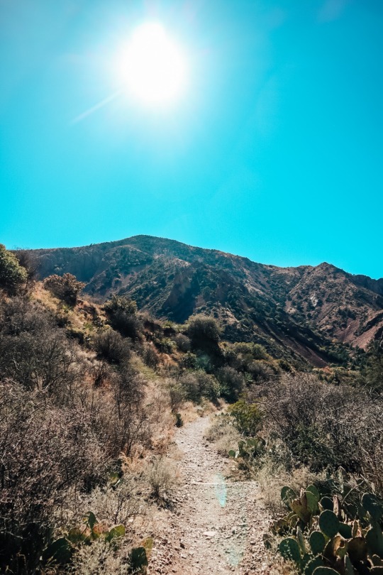
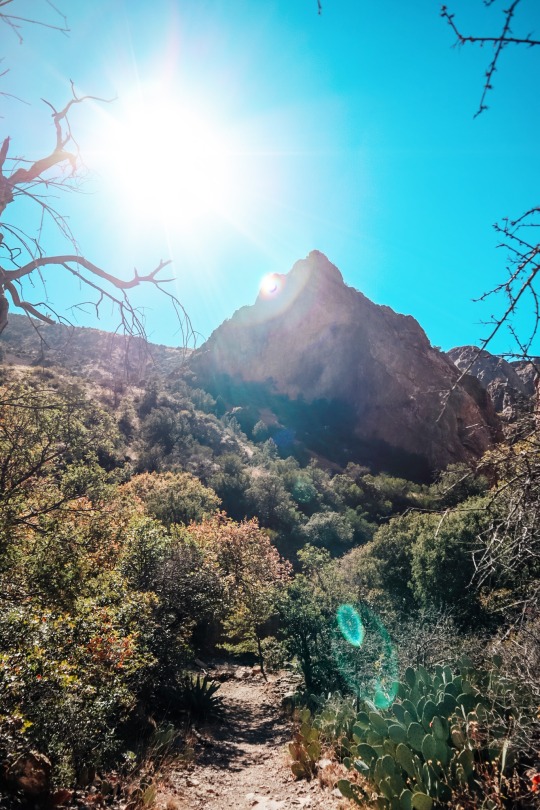
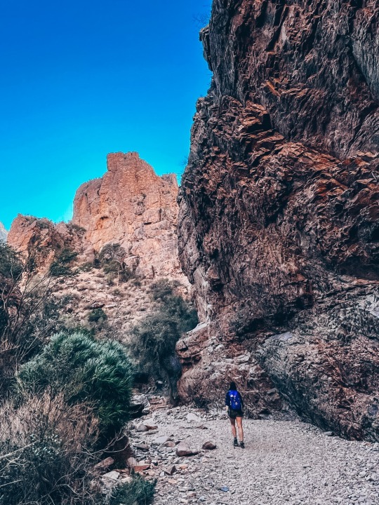
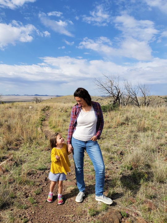
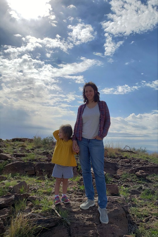
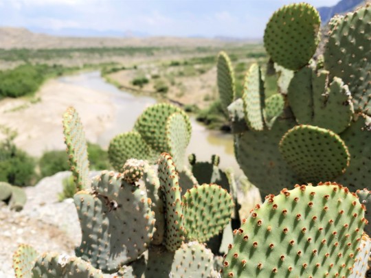
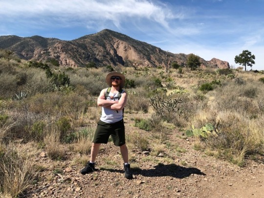
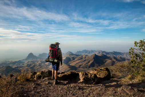
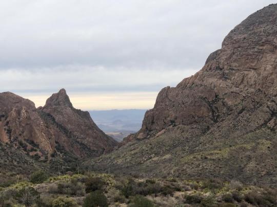
First two pictures are along the Emory Peak trail with a view of what they call The Window. The rocks are from a rhyolitic lava flow.
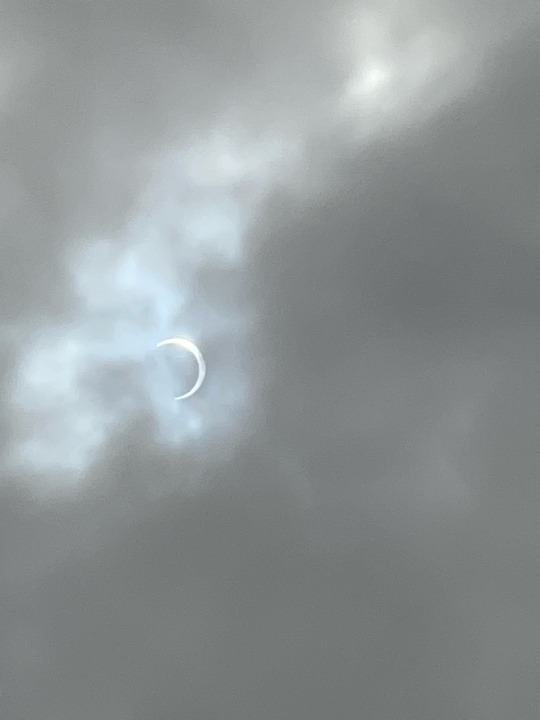
Third picture is of the eclipse.
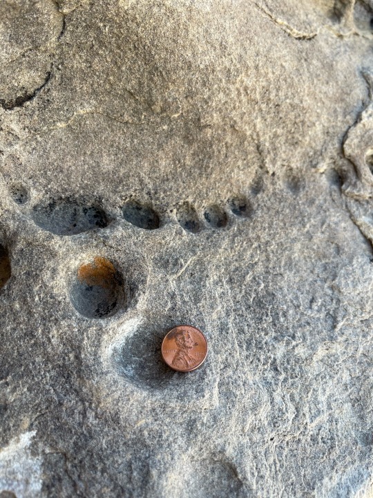
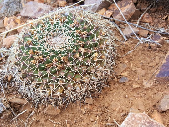
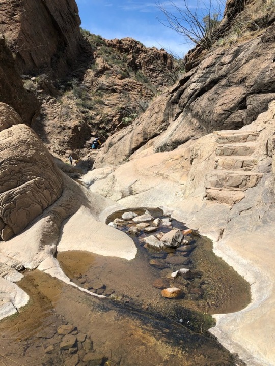
Fourth is of mini potholes or vugs from a random rock I climbed into.
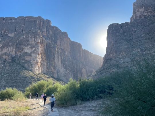
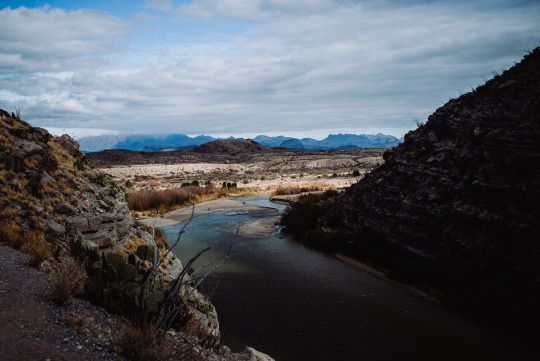
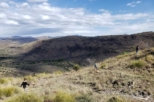
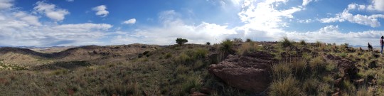
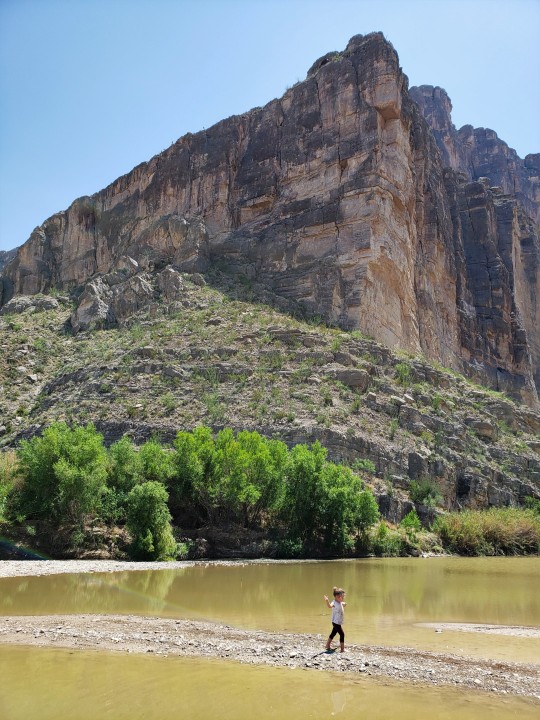
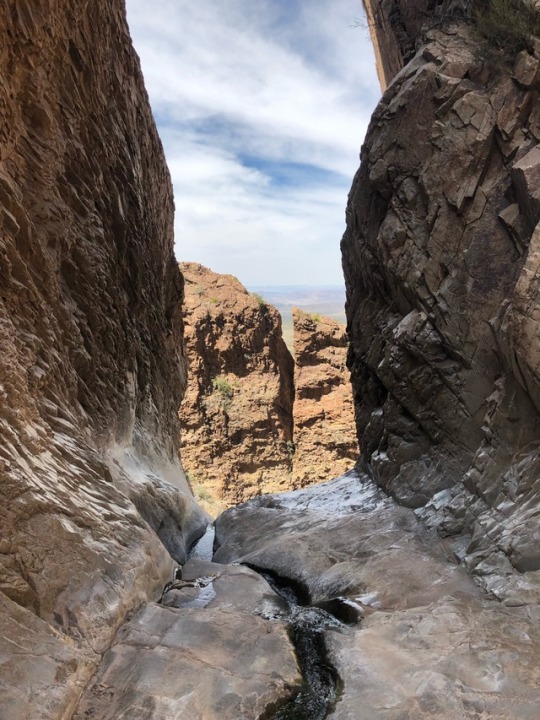
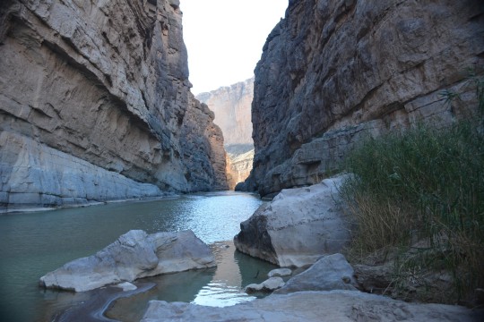
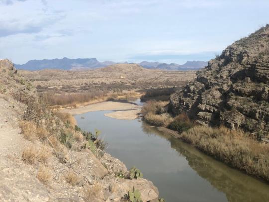
Fifth is the trail heading to the Rio Grande depicting the Santa Elena Canyon.
#geology#rocks#justgeologythings#just geology things#minerals#water#fieldwork#geology memes#geologist#i love water#big bend national park#national park
89 notes
·
View notes
Text
Thinking about national parks now and how I'd love to go to more of them. I'm going to list the ones I've visited and a thing or two I remember about each of them.
Acadia: thunder hole and the rocky shores
Badlands: the prairie hike and the way you can hike off trail, scooting down a very steep descent on my butt because it was better than falling headfirst
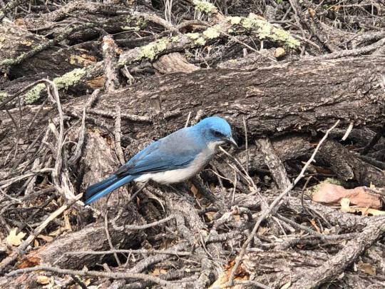
Big Bend: hot springs, jays in the Chisos Mountains, Ross Maxwell Scenic drive and sunset near Santa Elena Canyon
Bryce Canyon: the sun hitting the hoodoos late in the day
Carlsbad Caverns: bats and the descent, learning about the ascent into Halloween Hall
Gateway Arch: I didn't realize this was a national park?? It's surprisingly narrow but it was interesting seeing the mechanism to get to the top.
Grand Canyon: on the north side black squirrels and a storm rolling in, on the south side the classic view
Grand Teton: sunrise against the mountains, getting caught between a moose and a bear on a trail
Smoky Mountains: the fall colors, the way the fog really is mysterious and thick and smoky
Guadalupe Mountains: Smith Spring and the transition from scrub to forest
Indiana Dunes: spending a day at the beach before it became a national park, the bog hike, taking a solo hike in the rain while my friends slept
Mammoth Cave: the ice-cream cone formation, a playground at the motel (i was very young)
White Sands: my deep desire to spot a lizard, the bright white of it all, admiration for people doing multi-mile hikes
Yellowstone: my dad wearing socks on his ears because we did not expect winter weather in June, Moose Valley, my brother and i picking out the smallest hot springs and naming them after ourselves
Yosemite: lots of big ravens, bridalveil fall viewed at a distance, sequoias
Zion: bighorn sheep, peeking into the narrows, promising myself i'd come back with people who aren't afraid of heights and hike angel's landing
#national parks#np diary#<- maybe i'll remember that tag (unlikely) and add to this if I get to visit another park
12 notes
·
View notes
Text

Santa Elena Canyon Trail, Big Bend National Park, Texas
4 notes
·
View notes
Photo
santa elena canyon
#santa elena canyon#hiking trail#rio grande river#big bend national park#mexico#united states#border#West Texas
3 notes
·
View notes
Text


PART 1
calm sunsets
accidentally going to Mexico
sunrises in bed
hiking the window trail, grapevine road to balanced rock and Santa Elena canyon
Walking through the rio grande
Laying on a highway in the middle of the night
Erin throwing me off a mountain
Warmth and wind
Sun flares and exploding beers
Pure silence
A dinosaur and a lizard
Star trails
VIEWS
FRIENDS
❤️
BiBe
Big Bend National park- thanks for the memories
@er1nruns @elkay723 ❤️
82 notes
·
View notes
Photo

Third hike, Santa Elena Canyon Trail. Easy (thanks God) 1.7 miles round trip hike. The hike combined crossing Terlingua creek, muddy feet, ascends, descends, and for some a nice walk or swim in the river. I wish I had brought my kayak to paddle in the Santa Elena Canyon. #santaelenacanyon #bigbendnationalpark (at Santa Elena Canyon, Big Bend) https://www.instagram.com/p/CIEmFmMhJ4Rka3sbTEtqm0eSSiosjkjSTeJRw80/?igshid=93wlrx5scb7q
1 note
·
View note
Video

flickr
Santa Elena Canyon Sunrise Sky by Ken'sKam
An early morning view from the Santa Elena Canyon trail in Big Bend NP.
5 notes
·
View notes
Photo
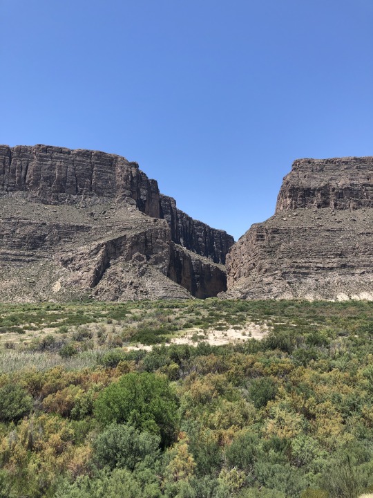
Santa Elena Canyon is one of the best-known natural features in Big Bend National Park. A short nature trail enters its shady depths, 8 miles west of Castolon, accessible by either Ross Maxwell Scenic Drive or the Old Maverick Road. The nature trail crosses Terlingua Creek, climbs several flights of ramps and stairs and then descends into the canyon along the Rio Grande. At this point the canyon walls loom over 1500 feet above the river below. During the rainy season, Terlingua Creek can flood and make access difficult. [visitbigbend.com] 📍: Big Bend National Park, TX 📅 : October 2019 .................................................. 📷: Nikon Z7 🔍: Nikon 24-70/4s 1/60 sec f/8 ISO 200 #nationalparkgeek #IBrakeForBrownSigns #visitbigbend . (at Big Bend National Park) https://www.instagram.com/p/B3mRwW7AKbT/?igshid=1nx26f8aw39ss
16 notes
·
View notes
Text
Day 7: Marfa
Started the day early, as you can see from our previous post. The sunrise was beautiful.
We didn’t even have that many bugs in the tipi when we woke up. No beetles crawling on the duvet or anything. I call that a win. But seriously: don’t go there if you can’t deal with bugs.
After making breakfast and lunch for the road, and cleaning the tipi as best we could, we drove down the dusty, up-and-down road from Basecamp, and found our way south towards Big Bend National Park. The whole area lacks cell reception, as we’ve said before, so we had to drive using a paper map today. It wasn’t too hard, though. The roads are clearly marked and relatively easy to see.
There’s so much to see in the national park, but there were two places we definitely wanted to visit.

First: Chisos basin and The Window. The nature is truly awe-inspiring, and I think our conversation mostly consisted of “Wow!” and “Look!” At first, we took a slight wrong turn and ended up at Chisos campgrounds, but a nice park ranger pointed us in the right direction.

Turns out we only missed our target by about 50 metres, but it was all for the best. If we hadn’t taken the detour, we would have missed the BEARS! Yes, that’s right! Not one, not two, but FOUR black bears just off the trail. The highlight of the trip, right there.

We walked around the bend to see the Window, and a gentleman with a camera shushed us and waved us over, mouthing “bears, bears”. I thought I heard wrong, but over on the ridge we clearly saw a mama bear and her three cubs. She was just wandering around in the shrubs and bushes, occasionally digging in the ground, probably for ants or something.
It took a long time before we could say anything, or even move along, but eventually it became too hot and we walked back to the car park - I almost stumbled over a road runner, but unfortunately I didn’t have my camera ready (but not before stopping in the shop to buy something cold to drink, and I finally got my sun hat! :)).
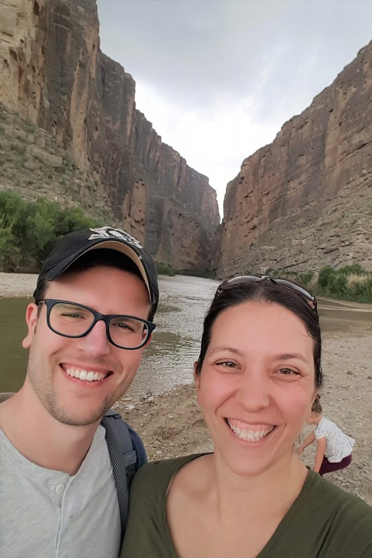
Taking the spiralling road back down the mountain, we continued south on Ross Maxwell Scenic Drive to the Santa Elena Canyon Overlook. We had our lunch on a bench, watching that spectacular view and feeling very small indeed.

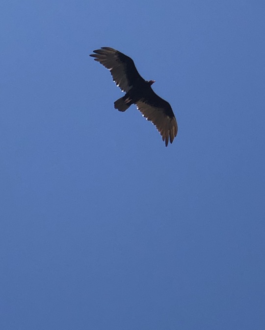
Finally got ID on the vultures we’ve been seeing. It’s Turkey vultures, if my knowledge and Google does not fail me. This one kept us company while we stood looking over the edge into the canyon.
After this, it was time to make our way to Marfa, backtracking up the Scenic drive, back to Terlingua and through to Lajitas and Big Bend State Park Ranch, following FM170 (The River Road) to Presidio, before turning north to Marfa. Let me tell you: part of the road between Lajitas and Redford would never have been approved in Norway. Deep dips and blind hilltops ending in blind turns, and it was equal parts exhilarating and terrifying.
But it was fun driving along Rio Grande and the Mexican border. Some places we could even see into Mexico as well.
The road from Redford to Marfa was pretty much uneventful, except for a small return of cell reception in Presidio, which quickly disappeared once we left the city limits again, but that meant we could use our digital map again. So helpful!
Tonight we’re staying in Hotel Saint George, the poshest hotel on this trip. It’s really luxurious after our trip through the desert, so I say we deserve it!
Marfa is one of the towns hosting Viva Big Bend (along with Alpine and Marathon), so after a mediocre dinner at Jett’s Grill (bacon penne with a red, creamy, tequila sauce for me, and a burger for Øyvind), we walked the few blocks to Planet Marfa to see some concerts. There were several venues with concerts, of course, but we started talking to a couple from Midlands, Melinda and David, if my memory serves me right, and we had a really pleasant evening. We totally forgot to go to the Lost Horse for the last concert we kinda wanted to see.
I really liked Planet Marfa. Wonderful ambiance, nice people, and good music!

After the last concert, we headed back to the hotel for some well-earned rest (loved the guy dancing dressed in a t-shirt, what looked like pyjama shorts, cowboy boots, a cowboy hat, and with a sigar hanging from the corner of his mouth. He looked like he was having the time of his life :)). And some cooling insect gel. I haven’t had this many mosquitos try to eat me before on this trip – clearly they all live in Marfa.
Today’s wildlife:
Plenty of road runners (meep-meep) - I almost managed to photograph a few of them, but the moment I got close enough, they took off into the bushes, vultures and other birds of prey, I saw a bunny, and something that looked like a squirrel, but did not move like one (I only saw its hind legs and tail), a dead kangaroo rat, a couple of beautiful, bright blue lizards with red-ish tails, and of course: the black bears. I still cannot believe we saw bears!!!
3 notes
·
View notes
Text
On the Road Again...
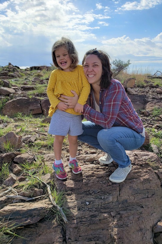
We have been in Texas now for 10 years! Can you believe that? We decided it was time to get our butts out to West Texas where we have heard so much about. Everyone said that we wouldn’t believe that we were still in TX; it’s like you’re in another country and it was so true. It was unlike anywhere we had ever been. The landscape, the wildlife, and the vegetation were breathtaking. I am already ready to go back and explore some more but we will need to wait until the crazy summer heat passes and go in late Fall or early Spring.
On the first day, we drove 7 hrs to our airbnb in Alpine, TX which was the closest town to Big Bend National Park, (even though it was an additional 2.5 hr drive to the park.) We listened to The Miraculous Journey of Edward Tulane on audiobook on the way and we HIGHLY recommend for all ages. It’s a beautiful story. We all loved it.


The first day we drove about 30 mins north from Alpine to Davis Mountains State Park, where we drove to the top of a mountain and explored and hiked. Driving up/down the mountains, Olive kept calling the switchback roads, “aisles” and said “here we go up another aisle.” Davis Mountains:

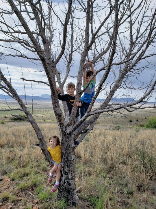
The kids spent about an hour using the rocks as building toys. Graham made a gumball machine.

youtube

the “perfect slingshot” Jonah found which he brought home to make one with a rubberband

If there is a tree, they will climb it. Actually, it doesn’t even need to be a tree--they’ll climb anything.

Next we decided to go to Chihuahuan Desert Research Institute which was near the state park. In Alpine the weather was beautiful--mid 70s and sunny but on our 15 min drive into the mountains to get to the research institute to hike it started hailing more than we’ve ever seen.

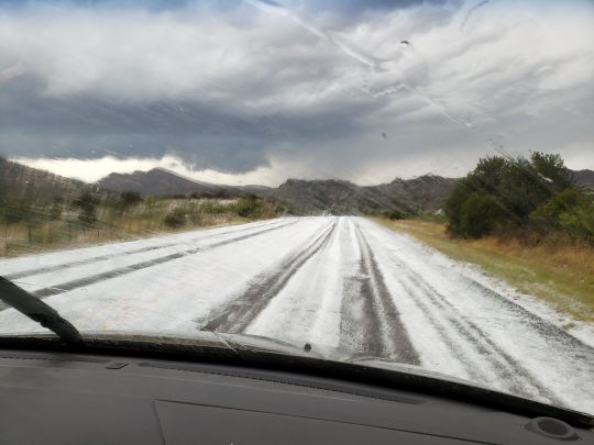
The roads were slippery like it was a snow storm in the middle of winter. We finally made it to the center for shelter from the hail storm and from a crazy downpour which would flood the hiking trails. It was quite the sight. We were grateful to not have been out with the kids on the trails in the middle of the hail storm since there is so very little protection from the elements in the desert. After we waited out the storm, we headed back into Alpine, where we hiked a small, local trail what was deemed an “easy, kid-friendly hike” on alltrails but ended up being very steep. It was beautiful and we were able to see a nice view of Alpine.

We managed to make it 95% of the way back to our car with no accidents, despite the trail being lined with cactus on either side. Graham tripped and landed hands first on a Prickly Pear Cactus. Once we picked out about 20 fine spines from his hands, he was fine. We had a few other encounters with cactus and kids during the trip but once the spines are removed, the pain is gone thankfully.

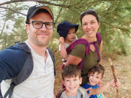
That night our good friends from Dallas joined us. They and their 4 kids parked their RV outside our house for a couple nights. We were so excited to be able to take a day trip together the next day to Big Bend. We drove 2 hrs to the park entrance
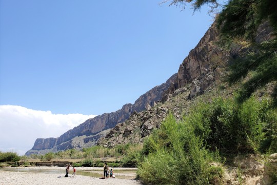
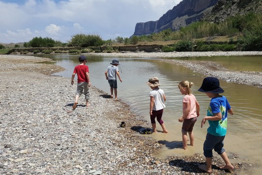
and drove another 30 mins south to Santa Elena Canyon which is on the Rio Grande River.

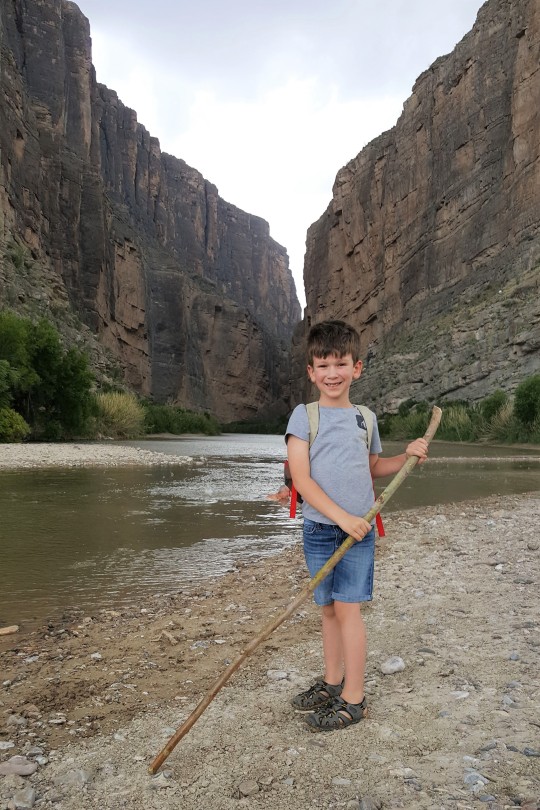
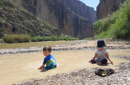
After finally making it to the canyon, getting 7 kids out of the car and walking to the river, OUT. OF. NOWHERE big, fat raindrops came and then...hail! Like, welt-leaving hail. Our family found protection under a tree.

The hail storm only lasted for 15 minutes and then we were able to continue on with our hike. The Santa Elena Trail gave us beautiful views of the canyon and the river.
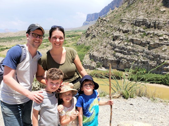
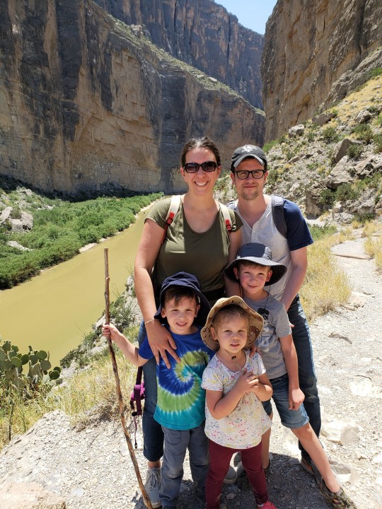

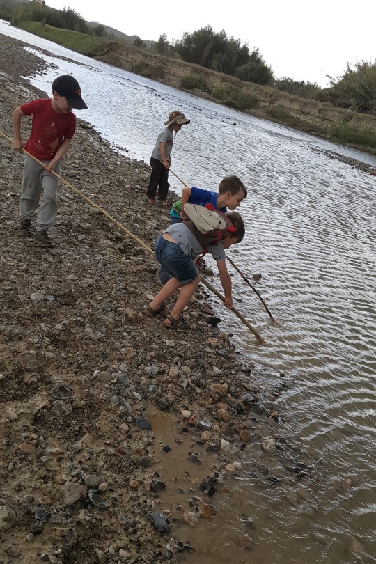
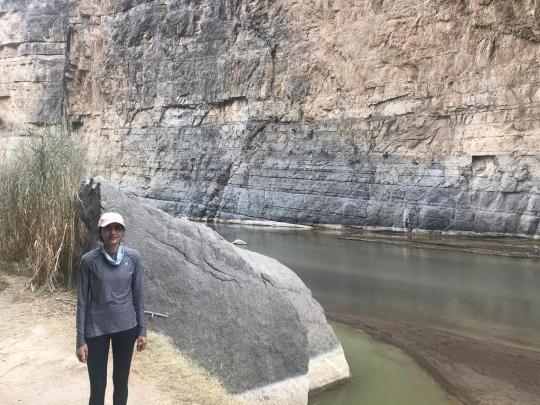
After our hike, we made our way back down to the river to cool off and explore. Mexico is on the other side of the Rio Grande River. We were allowed to swim but not across to the other side! Here you can see the Texas/Mexico boarder:


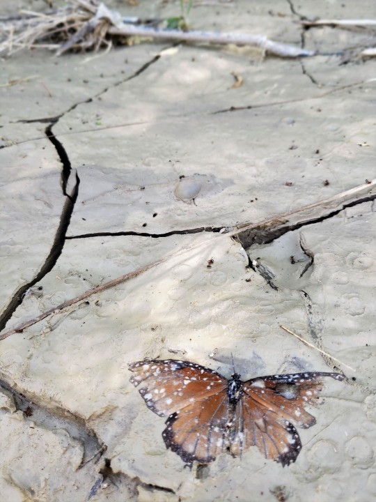
butterfly caught in mud

fresh mountain lion tracks!
Here’s an odd digging bee that Olive almost lands on
youtube

Headed back to the car.

From the Rio Grande and canyon, we stop at the lower burro mesa pour off trail, which was my favorite and most kid-friendly. Highly recommend.


Here Grambo is again building and creating, what he does best.
The 2 hr drive back to Alpine from Big Bend was gorgeous.
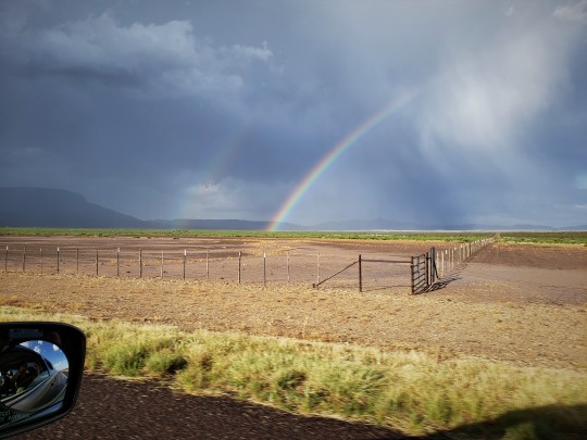
We saw storms form in the distant mountains and watched as we drove to them. We drove through hail, once again. If you’re not counting, that’s the 3rd hail storm in 2 days. And then we saw it--a double rainbow!
youtube
This is what 2 hikes and 5 hours in a car in 1 day look like with kids. In case you’d like to join on our next roadtrip, we have an extra seat in our van...
youtube
The last night we were in West Texas, we all stayed up late and took the kids to an odd town called Marfa to see the “Marfa Lights” which is a completely dark viewing center to see stars like you’ve never seen them before--think outdoor/real planetarium. There’s claims to thousands of people seeing UFO sightings there but we only saw beautiful stars.
We had such a great and tiring trip! I’m ready to go back already. Who’s with me?
6 notes
·
View notes
Text
Thanks Ronda


We made it! Tin Valley Retro Rentals. You can only get there via coordinates. No cell service, no hot water, no paved roads, no street lights. Ronda, the host, gave us the most specific directions, details and fun tidbits about the location. We got there no problem with about an hour of daylight so we could set up our first real campsite NOT in the dark. No problems there! There were so many cute animals (fur babies, as Ronda called them), 3 dogs, a burro (like a donkey) named Samson, who only liked junk food and sooo many cute tiny black cats. We made our first fire and first camp stove meal (pasta) and slept in our tent for the first time.
The next day we wake up at sunrise and head into Big Bend National Park. We had heard mixed opinions about going here but as of now both Andy and I agree that it was AMAZING. There were so many gorgeous landscapes. We saw the desert, mountains and rivers all in one day, in one park. The flora and fauna was beautiful- so many unique colors. A lot more green than we expected. We hiked the 5.2 miles Window View Trail- hard and hot but well worth it. The took the Ross Maxwell Scenic Drive south all the way down to the Rio Grande and the Santa Elena Canyon. I was at a loss for words. I know we have a lot of beautiful sights and national parks ahead of us, but we were really blown away. We took a short 1.7 mile hike up into the Canyon and it kept getting more and more beautiful. So many photos, I couldn’t stop!!! The sun was starting to set so we took the Old Maverick Road to the park exit- this was the bumpiest dirt road my poor car has ever been on. 10mph the whole way, 4 wheel drive cards only. My car needs a spa day.....
Once we finally got into an area with cell service, we drove to El Cosmico in Marfa, TX, a hippie-dippy village with RVs, yurts and tipis for rent. This time we opted for the open campgrounds. Took advantage of the communal outdoor kitchen and the free coffee. A good stop for the night. Next stop: Carlsbad Caverns in New Mexico!
5 notes
·
View notes
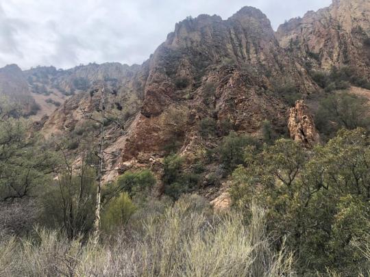
Photo
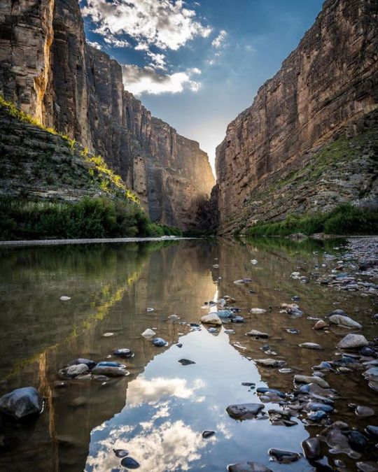
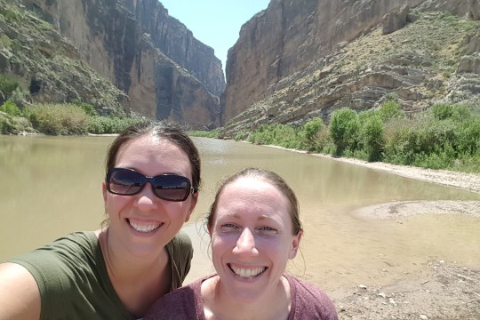
Santa Elena Canyon - February 2015
It took the Rio Grande River millions of years to carve the narrow Santa Elena Canyon. The canyon can be viewed by rafting through on the Rio Grande or hiking the trails along the steep walls. This image was taken from the one of the side trails which led almost down to the river.
MWM
1 note
·
View note
Video

flickr
Celebrating the Heritage of Our National Parks in Big Bend National Park by Mark Stevens
Via Flickr:
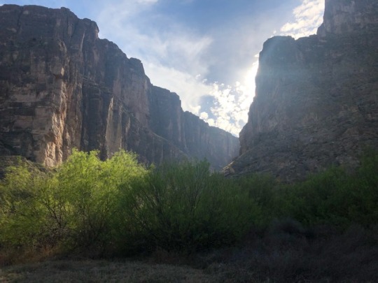
A view to the north-northeast while walking along the Santa Elena Canyon Trail to people playing and enjoying time in the waters of the Rio Grande. This is the point where the Rio Grande exits the Santa Elena Canyon and makes a turn to the "big bend" and namesake of the national park.
#Along Banks of Rio Grande#Azimuth 12#Big Bend National Park#Big Bend Ranges#Big Bend and Carlsbad Caverns National Parks#Blue Skies with Clouds#Chihuahuan Desert#Chisos Mountains#Day 4#Desert#Desert Landscape#Desert Mountain Landscape#Desert Plant Life#DxO PhotoLab 5 Edited#Hillsides#Intermountain West#Landscape#Landscape - Scenery#Looking NNE#Nature#Nikon D850#Outside#People#People Outside#People on Riverbank#Project365#Rio Grande#River#Rolling Hillsides#Santa Elena Canyon Trail
0 notes
Text
The Search for the Best Hiking Excursions in Texas
In 2020, the number of people participating in hiking increased significantly. When RunRepeat.com analyzed 7.9 hiking activities registered on the AllTrails app between 2016 and 2020, it found more people hiked in 2020 than they did in the years before. The major findings were that the number of hikers increased 134.7 percent, and the number of hikes logged spiked 171.4 percent, both higher compared to 2019.
Some of the people who hiked in 2020 did so in any number of Texas’s scenic parks and trails. Texas offers visitors the chance to hike in desert canyons, lush forests, rugged terrains, swampy grasslands, and meadows filled with flowers or walk along pristine waterfalls. Ultimately, the state offers something for every hiker.
One of Texas’s most popular hiking locations, Big Bend, is home to a few hiking trails. The location features more than 150 hiking trails along the Chihuahuan desert or Rio river for beginners to more advanced hikes in the Chisos Mountains.
The South Rim trail in Big Bend is more than 12 miles and gives hikers views of the Chihuahua Desert. Also a part of the Big Bend, the Lost Mine is a 4.2-mile trek where hikers can take in the area’s diverse plant life comprised of thick juniper, pine groves, and wildflower. Finally, Santa Elena Canyon, also in Big Bend, contains a short trail that is a mile and a half that begins at the end of Ross Maxwell Scenic Drive and finishes along the Rio Grande, where hikers take in lush vegetation and tall limestone rock.
The park covers 300,000 acres of land containing all sorts of wildlife. Hikers are likely to run into any of the 450 species of birds and 70 types of mammals and insects, including various bats, butterflies, ants, and scorpions.
Another park, Guadalupe Peak Trail, provides hikers the chance to take in panoramic views of the highest point in the state, Guadalupe Peak, which is 8700 feet above sea level. The hike is 8.1 miles beginning in the Pine Springs’ RV section and extending to Guadalupe Peak. From start to finish, hiking this trail can take between six and eight hours, which might require an overnight stay at a campground near the summit. Finally, El Capitan is another notable attraction that offers hikers the chance to take in majestic views of the canyon.
For those wanting to take in some art during their hike, Seminole Canyon State Park offers not only access to hiking trails, biking, and camping but also the chance to view amazing ancient rock art. More specifically, hikers see the Del Rio Paintings, remnants of civilization some 7,000 years ago.
Those who want to take in the vistas of the state’s various waterfalls while hiking should visit Gorman Falls Trail and Cattail Falls Trail. Gorman Falls Trail is considered a part of the Colorado Bend State Park. It is regarded as a living waterfall due to high carbon dioxide concentrations that flow through limestone deposits, causing it to grow over time. Only a 2.6-mile out-and-back (round trip) trail, Gorman Falls is accessible year-round.
Finally, Cattail Falls is another hiking location in Big Bend National Park, measuring 3.1 miles roundtrip. The trail winds 80 feet meeting with the falls, where visitors might catch a glimpse of black bears, but should also be aware of the poison oak.
1 note
·
View note
Photo
I’ve been feeling very... conflicted about my home state lately, but can’t ever deny the impressive variety of ecosystems and landscapes across this area. In particular, Big Bend National Park wows me every time. Itching for a camping trip these days, and am thankful to be going on one soon (although, not to Big Bend!) We’ll be visiting Guadalupe Mountains National Park, which is also in Texas. I’ve never been before. Let me know— have you been to both? If so, do you have a favorite? . . . . . . . . . #bigbendnationalpark #guadalupemountainsnationalpark #santaelenacanyon #moreillustrations #illustrationhowl #illustrationlove #illustreak #illustratedimpact #illustratorsoninstagram #lifeofanillustrator #illustratorlifestyle #illustratorlife #quarantineartclub #theillustrationroom #weloveillustration #illustree #getoutstayout #wildernessculture #optoutside #ourcamplife #theoutbound #wanderout #roadtrippin #takemoreadventures #radparks #howiparkit #findyourpark #trailful (at Santa Elena Canyon, Big Bend) https://www.instagram.com/p/CNSfMg3FCin/?igshid=1toyir8j8rx8b
#bigbendnationalpark#guadalupemountainsnationalpark#santaelenacanyon#moreillustrations#illustrationhowl#illustrationlove#illustreak#illustratedimpact#illustratorsoninstagram#lifeofanillustrator#illustratorlifestyle#illustratorlife#quarantineartclub#theillustrationroom#weloveillustration#illustree#getoutstayout#wildernessculture#optoutside#ourcamplife#theoutbound#wanderout#roadtrippin#takemoreadventures#radparks#howiparkit#findyourpark#trailful
0 notes
Text
Big Bend National Park
The Verdict: We loved our trip to Big Bend! The scenery is stunning and otherworldly; we were just waiting for the dinosaurs to show up and reclaim their epic territory. We definitely recommend visiting.
WHAT TO DO (2 DAYS):
Ranked starting with our most favorite (though all were amazing):
Lost Mine Trail (5 miles out and back, moderate)
Santa Elena Canyon (2 miles out and back, easy/moderate)
Emory Peak (10 miles out and back, strenuous)
Windows Trail (5 miles out and back, moderate) & Window View (0.4 mile loop, easy)
Russ Maxwell Scenic Drive (22 miles each way)
Note: We did all of these in one (long-ish) day except Emory Peak, which we did on a second half-day.
Lost Mine Trail (5 miles out and back, moderate)
This is a pretty steep walk up a mountain with incredible panoramic views at the top. It really reminded us of Kauai. It was tiring, but absolutely worth it. Take a windbreaker – the summit is windy! There wasn’t much shade and it was very sunny on the way down; we drank about 2 liters of water each on this hike. It took us just over 2 hours.

Logistics:
Parking: Extremely constrained. Get here early or be prepared to wait for one of the 15-20 spots (when we were there the park had blocked off about 5 spots with traffic cones). The wait wasn’t terrible, though; we ate our lunch in the car while waiting about 25 minutes, during which time 4 cars left the parking lot. The upside of the constrained parking is the trail wasn’t very crowded.
Bathroom: None
Location: Trailhead very close to Chisos Basin Visitor Center, the central area of the park. Closest lodging is Chisos Basin Campground or Chisos Basin Mountain Lodge.
Other: There is a sign at the trailhead that picnicking is not allowed on the trail.
Santa Elena Canyon (2 miles out and back, easy/moderate)
A few miles past the end of Russ Maxwell Scenic Drive, this is one of the park’s most popular attractions. You’ll walk through a stunning high-walled canyon filled with water (at least it was when we went!). Some people even waded in. It’s absolutely worth visiting, but there is a surprising amount of stairs/elevation for a hike marked easy. It was unpleasantly hot (low 80s), sunny, and crowded when we went around 3:30 p.m. It’s worth noting the crowds here were different than the other hikes we did – largely unmasked tourists with poor trail etiquette -- perhaps a cost that comes with doing an “easy” hike. We spent around an hour here.
Logistics
Parking: Somewhat limited; we snagged the last available spot when we got there.
Bathroom: Disgusting. Two unisex hole-in-the-ground type structures that stank morbidly.
Location: Trailhead close to Castolon Visitor Center. Closest lodging is Cottonwood Campground. It was about an hour’s drive from Chisos Basin, the central area of the park.
Emory Peak (10.6 miles out and back, strenuous)
This hike is a seemingly unending uphill climb that ends in phenomenal 360 degree views. It starts out on the fairly well-shaded Pinnacles Trail (4 miles each way), which is like a forest of low trees and shrubs with increasingly impressive views of mountain canyons. Once you feel you can no longer move your legs, you take the Emory Peak Trail (1.5 miles each way), which starts out deceptively flat, becomes very steep and rocky, and ends as a rock-climbing-for-novices adventure.
I had read on earthtrekkers that the last 25 feet of the hike are a “rock scramble”, which evoked images of something harmlessly diverting, like a breakfast burrito. In reality, getting to the peak is a seemingly impossible straight-uphill climb; we saw an extremely fit-looking young couple do it with obvious trepidation, and a few people rock-scrambled onto a peak a few feet away that looked a couple of feet shorter. Having braved the insane stairmaster of a trail to get there, we couldn’t just leave; we found ourselves in the latter group, and the rock scramble wasn’t as difficult as it looked. The views were, indeed, epic – but if you’re not into rock scrambling, the Lost Mine Trail is a good substitute.
This took us 5 hours, 10 minutes. We were fortunate to have a relatively cloudy day, with some but not a lot of sun exposure. Between the two of us, we drank 7 liters of water.


Logistics:
Parking: Parking is at the Chisos Basin Visitor Center and is decently plentiful, though it does get crowded as it is shared with several other trails.
Bathroom: The bathroom at the parking lot had normal toilets and was pretty clean. There is also a compost toilet at the top of the Pinnacles Trail, but we didn’t check it out. There is a sign up there recommending peeing outdoors and saving the compost toilet for other uses :)
Location: Right by the Chisos Basin Visitor Center, a couple minute drive from the Lost Mine Trail trailhead.
Other: A lot of people brought walking sticks, which may be useful especially for the steep, rocky descent. The trail warns of bears and mountain lions, but all we saw were a few tiny cute mice at the peak.
Note: The South Rim is another popular hike, known for spectacular views of the Chihuahuan desert, and is also accessed via the Pinnacles Trail. Some people hike the South Rim trail instead of Emory Peak (approx. 12 miles roundtrip) or do both (approx. 15 miles total). We didn’t have enough water, time, or confidence to take on both of these strenuous hikes in one day, but this sounds like an interesting option if you are less into rock scrambling or want to do both.
Windows Trail & Window View
The Window View is a 0.4 mile loop to a scenic overlook. It’s very nice and there is a bench right at the overlook that is a nice place to enjoy a snack, if it’s not too crowded.
The Windows Trail is a descent into a canyon where you’ll get closer to “the window.” The scenery along the trail was mostly cacti and desert-looking shrubs, and since you start with a descent, you then have a pretty steep ascent on the way back up. The hike is decent until the last ~10 minutes, which is awesome. We found ourselves in a gorgeous canyon that was stunning to walk through. Finding your foothold can require some dexterity in certain areas, but it wasn’t too tough. The window is a really cool view and has some boulders that look perfect to sit on for a snack with a view, if it isn’t too crowded.


Logistics:
Parking: Same as Emory Peak, parking is at the Chisos Basin Visitor Center and is decently plentiful, though it does get crowded as it is shared with several other trails.
Bathroom: The bathroom at the parking lot had normal toilets and was pretty clean. I’m pretty sure there was also a bathroom just off the trail not long into the hike.
Location: Right by the Chisos Basin Visitor Center, a couple minute drive from the Lost Mine Trail trailhead. The trailhead starts right next to the Pinnacles trailhead for Emory Peak.
Russ Maxwell Scenic Drive (22 miles each way)
This is a breathtaking drive through a winding canyon that starts around 10 miles from Chisos Basin and extends south to Santa Elena Canyon. There are several hikes along the way; most look flat and unprotected from the sun, so we didn’t try them. This is on the way to Santa Elena Canyon, so if you go there you’ll drive it anyways.
WHERE TO STAY
Having gotten to know the park a bit, we’d recommend (in ranked order):
Chisos Mountain Lodge – the only non-camping accommodations available inside the park. We didn’t stay here because it was booked out, so can’t comment on how good it is. The location is great because it’s so central and right by several of the hikes that start at Chisos Basin. There is also a visitor center, convenience store, and gas station very closeby.
Chisos Basin Campground – the most centrally located camping accommodations. If you want to hit the trails early, this seems ideal. We weren’t able to get a spot here and can’t comment on how nice or not the campground is. We read that it can get pretty cold here at night because it’s in the mountains.
Cottonwood Campground – located by Santa Elena Canyon. If you can’t get a spot at Chisos Basin, this is conveniently closeby to another of the park’s major attractions. Again, we didn’t visit the campground ourselves.
Rio Grande Village Campground – the only other campground inside the park. We got lucky and managed to snag a spot here about 6 weeks before our trip, likely due to a cancellation. This is located at the remote east side of the park and isn’t close to any of the hikes we did; it was about a 45 minute drive one-way to Chisos Basin, and further to Russ Maxwell Scenic Drive/Santa Elena Canyon. There are some attractions here, such as the Boquillas Crossing to Mexico and the Hot Springs, but these were closed when we visited due to COVID-19. There is a gas station, convenience store, and RV campground with electrical hookups.
The campground is flat, and part of it has campsites located in clear view of one another. There are other campsites that are more secluded and border what looks like a forest. We had one of the latter, which was lovely due to the privacy from humans, but apparently was VERY well-trafficked by animals. Throughout the night we heard animals walking around, panting, and eating nearby, which we corroborated in the daylight when we found javelina droppings within a few feet of our tent and coyote or fox droppings right by our car! Our neighbors encountered a bobcat by the bathroom in the evening, and we encountered a javelina (which ran off immediately) when we took a late-night bathroom trip. It was quite an experience. Luckily, the bathroom was clean and had drinking water closeby (though it tasted weird).
Terlingua: This seems to be the closest town outside the park and when we checked Airbnb, had the most available accommodations. You can camp, glamp in a teepee, stay in an RV, and I think there were also possibly some homes and hotel accommodations. We drove by and it definitely didn’t look fancy.
Alpine: This was the next big town after Terlingua and was about 90 minutes outside of the park. There are lots of hotels here and we stayed at The Antelope Lodge on the night after we left the park. It was basically a one-room motel room with a fridge and microwave: spare, clean, and met our basic needs. There are plenty of chain restaurants – Pizza Hut, Subway, etc. It seems inconveniently far from Big Bend, so less than ideal to stay here unless on your way out. Alpine also happens to be about a 25 minute drive from the infamous Marfa, TX.
GETTING THERE
If you’re road-tripping, the closest major cities are El Paso or San Antonio/Austin, which are a couple hours away. We took I-20 through Dallas to Abilene and then Midland, which was extremely long, no real views, and the “textured pavement” on I-20 after Abilene was very loud and unpleasant to drive on. We turned south at Midland and the views became gorgeous. When we hit Marathon, TX, we stopped for dinner at Big Bend Pizza. We had about a 20 minute wait and the vegetarian pizza was loaded with veggies and tasted pretty good. We were surprised by how barren Marathon is – we didn’t even realize we were driving through it until we had passed it and had to turn back for pizza – and from there we had a (stunning) 2-hour drive to get to our campsite. We entered the park through Persimmon Gap Visitor Center and barely encountered any hikes until we hit the center of the park, Panther Junction Visitor Center, which is just 3 miles from Chisos Basin.
OTHER LOGISTICS
Wifi/cellular connectivity: We barely had any connectivity in the park. We got cell reception in the Chisos Basin parking lot, Marathon, and Alpine. In Terlingua, we couldn’t get any reception and had to stop and ask someone to direct us to the closest gas station.
Gas: Fortunately, there were two gas stations inside the park. It is a vast park, so helpful to have such easy access. We never filled up in the park, but assume the gas prices were pretty high, as they were when we filled up on our way out in Terlingua.
Food: The Chisos Basin Mountain Lodge sells food, but when we visited their cafeteria was only open until 4PM. The convenience stores also seemed to close early, and we never checked out the groceries available there. We carried all the food we ate; given the very long drive from our campsite to Terlingua, we never left the park to pick up a meal.
Animals: This seemed like a park where it might be beneficial to pick up bear spray. We didn’t have any, but our campground and many of the hikes warned of bears.
Getting oriented: We stopped by the central Panther Junction Visitor Center on our first morning in Big Bend and picked up a park map, which was perfect for navigating through the park.
0 notes
Last Seen Blogs

practicesofinclusion
Untitled

hennydsblog
Henny

ninjigma
Ninjigma

amazingarfield
Untitled

sexy-amputee-girls
Sexy Amputee Girls