#GeographicInformationSystems
Photo
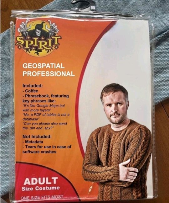
Nailed it! Thanks Austin, I died laughing when I got it. #geospatial #gis #geographicinformationsystems #culturesources #maps #happymappy #cartography #halloweencostume (at Hammock De Galvez) https://www.instagram.com/p/CkTQBIOsXMj/?igshid=NGJjMDIxMWI=
#geospatial#gis#geographicinformationsystems#culturesources#maps#happymappy#cartography#halloweencostume
12 notes
·
View notes
Text
Happy Geographic Information Systems Day! Join us on FreezeCrowd.com to freeze with your thoughts on GIS. Thank you geospatial professionals who are making a difference today! 😀❤️🌐🗺️❄️
1 note
·
View note
Text
instagram
0 notes
Photo
ArcGis 10.8 Pre release version #arcgis #arcgis10 #arcgis10.8 #geo #gis #geographicinformation #information #system #gismapping #geographicinformationsystems #geomaticsengineering #engineering #surveylife #surveying #orange #mapping #maps #earth #globe #arcgis #qgis #geography #topo #topography #trending (at Baciu, Cluj) https://www.instagram.com/p/B-9L-9AjHd3/?igshid=ugzmi1c1lql9
#arcgis#arcgis10#geo#gis#geographicinformation#information#system#gismapping#geographicinformationsystems#geomaticsengineering#engineering#surveylife#surveying#orange#mapping#maps#earth#globe#qgis#geography#topo#topography#trending
1 note
·
View note
Photo
GIS day was yesterday, I wish you all a happy GIS celebration weekend✨✨✨👌.The father of G.I.S, Dr. Roger F. Tomlinson. 💂♂️ #studiodavys #GISDay2021 #designer #earth #studiovibes #geographicinformationsystems https://www.instagram.com/p/CWdMPjdMJlY/?utm_medium=tumblr
0 notes
Photo

Swipe left to read more. Follow @the_unopinion for more updates. #nitiaayog #geospatialenergymap #economy #isro #geographicinformationsystems #dailynews #news #dailynewsupdates #digitalnews #updates #newsupdates #the_unopinion https://www.instagram.com/p/CVM-Mhmo-EI/?utm_medium=tumblr
#nitiaayog#geospatialenergymap#economy#isro#geographicinformationsystems#dailynews#news#dailynewsupdates#digitalnews#updates#newsupdates#the_unopinion
0 notes
Photo
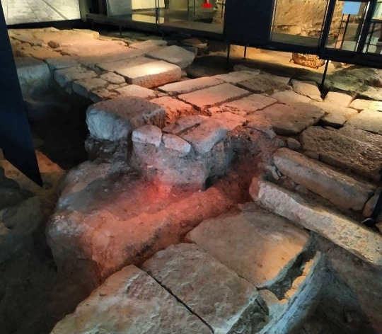
We continue exploring and mapping ancient #ViaAugusta. #GeographicInformationSystems. ==> Posted @withregram • @globallearningadventures This is where the ancient city of Valentia was born in 138 BC. Crossing of "Cardo Maximus" (N-S) and "Decumanus Maximus" (W-E). #ViaAugusta coincided with #CardoMaximus in #Valentia. #LAlmoina Archaelogical Center. #DiscoveringValencia #ExploringValencia #ecaptains_valencia #ecaptains_museums #ecaptains_ruins #TravelExploreDiscoverLearnEducate #ecaptains_maps (en Museo de la Almoina) https://www.instagram.com/p/CIafq0phovi/?igshid=98kwf6npowzz
#viaaugusta#geographicinformationsystems#cardomaximus#valentia#lalmoina#discoveringvalencia#exploringvalencia#ecaptains_valencia#ecaptains_museums#ecaptains_ruins#travelexplorediscoverlearneducate#ecaptains_maps
0 notes
Photo
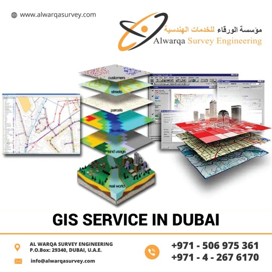
#GeographicInformationSystems can visualize spatial information, It has the power to create maps with the images.#GIStechnology offers time management. It has high accuracy, It presents higher predictions and analysis. If you want #GISServiceinDubai, UAE & Abu Dhabi #AlwarqaSurveyEngineering is the best option in terms of quality and productivity. AlwarqaSurvey Engineering provides GIS services with an all-inclusive solution for spatial data management to government and industrial organizations through #GISremotesensingservices.
For More Details
Phone:-+971 42676170
Email:[email protected]
Website:-http://www.alwarqasurvey.com/gis-services-in-ras-al-khaimah
0 notes
Photo

We have seven technologies which you can learn different modes of study accordingly:One year program in regular weekdaysYou will learn:- Geographical Information System- Remote sensing- Digital Photogrammetry- Digital Image Processing- Modern Surveying Technology- LIDAR- DRONE/UAV#digitalphotography
0 notes
Photo

My coworkers are really childish, seriously childish. I could get used to this remote work if all of the components would work efficiently. Also, I’ve had so many pretend meals that I think I’ve gained at least 10 lbs. and if these monsters (you know who you are big bad wolf) would quite bothering me I could get some serious cartography done. #gis #geospatial #remotework #vpn #notenoughseatsonthebus #eglin #tyndall #archaeology #geographicinformationsystems #culturalresourcemanagement https://www.instagram.com/p/B-pdIoFn3hR/?igshid=km64xw0q8htx
#gis#geospatial#remotework#vpn#notenoughseatsonthebus#eglin#tyndall#archaeology#geographicinformationsystems#culturalresourcemanagement
0 notes
Text
instagram
0 notes
Text
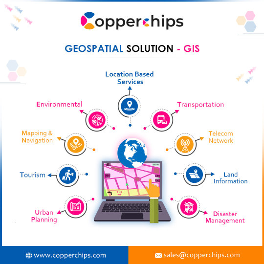
Geographic information systems (GIS) and mapping
Geospatial Solutions in maps refer to specialized services for geographic information systems (GIS) and mapping. These services typically focus on providing custom solutions for businesses and organizations that require advanced mapping capabilities and data analysis.
0 notes
Photo
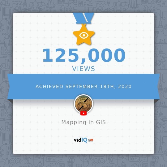
Milestone - link in BIO #youtube #youtubers #milestone #subscribetomychannel #subscribe #view #views #creatorstudio #mappingingis #maps #geomatics #geomaticsengineering #engineering #youtubelife #mapcreator #mapping #mappingingis #geographicinformationsystems #geography https://www.instagram.com/p/CFTkLFXj2tP/?igshid=14juj3pd5t6e4
#youtube#youtubers#milestone#subscribetomychannel#subscribe#view#views#creatorstudio#mappingingis#maps#geomatics#geomaticsengineering#engineering#youtubelife#mapcreator#mapping#geographicinformationsystems#geography
0 notes
Text
Map & Navigation vector circle glyph icons pack 3
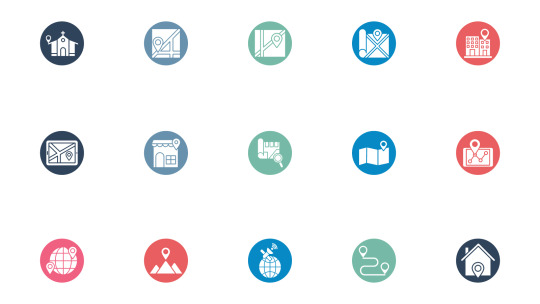
15 Map & Navigation circle glyph icons pack icons pack free vector icons in SVG, PSD, EPS and AI format file available for commercial use.
Read the full article
#Addressnavigator#circleicon#Earthplanet#findlocation#Geographicinformationsystem#geolocatingorpositioning#Geolocationtarget#geomarketing#globeandpointer#glyphicon#Gps#Gpsnavigation#Locationholder#Locationpins#mappin
0 notes
Link
Geographic Information System (GIS) is a computer-based tool or technology to manage, analyze and display geographically referenced information. Users can visualize, and understand the relationships between geodata in forms of reports, charts, maps etc. using GIS.
0 notes
Text
Geographic Information System Market Size Worth $11.2 billion by 2025
The global geographic information system (GIS) market is anticipated to reach USD 11.2 billion by 2025, according to a new report by Grand View Research, Inc. The rising adoption of GIS in infrastructure development, urban planning, and smart cities coupled with increasing location-based services are some of the key drivers of the GIS market.
GIS is a computerized system that connects data with geography. Several decisions are taken using GIS, right from tracking a store location to predicting climate change and analyzing a crime pattern. GIS helps users to link the data with geographic location to gain spatial insights from the extracted data.

The growing integration of GIS with conventional technologies has enhanced the business intelligence of companies. Moreover, the integration of GIS with IoT devices provides accurate data to users using the geospatial data analysis. For instance, an IoT-enabled valve can be monitored from anywhere around the globe using geospatial data.
The demand for location-based services, such as real-time status and control of a valve, have been on a rising curve around the globe. The market for GIS is expected to grow over the forecast period owing to technological advancements and growing applications. Moreover, the growing awareness among private companies regarding benefits such as improved productivity and optimization of processes offered by GIS has resulted in the technology’s increased demand.
Organizations in the private sector use the geographic information system for applications such as mining, oil & gas, transportation & logistics, and defense equipment, among others. The rising application of geographic information systems in construction is anticipated to, in turn, boost the market demand over the forecast period.
To request a sample copy or view summary of this report, click the link below: http://www.grandviewresearch.com/industry-analysis/geographic-information-systems-market
Further key findings from the report suggest:
The growing adoption of GIS in surveying and mapping by several regions is anticipated to drive the market growth.
The construction segment is expected to register a high CAGR of 11.2% over the projected period.
The Asia Pacific regional market is expected to witness significant growth over the forecast period, owing to the large-scale penetration of GIS.
Key players in the market include Autodesk Inc. The Economic and Social Research Institute (ESRI), Hexagon AB, and Pitney Bowes Inc.
See More Reports of This Category:
https://www.grandviewresearch.com/industry/communication-services
About Grand View Research:
Grand View Research, Inc. is a U.S. based market research and consulting company, registered in the State of California and headquartered in San Francisco. The company provides syndicated research reports, customized research reports, and consulting services. To help clients make informed business decisions, we offer market intelligence studies ensuring relevant and fact-based research across a range of industries, from technology to chemicals, materials and healthcare.
0 notes
Last Seen Blogs

kepoqq-blog
Sheila

n-ajumma
花樣年華

summer20sgreen
the summer addict

dadream88
Untitled

nerededurursakoradakalalim
nerededurursakoradakalalim