#Introduction to Geomatics
Text
a wild virgo appeared!
i saw someone else make an introductions post, and i thought it was a cool idea and wanted to make one as well!
name: virgo
pronouns: they/them
age: 22
location: texas
i am a surveying/engineering/geomatics student, studying part-time while working full-time at a land surveying firm here in texas. i’m working towards getting my associates degree so i can apply for my SIT (surveying in training) license, and then will go on to getting my bachelor’s so i can eventually get my RPLS (registered professional land surveyor) license. i likely have undiagnosed adhd, and have found that study blogs/videos/etc have helped me tremendously with holding myself accountable/keeping myself on track!
when i’m not studying/working, i’m usually playing video games like animal crossing, stardew valley, the sims, forager, minecraft, and other similar titles! i also enjoy penpaling, witchcraft, and hanging out in discord servers.
i’m super excited to get this blog started, and if anyone’s interesting in becoming pals, please don’t hesitate to message me! <3
#studyblr#introduction#hello#study#studying#student#engineering#engineering student#surveying#land surveying#college#school#studyspo#studyinspo#studygram
2 notes
·
View notes
Text
Introduction to Geomatics and Basic Surveying | By Ashutosh Nautiyal
https://www.akhandduttaengineering.in/2020/09/introduction-to-geoinformatics.html
#civilengineering #engineering #construction #engineer #civil #architecture #civilengineer #building #engineers #civilengineers #mechanicalengineering #design #concrete #civilconstruction #structuralengineering #engenharia #engenhariacivil #akhanddutta #civilengineeringstudent #jee #jeemain #electricalengineering #structure #technology #civilengineeringworld #architect #civilengineeringstudents #engcivil #civilengineeringwithakhanddutta #ashutoshnautiyal
2 notes
·
View notes
Text
Introduction to Shayna Cacciotti

Hello! My name is Shayna. I am a student at the University of Ottawa, studying Geography and Geomatics with a minor in Indigenous Studies. I hope to one day be a high school teacher! I am a new research assistant for La poison et la pomme, working on a very exciting project with my partner, Emily. In the summers I work as a beekeeper and during the school year I work in outdoor retail. I love the outdoors and all the experiential learning opportunities that can be found spending time outside. I find that time outside can be healing and calming, or heart-pounding and challenging, and I value both of these experiences equally.
I spend most of my time doing homework, but when I am able to claw my way out from under the pile of readings (wow, am I a slow reader), I like to do a lot of things: painting, drawing, embroidery, yoga, running, climbing, nature walks, everything! I also love spending time with my family, my friends, and my pets. Continuous learning is a must, as I believe it is the most important part of life and personal growth. If you aren’t learning, what are you doing?

In the past, I have worked as an outdoor educator and I loved the freedom and organic learning children, youth and adults alike were able to partake in. I was able to see kids explore new leadership opportunities that had otherwise not been within their reach in traditional school settings. This experience reaffirmed what I had already known about the power of nature, and it was incredibly enriching.
My favourite activities to do outside include hiking and backpacking, running and just hanging out, enjoying the space around me. There is something about type two fun – the fun that is really not fun during the activity but always seems more fun in memory – that is especially intoxicating. Working incredibly hard just to bring yourself from point A to point B for literally no reason at all is weirdly… thrilling. Nothing else in the world matters! The freedom of allowing myself to be in nature without any other distractions is like a factory reset for my emotional and psychological health.

I plan to bring the love I have for nature into my work with LPLP, and I am grateful for the experience and creative freedom we get to exercise working with a young organization. I am excited for what’s to come and for the learning, growing and challenges we will get to accomplish along the way. It was a pleasure to meet you!
2 notes
·
View notes
Text
Solution Manual for Elementary Surveying An Introduction to Geomatics 13th Edition by Ghilani
This is Full Solution Manual for Elementary Surveying: An Introduction to Geomatics, 13th Edition Charles D. Ghilani
Click link bellow to view sample:
https://getbooksolutions.com/wp-content/uploads/2017/01/Solution-Manual-for-Elementary-Surveying-An-Introduction-to-Geomatics-13th-Edition-Charles-D-Ghilani.pdf
Origin Book information:
Charles D. Ghilani
Hardcover: 984 pages
Publisher: Prentice Hall; 13 edition (January 8, 2011)
Language: English
ISBN-10: 0132554348
ISBN-13: 978-0132554343
what is solution manual elementary surveying an introduction to geomatics 13th edition
where you can download solution manual elementary surveying an introduction to geomatics 13th edition?
and how you can get solution manual elementary surveying an introduction to geomatics 13th edition in fastest way?
You will be guided to the product download page immediately once you complete the payment. If you have any questions, or would like a receive a sample chapter before your purchase, please contact us via email :
Full download link:
https://getbooksolutions.com/download/solution-manual-for-elementary-surveying-an-introduction-to-geomatics-13th-edition-charles-d-ghilani
Table of Contents
1 • INTRODUCTION 1
1.1 Definition of Surveying 1
1.2 Geomatics 3
1.3 History of Surveying 4
1.4 Geodetic and Plane Surveys 9
1.5 Importance of Surveying 10
1.6 Specialized Types of Surveys 11
1.7 Surveying Safety 13
1.8 Land and Geographic Information Systems 14
1.9 Federal Surveying and Mapping Agencies 15
1.10 The Surveying Profession 16
1.11 Professional Surveying Organizations 17
1.12 Surveying on the Internet 18
1.13 Future Challenges in Surveying 19
Problems 20
Bibliography 21
2 • UNITS, SIGNIFICANT FIGURES, AND FIELD NOTES 23
PART I UNITS AND SIGNIFICANT FIGURES 23
2.1 Introduction 23
2.2 Units of Measurement 23
2.3 International System of Units (SI) 25
2.4 Significant Figures 27
2.5 Rounding Off Numbers 29
PART II FIELD NOTES 30
2.6 Field Notes 30
2.7 General Requirements of Handwritten Field Notes 31
2.8 Types of Field Books 32
2.9 Kinds of Notes 33
2.10 Arrangements of Notes 33
2.11 Suggestions for Recording Notes 35
2.12 Introduction to Data Collectors 36
2.13 Transfer of Files from Data Collectors 39
2.14 Digital Data File Management 41
2.15 Advantages and Disadvantages of Data Collectors 42
Problems 43
Bibliography 44
3 • THEORY OF ERRORS IN OBSERVATIONS 45
3.1 Introduction 45
3.2 Direct and Indirect Observations 45
3.3 Errors in Measurements 46
3.4 Mistakes 46
3.5 Sources of Errors in Making Observations 47
3.6 Types of Errors 47
3.7 Precision and Accuracy 48
3.8 Eliminating Mistakes and Systematic Errors 49
3.9 Probability 49
3.10 Most Probable Value 50
3.11 Residuals 51
3.12 Occurrence of Random Errors 51
3.13 General Laws of Probability 55
3.14 Measures of Precision 55
3.15 Interpretation of Standard Deviation 58
3.16 The 50, 90, and 95 Percent Errors 58
3.17 Error Propagation 60
3.18 Applications 65
3.19 Conditional Adjustment of Observations 65
3.20 Weights of Observations 66
3.21 Least-Squares Adjustment 67
3.22 Using Software 68
Problems 69
Bibliography 71
4 • LEVELING–THEORY, METHODS, AND EQUIPMENT 73
PART I LEVELING–THEORY AND METHODS 73
4.1 Introduction 73
4.2 Definitions 73
4.3 North American Vertical Datum 75
4.4 Curvature and Refraction 76
4.5 Methods for Determining Differences in Elevation 78
PART II EQUIPMENT FOR DIFFERENTIAL LEVELING 85
4.6 Categories of Levels 85
4.7 Telescopes 86
4.8 Level Vials 87
4.9 Tilting Levels 89
4.10 Automatic Levels 90
4.11 Digital Levels 91
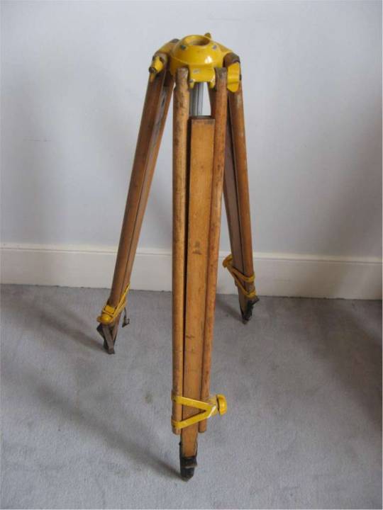
4.12 Tripods 93
4.13 Hand Level 93
4.14 Level Rods 94
4.15 Testing and Adjusting Levels 96
Problems 100
Bibliography 102
5 • LEVELING–FIELD PROCEDURES AND COMPUTATIONS 103
5.1 Introduction 103
5.2 Carrying and Setting Up a Level 103
5.3 Duties of a Rodperson 105
5.4 Differential Leveling 106
5.5 Precision 112
5.6 Adjustments of Simple Level Circuits 113
5.7 Reciprocal Leveling 114
5.8 Three-Wire Leveling 115
5.9 Profile Leveling 117
5.10 Grid, Cross-Section, or Borrow-Pit Leveling 121
5.11 Use of the Hand Level 122
5.12 Sources of Error in Leveling 122
5.13 Mistakes 124
5.14 Reducing Errors and Eliminating Mistakes 125
5.15 Using Software 125
Problems 127
Bibliography 129
6 • DISTANCE MEASUREMENT 131
PART I METHODS FOR MEASURING DISTANCES 131
6.1 Introduction 131
6.2 Summary of Methods for Making Linear Measurements 131
6.3 Pacing 132
6.4 Odometer Readings 132
6.5 Optical Rangefinders 133
6.6 Tacheometry 133
6.7 Subtense Bar 133
PART II DISTANCE MEASUREMENTS BY TAPING 133
6.8 Introduction to Taping 133
6.9 Taping Equipment and Accessories 134
6.10 Care of Taping Equipment 135
6.11 Taping on Level Ground 136
6.12 Horizontal Measurements on Sloping Ground 138
6.13 Slope Measurements 140
6.14 Sources of Error in Taping 141
6.15 Tape Problems 145
6.16 Combined Corrections in a Taping Problem 147
PART III ELECTRONIC DISTANCE MEASUREMENT 148
6.17 Introduction 148
6.18 Propagation of Electromagnetic Energy 149
6.19 Principles of Electronic Distance Measurement 152
6.20 Electro-Optical Instruments 153
6.21 Total Station Instruments 156
6.22 EDM Instruments Without Reflectors 157
6.23 Computing Horizontal Lengths from Slope Distances 158
6.24 Errors in Electronic Distance Measurement 160
6.25 Using Software 165
Problems 165
Bibliography 168
7 • ANGLES, AZIMUTHS, AND BEARINGS 169
7.1 Introduction 169
7.2 Units of Angle Measurement 169
7.3 Kinds of Horizontal Angles 170
7.4 Direction of a Line 171
7.5 Azimuths 172
7.6 Bearings 173
7.7 Comparison of Azimuths and Bearings 174
7.8 Computing Azimuths 175
7.9 Computing Bearings 177
7.10 The Compass and the Earth’s Magnetic Field 179
7.11 Magnetic Declination 180
7.12 Variations in Magnetic Declination 181
7.13 Software for Determining Magnetic Declination 183
7.14 Local Attraction 184
7.15 Typical Magnetic Declination Problems 185
7.16 Mistakes 187
Problems 187
Bibliography 189
8 • TOTAL STATION INSTRUMENTS; ANGLE OBSERVATIONS 191
PART I TOTAL STATION INSTRUMENTS 191
8.1 Introduction 191
8.2 Characteristics of Total Station Instruments 191
8.3 Functions Performed by Total Station Instruments 194
8.4 Parts of a Total Station Instrument 195
8.5 Handling and Setting Up a Total Station Instrument 199
8.6 Servo-Driven and Remotely Operated Total Station Instruments 201
PART II ANGLE OBSERVATIONS 203
8.7 Relationship of Angles and Distances 203
8.8 Observing Horizontal Angles with Total Station Instruments 204
8.9 Observing Horizontal Angles by the Direction Method 206
8.10 Closing the Horizon 207
8.11 Observing Deflection Angles 209
8.12 Observing Azimuths 211
8.13 Observing Vertical Angles 211
8.14 Sights and Marks 213
8.15 Prolonging a Straight Line 214
8.16 Balancing-In 216
8.17 Random Traverse 217
8.18 Total Stations for Determining Elevation Differences 218
8.19 Adjustment of Total Station Instruments and Their Accessories 219
8.20 Sources of Error in Total Station Work 222
8.21 Propagation of Random Errors in Angle Observations 228
8.22 Mistakes 228
Problems 229
Bibliography 230
9 • TRAVERSING 231
9.1 Introduction 231
9.2 Observation of Traverse Angles or Directions 233
9.3 Observation of Traverse Lengths 234
9.4 Selection of Traverse Stations 235
9.5 Referencing Traverse Stations 235
9.6 Traverse Field Notes 237
9.7 Angle Misclosure 238
9.8 Traversing with Total Station Instruments 239
9.9 Radial Traversing 240
9.10 Sources of Error in Traversing 241
9.11 Mistakes in Traversing 242
Problems 242
10 • TRAVERSE COMPUTATIONS 245
10.1 Introduction 245
10.2 Balancing Angles 246
10.3 Computation of Preliminary Azimuths or Bearings 248
10.4 Departures and Latitudes 249
10.5 Departure and Latitude Closure Conditions 251
10.6 Traverse Linear Misclosure and Relative Precision 251
10.7 Traverse Adjustment 252
10.8 Rectangular Coordinates 255
10.9 Alternative Methods for Making Traverse Computations 256
10.10 Inversing 260
10.11 Computing Final Adjusted Traverse Lengths and Directions 261
10.12 Coordinate Computations in Boundary Surveys 263
10.13 Use of Open Traverses 265
10.14 State Plane Coordinate Systems 268
10.15 Traverse Computations Using Computers 269
10.16 Locating Blunders in Traverse Observations 269
10.17 Mistakes in Traverse Computations 272
Problems 272
Bibliography 275
11 • COORDINATE GEOMETRY IN SURVEYING CALCULATIONS 277
11.1 Introduction 277
11.2 Coordinate Forms of Equations for Lines and Circles 278
11.3 Perpendicular Distance from a Point to a Line 280
11.4 Intersection of Two Lines, Both Having Known Directions 282
11.5 Intersection of a Line with a Circle 284
11.6 Intersection of Two Circles 287
11.7 Three-Point Resection 289
11.8 Two-Dimensional Conformal Coordinate Transformation 292
11.9 Inaccessible Point Problem 297
11.10 Three-Dimensional Two-Point Resection 299
11.11 Software 302
Problems 303
Bibliography 307
12 • AREA 309
12.1 Introduction 309
12.2 Methods of Measuring Area 309
12.3 Area by Division Into Simple Figures 310
12.4 Area by Offsets from Straight Lines 311
12.5 Area by Coordinates 313
12.6 Area by Double-Meridian Distance Method 317
12.7 Area of Parcels with Circular Boundaries 320
12.8 Partitioning of Lands 321
12.9 Area by Measurements from Maps 325
12.10 Software 327
12.11 Sources of Error in Determining Areas 328
12.12 Mistakes in Determining Areas 328
Problems 328
Bibliography 330
13 • GLOBAL NAVIGATION SATELLITE SYSTEMS—INTRODUCTION AND PRINCIPLES OF OPERATION 331
13.1 Introduction 331
13.2 Overview of GPS 332
13.3 The GPS Signal 335
13.4 Reference Coordinate Systems 337
13.5 Fundamentals of Satellite Positioning 345
13.6 Errors in Observations 348
13.7 Differential Positioning 356
13.8 Kinematic Methods 358
13.9 Relative Positioning 359
13.10 Other Satellite Navigation Systems 362
13.11 The Future 364
Problems 365
Bibliography 366
14 • GLOBAL NAVIGATION SATELLITE SYSTEMS—STATIC SURVEYS 367
14.1 Introduction 367
14.2 Field Procedures in Satellite Surveys 369
14.3 Planning Satellite Surveys 372
14.4 Performing Static Surveys 384
14.5 Data Processing and Analysis 386
14.6 Sources of Errors in Satellite Surveys 393
14.7 Mistakes in Satellite Surveys 395
Problems 395
Bibliography 397
15 • GLOBAL NAVIGATION SATELLITE SYSTEMS—KINEMATIC SURVEYS 399
15.1 Introduction 399
15.2 Planning of Kinematic Surveys 400
15.3 Initialization 402
15.4 Equipment Used in Kinematic Surveys 403
15.5 Methods Used in Kinematic Surveys 405
15.6 Performing Post-Processed Kinematic Surveys 408
15.7 Communication in Real-Time Kinematic Surveys 411
15.8 Real-Time Networks 412
15.9 Performing Real-Time Kinematic Surveys 413
15.10 Machine Control 414
15.11 Errors in Kinematic Surveys 418
15.12 Mistakes in Kinematic Surveys 418
Problems 418
Bibliography 419
16 • ADJUSTMENTS BY LEAST SQUARES 421
16.1 Introduction 421
16.2 Fundamental Condition of Least Squares 423
16.3 Least-Squares Adjustment by the Observation Equation Method 424
16.4 Matrix Methods in Least-Squares Adjustment 428
16.5 Matrix Equations for Precisions of Adjusted Quantities 430
16.6 Least-Squares Adjustment of Leveling Circuits 432
16.7 Propagation of Errors 436
16.8 Least-Squares Adjustment of GNSS Baseline Vectors 437
16.9 Least-Squares Adjustment of Conventional Horizontal Plane Surveys 443
16.10 The Error Ellipse 452
16.11 Adjustment Procedures 457
16.12 Other Measures of Precision for Horizontal Stations 458
16.13 Software 460
16.14 Conclusions 460
Problems 461
Bibliography 466
17 • MAPPING SURVEYS 467
17.1 Introduction 467
17.2 Basic Methods for Performing Mapping Surveys 468
17.3 Map Scale 468
17.4 Control for Mapping Surveys 470
17.5 Contours 471
17.6 Characteristics of Contours 474
17.7 Direct and Indirect Methods of Locating Contours 474
17.8 Digital Elevation Models and Automated Contouring Systems 477
17.9 Basic Field Methods for Locating Topographic Details 479
17.10 Three-Dimensional Conformal Coordinate Transformation 488
17.11 Selection of Field Method 489
17.12 Working with Data Collectors and Field-to-Finish Software 490
17.13 Hydrographic Surveys 493
17.14 Sources of Error in Mapping Surveys 497
17.15 Mistakes in Mapping Surveys 498
Problems 498
Bibliography 500
18 • MAPPING 503
18.1 Introduction 503
18.2 Availability of Maps and Related Information 504
18.3 National Mapping Program 505
18.4 Accuracy Standards for Mapping 505
18.5 Manual and Computer-Aided Drafting Procedures 507
18.6 Map Design 508
18.7 Map Layout 510
18.8 Basic Map Plotting Procedures 512
18.9 Contour Interval 514
18.10 Plotting Contours 514
18.11 Lettering 515
18.12 Cartographic Map Elements 516
18.13 Drafting Materials 519
18.14 Automated Mapping and Computer-Aided Drafting Systems 519
18.15 Impacts of Modern Land and Geographic Information Systems on Mapping 525
18.16 Sources of Error in Mapping 526
18.17 Mistakes in Mapping 526
Problems 526
Bibliography 528
19 • CONTROL SURVEYS AND GEODETIC REDUCTIONS 529
19.1 Introduction 529
19.2 The Ellipsoid and Geoid 530
19.3 The Conventional Terrestrial Pole 532
19.4 Geodetic Position and Ellipsoidal Radii of Curvature 534
19.5 Geoid Undulation and Deflection of the Vertical 536
19.6 U.S. Reference Frames 538
19.7 Accuracy Standards and Specifications for Control Surveys 547
19.8 The National Spatial Reference System 550
19.9 Hierarchy of the National Horizontal Control Network 550
19.10 Hierarchy of the National Vertical Control Network 551
19.11 Control Point Descriptions 551
19.12 Field Procedures for Traditional Horizontal Control Surveys 554
19.13 Field Procedures for Vertical Control Surveys 559
19.14 Reduction of Field Observations to Their Geodetic Values 564
19.15 Geodetic Position Computations 577
19.16 The Local Geodetic Coordinate System 580
19.17 Three-Dimensional Coordinate Computations 581
19.18 Software 584
Problems 584
Bibliography 587
20 • STATE PLANE COORDINATES AND OTHER MAP PROJECTIONS 589
20.1 Introduction 589
20.2 Projections Used in State Plane Coordinate Systems 590
20.3 Lambert Conformal Conic Projection 593
20.4 Transverse Mercator Projection 594
20.5 State Plane Coordinates in NAD27 and NAD83 595
20.6 Computing SPCS83 Coordinates in the Lambert Conformal Conic System 596
20.7 Computing SPCS83 Coordinates in the Transverse Mercator System 601
20.8 Reduction of Distances and Angles to State Plane Coordinate Grids 608
20.9 Computing State Plane Coordinates of Traverse Stations 617
20.10 Surveys Extending from One Zone to Another 620
20.11 Conversions Between SPCS27 and SPCS83 621
20.12 The Universal Transverse Mercator Projection 622
20.13 Other Map Projections 623
20.14 Map Projection Software 627
Problems 628
Bibliography 631
21 • BOUNDARY SURVEYS 633
21.1 Introduction 633
21.2 Categories of Land Surveys 634
21.3 Historical Perspectives 635
21.4 Property Description by Metes and Bounds 636
21.5 Property Description by Block-and-Lot System 639
21.6 Property Description by Coordinates 641
21.7 Retracement Surveys 641
21.8 Subdivision Surveys 644
21.9 Partitioning Land 646
21.10 Registration of Title 647
21.11 Adverse Possession and Easements 648
21.12 Condominium Surveys 648
21.13 Geographic and Land Information Systems 655
21.14 Sources of Error in Boundary Surveys 655
21.15 Mistakes 655
Problems 656
Bibliography 658
22 • SURVEYS OF THE PUBLIC LANDS 659
22.1 Introduction 659
22.2 Instructions for Surveys of the Public Lands 660
22.3 Initial Point 663
22.4 Principal Meridian 664
22.5 Baseline 665
22.6 Standard Parallels (Correction Lines) 666
22.7 Guide Meridians 666
22.8 Township Exteriors, Meridional (Range) Lines, and Latitudinal (Township) Lines 667
22.9 Designation of Townships 668
22.10 Subdivision of a Quadrangle into Townships 668
22.11 Subdivision of a Township into Sections 670
22.12 Subdivision of Sections 671
22.13 Fractional Sections 672
22.14 Notes 672
22.15 Outline of Subdivision Steps 672
22.16 Marking Corners 674
22.17 Witness Corners 674
22.18 Meander Corners 675
22.19 Lost and Obliterated Corners 675
22.20 Accuracy of Public Lands Surveys 678
22.21 Descriptions by Township Section and Smaller Subdivision 678
22.22 BLM Land Information System 679
22.23 Sources of Error 680
22.24 Mistakes 680
Problems 681
Bibliography 683
23 • CONSTRUCTION SURVEYS 685
23.1 Introduction 685
23.2 Specialized Equipment for Construction Surveys 686
23.3 Horizontal and Vertical Control 689
23.4 Staking Out a Pipeline 691
23.5 Staking Pipeline Grades 692
23.6 Staking Out a Building 694
23.7 Staking Out Highways 698
23.8 Other Construction Surveys 703
23.9 Construction Surveys Using Total Station Instruments 704
23.10 Construction Surveys Using GNSS Equipment 706
23.11 Machine Guidance and Control 709
23.12 As-Built Surveys with Laser Scanning 710
23.13 Sources of Error in Construction Surveys 711
23.14 Mistakes 712
Problems 712
Bibliography 714
24 • HORIZONTAL CURVES 715
24.1 Introduction 715
24.2 Degree of Circular Curve 716
24.3 Definitions and Derivation of Circular Curve Formulas 718
24.4 Circular Curve Stationing 720
24.5 General Procedure of Circular Curve Layout by Deflection Angles 721
24.6 Computing Deflection Angles and Chords 723
24.7 Notes for Circular Curve Layout by Deflection Angles and Incremental Chords 725
24.8 Detailed Procedures for Circular Curve Layout by Deflection Angles and Incremental Chords 726
24.9 Setups on Curve 727
24.10 Metric Circular Curves by Deflection Angles and Incremental Chords 728
24.11 Circular Curve Layout by Deflection Angles and Total Chords 730
24.12 Computation of Coordinates on a Circular Curve 731
24.13 Circular Curve Layout by Coordinates 733
24.14 Curve Stakeout Using GNSS Receivers and Robotic Total Stations 738
24.15 Circular Curve Layout by Offsets 739
24.16 Special Circular Curve Problems 742
24.17 Compound and Reverse Curves 743
24.18 Sight Distance on Horizontal Curves 743
24.19 Spirals 744
24.20 Computation of “As-Built” Circular Alignments 749
24.21 Sources of Error in Laying Out Circular Curves 752
24.22 Mistakes 752
Problems 753
Bibliography 755
25 • VERTICAL CURVES 757
25.1 Introduction 757
25.2 General Equation of a Vertical Parabolic Curve 758
25.3 Equation of an Equal Tangent Vertical Parabolic Curve 759
25.4 High or Low Point on a Vertical Curve 761
25.5 Vertical Curve Computations Using the Tangent Offset Equation 761
25.6 Equal Tangent Property of a Parabola 765
25.7 Curve Computations by Proportion 766
25.8 Staking a Vertical Parabolic Curve 766
25.9 Machine Control in Grading Operations 767
25.10 Computations for an Unequal Tangent Vertical Curve 767
25.11 Designing a Curve to Pass Through a Fixed Point 770
25.12 Sight Distance 771
25.13 Sources of Error in Laying Out Vertical Curves 773
25.14 Mistakes 774
Problems 774
Bibliography 776
26 • VOLUMES 777
26.1 Introduction 777
26.2 Methods of Volume Measurement 777
26.3 The Cross-Section Method 778
26.4 Types of Cross Sections 779
26.5 Average-End-Area Formula 780
26.6 Determining End Areas 781
26.7 Computing Slope Intercepts 784
26.8 Prismoidal Formula 786
26.9 Volume Computations 788
26.10 Unit-Area, or Borrow-Pit, Method 790
26.11 Contour-Area Method 791
26.12 Measuring Volumes of Water Discharge 793
26.13 Software 794
26.14 Sources of Error in Determining Volumes 795
26.15 Mistakes 795
Problems 795
Bibliography 798
27 • PHOTOGRAMMETRY 799
27.1 Introduction 799
27.2 Uses of Photogrammetry 800
27.3 Aerial Cameras 801
27.4 Types of Aerial Photographs 803
27.5 Vertical Aerial Photographs 804
27.6 Scale of a Vertical Photograph 806
27.7 Ground Coordinates from a Single Vertical Photograph 810
27.8 Relief Displacement on a Vertical Photograph 811
27.9 Flying Height of a Vertical Photograph 813
27.10 Stereoscopic Parallax 814
27.11 Stereoscopic Viewing 817
27.12 Stereoscopic Measurement of Parallax 819
27.13 Analytical Photogrammetry 820
27.14 Stereoscopic Plotting Instruments 821
27.15 Orthophotos 826
27.16 Ground Control for Photogrammetry 827
27.17 Flight Planning 828
27.18 Airborne Laser-Mapping Systems 830
27.19 Remote Sensing 831
27.20 Software 837
27.21 Sources of Error in Photogrammetry 838
27.22 Mistakes 838
Problems 839
Bibliography 842
28 • INTRODUCTION TO GEOGRAPHIC INFORMATION SYSTEMS 843
28.1 Introduction 843
28.2 Land Information Systems 846
28.3 GIS Data Sources and Classifications 846
28.4 Spatial Data 846
28.5 Nonspatial Data 852
28.6 Data Format Conversions 853
28.7 Creating GIS Databases 856
28.8 Metadata 862
28.9 GIS Analytical Functions 862
28.10 GIS Applications 867
28.11 Data Sources 867
Problems 869
Bibliography 871
APPENDIX A • DUMPY LEVELS, TRANSITS, AND THEODOLITES 873
APPENDIX B • EXAMPLE NOTEFORMS 888
APPENDIX C • ASTRONOMICAL OBSERVATIONS 895
APPENDIX D • USING THE WORKSHEETS FROM THE COMPANION WEBSITE 911
APPENDIX E • INTRODUCTION TO MATRICES 917
APPENDIX F • U.S. STATE PLANE COORDINATE SYSTEM DEFINING PARAMETERS 923
APPENDIX G • ANSWERS TO SELECTED PROBLEMS 927
INDEX 933
0 notes
Text
Using Participatory GIS to Forge Links Between Local People's Perspectives and Conservation

Introduction
The mapping of indigenous lands to manage natural resources, and strengthen cultures is a recent phenomenon, having begun in Canada and Alaska in the 1960s and in other regions during the last decade and a half. (Chapin et. al. 2005). Ghana as a signatory to the Rio Declaration on Environment and Development in 1992 and subsequently ratifying the Convention of Biological Diversity have searched for participatory methods and practices that would help manage and protect their natural resources.
A practice considered significant in mapping these indigenous lands for biodiversity protection is the Participatory Geographical Information System (PGIS). This geomatic tool is a combination of Geographical Information Systems supported by Participatory Rural Appraisal Approach. In recent years, the term PGIS has become more popular and drawn an increasing attention of GIS researchers and practitioners, particularly in its application in the development and biodiversity conservation context in developing countries.
Biodiversity and Conservation Goals
The overall goal of this research is to assess the relevance of PGIS for the conservation of biodiversity at the village and local level by looking at conditions for PGIS and the conservation of the Buabeng-Fiema Monkey Sanctuary. My objective in this project is to apply PGIS spatial tools to help conserve the Buabeng-Fiema Monkey Sanctuary which is situated in the heart for the Nkoranza district of the Brong Ahafo region in Ghana.
The design of a participatory buy ig followers geographic information system would be developed into an 'intelligent' GIS map depicting the areas cultural diversity using photographs, sound, video, cognitive maps and other audio visuals. The functionality of this approach is to support local cultural relationships and institutions, provide an opportunity for contemporary expression and innovation and ultimately attract tourist to the area to generate cash for the locals. PGIS would be valued for its practical efficiency and effectiveness, low cost, and its responsiveness to goals of empowerment and legitimacy in biodiversity conservation.
1 note
·
View note
Text
Chartered Building Surveyors

Surveying could cover many areas such as terrain, minerals, construction tasks, antiques, houses plus others. Hence, that is an occupation, which encompasses a lot of areas. When some sort of person is serious to work being a chartered surveyor, he must possess some expertise in keeping. Chartered surveyors can easily find career in several fields.
Chartered building surveyors are usually those who offer you advice on the construction and design involving new buildings and the remodeling in addition to redesign of outdated buildings. They may furthermore be required in order to assess safety and health requirements plus be involved in the particular improvement and preservation of buildings.
Right now there are other types of surveyors also like residential property surveyors who offer advice on development and even sale of homes or apartments. Structure surveyors are engaged in the development associated with construction projects such as new residences or dams. Supervision and assessment regarding costs pertaining to building projects comes under the work region of the Variety surveyors.
Environmental surveyors have to help make sure that the particular specifications for construction and design will not affect the atmosphere. They could also operate towards making advancements towards energy resource efficiency. Those who recommend ways and signifies to make maximum use of machinery and plants within an industry will be called the technological surveyors. Land prepared for redevelopment will be reported after analysis by the geomatics or land surveyors. Mining and Nutrients surveyors offer valuation services related in order to the introduction of mines, waste materials management sites, quarries and so forth
The have to have for a chartered surveyor is in addition felt in other areas namely challenge resolution, management agency, antiques and disciplines. Surveyors can send maps, charts or perhaps diagrams and log and interpret files. They can use other technical products other than the computer also. Mostly their own jobs involve providing ideas, bargaining, negotiation etc.
Chartered surveyors are required to work Monday by way of Friday and may well have to devote additional hours of work sometimes in buy to meet limited deadlines. Chartered surveyors can also discover part time work. They might work possibly on site or even at the office depending about their role. Typically surveyors have in order to work outdoors also in different climatic disorders. They may have to leave home in addition to work outside apart from their house lawn in UK and overseas. Having dilapidation surveys london driving a vehicle license is deemed mandatory for such jobs.
Depending about the place regarding work and company, salaries for chartered surveyors can vary. Preliminary pay can be around �24, 000 a year. Average transaction may be in order to the extent regarding � 49, 500 while an individual together with experience can in addition earn over �100, 000 a season easily. Chartered developing surveyors also can gain other benefits apart from their standard salary package. These may include the company car and even other incentives based upon performance.
Excellent fighting skill, problem fixing skills, methodical mindset, computer skills, fine written and voiced skills, a logical mind and interest to detail, multi tasking abilities and managing skills are largely required in a person happy to do the job as a chartered surveyor. Chartered building surveyors must in addition have an interest in the particular environment and scenery and buildings, real estate and architecture.
Surveyors can find excellent job opportunities in britain, but many careers are available with regard to such persons in USA, Europe and even other parts regarding the planet. Leading surveying firms in these types of cities have been in constant need for surveyors of all kinds.
As far because employers in typically the private sector are concerned, jobs are supplied by property companies, construction companies, consultancies, large firms, real estate agencies, housing interactions, etc. Universities, hospital trusts, government divisions and local authorities are usually some of the particular employers in the public sector. An individual can find work advertised in the website of Noble Institution of Chartered Surveyors (RICS), Home Week, Surveyor, Estates Gazette etc.
A person must become a member of the particular RICS, a specialist total body in order to become a chartered surveyor. With this, an individual must have some sort of degree given the green light by the particular RICS. Every person completes the RICS-accredited course, he/she offers to become fully qualified by attaining more experience.
Chartered building surveyors need excellent prospects with regard to career advancement. Surveyors can with a new few years associated with experience progress to be able to the senior managerial level. Surveyors can easily also become self-employed. There are exceptional work for surveyors abroad.
1 note
·
View note
Text
Chartered Building Surveyors

Surveying can easily cover many regions such as property, minerals, construction projects, antiques, houses and others. Hence, it is a career, which encompasses many areas. When a person is serious to work being a chartered surveyor, he or she must possess some skills in common. Chartered surveyors can easily find job in several fields.
Chartered building surveyors are those who present advice on the construction and design associated with new buildings plus the remodeling and redesign of aged buildings. They could also be required in order to assess safety in addition to health requirements plus be engaged in the improvement and preservation of buildings.
There are other types of surveyors also such as residential property surveyors who offer advice on development and sale of residences or apartments. Construction surveyors are engaged in the development associated with construction projects many of these as new residences or dams. Administration and assessment regarding costs pertaining in order to building projects comes beneath the work region of the Amount surveyors.
Environmental surveyors have to help to make sure that the particular specifications for construction and design would not affect the surroundings. Topographic Land Surveyors Leicester could also operate towards making improvements towards energy preservation. Those who suggest ways and indicates to make maximum use of equipment and plants inside an industry will be called the technical surveyors. Land prepared for redevelopment is reported after analysis by the geomatics or land surveyors. Mining and Vitamins surveyors offer valuation services related to the introduction of mines, waste management sites, quarries etc .
The need for a chartered surveyor is furthermore felt in additional areas namely question resolution, management consultancy, antiques and arts. Surveyors can refer maps, charts or even diagrams and journal and interpret information. They can work with other technical products aside from the computer system also. Mostly their own jobs involve giving ideas, bargaining, arbitration etc.
Chartered surveyors are required to be able to work Monday by means of Friday and may possibly have to devote additional hours of sometimes in purchase to meet tight deadlines. Chartered surveyors can also get part time employment. They can work possibly on site or perhaps at the office depending on the subject of their role. Mostly surveyors have to be able to work outdoors also in various climatic issues. They may have to leave home plus work outside aside from their house playing surface in UK and even overseas. Using a driving license is regarded mandatory for these kinds of jobs.
Depending upon the place involving work and company, salaries for chartered surveyors may vary. Preliminary pay could possibly be close to �24, 000 a new year. Average settlement may be in order to the extent of � 49, 500 while an individual along with experience can also earn over �100, 000 a season easily. Chartered developing surveyors could also make other benefits aside from their fundamental salary package. These kinds of may include a company car and even other incentives depending on performance.
Excellent settling skill, problem solving skills, methodical perspective, computer skills, fine written and voiced skills, a rational mind and attention to detail, multitasking abilities and supervision skills are generally required in the person prepared to function as a chartered surveyor. Chartered building surveyors must also are interested in the particular environment and panorama and buildings, home and architecture.
Surveyors can find excellent job opportunities in britain, but many careers may also be available for such persons throughout USA, Europe and other parts involving the globe. Leading surveying firms in these cities have been in frequent need for surveyors of all varieties.
As far because employers in typically the private sector happen to be concerned, jobs are offered by property organizations, construction companies, consultancies, large firms, estate agencies, housing organizations, etc. Universities, clinic trusts, government departments and native authorities are usually some of typically the employers in the public sector. You can find careers advertised in typically the website of Noble Institution of Chartered Surveyors (RICS), Home Week, Surveyor, Estates Gazette etc.
You must enroll in the particular RICS, an experienced body in order to be able to become a chartered surveyor. In this, an individual must have a new degree given the green light by the particular RICS. When a particular person completes the RICS-accredited course, he/she provides to become totally qualified by gaining more experience.
Chartered building surveyors experience excellent prospects intended for career advancement. Surveyors can with a new few years associated with experience progress to be able to the senior bureaucratic level. Surveyors can easily also become self-employed. There are superb work for surveyors abroad.
1 note
·
View note
Text
Chartered Building Surveyors

Surveying could cover many locations such as terrain, minerals, construction projects, antiques, houses and even others. Hence, it is a career, which encompasses many areas. When a person is curious to work like a chartered surveyor, he must possess some abilities in keeping. Chartered surveyors may easily find job in many fields.
Chartered building surveyors happen to be those who offer you advice on the construction and design associated with new buildings and the remodeling in addition to redesign of old buildings. They could furthermore be required to assess safety in addition to health requirements plus be engaged in the particular improvement and upkeep of buildings.
Generally there are other kinds of surveyors also for example residential property surveyors who offer advice on development in addition to sale of homes or apartments. Design surveyors are involved in the development regarding construction projects many of these as new homes or dams. Administration and assessment involving costs pertaining in order to building projects will come beneath the work location of the Amount surveyors.
https://propertyinspectionsnw.com/ have to help to make sure that typically the specifications for structure and design will not affect the environment. They could also function towards making advancements towards energy resource efficiency. Those who suggest ways and signifies to make optimal use of machinery and plants in an industry happen to be called the technical surveyors. Land all set for redevelopment is definitely reported after analysis by the geomatics or land surveyors. Mining and Nutrients surveyors offer worth services related to the introduction of mines, waste materials management sites, quarries and so forth
The want for a chartered surveyor is in addition felt in additional areas namely argument resolution, management agency, antiques and artistry. Surveyors can recommend maps, charts or diagrams and sign and interpret data. They can work with other technical tools besides the personal computer also. Mostly their particular jobs involve offering ideas, bargaining, negotiation etc.
Chartered surveyors are required to work Monday by way of Friday and might have to placed in additional hours of sometimes in order to meet tight deadlines. Chartered surveyors can also find part time work. They can work either on site or in the office depending on their role. Mostly surveyors have to work outdoors too in different climatic conditions. They may have to leave home plus work outside aside from their house turf in UK plus overseas. Creating a driving a car license is regarded as mandatory for these kinds of jobs.
Depending on the place regarding work and company, salaries for chartered surveyors can vary. Initial pay might be about �24, 000 some sort of year. Average repayment may be in order to the extent associated with � 49, 500 while someone using experience can likewise earn over �100, 000 a 12 months easily. Chartered constructing surveyors can also make other benefits aside from their standard salary package. These kinds of may include a company car and other incentives depending on performance.
Excellent fighting skill, problem resolving skills, methodical attitude, computer skills, good written and used skills, a reasonable mind and interest to detail, multi tasking abilities and management skills are generally required in some sort of person happy to work as a chartered surveyor. Chartered creating surveyors must also have an interest in the particular environment and surroundings and buildings, property and architecture.
Surveyors can find outstanding job opportunities in the united kingdom, but many work are also available for such persons in USA, Europe and even other parts associated with the planet. Leading surveying firms in these cities are in regular need for surveyors of all types.
As far because employers in typically the private sector will be concerned, jobs are offered by property firms, construction companies, consultancies, large firms, estate agencies, housing organizations, etc. Universities, medical center trusts, government sections and local authorities are really some of typically the employers in the particular public sector. A person can find work opportunities advertised in typically the website of Noble Institution of Chartered Surveyors (RICS), House Week, Surveyor, Estates Gazette etc.
You must become a member of the particular RICS, an experienced total body in order to become a chartered surveyor. With this, a person must have the degree approved by typically the RICS. When a particular person completes the RICS-accredited course, he/she features to become totally qualified by increasing more experience.
Chartered building surveyors experience excellent prospects regarding career advancement. Surveyors can with some sort of few years regarding experience progress in order to the senior managerial level. Surveyors can also become a sole proprietor. There are superb work for surveyors abroad.
1 note
·
View note
Text
Chartered Building Surveyors
Surveying can easily cover many regions such as area, minerals, construction assignments, antiques, houses and others. Hence, that is a profession, which encompasses many areas. When a person is curious to work being a chartered surveyor, he or she must possess some expertise in accordance. Chartered surveyors may easily find work in several fields.
Chartered building surveyors will be those who offer you advice on the development and design of new buildings and even the remodeling plus redesign of old buildings. They might furthermore be required in order to assess safety in addition to health requirements and be engaged in typically the improvement and preservation of buildings.
Right now there are other forms of surveyors also for instance residential property surveyors who offer tips on development plus sale of houses or apartments. Structure surveyors are engaged in the development associated with construction projects many of these as new residences or dams. Managing and assessment regarding costs pertaining to building projects comes under the work region of the Amount surveyors.
Measured Building Surveys Dorset have to help to make sure that the particular specifications for building and design will not affect the atmosphere. They will also function towards making advancements towards energy resource efficiency. Those who recommend ways and indicates to make optimum use of machinery and plants inside an industry are usually called the technological surveyors. Land prepared for redevelopment will be reported after examination by the geomatics or land surveyors. Mining and Nutrients surveyors offer worth services related in order to the introduction of mines, waste products management sites, quarries and so forth
The need for a chartered surveyor is in addition felt in some other areas namely challenge resolution, management consultancy, antiques and arts. Surveyors can relate maps, charts or perhaps diagrams and record and interpret files. They can use other technical equipment other than the personal computer also. Mostly their own jobs involve giving ideas, bargaining, negotiation etc.
Chartered surveyors are required in order to work Monday by way of Friday and might have to put in additional hours of work sometimes in purchase to meet restricted deadlines. Chartered surveyors can also find part time work. They can work both on site or even at the office depending on their role. Mainly surveyors have in order to work outdoors too in various climatic conditions. They may must leave home and even work outside apart from their house turf in UK plus overseas. Creating a driving a vehicle license is regarded as mandatory for this sort of jobs.
Depending on the place associated with work and workplace, salaries for chartered surveyors may vary. Primary pay could possibly be close to �24, 000 the year. Average payment may be in order to the extent regarding � 49, 1000 while a person using experience can likewise earn over �100, 000 a season easily. Chartered creating surveyors also can make other benefits apart from their standard salary package. These kinds of may include a company car and other incentives based upon performance.
Excellent discussing skill, problem dealing with skills, methodical frame of mind, computer skills, good written and voiced skills, a reasonable mind and interest to detail, multitasking abilities and management skills are largely required in some sort of person happy to work as a chartered surveyor. Chartered developing surveyors must in addition have an interest in the particular environment and scenery and buildings, home and architecture.
Surveyors can find exceptional job opportunities in the united kingdom, but many jobs may also be available for such persons in USA, Europe and even other parts of the planet. Leading surveying firms in these cities have been in frequent need for surveyors of all varieties.

As far since employers in the private sector happen to be concerned, jobs are provided by property organizations, construction companies, consultancies, large firms, estate agencies, housing associations, etc. Universities, clinic trusts, government sections and native authorities are usually some of typically the employers in the particular public sector. You can find work opportunities advertised in the particular website of Royal Institution of Chartered Surveyors (RICS), Home Week, Surveyor, Locations Gazette etc.
You must become a member of the RICS, an expert body system in order to become a chartered surveyor. With this, an individual must have a new degree approved by the RICS. Each particular person completes the RICS-accredited course, he/she offers to become totally qualified by attaining more experience.
Chartered building surveyors experience excellent prospects for career advancement. Surveyors can with the few years regarding experience progress in order to the senior managerial level. Surveyors may also become a sole proprietor. There are exceptional work for surveyors abroad.
1 note
·
View note
Text
Chartered Building Surveyors
Surveying may cover many places such as terrain, minerals, construction assignments, antiques, houses and even others. Hence, it is an occupation, which encompasses a lot of areas. When a person is serious to work as a chartered surveyor, he or she must possess some skills in keeping. Chartered surveyors can certainly find employment in numerous fields.
Chartered building surveyors are those who provide advice on the development and design associated with new buildings plus the remodeling and even redesign of aged buildings. They may furthermore be required in order to assess safety and health requirements plus be engaged in the particular improvement and upkeep of buildings.
Generally there are other sorts of surveyors also for example residential property surveyors who offer advice on development and even sale of homes or apartments. Building surveyors are involved in the development associated with construction projects many of these as new residences or dams. Administration and assessment of costs pertaining to building projects comes beneath the work region of the Quantity surveyors.
Environmental surveyors have to make sure that the specifications for structure and design will not affect the environment. They can also work towards making enhancements towards energy resource efficiency. Those who advise ways and indicates to make maximum use of equipment and plants inside an industry are usually called the specialized surveyors. Land ready for redevelopment will be reported after assessment by the geomatics or land surveyors. Mining and Vitamins surveyors offer value services related in order to the introduction of mines, waste materials management sites, quarries etc .
The need to have for a chartered surveyor is also felt in other areas namely argument resolution, management consultancy, antiques and arts. Surveyors can refer maps, charts or perhaps diagrams and record and interpret information. They can employ other technical products apart from the computer also. Mostly their particular jobs involve supplying ideas, bargaining, arbitration etc.
Chartered surveyors are required to work Monday by means of Friday and might have to place in additional hours of work sometimes in buy to meet limited deadlines. Chartered surveyors can also find part time career. They can work both on site or even in the office depending about their role. Mostly surveyors have to work outdoors also in various climatic issues. They may must leave home in addition to work outside away from their house playing surface in UK and even overseas. Creating a driving license is regarded as mandatory for these kinds of jobs.
Depending on the place of work and employer, salaries for chartered surveyors may vary. First pay might be close to �24, 000 the year. Average settlement may be in order to the extent involving � 49, 000 while someone with experience can likewise earn over �100, 000 a year easily. Chartered constructing surveyors can also gain other benefits apart from their fundamental salary package. These kinds of may include some sort of company car and other incentives based on performance.
Excellent fighting skill, problem solving skills, methodical frame of mind, computer skills, good written and used skills, a rational mind and attention to detail, multi tasking abilities and supervision skills are generally required in a person prepared to do the job as a chartered surveyor. Measured Building Surveyors Dorset developing surveyors must likewise are interested in the particular environment and landscape and buildings, house and architecture.
Surveyors can find exceptional job opportunities in the united kingdom, but many work are also available with regard to such persons within USA, Europe in addition to other parts regarding the entire world. Leading surveying firms in these types of cities will be in continuous need for surveyors of all sorts.
As far since employers in typically the private sector are concerned, jobs are supplied by property businesses, construction companies, consultancies, large firms, estate agencies, housing organizations, etc. Universities, hospital trusts, government departments and local authorities are usually some of typically the employers in the public sector. An individual can find careers advertised in the particular website of Royal Institution of Chartered Surveyors (RICS), Home Week, Surveyor, Estates Gazette etc.
An individual must become a member of the particular RICS, an experienced total body in order to become a chartered surveyor. For this, an individual must have a degree given the green light by the particular RICS. Each individual completes the RICS-accredited course, he/she has to become totally qualified by gaining more experience.
Chartered building surveyors experience excellent prospects with regard to career advancement. Surveyors can with a few years of experience progress to the senior bureaucratic level. Surveyors can also become a sole proprietor. There are excellent job opportunities for surveyors abroad.
1 note
·
View note
Text
Geoinformatics - A Unique Career Opportunity For Modern Indian Students!
Geoinformatics is the science and technology of developing and deploying information science infrastructure to address challenges in geography, cartography, geosciences, and other related fields of science and engineering. Students interested in the field have the opportunity to pursue MSc Geoinformatics in India.
Geoinformatics analyses geoinformation via computation and visualization. It has been defined as the science and technology concerned with the structure and character of spatial information, its capture, classification, qualification, storage, processing, portrayal, dissemination, and the infrastructure required to ensure optimal use of this information.
Geomatics is a similar concept that includes geoinformatics, although geomatics focuses on surveying. The tools that enable the processes of gathering, interpreting, and displaying geographical data are at the heart of geoinformatics. Geomatics and geoinformatics incorporate and rely significantly on geodesy theory and practical applications.
Geoinformatics - A Brief Introduction to The Field And Its Scope
Agriculture, telecommunications, oil and gas, environmental management, forestry, public safety, infrastructure, logistics, and other industries are critical users of geospatial technology in India. The geospatial market is made up of four distinct components:
Data
Software
Hardware
Services
Professionals in this discipline use electronics and communication technologies, including RADAR, G.S, remote sensing, and GIS, to research the earth's geographical conditions. It has resulted in the formation of various fields of study, including cartography, hydrology, and climatology.
The developments in geoinformatics as a discipline have resulted in the majority of aerial photography today. Geographic information systems (GIS) specialists' primary responsibility is to apply suitable technology to map the digital data gathered and then derive information from the assembled data.
The comprehensive maps contain several layers of information, and a profound grasp of the job-specific applications and programs is necessary to extract the most information from the available data. This sort of data has uses in government administration, architecture, engineering, and a range of other industries.
It is a sector with a wide range of job opportunities, both public and private. Companies such as Geoinfosys, Geospoc, TomTom, Dimension IGIS, Reliance Industries, Reliance Jio, Lavasa Corp, L&T, Suzlon, and Google Map are big recruiters in the private sector.
If students are looking for career security and want to work in the government sector, they might work for the Ministry of Defence or the Ministry of the Environment. Other important recruiters in this industry include Natural Resource Management, the Indian Agricultural Research Institute, and the Meteorological Department.
Choosing The University For Your Geoinformatics Education
How do students choose the ideal institution when the curriculum is unique and full of potential? Before making such an important decision, there are a few things to consider. Students usually make the mistake of evaluating only one or two factors. However, aspects like curriculum, pedagogy, faculty, facilities and placement options make colleges worth their time and effort.
Symbiosis Institute of Geoinformatics or SIG Pune is one such institute where efforts are rewarded with a wealth of career opportunities from some of the most outstanding firms in the nation. Consider the following FIVE critical factors while choosing the most outstanding college to pursue Geoinformatics:
Industry-Oriented Curriculum
Students graduating from SIG Pune would benefit from industry professionals' expert information acquired and classified. A strong curriculum will provide a firm foundation for pupils to build their abilities and professions. The curriculum at SIG Pune is dynamic. It is constantly compared to the course material of top-rated colleges.
Outstanding Facilities
SIG Pune will provide students with facilities and infrastructure to help them succeed in the future. For example, laboratories and libraries may be located throughout campus to gain additional knowledge. On the other hand, students at SIG Pune have access to amenities that will enhance their entire learning experience through practical pedagogy.
Blended Pedagogy
A well-rounded education ensures that students learn from books and hands-on experience. SIG Pune provides conclaves, seminars, and regular academic work to assist students to learn more. In addition, practical learning modalities such as field visits, coursework, and case studies are recommended to ensure effective learning.
Internships
Only through hands-on experience will students put their knowledge to the test. An internship is a practical way to put skills to work. Internships at SIG Pune will provide students with an on-the-job experience that will allow them to hone their talents even more. It will also enable students to contact a firm that interests them.
Placements
Finally, students must determine the best way to begin their profession. SIG Pune will provide students with a well-deserved chance to start creating a mark in the business. They will get offers from the industry's most prominent brands, ensuring that their career begins with the best possible start.
Geoinformatics is a highly technical area that requires professional expertise. Students with a background in engineering, science, geography, geology, agriculture, environment, forestry engineering, information technology, or computer science can pursue an MSc in Geoinformatics.
So, consider the field for a prosperous career and start your Masters in Geoinformatics with SIG Pune now!
0 notes
Photo

[Horizontal rectangular graphic. The background is a gradient of yellow-green, darker on the left to lighter on the right, with a repeating pattern of lavender-gray stylized leaves. A transparent white rectangle in the center contains dark blue, purple, and gray text: “New Items / January 2022 / Main Campus Library / Delaware Learning Center / Columbus State Library | library.cscc.edu”.]
We’ve got tons of new items this month! These are held in our main campus location unless otherwise specified.
Modern Epidemics: From the Spanish Flu to COVID-19 [Delaware]
Epidemics and Pandemics: From Ancient Plagues to Modern-Day Threats [Delaware]
Phlebotomy Essentials
Darby and Walsh Dental Hygiene: Theory and Practice
Uniquely Human: A Different Way of Seeing Autism
Hartmann & Kester's Plant Propagation: Principles and Practices
Document Smart: The A-To-Z Guide to Better Nursing Documentation
The Electronic Health Record for the Physician's Office for Simchart for the Medical Office
How to Read a Financial Report: Wringing Vital Signs out of the Numbers
Fundamentals of Building Construction: Materials and Methods
Building Construction Illustrated
Residential Construction Academy Carpentry
I Too Sing America: The Harlem Renaissance at 100, by Columbus author Wil Haygood
The Course of Landscape Architecture: A History of our Designs on the Natural World, from Prehistory to the Present
Encyclopedia of Landscape Design: Planning, Building, and Planting your Perfect Outdoor Space
Green Building Illustrated
An Experiment in Criticism, by C.S. Lewis
Representative American Speeches
The Ethics of Microaggression
Lost Christianities: The Battles for Scripture and the Faiths We Never Knew
Jesus and John Wayne: How White Evangelicals Corrupted a Faith and Fractured a Nation
Sociology, by Jay Gabler
Belly of the Beast: The Politics of Anti-Fatness as Anti-Blackness
A History of Hate in Ohio: Then and Now, by Michael E. Brooks and Bob Fitrakis, Professor of Social Sciences at Columbus State
Fat Activism: A Radical Social Movement
Callous Objects: Designs against the Homeless
Women's Rights in the United States: A History in Documents
Politics of Empowerment: Disability Rights and the Cycle of American Policy Reform
From the Folks Who Brought You the Weekend: An Illustrated History of Labor in the United States
Waste Management: A Reference Handbook
A Research Agenda for Sustainable Tourism
Enabling Acts: The Hidden Story of How the Americans With Disabilities Act Gave the Largest US Minority its Rights
Racism: Science & Tools for the Public Health Professional
Automating Inequality: How High-Tech Tools Profile, Police, and Punish the Poor
Natural Born Celebrities: Serial Killers in American Culture
Disfigured: On Fairy Tales, Disability, and Making Space
Elementary Surveying: An Introduction to Geomatics
Surveying: Principles and Applications
The Freshwater Mussels of Ohio
New items at our downtown campus location are housed on the second floor of Columbus Hall. Click here to search our catalog for more great books, ebooks, and DVDs, or visit our homepage to access virtual services and electronic resources!
1 note
·
View note
Text
AT CAGR of 19% Mobile Mapping Market is to Witness Significant Growth between 2020-2025
Mobile Mapping Market is valued at USD 14.32 Billion in 2018 and expected to reach USD 48.40 Billion by 2025 with the CAGR of 19% over the forecast period.
Mobile Mapping Market: Global Size, Trends, Competitive, Historical & Forecast Analysis, 2020-2025. Increasing adoption of mobile mapping devices, infrastructural development of telecommunication networks, and adoption of mobile mapping technology for various applications are some of the primary factors driving the growth of global mobile mapping market.
Scope of Mobile Mapping Market-
Mobile Mapping Is The Procedure of collecting geospatial data from a mobile vehicle, typically fitted with a range of GNSS, photographic, radar, laser, LiDAR or any number of remote sensing systems. Such systems are collected of an integrated array of time synchronized navigation sensors and imaging sensors attached on a mobile platform. The primary output from such systems contains GIS data, digital maps, and georeferenced images and video. It used by individuals and enterprises to access real-time, location-based information that helps in making informed decisions. The traditional mobile mapping systems are expensive due to the need for exclusive sensor components. The advent of mobile devices prepared with remote sensing and positioning abilities allowed the users to use the mapping applications for navigational purposes.
Mobile Mapping market report is segmented on the basis of product type, application and by regional & country level. Based upon product type, mobile mapping market is classified into ground survey, geometrics and Lidar. Based upon application, mobile mapping market is classified into real estate and construction, it and telecom and others.
The regions covered in this mobile mapping market report are North America, Europe, Asia-Pacific and Rest of the World. On the basis of country level, market of Mobile Mapping is sub divided into U.S., Mexico, Canada, U.K., France, Germany, Italy, China, Japan, India, South East Asia, GCC, Africa, etc.
Mobile Mapping Companies:
Mobile Mapping market report covers prominent players are,
Ericsson
Gexcel
Hyper Tech
TomTom International BV
Apple Inc.
TOPCON Corporation
IGI mbH
FARO Technologies Inc.
Trimble Geospatial
Google
Hexagon AB
Huron Geomatics Inc.
3D Laser Mapping
PASCO Corporation
Mitsubishi Electric Corporation
NAVVIS
The Sanborn Map Company Inc
NGC Aerospace Ltd.
Mobile Mapping Market Dynamics –
The global mobile mapping market is witnessing substantial growth due to increasing adoption of mobile mapping devices, infrastructural development of telecommunication networks and adoption of mobile mapping technology for various applications are some of the primary factors driving the growth of global mobile mapping market. According to the GIM International, Geo-matching is the world’s major product platform for surveying, locating and machine guidance, listing more than 2,000 products from 500 producers and inviting more than 250,000 users in 2017. Mobile mapping equipment is one of Geo-matching’s most important sections, containing 52 products from 25 manufacturers. In mid-2017 and 2018, Geo-matching started paying extra special attention to mobile mapping systems, with direct achievement. Since September 2017 the number of page views has more than doubled. However, the data accuracy concerns associated with the mobile mapping technology is hindering the market growth. Furthermore, increasing complexity of mobile mapping tech has allowed extensive acceptance of the mobile mapping market and is expected to be the vital booster for the global mobile mapping market over the upcoming period.
Mobile Mapping Market Regional Analysis –
North America is dominating the mobile mapping market with the potential rate due to growing demand for mobile mapping technology in the transportation sector to facilitate high-precision mapping over long range, capture details regarding road barriers, analyze road surface, locating overhead wires, light poles, and signboards along with route assessment. According to the International Trade Administration (ITA), the transportation industry in the United States is highly competitive. By investing in this sector, multinational firms position themselves to better enable the flow of goods through the world's largest consumer market. International and domestic businesses in this industry benefit from a highly skilled workforce and relatively low costs. United States Business Logistics Costs reached $1.6 trillion in 2018 (8 percent of GDP that year).
The Asia Pacific is expected to emerge as the fastest-growing regional market over the forecast period due to the increased adoption of smartphones, and growing demand for the survey of roads, bridges, land, and other public infrastructure in the Asian countries. In addition, Asia-Pacific is expected to witness a high demand for mobile mapping technology for land vehicle navigation, smart highway systems, and smart transport systems. According to the GSMA report, the smartphone adoption in India is likely to increase to 49 per cent by 2020 from 28 per cent in 2016. This will mainly be on account of growth in data usage which, in turn, will increase the demand for 3G and 4G data connections. However, smartphone adoption for India is lower compared to China.
Key Benefits for Mobile Mapping Market Reports –
Global Market report covers in depth historical and forecast analysis.
Global Market research report provides detail information about Market Introduction, Market Summary, Global market Revenue (Revenue USD), Market Drivers, Market Restraints, Market opportunities, Competitive Analysis, Regional and Country Level.
Global Market report helps to identify opportunities in market place.
Global Market report covers extensive analysis of emerging trends and competitive landscape.
Mobile Mapping Market Segmentation –
By Product Type: Ground Survey, Geomatics, LiDAR
By Application: Real Estate and Construction, IT and Telecom, Others
Regional & Country Analysis
North America, U.S., Mexico, Canada , Europe, UK, France, Germany, Italy , Asia Pacific, China, Japan, India, Southeast Asia, South America, Brazil, Argentina, Columbia, The Middle East and Africa, GCC, Africa, Rest of Middle East and Africa
About Us:
Brandessence Market Research and Consulting Pvt. ltd.
Brandessence market research publishes market research reports & business insights produced by highly qualified and experienced industry analysts. Our research reports are available in a wide range of industry verticals including aviation, food & beverage, healthcare, ICT, Construction, Chemicals and lot more. Brand Essence Market Research report will be best fit for senior executives, business development managers, marketing managers, consultants, CEOs, CIOs, COOs, and Directors, governments, agencies, organizations and Ph.D. Students. We have a delivery center in Pune, India and our sales office is in London.
Contact us at: +44-2038074155 or mail us at [email protected]
0 notes
Photo

(via Solution Manual for Elementary Surveying An Introduction to Geomatics 13th Edition by Ghilani - Solution manual testbank instruction manual download for text book)
0 notes
Last Seen Blogs

i-am-a-lesbigwen
Bug Pokemon Enthusiast

gaytragicthing
skrunkly man

bonnies-animatrussy
You blinked

bluukio
Bluukio

dracyas
yas