#gates of the arctic national park
Photo
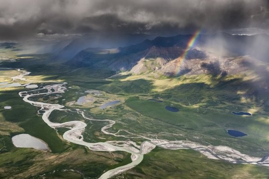
Gates of the Arctic National Park - Alaska
Patrick J. Endres/Corbis Documentary Collection via Getty Images
#patrick j endres#photographer#corbis documentary collection via getty images#gates of the arctic national park#alaska#rainbow#landscape#nature
233 notes
·
View notes
Text

Gates of the Arctic National Park | Garrett Ziegler
12 notes
·
View notes
Note
orko in gates of the arctic national park

[ID in ALT!]
Orko in Gates of the Arctic National Park. Once again getting close to the wildlife.
6 notes
·
View notes
Text
About Gates of the Arctic National Park

About Gates of the Arctic National Park
0 notes
Text
Biden set to block Alaska road key to accessing planned mine. (Washington Post)
The Biden administration is set to block a controversial road crucial to operating a planned copper and zinc mine in northern Alaska, saying it would threaten Indigenous communities and fragment wildlife habitat, according to two people familiar with the matter, who spoke on the condition of anonymity because they were not authorized to comment publicly.
The expected decision on Ambler Road reflects the administration’s selective approach toward boosting domestic mining of minerals used in electric vehicles, wind turbines and other clean-energy technologies. It underscores the challenges facing President Biden as he balances an ambitious climate agenda with the need to protect vulnerable communities and pristine wilderness.
The timing of the move, which was first reported by Politico, is still in flux, although it could come as soon as this week, according to the two people familiar with the matter. An Interior spokesman declined to comment.
Interior is expected to find that there should be “no action” on the federal land where the Alaska Industrial Development and Export Authority (AIDEA) wants to build the 211-mile Ambler Road. That would prevent AIDEA from receiving a permit to build the road, and it would effectively block the mining venture Ambler Metals from accessing the planned open-pit mine. The company has yet to seek or obtain permits for the mine.
AIDEA had planned for Ambler Road to extend 211 miles, crossing 11 major rivers and breaking apart unspoiled tundra. Twenty-six of those miles would have carved through Gates of the Arctic National Park and Preserve, sending giant trucks rumbling through wild lands where tens of thousands of caribou migrate.
The Trump administration approved a right-of-way permit for Ambler Road in 2020, saying it could provide access to significant copper and cobalt deposits. But after Biden took office, Interior Secretary Deb Haaland ordered a fresh review of the road, saying the prior administration had not adequately studied its environmental impact.
In an analysis released last year, Interior’s Bureau of Land Management found that the road would threaten Alaska Natives and their lifestyles more than previously thought. The agency identified 66 communities whose hunting, fishing and other subsistence activities could be affected, up from 27 communities in a highly contested 2020 analysis completed during the Trump administration.
Interior also warned that the road would alter the movement and migration of caribou and other animals, partly because of vehicle noise. With climate change and development already putting pressure on caribou herds, the road could reduce calving and survival rates, the analysis said.
11 notes
·
View notes
Text

Gates of the Arctic National Park and Preserve,
National park in Alaska, USA.
Gates of the Arctic National Park and Preserve is an American national park that protects portions of the Brooks Range in northern Alaska. The park is the northernmost national park in the United States, situated entirely north of the Arctic Circle. The park is the second largest in the US at 8,472,506 acres.
📸 Max Foster Photography
19 notes
·
View notes
Photo
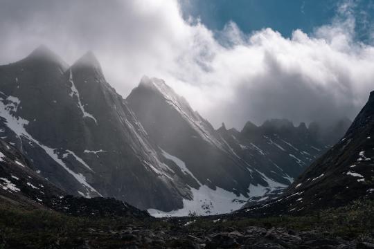
The Maidens of the Arrigetch Peaks. Gates of the Arctic National Park [OC][6897×4600]
2 notes
·
View notes
Text
Blog Post 12 (Chapter 11 review/weekly reflection)
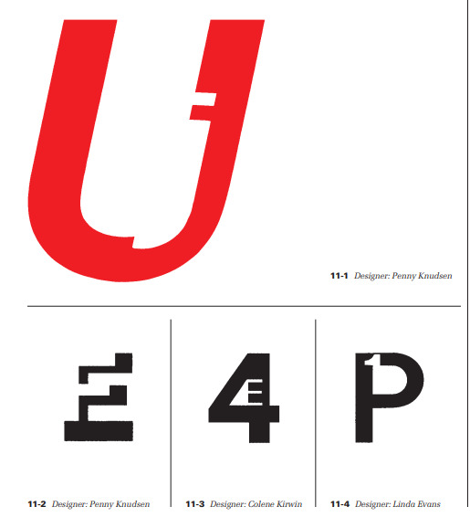
For this week’s reading we went further into our book and read chapter 11: “Typographic Design Education”. This chapter touches on quite a few things, mostly demonstrating various ways and styles of typography that can be put into use such as letter/digit configurations which I really liked (image below). However the lesson it was trying to teach was how typography is involved with the world as a whole, and how society is only becoming more and more focused on the use of visual media in daily living. Following that, the chapter highlighted the importance of having a good typographic education as technology as well as design advances and changes with the times, as well as developing a keen sensitivity to develop more effective designs no matter the state of the art is currently in.
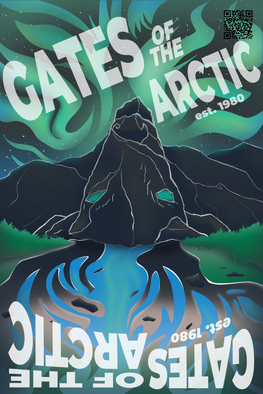
To recap this week, two things happened: we first got to the end of our TypeHike projects and turned them in this Thursday and we have officially gotten into the thick of our design process books. With the TypeHike, I’m actually proud of the final result that I was able to create as I believe it to be a satisfying design and honestly a poster I might hang up in my own room. The idea of the poster was to create a flippable design for the Gates of the Arctic National Park where both orientations show a different image, one side a mountain range with wild rivers and the northern lights in the sky, and the other showcasing a reindeer made out of the landscape. However the process books which are a means of showing all of this semester’s work and the process of how we made them is only now really underway. I’m taking a somewhat simple approach to this design utilizing simple blue shapes to create a more informational layout so that I can go fully into my descriptions while also having the space for images, all while hopefully not taking up too many pages.

0 notes
Text
"gates of the arctic national park" i;m going to be sick
#they have to let me up there. they have to. you don't understand i have to go there no matter what#(''they'' being i am in desperate need for my driver's license and if i do not get it soon i may turn into a horrifying beast and not in#an enjoyable way)
0 notes
Text
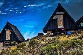
The Marangu route, also known as the "Coca-Cola" route, is the oldest, most well-established route on Kilimanjaro. This is the only route which offers sleeping huts in dormitory style accommodations in lieu of camping. There are 60 bunk beds each at Mandara and Kibo Huts, and 120 bunk beds at Horombo Hut. Guests are supplied with mattresses and pillows, but sleeping bags are still required. The huts have communal dining halls and basic washrooms, ranging from flushing toilets and running water at the lower huts to long drop toilets and buckets of water at Kibo Hut.
Many favor Marangu because it is considered to be the easiest path on the mountain, given its gradual slope and direct path. However, the short time frame of the route makes Altitude Acclimatization fairly difficult. The route approaches Mount Kilimanjaro from the southeast. Marangu is unfortunately less scenic than the other routes because the ascent and descent are along the same path. It is also the most crowded route for that reason.
Day 1: Marangu Gate to Mandara Hut
Elevation (ft): 6,046 ft to 8,858 ft
Distance: 8 km
Hiking Time: 4-5 hours
Habitat: Rain Forest
Hut: Mandara Hut.
We head to the Marangu Gate for the necessary formalities before beginning our trek. The trail climbs through a tropical rain forest near the upper edge of the forest line, where we sometimes see playful blue monkeys. The trail then widens to expose beautiful hillsides until we reach Mandara Hut.
Day 2: Mandara Hut to Horombo Hut
Elevation (ft): 8,858 ft to 12,205 ft
Distance: 12 km
Hiking Time: 6-8 hours
Habitat: Heath / Moorland
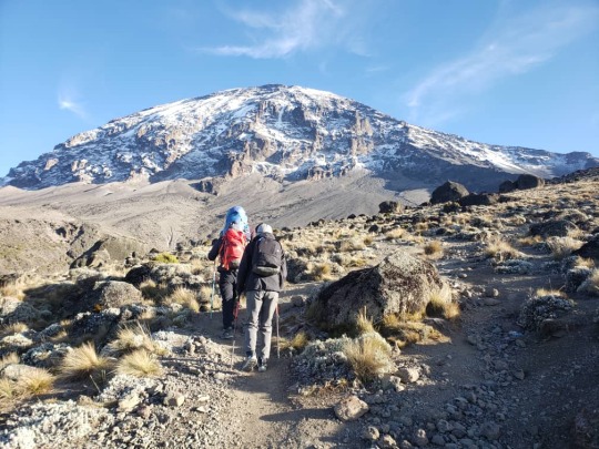
Our second day on the trail starts up with a steep ascent through the forest and opens into high moorland. If the sky is clear, we might get our first views of Kibo and Mawenzi Peaks. Those two volcanic peaks make up the summit of Kilimanjaro.
Day 3: Horombo Hut to Mawenzi Hut to Horombo Hut
Elevation (ft): 12,205 ft to 14,160 ft to 12,205 ft
Distance: 10 km
Hiking Time: 3-5 hours
Habitat: Heath
This extra day is used for Adaptation. We hike towards or all the way to Mawenzi Hut and back. The unique landscape offers motivating views of Kibo and Mawenzi.
Day 4: Horombo Hut to Kibo Hut
Elevation (ft): 12,205 ft to 15,430 ft
Distance: 10 km
Hiking Time: 6-8 hours
Habitat: Alpine Desert
On this day we climb gently, then cross the lunar desert of the “Saddle” between Mawenzi and Kibo to reach our campsite, which sits at the bottom of the Kibo crater wall. Once at Camp, we rest and enjoying an early dinner and prepare for summit day.
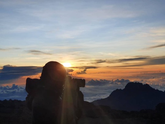
Day 5: Kibo Hut to Uhuru Point to Horombo Hut
Elevation (ft): 15,430 ft to 19,341 ft to 12,205 ft
Distance: 22 km
Hiking Time: 10-13 hours
Habitat: Arctic
We wake up in the middle of the night and begin the final push to reach the Roof of Africa. The trail to Gilman’s Point is very steep, and the ascent will be slow and steady. From Gilman’s, it is a traverse along the crater rim to Uhuru Peak. We stay at the summit for a short time, to take photos and enjoy the views, before retracing our steps all the way back to Horombo Hut.
Day 6: Horombo Hut to Marangu Gate
Elevation (ft): 12,205 ft to 6,046 ft
Distance: 20 km
Hiking Time: 5-7 hours
Habitat: Rain Forest
A long trek is in store for today, however it is mostly downhill. Once we reach the park headquarters, there at Marangu Gate, we pick up our certificate, that proves our achievement, and catch our vehicle transfer to the Hotel in Moshi.
Included
o Park fees,
o Hut fees
o Rescue fees
o 18% VAT on tour fees & services, which cost nearly 55 % of the total cost charged.
o Transportation to & from the Mountain Gate
o Professional mountain guides, cooks and porters
o 3 meals daily while on the mountain
Not Included
o Both national and international flights
o Medical Insurance
o Tips to Mountain Crew
o Items of a personal nature
o Laundry Services
o Alcoholic beverages
Contact Us via WhatApp +255 786499087
Email us Direct: [email protected]
#Marangu Route 6 days Trek#Kilimanjaro Marangu Itinerary#Marangu Route Summit Climb#6-day Marangu Route Highlights#Kilimanjaro Marangu Huts#Marangu Route Acclimatization#Best Time to Hike Marangu#Marangu Route Camping Options#Kilimanjaro Scenic Views#Marangu Route Difficulty Level#Kilimanjaro National Park#Marangu Route Accommodation#Kilimanjaro Guided Expeditions#Marangu Route Altitude Sickness#Kilimanjaro Weather Conditions#Marangu Route Trekking Adventure#Kilimanjaro Uhuru Peak Ascent#Marangu Route Flora and Fauna#Kilimanjaro Cultural Tours
0 notes
Photo
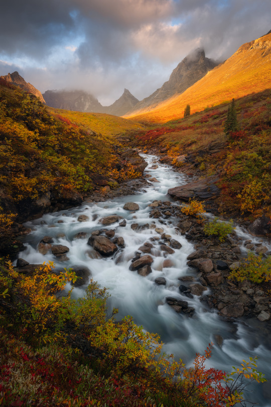
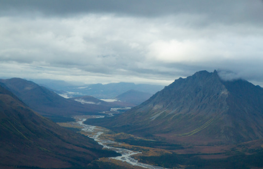
Fall Splendor
Gorgeous fall colors in one of the most remote pockets of Alaska - Gates of the Arctic National Park.
Photographer: Matt Meisenheimer
23 notes
·
View notes
Text
Gates of the Arctic National Park | Garrett Ziegler
6 notes
·
View notes
Text
Alatna River Valley, Gates of the Arctic National Park and Preserve, Alaska
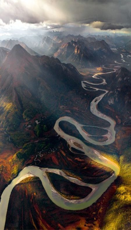
Embark on a scenic journey through the Alatna River Valley, a hidden gem within Gates of the Arctic National Park and Preserve, Alaska. Nature's finest awaits.
0 notes
Text
Gates of the Arctic National Park Information
Gates of the Arctic National Park Information
0 notes
Photo

Arrigetch Peaks, Gates of the Arctic National Park, photo gallery >> Alaska
Witness the breathtaking beauty of the Arrigetch Peaks in Gates of the Arctic National Park, Alaska. Check out our playful photo gallery to get a taste of this English-speaking nature lover's paradise on Pinterest.
0 notes
Text

file: Camping in Thunder Valley. Gates of the Arctic National Park, Brooks Range, Alaska.jpg
0 notes
Last Seen Blogs

aimaileafy
(do not) listen to songs of books, little star

livingformyotp
here and queer

family-responsibility-change
Untitled

bellamyblake
80 acres of happiness

why-am-i-tho
I Think, Therefore I Am.