#Liard River
Text
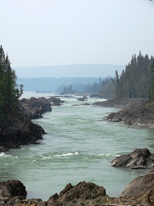


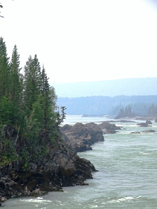
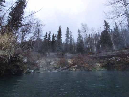
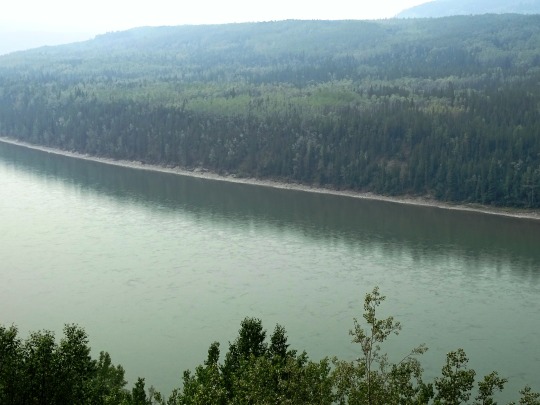
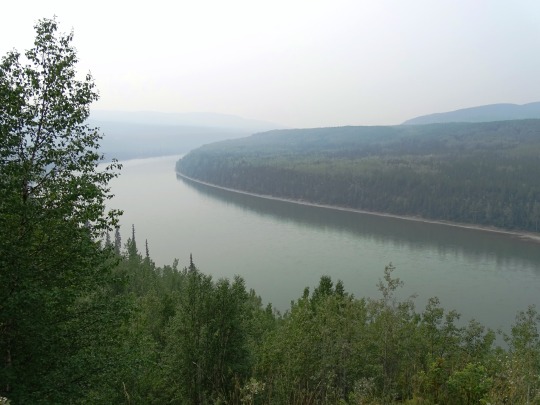
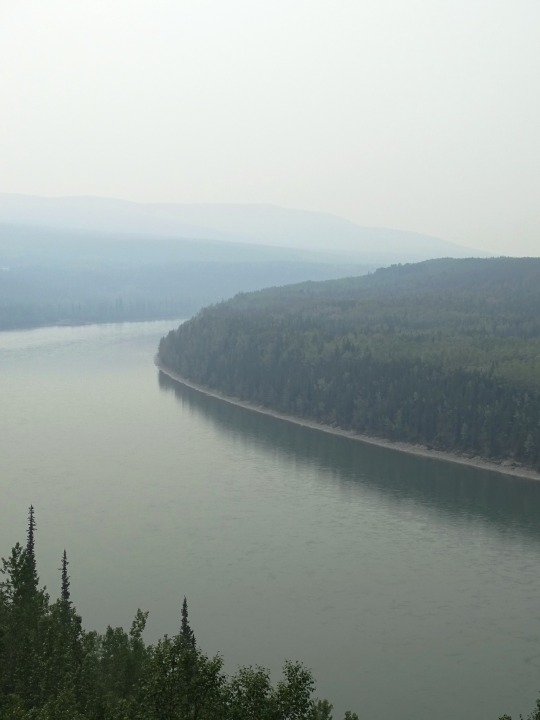
Whirlpool Canyon, BC (No. 5)
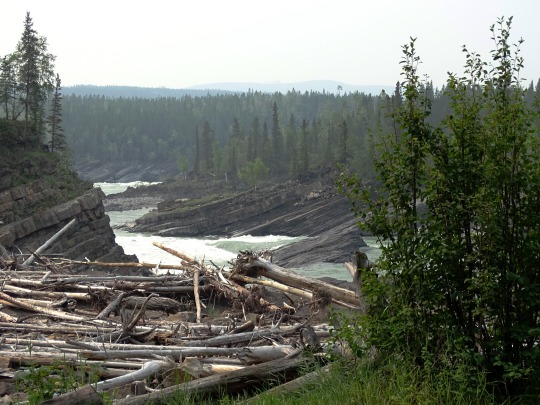
With the advent of industrial logging practices, the global quantity of driftwood has declined. Early accounts indicate that driftwood was once more plentiful. Early photographs of the pacific coast reveal greater amounts of driftwood on the beaches than is present today. Likewise, when traveling in Dixon Entrance in the late 1800s, George A. Dorsey recorded that many beaches were "piled high with drift, often to a height of sixty feet or more. " Melting polar ice may also contribute to the decline of Siberian driftwood in the Atlantic as the sea ice enabled driftwood to travel greater distances without becoming waterlogged.
Source: Wikipedia
#Skooks Landing#driftwood#Whirlpool Canyon#shale Rock#BC#Liard River#travel#original photography#vacation#tourist attraction#landmark#landscape#countryside#British Columbia#woods#forest#nature#flora#tree#river bank#wildfire smoke#summer 2023#Canada#view#vista point#boreal forest
24 notes
·
View notes
Text
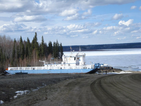

River Ferries, Northwest Territories
3 notes
·
View notes
Text
Airstreaming to Alaska - Chapter 10: The Alaska Highway
We finely made it to the Alaska Highway! The AlCan was born to be a military supply route, but it grew up to be a story-teller. This unforeseen attribute – like an E-ticket ride at Disneyland – had us riveted from Mile-0.
Posted October 7, 2022 – Narrated by Carmen
To listen to the podcast, click the play button
Chapter 10 of the “Airstreaming to Alaska” series.
“To travel hopefully is better than to arrive, and the true success is to labour.”Robert Louis Stevenson from the essay, El Dorado
The Alaska Highway was born to be a military supply route, but it grew up to be a story-teller.
Just Leaf Me Bee by…

View On WordPress
#Airstream#Airstream Blog#Airstream Life#Airstream Travel Blogs#Airstreaming#alaska highway#AlCan#Beaubeaux#Chetwynd#Dawson Creek#Fort Liard#Full-time Airstreaming#Full-time RV Living#Full-Time RVing#liard river hot springs#Living in Beauty#living simply#Living the Dream#muncho lake#Peace river#simple living
2 notes
·
View notes
Text

Liard River Hot Springs BC 🇵🇫
42 notes
·
View notes
Text
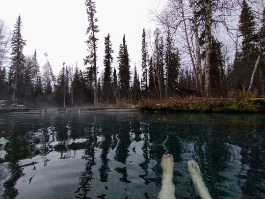
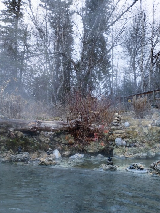
We're somewhere near BC and Alberta, in hour 9 million of the drive south, and we stopped for the afternoon at the Liard River Hot Springs.
It's 200m into the woods on a boardwalk, and then you come onto a little enclave of soupy heaven. The air temperature was hovering somewhere around 15F, but once you're in the pool it doesn't matter. It's the liquid version of Cold Room, Warm Bed.
The provincial parks website said the pool hits up to 52C, which is about 125F, and I was SKEPTICAL but nope, no, if you go waaaaay over to the side where it vents, you'll get there. Most of the pool is just a deliciously hot bath, but you can feel currents of different temperatures wave past. And if you're me, edge further and further towards the vents, muttering YES BOIL ME I AM THE SPAGHETTI.
13 notes
·
View notes
Text
The agency overseeing oil and gas producers in British Columbia is warning of potential water shortages in 2024. The B.C. Energy Regulator (BCER), formerly the B.C. Oil and Gas Commission, says persistent drought last summer and fall in the northern part of the province continue to negatively affect streamflows and groundwater, with snowpack levels at last reading only 72 percent of the historical average.
The northeast of the province, where much of B.C.'s oil and gas production is concentrated, has been hit hardest by the drought. The four water basins in the region--Fort Nelson, East Peace, North Peace, and South Peace--remain at drought level 5, the most severe classification on the provincial scale. Level 5 is declared when "adverse impacts on socio-economic or ecosystem values are almost certain."
A significant portion of gas extraction in the region involves water-intensive hydraulic fracturing or fracking. The fracking process blasts water, sand, and chemicals at high pressure more than two kilometers underground to release the natural gas trapped in rock formations.
BCER hydrologist Ryan Rolick said the warning about potential water shortages was issued out of an abundance of caution, recognizing that snowpacks might still improve and that spring and summer could still deliver the precipitation desperately needed. But the opposite is also possible, he said.
In a statement, the Canadian Association of Petroleum Producers (CAPP) said its members in British Columbia are monitoring the drought situation.
CBC science specialist Darius Mahdavi says the drought in the northeast has been at or near Level 5 since the fall of 2022.
Water permits remain indefinitely suspended on 10 rivers located in the Peace, Liard, and Fraser River watersheds, according to the BCER. Rolick said the message to the oil and gas sector is to be prepared for further water-use restrictions or suspensions.
0 notes
Text
Alaska Highway
Day 26 -
It rained during the night, so our awning and carpet were wet when we got up. We packed up started on our way to Liard Hot Springs, grey skies and it looked like nasty weather ahead and sure enough, we drove through some heavy rains.
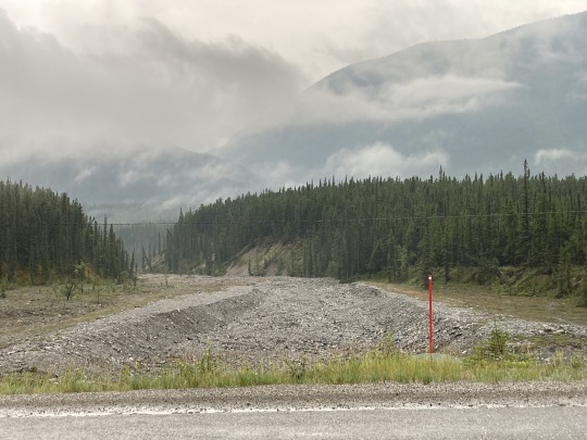
At around KM990 of the Alaska Highway we came upon a road washout which was mostly repaired. The cause of this washout made international news due to the fact that this was caused by the break of a massive beaver dam up river, which released the water from a substantial lake formed by this beaver dam. The wall of water came down through the gorge and wiped out 150m of highway. The Canadian Beaver strikes again!
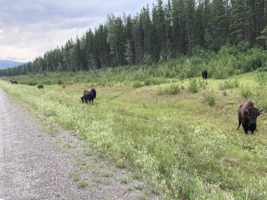

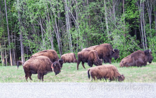
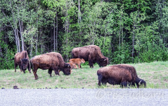
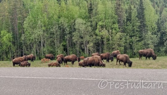
We came upon a small heard of buffalo grazing along the road, beautiful animals and looking healthy. Campers and motorhomes all stopping to take pictures. It was the most wildlife we saw in one place during the whole trip.
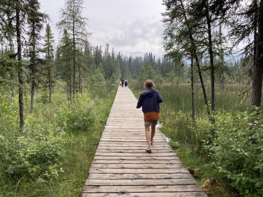
We arrived at Liard Hot Springs around 10am for a soak, paid $5 each for the park entry. There is a small campground here, fenced off with an electrified 2m high fence to keep out the bears and the campers safe. We walked through a gate and then along a boardwalk across some wetlands for 10 minutes to arrive at the pool, it’s actually a pond in the forest fed by the hot spring.


The water was about 38-39c, very pleasant. There are little side arms in the pond where some cold water trickles in, beautiful. We met friends from Kimberley, who were on their way north to Fairbanks Alaska.
Shortly after leaving Liard we drove through the the north end of the Rocky mountain range where we encountered some heavy rains until well past Muncho Lake. The highway crossed over some major washouts that happened in the past. What surprised me was the frequency of these washouts they came down from every side valley. It must be caused by heavy rains during spring run off. The low hanging clouds and fog deprive us of all the beautiful mountain views.

We drove past Toad River and through Stone River Provincial park. The mountain sides and side valleys are all very steep and rocky. At the Summit Lake there is camping and lots of hiking trails into the side valleys and around the lake. There were lots of campers set up for a stay.

From Tetsa River to Steamboat we’re getting into the foothills of the rockies and the smoke is getting thicker from the forest fires to the NE of here. The rain is easing off as we got to Beaver Lake and then another 30k to Fort Nelson where it was dry.
We stayed overnight at the Blue Bell Inn and Campground. The campground was a bit sketchy but the bathrooms and showers were nice and clean. There was a bit more rain overnight.
0 notes
Link
[ad_1] Heat warnings are in place for a number of areas in the Northwest Territories, including one community where wildfires are blazing just 1.5 kilometres away from the town's centre. Here's the latest: Temperatures could reach as high as 30 C in parts of N.W.T. today Wildfire remains 1.5 km from the centre of Hay River Westerly winds could cause "severe fire activity" Environment Canada and the Government of the Northwest Territories issued five heat warnings Sunday morning for the Fort Liard, Fort Providence, Fort Simpson, Wrigley and Hay River regions. Temperatures could reach as high as 28 to 33 C before falling to levels that are more "moderate" by Wednesday, the notices say. These warnings come as the territorial government turns its attention to the community of Hay River, a town along the south shore of Great Slave Lake with a population of 3,500 people. In recent days, Hay River has increasingly come under threat from the ongoing wildfires. As of Saturday afternoon, a fire nearly 4,000 square kilometres in size was burning one kilometre west of the town's airport and 1.5 km away from the centre of the community. The fire has already destroyed a cabin and a travel trailer near the shores of Great Slave Lake. Along with temperatures of up to 30 C and "extremely dry conditions," territorial officials say winds could start to blow in a westerly direction at speeds of 15 km/h, with gusts up to 40 km/h. "This may cause severe fire activity, and would support growth to the north, and to the east," read the latest wildfire update from the territory on Saturday. "Firefighting efforts today and tomorrow will be focused on reducing these risks." Hay River, along with the other South Slave communities of K'átł'odeeche First Nation, Enterprise and Kakisa, are under evacuation orders because of the fire. More than 200 personnel, along with 10 helicopters, 19 pieces of heavy equipment and air tankers, are fighting that blaze. Firefighting efforts have continued in other areas of the territory as well, including near the capital, Yellowknife, where a fire about 1,670 square kilometres in size has remained 15 km northwest of the city's boundaries for at least a week and a half. With files from CTVNews.ca Writer-Producer Noushin Ziafati [ad_2]
0 notes
Text
Day 19 June 15 Liard Hot Springs - Toad River 120kms
Fortunately the marauding bears didn’t make an appearance last night. Apparently the ranger had chased them away.
I think I managed quite well with my rustic accommodations yesterday but I can tell you, I’m absolutely loving tonight because my cabin is perfect! It’s not cheap but I finally has everything and even a view of the lake out the window.
However…..I really earned it today.
The first 40kms crawled by today. There were nice views of rivers, but the road ahead showed what was coming.

At 35kms was a very long, quite steep climb. As usual I just put Shirley in granny gear and crawled up. I was rather stressed thinking that there would be more of these hills ahead.
I was looking forward to a break today at Muncho Lake. I didn’t realise how absolutely stunning the lake would be.

On the downhill approaching Muncho Lake Lodge there were these goat things.
I was amazed at how brazen they were. They didn’t even run away when a huge semi trailer drove by. The traffic here is very conscious of wildlife and either stop or go very slowly when there is anything near the road. I shared a smile with the semi driver as he tried to manoeuvre his huge vehicle past the goats without scaring them away. He succeeded!
The lodge was just down the road a few kms past another abandoned place.
There are a lot of these here. It’s a bit sad that so many have gone out of business…especially for me. I need them!
I was looking forward to some good cake but there was only an ice cream to go with my coffee. At least I had coffee and a nice lounge to sit on. It would have cost about $300 Australia to stay the night at that place so obviously, I had to go further.
The ride around the lake was not a hardship.
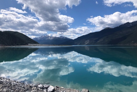
It was a blissful flat ride looking at the amazing jade colour of this beautiful lake.

There was another place a bit further on which had accommodation. If I had a phone that worked I probably would have booked it. Since I am usually under pressure, using someone else’s phone , I just book the first thing I can get.
It was at 67kms and I really wanted to stop there for the day but the people were not very welcoming. I went in and purchased this incredible cinnamon scroll.
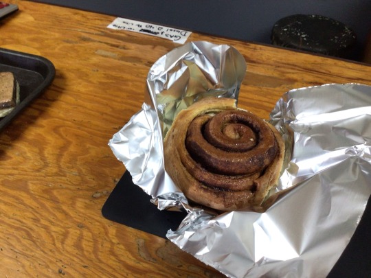
All the bakers here compete to make the best scroll. This one was pretty good. I had a nibble before I pushed on to try to improve my mood. My heart just wasn’t in cycling another 50 something kilometres. I grumped my way up the next kms dreading another steep hill like the morning. I would have been really happy to accept a lift if anyone had offered. They didn’t.
After about 10kms of slow going I reached the top and was rewarded by a fantastic downhill run. This lifted my spirits a lot and I allowed myself another break sitting on a rock looking and listening to this gorgeous crystalline river….and nibbling some more of my scroll.
Only 25kms to go I pushed on with a much more positive attitude. The road was running along the river

so I began to stop dreading another huge climb. There were a few bumps but nothing major.
It was a great relief to finally reach this place and find a well equipped spacious cabin…..with a really good shower!!
I don’t have anything to cook for dinner except some broccoli. I’ll have that as an entree then head over to the restaurant.
Here is the photo of the bison which came through from my phone.

I might even wander around the RV’s and see if anyone is going my way tomorrow!
0 notes
Text

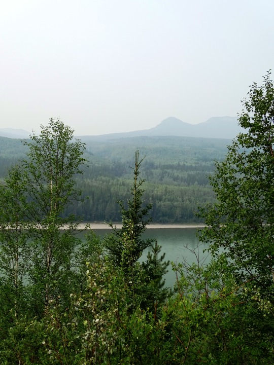


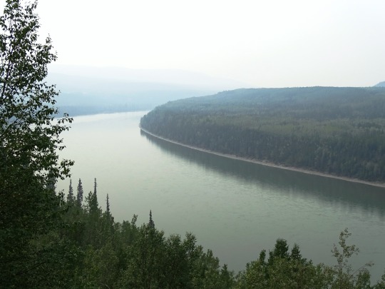


Allen's Lookout, BC (No. 1)
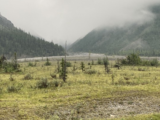
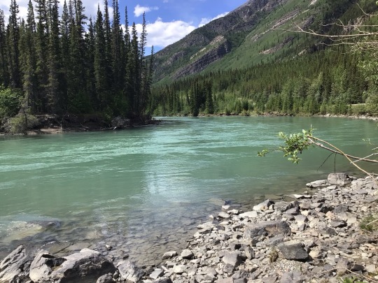
The Liard River of the North American boreal forest flows through Yukon, British Columbia and the Northwest Territories, Canada. Rising in the Saint Cyr Range of the Pelly Mountains in southeastern Yukon, it flows 1,115 km (693 mi) southeast through British Columbia, marking the northern end of the Rocky Mountains and then curving northeast back into Yukon and Northwest Territories, draining into the Mackenzie River at Fort Simpson, Northwest Territories. The river drains approximately 277,100 km2 (107,000 sq mi) of boreal forest and muskeg.
The river habitats are a subsection of the Lower Mackenzie Freshwater Ecoregion. The area around the river in Yukon is called the Liard River Valley, and the Alaska Highway follows the river for part of its route. This surrounding area is also referred to as the Liard Plain, and is a physiographic section of the larger Yukon��Tanana Uplands province, which in turn is part of the larger Intermontane Plateaus physiographic division.
The Liard River is a crossing area for Nahanni wood bison.
Source: Wikipedia
#Allen's Lookout#BC#Liard River#travel#original photography#vacation#tourist attraction#landmark#landscape#countryside#British Columbia#woods#forest#nature#flora#tree#river bank#wildfire smoke#summer 2023#Canada#view#vista point#boreal forest#Northern Rockies#Rocky Mountains
22 notes
·
View notes
Text
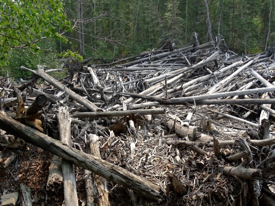
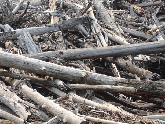
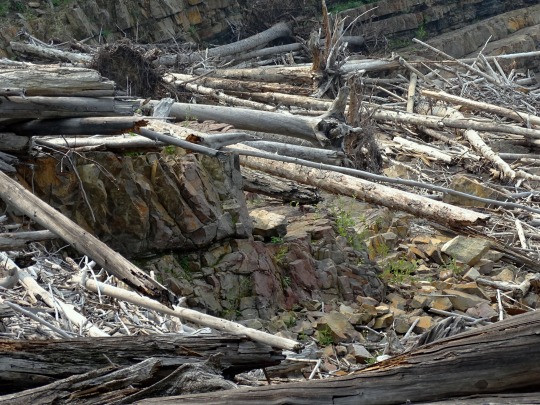
World's biggest cumulative logjam mapped in the N.W.T. — and it stores tons of carbon
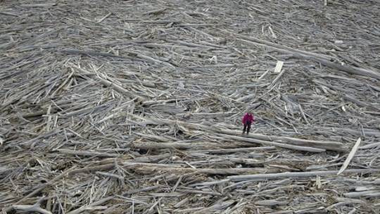
You won't assume of the Arctic as a spot with rather a lot of timber, however a latest research says the Mackenzie River Delta in the N.W.T. is residence to the world's biggest identified cumulative logjam — and it stores an enormous quantity of carbon. "In every single place you go, there's driftwood," stated Roy Cockney Sr., an elder dwelling in Tuktoyaktuk, N.W.T., which is above each the Arctic Circle and the treeline. Cockney stated the wooden provides folks in his group a supply of heating gas yr spherical, and it's generally used to construct cabins too. "It is one thing that we like, when it piles up it's good for us," he stated. When Alicia Sendrowski, a analysis engineer out of Michigan Tech Analysis Institute got here to Tuktoyaktuk to review logjams, Cockney confirmed her staff a spot alongside the coast with tons of driftwood pushed up in opposition to the shore. Roy Cockney Sr., an elder in Tuktoyaktuk, took Sendrowski and her analysis staff to this spot. He informed them that the giant piece of wooden in the foreground hadn't been there the yr earlier than, providing Sendrowski's staff perception into how rapidly the wooden can transfer from place to put. (Alicia Sendrowski)"There was this actually big log there, like an enormous tree, and he may inform us 'Oh, that tree wasn't right here final yr,'" stated Sendrowski, who was figuring out of Colorado State College when she did the fieldwork. That native information was "actually essential," she stated, as a result of it confirmed her how robust the river present could possibly be and how rapidly the logs may journey.
How large is the logjam, and how a lot carbon does it retailer?
With the assist of satellite tv for pc imagery, Sendrowski and her staff studied 13,000 sq. kilometres of the Mackenzie River Delta, which lies above the Arctic Circle. They discovered greater than 400,000 caches of wooden. Added up, this cumulative logjam would span a 51 sq. kilometre space. That is roughly a 3rd the dimension of Yellowknife. Sendrowski calculated all that wooden stores 3.4 million tons of carbon — which she stated was equal to a yr's value of emissions from 2.5 million vehicles.Roy Cockney Sr. in Tuktoyaktuk, N.W.T., in December of 2019. He is noticed driftwood throughout the place in his group, and says folks use it as a heating gas and generally to construct cabins. (Eriel Lugt/TukTV)This calculation is essential, stated Sendrowski, as a result of little is thought about how a lot carbon is saved in wooden deposits round the Arctic, and as a result of local weather change influences how a lot carbon makes its means again into the ambiance.
The place does the wooden come from?
Most of the logs jammed up in the Mackenzie River Delta are coming from the Liard River, stated Sendrowski. However her work discovered logs from alongside the Mackenzie River itself, and the Peel and Arctic Crimson rivers too. So how do timber find yourself in the river? "A tree falls in the forest and snow soften occurs and it will get pushed right into a river and it will get transported in the river," Sendrowski defined. Sendrowski says that is the largest single logjam they discovered in the Mackenzie River Delta, discovered close to the coast. (Alicia Sendrowski)Water in the Mackenzie River Delta flows north towards the Beaufort Sea. Sendrowski's report — revealed this month in the journal Geophysical Analysis Letters — says the Mackenzie River is "well-known" for spitting wooden into the Arctic ocean. However earlier than these logs attain the ocean, they could get caught someplace alongside the means. Most of the logs Sendrowski's staff sampled started rising round or after 1950, however some had been a lot older, suggesting they'd been trapped in the delta for hundreds of years. The research says one pattern from the Peel River dated again greater than a thousand years in the past. This map reveals what components of the Mackenzie River Delta Sendrowski and her staff studied, and how. (Geophysical Analysis Letters)"You'll be able to inform that some of them are very outdated," stated Cockney, of the driftwood he is seen in large piles round Tuktoyaktuk. However he is additionally noticed youthful driftwood increase, particularly after there's been flooding additional south in the N.W.T.
Why does this matter?
Some scientists say the Arctic is warming 4 occasions quicker than the relaxation of the world.The Mackenzie River Delta is an space that is going to endure rather a lot of change, stated Sendrowski, which may affect how the carbon from these timber cycles again into the ambiance. Local weather change might break the logs down extra rapidly, dashing up the carbon's launch, she stated. It will probably additionally change the place timber are coming from and how they attain rivers. "Precipitation patterns, if these are altered, when you're now going to have extra precipitation in the space, that might result in extra speedy degradation of timber , falling and coming into the river," she stated. A 3-meter-tall logjam discovered in the central half of the Mackenzie River Delta. (Alicia Sendrowski)
What are the limitations of this analysis?
Sendrowski's work solely scratches the floor. She and her staff travelled to the N.W.T. communities of Aklavik, Tsiigehtchic and Inuvik to review logjams as nicely, however they solely mapped what was seen. Wooden that was hidden under dwelling vegetation or buried beneath floor wasn't accounted for. She says it's potential the delta's driftwood stores twice as a lot carbon than what she calculated. There are additionally no less than a dozen deltas greater than 500 sq. kilometres round the North. Sendrowski says all these deposits of wooden may add as much as a big pool of carbon, and it's one we all know little about.
Read the full article
0 notes
Text
12 years after his death, N.W.T. woman still trying to finalize her father's estate
12 years after his death, N.W.T. woman still trying to finalize her father’s estate
Rose Betthale-Reid lost her father, William Betthale, in 2010. He went missing on the Petitot River in B.C., a tributary of the Liard River, after leaving his cabin in a canoe to check his fish net.
As time went on, they had to face the reality that he most likely lost his life on the river. The loss was devastating for her family.
Out of five Chipewyan-speaking siblings, Betthale-Reid is the…

View On WordPress
0 notes

Photo

“Prince George Route Favored for B.C.-Alaska Road,” Vancouver Sun. November 13, 1941. Page 14.
-----
Commission's Report Tabled; Cost Set at $25,000,000
----
By Canadian Press
---
OTTAWA, Nov. 13. - Prime Minister Mackenzie King tabled in the House of Commons today the report of the British Columbia-Yukon-Alaska Highway Commission which said two routes considered, known as "A" and "B" are feasible, but the "B" route will best fulfill the purpose of the highway.
The "B" route would run from Prince .George, B. C, north through what is known as the Rocky mountain Trench to the Liard River and down the valley of the Pelly River to the Yukon and from there to Dawson and the Alaskan Boundary.
The "A" route considered by the Commission runs roughly from the vicinity of Fort St. James in northern British Columbia and by way of Atlin, near the British Columbia-Yukon border to Whitehorse and from there to the Alaskan, boundary.
"In its consideration of the proposed highway the commission has assumed that the existing roads of British Columbia from. the international boundary north to Prince George and Fort St. James would form part of the highway whatever route might be adopted, and confines its consideration of these existing roads to an estimate of the cost of bringing them up to the suggested standards of the highway," said the department's statement.
The Commission found the "B" route would mean a highway of about 1700 miles and about 1900 miles under the "A" route.
Cost of a highway, completed to the required standard, but exclusive of paving, was estimated at from $25,000,000 to $30,000,000.
The report tabled by Mr. King formed a bulky bundle of documents.
The Commission was required only to report on suitable routes, leaving decision as to which may be chosen to the government.
The report contained detailed studies of snowfall and other conditions.
The Commission was headed by Hon. Charles Stewart.
A similar commission was appointed by the. United States which held meetings with the Canadian Commission and, it was understood, concurred in the findings of the Canadian commissioners.
The U.S. commissioners were instructed to investigate the extension of the road to Fairbanks, Alaska, beyond the boundary with Canada.
#house of commons#parliament of canada#mackenzie king government#prince george#highway construction#road construction#alaska highway#boundary commission#government investigation#world war II#canada during world war 2
0 notes
Text
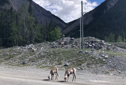
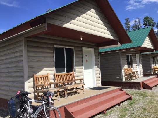
It was getting late, so our hopes of reaching Liard river hot springs before nightfall (and closing time) were dashed, but we did see some cows!
0 notes
Text
On the bank of a swollen South Nahanni River, this Northwest Territories community is bracing for the worst
On the bank of a swollen South Nahanni River, this Northwest Territories community is bracing for the worst
Nahɂą Dehé Dene Band Chief Steve Vital’s message to his community on the banks of the flooding South Nahanni River is to hope for the best, but prepare for the worst.
And the people of Nahanni Butte, Northwest Territories, took that message to heart.
The community of 93, which sits next to where the South Nahanni River joins the Liard River, was put on flood alert this week. The Government of the…
View On WordPress
0 notes
Last Seen Blogs

briarpatch-kids
Jam Fool

cupiddust
ᜊ( ' ⩊ '𖦹)ᜊ

notourdivisionmaximoff
spacegays

kpercell
this and that

covivent
vivian