the-rediscovery-corps
the rediscovery corps
amateur photography
&
travel
52 posts
Don't wanna be here? Send us removal request.
Last Seen Blogs

customerapplestatement-2020-blog
Untitled
fuzzybug
: F l y :

bee-full-of-honey
we are rad.

tech-connect
Tech-Connect

astoldbysosa
As Told By Sosa
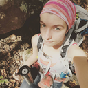
Photo
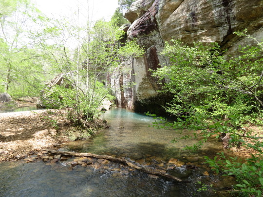


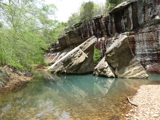


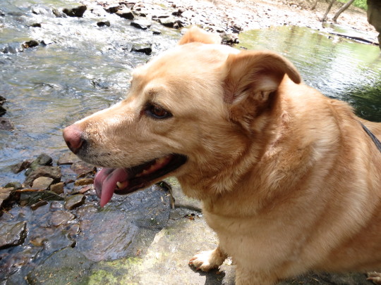


first camping trip of the year with my best friends, Laika and @majoras-skull-kid, at Shawnee National Forest, specifically the Bell Smith Springs area
17 notes
·
View notes
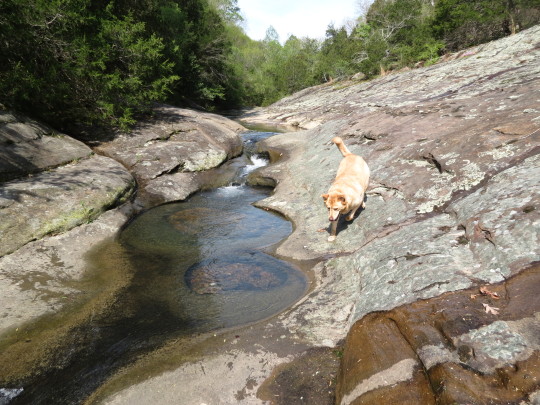
Photo


some pics of my dog, Laika, from our last hiking trip to Shawnee National Forest
completely forgot about these until I was getting on my SD card just now to get some pictures of the snow off
10 notes
·
View notes
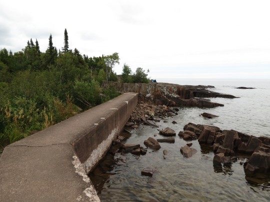
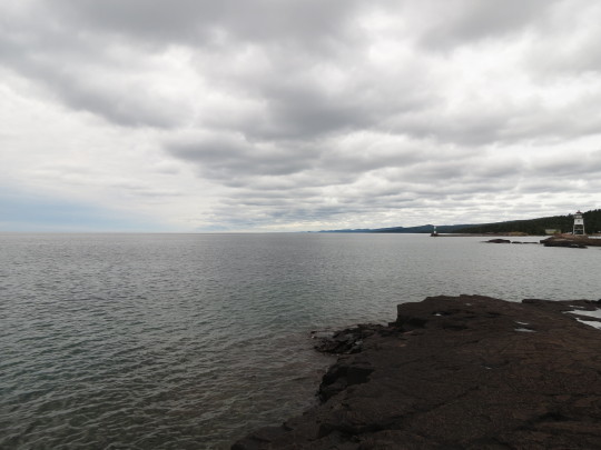
Photo
(posted to the wrong blog, whoops)

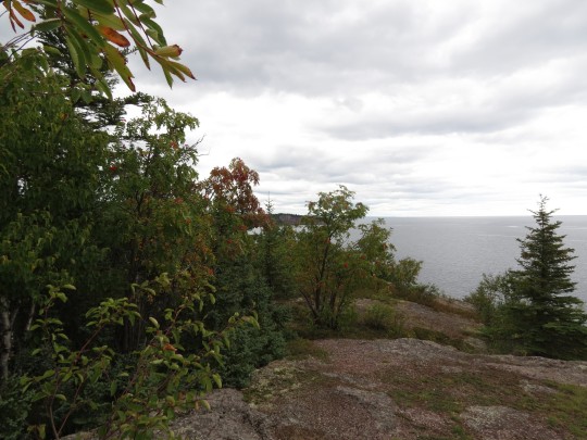


BWCAW - Seagull Lake - Drive Back
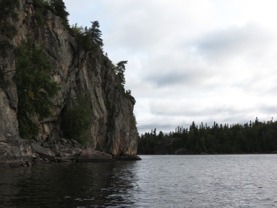
Palisade Head
36 notes
·
View notes
Photo
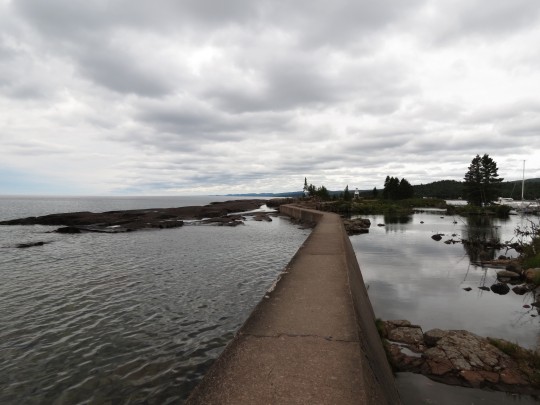
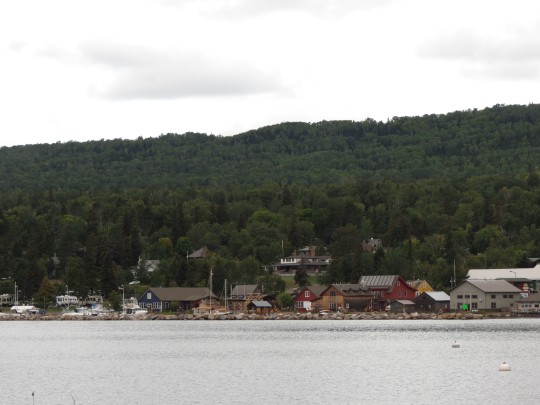

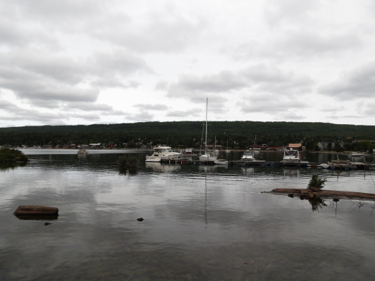


BWCAW - Seagull Lake - Drive Back
Specifically, Grand Marais, where we stopped to get some coffee and brunch at Java Moose. I got a Nordic Miel latte and it was delicious.
16 notes
·
View notes
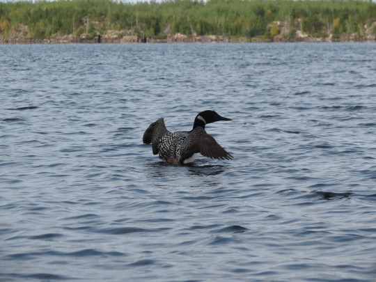
Video
The loon who sang for us as we were leaving
34 notes
·
View notes
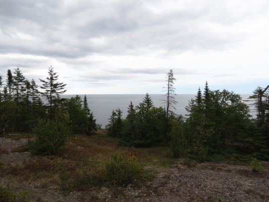
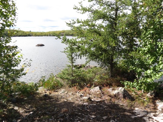
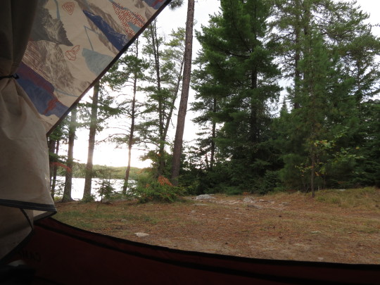
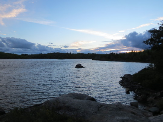
Photo
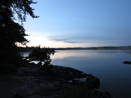


BWCAW - Seagull Lake - Day Three
The relentless wind finally died down the night prior, so I could sleep without fearing that the camp was going to blow away, though the front brought what were, I’m fairly certain, below freezing temperatures. It also brought a beautiful foggy morning and as we were sitting, listening to the loons and drinking coffee, we became aware of another sound, far to the north. Wolves howling.
With less wind, leaving the lake was far and away easier than it had been entering. On the way out, we were treated to a loon, no more than 10 feet from our canoe, who sang for us. I’ll post the video.
By the time we got back to the dock, I could hardly feel my fingers and was much looking forward to a hotel in Duluth with a hot shower and something non-dehydrated for dinner.
2 notes
·
View notes
Photo

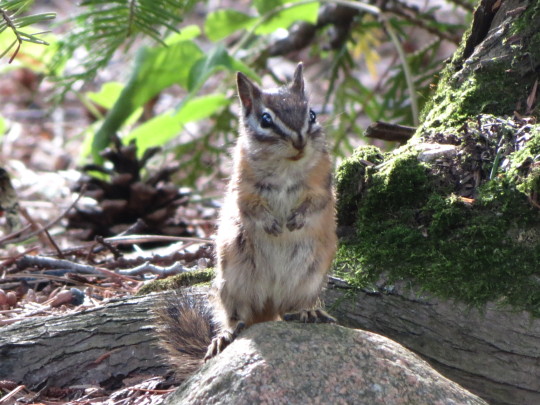

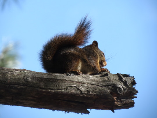


BWCAW - Seagull Lake - Day Two
Originally, the plan for our full day on the lake was to take the canoe and head over to Alpine Lake for a day trip, but the wind from the previous day refused to die down. There was a front moving south and we were right in the way of it. We went out paddling a bit, but we were both still sore from the previous day and gave up pretty quickly, spending the day in camp or exploring the woods around the peninsula where we were camping.
For someone who came from Southern Illinois, where it’s still in the 80s, it was a bit of a shock having days barely getting into the 50s. Luckily, we took a little luxury with us, since we weren’t going to be portaging, and had a french press and lots of coffee and hot chocolate.
We had at least three different chipmunks around our camp and a few squirrels. They were quite friendly, I expect because they see so few people they had no reason to be afraid of us.
With the cold air and nothing else to do, we quickly ran through the supply of firewood previous campers had left and had to take the canoe out into our little sheltered bay and steal some more from an abandoned beaver hut.
14 notes
·
View notes
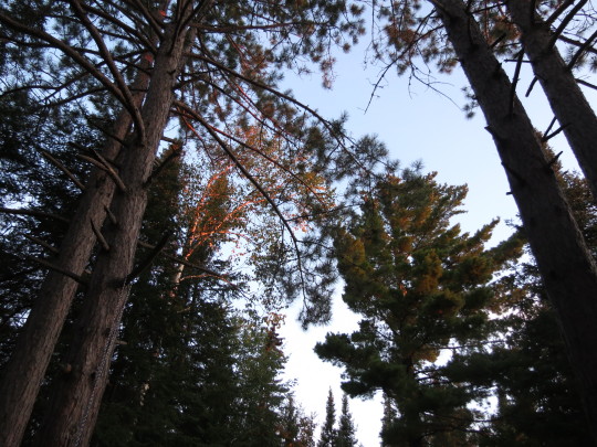
Photo


BWCAW Trip - Seagull Lake - Day One
My first time in the Boundary Waters, spent three days on Seagull Lake with my cousin. The drive up the Gunflint Trail was threatening inclement weather and once we were out on the water, we had to fight against a brutal headwind and massive waves as we tried to scoot our way around the north shore of Seagull Lake. By the time we found an empty campsite, neither of us could paddle much further.
3 notes
·
View notes
Photo
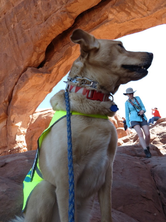

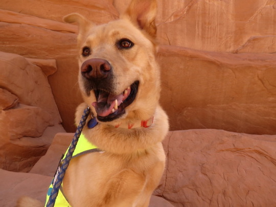

and now, a bunch of pictures of my beautiful service doggie, Laika, who was very good the whole trip, but I think enjoyed Colorado far more than Utah (she’s part husky, so the desert is not her strong suit) but she loves hiking and climbing on rocks and things, so she had a lot of fun
North Window, Sand Dune Arch, and finally she got to play in some snow at a rest area near Vail Pass
#utah#colorado#dogs#laika#service dog#i love her she's so pretty#and mostly photogenic#although she makes funny faces sometimes
23 notes
·
View notes
Photo

Wolfe Ranch, Arches National Park, Moab, Utah
These petroglyphs were made by the Ute tribe sometime between the 1600s and 1800s.
19 notes
·
View notes
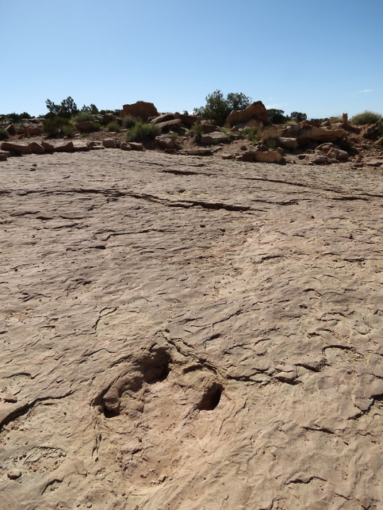
Photo

“Dinosaur” tracks, Courthouse Wash, Arches National Park, Moab, Utah
Not sure what kind of bird made these, but they were big! They remind me of grey heron tracks, but I’m not sure if those live in the area, since they’re wading birds. But maybe they come around when water is flowing.
0 notes
Photo

A dope example of fault activity just across the highway from the Arches visitor center, on the Moab Fault. Most fault activity in the area is caused by salt moving underneath the ground.
9 notes
·
View notes
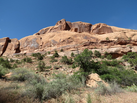
Photo

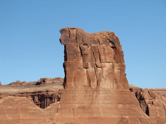


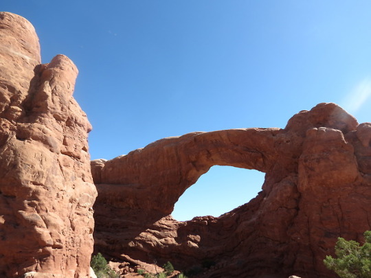

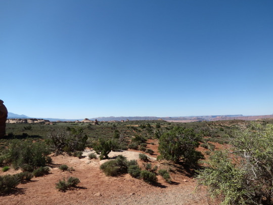


Arches National Park, Moab, Utah
This place is a rock enthusiasts playground. Absolutely gorgeous examples of different formations of rock. Particularly noticeable on Balanced Rock, the base is Dewey Bridge (Carmel formation) sandstone which is water deposited, and the cap is Slick Rock (Entrada formation) which is wind deposited (eolian). But the entire park is stunning exposed Jurassic (mainly) rock.
A fun fact about Dewey Bridge sandstone, it’s very convoluted in the area. There are large waves and deformations in it. There are a few explanations for this, but my favorite is that in the late Jurassic, just after the Dewey Bridge sand had been set down, a meteor struck (forming Upheaval Dome) and the shockwaves forced the still pliable sand into the strange wavy shapes before it hardened into rock. Apparently the convolutions get worse and more drastic the closer you get to Upheaval Dome (we didn’t go there, so I can’t say for sure)
Rock formations are named in the captions.
#disclaimer: i am not a geologist i just like rocks and had a geology of the co plateau book with me on this trip#utah#moab#arches national park#geology#photography#three gossips#sheep rock#baby arch#windows arches#turret arch#double arches#sand dune arch#balanced rock
6 notes
·
View notes
Photo

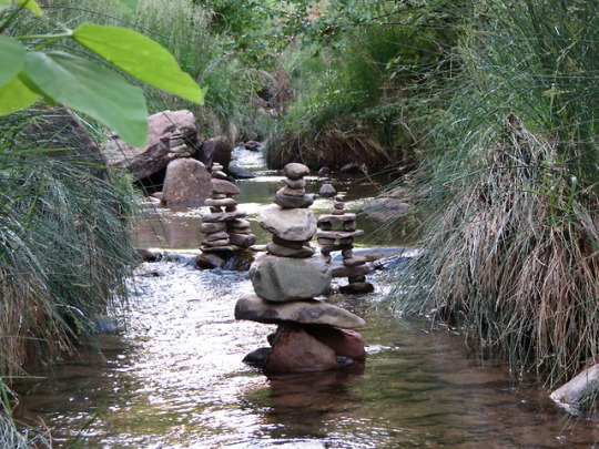
Grandstaff Canyon, Colorado River Reacreation Area, Moab, Utah
An evening walk through a bit of Grandstaff Canyon. We didn’t go all the way to the arch, but the shade and the cold creek water were very pleasant. Laika had a lot of fun wading around. The cairns were built by other hikers and, while they look nice, they can be quite disruptive to the stream bed, and I don’t endorse building them (also avoid building them near primitive trails, as cairns are often used to mark trail direction and you can end up leading people astray).
The canyon is named for William Grandstaff, who was a black/native american cowboy who prospected and ran cattle there with a Canadian trapper called Frenchie. They also took joint possession of an abandoned mission near Moab. The canyon was renamed in 2017 to Grandstaff Canyon, previously called Negro Bill Canyon.
#according to wikipedia it was called something more offensive#but the info we found in the area said negro and not the other word#at any rate#grandstaff canyon#is a much better name#utah#moab#colorado river#photography
0 notes
Photo
(accidentally posted this to the wrong blog 😅)
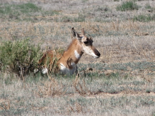


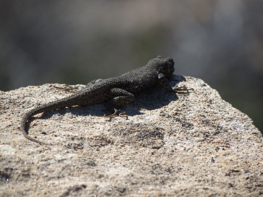


Copper Ridge Dinosaur Tracksite, near Moab, Utah
A very cool, short hike off 191 before you get to Moab. A few pronghorns, a Whiptail Lizard (very common in that area, we had a bunch of them in our campsite along the river!), and a black lizard that I can’t identify. My best guess is Western Fence Lizard, but if anyone can identify it, please let me know!
The landscape is beautiful out there. Huge tumbles of sandstone boulders and dry riverbeds. The green coloration in some of the sand/sandstone is a result of ancient marine deposits.
The dinosaur tracks are, of course, the main attraction. There are a set of sauropod tracks, with a few small theropod tracks next to them, and then a set of larger theropod tracks. The larger theropod was limping when it made the tracks.
#utah#moab#copper ridge#dinosaur tracks#sauropod#theropod#dinosaurs#pronghorn#whiptail lizard#lizards#photography
7 notes
·
View notes
Photo


Frisco, Colorado
This was a short walk from our hotel, where we stayed the first night of the trip. At about 9,000 feet, everyone was buzzing a bit from the altitude, but even so, I felt at home among the mountains. I knew I missed them, but I didn’t realize how much until we got into the Rockies. I didn’t want to leave.
#colorado#frisco#mountains#water#photography#rocky mountains#coming back through was worse#because i knew we were heading toward boring prairie alnd#instead of fun new stuff out west
0 notes
Photo
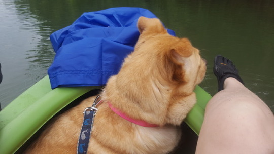


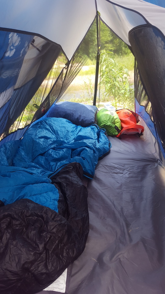


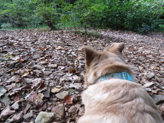
some pics from this weekend. took a 3 day camping trip to the meramec river in missouri with the extended family. mostly i took pictures of my dog, laika, because she's cute and i love her. but here also is my new backpacking tent (a tight squeeze with a big dog! but no worse than having her in my kayak :p ) and another dog, gwen, who made quick friends with laika and my cousin's daughter, penny, who just loved laika. all in all, a good trip with lovely weather.
#camping#missouri#meramec river#meramec river state park#dogs#family#phone photography#didn't take my camera on this one
2 notes
·
View notes