#Drakesbad
Photo
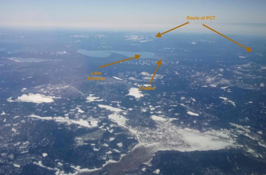
On February 13th, on a flight from Denver to Arcata, California we flew over Lassen Peak which provided an excellent view of the route of the PCT between the Feather River and Lassen Volcanic National Park. Most striking to me was the very low snow coverage of an area that should normally be almost entirely snow-covered in mid-February.
This stretch of the PCT includes such notable landmarks as the PCT mid-point, the crossing of Hwy 36, Drakesbad, and the old Noble Wagon/Emmigrant Trail.
[Double-click on the photos to get a larger view.]
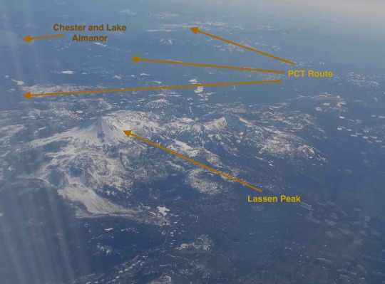
#PCT midpoint#Hwy 36#Drakesbad#Chester#Lake Almanor#Lassen Peak#Noble Wagon Trail#Lassen Volcanic National Park
4 notes
·
View notes

Text
1600 miles (Gaelen)
I reached Sawyers Bar Road at mile 1599.7 on August 14th and caught a ride into the town of Etna. Unfortunately my feet were in pretty bad shape when I reached town and were feeling so achy and tender that I stayed in town to recover and had a hard time walking for a few days.
A lot has happened in the last 300 miles. When I hit the halfway point I was admittedly starting to feel pretty crumby, and was worried I might be hitting my physical limits. It was getting harder and harder to get moving each morning and harder and harder to get back up after stopping for a break.
Despite running into some friends I hadn't seen in several hundred miles (Oilspill & Footloose near Chester and Buddy & Silver near Drakesbad Guest Ranch) I was starting to feel a bit down about the trip until I had the sudden realization one day that in my efforts to make good mileage and short efficient resupplies I had lost track of getting enough protein each day. At the very next opportunity I made sure I had a good solid 80 grams of protein for each day in my food supply and within a couple days was starting to feel like my old self again.
Hiking through the Shasta Trinity Wilderness area was amazing. Mt Shasta is an impressive sight (one to rival Mt Rainier) and the mountain is visible for a significant portion of the trail.
The night before crossing I-5 I was hit by a thunderstorm during the night. A gust of wind knocked a dead branch loose which fell on my tent. Luckily the rain had softened the ground and a tent stake came out and the tent collapsed rather than tearing. The rain had just hit a lull, so it was quick work to get out of the tent and re-stake it. Once the tent was back up the night passed uneventfully (other than the thunder, lightning, and rain).
Everything seemed to be going well after I left Mt Shasta city at I5. It was 4 days from there to Sawyers Bar Road. I have gotten used to having a little bit of swelling in my feet in the morning, which quickly goes away once I'm up and moving about. However for the two days before I got to Etna the swelling took longer and longer to go down, and I started feeling so twinges and pain in my feet. My feet were still a bit swollen and tender when I got into Etna, but the next morning the swelling was extreme and did not go away all day.
I rested on town for several days and got to see a lot of friends as they passed through Etna, including Wildcard (previously Coolaid), Hot Take, and Big Money. After my feet started feeling better I hit the trail again. However the pain came back pretty quickly and I only made it 11 miles that day. The other thing I wasn't expecting was that my left hip was incredibly sore and wasn't moving right.
The next morning my feet were very swollen again. I spent almost 6 hours in camp that morning evaluating things. I realized my hip wasn't moving right and was causing alignment changes in my knees, ankles, and feet, and that the swelling in the feet was a symptom of my hip. After a lot of thought and deliberation I came to the unfortunate conclusion that I needed to get off the trail at least long enough to properly focus on my hip.
So the next morning I hiked back to Etna.
I am now off trail after 1610 miles, focusing on healing. I am currently hopeful that with a couple weeks of focused work I will be able to head back to the trail.
2 notes
·
View notes
Video
flickr
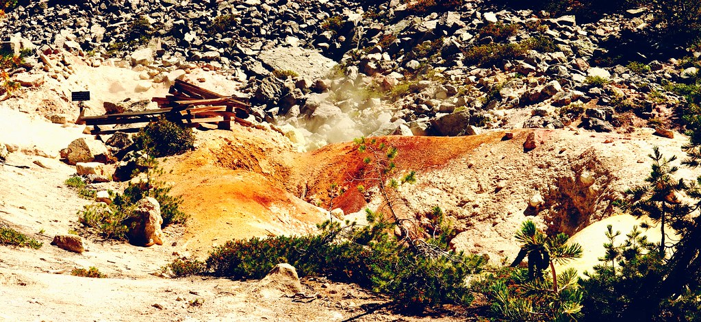
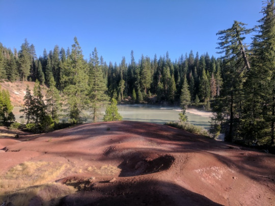
Devil's Kitchen by Dan Gildor
Via Flickr
We started the morning on the north side of Lassen Volcanic National Park in Old Station. After a huge bowl of oatmeal at JJ's Cafe, we headed to Subway Cave nearby--a lava tube that is open to the public. Make sure you bring a flashlight and a jacket as its pitch dark and 46 degrees inside! Getting there early ensured that we had the place entirely to ourselves.
From there, we drove around the backside of the park, stopping in Westwood before we headed to the Drakesbad Guest Ranch, from where we were scheduled to go on a horseback ride. Though the original plan was to go to Terminal Geyser (a 3 hour ride), some of the guests arrived late necessitating a change in plans. Instead, we went out to Devil's Kitchen, the park's second largest display of geothermal features and only a 2 hour ride.
After the ride and the short hike down into Devil's Kitchen, we soaked in the hot springs at the Guest Ranch while hikers on the Pacific Crest Trail stocked up on their supplies.
The day ended with a fabulous pizza at Tantardino's Pizzeria in Lake Almanor Peninsula.
#drakesbad#geothermal#lassen volcanic national park#devil's kitchen#original photographers#photographers on tumblr#artists on tumblr#lensblr#imiging
0 notes
Text
As Dixie Fire size doubles inside Lassen park, crews fight to keep flames from Manzanita Lake, Old ...
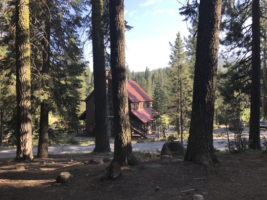
Built in 1900, Drakesbad Guest Ranch is the only lodging within Lassen Volcanic National Park. “It's going to require some heavy equipment to get to ...
from Google Alert - Heavy Equipment https://ift.tt/37KwZSm
0 notes
Photo

Drakesbad Out of @anzulaluxuryfibers Burly And with @katrinkles_knitting_jewelry buttons
1 note
·
View note
Photo
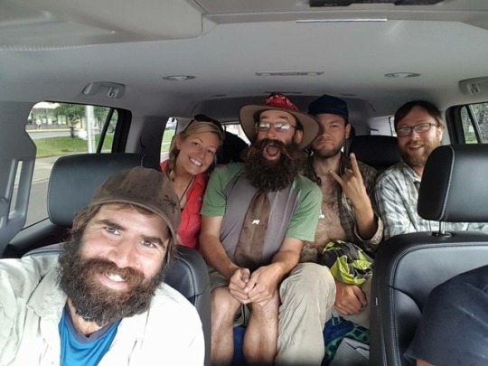


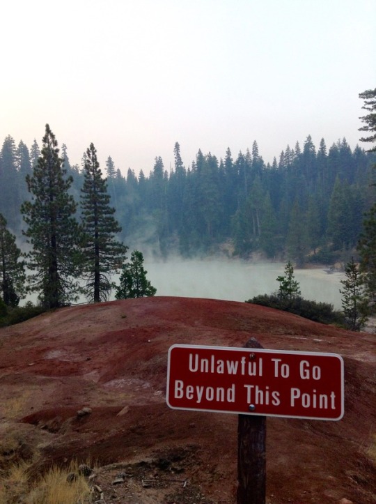
Day 95.
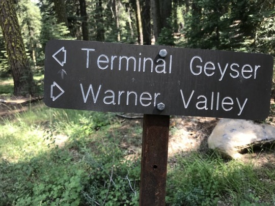
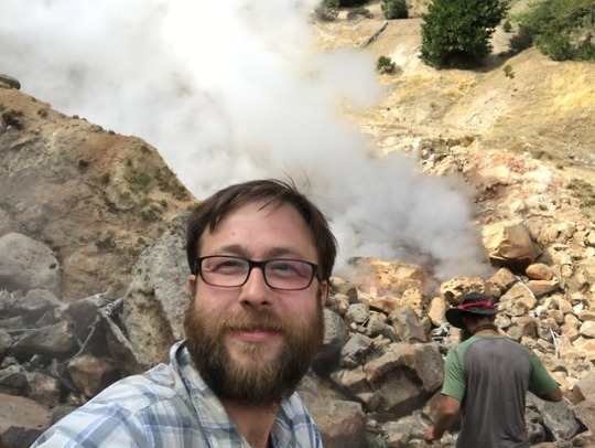
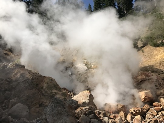
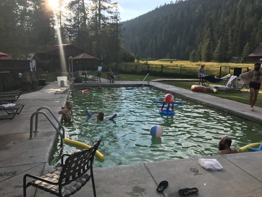
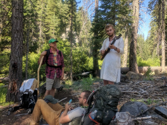
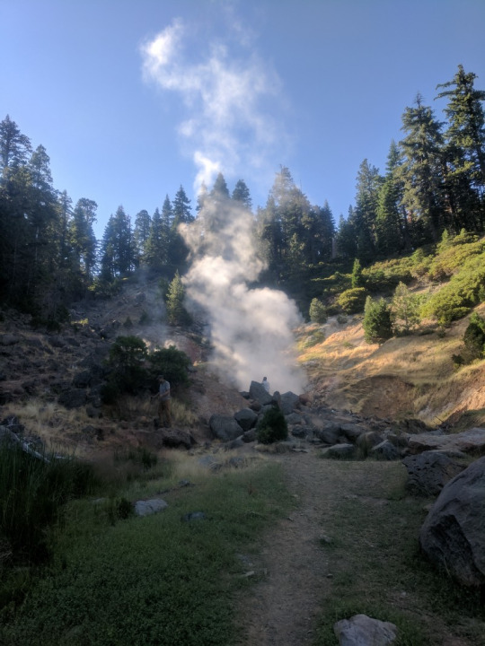
There’s nothing like waking up to a real breakfast and coffee. We all had our respective breakfasts, packed up and were picking up any last minute items. We had picked up another hiker from Romania named Thomas whom I had crossed paths with a couple of times and he seemed cool as well as one other guy I hadn’t met. It is always like herding cats with a group this size and we never end up getting out to the trail early on mornings like this. But we did have one stroke of luck to make things easier… there was one lady in a giant white SUV who gave like 5 of us a ride all at once back to the trail. There was a surprising slight drizzle and it felt like a much needed break from the heat we had been having. We all made it and headed out. Eventually, we started seeing signs relating to all of the geothermal activity in the area, we were afterall in Lassen Volcanic National Park. The first cool thing we encountered was a “geyser” called Terminal Geyser. It wasn’t like you would think of Old Faithful or anything where water gushed out, but it there was a lot of steam rolling out and extremely hot water flowing out and down in a small creek. Perk and Dixie were with me and Perk being the scientist he is even got down to the water to test the temperature to see how hot it was. Hot enough to cook food in turns out and needless to say could burn you if you touched it. We played around the Geyser for a bit taking time lapse videos and such and since the signal was good, the timing OK, and I wanted to enjoy this for a bit, I facetimed with Angie, who was with her friend Amber in a car. They stopped and chatted for a while and I showed them video of the steam rolling out behind me. The day was getting on and so did we. It wasn’t far from there when we came to Boiling Springs Lake. This was also pretty cool. It was a whole lake of hot and acidic water where nothing lived other than perhaps some bacteria maybe. There were parts near the bank where mud bubbled and spit. You could hear and see all of this. Many of the hikers went down near the waters edge. I was a little apprehensive to be honest since I had heard pf people dying in such ways: falling in as a thin crust gave way to the boiling water below… yeah not really worth the risk for me as there were warning signs all over the place. I did eventually step down carefully to the edge of the water at one spot to see the boiling mud, but yeah, I didn’t push my luck as far as others, and luckily nothing bad happened. It was around dinner time when we finally made it to Drakesbad Guest Ranch. This place we a pretty nice stop. I have to give them credit for allowing us to come to their place and hang out… I mean its seems like a pricey nature get away for city folk complete with a geothermally heated pool. And although I give them all the credit in the word for their generousity here, they did make you feel like second class citizens. They had a separate shower for hikers out back of the nice shower/changing rooms for their paying customers and we were only allow to swim there after a certain hour (when they started serving dinner to their guests). But we got showered and jumped into the pool and it was pretty nice. Probably would have been nicer in cooler weather, but was pretty comfortable and a nice way to spend the evening and changing it up from the norm for sure. So after swimming and chatting with a few locals who were also hanging out there, we showered again and came back up to the restaurant part. We basically were served the leftovers from their guests dinner and we were at the mercy of their guest as to what was left over… we had heard stories of some pretty amazing food though, so we were excited to see what they had in store for us. Again it made us feel like second class citizens, but honestly it wasn’t cheap at all, over $20 with a drink and a tip. First we were served huge bowl of salad, and although that’s not really what you’re waiting for, it was nice to cram down for fresh green leafy salad and get some of those vitamins that you’ve been missing out on with trashy hiker food nearly every day. We were a little disappointed to see kind of normal chicken breast, stuffed bell peppers, potatoes and squash/zucchini as our main meal as we had heard of some amazing meals from other hikers… but when it was all said and done it was pretty good and I had eaten to the point of excess before I had left. One thing that also kind of sucked was that this place wouldn’t let us camp anywhere on their property for free. So even though it was getting dark by the time we left the table. We again shouldered our packs and had to head a couple of miles further down trail to a campground. It was a pretty good sized campground and we all got to set up pretty close together. The guys gut a fire started and there was a lot of discussion going on about tomorrow. I was full and beat and wanted to get to sleep early so I could get a lot of sleep. Before I did, I heard some of the people start talking about these personal challenges that sounded terrible to me. Dixie straight up asked me if I wanted to join her, perk, and I think Thomas or the other new guy, in doing a “24-hour challenge”. They were going to wake up and see how far they could push themselves and see how many miles they could hike in 24 hours. It was a personal challenge but they were also in a bit of a competition amongst themselves. I without hesitation said that that idea sounded terrible and that I had no interest in doing this. It seemed pretty counterproductive to me to push yourself that hard to just hit an arbitrary number and then have to spend extra time to rest and recover, seemed like normal hiking would be the better pace and ultimately you’d cover more miles when it was all said and done. I figure normal paced hiking would let us catch up to them while they recovered and wouldn’t be a big deal, but I had pushed so hard to catch up after my tailbone issue and honestly just wanted to be around my friends and it was a little frustrating that we had just reunited and now this competition was going to split us up and stagger us yet again right off. But their minds were made and that was that. I put in earplugs and I think I was the first to sleep.
NOTE: We were had been happy to have recently survived the Sierras and all the crazy snow, and now we were hearing about all these crazy fires. We saw this report and I took a screenshot to show how bad they were getting and how bad the air quality was due to all the smoke.
0 notes
Text
Entering Lassen
2 July 2017
I hiked a lot this day. Felt like I was doing better miles. Maybe. Who knew.
Ran into some day hikers.
Entered Lassen National Park this day.

Took a side trip to Terminal Geyser.
Passed by Boiling Spring.
Paid too much for a meal at Drakesbad.
Met some cool hikers and camped in a campground.
That is all.
7 notes
·
View notes
Text
Input sought on replacement of Drakesbad <b>septic system</b>
At Drakesbad, the wastewater system consists of a gravity sewer collection to a septic tank and effluent pump station that delivers wastewater up to a ...
from Google Alert - Septic tank https://www.google.com/url?rct=j&sa=t&url=https://www.redbluffdailynews.com/2019/04/02/input-sought-on-replacement-of-drakesbad-septic-system/&ct=ga&cd=CAIyGjhkNzcyMWM4YzFlNGI3OTU6Y29tOmVuOlVT&usg=AFQjCNEzsHI5k5QXZAV8KPusXfZ6WOTbdg
0 notes
Photo
Don’t go! Also, if you’re a vegan thru hiker, skip the meal at Drakesbad (mashed potatoes - prolly made with butter as I was sick for a few hours after, and broccoli florets for $14 while the carni’s got prime rib), tho the hotsprings are ok. You’re better off hitching into Chester the next day and hooking up a no-cheeze pizza at the Pizza Factory, and heading to the awesome candy store across the street...
2 notes
·
View notes
Text
My Other Nearly ‘Bests’
By Howard Shapiro
It is challenging, really challenging to consider and pick one’s favorite, the best of the best, places, experiences, and people encountered on a 2,650 mile hike. I attempted to identify my ten ‘best’ in previous posts. Following are some of the others that didn’t make my cut in no particular prioritized order. The fact remains that even these ‘also rans’ are significant.
Mount Adams through the Goat Rocks Wilderness- This is one of those stretches I want to re-visit. At the time I experienced it I had never encountered the kinds of challenges found in this snowy high place that led to the exposed reaches of Goat Rocks.Being up close and personal with Mount Adams was breathtaking. The long distance snow travel that we did around the flanks of Adams were tough but confidence building. This stretch displayed the path ahead with views of Mount St. Helens and Mount Rainier. This stretch was super charging for the days ahead.
Glacier Peak Wilderness- This was so stunning in so many ways. As we hiked in to the valley where Kodak Peak welcomed us and the many deer stood as sentinels watching our every move we were simply blown away by the setting. The late afternoon light made the greens nearly neon, the rocky outcrops stood out in sharp contrast. That night we were visited by numerous deer wandering out of the fog that had settled in to get a lick or two off of our salty gear.
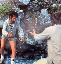
Stream crossing below Mount Daniel- This was the ultimate test of our stamina, friendship, and trail knowledge. We arrived at this creek late in the day. The water was flowing fast and creek appeared full from the snow melt from above. We elected to wait and cross early the next morning when the volume of water may have shrunk a little in the night chill. We cowboy camped on the trail next to the constant sound of the water we were destined to cross at first light. With the confident leadership of our partner Jim Peacock, Rees and I summoned the trust and courage to literally take the leap.
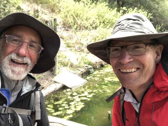
Timberline to Lost Lake- Hiking with my wife and daughter was a dream I had long held. My dream come true was enhanced in that we were joined by our dear friends Rees Hughes, his wife Amy Uyeki, and their daughter (and one of my daughter’s best friends) Chisa. This trip was documented in the published ‘Pacific Crest Trailside Reader’ in the Oregon/Washington volume under the title ‘Hiking in 5-7-5′. Hiking together around the flanks of Mount Hood was magic. Here we were with our nearest and dearest sharing some of the experience of backpacking along the PCT that they had heard about so often. Amy had accompanied Rees and I on a much earlier trip in the Pasayten but many years had passed since then. Now here we were together laughing and loving every minute. What was among the most striking memories of this trip was everyone’s perspectives of where we were and what we were doing. Our six shared perspectives made this time especially memorable and one I would never exchange.
Lassen National Park-Drakesbad- Rees has already featured this particular memory in his ‘best’ posts. All I can say is this moment at Drakesbad set the bar for ‘trail magic’ and whatever karma/magic was at work during this hike it continued for another day or so.After an amazing meal and conversatoin with some nearby diners we proceeded to continue on to our eventual goal of Belden. That was not to be.
On this hike we had Rees’s cousin and the son of one of our dear friends joining us. Unfortunately they were both experiencing foot problems. In the end we decided the best way to preserve the otherwise good experience we were enjoying. The determination was made to exit at Highway 36 near Chester.We had left a car near Belden so now we faced getting at least one of the four of us there to retrieve the car. At Highway 36 we found a little trail magic stash and a business card with the name of a trail angel. In the end she and her husband not only ‘rescued’ us but willingly drove us to Belden. Our great fortune in light of some physical setbacks was not lost on any of us. This was trail magic at its best!
Quincy-La Port Road- Highway 36- This hike stands out for several reasons. First it was my best friend’s final section toward completing the PCT and I was invited to be a part of that experience. Second, I was introduced to Bruce and Mona Johnston who are some of the finest people you can ever meet. Lastly, we got to enjoy the hospitality of the lovely trail angels from Chester who we had met several years before. (see above) Hiking this with Rees and Bruce was a real joy. Completing the PCT with Rees was both an honor and thrill for me. The hike itself was not without some challenge but we overcame them.What could be better than that?!
Hiking with Billie and Doug 2017,2019- So much of my PCT experiences have been shared with Jim Peacock and Rees Hughes. As I began my effort to complete the PCT, two longtime friends offered to join me on parts of my remaining sections. Billie bravely offered to accompany me from Pines to Palms on to I-10 near Palm Springs. Another time he would join me from Tehachapi to Walker Pass. Doug had always wanted to be a part of some of my PCT experience. Due to work restraints that never worked out. Now in 2019 we would get that chance. Doug and I walked two different sections, one from near Ashland to Seiad Valley and another from Hat Creek Rim to Parks Creek Road near Mount Shasta. What really stands out for me is how these experiences deepened already strong friendships. A bond was forged that won’t ever break because of our times together.
Hiking alone 2017 and 2018- If you have read this post this far you have likely noticed that I have some deep connections with the people who I have shared the trail with over the years. In 2017 and again in 2018 I walked by myself. Altogether it was probably only less than ten days total. However in that time alone, I was able to recognize the strength I have slowly gained over the years being in the back country with partners. Despite.my trepidation for going it alone, I found being by myself was enlightening. I could think long and hard about all kinds of things. I was able to take stock in my self. I am all the better person for having had these experiences.
#Mount Adams#Goat Rocks Wilderness#Glacier Peak Wilderness#Mount Hood#Lassen National Park#Drakesbad#Highway 36 Chester#Quincy La Port Road#Friendship
4 notes
·
View notes
Text
The questions surrounding Pacific Crest Trail resupply in this year’s Pacific Crest Trail Thru-hiker Survey were expanded to better answer what’s one of the trails biggest challenges (at least in the planning stages).
Hopefully this information will help to lessen the unnecessary stress that hikers put themselves through when attempting to plan how to get more food and supplies into their packs whilst tramping through PCT wilderness.
Remember, this information is sourced from actual PCT hikers and is more than just one dude’s opinion (I’m that dude), but if we come across any anomalies in the data I will be sure to add my two cents (because I can’t afford more).
NOTE: A list of the different categories I broke hikers into and how they are identified can be found at the end of this post.
What your future holds.
TO MAIL OR NOT TO MAIL?
First, hikers think they must decide how many resupply boxes to send.
THIS IS WRONG.
Unless you’ve chosen to mail yourself ALL your resupply boxes, which I would definitely NOT recommend doing unless you have a very legitimate reason (e.g. you only eat Vegemite and dehydrated free-range poultry), then the only boxes you’re going to want to concern yourself with sending before you begin your hike are those you’ll need in the desert.
Instead, what you do is MAIL YOURSELF BOXES FROM THE TRAIL. When you get to a stop with a large and affordable enough selection of hiker food you buy yourself an extra resupply, pack it into a box, and mail it up the trail.
This saves you the stress of needing to pack everything into boxes beforehand and allows you the flexibility to mix up your resupplies on the trail (because chances are your taste/diet will change as you being to turn into an unstoppable hiking machine).
STRATEGY | 75% mailed SOME resupply boxes, 16% mailed ALL, 9% mailed NONE
FINISH – AVERAGE BOXES SENT | 12 (σ = 8.5)
Let’s go with the average and mail 12 resupply boxes. Where do we want to send them?
According to this year’s class, the places you’re going to want to mail your twelve resupply boxes are (in geographical order from south to north):
Warner Springs (Desert) – Mile 110
Kennedy Meadows (Sierra) – Mile 703
Sierra City (NorCal) – Mile 1,198
Crater Lake/Mazama Village Store (Oregon) – Mile 1,830
Shelter Cove (Oregon) – Mile 1,912
Big Lake Youth Camp (Oregon) – Mile 2,002
Timberline Lodge (Oregon) – Mile 2,107
Trout Lake (Washington) – Mile 2,234
White Pass (Washington) – Mile 2,303
Snoqualmie Pass (Washington) – Mile 2,402
Stevens Pass/Skykomish (Washington) – Mile 2,476
Stehekin (Washington) – Mile 2,574
RESUPPLY BOXES
So for the ENTIRE STATE of California you are only sending yourself THREE BOXES.
A lot of hikers also say that they wish they would have SENT BOXES FROM THE TRAIL instead of preparing all their resupplies ahead of time.
I know this might sound like a scary idea (does it really?), but trust me, it’s a smart move.
TOTAL PER SECTION:
DESERT: 1 (Warner Springs)
SIERRA: 1 (Kennedy Meadows)
NORCAL: 1 (Sierra City)
OREGON: 4 (Crater Lake, Shelter Cove, Big Lake Youth Camp, Timberline Lodge)
WASHINGTON: 5 (Trout Lake, White Pass, Snoqualmie Pass, Stevens Pass, Skehekin)
That’s it? Yes, that’s it.
PRO TIP: Use something flashy on your box so it stands out.
And the idea that you don’t need to mail a lot of resupply boxes isn’t only coming from people who mailed themselves far too many. An entire 12% of people who sent FEWER than the average of 12 said they would have preferred fewer boxes when asked what about their resupply strategy they would have changed.
I also asked hikers where they would have rather mailed themselves a box instead of buying locally. This could be either because the selection isn’t very good, the prices are high, or the store owners are assholes.
The top responses were (in geographic order from south to north):
Warner Springs (Desert)
Agua Dulce (Desert)
Vermilion Valley Resort (VVR) (Sierra)
Kennedy Meadows North (NorCal)
Sierra City (NorCal)
Belden (NorCal)
Mazama Village Store (Crater Lake) (Oregon)
Stehekin (Washington)
Agua Dulce, VVR, Kennedy Meadows North, and Belden did not make the “send a box here” list, so if you’re planning on resupplying at one of these locations (our “average resupply plan” is below) then you may want to consider sending an additional box.
Lastly (for this section), I asked what CHANGES hikers would make to their resupply strategies?
Mail fewer boxes (overwhelmingly).
Mail boxes from on then trail instead of ahead of time.
Send less food in resupply boxes.
Resupply more frequently.
WHAT FOOD TO SEND
Okay, but once you have your boxes, what should you be PUTTING INSIDE them? Some of the TOP COMMENTS I got from hikers about their resupplies said the following:
More variety in boxes (you can only eat so many Snickers and tortillas)
More dehydrated foods in boxes (if you have the means, then do it)
Less food in boxes (you’ll be stopping more than you think)
Healthier food in boxes (empty calories only get you so far)
More snacks, fewer meals in boxes (forget about the idea of “meals”)
#gallery-0-5 { margin: auto; } #gallery-0-5 .gallery-item { float: left; margin-top: 10px; text-align: center; width: 33%; } #gallery-0-5 img { border: 2px solid #cfcfcf; } #gallery-0-5 .gallery-caption { margin-left: 0; } /* see gallery_shortcode() in wp-includes/media.php */
Looking for meal suggestions? The favorite (and least favorite) foods as reported by hikers was as follows:
FAVORITE SNACKS:
Tortillas
Snickers
Ramen
Candy
Nutella
Mountain House
“NEVER AGAIN” FOODS:
Clif Bars
Idahoan Potatoes
Pop-Tarts
Assorted bars
Tuna
Oatmeal
HOW FREQUENTLY TO STOP
Another question on the resupply agenda is “How often do I want to resupply?”
This is incredibly difficult for hikers to accurately predict before starting the trail because few people know what their pace is going to be or what their still unknown trail friends will want to do (just remember to hike your own hike).
Stopping more frequently means less time spent hiking (which before starting your hike might sound like a bad thing), but it also means that you will not be carrying as much weight (in food) between your resupplies (lighter = better).
So how many stops did the Class of 2016 make on their thru-hikes?
FINISH – AVERAGE RESUPPLY STOPS MADE | 26 (σ = 6.5)
And in their comments, many said they would have liked to resupply MORE OFTEN.
So let’s say that we’re going to just take the average plus one standard deviation to accommodate for the “more often” factor. That gives us a total of 32 resupply stops. That means you’re resupplying EVERY 83 MILES (134 km) on average. If you don’t want to carry more than seven days worth of food (which is a lot), then you would need to be doing an AVERAGE OF 11.8 miles per day (18.9 km).
How many miles per day did this year’s PCT Class average? 19.6 miles / 31.5 km.
Seems reasonable enough.
Good thing I haven’t begun to hate Snickers yet.
THE AVERAGE PCT RESUPPLY PLAN
Based on survey responses we can piece together what an “average” Pacific Crest Trail hiker’s resupply looked like for a 2016 thru-hike.
Now that we know how many boxes we’re mailing (12), where we’re mailing them to, what’s going in them, and how often we want to stop for resupplies, we can focus on arguably the most important question: where exactly are we going to stop?
A look we shall take, yes?
NOTE: The percentage of hikers who resupplied at each of the following places has been coded as follows: OVER 66%, 33-66%, LESS THAN 33%. Also, stops are listed in geographical order from south to north.
DESERT
Campo (42%)
Mount Laguna (88%)
Julian (55%)
Paradise Cafe (77%)
Warner Springs (90%)
Idyllwild (94%)
Anza (1%)
Cabazon (22%)
Big Bear City (44%)
Big Bear Lake (40%)
Big Bear Hostel (27%)
Wrightwood (85%)
Acton (47%)
The Saufley’s/Agua Dulce (78%)
The Anderson’s (70%)
Hikertown (74%)
Tehachapi (80%)
Majove (18%)
Ridgecrest (3%)
Kernville (1%)
Onyx (7%)
Lake Isabella (45%)
SIERRA
Kennedy Meadows (94%)
Lone Pine (35%)
Independence (45%)
Muir Trail Ranch (15%)
Bishop (57%)
Vermilion Valley Resort (49%)
Red’s Meadow (50%)
Mammoth Lakes (75%)
Tuolumne Meadows (85%)
Yosemite Valley (1%)
Lee Vining (5%)
Sonora Pass Resupply (1%)
Bridgeport (16%)
Kennedy Meadows North (45%)
Markleeville (3%)
For more on the Kennedy Meadows to Vermilion Valley Resort resupply, find my detailed post here.
If you’re interested in my PCT resupply for each section then check out the following posts:
PCT Progress Report I: The Desert
PCT Progress Report II: The Sierra
PCT Progress Report III: NorCal
PCT Progress Report IV: Oregon
PCT Progress Report V: Washington
NORTHERN CALIFORNIA
South Lake Tahoe (90%)
Echo Lake (26%)
Tahoe City (9%)
Soda Springs (7%)
Truckee (32%)
Sierra City (90%)
Quincy (20%)
Chester (57%)
Drakesbad (45%)
Old Station (71%)
Belden (83%)
Burney (38%)
Burney Falls Guest Ranch (2%)
Burney Falls (64%)
Castella (42%)
Dunsmuir (23%)
Mount Shasta (55%)
Etna (73%)
Seiad Valley (85%)
OREGON
Callahan’s (49%)
Ashland (85%)
Fish Lake (22%)
Lake of the Woods Resort (3%)
Mazama Village Store (Crater Lake) (95%)
Diamond Lake Resort (10%)
Shelter Cove Resort (79%)
Odell Lake Resort (7%)
Elk Lake Resort (38%)
Sisters (29%)
Bend (50%)
Big Lake Youth Camp (61%)
Olallie Lake Resort (55%)
Government Camp (13%)
Timberline Lodge (86%)
Cascade Locks (93%)
Hood River (8%)
Portland (1%)
WASHINGTON
Trout Lake (51%)
White Pass (93%)
Packwood (23%)
Snoqualmie Pass (96%)
Stevens Pass/Skykomish (71%)
The Dinsmores (22%)
Leavenworth (4%)
Stehekin (93%)
Mazama (9%)
Winthrop (10%)
That’s a lot of information.
How would our average Pacific Crest Trail thru-hiker have used his or her 32 resupply stops based on this information?
It would look something like this (COLORED NAMES indicate that sending a box was prefered by this year’s class):
DESERT:
Potential resupply options.
MILE 110: Warner Springs
MILE 179: Idyllwild
MILE 265: Big Bear City
MILE 364: Wrightwood
MILE 454: Agua Dulce
MILE 558: Tehachapi
MILE 652: Lake Isabella
SIERRA:
MILE 703: Kennedy Meadows
MILE 790: Independence
MILE 831: Bishop
MILE 903: Mammoth Lakes
MILE 942: Tuolumne Meadows
MILE 1018: Kennedy Meadows North
NORTHERN CALIFORNIA:
Sierra City’s overpriced store.
MILE 1093: South Lake Tahoe
MILE 1198: Sierra City
MILE 1334: Chester
MILE 1378: Old Station
MILE 1424: Burney Falls
MILE 1507: Mount Shasta
MILE 1606: Etna
MILE 1662: Seiad Valley
OREGON:
MILE 1727: Ashland
MILE 1830: Mazama Village Store (Crater Lake)
MILE 1912: Shelter Cove Resort
MILE 2002: Big Lake Youth Camp
MILE 2107: Timberline Lodge
MILE 2155: Cascade Locks
WASHINGTON:
Seiad Valley store.
MILE 2234: Trout Lake
MILE 2303: White Pass
MILE 2402: Snoqualmie Pass
MILE 2476: Stevens Pass/Skykomish
MILE 2574: Stehekin
WHERE DO WE LIKE?
I also asked about hikers’ FAVORITE and LEAST FAVORITE resupply points. Here’s what we came up with (for each section):
FAVORITE RESUPPLY POINTS
DESERT: Idyllwild
SIERRA: Bishop
NORCAL: South Lake Tahoe
OREGON: Ashland
WASHINGTON: Stehekin
HONORABLE MENTIONS
Mammoth Lakes (Sierra)
Wrightwood (Desert)
LEAST FAVORITE RESUPPLY POINTS
DESERT: Hikertown
SIERRA: Kennedy Meadows
NORCAL: Belden
OREGON: Shelter Cove
WASHINGTON: Snoqualmie Pass
HONORABLE MENTIONS
Seiad Valley (NorCal)
Sierra City (NorCal)
And lastly, what about hitchhiking into town? I asked hikers what resupply stops (if any) they had difficulty making it to from the trail. The top responses were (from south to north):
Lake Isabella (Desert)
Independence from Kearsarge Pass (Sierra)
Bishop (Sierra)
Etna (Northern California)
Trout Lake (Washington)
If there is ANYTHING you can think of that would make this information more useful (or any more resupply-related cross-referencing you would like to see), then please LEAVE A COMMENT and let me know.
FOR MORE ON PCT RESUPPLY, CHECK OUT THESE POSTS.
Here are the labels used to differentiate hiker segments in this post:
FINISH: Everyone who completed the entire PCT (regardless of direction hiked)
#mc_embed_signup{background:#fff; clear:left; font:14px Helvetica,Arial,sans-serif; width:100%;}
ENTER YOUR EMAIL TO PARTICIPATE IN NEXT YEAR’S SURVEY
PCT Class of 2016 Survey: The Resupply Guide The questions surrounding Pacific Crest Trail resupply in this year's Pacific Crest Trail Thru-hiker Survey were expanded to better answer what's one of the trails biggest challenges (at least in the planning stages).
0 notes
Text
Drakesbad is open to hikers and seems this year, with new management, is more hiker friendly than with the last managers.
Drakesbad is open to hikers and seems this year, with new management, is more hiker friendly than with the last managers.
I saw this information online and asked Piper’s Mom if I could post it up here and so here it is: Hope this helps you along your hike! “Drakesbad is open to hikers and seems this year, with new management, is more hiker friendly than with the last managers. Breakfast and lunch are about $12-14. There is a special hiker dinner for about $14 and you do not need reservations. If you want the…
View On WordPress
0 notes
Text
Go nuts for national SQUIRREL month!
It is difficult not to love squirrels – they are just simply AWESOME!
Big bushy tails, relentless nut foraging, endearing nut hiding/losing – what is there not to love?!
My love of squirrels was fuelled three-fold during our recent trip to California, where the State just seems to be overrun by these adorable little critters. Unlike here in the UK, where the invasive eastern grey squirrel has…
View On WordPress
#californian ground squirrel#chickaree#chipmunk#douglas squirrel#Drakesbad#golden-mantled ground squirrel#grey squirrel#Lassen#marmot#National Parks#pine cone#red squirrel#squirrel#Squirrel awareness month#western grey squirrel#Yosemite
0 notes
Photo

Drakesbad With @katrinkles_knitting_jewelry buttons
1 note
·
View note
Text
Wednesday, July 22nd - Day 91
We celebrated the halfway point yesterday in Chester with milkshakes (30 flavors!) and ice cream (a giant tower of vanilla dipped in butterscotch!), so there wasn't much need to celebrate again today, but we found out that Drakesbad, a popular resort in the middle of the woods, offers free showers, laundry, and hot spring access. Thus, the longest run-on sentence ever.
We hung out there for too long, waiting on our laundry, and hiked out around five thirty. Twenty minutes later, we were in the worst mosquito territory in a long time. Most of the time, mosquitoes get us when we stop hiking for a minute, but these ones are ambitious. They were swarming all over us, and no amount of swatting or slapping or sobbing seemed to help. I was bitten in the exact same spot on the back of my knee by four or five different mosquitoes.
Eventually, we set up camp, and dove into our tents. I can hear them whining outside, trying to get in. Chumps.
'Night.
1 note
·
View note
Last Seen Blogs

carry-on-my-wayward-gays
Mr Shadow the Purple

dabifixation
dabi's weed dealer

theblackmana
Short Rests

viridianevergarden
Rot & Bloom & Bones

herald-divine-hell
Writer of Leliana/Inquistior