#southeast arizona
Text

Night sky. Cochise County, Arizona. Photography by j.e.syme
173 notes
·
View notes
Text
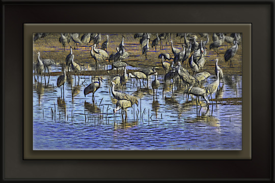
Sandhill Cranes
Sandhill Cranes (Whitewater Draw) — Photo-Artistry by kenne
Moving elegantly theystand in shallow waterof the whitewater draw.
Their loud, trumpeting call creating a cacophony of soundinspiring to nearby birders.
These crimson-capped birdswith their dignified manner appear in a stately procession.
— kenne
View On WordPress
0 notes
Text
The ulterior motive to keep Haiti in turmoil
#haiti#iridium reserves#economics development#dr. henry vixamar#south africa#bureau of mines and energy#southeast department#beloc#alan k. hildebrand#university of arizona#bainet#economy#job creation#national economy#radio métropole
255 notes
·
View notes
Text
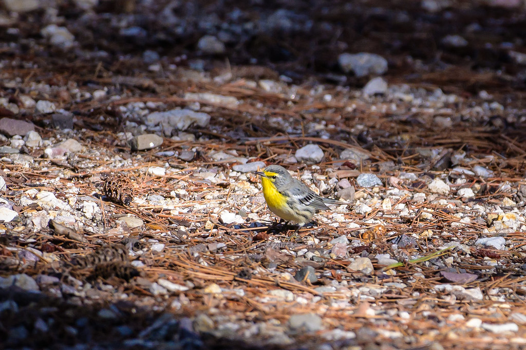
flickr
Got the rest of my Southeast Arizona Birding Festival photos uploaded, and it's not all hummingbirds either! Behold, a Grace's warbler!
11 notes
·
View notes
Link
Chandler might not be that well-known outside of Arizona, but it’s a beautiful suburb southeast of Phoenix. The city is a vacation destination with gorgeous parks, a vibrant downtown, championship golf courses, and numerous shopping and dining opportunities, all with a Sonoran Desert landscape.The area is also rich in culture and history, with the Gila River Indian Community located in South Chandler. There are so many things to do in Chandler, Arizona, no matter your age!
#Chandler#Arizona#well-known#outside of Arizona#beautiful suburb southeast#Phoenix#vacation destination
0 notes
Text


Arizona Monsoon Skies are Back...
at Willow Lake - well, part of the lake bed anyway. The water is gone at the Southeast end of the lake, and the reflections with them. The geese in the top photo announced their approach in time for a photo opp. They usually make their way to Watson Lake (about 1 mile behind me) around sunset.
#willow lake#original photography#photographers on tumblr#bkpic#arizona#canon 90d#sigma lens#sunset#geese
493 notes
·
View notes
Text
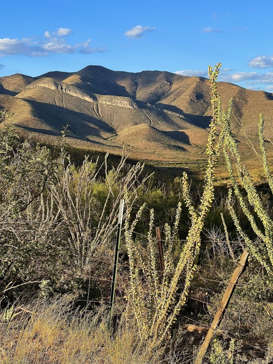
Arid limestone hills southeast of Bisbee, Cochise County, Arizona.
173 notes
·
View notes
Note
i think thats kudzu not petunia! unless theyre related, sorry
hmmmmm

this is what the flowers look like
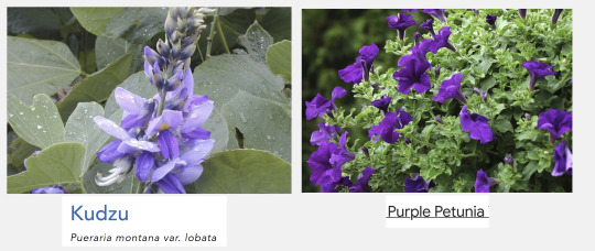
i knew it wasn't kudzu, but it looks like i was wrong about it being petunias as well. on closer inspection, it seems to actually be...

...morning glory! another famously tenacious climbing plant, native to central america. like kudzu, morning glory is hard to get rid of, in part because deer don't eat it, and it's on the invasive species list in arizona and virginia.
funnily enough, i was already very familiar with morning glory before sleuthing out those photos - not for its flowers, but as a popular stir fry ingredient in southeast asia :)

313 notes
·
View notes
Text

Lightning over the Chiricahua Mountains, looking east from southeast Arizona. 9/16/2023, Photography by j.e.syme
103 notes
·
View notes
Text
Doubtful Canyon Tree
Doubtful Canyon Tree — Image by kenne
You must trust and believe in people, or life becomes impossible.
— Anton Chekhov
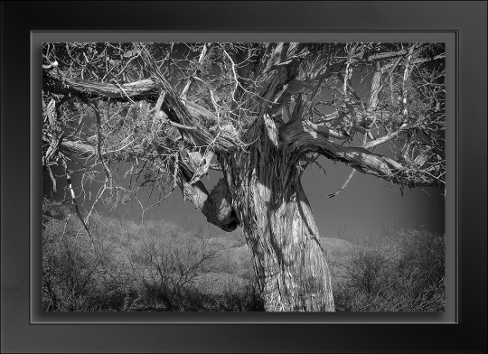
View On WordPress
0 notes
Text
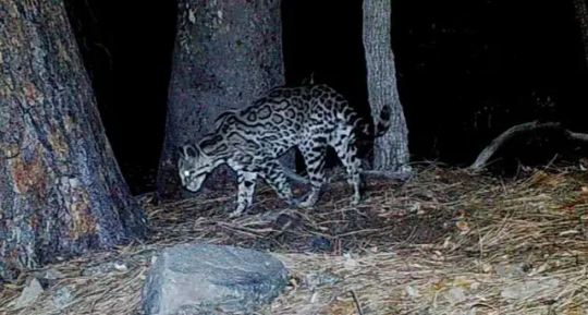
Trail cam confirms 'Lil' Jefe' the ocelot still roams the mountains of SE Arizona
Arizona’s lone confirmed ocelot still roams the Huachuca Mountains more than a decade after his first sighting there, state wildlife officials said after viewing a hobbyist’s trail camera video shot on July 4.
The footage was retrieved from a camera that Vail resident Jason Miller set out in a canyon on the south side of the southeast Arizona range, and is the latest of more than 100 shots gathered of the same male ocelot since 2012, Arizona Game and Fish spokesman Mark Hart said.
The most recent prior confirmed sighting of this cat in the Huachucas was last October...
Read more: https://www.azcentral.com/story/news/local/arizona-environment/2023/07/25/a-trail-cam-video-confirms-a-familiar-cat-still-roams-arizona/70467196007/
74 notes
·
View notes
Text
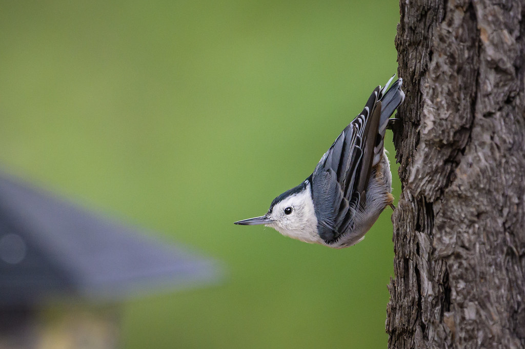
flickr
A white-breasted nuthatch checks to make sure the coast is clear before leaping over to an open bird feeder.
2 notes
·
View notes
Text
Hawaiian officials attributed the cause of catastrophic wildfires to alleged failures from the state's main power utility company and downed power lines this week after Democrats blamed the disaster on global warming.
In a lawsuit filed Thursday, the government of Maui County, Hawaii, alleged Hawaiian Electric Company (HECO) and its subsidiaries failed to properly power down live electrical equipment amid a red flag windstorm earlier this month. Due to this failure, downed power lines operated by the utility company sparked a series of deadly fires on the island, the lawsuit claimed.
"The lawsuit alleges that the Defendants acted negligently by failing to power down their electrical equipment despite a National Weather Service Red Flag Warning on August 7th," Maui County said in a release announcing its lawsuit.
"The lawsuit further alleges HECO’s energized and downed power lines ignited dry fuel such as grass and brush, causing the fires," the announcement added. "The lawsuit also alleges failure to maintain the system and power grid, which caused the systemic failures starting three different fires on August 8th."
EXPERTS THROW COLD WATER ON DEM CLAIMS THAT HAWAII WILDFIRES CAUSED BY CLIMATE CHANGE
Maui County argued in the lawsuit that HECO has a duty "to properly maintain and repair the electric transmission lines, and other equipment including utility poles associated with their transmission of electricity, and to keep vegetation properly trimmed and maintained so as to prevent contact with overhead power lines and other electric equipment."
However, Democratic lawmakers, a top White House official and Hawaii Gov. Josh Green have all blamed the event, which has claimed the lives of at least 115 people, on human-caused global warming.
ENVIRONMENTALISTS ARE BLOCKING FOREST MANAGEMENT METHODS SAVING ICONIC SEQUOIAS AMID YOSEMITE WILDFIRE
"This is devastating. This is a climate emergency," Sen. Ed Markey, D-Mass., an original sponsor of the Green New Deal, wrote in a post on X on Aug. 10. "I stand in solidarity with my friends and colleagues from Hawai’i — we must act fast, provide aid, and invest in a resilient and safe future."
"Heartbreaking fires in Hawaii! Scientists are clear that climate chaos wreaking havoc on ecosystems everywhere is the new norm," Sen. Jeff Merkley, D-Ore., said in a separate post. "We need to take action immediately or else it will get even worse."
Rep. Ro Khanna, D-Calif., who spearheaded a recent congressional investigation into Big Oil, called on President Biden to declare a "climate emergency" in response to the fires.
"My heart breaks hearing of the devastation in Maui," Rep. Cori Bush, D-Mo., added. "The climate crisis is here and it's killing people. It’s time for [Biden] to declare a climate emergency."
Sen. Dick Durbin, D-Ill., joined in, saying the wildfires were a "devastating view of our planet as we fail to adequately address the climate crisis."
And White House clean energy czar John Podesta called for policies to reduce carbon emissions to fight future natural disasters like the Maui wildfires which he said were "fueled by climate change."
HAWAII WINDS TO LESSEN AS FIREFIGHTERS ATTEMPT TO CONTAIN WILDFIRES; CONDITIONS REMAIN DRY AND BREEZY
"This summer has brought one climate disaster after another, from extreme heat in Arizona and Texas and across the Southeast, to floods in Vermont and upstate New York, to thick smoke from Canadian wildfires," Podesta told reporters on Aug. 16. "And all of us have watched in horror as the Maui fires have claimed over 100 lives — the largest loss of life of a fire in the last 100 years in America."
"To stop these disasters from getting even worse, we have to cut the carbon pollution that’s driving the climate crisis, and that’s what the Inflation Reduction Act is all about," he continued.
Experts, though, have thrown cold water on claims that climate change triggered the Maui fires.
Instead, they said the event was largely a result of years of poor forest and brush management, in addition to declining agriculture. Such conditions, they said, allow fires to spread rapidly and make fires harder to contain.
"Blaming this on weather and climate is misleading," said Clay Trauernicht, a University of Hawaii at Manoa professor and environmental management expert. "Hawai'i's fire problem is due to the vast areas of unmanaged, nonnative grasslands from decades of declining agriculture."
"These savannas now cover about a million acres across the main Hawaiian Islands, mostly the legacy of land clearing for plantation agriculture and ranching in the late 1800s/early 1900s," he continued. "The transformation to savanna makes the landscape way more sensitive to bad 'fire weather' — hot, dry, windy conditions. It also means we get huge buildups of fuels during rainy periods."
42 notes
·
View notes
Text
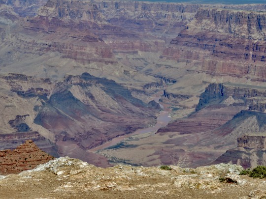
View in the southeast corner of Grand Canyon National Park, Arizona, 2014.
18 notes
·
View notes
Text
bat of the year 2023 round four


Painted Bat (Kerivoula picta) is a distinctive bat of southeast Asia with orange and black markings. Often referred to as the Halloween bat due to its coloration, this bat is believed to use its bright colors as camouflage as it blends in with dried leaves and flowers as it roosts.
Pallid Bat (Antrozous pallidus) is a native of the more arid and rocky parts of North America, from just barely into Canada in the north all the way down south into Mexico. They are well known for eating the most venomous scorpions in North America, the Arizona bark scorpion, but they have been seen eating nectar from some kinds of cacti (cardón cactus in particular).
72 notes
·
View notes
Photo

One of the things we do very well here in my part of Arizona is wide open spaces. Cochise County is as big as Connecticut and Rhode Island combined, with a population of fewer than 130,000 people, so we all have plenty of elbow room. Isolation and vast distance is kind of our thing. Even so, it’s difficult to express how extremely out of the way you have to go to reach this roadside pony ride. It is on a road in the southeast corner of the county that hugs the border with Mexico – the sort of road you can drive on for miles without passing another car, or habitable structure, or even a power line. If you want to check it out for yourself the coordinates are 31° 21′ 54″ N, 109° 23′ 33″ W. It may not be the at the end of the world, but you can definitely see it from there.
Still, at five minutes for just 25¢, it just might be worth the drive.
87 notes
·
View notes
Last Seen Blogs

tee-mo-tey
Anyone Up For A CMBYN 2?


sarahbourn
My World

icnnetwork
India Core News

incorrect-obeyme
Incorrect Obey Me Quotes