#taal lake
Text

Lightning through the ash cloud of Taal Volcano (x)
#taal volcano#volcano#volcanoes#lightning#ash cloud#volcanic eruption#lightning volt#nature#the philippines#earth#taal lake
2K notes
·
View notes
Text
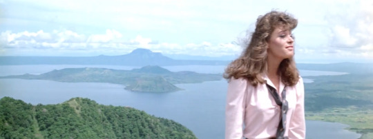


Nine Deaths of the Ninja
Emmett Alston. 1985
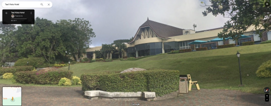
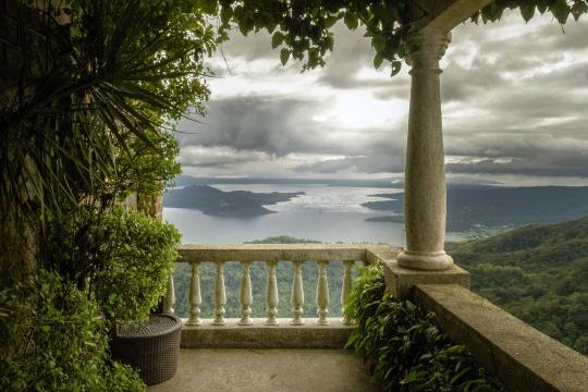
Panoramic View
Taal Vista Hotel, Kilometer 60 Emilio Aguinaldo Highway, Kaybagal South, Tagaytay, 4120 Cavite, Philippines
See in map
See in imdb
#emmett alston#nine deaths of the ninja#taal volcano#taal lake#philippines#lisa friedman#kaybagal#tagaytay#cavite#panoramic view#movie#cinema#film#location#google maps#street view#1985
5 notes
·
View notes
Text

Taal Lake and volcano in the Batangas province of the Philippines
Spanish vintage postcard
#taal#lake#carte postale#ephemera#photo#historic#postcard#taal lake#tarjeta#postal#spanish#briefkaart#volcano#ansichtskarte#photography#philippines#vintage#postkaart#postkarte#old#batangas#sepia#province
5 notes
·
View notes
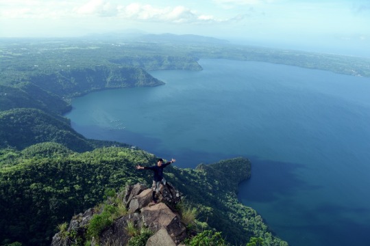
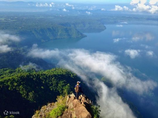
Text
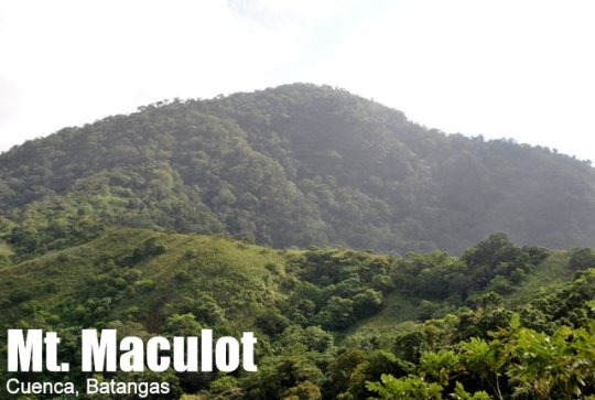
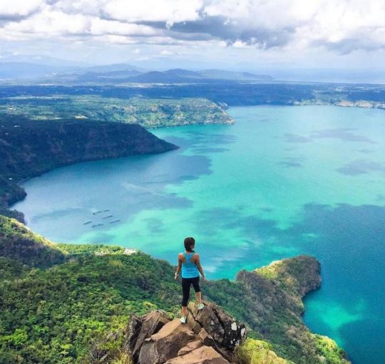
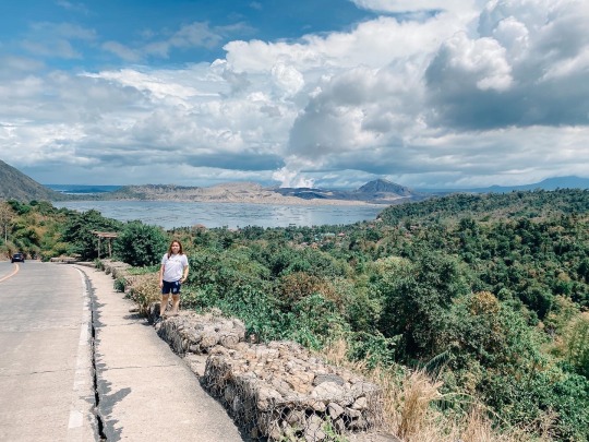
Cuenca, Batangas
Major Jumpoff: Mountaineer’s Store, Brgy. 7 “Siete”, Cuenca
Exit point (traverse): Brgy 5 (to Grotto), Cuenca
LLA: 13°55 N; 121°2 E; 706 MASL (Rockies) / 930 MASL (summit)
Days required / Hours to Rockies / summit : 1 day / 1-2 hr / 2-4 hr
Specs: Minor, Difficulty 3/9 (Rockies); 4/9 (Traverse) Trail class 1-3.
Features: Scenic views of Taal Lake, rock formations, forests
One of the top hiking spots in the Philippines is Mount Maculot. It provides sweeping views of Batangas's neighboring towns and the renowned Taal Lake. The top of Mount Maculot is 930 meters (3051 ft) above sea level. Mt. Maculot Rockies, on the other hand, is 706 meters or 2316 feet higher than sea level. Despite being less than 1000 meters above sea level, Mt. Maculot may be viewed from Puerto Galera and several locations in the province of Northern Mindoro.
Mt. Maculot is located at the heart of Batangas which is in the municipality of Cuenca, Batangas. This mountain attracts a lot of hikers and mountaineers on weekends and during the summer because of its proximity to Metro Manila. Today, Mt. Maculot is a significant tourist site, a dormant stratovolcano that is ideal for a day hiking excursion for hikers of all skill levels.
Mt. Maculot has a rock formation on top that overlooks the entire Taal Lake, including the Taal volcano, as well as the plains of Batangas, is situated next to Taal Lake. From a distance, Mt. Makiling and the Tagaytay Highlands can be seen on opposite sides. You can view Mt. Halcon in Mindoro if you continue south along Batangas Bay and pass Maricaban Island. It can take less than an hour for expert climbers to reach the Rockies, but it can also take up to two or three hours at a more leisurely pace. Due to the trail's popularity, some enterprising residents would offer drinks at the rest spots along the relatively steep trail, including buko juice.

6 notes
·
View notes
Text
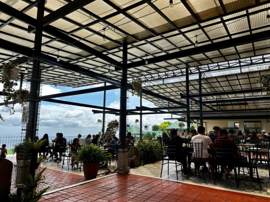
My Most Recent Tagaytay Trip
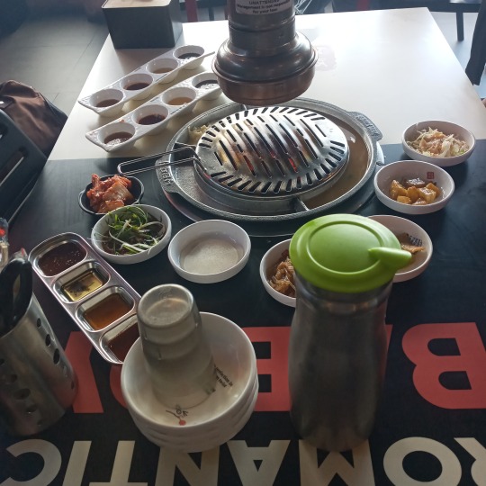


First three pics: Lunchtime at the samgyeopsal place.
Last two pics: View from the balcony. The Taal Volcano has calmed down by the time I got to the Wind Residences.
2 notes
·
View notes
Text
Taal Lake and Taal Volcano, province of Batangas, Luzon, Philippines
Taken by Hector John Periquin
1 note
·
View note
Text
Unwinding with excellent food and spectacular views at Leslie's Restaurant in Tagaytay
Leslie’s Restaurant is a popular dining destination located in Tagaytay City, Philippines. The restaurant has been serving local and foreign tourists for over three decades since its establishment in 1984. It is known for its stunning panoramic view of Taal Volcano and Taal Lake, making it an ideal spot for romantic dates and family gatherings.
The restaurant’s menu features a wide range of…
View On WordPress
#family-friendly restaurant#filipino food#leslie&039;s restaurant#nature scenery#overlooking taal lake#panoramic view#restaurant review#restaurant with a view#taal lake#taal volcano#tagaytay#where to eat in tagaytay
0 notes
Text
Taal Lake
1 note
·
View note
Text


Brgy. Buso- Buso, Laurel, Batangas
03122022
0 notes
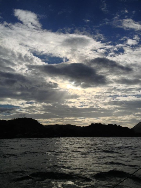
Text

Sandwiched between two lows, one near VIE on the South China Sea, the other in the Pacific. Windy’s 8am Sunday forecast for Taal Lake. Winds from the South, this will be an unusual start line direction. Hello, 2nd Sunday Regatta!
0 notes
Photo
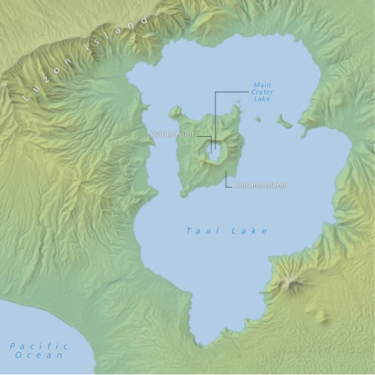
The Island in a Lake on an Island in a Lake on an Island : Lake Taal, which is located within the island of Luzon, has an island (Volcano Island) that has a lake (Crater Lake) that contains its own small island called Vulcan Point.
by @luca_northsouth
441 notes
·
View notes
Text
Imagine, Pacific Rim but written by someone actually from the Pacific Rim
#this post brought to you by the lore saying the second ever Kaiju attack came from Taal lake#A body of water not in the ocean because it's a lake#Also they mentioned Manila being the site of a multi Jager drop#but the only Jagers we see are from the world superpowers
37 notes
·
View notes
Photo
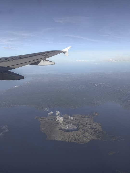
© Paolo Dala
My Heart Is [Not] Jet Lagged
Hop a plane across several time zones, and you may end up with what scientists call circadian dysrhythmia (aka jet lag). It’s a temporary sleep disorder where your body’s internal clock isn’t in sync with the time cues in your destination - daylight, dark of night, mealtimes.
It’s also why you might doze off at lunch on your first day in London or be unable to get to sleep the first couple of nights of a vacation to Japan. “We have a natural rhythm to our bodies, and it’s pretty well set,” says Vivek Jain, director of the George Washington University’s Center for Sleep Disorders.
But jet lag doesn’t have to wreck your trip. “If you plan for it, you can do most of your acclimatizing to your destination a few days in advance,” says W. Chris Winter, neurologist and author of The Sleep Solution: Why Your Sleep Is Broken and How to Fix It.
You can use light exposure, sleep, strategically timed naps, snacks, and caffeine to ease into your new time zone. There are also recent scientific innovations, from high-tech gadgets to safer pharmaceuticals, that might be worth adding to your anti-jet lag arsenal.
Jennifer Barger
How do You Avoid Jet Lag? Experts Weigh in,
#Jennifer Barger#How do You Avoid Jet Lag? Experts Weigh in#Plane#Airplane#Water#Lake Taal#Taal Volcano#Volcano#Plane Window#Jetlag#Talisay#Batangas#Philippines
1 note
·
View note
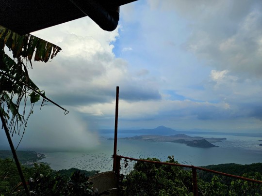
Text

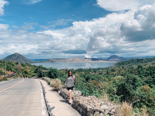
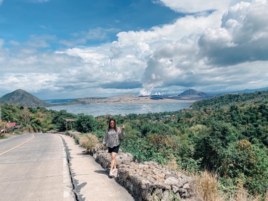
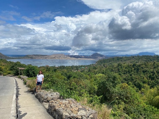
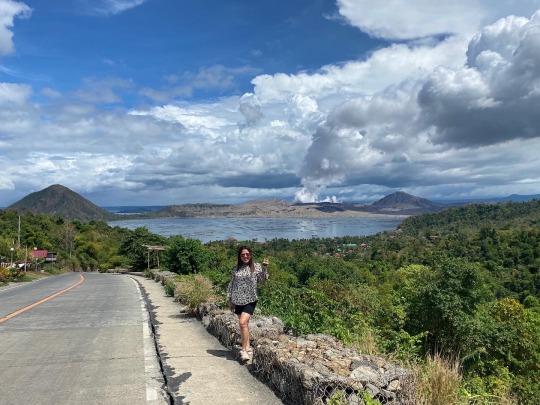
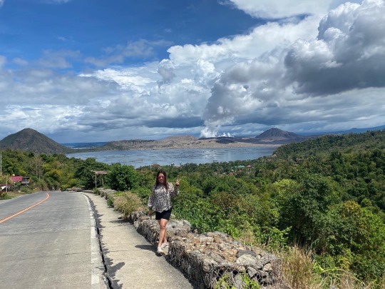
Taal Lake at Picnic Grove, Tagaytay
1 note
·
View note
Last Seen Blogs

rosilovesbirds
Rosi Loves Birds

witchlightdesigns
✨Cauldron Born✨

x-queen-of-disaster-x
Baby I'm the Queen...


aurorhwa
⋆ 𝘥𝘦𝘫𝘢 𝘷𝘶